Ergaki natural. Fabulous Ergaki: Lake of Artists, Parabola. Preparing for the hike to Ergaki
Ergaki Park is located in the south of the Krasnoyarsk Territory, within the Ermakovsky and Karatuzsky districts, at the sources of the rivers: Bolshoi Klyuch, Taigish, Bolshoi Kebezh; Upper, Middle and Lower Buiba.
Ergaki is a ridge in the Western Sayan. The name of the ridge is relatively new; even at the beginning of the 20th century, on geographical maps it was necessary to look for the variant spelling “Irgaki”.
In the eastern part of the mountain range the federal highway M-54 is laid. 200 kilometers to the south along the highway is the city of Kyzyl, the same distance to the north is Abakan, a little closer is Minusinsk (175 km), Ergaki is separated from Krasnoyarsk by 600 kilometers. The nearest settlements are the villages of Tanzybey (50 kilometers to the north) and Aradan (30 kilometers to the south).
The park is divided into three functional zones, differing in security regimes. 74% of the territory is occupied by the largest of them; it is used for recreational purposes, as well as for the development of ecotourism. The main hiking routes are concentrated in this area. Access to 24% of the park area is prohibited without special permission; this is a special protection zone and must remain in its original form; human intervention is undesirable. 2% of the park’s land is allocated for the economic zone; it includes several tourist infrastructure facilities (hotels, ski resorts and others).
The shapes of the mountain peaks of the Ergaki Natural Park are bizarre and names were given to match them, for example: Mirror, Camel, Dragon Tooth, Parabola. Thus, the peaks are an open-air museum of stone sculptures. The highest of which are the peak in the Aradansky mountain range (2466 meters) and the Zvezdny peak (2265 meters) in the central part of the Ergaki ridge. The Artists' Pass is a favorite place for aesthetes and artists; it offers a picturesque panorama of the “heart” of the Ergaki mountain range and the valley of the Left Taigish River.
The most recognizable thing in the natural park is "Sleeping Sayan"- a chain of mountain peaks resembling a sleeping giant with his arms crossed on his chest. A wonderful view of the “Sleeping Sayan” opens from the highway crossing “Ergaki”. They say that the “Sleeping Sayan” is the permanent guardian of the taiga, the protector of the forest and its inhabitants. According to legend, in the old days there was a real man named Sayan, kind and fair, in love with taiga places and protecting them. Sayan understood the language of animals and birds, surpassed ordinary people in strength, therefore, when he died, the gods transformed Sayan’s body into stone and allowed him to protect “Ergaki” for the next generations of people.
It also affects "Hanging Stone"- a huge boulder weighing 10 tons, hanging menacingly over the abyss at the top of one of the peaks. Ergaki Park is overgrown with legends, one of them tells the story of a young warrior, a long-awaited and therefore spoiled child with parental love, who imagines himself worthy of life in heaven. The angry gods turned Batyr to stone, and for the edification of future generations they left only the hand of the proud man - the stone fingers of the rocks - with which the young man still reaches out to the sky.
"Ergaki" is one of the most popular tourist spots Krasnoyarsk region. Visitors to the park have the opportunity to relax in one of the complexes with restaurants, Russian baths, ski slopes and lifts. In Ergaki there are recreation centers: ski resort and others.
Most of the park area is intertwined with a wide route network - fertile ground for hiking. The Ergaki management is ready to provide qualified guides.
Travel along the Ergaki eco-trail - The best way to get to know the nature of the park better is by enjoying its beauty. This path was developed with the support of WWF in 2005. The trail, which is about 35 kilometers long, is well-trodden for various categories of travelers and involves visiting the most picturesque corners of the park. The view will reveal spiky peaks, the blue of glacial lakes, impressive mountain canyons and rivers with waterfalls. The route is designed for 3-5 days. Those who walk the entire trail from beginning to end will see Lake Raduzhnoe, the “Hanging Stone”, the Artists Pass and Lake Svetloe and other impressive places. On the way you may encounter deer, foxes, bears, lynxes or red wolves.
Road "Stone City" is the Kulumys mountain range, which lies in an ornate labyrinth among the rocks. The bizarre silhouettes of stones, many of which reach 30-40 meters in height, resemble the faces of people and the outlines of animals. Here you can see the heroes of local legends, as well as visit the stone “Altar”, covered in legends, according to which it has magical properties.
You can get to Abakan by train, and then transfer to the Abakan-Kyzyl bus, which departs from the railway station square. You can also leave from here by taxi.
From Novosibirsk, from the Gusinobrodsky clothing market and to the Ergaki natural park, a commercial bus runs all the way to Kyzyl.
A source of information:
Ergaki. Lake of Artists. August 26th, 2016
Lake of Artists turned out to be our third base in Ergaki and, in fact, the key one. But it seems that it was key not only for us, but also for many other tourists passing here. Yes, Lake of Artists is really worthy of attention and it is difficult for a photographer to ignore it if he has already come to Ergaki. But, unfortunately, now there are too many people here, and this despite the fact that you can only get here by overcoming one of the passes, which only people in normal physical shape can do. However, we managed to find a good place for camp without much difficulty. Nevertheless, although in the vicinity of the lake one could count several dozen tents, and sometimes even notice individual people with tripods, only ours was such a distinct photographic group. It took less than an hour to go down, the walk here is very close, and when we arrived, and even later, when we had already set up and even had lunch, Lake Khudozhnikov remained covered with fog. And when the time came for photographic exploration of the territory, it was precisely this circumstance that they tried to use for artistic purposes.

The entire first day at Lake Khudozhnikov passed in exactly this vein. Well, there is something in this too.


Lake of Artists is one of the most important attractions of Ergaki, but on the lake itself one of the main attractions is this island with a cedar tree, it should be in the photographs of any photographer who has been here.
The first day was completely foggy, but the morning of the second day was encouraging, the fog began to rise, and the sun warmed the valley. In the photo below, there is just a view of the Khudozhnikov Pass, through which we will have to leave from here.


Daytime is not very creatively interesting for a photographer, but you can take a walk. We used this time to hike to the pass to a large blockage.

There are also a lot of mushrooms here. Although Andrey Chernov came here to study photography, the main lure of hiking for him, as for most tourists, is hunting, fishing and gathering.

Of course, you won’t find firewood nearby, but if you move further away, you can gather it for the fire.

In addition to the island on the lake, there is an even more significant attraction - Parabola. This is the name given to two characteristic rocks hanging over the lake. I managed to shoot it at the wrong time in the world. Here I had to get a little tricky, the Parabola couldn’t fit into my 24 mm, so that there was at least some kind of foreground, so I had to run a panorama in three rows at 50 mm.
And then a wonderful evening came and it became clear that today the sky could sparkle with sunset colors. The angles were already known; all that was needed was to take a position and wait for the presentation.

The situation is still more daytime, but the picture is already not bad.
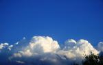
There is always a certain mystery in the sunset itself, and even just when you observe it, it is impossible to remain indifferent. All the movements of the clouds, the moment-to-moment transitions from tone to tone, all this responds with some subtle movements in the soul. It's like there's a melody inside. You don’t hear any sounds, but the sensations are close to that.


And then it was night and we were filming the Milky Way over Parabola.

Forward! To the west! On Ergaki, from the smog of fires and crowds of resting bodies, to rocky peaks, crystal streams and the blue of the sky!
With such thoughts we rushed with Baikal, to the blessed land of rocks and taiga.
But at that moment we knew almost nothing about the area except that these are the Sayan Mountains, these are rocks, these are frequent bear attacks, and that this is an excellent option to save August.
Along the way, without stopping, we passed through Krasnoyarsk, almost on the go, consulting and sketching out a route with a guide and a wonderful, responsive person Reliable Nekrasova .
On the descent into the Minusinsk Basin, the rain catches up with us and accompanies us the entire remaining, not long, road to Ergak.
Descent into the Minusinsk Basin
The first look from the road at the peaks lost in the rainy gloom...
 View of Ergaki Natural Park from the M-54 Abakan-Kyzyl highway
 And we're in Visit center, a logical and very convenient place to start your journey through the Ergaki Natural Park.
Free registration, consultation and forward to the world drowning in clouds and water.
On the day of arrival, it’s well past noon, we decide to get out of the forest zone as quickly as possible, because our style is to spend the night at the top.
Where there are no midges, where there are beautiful views, and the sun rises in the right vestibule of your tent, and sets below the horizon in the left.
And it doesn’t matter that it’s pouring like buckets around us, and clouds are flying through us, because in the morning everything can be different.
We climb along the gentle spur of the ridge, clouds begin from a height of 1500 meters.
 Ergaki Natural Park
 We stop for the night on a more or less level place at an altitude of 1700 meters.
 Overnight on the slope of the ridge
 In 3 hours we walked 7.7 km.

The morning begins bleakly, clouds are still flying through our tent, but while I am preparing breakfast, in no hurry to get out of my sleeping bag, it begins to clear up.
 Better weather
 This magic of unseeing always delights me. A piece of rock appears from the clouds flying past, and immediately hides. Here the distant slope is outlined in a broken silhouette, only to drown at the same moment in milk. Here and there rocks, valleys, ridges and kurums begin to appear, and not even half an hour passes before a mountainous country opens up before us, sleek and covered with taiga.
 View of our yesterday's path
 But where are the famous rocky peaks of the Ergaki Natural Park?

Hurry to the ridge, who knows how long the weather window will last.
 Gentle slopes of the side ridges of the Ergaki Natural Park
 We climb the ridge and begin to move along the watershed to the east, towards the Sleeping Sayan.
 Rock Whale and Sleeping Sayan
 We admire and photograph one of the wonders of stone architecture, the Whale Rock.
 First look at the sharp peaks of Ergaki Natural Park
 The weather is getting better every hour.
We meet a lonely photographer under one of the peaks Sergei Shmidt, more than 2 weeks traveling around the park. His eyes are inflamed from the smoke of the fires, he has a homemade staff in his hand, and behind his back is a backpack full of photographic equipment. It all looks impressive, I can’t resist taking a portrait.
 Photographer Sergey Shmidt
 We have lunch in the area of a beautiful rocky outcrop, a stone nose.
 Stone nose
 And we descend through the Krasnoyarsk Pass to the epicenter of the tourist movement. There is a hanging stone on the right, we don’t go there, it’s not at all interesting to look at what can be seen in a million photographs of excellent quality.
 Circus formed by the Sleeping Sayan massif
 We descend along the 1A Sleeping Sayan pass and ascend to the 1A Taigish 2 pass.
 Climbing to the Taygish 2 pass
 The pass is rarely used, which is what we need. Great place to park.
 Parking at the Taigish pass 2
 Flat area, magnificent view of Zvezdny Peak and Parabola.
 View of Zvezdny and Parabola peaks from the Taigish pass2
 We set up camp, eat, and film the sunset.


 View at sunset from the Taigish pass2
  View at sunset from the Taigish pass2
 On the second day we walk 12 km.

I get up early, before dawn.
I admire the jagged panorama of the mountains and greet the sun.


A new day fills the sea of taiga with light, spread out under your feet, there are sharp peaks around you, you can breathe easily and freely, and it blows your mind!

We pass through a picturesque mountain lake, Lazurnoye, a popular stopping place.


If I’m not mistaken, it was here that one of the tragic incidents of a bear attack on tourists happened in 2015.
There were several attacks in total in 2015, mostly at night and, as I understand it, people were not the main target.
The careless attitude of vacationers towards the storage and disposal of food has taught bears to perceive campsites and people as a source of food, and in search of food, animals come to camps, climb into tents, injuring people along the way.

And without going down to the lake of the same name, we climb to the pass of the Norilsk Tourists Club.
From the pass there is a wonderful view of the double lake Eight, which lies below,

and to all the surrounding peaks.

We admire it a bit, relax, and go down to the lake,
The lintel, which seemed small from above and not deep, turns out to be quite wide, with slippery, but damn beautiful yellow slabs.

It’s getting close to evening, but we decide to try to cross another pass 1B Mezhozerny, and spend the night near Lake Severnoe, at the highest local waterfall, with the logical name Bogatyr. But our strength is not the same, and the pass turns out to be long and steep, so we wisely turn around and set up a tent in a magnificent place on the edge of a sloping stone forehead, with a wonderful view of the surrounding peaks.
But there is no time to photograph the newly created camp,

the sun is rapidly running behind the pass of the Norilsk Tourist Club, so leaving Tanya in charge, I run away in its wake, climb the pass and spend about two hours alone with the mountains and the sun.
And photographs speak better than any words...


The last peak is burning down, the world is plunging into night, and it’s time for me to go down.
Here is our camp, overlooking the sleeping rocks.

While I was walking, up in the valley it became crowded, and a group camped next to us for the night. Let’s introduce ourselves, the leader, two females and a child, nice people. Tomorrow I propose to join us on a radial trip to the Bogatyr and Gratsia waterfalls, which is what we agree on.

We covered 12 kilometers in a day.
Day 4 of our easy hike along Ergaki becomes the day of a radial trek.
The morning sun pleases with good weather and beautiful light falling from around the bend of the gorge onto the rocks.

We climb the pass 1B Mezhozerny.

The ascent from our camp: a steep path, along the edges overgrown with lush and slippery vegetation.

The descent is more difficult and longer than the ascent, with small stone ledges, loose rocks and smooth inclined slabs. Can be dangerous in wet weather.
We are glad that we decided not to walk along it last night tired and with large backpacks.
We go down to Lake Severnoye, from which a stream flows, cascading down, this is the highest waterfall in the area - Bogatyr, and then to the very base of the waterfall.


And we find ourselves in impenetrable blueberry thickets.


The large berry, the size of the phalanx of the little finger, catches the eye with a death grip and does not allow one to go further.

At least 30 minutes, we barely overcome the 200-meter clearing.
At the entrance to the neighboring circus, the Grazia Waterfall flows; sparkling streams of water fall into a hard-to-reach well on the side.


Having climbed down to the waterfall, we climb up large boulders to Lake Glubokoe.

The sun is burning mercilessly, so we find no reason not to take a swim in this refreshing font.

We cross the N/A pass into the valley of Lake Severnoye and, without going down, we go to the camp.
We spend the evening in pleasant conversation, drinking herbal tea.
It's nice to talk to people sometimes.


15 km covered in a day.
Day 5, begins with how the day before yesterday ended, I got up earlier, a couple of hours before sunrise I climb the NKT pass, someone will think, why? after all, I was there at sunset, but I would reasonably argue that sunset and sunrise are two completely different entities, and it’s stupid to sit below, surrounded by mountains, when you can go up and shoot something interesting.
While I’m waiting for dawn, I watch the highway along which rare cars are driving, it was from that place that we photographed the “peaks lost in the rainy gloom” (see photo 2)

The sun rises everyday

and I'm hurrying down

We have a long way to go to Dragon's Tooth Peak.
We get ready, say goodbye to our neighbors and down into the forest zone, we get lost a little, having lost the path, in a place where the rocks are adjacent to the first low spruce trees, but after walking a little along the azimuth we come to a good trampled trail and climb along it to the wonderful Taigishonok waterfall.

Again, there is no reason not to take a swim, and at the same time take a photo for one of the months of the outdoor calendar created by Tanya.
 Waterfall in Ergaki

We splashed around in the icy water for about an hour, sunbathed on dry smooth stones, and took pictures. Of course, in the costumes of Adam and Eve.
After swimming, we go down to the Left Taigish River, to a place called Strelka. The place is popular, and very dirty, which is why we prefer to camp outside popular places, since we have everything to not leave any traces behind.
A couple of kilometers upstream of the Left Taigish and, taking the slope head-on, we go out in azimuth to Lake Teploe.

The place is stunningly beautiful and cozy. Surrounded by cedars and mountains.
 View of Dragon's Tooth Mountain
 We have lunch and start climbing the Dragon’s Tooth along the trail.
The trail immediately climbs steeply and jumps over rocks and screes until it reaches the ridge. The hard climb ends in tundra dotted with rocky outcrops, with beautiful rock outcrops along the mountain ridge and stunning views.

We decide not to climb all the way up, but to camp 200-300 meters below the top; we find it difficult to find a level place.

First of all, I provide the camp with water, for this I have to go down 200 meters lower, and without stopping, just leaving the water, I go up, trying to reach the top in time for sunset.

Tanya is freeloading and remains in the camp.
The peak visible from the camp, as one would expect, turns out to be not a peak at all.
I make my way through the stone labyrinths for quite a long time until I reach the top, looking up at a platform that ends with a cornice into the abyss.

I spend about half an hour at the top, admiring the surrounding peaks.

At sunset I set off on my way back.

I slowly walk down, photographing beautiful flowers huddled in thoughtless places, in the crevices of rocks above steep cliffs.

The sunset this evening is beautiful and gentle, at such moments you want to sit on a warm stone heated during the day and think about something big and good, about the laws of existence, love, the meaning of life, or not think at all, but just smile, reflecting the mountains in your eyes .

In the dark I go down to the tent, where tea, hot food and my beloved woman are waiting for me.
The day was definitely a success.

Walked 10 kilometers in a day.
I open the tent flap, and lo and behold!

It is precisely for such moments that we carry backpacks upstairs, carry water with us, and sleep on inclined surfaces.
In order to be guaranteed to admire the most beautiful moments of the day.

We descend from the Dragon Peak mountain not along the ascent path, but along a kulurau leading to the foot of the peak to the area of Lake Tsvetnoye.
The descent is easier and more convenient than the ascent yesterday, and is more frequently used. But when moving in a group, it is possible to lower the stone.

We go around Mount Antey along the border of the forest, jumping over huge kurums.

And we go out to the “densely populated” Lake of Artists.
With a classic view of the Parabola Mountains and Zvezdny Peak.
Not feeling any particular desire to be among the idle camps for a long time, we leave through the beautiful Kamenny Gorod tract to the 1A Kursantov pass (west).

From the pass to the South, a completely unusual picture opens up, gently sloping peaks overgrown with forest, and no rocky landforms. This is where the amazing country of Ergak ends.
We descend into the valley of the Jerboa River, planning to spend the night at the Mramorny waterfall,

but the sight of crowds of vacationers wandering towards us and the abundance of camps around the lake and waterfall force us to reconsider our plans, push ourselves and walk a few more kilometers to the Jerboa Pass, at the top of which, near a rock with a memorial sign, we stop for the night.

We spend our last evening in hospitable Ergaki leisurely and with pleasure, basking in the setting sun and eating leftover food.


The last sunset of the trip to Ergaki


Traveled per day: about 10 km.
In fact, this is where the hike through the Ergaki Natural Park ends.
On day 7, we slowly walk along a good marked trail to the visitor center for 7 km, say goodbye to the beautiful mountainous country, and leave for the wonderful city of Krasnoyarsk.

Route thread: Abakan - Usinsky tract - Tushkanchik river - Svetloe lake - Tushkanchik pass (n/k) - Nizhneye Buibinskoe lake - Khudozhnikov-2 pass (1A*) - Nizhnyaya Parabola pass (n/k) - Bird pass (1A) - Svetloe lake - Zvezdny pass (2A) - Piquant pass (1B) - Vidovka pass (n/k) - Lake Svetloye - Jerboa waterfall (radially) - Lake Zolotarnoye - Zeleny pass (1A) - Lake Bezrybnye (radially) - Gemini Western pass (1B) - ascent to the Dragon's Tooth peak (2176 m) - link Zharki pass - Vostochny pass (1A) - Bolshoye Buibinskoye lake - Verkhnyaya Buiba river - Lugovoi stream - Svetloye lake - Tushkanchik river - Usinsky tract - Abakan.
Key points along the route (Google Earth): download
Preparing for the hike to Ergaki
Ergaki are famous for their beauty not only in Siberia, but throughout the country. High mountainous terrain, deep trough valleys, tarn lakes, numerous waterfalls... All this makes a hike to Ergaki a wonderful place for lovers of pristine nature. It is also important that you can get to Lake Svetloye or Lake Raduzhnoe (the starting points of most routes in Ergaki) in just 3-4 hours of trekking from the Abakan-Kyzyl road. Most of the peaks of the main Ergakov ridge exceed 2000 meters, the highest point being Zvezdny Peak (2265 m). Most of the passes have elevations exceeding 1500 m and are located in the alpine belt. About 15 passes are qualified, including 4 passes 2A, 6 passes 1B kt.
In the summer of 1996, German Nikolaevich Babushkin gathered a group on a trip to Lake Baikal. But due to a number of circumstances, the trip to Baikal had to be postponed until next year, and I was handed over to the caring hands of Vladimir Georgievich Fiofilov, who was gathering a group for Borus. However, at one of the evenings of the Zelenogorsk tourist club "Firn", Rimma Ivanova appeared and offered us another option - a trip to Ergaki, where she herself was going with her children in mid-June. That's what they decided on. The preparations have begun.
Final composition of the group:
- Vladimir "Grandfather" Fiofilov - IV mountaineer, 43 years old, leader
- Nelly Simonova - III mountaineer, 48 years old, supply manager
- Natalya Ryabykh - III mountaineer, 30 years old, doctor
- Dmitry Kovinov (that is, me) - no experience, 15 years, photographer
- Sergey Rubanenko - no experience, 14 years old, repairman
A food ration was prescribed. I was assigned to purchase, pack and carry throughout the entire trip
- three cans of stew
- kilo of dried potatoes
- 2 kg sugar
- 1.5 kg dried smoked sausage
- three packs of jelly
- 1 kg raisins
- 1.5 kg loin
- 1 kg cookies
- crackers from 2 loaves of bread
- 5 cans of canned fish
- 1.5 kg semolina
The result was 12.5 kg. The rest had about the same amount, but of course other products. Thus, our budget for this trip to Ergaki amounted to 850 grams per person per day.
From public equipment I carried: a two-handed saw, a coil of 11 mm rope, and from personal equipment in addition to the usual: a chest harness, a carabiner and tops. Plus, since my mom is a doctor, I was tasked with packing a first aid kit. It contained the following medications: stomach tablets, painkillers, tablets for infectious diseases, dressing material, 200 grams of medical alcohol, antiseptics and an elastic tourniquet.
It must be said that before going to Ergaki I was a real “teapot”. I had no experience of large hikes, and most importantly at that time, practically no hiking equipment! I had to buy a backpack, a sleeping bag and an anti-encephalitis suit, which was outlandish for me.
Road to Ergaki
So, the start of the hike (boarding a bus on the route Zelenogorsk - Zaozernaya) was scheduled for “five thirty on Monday.” On Sunday, as a conscientious tourist, I packed a backpack (it turned out to be 37 kilograms!!!) and tried to walk with it along the road near the house. Then it seemed to me not just heavy, but very heavy. Fortunately, before this hike, I walked six times with a weight of 15-20 kilograms up the mountain near my house (I put bricks in my backpack).
In general, on the scheduled day, I got up at 4:20 in the morning, conscientiously had breakfast and harnessed my dad to take me to the bus. Having arrived at the place, I discovered, or rather did not find, a single soul from our group. In complete bewilderment, after waiting for the bus to leave, I went to “Grandfather”. When the doorbell rang, a sleepy, but already clean-shaven man with a bewildered expression on his face answered the door. In response to his bewilderment, I began to explain to him that our bus had already left, to which I received a very clear answer: “Dima, the train from Zaozerka is at seven o’clock in the evening!!!” Turning around, I went home and went to bed for another two hours. When my mother came home from work, she was very surprised why I was still at home. Then, without incident, we reached Zaozerka, and then to Uyar station.
New surprises began in Uyar: it turned out that previously ordered tickets for seats on the train ended up in different cars. After a short conversation between Natasha and the cashier, everything was settled.
We traveled normally on the train and arrived in Abakan at 11:15 am the next day. We were lucky, and already at 12 o’clock we were sitting on the Abakan-Kyzyl bus. It should be noted that on the bus, most likely, we were the only Russians, the rest were Tuvans. The bus was good - Ikarus, and we hit the road. On the way I slept a little, but after 3 hours the MOUNTAINS began to appear. Then the whole dream vanished. Our bus, as it turned out, was only good in appearance.
In the village of Ermakovskoye, the bus made a long stop at a roadside cafe, where we, like almost all the passengers, had a hearty lunch. Almost immediately after Ermakovsky the road went uphill. Our Ikarus, like a donkey, was forced to stop every hour so as not to overheat. Having probably reached the highest point of the road, the belts on the engine broke and another hour-long stop followed. But despite these troubles, the impression of the mountains visible mainly to the left of the direction of travel was enormous. I looked at some “Sayan head”, at a “bird”, “starry” and could not even imagine that in three or four days I myself would be making my way among these peaks...
Up the Jerboa River
Well, at five o’clock in the evening the Jerboa River, which we had been waiting for so long, finally appeared. Before we could get off the bus, we saw our friend, Rimma Ivanovna, who was already waiting for us. After saying hello, we set off. But they hadn’t walked even a hundred meters before they came to the camp. There were a lot of people there, young and old: both children and adults. Some sat and talked, others joked, others bustled around the camp. After sitting in their camp, we moved up Jerboa. I must say that at first the mood was not very good due to what we were told. Namely: “Two weeks before our arrival, just as Rimma Ivanovna’s group was starting to hike, the rains began, and out of the 15 days they spent in Ergaki, 12 days it rained.” The path we walked along was muddy and wet. The backpack seemed terribly heavy to me. We walked with stops every 15-20 minutes. And after passing some kind of “ant hill” we met three guys. They turned out to be members of Rimma Ivanovna’s group.
We decided to spend the night at a place with the funny name “ant hill”. This was my first night in a tent, much less in the mountains. The boys told us about the difficulties of the hike, and looked very serious and important, apparently mistaking us for “dummies” who do not understand anything about real hikes. In the evening they cooked dinner and sawed wood. It was very interesting to watch the rather well-coordinated work of everyone in the camp, and I thought that I, too, would soon know exactly what to do without outside help. That day we walked only 4 km, but that seemed enough to me. Clean running time is about 1.5 hours.
Nice sunny morning. We still go up along the left bank of the river. About an hour later, our road is blocked by a stream flowing into Jerboa. It turns out that this stream flows out of Lake Svetloe. Without crossing it, we go further along the coast, gaining altitude quite quickly. Mountains appear on the left. “Bird” and “Star” are clearly visible - the most famous peaks of the Ergaki ridge. We come out onto a huge field, completely covered with roasts and wild garlic. Let's grab some for lunch. We turn left, and after 10 minutes we find ourselves on Lake Svetloe.


Meadows with wild garlic and frying near Lake Svetloe
Base camp on Lake Svetloe
Lake Svetloe is one of the most convenient places for a base camp for a circular route. From here it’s easy to get to Lake Maloe Buibinskoye, get to the valley of the Taigish River through the Lake of Mountain Spirits, or along a good trail in just a couple of hours you’ll be on Lake Zolotarnoye. It is here that we decide to set up our base camp, which will become the starting point of our three rings and one radial exit. There is warm water, a lot of space for tents, there is a lot of forest around and there are not many problems with firewood. In addition, it is very close to the road, and if something happens, you can run to the road in 2 hours if you are light.

We leave immediately after lunch. We take food with us for 3 days, the rest is to be thrown away. Now there are 10 of us: five of us and Rima and four boys. We go around Lake Svetloe on the left, not far from the shore we cross the stream along the logs, which originates here. Then we move along a good path. We pass several small “rotten” lakes and go to the Medvezhiy spring. We cross it on an overturned log; you can’t get through the ford without insurance. On the right bank there is an alpizba. We go inside - no one. Then continue along the path again to the Jerboa River. We cross the ford and take the path straight to the Jerboa Pass (n/k), located to the right of the top of Mount Jerboa itself, an ancient volcano with a destroyed crater.

At the Minusinsk hut (they say it burned down after a couple of years)


Jerboa Pass (n/k, 1700 m) - really n/k (nothing!) - forest, grass, in some places even a horse trail. In a word - a puller. The pass saddle is very wide. During a smoke break we ran closer to the top. There, from the bottom of the crater, along the inner slopes, you can make technically challenging ascents using rock climbing techniques. Then we go down to Lake Maloe Buibinskoye. We arrive at the overnight stay only at 21:30. We set up our tents right on huge boulders, as this is the only dry and almost level place in the area. Moreover, in the event of a rainstorm, there is nothing to be afraid of water going under the tent.
"Hanging Stone" and Khuzhnikov Pass
In the morning we went to the “Hanging Stone” - a huge boulder at the top of the mountain, lying on the ground only a small part, forming a huge canopy. The name is due to the fact that this stone lies on the edge of a large cliff, so that it seems to be hanging. Many tried to push it, but no one succeeded, this pebble was too heavy.

On the ridge near the Hanging Stone
Below is Lake Nizhneye Buibinskoye

"The Hanging Stone" is the calling card of the Ergakovs!
Below is Lake Maloye Buibinskoye (Rainbow)


At 16:00 we go to the Khudozhnikov Pass (1B). The ascent from the camp on Lake Maloye Buibinskoye to the pass flight took only 1.5 hours. The climb to the pass from the Nizhnyaya Buiba river valley is very simple and takes no more than 30 minutes. At the pass we relax and admire the mountains. The pass is named so for a reason. Below is the most beautiful trough valley of the Left Taigish River. To the right you can see, resembling the blade of a bayonet shovel, Zvezdny Peak (2265 m), and a little to the left and in the distance is Dragon Tooth Peak (2176 m).


Behind are the highest peaks of the Ergaki ridge: Dragon's Tooth, Star, Bird.
The descent is quite difficult, as it goes through loose rocks, we descend straight from the saddle - quite difficult. Some recommend the following option for descending into the valley of the Taigish River: do not descend directly from the saddle, but climb a little in the direction of Molodezhny Peak (on the left - if you look into the valley of the Taigish River) to the huge vertical boulders called “fingers”. There are three of them in total; you can descend between the first and second fingers, counting from the pass saddle. Even from the pass, I noticed that the foot of the pass was strewn with stones. Then I thought it was good that we wouldn’t have to trudge through the mud, we’d jump from stone to stone. But what was my amazement when, as I approached the stones, I began to understand more and more clearly their real size. Crossing the stone platform, which I thought while standing on the pass would take about five minutes, actually took half an hour.
Having overcome the stones, some of which were the size of a 3- or even a five-story building, two hours after the start of the descent, we found ourselves on a small, dry, elevated place, not reaching 500 meters from Lake Khudozhnikov. We set up camp.

Artists' Pass from the "Dream" parking lot

The evening was wonderful. Looking back, I realized how large the scale of things created by nature is. Huge boulders ahead, giant mountain ranges to the left and right, a lake and stream behind. All this creates a feeling of something unearthly, not something that a person who has lived his whole life in cramped city corners gets used to.
The sun began its path to the horizon and the camp became quiet. And in such a huge place, constrained on all sides, there was such a silent silence, unusual for a person, which was interrupted only by one very melodic ringing of a stream running nearby, which here began its long journey to the Yenisei. You can’t help but think: “Isn’t this an ideal place for a person to live? A place where there is no fuss, no quarrels, no fleeting desires. A place where you would like to truly relax, a place where you would like to be in the moment of greatest happiness!
But let's get back to worldly matters... While the porridge was cooking, we made a foray into the hut, with the strange name “Dream” for a person who found himself here right after visiting some restaurant or supermarket. The dream turned out to be nothing more than a small depression in a huge boulder, boarded up on one side with boards. It was quite dark inside, but we were still able to notice a large notebook lying on a wooden table. They brought it to the camp and only there did they see that it was nothing more than a “visitor’s book.” It was covered with many different wishes that different travelers left in it. We also left our entry.
After dinner we sat for a long time by the fire, telling jokes on a variety of topics.

In the parking lot "Dream"

16:15 – departure from the camp
17:45 – start of the ascent to the pass
18:00 – 20:15 – descent from the pass
20:45 – camp at Lake Khudozhnikov.
Valley of Mountain Spirits - Ptitsa pass - Lake Svetloe
After breakfast, the usual preparations began, which consisted of everyone running around the camp and looking for their things scattered before. Since there were still a lot of us then (10 people!), the preparations took a long time. But at 11 o’clock we rushed to storm Parabola. Parabola Pass is a depression between two peaks created by nature according to the canons of geometry.
Having walked along the kurumnik, we hugged the Eastern Brother and then, along a small shelf located on its western side, climbed to Parabola. The path was not dangerous, but the shelf in some places was quite narrow and steep, so in order not to fall, one sometimes had to grab the roots and branches of trees growing on the shelf with one’s hands. Having climbed the Parabola pass, I was literally stunned!
Everything told about some Valley of Mountain Spirits and the lake of the same name turned out to be just a description of paradise from a person whose vocabulary contains only two words... The Valley of Mountain Spirits is perhaps the most beautiful place on earth that I have ever seen before. It is a valley surrounded on three sides by majestic steep cliffs and a lake between them. The very shape of the lake resembles the footprint of a barefoot giant who created these unique mountains. The most interesting thing is that from the height of the Parabola Pass the size of this lake really seems equal to the size of a person’s foot.
Upon returning from the top, right at the pass, we had a light picnic. The menu consisted of water, which we brought with us, diluted this water with Invite (which “just add water”), bread (at that time we still had more or less stale bread), lard, boiled pork and canned fish. After having a snack, we hit the road.

After walking quite a bit we were caught in the rain. The first rain since our stay in Ergaki. Having pulled on our capes, we huddled together in one group near a steep cliff. After sitting for about 20 minutes, we felt that the rain had stopped and moved on. After walking quite a bit, we came to a snowfield. Having thrown our backpacks at lightning speed, we gave ourselves over to carefree fun: we began to ride around this snowfield on seats, and some simply on their butts. Then it seemed that this was the best attraction in the world! Snow in the middle of summer. Wow!!!

Having rested a little after the races on the snowfield, we moved up to Bird pass(1A, 2097 m). The climb was not at all difficult, apart from the danger of falling in two or three places and getting hit in the head with a stone that your friend, who happened to be above you, carelessly moved. Having climbed the pass and rested a little, we decide to climb the “Bird’s Shoulder”. The climb was very easy, and at five o'clock in the evening we were at an altitude of about 2150 meters!!!


On the “shoulder” of Ptitsa Peak. Behind are Zerkalny Peak, Molodezhny Peak and Sleeping Sayan Peak
Having thoroughly enjoyed the altitude and the views of the Sayans opening in all directions, we moved down to the camp on Lake Svetloye, from which we left the day before yesterday. From the top it seemed that it was very close to him. Less than an hour later, a fierce downpour hit us. Taking out our capes, we hid under them, like turtles in a shell, and sat quietly and waited for the downpour to end. We sat there for half an hour...

Although there was very little left to our base camp, the most difficult, as it turned out, was still ahead. Moving almost constantly only downwards, we risked ending up on wet ground. Their legs were buzzing from fatigue, their attention weakened, and the group members kept landing on their butts. Dirty, wet, slippery...
But slowly and surely we approached the lake, which I renamed Lake of Hope. I really wanted to dry out and rest as quickly as possible. Having passed a small swamp in the eastern part of the lake, at eight o’clock in the evening we reached our base camp on Lake Svetloye.
Without even changing into dry clothes, everyone began to fuss. “Grandfather” and I went to get the drop off. Seryoga and Natalya began to make a fire from wet branches. It was hard, but we had to work. Quite quickly and harmoniously, we achieved that within an hour and a half the fire was burning, the tents were standing, the food was cooking...

It was our farewell evening. Rimma Ivanovna and the boys were getting ready to go home the next day. The adults drank a little to say goodbye. This day was perhaps one of the three most difficult days of this hike.
11:10 – departure from the camp
11:50 – Parabola. Climbing the Eastern Brother peak ()
13:55 – beginning of the descent to the Valley of Mountain Spirits
14:40 – 14:50 – fun at the snowfield
16:20 – pass, ascent to the “shoulder” of Ptitsa Peak
17:50 – start of descent
20:05 – camp on Lake Svetloye.
Day on Svetly
The most boring day. It rained almost non-stop all day. We were lying in a tent. They played cards, wrote diaries, and studied maps of the area. Seryozhka accompanied Rimma Ivanovna and the boys down to the road.
Super day: per. Zvezdny - lane Spicy - trans. Vidovka
Ivan Kupala Day. In the morning I carefully get out of the tent - as long as no one splashes me! But everything was dry! After breakfast, we hit the road. The day was planned to be the most difficult (more or less what it turned out to be!). Our planned route for today didn’t look too bad - three passes in a day, one of them a specific “double a”. So, with great zeal after lying in the tents yesterday, we moved upward. After walking for about 40 minutes, we decided to rest and have a drink. That's where it all started! I don’t remember who started first, but within a minute we were all equally wet from head to toe!
Having dried off, we start from the foot of the pass straight ahead. On the ascent side, the slope is very simple and we climbed to the pass without incident. It opened up an amazing panorama of the Brothers, the Lake of Spirits and the valley of the Taigish River. Everything was nice until I looked straight down, directly to where we had to go down.
Then, unexpectedly for myself, I felt a very strong desire to eat. Unnoticed, in a couple of minutes, I devoured my entire daily ration, which according to the plan should have lasted for three to four hours. The descent from the pass, in principle, was not so difficult. And we could have done it even without ropes, but we played it safe. The descent into the most difficult part of the pass took us 2.5 hours and three pitches.

Zvezdny Peak (on the left), Zvezdny Pass (the closest couloir to Zvezdny Peak) and Ptitsa Peak. View from Mountain Spirits Lake
Having rested and calmed down (this is me to myself), we continued our descent. We went down to the Lake of Spirits, walked along its shore and stopped for lunch at the northeastern end. Noodles, sausage, crackers and ice cream for dessert. Personally, I didn’t really like it, but just in case, the recipe is: “take a can of condensed milk and mix it with fresh (if there is no fresh, then old will do) snow.”
While some comrades, for their dear souls, devoured this mountain dessert, I preferred to wait until the snow melted and, mixed with condensed milk, became just cold milk. Lunch took about an hour. We traversed the side spur and came out to a platform from which a very picturesque view opened up. Not wanting to lose altitude, we began to traverse towards the Pikanty pass.

So, without going down into the valley, we continued on our way. But it turned out that we could not avoid the descent since we came out onto steep cliffs. Having descended to the bottom of the valley, completely covered with huge boulders, we moved upward. The path was quite exhausting, as we had to constantly jump from one boulder to another. It’s good that we only have two backpacks for five of us, and we carry them in turns.
The path was quite exhausting, but then a pass appeared in the distance, and having gathered all our strength, we set out on a forced march. And what a surprise we were when, instead of the desired pass, we found ourselves only at the terminal moraine of an already disappeared glacier. The moraine created a dam and several small lakes appeared in the resulting basin.
Now we could clearly see our target, it was another 200 meters higher! Seryoga, having lost his temper during a smoke break, rushed to the assault. We walked slowly. I’ll say right away that it took us another 1.5 hours to climb up to the pass from the moraine.
Having gone around the lake to the left, we went straight to the pass, which looked quite menacing. But, approaching the foot, we saw snow (after all, it was a northern slope). I began to climb right in Seryoga’s footsteps. Seryoga, without thinking about the group, simply ran to the pass. Therefore, I had to literally knock out the steps with the toe of my boot. Having risen quite easily, we saw Seryoga there, who immediately received a fair beating from Uncle Vova for separating from the group.
Since time was running out, we rested for only five minutes and began our descent towards the third pass of the day – Vidovka Pass. Here, either from fatigue or, on the contrary, from joy that we had succeeded in the most difficult part of the route, everyone was cheerful: we walked for about 20 minutes and laughed without stopping, sang and told all sorts of funny stories as we walked... However, as soon as the descent ended and the ascent began, I was in no good mood. The climb did not seem so easy. We're already pretty tired today!
Slowly but surely we crawled up. Right behind us was the beautiful Zolotarnoye Lake. At 20:15 we reached the pass. Although it was still far from darkness, even further away was the camp on Svetloye, which became our real home.
Having rested at the “Elephant” rock - a remnant on the Vidovka pass - we began the descent, as usual, Comrade Natasha cheered up again. The descent was quite difficult and consisted of dense bushes. The walking speed dropped very much, and only by 11 o’clock we reached the camp and quickly, before it got dark, began to make a fire and set up tents. That day we sat by the fire for a very long time, until two in the morning. True, around midnight Seryoga went to bed, and Comrade Natasha and I stayed by the fire. She told me a couple of legends about the Sayans.
This was one of the three most difficult days. Although according to the map we walked only 13 kilometers, it felt like fifty kilometers!
9:30 – departure from the camp
11:45 – Zvezdny pass (2A, 1950 m.)
12:15 – 14:35 – descent from the pass
15:30 – 16:40 – lunch at the Lake of Mountain Spirits
18:20 – moraine under the Pikanty pass
19:50 – 20:15 Piquant pass (1B, 1850 m.)
21:45 – Vidovka pass (1A, 1700 m.)
23:00 – camp at Lake Svetloe
Radial to the Jerboa waterfall
Of course, after such a load as the previous day, the human body requires rest, and we (more precisely, our commander) decided to have a day's rest. The sun shone all day and the weather was wonderful, but this was the only day when I regretted going on a 16-day hike. A week would be enough...
But after lunch, I suddenly had a very bad stomach ache (the only ailment I had during the entire trip). On this day we cooked jelly from all sorts of “pasture” (rhubarb, etc.). Perhaps it was because of this rather tasty jelly that my stomach started to hurt... I didn’t take any pills, although they were there, I just lay on the rug in the shade, curled up in a ball.
On this day, guests came to our camp: a woman and a guy of about eighteen. I was immediately struck by their manner of communicating with each other. They talked almost like street kids. But Comrade Nelya knew this woman. At first we talked about everything a little, but then, having learned that we were going to the waterfall, the woman calmed down a little. Then she began her long, and sometimes even scary story. They talked for a long time, but the meaning of what was said was this:
All climbers know the legend about the black climber. A black climber is some kind of person who seems to have died, as I understand it, something like a zombie who walks through the mountains at night and can easily pass even the most difficult sections.
So, this very black climber walks through the mountains and sometimes looks into the tents of tourists. There is a legend that says that if a climber or any tourist in the mountains sees a black climber, this means his imminent death.
She talked for quite a long time, and even my hair stood on end, although I tried not to believe in her stories... Now, when I am writing this diary, I no longer remember how this woman moved on to another, even more terrible topic. Undoubtedly possessing the talent of a skilled storyteller, she began her story with the fact that a boy in their group fell ill. According to her, the boy is an experienced hiker and that nothing like this has ever happened to him. She told us that just not far from the Jerboa waterfall, which we were going to, or rather, right next to the lake from which the waterfall originates, there is some kind of hut - not a cave in which some kind of person used to live. then a sorcerer (in her words, a hermit). It turned out that shortly before this boy fell ill (who had terrible headaches), he was at this lake. No one dared to even come close to the hermit’s dwelling, and this guy allegedly even went there. And according to her story, upon returning to camp, he became very ill.
Having firmly ordered us not to even come close to the hermit’s dwelling, he, having said goodbye to us, went with his companion to his camp, which, like ours, was located on the bank of Svetly, but a hundred meters to the west. In parting, she said that tomorrow she and two guys would take the sick guy to the Minusinsk hospital. After she left, my soul somehow felt better. I really didn't like her...
But my stomach still hurt, and our group was still going to the waterfall, which was only 4-5 kilometers away. But the desire to miss a valuable shot overpowered the pain in my stomach, and barely getting up, lightly, I went with everyone to the waterfall.
Having reached the waterfall without much incident, I was still in pain. The waterfall was really beautiful. The height reached 12 meters. The weather was sunny, and we decided to swim in the icy stream of the waterfall. Having stripped down to our swimming trunks, Seryoga and I climbed up to where the water was falling from. But halfway up, in one of the steps of the waterfall, we saw a rather deep pocket formed by the fall of water. After thinking a little, I finally plucked up the courage and plunged approximately up to my neck into the icy water...
In the first second my heart almost stopped. But after a while my breathing began to quicken. Without sitting in the water for even 3-5 seconds, I jumped out onto dry stones. The effect was amazing! All the pain in my stomach went away instantly!!! Having warmed up a little, and with more courage, I again plunged into the ice bath. Again my breathing increased to 2-3 breaths per second, but it was great. A few minutes later, all of us, with the exception of Seryoga, were taking contrast baths. After waiting a little, Seryoga made up his mind. After five minutes of procedures, we settled down on the hen to dry.

Having completely dried out, we went to the camp. On the way back, we stopped for an hour at an alp hut, where Grandfather’s friends from the Minusinsk Alp Club were. As I understand it, this time there were good guys in their camp. Their leader told us that one of these days they are going to Bird and Star!
After treating ourselves to free sweets and tea, we continued on our way. Half an hour later we were in our home camp on Svetly.
16:00 – exit to the waterfall
17:45 – 18:15 – waterfall
20:00 – camp (with a 40-minute stop at the hut)
Lake Zolotarnoye - Green Pass
After having lunch in the morning (that is, having breakfast), we prepared for the third, final and largest circuit with a planned five overnight stays (later it turned out that six would be needed). As soon as we started packing our things, guys from the neighboring camp passed by our camp in an easterly direction. They, like us, went to Lake Zolotarnoye. But since we were not ready yet, they moved on without us.
At 11 o'clock we were finally ready and went out to get them. Having gone around the ridge and Mount Vidovka, we came to the lake. After 1.5 hours we approached the lake where the guys were already standing. Some of them drank condensed milk from cans - a sight that was unbearable for me at that time due to the fact that we did not have so much tasty food. I went to the lake. There, with our trouser legs rolled up, Seryoga and I sat on the rocks.
Having rested, at 13:30 we left the lake in the direction of the Vostochny pass, and our “competitors” were going to conquer the Piquant pass we had passed two days earlier, but from the opposite, more difficult side.
As soon as we approached the foot of the pass, my stomach suddenly (for the second time) began to hurt. I quickly “walked on a seal,” but the pain never went away. I didn’t say anything and silently climbed the pass. It was pretty hard. And so the pass is stringy, arable, and even my stomach hurts! But somehow I still climbed to the pass, on which there was a huge outlier boulder, in the shadow of which we settled down for a rest.
Having finished a 1.5-liter bottle of water for five of us, eating a piece of cheese and sausage and eating it with five (one for each) sweets, I suddenly noticed that my stomach didn’t hurt, and was finally able to carefully examine the surroundings. And they were truly beautiful: far ahead stretched a lake that looked like two man-made pools. One of which was twice the size of the other. This whole lake was called Fishless, where they say there is good fish!

At half past five we started going down. This pass (Green) was one of the easiest we climbed on this hike, only 1A. Having descended to the very foot, we saw an amazing picture on the left: three majestic peaks stood like giant towers. Between which narrow gaps—passes—were barely visible. A little lower and to the left there was a very beautiful waterfall, which, unfortunately, we never went to.
At first we wanted to set up camp right next to the stream, which jumped over the stones like an unbroken horse. But having noticed a small dry hill with forest a hundred meters below, we moved there.
While dinner was cooking, I decided to toughen up a little, since the day turned out to be very hot. I went down the hill where we had set up camp to a stream at its foot, no more than a meter wide and knee-deep. Having stripped down to my swimming trunks, I plunged completely into this icy stream. At first I was almost struck by the cold, but after a little, I climbed out of the water and settled down on a rock under the evening, but still scorching sun. I repeated this operation three times, after which I returned to camp.
After dinner, everyone went about their business. “Grandfather” and Comrade Natasha, as usual, were having fun. Its meaning is that players have in front of them a square of 8x8 cells with one word inscribed there horizontally. Then, in turn, each player writes a letter there so that they get a new word that is as long as possible. For each word, points are given at the rate of one letter of the word - one point. Having tried to play “balda” with the aces, I soon realized that there was nothing for me here. That evening, Aunt Nelya and I sat around the fire reading various camping tales and legends.
11:10 – left the camp
13:50 – started climbing the pass
15:00 – 16:20 – per. Green (1A)
17:00 – camp
Radial to Lake Bezrybnye
On this day, “because of the beauty of these places.” But having spent more than a week in the mountains, it was unusual for us to sit in tents all day, especially in such good weather. After breakfast, at 12 o’clock we went to Lake Bezrybnoye. The path was quite easy and in a little less than an hour we were on the stone shore of the lake. As usual, I quickly took off my boots and socks, rolled up my trousers and lowered my feet into the water. This simple procedure is surprisingly good at relaxing tired leg muscles.
After sitting on the rocks for a while (and “grandfather” and Comrade Natasha even swimming), we began to prepare a small lunch. It was quiet and we noticed that two ducks were swimming on the calm surface of the lake. Taking out binoculars, we watched these wild and unafraid animals for half an hour. They swam so close that we could see them even with the naked eye. It was immediately clear that these birds had not yet heard gunshots or human voices.
After resting, we decided to walk to the isthmus between the two halves of the lake. There were larches growing on the isthmus and I tore off a piece of resin from the tree. At first it was quite bitter, but then it became okay. The only thing is that sulfur makes your jaws very tired.
We returned to camp and fell asleep as usual.
12:00 - departure from the camp
12:50 – 17:00 – rest on Lake Bezrybnoye
17:45 – camp
Gemini West Pass
After breakfast, at 9:50 we leave the camp in a northerly direction. Before us is an unusual wall of three huge peaks, reminiscent of the towers of a medieval castle. We are going to the middle pass - Western Gemini (1B). The climb is simple, and after an hour of walking, at 10:50 we are near the pass. We take down another note and leave ours.

At 11:05 we begin our descent along a narrow, rather steep couloir. You probably won’t be able to get by here without a rope, although you can also walk in a strut. The rope can only be useful in two sections, 8 and 5 meters. We rappelled them with a top rope; the belayer free climbed these sections. Just 45 minutes later we were already having lunch under the pass. After a 2-hour lunch, we decide to move on, but five minutes later we come across a place suitable for spending the night, and we decide not to go anywhere else, and at 14:00 we set up a tent on the left bank of the Ledyanaya stream near a small lake.


On the left is the Eastern Gemini Pass (2A), in the center is the Western Gemini Pass (1B), on the right is the Vysotsky Pass (2A).
9:50 - departure from the camp
10:50 - 11:05 – pass
14:00 – camp
Detention on Lake Ledyanoe
A 40-minute walk without backpacks took us to Lake Ledyanoe. It’s a pity that visibility was poor, and after lunch it started to rain tediously, and we spent the rest of the day in tents. Fifteen years later, Mikhail Popov perfectly conveyed the fantastic beauty of this lake in his photographs!

Climbing Dragon Tooth Peak
We decide to climb the Dragon's Tooth (2176 m, 1A). We leave the camp at 10:35 and go down the Ledyanoye stream. At 11:20 we stand opposite the “second glass”, leave our backpacks under the stones and at 11:45, taking a snack and water with us, we begin the climb.
The climb to the top consisted of three sections of different nature. The first one has large boulders mixed with trees, and is quite steep. The second is more flat, overgrown only with moss and wild rosemary. And the third is almost without vegetation cover, quite steep and rocky. It’s a wonderful peak for seeing the entire Ergaki ridge, and you don’t need anything more than your feet and head to climb it. The climb in total took less than 2 hours, and already at 13:30 the group was at the top. The peak, with its south-eastern slope, drops steeply into the lake, forming a huge 400-meter cliff, which even has a negative slope in its upper part!

From left to right: Natasha, Sergey, Neli Vyacheslavovna and me.
Behind are Star Peak and Bird Peak!
10:35 - departure from the camp
13:30 - 15:05 – pass
18:00 – camp
Link Zharki pass - Vostochny pass
We got up early, since the pass we had seen yesterday in all its “glory” was going to be terribly long. And so it turned out. Leaving camp at 9:50 we headed straight ahead. It's quite difficult to walk, as there are a lot of trees and the slope is quite steep in places. We walked at this pace: 30 minutes of rise – 10 minutes of rest. Little by little, at 11:50 we approached the pass tour. In the removed note we read: “A group of tourists from .... ... climbed the Zharki pass ....”.
Indeed, during the ascent we got a little carried away with the traverse and went a little to the right than necessary. This was confirmed by the fact that the fishless lakes were visible from the pass. Traverse the ridge to the saddle Vostochny pass(1A), thereby completing the saddle connection. At 13:15 we began our descent, which turned out to be somewhat more difficult than the ascent, mainly due to the unusually hot weather; it was at least 30 degrees in the shade.
At the border of the forest we came out to a very beautiful lake and decided to have a big lunch. The time was 14:35. The water in the lake turned out to be unusually warm, which is why the rest lasted until 17:00. Next is a rather difficult section. There is a lot of tall grass, stones are not visible at all, and spruce trees are not very conducive to fast movement. But we must pay tribute to the leader who led us exactly to the lake. The time was 18:25. We walked a little along the lake and spent the night on a rather long cape overgrown with forest, which we often visit because there are a lot of fire pits and, pardon the word, garbage.
9:50 - departure from the camp
11:50 - 13:15 – pass
18:25 – camp
Lake Buibinskoe - Lake Svetloe
One of the most difficult days of the hike. We swam a little in the morning, the water was quite warm, and left only at 12:40. We immediately followed a good path right along the lake. We quickly reached the southern end of the lake. We went into a fisherman's hut, which stood right next to the water. There was no one there, but there were crackers, salt and bread. It is immediately obvious that this place is visited quite often.
Then we simply walked along a very cool horse trail along the Verkhnyaya Buiba River, since for the last 3 days there was not a cloud in the sky, the trail was more like an asphalt path. But, after walking along such a path for two hours, they began to notice that the paths began to diverge, and therefore worsen. We walked for another half an hour and turned sharply to the right, straight into the forest. It turned out that we took a successful turn, and after 30 minutes we reached the Lugovoi stream. At 15:50 we got up for lunch. They ate saury, bread, sweets, halva, apricots, and prunes. So much because of the last day of the hike, you can’t bring food back. At 16:45 we went further, immediately crossed a ford, and then continued along the same horse trail up along the right bank of the Lugovoi stream.
After about two hours we came to a hut, quite large and strong. There was no one inside, but it is clear that shepherds live here. Go ahead. At approximately 20:15 we approached the confluence of two streams. They didn’t cross right away, but went along the same right bank. After 100 meters we still cross this stream, since it is simply impossible to walk. Mosquitoes appeared from somewhere, so many that I had to take out the repellent lying unnecessarily at the bottom of my backpack. After walking for another 30 minutes, we realized that we had gone further to the left than necessary. With our penultimate strength we abruptly climb up the hill, which is very close, and we realize that it was in vain that we didn’t follow the right stream. We descend straight into the flooded meadows beyond Lake Svetloye. At 21:30 we finally reached the base camp. We quickly ran to get some food (it turned out that chipmunks or mice had chewed through the plastic bags and pulled out a fair amount of halva and gingerbread).
12:40 - departure from the camp on Lake Buibinsky
21:30 – camp on Lake Svetloe
Exit to the Usinsky tract and return home
During the day, we collected our things, dried them, and washed them. After lunch we had a festive dinner. Celebrated my birthday. I turned 16. Suddenly, such a strong hailstorm broke out that I had never seen before. Some hailstones reached 1.5 cm in diameter! Some of ours were not left without bruises on their heads, since even their hobs could not save them from the blows of hailstones.
The hail continued for about 20 minutes. During this time, the pot in which there was a little less than half of the soup was filled to the top with pure mountain hail. Everything changed instantly. Nothing could be known. A layer of hail covered literally everything with a layer of AT LEAST 15 CM! After the end of the hail, the mountains simply rumbled, overflowing streams boiled, and in some places small mudflows occurred.
After that, they tried to start a fire for a long time. We succeeded after about 30 minutes, and only because we accidentally found dry twigs under a stone.
Having taken a last look at the Bird and the Starry, at 18:45 we headed back. At first we had to literally walk on water, since the snow melted instantly, the earth did not have time to absorb such a huge amount. At 21:45 we reached the asphalt road, the first smooth surface in the last 15 days.
The next day, at 12 o’clock we took the bus, and in the evening we took the train, and the next morning we were home.
18:45 - departure from the camp
21:45 – Usinsky tract
Ergaki can be called the natural “pearl” of the Krasnoyarsk Territory. This amazingly beautiful place is located in the south of the region and is a mountain range with many bizarre peaks, lakes, waterfalls.. I have already visited many natural attractions of Siberia, but this was my first time here. Still, going to Ergaki is far from the same as running to Stolby on the weekend. Due to the considerable distances and difficult terrain, a walk through the natural park usually involves several days of walking through mountain passes with a heavy backpack. But finally, in the second half of August, two comrades and I finally got to this interesting place.
1. Travel from Krasnoyarsk by car almost the whole day - 600 kilometers south along the M-54 highway. 
2. The ridge is clearly visible from the highway if you stop in front of the so-called “shelf” (avalanche gallery on the Buibinsky Pass). 
3. A few kilometers from the pass, a hiking trail to Lake Svetloe begins. This lake is a traditional stopping place for many travelers. The walk from the highway to it takes 2-3 hours, depending on the weather and the load on your back. We arrived at dusk and immediately set up camp. 
4. From Svetly there is a picturesque view of the Ptitsa (left) and Zvezdny (right) peaks. 
5. Peak Zvezdny - the highest point of Ergakov (2265 meters). 
6. In the morning the weather deteriorated - it drizzled periodically, but there was nowhere to go. To have time to see something, you had to go out. Initially, the plan was to set up a camp on Svetly and travel lightly for two days. On the spot, it became clear that it would be very difficult to survive two days in this mode, because in order to get somewhere from Svetly you must climb through one of the passes, go down, climb to some peak, and then repeat all this in reverse order . Therefore, we decided to take our backpacks and make a circle, seeing the main attractions of the park in two days. 
7. At the end of August in the taiga you won’t die of hunger - there are mushrooms, blueberries, lingonberries, and pine cones all around. We periodically refreshed ourselves along the way with blueberries. 
8. Climbing to the Bird Pass (2097). 
9. In general, the climb from Svetly, which is about 600 meters, is quite gentle on this side and is quite calm, especially when you come out of the forest where the path passes through mud and stones. 
10. At first it seems that the clouds are running somewhere far away. But the higher you go, the closer they become and sometimes they pass very close. 
11. Pass. 
12. Basically, this is where we managed to take the best shots. 
13. View of Svetloye. Somewhere there is the Aradan Range and behind it is Tyva. 
14. Marble Lake. 
15.
16. Peak Molodezhny and Zerkalny, Kursantov Pass. 
17. It is interesting that around the ridge all the mountains are more rounded and covered with forest. Ergaki stands out very much against this background. 
18. In some places the path through the pass passes literally half a meter from the cliff. 
19.
20. Bird. The best view of the bird's head is from its shoulder. Theoretically, you can climb to the “head” without equipment, but after the rain it was quite risky, so we decided that it would also be nice to shoot from the shoulder. 
21. View of Parabola and Lake of Mountain Spirits. 
22. Dragon's Tooth. 
23. But the descent into the valley turned out to be more difficult than the ascent, although perhaps fatigue was already taking its toll. 
24. As soon as we got down, it started pouring rain. We went to the camp, which was located not far from the lake, hoping to wait out the downpour under an awning. But after some time, water began to flow down from the mountains in streams, the stone “mirrors” turned into real rivers. The tents ended up in the water, and the barely smoldering fire, fenced with stones, turned out to be an island among the stormy streams. It became clear that there was simply nowhere to put a tent and we decided to look for shelter under huge boulders at the foot of Zvezdny. 
25. After some time, several seemingly dry places were still filled with water, but finally, almost after dark, we found a good shelter. There was enough space here to throw three carimats and no water would flow in here. 
26. Of course, there was no talk of any fire. The gas burner came to the rescue. To warm up, they also came up with a “gas candle” - they put bread in a can of stewed meat, sprayed gas from a cylinder and covered it with a piece of bread with a hole on top. This design burns for several minutes. Overall we had a fun evening. We raked up the stones a bit and got exactly three almost horizontal places for sleeping bags. We covered the top with a tent awning, thanks to which it was generally not even cold to sleep. 
27. We hoped, of course, that the weather would improve, but this did not happen. In the morning it rained almost continuously, although not too heavily.
Vanya and Lesha kapolov
a little depressed, but not desperate. Things hardly dried out in such humidity; it was a good idea to take a dry set with you. So we changed into dry clothes and hit the road. 
28. Everything around was foggy. During the whole day I couldn’t take a single shot without him. But this, too, of course, has its own kind of beauty.
Lake of Mountain Spirits. 
29. Waterfall near the Lake of Artists. Initially, on the second day we wanted to go down here to the lake and put up a tent below. It’s good that we didn’t decide on this forced march, because descending on slippery stones in the dark could lead to very sad consequences. 
30. Everything is in the fog. 
31. Lake of Artists is one of the most famous places in Ergaki. 
32. In theory, there is a gorgeous view of Parabola from here, but we never saw it in full. 
33. That day we practically didn’t photograph anything - carrying a camera around your neck in the rain is quite risky, and stopping and taking off your backpack was difficult. 
34. I didn’t really want to spend another night, only this time not under dry stones, but in a wet tent in the taiga in the rain, so we just walked all day from morning to evening, periodically making short stops for a snack. 
35. Ahead lay a difficult road through a huge kurumnik, the Khudozhnikov Pass, which in the rain turned out to be quite dangerous in places, and a long, long descent to the Ministry of Emergency Situations base through lakes Karovoe and Raduzhnoe. 
36. The final shot is Lake Rajuzhnoe, in theory, from here on the top of the mountain you can see the famous Hanging Stone. And again, almost at dusk, we reached the road, wet, dirty and tired, but happy :) 
In a good way, you need to go to Ergaki not for three days, but for at least a week and better in July, when there is almost no snow and it doesn’t rain so often. But as practice has shown, in express mode you can get a lot done in three days, although you will have to work pretty hard. So I think I’ll come back here more than once!
See you later, Ergaki!