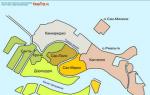
Climbing the Matterhorn. Matterhorn. Northeast ridge "Hörnli". A.D. Walks in the vicinity of Zermatt. Gornerschlücht Canyon and mountain villages
"I think every climber has a lot
their reasons to climb the Matterhorn.
But the main reason is the same for everyone:
climb the Matterhorn!
Gaston Rebbufa
It seems to me that there is a need to prepare a description of the classic route to the Matterhorn. It has matured for several reasons. Firstly, I am often asked for help in finding a clear, Russian-language description. As far as I understand, it still doesn’t exist. Secondly, according to my feelings, out of 10 groups trying to climb the Horn, 8 leave with nothing. These are just some of the bands I've only heard about. Unsuccessful ascents, as a rule, are caused primarily by insufficient information. A trip to Switzerland is an order of magnitude more expensive than a trip to the Caucasus, so it is doubly disappointing if the reason for the failure was the lack of basic information on the mountain.

Photo: © GunnarF
Let me make a reservation right away: if you understand English, read the site SummitPost, there you will find the most extensive route descriptions on the Internet. If you are going to the Matterhorn along a route other than the classic one, then you will still have to look for information on your own. I didn’t go to the Matterhorn from Italy, I wasn’t interested in the possibility of climbing from that side and I don’t intend to be interested, therefore I won’t be able to advise. So, let's begin...

Photo: © badyl
The Matterhorn, 4478 meters above sea level, is located in the Pieniny Alps on the border between Switzerland and Italy. Coordinates: 45.97627 N / 7.65738 E.
Difficulty category: sections of category III+, on railings III-/A0, throughout the rest of the route mainly I and II, on fairly long sections just on foot. Subject to the use of all railings on the route, the proposed Russian category is 3B.
Equipment: The proposal for the choice of equipment is made based on going out in ideal weather, in two in mid-August (ideal season). If the conditions are not ideal, there are more than two of you, or it is not the season, then the list will have to be supplemented. What to supplement and by how much - you should be able to determine for yourself. If you are not able to do this, then you most likely should not climb the Matterhorn out of season, or in bad weather or in a large group.

Photo © A. Abramov
Most bundles come with a main rope 40-50 meters long. In difficult areas it is used to its full length, in simple areas it can be “shortened”, on pedestrian sections it can be taken “in circles” and walked at the same time. Of course, you can use a double or longer rope, but you won’t get much benefit from it. Guys and other “hardware” are not needed on the route. Under normal conditions, it is enough to have loops with you for intermediate points: 4-5 loops 60 cm long and 3-4 loops 120 cm long. If you find this recommendation a little thin, then of course, additionally equip yourself with everything you deem necessary.
Despite the fact that many people go to the summit without a helmet, I would not recommend leaving it at home. Rockfall, according to statistics, is the most common cause of accidents on the Hernley ridge. For the upper part of the route, from the "shoulder" and above, crampons and an ice ax will be needed. The crampons can be anything you want, they must fit well on the boots. You can, of course, take Rambos and two ice tools in your hands instead of ordinary crampons, but this will not cause anything other than condescending smiles.
Clothes and shoes: For climbing in normal weather conditions, high-quality soft-shell clothing is quite sufficient. Pants and jacket with a hood. In case of unexpected and sudden deterioration in the weather, you should definitely take a membrane jacket with you and, optionally for the cold, membrane pants. If you don’t know how to quickly and confidently move along “three-point” rocks in bad weather, then it won’t hurt you to take an insulated vest (light down jacket) with you. Of course, gloves made of membrane fabric are also important, but such little things should always be with you.
It’s difficult for me to give any definite advice regarding shoes. Go with what you currently have. You must understand that in ideal weather conditions you will be hot in plastic, and in bad weather conditions in light membrane boots (like La Sportiva Trango) you will be cold. In both the first and second cases, you will have to be patient, but patience is one of the main qualities necessary for mountaineering.
Additional equipment: Be sure to take a headlamp with you (early departure, late arrival). Of course, you can take a thermos with you; before leaving the shelter you can fill it with hot tea for 8 francs. Or if you live in a tent, you can prepare hot tea yourself. Personally, I haven’t carried a thermos with me in the summer for a long time. A 3-liter volume “sippy cup” with a hose is enough for me, and for unforeseen circumstances I carry a jet boiler with one micro-cylinder inside. You can also throw in a few tea bags, a couple of hermetically sealed bags of sugar (taken from any coffee shop for free) and, to taste, a few bouillon cups sealed in plastic. This "gentleman's set" is lighter than a full thermos, but much more versatile than it. If you have a lightweight bivouac bag, take that too.
TACTICAL SCHEDULES OF THE EVENT:
Taking into account bad weather, days and trips to souvenir shops, you will need about 10 days to visit the Matterhorn project. Switzerland is famous for its excellent train connections, so if you arrive in Zurich/Geneva early in the morning, you will probably check into a hotel in Zermatt or Jugendherberg in the evening. The latter can be imagined as something reminiscent of a pioneer camp with multi-bed rooms and “divine” prices. Among other things, there is a campsite near Zermatt, but those who are especially thrifty can find a quiet corner in the surrounding area. I will not suggest/recommend such corners to anyone. It is not very legal to spend the night there and everyone must make this decision on their own.
The first day should be spent getting to know the village, believe me, it’s worth it. Along with numerous chic shops, increasingly aimed at the “Rublev” crowd, Zermatt has many historically significant places. Museums and climbing cemetery. You can find out more about all this at the tourism office. I won’t focus on this information; anyone who needs it can deal with this problem on the spot. It is much more important to take care of obtaining the latest weather reports and, if possible, information about the condition of the routes in general and the Hernley Gratt in particular. You can get all this information at the Alpine Center in Zermatt City.
Zermatt is surrounded by beautiful mountains! Everyone can tailor the acclimatization program to their own taste. To do this, you just need a map of the surrounding area, a guidebook (in German or English) and a desire. Anyone who lacks one of the ingredients can use the standard program practiced by both independent athletes and guides serving their guests. The essence of the acclimatization program consists of two ascents. One of them takes place on Rifelhorn 2927 meters above sea level. m., the second on Breithorn 4164 meters above sea level. m..
Rifelhorn
This peak is located southeast of Zermatt and is easily reachable on a one-day hike. Surrounded by dozens of “four thousand meters”, Rifelhorn somehow gets lost with its less than three kilometers of height. Nevertheless, it is a very interesting mountain. Composed of serpentinites (one of the igneous monolithic rocks), it provides an excellent vantage point over Zermatt. And for fans of multi-pitch routes, the southern face of the Rifelhorn is a real “Klondike”. I see it as ideal for acclimatization with a "fun factor". Not a difficult climb, the ridge route (also known as descent) from the Murishloch saddle (2775 m) to the top of the Rifelhorn can be rated as easy 2B, and multi-pitch on the south face, up to 300 meters long, varies between French categories 4a and 5c .

Rifelhorn with the Matterhorn in the background. The classic ascent route follows a sunlit ridge and then a series of climbs to the highest point (here the ridge is clearly visible in profile). More interesting are the multi-pitches along the south wall. She is on the left in the photo. To access the routes you need to go down to the terrace at its base.
There are two ways to get to the Murishlokh saddle. It is more sporting and useful for acclimatization to climb on foot. To do this, you need to leave Zermatt in the direction of the town of "Rifelberg" located at an altitude of 2582 m and further past Lake Rifelsee to the saddle. This will take you, taking into account breaks, about 2.5 or 3 hours. It can be done faster, but it’s better to go slower. In the end, there is nowhere for you to drive here. A more relaxed, but not cheap, way is to take the train up "Gornergratbahn" to Rothenboden station. The carriage passes directly under the northern wall of the Rifelhorn. Rothenboden is located opposite the Murishloch saddle. From the station to the saddle it is a 10-minute slow walk.
Rifelhorn at the summit post
Breithorn

Foto: Great view of Monterosa, Liskam and Breithorn (far right) © ferrom
After climbing Rifelhorn, you need to get even higher altitude acclimatization. The ideal location here is Breithorn, located south of Zermatt and, thanks to the cable car, "Klein Matterhorn" has become very accessible. You must, at a minimum, go up to the upper station of the cable car and walk the remaining 300 altitude meters to the top. This is not God knows what a feat, but it fully fulfills its acclimatization function.
To climb, you can choose one of two popular routes. The easiest option is to climb to the top using the “classic” method. To do this, you just need to walk from the Klein Matterhorn station along the supports of the rope tow about 400 meters to the south, after which the well-trodden path turns east and, having reached the saddle of the Breithornpass pass (3824 m, very unclear), turn north. Further the route passes along the snow-ice slope and leads to the western ridge of the peak. Along the ridge there are still a few tens of meters to the highest point. As a rule, this route is well trodden and quite clearly legible. Since this is the most easily accessible “four-thousander” in the Alps, it is wildly loved by both representatives of “collective” mountaineering and candidates for the Matterhorn who want to get quick acclimatization.
More interesting, both from the sporting side and in terms of enjoying the process, is the traverse of the central and main peak of the Breithorn. To climb the central peak, a combined route along the eastern ridge is used. The approach at the beginning is like a “classic”, but from the Brighthorn Pass pass do not turn north, but continue moving east towards the rocky outcrop with an elevation of 3831 m. To the right of it further, to the right of the southern edge to the Selle saddle (4022 m.) east of the central peak of Breithorn. Access to the saddle on fairly steep ice with a slope of up to 50 degrees. In the upper part you may encounter a rather unpleasant bergschrund.
The route itself is very pleasant, running along the eastern ridge of the central peak. The maximum difficulty of the climb does not exceed the French climbing category 3b. If in the upper part of the route you climb directly through the Spitz gendarme, then the difficulty of climbing in this section rises to 4a, but if desired, the gendarme can easily get around the shelves on the north side. Having reached the dome of the central peak (4159 m), continue moving west to the saddle at an altitude of 4070 m and climb along the eastern ridge to the main peak of the Breithorn. This route can be rated as Russian "2B". The descent from Breithorn follows the “classic” route.
There are several other routes to climb Breithorn. You will have to learn about them, organize and go through them yourself. In the end, I did not have the task of writing an online guidebook on the Pieniny Alps. For those who would like to climb the Breithorn “to be honest,” I can immediately say that this event will not evoke particularly positive emotions in you. The route from Zermatt goes along the ski slopes, which in summer are not very picturesque. In the upper part you will again walk along the tracks, but they are already active and for my taste this is a pointless activity, but not to mention the fact that you are wasting time and energy on it. If you’re really feeling bored, it’s better to go to Zinalrothorn or Obergabelhorn, it can entertain you a lot more.
Breithorn at the summit post

Photo: Excellent view of the eastern ridge of the central peak of the Breithorn © Bernd Stahl
TACTICAL DIRECTIONS FOR CLIMBING THE MATTERHORN:

Let's stop at the fact that you have acclimatized, found out the weather report for the next 3-4 days, rested and are ready to go to the top, which became the actual reason for your trip. First of all, you need to decide whether you live in Hernley shelter or not. Actually, there are not many alternatives. One of them is in the tents to the left of the shelter. This option is readily used by Spanish, Eastern European and other money-saving climbers. There are no particular problems with overnight stays at the shelter. Water can be "mined" from the glacier behind the ridge (on the north side of the Hernli ridge) or purchased at the shelter. Czech friends told me a story about how they went to a shelter to get water from the toilet, where they could get it from a tank, but were caught and shamefully escorted outside the hut.
If you don’t want to carry a tent, bivouac, food, etc., then you have only two options. One is to check into a shelter, I’ll tell you about the other below in the text. In order to check into the shelter, you absolutely need to reserve a place. If it is July or August and there are good conditions on the mountain and beautiful weather in the sky, then it is quite possible to fly past the reservation, then only the option of a tent will save you. Although I once saw such a situation that there was nowhere to put a tent. In general, the sooner you decide on the start day, the better for you. It is better to reserve immediately with half board. It involves a fairly extensive dinner and a very meager breakfast. You can simply reserve an overnight stay, but then you will have to prepare for dry meals or cooking outside the shelter.

Matterhorn, Hernli and shelter
You can get to the shelter either by foot or by using a cable car. In my choice, I am inclined to use the cable car, it saves energy and time. But if you have both in abundance, then you can easily climb to Lake Schwarzsee on foot. This will extend your approach time to the shelter by an extra 2 hours. From the center of Zermatt you need to walk in the direction of the Matterhorn, which is clearly visible all the time, and already in the village of Furi there are signs on the walking paths, one of which leads to the Schwarzsee. If you want to take the cable car to "Schwarzsee" then at the southern tip of Zermatt you will see the Furi cable car station from which, with one change, you will get to the upper cable car station. From there you can, following the signs, go down to Lake Schwarzsee and then follow the path to the shelter in a couple of hours.

Photo: Matterhorn in the rays of the rising sun © A. Abramov
If you climbed the Schwarzsee with the first cable car, then you will have time to both climb the hut and settle in it, and explore the lower part of the route. It makes sense to walk 2-3 hours along tomorrow's route in order to be able to remember key points for night orienteering the next day. It’s better to go to bed early, because the standard wake-up time at the shelter is around 3 am. I do not recommend that you get up before the general rise. You will probably not be able to leave the sleeping area silently; you will rattle, sniffle, and turn on a flashlight.
Most likely you will wake someone up with your fussing. But this is not the worst thing, it will be worse immediately after. Awakened climbers are unlikely to fall asleep peacefully. Most likely, overwhelmed by internal anxiety, they will also begin to get up and get ready. In this way, you will cause a chain reaction and, most likely, no one, and especially the shelter servants, will thank you. Therefore, sleep peacefully until the first wake-up call. Get up with everyone, go out, if possible, in the first rows. Of course, by climbing earlier you may gain a couple of hundred meters, but this is unlikely to save you from being overtaken by turbo guides with their crazed “guests” on a rope.

Photo: Anchor driven into the rock for insurance © A. Abramov
Let's get back to the climb. I would recommend that you also buy sausages, cheeses and Snickers for breakfast in Zermatt. Breakfast at the hut - tears of the occupiers. These are two slices of bread, a small briquette of butter and one bowl of marmalade for the table. Maybe in the couple of years that have passed since my visit to the shelter, a buffet has appeared there - I don’t know, but I have vague doubts about it. Most likely, everything remains the same, so just take all the pickles with you.
Don't waste time at breakfast. You absolutely need to finish in the top ten. Firstly, in this way you will avoid the queue on the first ropes, and secondly, you will be able, as far as circumstances allow you, to stand in the fairway of the guide and try to follow him without wandering along the route. Most likely you won't succeed. But it's not scary. If the weather is good, there are always a dozen guides with “guests” on the route. Losing sight of one simply slows down your pace. Move forward carefully and carefully. Having waited for the next “locomotive”, you get “on the rails” and try to keep up with them as much as your “breathing capacity” and your personal “relief development speed” allow. But you will fall behind - just to wait for the next tour guide.

Photo: Unforeseen overnight stay at the Solvay shelter © A. Abramov
Around the third hour (and you scouted everything yesterday, right?) it will dawn and you can calmly continue the route in accordance with the description. Above, I promised to talk about another tactical option for climbing. On the ridge of Hernli, at an altitude of 4003 meters above sea level. m. there is another hut, it is called the Solway shelter. There is no caretaker at this hut. It is open all the time and there is nothing on it except for bunks for 6 people (this is if half-sitting across, in fact these are ordinary two-story bunks for 2 people), a table and a bench. There is also a stationary radio station installed, through which you can contact either the hut or the Zermatt rescue service. I do not know exactly. Usually it is used by climbers who, due to circumstances, are unable to go down on their own. A helicopter comes after them and “rescues” them.
I suspect that some climbers, having slept at the shelter and waited for dawn, begin to leisurely climb along the ridge to this very hut. Some manage to do this quite quickly and, leaving the bag with a torch and whatnot, they calmly work further to the top. Having reached it quite late, they go down to the Solway shelter and stay there for an “emergency” (that is, not planned) overnight stay. Those who are even slower simply climb up to it and immediately stay there overnight. The next day, early in the morning, they continue to climb the Matterhorn and turn back within a day. Whether to stay there for the second night or go down depends on how early they “returned” to the Solway shelter.

Photo: Descent along the route in unpleasant weather © A. Abramov
Here I wanted to emphasize that such tactical arrangements are not entirely legal and are not always honest. This hut was erected for the sole purpose of saving climbers' lives in case of emergency. If you are found at this shelter, having checked in in advance, rather than hiding in bad weather or not making it down, then you are very likely to have problems. I don’t know what kind of problems these will be and how the retribution for such unethical behavior will be implemented, but it seems to me that it is already clear that this should not be done. If you ended up in this hut simply by “getting there” on the route, you can spend the night peacefully, just don’t forget, when passing the Hernley shelter on the way down, to pay the caretaker for that night. In general, this third tactical alignment is very unethical. That's all I wanted to say on this topic.
Climbing route: 1200 m. 4 hours, ↓1200 m. 4 hours, ↓ 8 hours
The route starts in the immediate vicinity of the hut; it takes at most ten minutes to get there. Leaving the shelter, you turn right, go around the house and behind it climb the path to the ridge leading to the first wall on the route. Along it, using a rope (the railings on the route are made of ropes similar to those that hung in Soviet gyms) up to the first balcony. Follow it a couple of meters further to a crack, along which again up to the next balcony. Follow it again to the left, along simple terrain, partially covered with scree, and climb, adhering to the ridge, to the first couloir.

Photo: © Marcus Liwicki
Along the couloir, which looks very welcoming, just a couple of meters (!!! despite the fact that further ascent seems quite logical!!!) up, and then again along the terrace to the left to the fireplace, which you need to cross and go out to the left onto the slope. Cross the slope and enter the second couloir, along which you climb 25 meters up and further along a clear inner corner going up to the right. In the very corner the view is quite limited. Climb along it until a large scree-covered terrace opens on the left. Along the terrace again to the left and cross it to enter the third couloir, along which you do not need to climb up at all (!!!), and after passing across it, exit on the other side at the same height.

Photo: The first meters of the route. Wall with ropes © hansw
Then traverse to the left until a logical and simple path opens directly up to the edge of the ridge (it’s worth scouting the route to get here the previous day). After walking along the ridge for some time you will find yourself at the foot of one tower. There is no need to climb it, but after making a traverse at its foot, climb up along its left side. Following several successive inner corners you will again emerge on the eastern slope of the mountain. Further along a very simple path, running along the eastern slope parallel to the next take-off of the ridge, more and more to the eastern wall, until you realize that you can climb along a not clearly defined rocky edge to the ridge itself above this take-off. Following this, the sharp gendarmes on the ridge again walk along the slope of the eastern wall, which is slowly beginning to become steeper.

Photo: Section of the Hernli ridge with the Solway hut in the middle © Velten Feurich
Along the eastern slope to the next rocky edge, characterized by its fault, and climb up along it (bolts) until you have 50 meters of height left to the ridge. Next come successive shelves of stones and smooth rock slabs. Follow them until you see the upper, wooden Solway shelter. Here begins one of the famous "Matterhorn places", the so-called "lower plates of the Moselle". First, along the slab (safety points in the form of reinforcements driven into the stone) straight up. When icy, these slabs can be slightly unpleasant. The difficulty of the climb does not exceed category III. Further along simple rocks to the hut.

Photo: Top slabs of the Moselle © skywalker
From the hut along the shelves to the left to the eastern wall, and from there along the next slab (“upper slabs of the Moselle”) back to the right, almost to the very edge of the ridge. In the immediate vicinity of it, to the left up to the base of the “red tower”. Climb directly over it, and go around the next tower on the left and go out again to the very ridge. At this moment you will be directly under the famous “shoulder of the Matterhorn”. Along the ridge or along the snow patch to the left of it, climb to the very top and along the sharp firn knife approach to the left to the base of the summit tower.

Photo: On the “shoulder” of the Matterhorn © skywalker
Now to the right of the ridge along the icy slope that formed the roof of the northern wall of the summit up to the beginning of the railing ropes. Now several ropes along the icy rocks of the edge of the summit tower upward. If you don’t use railings, the difficulty of climbing can reach category IV. More often than not, the whole thing becomes icy and there is not much joy from climbing. This place serves as one of the “eyes of the needle” of the entire route. You can get around the “protruding” ligaments only along the northern wall, on which there are not many opportunities for belaying.

Photo: Upper part of the “roof” © Michael Rauter
When the roof goes down, the ropes end. But even here, after 25 meters, crowbars are driven into the rocks on which you can throw a stirrup for insurance. In principle, you can walk on the roof at the same time, but you have to be damn careful so as not to slip or get pulled off by the rocks climbing below. At the end, the roof goes down completely and you can walk to the higher “Swiss” peak. There is a statue of some saint on it (I don’t know which one and I’m really ashamed). If you are interested in going to the Italian peak, then it will take you about 20 minutes there and back. The descent follows the path of the ascent. Be vigilant in finding the right route and be careful when descending with rocks. There will be people below you, probably a lot of people.

Photo: At the top of the Matterhorn © A. Abramov
PHOTOS FROM THE BOOK "Faszination MATTERHORN"


With this I have finished my, this time, virtual ascent and I wish you success in planning and implementing your ideas on the most recognizable and one of the most beautiful peaks in the world. If this description helps you climb to the top of the Matterhorn, then everything is not in vain. Your thanks are enough for me.
Sincerely,
Guiding in the Alps: [email protected]
Cool! Thank you!
Offtopic: Breithorn's traverse through the gendarme.

Expand discussion thread
Expand discussion thread
Naturally, the matter was not limited to the Matterhorn. In the process of acclimatization and to broaden our horizons, we went to Breithorn(4164 m), Castor(3920 m) and completed a traverse (4527 m).
My friend Sergei Popov invited me to Europe. Remember I wrote a post about and about? So, this is him.
Breithorn
Breithorn is probably the most visited mountain in the Alps. From Zermatt everyone takes the cable car to the Little Matterhorn station (Klein Matterhorn) from where you can climb to the top in about an hour. We walked the half-traverse of the Breithorn, that is, we climbed the western slope to the Western peak, walked along the ridge to the Central peak and before the Eastern Breithorn we turned right, into Italy. In the fog, Italy seemed like a gently sloping glacier with an icefall at the bottom. On the way down we accidentally came across Rossi e Volante Bivouac- one of the many huts built for the convenience of climbers. The hut turned out to be a tightly built birdhouse standing on the edge of a 100-meter gendarme. Bunks on two floors, table, bench. Clean and tidy. There are blankets and pillows on the bunks. There is a piggy bank on the wall in which you need to put 10€ per night. In general, in essence it resembles the Crown Hut in. I really liked it.
The weather was foggy.
The next day we tried to climb Castor. Visibility was about 5 meters, so while footprints were visible in the snow, we walked. And as soon as the tracks ended, they immediately stood up, since it was not clear where to go. We sat for a while, and it became clear: we need to go down. We went down to the hut Guide della Val d'Ayas.
Separately about the huts. They are more like hotels. Two- or even three-story buildings with electricity, a restaurant and free Internet access. The buildings are all solid, standing on massive foundations. IN Guide della Val d'Ayas, for example, up to 80 people can live simultaneously. There are 56 (!) such huts on the Italian side.
Castor
In good weather, Castor turned out to be a large snow and ice slope. In our case, more snowy. In a couple of hours we reached the top. Continue along the ridge east towards Lyskamma and the hut Rifugio Quintino Sella.
 On the ridge of Castor
 The comb is simple and spectacular. The hut is even larger than the previous one. It was Friday, and it was tightly packed with talkative Italians.
 Deuce under Liskamma's wall
 We spent the night and in the morning, surrounded by a crowd of local lovers of this activity, we moved upward. For the most part, everyone went to Castor, but we were the last group to go to Liskamm.
 Liskamma ridge
 Liskamm is a big mountain. The maximum height of 4527 meters and the long (about 5 kilometers) ridge make it difficult. In some places, only two feet can fit on the ridge, so you have to balance while walking. In case of strong wind, we can assume that it will be quite entertaining. On the ridge, I constantly remembered the “Komsomol insurance” (this is when, in the event of a failure of one of the participants, the other jumps to the opposite side of the ridge). Once my partner was about to roll away, and I almost jumped. But he changed his mind in time, so that I managed to catch the ridge.

From Liskamma we descended to the Swiss side along the glacier Horner, having drunk tea on the way Monte Rosa Hutte. I never cease to be amazed by this situation: all around is a glacier or, at best, a moraine, and in the middle there is a three-story building with a summer terrace, tea and delicious pastries.
 Trail from Gorner Glacier to the railway
 We missed the last train to Zermatt. And, you know, it’s not a pity. In the morning we were shown the stunningly beautiful Matterhorn.
Climbing the Matterhorn along the Hörnli ridge can hardly be called technically difficult. Even though in the fog we climbed almost entirely along the ridge (which for the most part goes along the trail), it is not very difficult. But it's damn long. Hörnli's hut is currently being renovated, so we lived in Solvay Hutte- this small hut with 10 seats is located in the middle of the route. It smelled like a public toilet, there was garbage and disorder inside. It’s immediately obvious that the place is popular. I took a shovel, cleared the snow from feces, cleaned the house and immediately felt better. I found a logbook on the shelf. There are many familiar names in it: Rozov, Ruchkin, Provalov, Selivanov, Klebansky. I also modestly signed up.
 Upper part of the Hörnli route
  Approach to the summit tower
 The entire route is equipped with bolts, cables, ropes and rappel rings. The main thing is to find them. We followed them strictly only at the very top of the ridge, where it was more difficult to go to the side than to go up.

On the summit ridge there is a cornice with a path. In one place the path (together with the cornice) is interrupted by a meter-long gap. Apparently the cornice couldn't withstand someone.
 Exit to the top of the Matterhorn
 Below the top there is a large cross. Just below there is a statue of St. Bernard. I treacherously insured for them.

We descended along the ascent path. Along the way I found the right road to climb. It goes to the left of the ridge (if you go up). By the time we got down, the cable car to Zermatt had already stopped working. We could have walked, but we stayed in Schwartzzi- hotel next to the cable car station. There... but by the way, mountaineering has already ended there.
This story happened in September 2011, and only three years later did we find time to write it down. So there may be some inaccuracies due to forgetfulness, but in general the author tried to be as thorough as possible and as memorable as possible.
In addition to mine, the article uses photographs of Tanya Egorova, Masha Borisova and Sasha Khalyapin.
Mountaineering has been present in my life for quite a long time. Training, running, skiing, climbing stands, trips to the rocks in May and finally - climbing camps in the mountains as a summing up: a year has passed, we need to prepare for the next season.
But over the years, our company began to go to the mountains less and less.
The last time my friends and I went to a mountaineering camp was in 2006, to the Caucasian alpine camp “Ullu-Tau”. And after that, somehow gradually but steadily, our community split into two groups: hedonists and masochists. Hedonists became addicted to holidays at seaside resorts and educational tourism, and only went to the mountains as skiers. In general, we became closer to normal people.
Masochists became addicted to Rogaine.
- What? - you ask.
- Well, it's something like orienteering. A place of swamps, pits and brown areas is chosen (if there are slides, that’s also very good), a lot of people gather there, the participants are given maps and they run for a day (sometimes less), collecting checkpoints throughout the area. And then they discuss who made a mistake where, where they lost time, or what control point they couldn’t find.
I found myself in the first group: hedonists - and became interested in educational tourism. What brought my travels closer to rogaine was the fact that in each new place I tried to “take in” the maximum number of attractions.
But one spring I suddenly wanted all of us, like before, to get together and go to the mountains. So that everything would be as before: tents, early rises, meeting the dawn in the mountains, snow on the slopes. Well, let it not be a climb, let it be an easy, beautiful mountain hike. I called out - shouldn’t we go on a hike around Mont Blanc?
Unexpectedly, my call found a lively response. And now we are sitting in one of the Moscow cafes and discussing plans for the summer. 4 rogainers: Sasha, Masha, Dima and Tanya - and 2 hedonists: me and Kolya.
The hike around Mont Blanc was immediately abandoned. Sasha said: well, this is for pensioners. Maybe in 15 years we’ll take a walk.
Instead, the idea of going to the Matterhorn arose, which was accepted with enthusiasm. Even Dima, who promised his wife to spend a vacation with his family, said that he was unable to refuse such an offer.
(Climbers, if there are any among the readers, can skip the next paragraph). In case anyone doesn’t know, the Matterhorn is one of the most beautiful Alpine peaks on the border of Switzerland and Italy (the Italians call it Monte Cervino). Translated as “horn in the meadow.” It really stands apart, apart from other peaks, alone in the “meadow” - a delightful pyramid with sharp ribs and a slightly broken beak.
People go to it both from the Swiss side of Zermatt and from the Italian side, from Cervinia. Several years ago (in 2005) I had an unsuccessful attempt to climb the Matterhorn, the weather interfered - the night before our ascent there was a severe snowstorm. And now, of course, I was glad to have the opportunity to try again, and in such wonderful company.
But it turned out that that's not all. Tanya said that her dream is to complete the Monte Rosa traverse. (The climbers skip the paragraph again.) The Monte Rosa massif is a long mountain range with many peaks, one of which, Peak Dufour, is the highest point in Switzerland and the second peak in the Alps after Mont Blanc. I had already been to Dufour, I didn’t want to go there the second time, and the prospect of going on a 6-day traverse of the entire massif seemed very doubtful to me (for me personally). I had a feeling that after the traverse I would no longer need the Matterhorn.
But I remained silent, thinking that I would go to one of the peaks for acclimatization, and then my sports comrades would go further along the ridge, and I (say, with Masha: I hoped that she would support me) would go down and take a walk around the outskirts of Zermatt. Or I’ll see some Swiss town. And then we will reunite and climb the Matterhorn together.
So I decided to myself and remained silent. And later it turned out that Kolya was also confused and even slightly frightened by such far-reaching plans. The Matterhorn is one thing: what climber doesn’t dream of climbing there! Another thing is endless sawing along an endless ridge. But Kolya also remained silent. And after the meeting I thought and thought and went on vacation with my wife to the Canaries. And we lost a valuable male unit.
Preparing for the trip and training period
There were five of us left.
And they began to prepare for the trip.
After this phrase, it is necessary to explain that when Sasha joins an event, everyone else can relax a little. The phrase “started preparing” in our case meant that Sasha was looking for options, putting forward some proposals, booking something, and we handed him the money. Somehow, unnoticed, tickets to Geneva were purchased, hotels were booked, sports nutrition was purchased, and equipment was selected. On the appointed day, we went to the visa center and received visas (about preparing for the trip -).
I honestly tried to improve my fitness, but for some reason every attempt to go for a run ended in severe pain in my foot. 3 days after the run I walked with a limp, the pain went away, I went to run again - and everything repeated. At work, there was also a moment of uncertainty: either we were all letting ourselves go, or we were working as hard as we could - in any case, there was no talk of vacation; rather, it was about finding a new job.
A person who listens to his inner voice would have abandoned the idea long ago, but I persisted. And the process gained momentum.
Therefore, when a week before departure I suddenly fell down with a temperature of 38, it could no longer affect anything. A heavy dose of antibiotics - and I pack my backpack. “If my health does not allow me to walk in the mountains, I will walk through the valley, travel through Switzerland, and when my friends (from time to time) come down from the mountains, I will joyfully meet them and listen to their stories,” I reasoned.
The day of departure arrived.
“Make sure you don’t crash there,” my son said to me goodbye. - This would be completely inappropriate.
(Once upon a time I asked my child how he liked the new teacher in kindergarten.
“She has a great sense of dark humor,” the kid answered.
Looks like he learned a thing or two from her.)
Thus instructed, I went to Domodedovo.
Geneva-Zermatt. First trip to the mountains
We landed in Geneva late in the evening. At the exit from the airport a man was waiting for us with a sign. We loaded into his minibus and went to the reserved apartment. The next morning, he moved us with our backpacks to the railway station, and we went by train to Zermatt.
The sun was shining, Lake Geneva sparkled outside the window, Chillon Castle flashed by. The mountains began.
In Visp we changed to a local train and drove along a picturesque narrow gorge, past charming small villages. The eyes rejoiced, the soul sang.
And here is elegant, lively Zermatt, filled with tourists, idle and prosperous, and every house is decorated with flowers. An orchestra is playing on the station square, and there are carts with horses. Either a crowd of small Chinese in wide-brimmed hats will run by, then a gray-haired traveler with a cane will walk with a sedate gait, then laden climbers with singed, weathered faces will pass by. In their eyes there is still snow, and a blizzard, and a reflection of another world from which they have just returned. But soon they will throw off their backpacks, wash themselves, change clothes and mingle completely with the rest of the crowd.

On the main street of Zermatt

Trio on the station square
How nice it is to find yourself again in a place where you once visited, and to be surprised to discover that little has changed here: the streets are still bustling with life, and the beautiful Matterhorn rises above the roofs. It always happens strange to me: you leave your favorite place, then you return - and life, it turns out, continued here without you.
Arriving at the campsite, we set up tents on the lawn and settled in. We got hold of a table and chairs. And we went to explore Zermatt. The walk around the city ended with a visit to the local Coop supermarket, buying all sorts of delicious cheeses, cookies and wine.
The next day we walked through the mountains, climbed up to 3000 m on the plateau, to the Gandegg hut. I was afraid that our athletes would run like they were on their rogaine, Sasha was especially suspicious. However, a pleasant discovery awaited me - recently Sasha had become interested in photography, bought photographic equipment and now reacted to every beauty.

Sasha in the face of Beauty
And then he and Masha got completely lost - it turned out that they met a large concentration of mountain goats among the stones and until they had captured everyone, they did not move. And most of all, Sasha wanted to photograph the groundhog.
Climbing the Riffelhorn
A day later we climbed the Riffelhorn. A pleasant rocky mountain, from which there was an excellent view of the long winding tongue of the Monte Rosa glacier, the observatory on the Gornergrat and, of course, the Matterhorn. At the foot of the mountain there was a dark lake, and a small mountain train was crawling back and forth along the slope.

Lake Riffelsee

Start of the route

Dima on the rocks

Masha goes after Dima, I belay and pose

My turn

The top is getting closer

First link at the top

The second bunch is on its way

Everything's on top

Descent. Masha rappelling
Having descended from the mountain, we found ourselves at Lake Rifelsee, among the walking public, attracted by the beauty of the mountain lake. The main aesthetic component of its beauty was the unbearably beautiful reflection of the Matterhorn on the water surface.

Lake Riffelsee
Sasha ran ahead and took the lower path in the hope of bumping into a marmot.

And from our path we saw a fat marmot down by the stream and shouted to Sasha, but for Sasha’s photo lens the coveted animal was already out of reach.
On local trails, there are periodically transverse partitions made of stones so that water during rainstorms does not wash away the trails, but spreads along the edges of the trail.
“Yes, a cyclist can’t get through here,” we summed up. Just then a cyclist appeared around the bend and rode past us, jumping over every barrier on the path. We just didn't applaud such acrobatics.
On the border of grass and forest there was a lonely hotel, with swings, flower beds, a chapel - Riefelalp Resort 2222. Charming local sheep, white-fleeced and with black faces, grazed around. Some of them poked their noses at the doors of houses, but no one invited them inside.
And in the forest we saw a deer.
Then there was a day of rest, almost entirely given over to rain. And talk about traverse. The question was raised about how to arrange it so that Masha and I could return down after the first peak, releasing the three fighters for a long traverse. In Moscow, selfless Tanya spent almost a month, going to work in the metro, translating an English book with a description of the traverse and putting together a thread of the route from the pieces. I was preparing to make my dream come true. She planned to go from east to west, from Nordend to Breithorn.
Sasha looked at the maps, the navigator and said that we would go from west to east. Tanya objected furiously, a month of her work was in vain: where rappels were supposed to be, now there will be railings and vice versa. Not at any gate. Sasha immediately began to translate her book, as if we were going in the opposite direction. Finally Tanya was persuaded.
Then the rain stopped, and we began to prepare for tomorrow's departure.
The next morning we didn’t get up early, took the ski lift up to Trockener, then walked along the glacier. Several skiers passed us from the pass. To be honest, I would have regretted the skis - there were a lot of small pebbles on the slope.

We go up, skiers go down

4 swallows on a glacier
We pitched our tent a little below the Theodulpass pass.

Our plan for the next 24 hours was to spend the night at altitude, traverse the entire Breithorn, and spend the night in a hut near Rocho Nero. Then our paths diverged: Masha and I went down, and Tanya, Dima and Sasha walked to Nordend.
We had a snack in the tent, then, lightly, without backpacks, we went to the pass.
I looked after the skiers, and lo and behold, Dimka had already fallen into the crack. He spread his elbows, caught the edges, and looked out from under the hood. And under my feet, he says, there is emptiness.

The rest ran up, pulled out their comrade, took out a rope and went, already tied, to the pass.
There used to be a border post at the pass. Many buildings of various purposes remain from that time. Now the Italian-Swiss border is marked by a stripe on the concrete floor, which we, lined up in a line, stepped over together.

We wandered among strange structures.

We wander along the pass

Two huts were open, there were cafes and even people there. We drank coffee and strudel and went to our tent. The snowcats had just begun ironing the glacier and preparing the slopes for skiers for tomorrow.
We left before dawn. At altitude the colors are thick and viscous. The thick, dense blue turned into a crimson dawn, and the surrounding mountains changed color before our eyes, from crimson to pink.

The light grew, and now the sun had broken away from the snowy slope, and nothing was left of the pink - an ordinary sunny day, white snow and purple sky.
The lift to the Klein Matterhorn started working, delivering portion after portion of fresh skiers and climbers. We were just still alone, and then the skiers began to rush by one after another, and climbers flocked towards the Breithorn.
The Breithorn massif has 5 peaks, all of them above 4 thousand meters. The most visited is West Breithorn, closest to the lift station. As a rule, it is part of the standard acclimatization program before climbing the Matterhorn: to “get loose,” they go to the Riffelhorn; to get used to the altitude, they go to the Breithorn. And then to the Matterhorn.
A chain of footprints climbed the snowy slope to the top. The black dots of the climbers moved on the white side of the mountain. We also went upstairs.

Climbers climb West Breithorn
There is pandemonium on the broad summit of West Breithorn. Someone sits and has a snack, someone takes pictures, people come and go. For most, this is the apotheosis of today. The main task is completed, you can relax, sit for a while, admire the views and head down into the green, sunny Zermatt.

At the top of the West Breithorn

Group of traversants
Not us. For us, this peak is the very beginning of the day. We stood with everyone, drank water, took pictures and headed east along a narrow snow ridge stretching into the distance.

We're leaving for the traverse

Along the snowy ridge

At first there was still some kind of group looming ahead of us, then we were left alone, no one was catching up with us, and we didn’t meet anyone else for the whole day. We walked and walked along the ridge, climbed oncoming rocks, rappelled, everything was as usual. Sasha forgot to turn off his mobile phone, and from time to time he received SMS congratulations from Beeline on his arrival in Italy or Switzerland (7 pieces in total).


Descent from the "gendarme"


It was already getting dark when we finally descended from the ridge onto the snow plateau. Sasha took out the navigator and announced:
— 400 meters to the hut.
The endless snow stretched before us without the slightest sign of a hut. Trustingly we followed Sasha.
- 100 meters to the hut - the same picture. We are walking knee-deep in snow.
“10 meters to the hut,” Sasha finally announces.
We stop and turn our heads. Everything is the same: on the left rises the steep side of Rocha Nero, on the right is a gentle snowy slope going into the Champoluc valley. Far below, the rare lights of an Italian village glow. And, by the way, it’s already quite dark, as if it had just been twilight.
I mentally sigh, imagining how we will now dump the contents of our backpacks into the snow, take out the tent, and set up.
Dimka takes a few steps to the side and finds himself on the edge of a cliff.
- There she is, below us!
Hooray! We climb down the rocks, untie ourselves and go into the house attached to the rock.
There is nobody there. The hut is very small, two-tiered chambers, a wooden table with a bench. Boil water, dilute galu-gala. Everything is just great! What a pleasant evening!
We woke up from the “commander’s steps”: the iron clatter of cats on the metal platform of the hut. Bang-bang-bang! The door opened and two people entered the hut. The new arrivals turned out to be Italian guides. In the morning they set out to climb, but bad weather and strong wind forced them to seek shelter.
We boiled water, had breakfast together and drank tea. Tanya, who studies English and never misses an opportunity to practice the language, asked them in detail about obtaining the title of alpine guide.

Soon the guys left. We also got ready and all went together to the Klein Matterhorn to see Masha and me off.

Rescue hut
The weather had really turned bad: lead clouds had descended on the mountains and the wind was blowing.
We walked along the plateau along the steep wall of the Breithorn massif, and the distance that we covered yesterday all day along the ridge, today we covered it below in about thirty to forty minutes.

We thought that the lift would not work in such a wind. However, when we, snow-covered, in harnesses, with rings of rope over our shoulders, stumbled into the station, we were happy to see that the carriages were coming and going, the cafe and store were open, and, in general, it was quite lively here.


We sat in a cafe, then our comrades went back, and Masha and I got into the trailer, taking off systems, down jackets, polars, self-resets as we went, and after a while we found ourselves in Zermatt in the middle of open summer, in the thick of an idle resting crowd.

From winter to summer

Shower, shop, long dinner. The people of Kiev were camping next to us. They arrived later than us, they had about 10 days to do everything. Now there was one of their girls in the camp, non-climber Katya, who was promised an extensive cultural program, such as Milan, Venice - as soon as the men went to the Matterhorn. And so, while her friends were undergoing shock acclimatization, Katya, having acquired a map of walking routes, walked alone along the surrounding paths. That day I walked the “Across Five Lakes” route, and he said it was very beautiful.
Walks in the vicinity of Zermatt. Gornerschlücht Canyon and mountain villages
In the morning after breakfast we set out to look for a canyon-cleft that we noticed when we were going down on the ski lift yesterday. But, passing by the church in the central square, we decided to look inside and got stuck there for a long time. These days there was a music festival in Zermatt, and we just got to an orchestra rehearsal. The musicians in jeans and T-shirts sat in a semicircle in front of the altar, in the center in front of them stood the soloist violinist, and we, either from the sounds of the music or from the handsome violinist, still could not tear ourselves away and go about our business.

By the way, the church is painted in a non-trivial way. Noah's Ark is floating on the ceiling, sad people (righteous) are sitting there. And in the depths of the sea lie the dregs of humanity: a skier, a man who stuck his head into the TV and other characters. The allegories are not very clear. The contemplation of these frescoes always plunged me into some thoughtfulness. Why is skiing frowned upon? So much for a church at a ski resort.

Fragment of a painting in the cathedral. What a disgusting fat skier falls right into the shark's mouth!
We finally escaped from our sweet captivity and went to look for our canyon. On the way, several times we came across a sign with this set of letters “Gornerschlucht” and I had a suspicion that this was exactly what we needed.
We left the town, passed the cable car station and the fan park behind it, and here is the entrance to. Grandma came out of the booth and sold us a ticket.
A wooden flooring with railings is laid along the walls of the canyon, a bridge is thrown to the other side of the gorge, and a staircase goes up from it. Below, squeezed by the walls, an uncontrollable stream rages, falls down and pacifies.


We admired the canyon, climbed up and went further wherever our eyes led us.
We walked past small villages - literally 5-6 houses. The houses in them outline a certain space. You walk through a narrow gap between neighboring houses and find yourself in a lovely clearing, where among flowers and stones there are open-air cafes with just a few tables. And a little on the outskirts there is an indispensable chapel. And what delicious homemade desserts there are - with strawberries and local whipped cream!

We crossed the gorge along a narrow bridge, and the path began to climb higher. We found ourselves above the Furi station, and around the bend Zermatt opened up. Sheep were wandering along the path towards us. Seeing us, everyone climbed up as if on command and walked around us along the upper path.

It's starting to get dark. We went down to Zermatt and stopped at a bookstore to decide where we should go on an excursion tomorrow. The fact is that before the trip we bought a Swiss Flexi Pass - a card that gives us the right to travel throughout Switzerland for three days. The first and last day are, of course, traveling with backpacks between Geneva and Zermatt. And we decided to use one more day tomorrow. After looking through the guidebooks, we chose Thun and Bern.
Just in the evening we received an SMS from our climbers. They reported that they had interrupted the traverse and would be in Zermatt tomorrow evening.
Thun and Bern
The next day around 8 am we arrived in Thun. Masha, as a trained orienteer, quickly discovered the letter “i”. At the information center we took a map of the city with attractions and went for a walk around Thun.
Thun turned out to be a lovely town. It stands on the shore of Lake Thun, and the fast-moving Aare River flows through the city, flowing from Lake Thun. In the center of the city, the river splits into two branches and forms a narrow island. Wooden bridges are built over the water streams, not primitive functional passages from one bank to another, but decorative covered galleries decorated with flowers that cross the river at an acute angle, and even with a knee. I've seen bridges like this before in Lucerne.

Thun, bridge over the Aare. Pay attention to the color of the water!
The water is clear and greenish in color. Every fish is visible. And there are a lot of fish here. Swans are swimming.
The town hall of Thun stands below near the river. Thun Castle rises above. The castle offers wonderful views of the lake, mountains and the lower city.

After walking around Thun, we took the train and in 20 minutes we were in Bern. The train station in Bern seemed simply cosmic compared to the Thun station, but Masha found the letter “i” here too without hesitation. I told the girl at the tourism office that we didn’t have much time, and asked her to mark on the map what we should see first. And with this marked map, we went for a walk around Bern and looked not only at the marked points, but, it seems, at all the objects marked with numbers on the map. We just didn’t go to museums.

We liked Bern. The weather was sunny, people were sitting idly in a cafe on Town Hall Square, we also had dinner, then walked again, and at about 6 pm we went to our Zermatt.
It was already dark when we arrived. At the campsite we met our friends, who were found in a rather cheerful state, and not completely exhausted, as we had expected. They told of their heroic march and descent to the Monte Rosa hut. On the day we parted with them, they went to the rocky peak of Rocha Nero, spent the night in the same hut as the day before, and the next day they went towards the brothers Castor and Polux. And they walked along the snowy ridge, conquering the passing peaks. (Since only Tanya had the camera, all the following photographs of the traverse are from Tanya).


Endless Comb
At some point, Sasha realized that they would not have time to meet the allotted time - an endless snow “knife” of the Lisks loomed ahead.
You can’t take Sasha with your bare hands, he is always ready for any turn of events, and all his options are calculated in advance. For such a case, he had downloaded a track of descent to the glacier along the bottom of the northern face of Liska, and it was this trump card that he calmly pulled out of his sleeve.

And so, along snow-covered rocks, then along a torn glacier, they descended, and descended, and descended.


And the hut on the other side of the river was already visible. But we had to spend the night on this bank - wait until the flow of the mountain river froze overnight, and cross it in the morning through low water.
They ate at the hut and toured the hut itself - the embodiment of new technologies and modern design. The hut was built in record time - 4 months - and for decent money (in the Zermatt Museum all the costs of its creation were outlined and a film about its construction is shown).

The Monte Rosa Hut is a marvelous creation of human hands

Hut inside


Well, and then they went home. And this path was also not close, although it did not count, since it no longer represented anything heroic.

Fragment of the way back - climbing a steep staircase
Relax and get ready: Zermatt Museum, walk to Tasch
Tanya immediately said that she was not ready to go to the Matterhorn the day after tomorrow, she needed two days to recuperate. And the next day, indeed, I lay motionless in the campsite on a rug near the tent. And a day later she began to move.
Without Tatyana, we spent the day at the Alpine Museum in Zermatt, where four of us went. We went to a cafe where the waitress turned out to be a girl from Croatia. In general, we wandered around Zermatt.
The next day, the revived Tanya and Dima set off in the footsteps of our walk with Masha: to the Gornerschlucht canyon, Blatten - Zum See - Zmutt. Sasha and Masha went on a photo hunt for marmot marmots.
And I walked along the mountain path to .
In the evening we gathered at the campsite and after dinner began to prepare for climbing the Matterhorn. That same evening, Ukrainian guys returned from the Matterhorn and described their ascent to us in detail. Their story was emotional. They had to spend the night in an intermediate hut, where one of them left his helmet.
Dima said that we also couldn’t avoid spending the night at the Solvay intermediate hut (the Solvay hut is located in the middle of a rocky edge and is intended for emergency overnight stays). Sasha said that this was not sporting and was somehow even embarrassing.
In the morning, in a cheerful, wide front, in a line in a row, we headed to the ski lift. The morning was slightly gloomy, but the mood was victorious.


The whole team is near the lift
The lift took us to the Schwarzsee lake, from which the trail to the Hörnli hut began.
“Yo-prist,” Dima cried. “I forgot Kolya’s stick downstairs.”
Before leaving, Dima borrowed some climbing equipment from Kolya, who had not gone. Kolya is a neat person. Dima was very amused that special caps were put on the ends of the trekking poles, and on the last evening before our departure Kolya called Dima and specially emphasized that Dima would not lose the caps.
Actually, these caps for the sharp ends of the sticks are the only thing that Dima managed to save from Kolya’s property on this trip.
So, the poles were left at the lower station of the cable car.
Tanya gave Dima one of her sticks, and we moved towards the Matterhorn.

Climb to Hernley Hut
The path to the hut runs along the rocky ridge, moving from one side to the other. Below the path there are faults, then there is flattening.

In one place, under the dumps on the “shelf,” we see among the stones a huge inscription in Russian: “Zhenya, marry me!” I’ll be honest, I was proud of Russian men in my soul! Somehow the man climbed down the rock, marking out the giant letters so that Zhenya could see for sure. I think the girl appreciated this extravagance.
We arrived at the hut. A fresh wind was blowing and the sun was shining. On the open veranda of the cafe there were menus on the tables, sealed with numbered stones so that the menu would not be carried away by the wind.

At Hernley Hut
We descended from the hut onto a dry, covered slope where we could pitch our tents. The Ukrainians warned us that there was no water nearby, we had to either buy bottled water at the hut (8 francs per liter), or climb about forty minutes to the glacier and chop some ice. We brought some water with us.

Having set up the tent, we had lunch, then Sasha and Dima went to explore the beginning of the route. Since we were supposed to leave early in the dark and we were told that many people wander at the beginning of the route, it was decided to find a way out to the ridge in the light.

The men gather to explore. Hernley hut is in the background.
The guys left, and we stayed at the tents to gain strength for tomorrow. We watched their movements through the camera lens - two colored dots moved along the rocky wall, then disappeared around the bend.
About two hours later the guys returned and we had dinner. Tanya and I went up to the hut to buy bottled water. The hut was full of people, all the benches in the cafe were filled, the waiters were rushing between the tables. Climbers, both independent and mountain guides with their clients, were preparing for the ascent. The next day there was a good weather forecast, and on days like this the hut is usually full.

The night before reaching the summit
This is good income for local men. During the season, mountain guides make 40 ascents of the Matterhorn, receiving 700 francs for each. In winter they work as ski instructors. The owner of our campsite, Richard, made countless ascents to the surrounding peaks (but first of all, all visitors are attracted to the Matterhorn), and in his old age he became the owner of the campsite.
For clients, the climb costs 1,300 francs. Those. a person comes to Zermatt, comes to the mountaineering office and hires a guide for the climb. Naturally, he must be physically prepared, otherwise his money will be wasted. The route must be completed in a day. They leave the hut at 3 am. By 8 am (no later) the guide and the client must pass the Solway intermediate hut. If the client “doesn’t stick it out” and they come to Solvay later, then it is considered that they do not have time to complete the route in a day and turn back.
Some hire guides only up to Solway Hut, the price of such a half ascent is half as much.
The standard acclimatization program for climbing the Matterhorn is as follows.
The first day is a walk from Zermatt to altitude 3000 (we walked to Trockener station and to the Gandegg hut). Then – climb to the top of Breithorn (4164).
To “refresh” your climbing skills, go to Riffelnorn (2927) - a short, purely rocky route.
To complete acclimatization, they go to Peak Dufour (4634) - the highest point in Switzerland. The route runs along a long snow ridge with climbing sections. Its main difficulty is the large climb and, accordingly, loss of altitude. The Monte Rosa hut, from which they begin their ascent, is located at an altitude of 2795.
After completing this program, a person is considered ready to climb the Matterhorn.
The guide gives recommendations on equipment, the client buys what is missing in one of the many sports shops in Zermatt or rents it. Guides, I noticed, like to recommend buying a new rope, although they themselves lead the client on a “short leash” of 3-4 meters - not at all the way we were taught in mountaineering camps. Although, on the other hand, if a client pays that kind of money for an ascent, he realizes that he is quite capable of the ascent and is sufficiently prepared for it.
So, there were too many people at the hut. Just such a mountaineering brotherhood was in the air, as if before a decisive battle.
But on the site in front of the open cafe there was calm and tranquility. The full moon hung in the pale pink sunset over the mountain peaks. The air was fresh and very calm. The campground turned off its lights and fell silent.

We planned to leave early to get ahead of the main crowd and, if possible, be on the ridge before everyone else.
We got up at three o'clock in the morning. With difficulty we stuffed some porridge and tea into ourselves. Having crawled out of the tent, we began to get ready and put on our harnesses.
The night was warm and starry.
Sasha and Masha were the first to gather and went towards the mountain, quickly disappearing into the darkness.
We soon followed them out.
We climbed the first railing, the second - all using stationary, tensioned cables. The railing ended, and here we wandered a little in the dark.
In the darkness, a presence was always felt, someone’s screams and voices were heard. A group of Czechs lined up behind us.
Finally we got our bearings and soon climbed onto the ridge.
At some point, I looked back and saw in the darkness a dense moving snake of lights approaching us. It was the guides and their clients who quickly climbed up. The guides knew every stone here by touch, they didn’t have to think about which shelf to walk on, they powerfully and smoothly rushed forward. For them it was less a climb than a race. The main thing is that the client maintains the pace and moves at a given speed.
It's dawn. I looked back again and saw that the rocks behind me were strewn with multi-colored helmets. I have never seen such crowds in the mountains before.
“Holy shit,” Dima cried, clutching his head, “I forgot my helmet!”
Tanya and I stopped. “I didn’t bring a spare helmet,” Tanya said guiltily. Usually Tanya always helps everyone out. She very usefully has extra ropes, glasses, mittens, medicines, etc. But she didn’t provide for a helmet.
“Damn, what to do! – Dima looked at the approaching guides, then up. - Okay, let's climb the ridge. But on Solvay, the helmet from the Ukrainians remained.”
And we climbed up the ridge.
Soon the main crowd caught up with us. It was as if a cloud of locusts had flown through us. People were climbing from above, from below, along parallel shelves. A girl with a small backpack walked next to me and was led by a guide on a short rope. Her breathing was even and serene, as if she were walking across the plain, and not rushing after a guide.
“She doesn’t have a backpack at all,” Dima explained. He always finds a convincing reason for someone else's superiority.
It’s interesting that all the climbers were dressed in Marmot clothing. One girl correctly noted: “Army of marmots.”

Numerous climbers on the slope of the Matterhorn
There were vertical railings that we had to stand in line for. And already the Solvay hut appeared above - a house very unexpectedly appeared on the very edge of the abyss, and my heart was filled with joy.


Last pitch to Solway hut

Solvay Hut (Ernest Solvay - Belgian mountaineer who financed the creation of an emergency hut on the edge of the Matterhorn)
Near the hut we met Masha, she was just adjusting her leg to a high hold, preparing to climb the rock. Sasha has already gone upstairs.
We entered the hut. It was 8:30, that is. time is an indicator of whether the group has time to climb the mountain in a day or whether there is a possibility of an emergency overnight stay. It turned out that we were on the verge.
They searched the entire hut, but did not find the helmet left by the Ukrainians. Someone has already picked it up.
We sat at the table.
- Well, it’s clear why I forgot my helmet, right? – Dima asked under our condemning gaze. “I put a flashlight on my hat, but I thought I was already wearing a helmet.” All because of the flashlight.
Finally he waved his hand: “Okay, let’s climb on.”
We decided to lighten our backpacks and left some of the supposedly unnecessary things in a bag on the hut.
When we lined up on the railing, we found ourselves in the rear guard of a flying squad of climbers. Moreover, after Solvay, some of the people turned back.
If in the first part we mostly climbed at the same time, then in the second there were a lot of railings. On the railing, the speed of the three dropped significantly, and we slowly but surely moved to the very end.

Railing above Solway hut

Meanwhile, those who had already gone to the top and were now running back to the hut fell from above. Especially fast ones (including guides) usually go down to Zermatt on the same day, rather than spend the night on Hörnli.
Therefore, we now had to wait on the railing until someone came down from above.
The rocks ended and ice began, covered with snow. We put on our crampons and climbed up the ice-rock slope. Dima reproached me for climbing slowly.

Ice-rock slope
On one steep section, in addition to the cable, there was a chain hung. And in one of the rings of this chain I got a cat’s tooth stuck. It's stuck tightly, and won't budge. I was hanging on the rope with one hand, trying to free myself from the chain with the other, and from above, right above me, I heard Dimka talking to Masha and Sasha, who were already walking down from the top.
Finally, the damn chain let go of me, and I climbed out onto the shelf with my comrades.
Sasha said that it was not far to the top. But I, feeling guilty for slowing down so much, said that I would probably go down with them. It is clear that the three of us are climbing slowly, and even to the intermediate Solvay we will have to descend in the dark.
Tanya climbed onto the shelf (in my background - lightning fast).
“What are you talking about, Len,” she said, “you simply won’t have another chance.” You will never forgive yourself.
Thus, Tanya easily and without doubt signed up for night rappels, slow progress, waiting on the railing. Removed, so to speak, the moral burden from my soul. And I moved on.
Another group was walking right in front of us, then it disappeared somewhere. At some point we found ourselves alone. We climbed onto a snowy shoulder, and I suddenly saw a black statue of St. Bernard standing in the snow. This meant that we were almost at the top.

Saint Bernard and Dima overlooking the summit
Dima reached the narrow summit ridge. There was a path in the snow along the top of the ridge, trodden by numerous today's visitors to the peak. The mountain ended today's reception of visitors with us, and we were completely alone at the top.

It was a moment of dazzling happiness. We stood at the highest point of the most beautiful peak. Below us, on the Italian side, there was a green valley with lakes, the houses of Cervinia were crowded below, and Dimka and I even spotted the house in which we rented apartments a couple of years ago when we were skiing here. On the other side, the Valais gorge with Zermatt at its head went north. Oh, it's a pity, there is no paraglider to push off from the top and glide slowly over the valley, descending little by little, and landing right in front of our tent at the campsite. And soon Sasha and Masha would come up there.

We begin the descent

It was two o'clock in the afternoon. We began our descent, and after a while, already on the rocks, we caught up with a group of five guys who turned out to be Spaniards, and who didn’t understand a word of English. At some point, we even helped them out - their rappel rope got stuck, Dimka lowered himself and freed it.
And so, rappel after rappel, we slid lower and lower. We had only one rope, so we rappelled 25 meters, and in some places free climbed down. But with the onset of darkness we switched only to rappelling.
And everything went smoothly and calmly. Everyone did their job. “Choose - Secure - On the lanyard - The belay is ready - The rappel is free - Got it...” Somewhere below us the Spaniards were swarming, their flashlights were visible in the darkness, their voices could be heard.
The night was warm and windless. The full moon hung over the mountains, its light reflecting off the lakes like dazzling spotlights. The black outline of the mountains stretched into the distance, and at the station near the Klein Matterhorn a lonely window shone. Below, in the depths of the valley, the multi-colored lights of Zermatt sparkled, like a scattering of precious stones. I regretted one thing - it was not possible to capture this solemn, sad beauty.
And there was also a royal gift waiting for us - Tanya found a bottle of water, half full, among the stones. I found it and even put it in my bosom to warm it up for our arrival. But we drank it well, even half-warmed. It was carbonated, deliciously tasty, effervescent, and every sip filled the body with acute pleasure.
Our Spaniards had already broken away from us - after all, they had three 60-meter ropes. We kept driving and driving. Tanya descended 25 meters, looked for a station (a large surface of the Matterhorn is covered with bolts), received me, I released Tanya and received Dimka if he was descending by climbing, or we waited for Dima and pulled the rappel.
At some point Tanya said: “Some kind of strange rope is hanging.” I'll follow it.
Indeed, there was a rope leading down from the station. In vain we tried to convince Tanya not to use it - she sat down on the rappel and slid into the darkness.

For a long time nothing was heard. Finally, a faint scream came from somewhere far away. What emotions he expressed was not entirely clear. In this cry I thought I heard the word “That’s it!”
- Maybe Solvay already? – I asked Dimka.
I sat on the same rope and went down. The surfaces and folds of rocks floated in front of the beam of my flashlight, my feet pushed off the stone, push, jump, push, jump.
Finally, I saw Tanya below me.
And now I’m landing on the shelf next to her.
All around are the same rocks. And no Solvay. She and I are alone among the stone walls.
I still asked: “Where is the hut?”
Tanya waved around the corner. I looked over the rock and saw a house clinging to the rock and the Spaniards in front of the entrance.
It turned out that they left us their long rope so that we could immediately ride down to Solvay.
We accepted Dima, pulled the rope and, joyful, tumbled onto the hut.
Besides the Spaniards, there were other people there, and all the rooms were full. But they cleared out the back room for us. We first decided to drink some tea.
Ice for tea was found only on the roof of the hut. And they had to extract it using an ice tool. Dima climbed onto the roof and knocked off pieces of ice, and I caught them in a bag from below.
Having filled the bag with full ice, we returned to the house. The guests all woke up - somehow we didn’t think about how hammering on the corrugated roof would reverberate inside the hut.
We drank tea, lay down and woke up only at 7 am to the voices of the climbers who had already approached from below.
The weather continued to spoil us. Coming out onto the porch of our high-mountain shelter, we saw mountains bathed in the morning sun and a line of new climbers.

New climbers

Morning at the hut
After drinking tea, we went downstairs.

Again there is a line on the railing - some up, some down

Dulfera
And we descended slowly, so that soon guides and clients began to catch up with us, walking down - first from the Solway hut, then from the top. And this was very helpful - when we reached the shelves of the eastern slope of the mountain, it was sometimes difficult to understand the complex web of passages. And here you stand, like a knight at a crossroads, and don’t know which shelf to follow, and then a guide overtakes you and, without hesitation, dashes into some crevice that you hadn’t even considered. Well, you follow the guide, and, indeed, you immediately find yourself on a clearly well-trodden path, on a wide shelf. One problem - the guides quickly ran ahead. And here you are again at a crossroads...
In general, several times we received such hints during the descent, which reduced the time of wandering along the slope. They say many people wander there.


On the shelf

Hernley Hut is very close
And now, it seems, Hernley’s hut is quite close, and Sasha and Masha are waving to us.
- Is there any tea? – we shout together.
Under our screams, Sasha runs to the hut to buy water, and Masha films the descent process.


And here is our trio - the latest conquerors of the Matterhorn - posing at the foot of the Matterhorn.


Then there was food, tea, packing and a descent to the Schwarzsee. The lift was open until 16-45, and we arrived 10 minutes before closing.
At the campsite we washed ourselves, changed clothes and went to celebrate our successful ascent at the “At the Bridge” cafe, where we chose various specialties of national cuisine, such as rosti, raclette and fondue. All these dishes were variations on the theme of potatoes with cheese (they also brought a bowl of jacket potatoes for the fondue). Cheese and potato abundance with a jug of local wine cost us 50 euros per bottle.
Well-deserved rest: Rothorn with lakes and Zion
The next day was listed as a reserve day in case of bad weather, which means it was completely devoted to rest.
Masha and I had already used an extra day of unlimited travel in Switzerland (for a trip to Thun and Bern), the others wanted to use it too. But the day before, the travel route was not chosen.
For some reason this morning we woke up early.
“I’m kind of hungry for milk,” I said.
Dimka also wanted to eat something.
Literally right there we heard the cheerful voice of Sasha, who had already come running from the store with a full bag of goodies, including milk and cappuccino. Moreover, I managed to run into the tourism office and ask where it was better to go for the day. The girl in the office said that the closest town with something to see is the city of Sion, the capital of the canton of Valais.
Well, Zion is Zion! Everyone began to dress in a city style. I said that today I’ll take a walk around Zermatt, and in the evening I’ll go to the final concert of the music festival.
The guys left. I walked around Zermatt, went to the English Church, then went to Rothorn station and went upstairs. Our camping neighbor praised the Five Lakes route that started from that lift. So I wanted to go through. I looked at two lakes from afar, and passed through three. It was beautiful.
Returning to Zermatt, I quickly had a snack of beer and cheese and ran to the closing of the festival. The concert took place in the Zermatterhof hall, the most luxurious hotel in Zermatt.
When I, hot, fresh from the mountains, flew into the hall, I discovered that the hall was filled with ladies in evening dresses and men in suits, and not at all with the mountaineering fraternity so familiar to Zermatt. To be honest, I was embarrassed by this circumstance and didn’t know what was best to do: whether to take off the polar and stay in a T-shirt, or sit in the polar, to which fluff from the puff was stuck here and there.
And so, I really liked the concert!
Introduced to the beauty, in high spirits, I returned to the campsite and met Sasha, who said that Tanya had left her favorite down vest at the top hut and they were very sad about it. Apparently, the virus of Dima’s pathological forgetfulness was partially transmitted to the meticulously collected Tanya.
Indeed, at the campsite we found the rest of the party in some mourning. The three of them sat sadly around the table.
I told about my walk and concert. Dima responded by describing how they saw the sights of the city of Zion and the air show taking place over the city. We didn’t have time to cover all the sights because we spent a very long time photographing everything along the way.

Lausanne for a snack
The next morning we packed up camp and took the train towards Geneva. At first we were going to stop in Montreux and take a walk there, then in Lausanne and arrive in Geneva in the evening. But then we realized that we really only had time to see one city. We chose Lausanne.
In Lausanne, at the train station, we stuffed our numerous backpacks into automatic storage lockers and went out into the city.

Our numerous backpacks and backpacks
The city was bathed in sunshine and looked idle and serene, like all southern resort towns.
We reached Notre Dame, from whose tower we had a view of the whole of Lausanne, Lake Geneva and the snowy peaks beyond. At the foot of the cathedral there was a building with the sign “Mudac” - the Lausanne Museum. Usually it makes Russian-speaking tourists very happy; in any case, it is present in all photographs of Lausanne.
An organist played in the cathedral itself, and the organ stood right in the hall, and not somewhere in the choir.
After the cathedral we separated. Dimka and I decided to purposefully go sightseeing; our friends said that they would wander around the city without a plan, wherever they wanted.
And according to the map we reached the castle of Sainte-Marie.

Then through Ryumin's palace we descended to a lower level. The palace was built in the Florentine neo-Renaissance style and looks very impressive both inside and outside. Now there are four museums around the palace: arts, geology, archeology and history, zoology. We were flattered that the most beautiful building in Lausanne was built with money from people from Russia.

Ryumina Palace from outside


We took the funny Lausanne metro to Lake Geneva, walked along the park embankment, past the port with snow-white ships, past gracefully gliding swans.
We had lunch at a cafe. We arrived at the Olympic Museum at closing time. Lausanne is home to the Olympic Committee, and the Olympic Museum is considered one of the attractions of Lausanne. Unfortunately, we were late for the museum, but we enjoyed a walk in the park in front of the museum with interesting sculptures installed among trimmed boxwoods and flower beds.


In the evening at the station we met our comrades. They said that they decided to go straight to the lake, followed the shortest route on the map, and ended up in some Arab quarter. In general, after spending half a day in the city, we got completely different impressions of Lausanne. Dima and I found him attractive and quite interesting, our friends found him boring and disgusting.
We took the train to Geneva airport, where we checked in for the flight and checked in our backpacks as luggage. It is very convenient that you can check your luggage for your flight a day in advance, and not just before departure.
We had an apartment booked for our last night in Geneva. We had dinner there and celebrated the end of our wonderful vacation. And the next morning Swiss Airlines flew to Moscow.
Thus ended our stay in Switzerland, short but eventful. Tanya, of course, was disappointed that the Monte Rosa traverse could not be completed. However, the main goal of our event - climbing the Matterhorn - was achieved, so it seems that everything turned out just fine!
Videos for the story
1. Riffelhorn
3. Orchestra rehearsal in church
Travelata
Train and bus tickets in Europe - and
Rental of bicycles, scooters, ATVs and motorcycles -
If you would like to receive notifications when new stories appear on the site, you can subscribe.
When Carrel, during his next attempt at first ascent, was hiding from a rockfall a hundred meters from the top, he was extremely surprised. Where does a rockfall come from at such a time on completely dry rocks?
And only when he looked towards the top he discovered the British hats. Whymper, accompanied by his Swiss guides, celebrated the conquest of the inaccessible peak.
Carrel had no choice but to go down to Italy without the desired trophy. It was quiet at the top then.
Now the conditions have changed, both on the Swiss and Italian sides - the Matterhorn is a highly popular destination for pilgrims from all over the world.
This route is one of the brightest gems of the Alps. It passes through fairly monolithic rocks. The art of success lies in ideal conditions on the route and the speed of its passage.
The path to the top of the Matterhorn along the “Italian classic route”, the Lion ridge, starts from the town of Broil Cervino, north of Aosta (Italy).

APPROACH TO THE SHELTER
Leaving Broil (2006 m.) in a northerly direction you will find yourself on the road that leads to the shelter of the Count of Abruzzo (2802 m.). Along this road you can reach the shelter in two hours.
From the shelter along the path north, to the first rocky rises. They are easily traversed using the shelf system. Further along the snow and scree to the southern slope of the Testa del Leone tower.
Along the right side of this slope to the rocky edge at the top of the tower. Without climbing the tower, traverse to the right. While crossing couloirs and rocky ridges, without gaining altitude to the Col del Leone saddle (3580 m.). From time to time there are rock pitons on this traverse.
From the saddle, climb further along the ridge. Starting from the saddle, all difficult sections are secured with bolts and, in some places, even marine ropes. Pretty soon there are rock slabs along which rope railings are laid. Behind the slabs along light rocks (II) to the vertical inner corner.
Straight along the corner, using the railing, up. Further more or less directly along the ridge up. After about four hours, after leaving the Abruzzo refuge, you will reach the Carrel refuge at an altitude of 3829 m.


COMBET LYON
Immediately behind the shelter, a little further from the old Savoy bivouac, the first fixed ropes of the route begin. Along them you will ascend to the southern side of the “Big Tower”. Along its southern wall, past the ruins of an old hut, up.
Further to the right, through the passage between two rocks to a rocky rise. It is very often icy. The takeoff is overcome with the help of a railing rope. This is followed by a 30-meter traverse to the right. Then along the inner corner and slabs to the beginning of a small couloir.
Along it you will again climb out to the tip of the ridge. Small gendarmes go around on the right side until you find yourself on a small snow and ice field.
Along its left edge up through rocky steps and rises to the base of a vertical 30-meter wall. It is overcome along the fixed ropes, rather strenuous climbing, to the edge of the ridge at an altitude of 4080 m. Further along the ridge and not very pleasant slabs upward. Along the wide terrace to the right of the ridge you will reach the summit of Tyndall Peak 4241 m.
From here the path to the top is clearly visible. And the stationary railings will prevent you from getting lost. From Tyndall Peak along the ridge, partially descending, continue moving in a northerly direction. Snow cornices often form on the ridge, so extra care is required when passing them.
Having descended to the saddle called Enjambee, you need to take long strides to the other side of the ridge. Further along the wide, sometimes scree, sometimes snowy ridge up to the summit tower.
You need to go out onto a rocky platform at the base of a vertical wall. The takeoff is overcome on the left, and the ridge is filled with tedious steep sections. First to the left of the rib, then to the right of it to the base of the 12-meter railing rope. Having climbed up them, traverse to the shelf with the next railing. These railings lead to a rope ladder, which helps you overcome the overhanging rocks.
Tense moment.
Three more sections of railings and steep rocks lead to the “Italian Peak”. The main one is the “Swiss Peak”, which is reached along a simple connecting ridge.
The descent from the summit can be carried out along the ascent route or along the “Swiss” ridge of Hoernli.
Matterhorn mountain
Time flows differently for mountains and people; human centuries are just seconds for the imperturbable stone giants. People come and go, generation follows generation, the history of mankind washes cold granite like the wind, leaving no trace on it... Only for an impossibly short moment will the stone retain the warmth of the hand, the mountain echo will for a moment prolong the sound of a living voice. And everything will calm down again.
Mountains were before man, and will be after him, unchanging in their cold grandeur, impregnable guardians of eternity... Mid-19th century. Europe takes a step into the future, the airplane, the telegraph, and dynamite are invented. Russia is abolishing serfdom, America is in hysterics of civil strife... The reforms are completely changing the way of life of millions of people. Behind the thunder of great world achievements, a seemingly imperceptible, modest achievement is lost; several brave people unite to solve the most difficult task for that time and together achieve success.
A man has set foot on the top of the most difficult and inaccessible Alpine mountain... Almost a century has passed since a group of adventurers climbed Mont Blanc in 1786 and proved to the whole world that snow-white mountain peaks are accessible for climbing. Mountaineering found its adherents and became a fashionable sport. In the civilized Alps there was only one unresolved problem - the Matterhorn. And to this day, this gigantic rock tooth, grinning predatorily at the sky, does not leave indifferent those who, by the will of fate, were given the opportunity to witness this grandiose spectacle... On July 14, 1865, a team of seven people began climbing along the route now known as Hornli Ridge under the leadership of the famous climber and traveler, Englishman Edward Whymper.
Along another route, from Italy, another team was climbing at the same time, led by the Italian Jean-Antoine Carrel. The reason for the simultaneous ascent was a bet made the day before about who would be the first to reach the top. The route from Switzerland that Whymper took unexpectedly turned out to be much simpler than the route chosen by Carrel. The Englishman won the bet, reaching the summit three days before his opponent. But it is difficult to call this gain a victory. Of the seven participants in that ascent, only three managed to descend. Four climbers died during the descent.
According to the official version proposed by Whymper, the rope with which everyone was tied broke when one participant fell, causing a general fall. But not everyone below believed this explanation. They claimed that the rope had been cut; the edges of the cliff looked too smooth. But the truth was never found. A mute witness to this long-standing tragedy, a disheveled piece of that same rope, is still carefully preserved in the mountaineering museum in Zermatt. ...At the same time, Carrel’s team climbed to the top and descended in full force, completing a route that for a long time remained the most difficult mountaineering route in the Alps.
Climbing the Matterhorn along this route in our days, when the level of technological progress has made the impossible possible, using the most modern climbing equipment, light and warm clothes designed specifically for mountaineering, spending the night in a comfortable hut equipped with solar panels, you involuntarily think about those people. How did they do it? What strength of spirit led them up through the snow, cold, and steep icy cliffs? This is the question that interests me most. I don’t think that the value of human life has changed in any way. In my opinion, the motivation for mountaineering has not changed either.
But such self-sacrifice, such purity of aspirations no longer exist, and there are no more such people. Against the backdrop of their feat, you feel like a pygmy, a helpless greenhouse plant. Here I stumble over another thought: doesn’t progress entail technical spiritual regression, a weakening of the spirit? But this is another topic, far from the topic of my story. ...On August 26, 1891, Jean-Antoine Carrel, the best guide in Italy, a brilliant climber, who had dozens of first ascents of the most difficult mountaineering routes behind him, the founder of sports mountaineering, dies of exhaustion on the slope of Testa di Lione while descending from the Matterhorn...
Today, the Matterhorn, or Mont Cervin, as this mountain is called in Italy, is one of the most popular Alpine peaks for climbing, the desired goal of many thousands of climbers. ... Plans were ruined due to stable bad weather. The Monte Rosa traverse - the most beautiful route in the Alps - had to be shortened and limited to several ascents in the complete absence of visibility; the climb to Mont Blanc in a snowstorm did not bring the expected pleasure. The next stage of our program was the Matterhorn. Knowing well the nature of this peak, I had no illusions about trying to climb it in bad weather...
By the light of lanterns, inside the Carrel mountaineering hut located at an altitude of 3820 meters above sea level on the steep southeastern ridge of the Matterhorn, the morning swarming begins. Four people, waking up before dawn, are preparing breakfast and packing assault backpacks. In order to have as much daylight as possible, we, already tied up and wearing crampons, go out to climb as soon as the first signs of dawn appear on the rocks... Pre-dawn twilight. The horizon takes on a pale pink hue, its dark broken line is separated from the brightening sky, becoming clearer and more contrasting. Not a cloud. The air is calm and still, the mountains are still sleeping, smiling like children... It seems that the weather has finally had mercy and given us the chance that everyone was hoping for!
Now only up. First, along simple rocks, with a long traverse we climb along a heavily destroyed ridge cut by gendarmes. I recognize the familiar contours of the relief. I have already passed here in the winter, during my unsuccessful attempt at solo ascent. The traverse leads to the base of a 60-meter sheer wall. There is a long chain hanging here, going far up, beyond the bend of the cornice it would be difficult without it... Several memorial plaques are nailed to the beginning of the chain. Someone here paid with their lives for their desire to reach the top...
Handling the securely fastened steel links with my hands, I thought about how the pioneers walked here.
After all, the only equipment they had was strong hands and an unshakable desire to succeed... From the southeast, the Matterhorn is adjacent to a narrow rocky shoulder, the so-called Tyndall Peak, the height of which is 250 meters less than the height of the Matterhorn itself. From here begins the most interesting part of the route - a smooth steep rock, filled in the upper part with ice from the melted snow cap at the top. The entire further path is visible in the palm of your hand, first up, then a little to the right, then up again and traverse to the left to reach the top. However, these 250 meters are the key section of the entire route, its most difficult part, for which you need to mobilize all your remaining strength.
Vertex. The arch of space suddenly unfolding above your head causes dizziness. The horizon opened up to 360 degrees, nothing obstructs the view. In the north there are green valleys and snow-white peaks of the Swiss Alps, in the south all of Italy to the Mediterranean Sea is in a light haze... I am standing at the very tip of a two-kilometer rocky needle, under the bottomless blue dome of the sky, free from everything in the world. The feeling of such freedom is alien to human nature, it cannot be preserved, it cannot be carried down with you. Maybe this is one of the reasons why people climb the highest mountain peaks again and again, risking their lives for a few short moments... The Matterhorn has two peaks, separated by a small saddle.
One of them is “owned” by Italy, the other by Switzerland. It's funny. 50 meters of climbing rope attached to the Italian peak was just enough to climb to the Swiss peak!
At the end of the last century, a two-meter iron cross was installed on the Italian peak. It looks very impressive, especially if you think about the fact that there were no helicopters then...
Time flows differently for mountains and people; human centuries are just seconds for the imperturbable stone giants.
People come and go, generation follows generation, the history of mankind, like the wind, washes cold granite, leaving no trace on it... Time seems to have frozen in stone agony. If you touch it, touch the unevenness of the stone, trace the winding pattern of a rock crack with nervous frozen fingers, you get a feeling similar to the one you experience while holding a dusty, ancient book in your hands... A feeling of closeness to something very distant, touching a Legend .
TECHNICAL INFORMATION
The route to climb the Matterhorn (Lionridge) from Italy is not classified in Russian mountaineering, approximately 5B grade. Season - from June to September. (Description of the route provided by the Moscow School of Mountaineering and Rock Climbing “Alexclimb”.) The approach starts from the resort town of Cervinia. You can get to it from Milan either by intercity bus or by train to the town of Chatillion and then by local bus. You can also travel by car along the Turin - Aosta motorway (exit for Cervinia at Chatien) following the signs. From Cervinia, in 2-3 hours you can climb along a dirt road to the mountaineering hotel “Abruzzi Hut”.
True, for the last three years it has been constantly being repaired, and it is closed. A little above Abruzzi Hut there are several small glacial trout lakes with excellent camping sites. (If you use a hotel, you do not need to carry bivouac equipment with you). From the Abruzzi Hut, follow the path towards the left side of the Testa di Lione massif. The trail is marked. Along the non-steep rocks you can take a serpentine path under a couloir that goes to the left, steep in the upper part (10 m, 80°, simple rocks). Having passed it, you find yourself on a non-steep rocky slope (20-30°), along which you then have to climb under the summit tower of Testa di Lione (from “Abruzzi Hut” 2-3 hours).
Further to the right, with a traverse without climbing (it is possible to organize insurance, you need pitons), you should go around the rocky bastion of Testa di Lione and go out to the Col di Lione pass (Col di Lione, another 1 hour). The climb to the Matterhorn itself begins from here. Along a wide, not clearly defined rock ridge, you need to move up to the Capanna di Carrel hut, clearly visible from here. As you climb, the ridge gradually narrows and becomes steeper; ropes and chains are hung here. Rock climbing is difficult in places. Insurance at stationary points. The upper part of the ridge up to the hut is completely hung. From the pass it takes 2-3 hours. Attention!
Rockfalls and large landslides are possible in this area; it is recommended to pass through it quickly. You can rest comfortably in the hut before climbing. The cost of an overnight stay is 15 euros, there is stationary gas, a constantly working walkie-talkie, warm blankets. It is recommended to start the assault on the summit the next day early in the morning (at 3-4 o'clock). The route is well equipped: all difficult sections are suspended with chains, ropes, and rope ladders. But don’t delude yourself: the threshold of difficulty is different for all people, and it may well turn out that an unequipped area is quite difficult for you, especially in bad weather.
It is recommended to have a set of short guylines, several long (1.5 m) loops, a set of stoppers, several rock pitons, a rock hammer and an ice axe. Crampons and a helmet will be required on the approaches to the route. First, the route is laid as a traverse along the left side of the ridge. Easy to moderate climbing. Having gained 300 m vertically, we find ourselves at the beginning of a long chain suspended along a 70-meter vertical wall (80-90°). There are several signs nailed to the base of the wall. Follow the chain to the ridge. Further along moderately steep rocks (45-60°, there are almost no stationary points) to the top of Tindal Peak - a rocky shoulder adjacent to the Matterhorn on the south side.
3-4 hours from the hut. Further, without climbing along the narrow snow-rocky ridge of Tyndall Peak (attention, cornices!), you need to approach the base of the summit tower of the Matterhorn. Between it and Tyndall Peak there is a gap 2-3 m wide and at least a hundred deep. This place is called Enjambe, you need to jump over here. Insurance is organized at stationary points. The first few pitches from the base of the Matterhorn summit tower are not particularly difficult and are usually climbed with a simultaneous belay (50-70°).
There are few stationary points, 1-2 per rope. Further, the slope becomes steeper (90-100°), and the climbing becomes more difficult. The last 200 m to the top are fixed with “railings”. Descent along the ascent path. The main recommendation would be the following: soberly calculate your strengths and do not relax! Despite its popularity, the route is quite difficult and dangerous. The presence of railings and belay points along the route should not be misleading - it is always safer to organize your own insurance than to use someone else’s (for example, stationary “railings” are regularly worn out).