Mountains - interesting facts. Quotes about mountains, travel and wildlife - my collection The most interesting things you can tell about mountains
Usually by mountain they mean mountain tectonic origin. But there are also erosive And volcanic. Among the tectonic ones there are folded, blocky And fold-block mountains.
Tectonic mountains
Tectonic mountains- these are mountain ranges that originated on the seabed.
Volcanic mountains
During volcanic eruptions, magma does not always manage to reach the earth's surface. If the upper layers of the earth's crust at the site of the eruption turn out to be very strong and the cracks do not reach the surface of the Earth, the magma stops and solidifies, raising sedimentary rocks. Huge domes are formed, like mountains. Gore volcanic origin not much on the globe.
fold mountains
fold mountains- these are mountains in which layers of rocks are crushed into folds and, as a result of vertical movements of the earth’s crust, are raised above the surrounding area.
Parts of mountains
The highest parts of the mountains are called peaks, and pointed vertices - in peaks.
Rocks
mountain range
It is very rare to find a lonely mountain on the earth's surface. Usually mountains are located in a row, one after another, for several tens and even hundreds of kilometers. Such a group of mountains stretched in a line is called mountain range.
mountain valley
The depression between two mountain ranges is called a mountain valley (Fig. 57).
Mountain country
Sometimes in a relatively small area there is a huge concentration of individual mountains and mountain ranges. It is difficult to make sense of such a jumble of mountains, because the mountain ranges stretch in all directions. This cluster of mountains is called mountainous country.
It is known that everything on Earth, absolutely everything, is born at some point, exists for some time, develops and then dies, is destroyed, being replaced by something new. And this applies not only to plants and animals, but also to rivers, lakes, seas, and mountains. Mountains, made of very hard rocks, live their own lives.
Thousands, hundreds of thousands, millions of years pass, the mountains age, the pointed peaks disappear, and the once mighty ridges more and more resemble hills. Vast plains are formed.
Alps
Alps These are the highest mountains in Europe. The peaks of the Alps are covered with snow and ice, which do not melt throughout the year. The highest mountain, Mont Blanc (height 4810 m), is called the “white mountain”. Glaciers descend down the slopes of the mountains. Melting, they give rise to mountain rivers and waterfalls- streams of water falling vertically down steep cliffs. Deep valleys divide the mountains into separate ridges- elongated chains of mountains. The lowest parts of the ridges are called mountain passes.
Mountaineering
Every year, hundreds of climbers climb the highest peaks of mountain ranges. Their path is not easy: after all, most of it passes along slopes covered with ice and snow. At the height of summer there are frosts and strong winds blow. The climbers have boots with iron spikes on their feet and ice picks in their hands. You have to walk very carefully: there are narrow, deep cracks in the ice that are not visible, since they are often covered with snow from above.
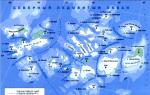
The Ural Mountains stretch for 2000 km from north to south, dividing our country into 2 parts: European and Asian. They start at the Arctic Ocean, cross Russia and end in Kazakhstan. This is clearly visible on the map. The highest mountain in the Urals is Narodnaya. It is located in the north, its height is 1894 meters. The width of the mountains throughout varies from 40 to 150 km.
The ancient Greeks knew about the existence of the Ural Mountains. They believed that just beyond the mountains was the legendary country of Hyperborea.
Geology of the Urals
The Ural Mountains were not always so low. Their formation began about 350 million years ago. During their youth, the mountains reached a height of approximately 6000 meters. There was a time when here volcanoes were active, strong earthquakes occurred, Magma poured out, new rocks formed, and future mineral deposits were laid. Hundreds of millions of years have passed since then. The volcanoes grew old, the mountains collapsed. But occasionally the Ural remembers its turbulent youth, and then. The last of them happened in the fall of 2015.
Nature
For 2000 km the mountains pass several natural areas, starting with the tundra in the north, continuing with the taiga in the middle and ending with the steppe in the south. Naturally, both nature and the animal world are different everywhere. While marmots and gophers can be found in the north, marmots and gophers are common in the south. When tulips are already blooming in the south, winter is still being bid farewell in the north.
Although the mountain slopes are not steep, they interfere with the winds, so the climate of the European part differs from the climate of the Asian part.
Minerals
It is located and mined in the depths of the Urals. Some of them are very rare and can only be found here. Some of the most famous include:
- silver;
- copper ore;
- ornamental stones;
Everyone knows crafts and jewelry made from the beautiful green Ural stone - malachite. Products made from it can be seen in the St. Petersburg Hermitage. Many folk tales about the extraction of mineral wealth were processed by the storyteller P. P. Bazhov.

Population
The majority of the population lives in large industrial cities. In terms of national composition, they are mainly Russian. Next come the Tatars, Bashkirs, Ukrainians, Kazakhs and other nationalities.
Industry
In the Ural region, the most common industries are metallurgy and mechanical engineering. Even 5 thousand years ago, copper ore was mined here. The modern period of development of metallurgy began under Peter I. The most famous industrial city is Chelyabinsk. If Yekaterinburg is called the capital of the Urals, then Chelyabinsk is the capital of the Southern Urals. All cities in the region have well-established rail, road and air connections. A highly developed industry also has its downsides: The cities in the region have a very dirty atmosphere.

Books have been written and feature films made about the origin and development of industry in the Urals. During the Great Patriotic War, the Urals received enterprises from the western part of the Soviet Union. Both young and old worked here, supplying the front with ammunition. Military hospitals were established in cities to treat wounded soldiers.
The Ural Mountains still hold many unsolved mysteries that future historians, naturalists, geologists, and zoologists can discover.
If this message was useful to you, I would be glad to see you
Our planet Earth was once a hot ball that gave off its heat into interplanetary space and gradually cooled. The Earth contained various chemical elements, and as it cooled, the heavier ones sank down. Lighter elements floated to the surface, they were the first to undergo cooling, and hardened faster. As a result of this process, three main shells of the Earth were formed: a frozen shell of granites and basalts; an ore shell of light metals and, finally, the core of the Earth, formed by heavy metals. The Earth's crust did not form immediately. During the solidification, violent processes took place; entire seas of molten mass broke through the solidifying crust. This mass also subsequently solidified, the resulting depressions were filled with water, and continents and oceans emerged.
The earth continued to cool. Its inner part decreased in volume, and the outer stone shell, under the influence of gravity, sank and wrinkled. Large folds formed on the earth's surface. These folds, sometimes reaching enormous heights, are mountain ranges of folded origin. During this formation of folds, the earth's crust cracked, and in some places molten masses erupted again. In such places, huge cones of ejected materials were piled up, and mountains of volcanic origin were formed.
Mountain-building processes did not occur everywhere and not always with the same intensity and at the same time. Mountains have their age. The youngest mountain ranges are the Alps, the Caucasus and the Himalayas. The Urals arose earlier than these mountains, and the Donetsk Ridge is even more ancient.
And today the earth's crust is not at rest. Some parts of it slowly rise, others fall.
Along with mountain-forming processes, processes of mountain destruction occurred and are occurring. Destructive factors are: wind, temperature changes and water.
The study of the outer shell of the Earth has shown that the rocks that make it up can be divided into three main groups: sedimentary rocks, igneous rocks, metamorphic (altered) rocks.
The products of rock destruction, dumped into the sea, and the remains of marine animals are deposited on the bottom of oceans and seas for many thousands of years, forming thick layers of sediment. Thanks to the movement of the earth's crust, these layers rise from the depths of the sea, sediments are compacted, and sedimentary rocks are formed. The main characteristic of sedimentary rocks is their layering and homogeneity; All sedimentary rocks are relatively weak in strength. Examples of such sedimentary rocks are sandstones, limestones, pebbles and clays.
Igneous rocks were formed when a molten mass solidified. These are very strong, monolithic rocks that lack any signs of layering. These include granites, porphyries and basalts.
Metamorphic, or altered, rocks are formed when sedimentary rocks are altered by high pressure and high temperature. From this group we can name: shales (modified clays), marbles (modified limestones). They still show signs of layering. Their strength is less than that of igneous rocks. Many of these rocks flake quite easily.
The processes of mountain building and destruction create the relief of mountains. In any mountain range or individual mountain we distinguish: foot, slope, ridge and peak. Sometimes several ridges meet at the top. The part of the ridge enclosed between two peaks is called a saddle; if there is a path through the saddle or even a path from one slope to another, such a saddle is called a pass.
The ridges are very often used as a route to the top, since they are the safest from avalanches and rockfalls. A steep mountainside is called a wall. Individual rock towers blocking the path along the ridge are called gendarmes.
On mountain slopes there may be excavations and trenches of varying depths. Wide openings are called couloirs and are often filled with snow or small glaciers. Narrow couloirs are called gutters. A wide vertical crack in a rock or ice slope is called a chimney. A narrow, inclined or vertical crack is called a crevice. From the slopes of mountains and from wide couloirs, sometimes entire “rivers” flow down from large and small fragments of rocks breaking off from the mountain slopes; these rivers of stone are called talus.
Mountain ranges are separated from each other by gorges or valleys. If there were glaciers in these valleys, the bottom of the valleys is relatively flat, the valleys are filled with moraines - high ridges of large and small fragments cemented with sand or clay.
Map
A map is a distorted image on paper of the entire earth's surface or part of it. The distortion occurs due to the fact that a spherical convex surface, the example of which is the surface of the Earth, cannot be expanded on a plane without breaking, just as, for example, the surface of a ball cannot be stretched on a plane without tearing it. The exception is when the map shows a very small part of the earth's surface, which we can consider almost flat.
Maps vary in content and scale. According to the content of the map, there can be: economic, physical, topographical, maritime and special. The map scale is a ratio indicating how many units of length on the earth's surface correspond to a unit of length on the map. For example, a scale of 1: 100,000 indicates that 1 cm of the map corresponds to 1 km on the earth's surface. According to the accepted scales, maps (1: 500,000, 1: 250,000, 1: 100,000, 1: 50,000) and plans (1: 25,000, 1: 20,000, 1: 15,000 and 1: 10,000) are distinguished.
A topographic map also gives us an idea of the terrain, which is conventionally depicted by shading or contour lines. In the first case, places with different heights are painted in different shades of green and brown. A more convenient way is horizontal lines, which make it possible to accurately determine the angle of inclination of the earth's surface. Horizontals are the projection onto a plane of lines connecting points that have the same height above sea level.
In order to distinguish a depression from a peak on a map, they use conventional dashes - berg strokes, which indicate the direction of the slope. Each horizontal line has its relative or absolute mark (height above sea level). This makes it possible to understand the relief without berg strokes. Knowing the distance between two horizontal lines and the excess of one of them over the other, you can graphically determine the angle of inclination of the surface.
Using a map, we can judge the terrain, determine our location and choose the right path. To do this, we need to orient the map according to the cardinal points and determine the direction to the peaks of interest to us or another destination of the path. Orientation to the cardinal points is done using a compass. As you know, the magnetic needle is located approximately in the plane of the meridian, pointing one end to the north and the other to the south. When the needle stops, you need to turn the map so that the northern part of the map coincides with the northern end of the magnetic needle. (Usually on a map, north is at the top, south is at the bottom, east is on the right and west is on the left.) Any direction on a map or on the earth's surface is determined by azimuth. This is the name of the angle between any direction and the northern end of the meridian; this angle is counted clockwise, varying from 0 to 360°.
On a map, azimuth is determined by measuring the angle from the plotted coordinate grid, and on the ground by a compass. How can you now determine your location on the map? To do this, you need to see at least two peaks known to you, which are also shown on the map. Having determined the direction to these vertices, you can calculate the azimuths from these vertices to you. Having plotted these azimuths on the map with a pencil, you will find your place at the intersection of the two drawn directions. If you need to put some vertex on the map, to do this you need to solve the problem inverse to the one stated above. To do this, you need to observe the vertex from two points, plotting the azimuths determined from the two points from the corresponding vertices on the map, at the intersection point you will get the desired vertex. Using the same method, you can determine the distance to a point that is inaccessible for some reason. Knowing how to solve the two described problems, it is easy to draw up a rough sketch of the area.
A climber must be able to use a compass and map in fog. Often he has to travel in conditions where the destination is obscured and he has to navigate by compass. We have already said above that one point does not determine the direction in space, therefore, when moving in the fog, a group of climbers should be lined up along a given course and the compass should be handed over to the last one. The trailing one, observing the entire chain using a compass, will ensure progress in the given direction. You should use the compass in the same way at night.
Brief information on meteorology
Due to the fact that the Earth's axis of rotation is not perpendicular to the plane of the Earth's rotation around the Sun, the average height of the Sun above the horizon is not the same for different points on the globe. For example, in the polar regions the Sun makes its visible path relatively low above the horizon compared to regions near the equator. The higher the Sun stands, the greater the amount of heat coming from the Sun. Therefore, polar regions receive less heat per year than equatorial regions. The sun's rays, penetrating through the atmosphere, hardly heat it, but greatly heat the surface of the Earth. As a result, the atmosphere is heated from below. As numerous observations show, temperature decreases with altitude by about 5-6° per 1 km. At a certain altitude above sea level, conditions are created that the heat that comes during the summer is not enough to melt the snow that has fallen during the winter. As a result of this, snow masses accumulate, forming a strip of eternal snow. The height at which the heat balance is zero is called the snow line. The closer the mountain region is to the pole, the lower the snow line lies.
The climate in any area is determined by the totality of weather throughout the year; in turn, the weather is determined by a combination of such meteorological elements as cloudiness, wind, rain, snow, hail, blizzard, thunderstorm.
Air masses of different temperatures and humidity move over the earth's surface. At the junctions of these masses, all meteorological elements are especially strongly developed. This division of air masses is called a meteorological front. A front always brings with it a change in weather.
In order to roughly say what kind of weather we should expect in the coming days, it is necessary to keep in mind that any intense movement in the atmosphere indicates the instability of a given air mass, which, therefore, we must wait for a change in these masses, the arrival of a front, and with it changes weather.
When determining the nature of the phenomena occurring, it is very important to establish whether these phenomena are local, indicating the stability of the weather, or whether they are of a general nature and associated with the general movement of air masses. Essentially speaking, all weather signs are indicators of local or general processes.
If in mountainous areas there is a mountain breeze, in the morning and evening a light wind blows from the mountains to the valleys, and in the afternoon blows from the valleys to the mountains, this is a sign of stable weather. Stable weather is also indicated by the appearance of fog and dew in the valleys in the evenings. In a stable mass of air under clear skies, the atmosphere is cooled from below due to nighttime radiation from the earth's surface, and the temperature begins to increase with height in some cases. You can notice this sign and thereby determine stable weather by climbing the slopes and directly observing temperature changes. The same temperature distribution is indicated by the appearance of haze in the gorges in the evenings, as well as cumulus clouds floating at the same height during the day with slightly smoothed tops.
Any advance of the front indicates a change and worsening weather. A gradual decrease in atmospheric pressure is a sign of the approach of a front, bringing with it clouds, precipitation and increased wind. The advance of a bank of high clouds is also a sign of approaching bad weather. At night, the approach of a front can be determined by the crown around the moon. In the mountains, the approach of bad weather is often determined by the appearance of standing clouds over the peaks.
Any strong movement in the high layers of the atmosphere indicates instability of the air mass. These winds in high layers can be identified by the appearance of cumulus clouds (wings), and at night - by the increased twinkling of stars. Powerful cumulus clouds with blurry tops usually herald a thunderstorm.
Glaciers
We have already said that above the snow line there is a continuous accumulation of snow. At the same time, the peaks are unloaded from snow and ice. This unloading is carried out by falling avalanches and glacial runoff.
Avalanches and snow slides falling from ridges and peaks usually accumulate in circuses and depressions surrounded by a number of ridges. These cirques are the origins of the glaciers. The snow that accumulates in circuses gradually turns under the influence of meteorological factors and under the influence of its own gravity into firn-grained dense snow. Further compaction leads to the formation of firn ice, consisting of individual crystals. Individual crystals are soldered together, forming continuous glacier ice, already devoid of signs of crystals. Under the pressure of snow masses, ice flows into gorges, forming a glacial river. The speed of glacier movement depends on the amount of snow and ice in the cirque and ranges from 25 mm to 1.25 m per hour. Descending along the gorge, the glacier destroys rocks, smoothes the bottom of the gorge, and carries with it stones falling onto it from the ridges and from the surrounding peaks. The glacier carries all destruction products down and, having reached the melting strip, deposits them in the form of lateral and end moraines.
Irregularities in the bed along which the glacier moves cause the glacial mass to crack. In places where the glacial mass flows through ridges running across the bed, cracks are formed, widening upward, and widening downwards above the depressions. These cracks are located across the flow of the glacier and are called transverse. If a glacier flows into a wider part of its bed, longitudinal cracks form in these places due to the spreading of the ice mass. The different speeds of ice movement in the middle of the current and near the banks of moraines cause the appearance of edge cracks directed at an angle to the banks. In the mountains, a climber has to overcome two more types of cracks: bergschrunds and randklufts. The Bergschrund is a large crack that separates the actual flowing glacier from its cirque. Rantklufts are formed near the shores of a glacier due to different heating of the coastal rocks and the ice itself by the sun's rays. In those places where the slope of the glacier is especially steep, the ice masses, breaking apart, pile up in blocks and form icefalls.
The upper part of the glacier, above the snow line, is usually covered with snow. The snow covers the cracks, forming snow bridges underneath them. Below the snow line, the glacier is exposed, and numerous streams flow along it. These streams then gather into one stream and, flowing from a grotto, usually located at the tongue (end) of the glacier, form a mountain river. Glaciers are divided into three main groups: valley glaciers, hanging glaciers and glaciers, which have a break in their flow.
Mountains occupy about 40% of the Earth's surface* They are found on every continent and large island* Even along the bottom of the oceans there are mountain ranges, individual peaks of which rise above the water, forming islands or chains of islands* Australia has the fewest mountains, and most of the mountains of Antarctica are hidden under ice.
The youngest mountain system on our planet is the Himalayas, the longest is the Andes (about 7560 km long), and the oldest mountains are those belonging to the Nuvvuagittuq mountain formation, located in the vicinity of Hudson Bay (age approximately 4.28 billion years ).
The mountains are very diverse. According to the shape of the top There are peak-shaped, dome-shaped, plateau-shaped and other mountains. Mountains and by origin: tectonodenudation, volcanic, etc. In the Sayan Mountains, Transbaikalia and the Far East, a special type of mountain predominates - hills. The hills are distinguished by their conical shape and rocky or flattened top.
In rock formations there are often individual peaks, rising high above the surrounding, even high-mountain, landscape. Such peaks include Mount Chomolungma in the Himalayas, Elbrus in the Caucasus, and Belukha in Altai.
The relief of mountainous areas is characterized by the presence mountain ranges– elongated mountain formations with a clearly defined axis along which the highest mountains are located. This axis is often the watershed of a given area.
In the case when the height of the mountain range is small and the mountain tops are rounded, then such a chain of mountains is called mountain ridge. Mountain ranges, as a rule, are the remains of ancient destroyed mountains (in Russia - Timan Ridge, Yenisei Ridge, etc.)
The mountain range has two slope, often different from one another. While one slope is gentle, another may be steep (Ural Mountains).
The top part of mountain ranges is called mountain ridge. The crest of the ridge can be pointed (in young mountains) or rounded and plateau-shaped (in old mountains).
 Wide depressions with gentle slopes are called mountain passes.
A mountain uplift approximately equal in both length and width, which is characterized by weak dissection, is called mountain range. (Putorana plateau in Eastern Siberia, Russia).
The intersection of two mountain ranges is called mountain node. Mountain nodes consist of high, inaccessible mountains (the Tabyk-Bogdo-Ola mountain node in Altai).
Mountain ranges that are identical in origin and arranged in the same order (linear or radial) are called mountain systems. The outskirts of mountain systems characterized by low altitudes are called foothills.
 Africa is characterized by a special type of mountains called canteens. They are characterized by flat tops and stepped slopes. The formation of these mountains is associated with the action of water from rivers cutting through the stratified valley.
The presence of mountains is characteristic not only of land. The ocean floor is also replete with various kinds of rock formations. Single mountains of volcanic origin are scattered here and there along the ocean floor. Active volcanoes emit lava, ash and rock fragments and have pointed peaks. The peaks of extinct volcanoes are smoothed by waves and currents. The summits of many underwater volcanoes form islands. Iceland is an example of such an island.
There are also mountain ranges at the bottom of the oceans. The most important discovery of recent years in oceanology has been the discovery mid-ocean ridges. They run almost through the middle of every ocean, forming a huge single chain. You can read more about mid-ocean ridges
A message on the topic “What are mountains” for children will briefly help you prepare for a geography lesson and deepen your knowledge about these large landforms.
Message about the mountains
You already know that the surface of the planet is not perfectly flat. It has hills, canyons, plains and mountains. These “irregularities” are collectively called relief. And each area is characterized by its own unique topography.
Mountains is a large elevation of the Earth's topography that can be seen for kilometers. Even the smallest mountain will be visible from afar. By the way, over time, the elevations may decrease, since the winds blowing the mountain carry away grains of sand that have broken off from it year after year.
The mountains consist of:
- Peaks - the top of a mountain.
- Slope - that part of the mountain along which one descends from the top to the bottom.
- Foot – the bottom of the mountain. This is where the slope ends and the normal terrain begins.
The shape of mountains can be very different. Some have sharp peaks, others are flat topped or look like oval domes.
The higher the mountain, the harsher and colder the climate at its top. And what’s most interesting is that at the foot there can be incredible heat, and at the same moment the top of the mountain is covered with a huge cap of snow and ice. Then small streams begin to gather from the top and closer to the slope they turn into a real river. Yes, rivers also erode the surface of the elevation and reduce the height of the mountain.
When did the mountains appear?
They appeared a long time ago, millions of years ago, when terrible earthquakes occurred on the planet. Fountains of hot lava erupted strongly from the ground and froze, turning into mountains. Today such mountains still exist. Lava is still boiling under them, which can burst out at any moment. This process is called a volcanic eruption, and such mountains are called an active or dormant volcano. But mountains under which lava does not show activity are called an extinct volcano. It is worth noting that solidified lava is a source of minerals, so work is underway in the mountains to extract metals, ores or precious stones.
It is also rare to see seamounts. It is impossible to notice it underwater, but sometimes the top of such a mountain sticks out from the waters and resembles a rocky island.
Interesting facts about mountains for children:
- The world's highest mountain stands on the border between Nepal and China. It's called Everest. The height of its peak is 8848 m.
- Some mountains were formed in places where there once was a sea or ocean. This happened during the process of shifting folds of the seabed. These mountains include the Carpathian Mountains, the Himalayas and the Alps. In them you can find the remains of marine organisms.
- Africa's Mount Kilimanjaro was formed due to the eruption of lava from underground.
- The process of aging, reduction or growth of mountains is invisible to the human eye. After all, these processes take millions of years.
- In ancient times, mountains were considered the home of the gods. Therefore, it was strictly forbidden to even approach the sacred mountains.
- The highest peaks in the world are Everest, Mont Blanc and Elbrus.
We hope that grade 4 was able to use the message about mountains in preparation for the lesson. You can leave a short story about the mountains using the comment form below.