Barn-mountain, two minutes past four... Second offensive on Tuapse
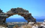
... Sarai-Mountain, the highest peak (1327 m) of the Lesisty ridge. With its top, representing a large plateau, it really somewhat resembles the roof of a barn.
As G. Podyapolsky reports, “on geographical maps the name of this mountain is Izdar (on some maps - Izbor).
It is all covered with deciduous, tall-trunked, predominantly beech forest, which gives way to clearings only on its southern slopes and at the very top, from where a wonderful view of the Skalisty, Side and Main ridges opens up...”[Podyapolsky G.N. Sights of Kabardino-Balkaria. Nalchik: Elbrus, 1977. P. 68.].
In these places there is an interesting man-made monument - a “monastery”, carved right into the mountain...
Here is what E. Kühl reports on the topic that interests us: “One of the Christian historical and architectural monuments is the Izdara complex of monasteries, located... in the upper reaches of the Heo River (the area of Mount Izdara). Both monasteries - male and female - belong to the catacomb type. Four-tiered rows of cells, connected by underground galleries, were carved into clay deposits on both banks of the river. The Izdara monastery complex resembles the famous Georgian cave temple complex, built during the reign of the Georgian Queen Tamara...”[Kul E.V. Izdara complex of monasteries as a monument of history and architecture // VII Slavic readings in Kabardino-Balkaria. Nalchik: Elbrus, 2004. pp. 91–92.].
In the “Guide to Kabarda and Balkaria...”, published in 1928, the director of the Museum of Local Lore M. I. Ermolenko wrote: “About 16–18 versts from the city of Nalchik there is a mountain called “Sarai-Mountain.” It is visible even from Nalchik in the form of a gray-stone cliff, sheerly protruding to the north, covered with forest. The way to it from Nalchik is through the Dolinsky dachas, the Nalchik River, and villages. Khasanya (6 versts from Nalchik). From the latter there is a wheeled road to the southwest to the base of the mountain. Then the road goes up the slope, through the forest, and then it narrows to a simple path and rises steeply to the very end of the ridge. Almost next to it there are caves in the form of dugouts and rooms, dug into the mountain mass to the northeast. These caves are ancient. Hermits and pilgrims probably lived in them... It is interesting to examine the caves themselves, their spring and the surrounding area and breathe in the crystal-clear mountain air there.”[Ermolenko M.I. Guide to Kabarda and Balkaria: A manual for tourists and excursionists with the appendix of an essay by N. Krylenko “On the mountain heights.” Nalchik: Excursion Society of Tourists at Oblono, 1928. P. 25.].
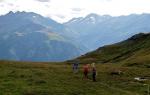
You can get to the “monastery complex” by several routes (including the most proven one - along the ridge of Sarai Mountain in six to seven hours, which means spending the night). The authors of these lines headed here in a military cargo ZIL of one of the residents of the village of Khasanya. Before reaching the village of Gerpegezh, we turned right and moved straight along the Kheo gorge. What we followed can only be called a road if you have a lot of imagination - a track winding from side to side, sometimes going sharply upward, sometimes laid along the very edge of a cliff, sometimes going straight along the river bed. Dozens of times the road crosses the river, and the bank sometimes rises so steeply that you wonder how the car’s engine, indignant at such an unbearable load, did not stall, and the car itself did not turn over from almost vertical climbing, waddling like a cuttlefish from one huge boulder on the other, a wayward and quarrelsome river moves them from place to place (but only after the rains, since it is a spring and is fed only by heavenly moisture). Every now and then dodging tree branches hanging over the track, mercilessly whipping our faces (we drove standing in the back, squeezing the side of the car with our hands until our knuckles turned white), we covered 18 kilometers in almost two hours. But among what beauties these kilometers lay!...
The kingdom of vegetation, filled with life-giving sunlight and warmth, a riot of bright colors, river sides that go steeply upward for tens of meters - the eyes never tire of being amazed at the pictures that appear before the gaze. And here is the “monastery” itself - on the right side, at the very top of the almost vertical cliff, there are gaping windows-sinkholes. From below they seem tiny and somewhat reminiscent of swallows' nests, only they were stuck not under the roof of the house, but right on the wall. The “windows” are about a hundred meters away, no less.
We climb up a gentle slope and reach the top in about half an hour. Now the “monastery” is below us, all that remains is to enter it. But the path leading to the entrance has practically collapsed, breaks off above the void - you have to make your way along a narrow trunk of a tree that someone felled, thrown from one side to the other. We overcome this obstacle and along a narrow passage, no more than half a meter wide, going somewhere into the earth, we begin to slowly descend in single file. Frightened by unexpected guests, bats now and then rush past, touching faces with their sweeping wings. The lanterns illuminate the low, almost average human height, vaults - rounded, with traces of soot.
Here is the first cell - an earthen room about four meters in area, with a relatively flat base that serves as the floor; at a height just above the waist there is a hole in the wall (one of those “windows” visible from below). We look into it - and the opening prospect takes our breath away: a flat rocky surface goes down almost vertically, only after 60-70 meters it turns into a sloping, short slope, constantly washed away by a raging river. It and the trees growing along the riverbed seem like toys from here. A blue endless expanse appears before the eye.
Here is another cell, it has something like an earthen bed. And this room, the largest in size, probably served as something like a refectory - when they were hollowing it out, they came across a huge boulder, which the hermits could not cope with. Then they dug it up from all sides, deepening the floor underneath and making some efforts to level the top: a very comfortable table was obtained.
All the cells - and they are located on two levels - are connected by a narrow corridor winding from side to side, in one place ending in a dead end, with several small niches cut out in the walls. Its length is several tens of meters, the plan of the people who created this underground complex is not always clear (most likely, the passages were dug spontaneously, depending on the strength and capabilities of the diggers), but their diligence, patience and faith evoke the most sincere respect. These same feelings possessed Fyodor Chaliapin, who visited these places in the summer of 1917. Subsequently, many hunters of everything unusual visited here - some tested themselves, others, hiding from persecution by the authorities, found temporary shelter from bad weather.
During the Great Patriotic War, those who used to be called irreconcilable enemies of Soviet power hid here. They say that one of these groups was surrounded by NKVD troops. The security officers, in order not to risk people, “locked” the saboteurs with explosions, destroying part of the underground passages. And it was as if all those hiding were destroyed. But people's rumors tell a different story - one of those surrounded was saved, he jumped down and did not crash: his fall was softened by a cloak, the flaps of which, when opened, served as something like a parachute. This legend has a basis: we were even told the name of this man. Moreover, one of the participants in that operation (the name is also known) said that soon - while crossing the state border - the “parachutist” was shot, as a result of which it turned out that he managed to escape from the KGB encirclement. Whether this is true or not is not so important, because such places are literally created for all kinds of legends and myths, and time itself contributed to them.
And here is how this story is complemented by the ranger of the forestry located not far from the “monastery” Murat Khulamkhanov: “This was in the mid-70s of the last century. My friends and I decided to visit the monastery. Coming closer, we saw an old woman and a young woman cultivating a garden, which, as it turned out, belonged to the nuns. We said hello, and they took us to their monastery, took us into the kitchen and treated us to sweets and fresh buns. One of the women told an interesting story. Once upon a time, bandits came to the monastery to hide there for a while. Soon the soldiers arrived, and everyone who was inside the monastery was surrounded for sixteen days. Water was obtained through hollow reed stalks that passed through the walls. Having learned about this, the soldiers cut them off from the water. When the water ran out, two bandits, wearing burkas, jumped from the balcony and disappeared into the forest. After this incident, the soldiers mined the entrance to the monastery and blew it up. The crack from this explosion runs along the ceiling of the main gallery of the monastery. The remaining bandits were forced to dig a trench, which became their last refuge. The criminals were shot, and the nuns were given twenty years for concealment.”
And further: “They say that after the liberation the women returned. They were very secretive and ran away when meeting strangers. It was necessary to approach the monastery very carefully. Its location is such that the slightest noise below or at the entrance echoes inside. The old people said that the monastic path began in the vicinity of Nalchik and led straight to the monastery. Along the path, the monks carved crosses in the trees so as not to get lost. Inside the monastery, the first door led to a storeroom, then a stable where they kept donkeys. Then the gallery branched out. There are eight cells in total in the monastery. No one has lived here since the mid-80s. For some time there lived a hermit monk who lived by selling crosses that he carved out of wood to tourists. In 1999, a priest came to the monastery. What he had in the chaise was very reminiscent of a human body wrapped in burlap. A few days later I discovered a fresh grave in the monastery cemetery.”[Zhanimov A. The secret of the monastery on Sarai Mountain // Kabardino-Balkarian Truth. 2006. September 16].
Material prepared by M.A. and V.N. Kotlyarov. Photo by Zh. Shogenova.
...Another unforgettable trip around Nalchik - to Saray Mountain, the highest peak (1327 m) of the Lesisty ridge. With its top, representing a large plateau, it really somewhat resembles the roof of a barn. As G. Podyapolsky reports, “on geographical maps the name of this mountain is Izdar (on some maps - Izbor). It is all covered with deciduous, tall-trunked, predominantly beech forest, which gives way to clearings only on its southern slopes and at the very top, from where a wonderful view of the Skalisty, Side and Main ridges opens up...”In these places there is an interesting man-made monument - a “monastery”, carved right into the mountain. How many times we heard about him in childhood, how we dreamed of visiting his cells, but we managed to do this only recently...
Here is what E. Kühl reports on the topic that interests us: “One of the Christian historical and architectural monuments is the Izdara complex of monasteries, located... in the upper reaches of the Heo River (the area of Mount Izdara). Both monasteries - male and female - belong to the catacomb type. Four-tiered rows of cells, connected by underground galleries, were carved into clay deposits on both banks of the river. The Izdara monastery complex resembles the famous Georgian cave temple complex, built during the reign of the Georgian Queen Tamara...”
In the “Guide to Kabarda and Balkaria...”, published in 1928, the director of the Museum of Local Lore M. I. Ermolenko wrote: “At 16-18 versts from the city of Nalchik there is a mountain called “Sarai-Mountain”. It is visible even from Nalchik in the form of a gray stone rock, jutting vertically into the
north of a cliff covered with forest. The way to it from Nalchik is through the Dolinsky dachas, the Nalchik River, and villages. Khasanya (6 versts from Nalchik). From the latter there is a wheeled road to the southwest to the base of the mountain. Then the road goes up the slope, through the forest, and then it narrows to a simple path and rises steeply to the very end of the ridge. Almost next to it there are caves in the form of dugouts and rooms, dug into the mountain mass to the northeast. These caves are ancient. Hermits and pilgrims probably lived in them; after... there was a group of Tolstoyans, but they broke up and scattered. It’s interesting to examine the caves themselves, their spring and the surrounding area and breathe in the crystal-clear mountain air there.”
But it was not by chance that we put the word “monastery” in quotation marks above.
In everyday consciousness, this definition is indeed firmly attached to the Nalchik complex. Let us recall that monasticism (from the Greek monachos- “living alone”) is a dedication to religion and God, its essence is the renunciation of worldly life. The first Christian monasteries arose precisely as settlements of hermits back in the 3rd-4th centuries AD. e. in Egypt. They appeared in Rus' much later - with the adoption of Christianity and became a kind of “cultural centers”; after the revolution of 1917 they were closed “as hotbeds of religious intoxication and counter-revolution.” Small monasteries located far from cities were called “deserts”. Even smaller ones were called “sketes”, “cines”. The cave complex near Nalchik did not meet the requirements for them. And even the naturalist Georgy Podyapolsky, who has been here several times, never calls this place anything other than a “so-called monastery.”
Indeed, the cells in Mount Izdara resemble the dwellings of hermits. “a God-loving silent man, a hermit, a hermit” was the widely known and revered Blessed Seraphim of Sarov, the recluse of the Zadonsk Monastery, Blessed George. But even at the end of the 19th century, precisely in those years when the first news about the Nalchik “monastery” appeared, Saint Ignatius (Brianchaninov) wrote: “At the present time in our fatherland, hermitage in a deserted desert can be considered absolutely impossible, and seclusion very difficult, as more dangerous and more uncooperative than ever. We must see the will of God in this and submit to it. If you want to be a silent person pleasing to God, love silence and get used to it with all possible effort. Do not allow yourself idle talk, either in church, or at meals, or in your cell; do not allow yourself to leave the monastery except for the most extreme need and for the shortest time; do not allow yourself to make acquaintances, especially close ones, either outside or inside the monastery; do not allow yourself free circulation or harmful entertainment; behave like a wanderer and stranger both in the monastery and in life itself....”
We allowed ourselves such an extensive quotation in order to clarify the essence of hermitism, because at all times there have been people who choose “the hardest of all possible life paths”, without regard to “the contempt of society, the direct danger of being imprisoned and even losing life itself.” .

All sorts of things were written about the Nalchik hermits, who were considered sectarians, but in the overwhelming majority of cases these publications had a negative connotation. In particular, in the magazine “Living Antiquity” in the article ““Holy Elder” Michael” it is reported that in the winter of 1893/94 a certain Mikhail Subbotin appeared in Nalchik, who was said to be a seer. And “soon several people left the settlement for the mountains, dug a cave there and began to lead a “righteous life,” spending days and nights in tears and repentance, “in killing his flesh." People began to call them “Mikhail’s cave dwellers.” The “hermits” stayed in the cave until the fall of 1894, but, not getting along with the local residents (we are talking about mountaineers), they returned to freedom. Then they chose a place more “remote from the human eye”, with joint efforts (the group of diggers included about ten people) dug several more caves and built a monastery with cells in it.
True, there is one confusing circumstance: the publication says that the cave was located on the banks of the Urvan River. But this is inaccurate, since we did not find any mention of Urvan monasteries in historical documents and printed sources of those years.
How did the hermits live? In “prayers and struggles”... Not everyone survived such a path to salvation. After all, in the words of the author of the notes “In the Caucasus Mountains...”, “people living on the plains do not know the difficulties experienced by desert-dwelling monks, who are often forced to climb mountain passes with a load on their shoulders. They are often so tired that all the muscles of the body are shaking from excessive fatigue. A distance of 14-15 kilometers on a summer day can barely be covered in 12-13 hours. But the hardest thing is if unexpected rain catches you on the way, especially in the autumn. He will soak all his clothes to the last thread. Water will flow from your head and shoulders throughout your body, flowing into your shoes. But even if the rain stops, the situation does not get any easier. As soon as you lightly touch a bush or tree, new streams of water pour out onto the traveler. In addition, the feet slide on the soggy clay soil as if on ice, so travelers endlessly stumble and fall on the descents and ascents, which infinitely aggravates the already difficult path.”
Sarai-mountain - length - 12.5 km. Duration - 5.5-6 hours. Elevation difference ± 600 m.
It appears from the windows of the train at the entrance to Afapostik. Saray-Mountain is very similar to the Sober-Bash mountain massif, which is near Ubinskaya: in height - 772 and 736 m, respectively; externally - with steep rises and a table-shaped, almost flat top and steep southern outcrop; its dominant position over the surrounding peaks within a radius of 10-15 km. From the lips of some tourists you will hear another name for Sarai-Mountain - “Sadovsky Sober”, and partly this will be true.
Having got off at the Chinary station, we follow a good gravel road along the railway bed to the road bridge over Psekups (350 m). Along the bridge - further past the dachas of the Chinary gardening partnership. After 700 m from the bridge we turn onto a dirt road (direction B-B-C). The gravel road goes to the village of Shaumyan. After 2-3 minutes we pass the last houses. A little later, before the valley begins to narrow, we cross one large clearing, stretching 110 m in latitude with a width of 80-90 m, then almost the same in length, but 2 times narrower. Part of the clearing is occupied by vegetable gardens. Horsetail is often found on the side of the road; the untrodden road is impassable due to nettles.
Horsetails are ancient and mysterious plants. Their distant ancestors were giants; together with mighty ferns, they formed coal deposits. Horsetails are found on all continents, with the exception of Australia. There are 25 species worldwide, half of them are observed within our country. In the Caucasus, the most abundant horsetail is the field horsetail, which is popularly known as Christmas tree, earthen cones, pigtail, the scientific name translated means “horse tail”. The branchy grass actually vaguely resembles a horse's tail. Horsetail grass is rich in valuable medicinal substances: tanning agents, sanonin, silicic, malic and oxalic acids, calcium salts and potassium oxide, resins. It has long been recognized in medical practice as a diuretic for diseases of the kidneys and bladder, and also as a means of improving blood circulation; horsetail is also used to treat old wounds. Decoctions from it are used to strengthen hair.
We continue moving upstream of the right bank tributary of the Psekups River. About 200 m from the second clearing there is a confluence of two streams. The road rises to the watershed between them in a northerly direction (A-10°). There is a picturesque clearing at the top. Next is a hundred-meter section of steep ascent (16-17°) along a wooded ridge. There is an oak tree with an azalea undergrowth here. On the left, as you move, you can see the basin of the Sosnovoy stream, which flows into Psekups near the village of Afapostik. After 200 m there is again a clearing, stretched along the route, of relatively large size. There are many thickets of blackberries and ferns. A little further on there is a smaller clearing, from the eastern edge of which a panorama of piled up rises opens to the west. When the road turns from the southeast to the northeast, the view of Mount Lysaya (A-203°), Mount Psif (A-220°), and Mount Pochepsukha (A-235°) is remembered.
On the upper part of the ridge there is a chain of dilapidated trenches and dugouts. Several roads cross our path. At one of the forks there is an obelisk to the defenders of Sarai-Mountain. Only a knowledgeable guide will reveal the secrets of past battles.
“In mid-October 1942,” says Hero of the Soviet Union, former commander of the 32nd Guards Rifle Division M.F. Tikhonov, “breaking the resistance of our troops with superior forces, the enemy reached the southern outskirts of Shaumyan and the valley of the Pshish River - an important natural boundary defense on the approaches to Tuapse. This extremely complicated the situation in the Tuapse direction... Our few units, stretched out in a chain in the defense sector, staunchly repelled the attacks of the fascists. The 395th and 32nd Guards Rifle Divisions especially distinguished themselves in these battles. They fought off 5-6 attacks every day for 10 days.
On October 20, the enemy pushed back the units defending the Elisavetpol Pass and captured it. It was necessary to move to a new frontier.
We set off along forest paths and by the end of the day the division, having in the second echelon the 82nd Guards Rifle Regiment in the area of \u200b\u200bheight 490.7 m, took up defense at the line of Sarai-Mountain and further south through the valley of the Tuk River and 1.5- 2 km east of Mount Sedlo.
On the morning of October 21, counterattacks by division fighters began on Mount Sedlo in cooperation with units of the 119th Infantry Brigade and the 328th Infantry Division. By 12.00, the battalion of the 229th Nazi Infantry Regiment, which occupied the mountain, was destroyed. Our troops firmly took up defensive positions. The task was set to prevent the enemy from breaking through from the area of Navaginskaya station and the Elisavetpolsky pass to the west and southwest.
Despite the success achieved by the Soviet soldiers, on the right flank of the army the enemy, waging fierce battles with our units, slowly moved south. Each warrior understood perfectly well that there was nowhere to retreat further. And we survived... The initiative passed into our hands..."
The drama of the events of those days was that this area was located at the junction of the fighting of two Soviet armies defending Tuapse - the 18th and 56th. Because of this, confusion was created in the coordination of military operations, which led to hundreds and thousands of casualties. Every time you climb Sarai Mountain, you discover either a rusted German shell casing, or a well-preserved helmet of a Russian soldier, or human bones. The story told by my friend, a great expert on the local mountains, Artur Brikalov about a soldier’s flask, is etched in my memory. On one of the expeditions, Arthur, among the dogwood thickets near a dilapidated dugout, discovered a simple soldier’s flask, a little dented, but generally in good condition. After wiping the flask of dirt, he turned his attention to the letters and numbers. The names of the soldiers who fought in these places clearly appeared - Atarbekyan, Sahakyan, Refaeli and others. The owner of the flask also imprinted on it his return address - the Artik region of the Armenian SSR. The valuable find makes it possible to restore the names of those who fought here. These people defended the village of Shaumyan in October-November 1942. It is quite possible that some of the mentioned soldiers are still alive, while others are missing, and relatives do not even know where he died. Despite the loss of interest among today's youth in military-patriotic themes, we think that there will be enthusiasts who will have to do a lot of work to restore the historical truth.
130 m from the obelisk our road joins an improved dirt road rising from the south. The peak of Sarai Mountain is shown (A-70°).
We turn off the road onto a narrow path leading to the top. The final ascent is up a very steep slope (slope 30-35°). At the top there is a trigopoint, an almost circular panorama.
You can return back along the same route or go down to the upper reaches of Sosnovaya Glit and along a gravel logging road to get to Afapostik in 3-4 hours.
The 2nd option of climbing Sarai Mountain is a little longer, but easier from the point of view of orientation. We continue driving along the gravel road; immediately after the dachas a steep ascent begins. In winter, when there is snow and frost, not every car will pass here towards Shaumyan. Then there are 2 more “thrusts”. We find ourselves at the highest elevation of the road after half an hour of driving from the outskirts of the holiday village. Ahead (A-60°) Sarai-mountain is visible. A 10-minute descent leads to a fork. The main main road goes to the right in a southern direction, the 2nd road, less traveled, climbs steeply up and after 0.5 km connects with the main one. Fork again. We say goodbye to the gravel road. A forest path along the ridge leads us to our cherished goal. Direction of movement is E-N-E. Several ascents alternate with descents. After 35-40 minutes we approach the obelisk with the inscription “Dear Vladimir and Fedor from friends and hunters.” On the map it is a height of 456.2 m. The further ascent is described above.
Main peak Oskol Mountain
The closer you get to Oskol Mountain, the more traces of the Great Patriotic War you come across along the way. Traces of former trenches, the contours of collapsed dugouts, defense lines cutting through a mountain range, and places of military camps are visible. How many years have passed, but the scars of war have not healed.
The peak of Oskol Mountain itself is unremarkable. Quite steep on all sides and overgrown with forest. Its beautiful rocks are located on the steepest southwestern slope, facing the Black Sea. And the rocky peak, which is lower than the main one, is generally located somewhat to the side behind the lintel.

From the rocks of Oskol Mountain there is a beautiful view to the southwest. An endless sea of mountains. The Turkey Rocks and the Main Caucasus Range are clearly visible. The railway and highway to Tuapse are also clearly visible far in the valley near the village of Navaginsky.


View from Oskol Mountain to Sarai Mountain.
Between the rocky peak of Oskol Mountain and the rocks of the main peak there is a descent to a lintel that leads to Sarai Mountain. It is quite steep, but quite surmountable.
Having descended to the piles of stones that have fallen from the cliffs, you need to move along the rocky cliff of Oskol Mountain, without descending lower from it either to the right or to the left. Jumping over stones, making your way through bushes and windbreaks, you get to the desired jumper. Immediately behind a huge boulder you come across a trench dug up by search engines. A rusted, unusable grenade from the war lies on a stone, reminiscent of past battles. A very convenient place for organizing defense. The boulder reliably covers the trench from shelling from the side of the overhanging Oskol Mountain.

Grenade at the trench
About 20 meters from here you come out to a new portage that runs straight along the lintel. Timber trucks carry trunks of cut trees along it. Feet sink in dry yellow clay, ground into dust. It’s good that it’s not raining, otherwise you could just get stuck here.

The portage stretches along the ridge for a couple of kilometers, then abruptly goes into the valley of the Sosnovka River, located between the Saray and Oskol mountains. Judging by the condition of the trail, loggers are very active here. There is no need to talk about the wilderness of these places. The bridge to Sarai Mountain, as well as the ridge to Oskol Mountain, is cut off by many roads, both overgrown and active, which come from the Tuapse and Goryacheklyuchevsky districts. So the legends about fascists hiding here since the war are clearly exaggerated.
The dragging path along the jumper jumps up and down many small hills. Here, traces of war are visible literally at every step. Trenches, lines of defense, squares of former dugouts are literally everywhere, especially on flat areas convenient for the location of the camp. Wartime pieces of iron are not often found, and they are mostly junk that no one needs, like broken iron cartridge boxes. Search engines and diggers come here regularly. This can be seen from the traces of numerous excavations along the entire route along the lintel up to the top of Sarai Mountain.

On the rocky slopes of the lintel, in some places small grottoes and caves are visible, possibly made by soldiers during the war to hide from bombing and shelling.

Cave in the rock
The ascent to Sarai Mountain from the side of the lintel turned out to be very gentle, almost like on a cuesta. Surprisingly, there are many thickets of hazel and wild pear here.
A group of searchers from the Kuban Bridgehead organization continues to search for the remains of Soviet soldiers who died during the Great Patriotic War. This time, excavations are being carried out in the area of Sarai Gora, where bloody battles took place in the fall of 1942. Reports on the work done and search engine findings await you further.
Early morning in Shahumyan. What hung in the low sky threatened dirty tricks, and it was drizzling.
There was no smell of spring, and Valentine’s Day already seemed like a convention alien to us. Rather than sticking out your tongue in zeal and drawing a Valentine, we’d rather go to the forest. Since yesterday, the reconnaissance group of the Tuapse “Kuban Bridgehead” had been wandering near Sarai-Mountain, but we were already arriving for thorough work.
It seemed that at first there was nothing - it was fun. The reconnaissance went out on foot to the given area, but we, in the combat Niva, shortened our walking distance.
But at the very first forest pass it became bad. The timber truck, driven into the abyss, threw the Niva into the wrong track, and we got stuck.

The car swayed in heavy thoughts - to lie on its side, or to wait a little. And there are only two of us. And then one - for a counterweight. The horizon is shaking.

There is no winch, it is drizzling and there is a lot of mud. And there is still wind. The car is shaking. Well, somehow we got out. Little by little, back and forth, then gas, and our Niva became level. To go further is just to wet your panties. And we left the sufferer and moved to the rendezvous point on foot.
This is our goal - Sarai Mountain. Its southwestern slopes. We don't need to go to the mountain itself. Firstly, we visited there more than once in the shaggy years, and secondly, it became a mecca for all kinds of hunters for German swag, everything was rummaged through.

So we go, the circle of the mountain. We're practically on the other side. We walk a kilometer, we walk three. Along the long-ago, overgrown path into the abyss. I'm already tired of walking, really.

But we are already on the other side. The rain has passed, the sky is milk, but here she is. Sarai-mountain, in all its wild beauty.

There is an opinion that an ancient city was here an indecently long time ago. And the name “Sarai-Mountain” itself carries the Turkic word “City-Mountain”. Maybe it was like that, maybe not. One thing we know for sure. In the autumn of 1942, in the northern part, and around the mountain itself, there were strong battles. And we have to work here.
GPS? Navigators? "Garmins"? No – it’s not ours. You can stare at your smartphone at the map for a long time. Damn it all. The most reliable mark of the rendezvous point in the forest - here it is! Green plastic bottle placed on a branch.

This is what always works. Even though all the satellites fell from the sky. All. We are at the meeting point, the start of work. And about a hundred meters away the voices of our intelligence can already be heard.
However, spring began to drive away winter. Primroses appeared in the gray-brown forest. Greenery pleases the eyes and the heart, which over the winter have become accustomed to the gloomy forest.

Not long fraternization at the fronts, a rush march to the found battlefield, and we are already digging. We are working. Where ours were, where the Germans were, has already been established. Excavations begin. The earth is completely covered in water. Complete dirt. Even though it’s a backbone.

Pot. German-fascist. Surprisingly, in a completely alert state. There was an extra one for someone.

The recovered artifact is examined by Vitaly. Yes, he turns it so thoughtfully that I want to say to me - “Poor Yorick”...

This is the situation we have here. Our defensive positions were on this spur of Sarai Mountain. 32nd Guards. So that the Germans would not be allowed into the river valley, but to the neighboring heights, along which during the war years there was a quite tolerable forest road. And roads in the mountains are a strategy, this is life.

Descending from the top, the Germans rolled up our defenses like a carpet, occupying the next and next lines. The 500th penal battalion was marching here. All sorts of crap. However, trained and angry. They, too, in battle, had to curry favor, from the penalty box.
German shot - fewer leaves. Ours is more modest. The German was rich in cartridges, not like ours. And there were fewer of our soldiers here.
The combat is close-quarters, almost hand-to-hand. There are many torn remains of our RG grenades. There are no fragments of shrapnel shirts. And they themselves, not used in close combat, are scattered in abundance on the ground and in cells.

The same thing happens with lemons. In the trenches - simply unused, some with plugs, some without fuses at all. Throwing F-1 in close combat is more expensive for yourself. The place is damp. There is water in the dugouts. It even pours out of these very “lemons”...

Oh, I'll have to work here in the summer. Make mosquitoes happy. Because of this, the earth will dry out.
In all positions - everything is mixed. Both ours and theirs. At the bottom of the cells, our cartridges are covered with German ones. They knocked the guards off the ridge...

And bones. Here and there. Our. The German buried his own. And we... We retreated.

At lunchtime we go to the camp set up by the vanguard. We fall and see what they have collected without us.

Remains of German pack saddles, or even complete ones, are a fairly common find here. The mountain shooters were thorough.

Such a thing was hung on a horse or mule, and a lot of military necessities were attached to it. From boxes with “mallets” and shells, to a mountain gun disassembled into pieces.

Such a universal thing. And comfortable.

Interestingly, our military industry also decided to make life easier for horses and soldiers. But something didn’t work out here. We made wonderful weapons and tanks, but things didn’t work out with pack saddles. Maybe because the Russian soldier was more thorough and skillful? And could he fasten anything he wanted to a horse, without any machine saddles? Here is an interesting document on this issue, the result of a field test of our pack saddles in 1943:
DEPUTY HEAD OF GAUKA I
TO THE CHAIRMAN OF ARTCOM GAUKA
Lieutenant General of Artillery
Comrade Khokhlova
Packs for 14.5 mm PTRS were submitted for field testing without technical documentation. The design of the packs is such that all attempts to understand their structure, the purpose of individual elements and the rules of the pack have not yielded positive results. It is not even clear whether 1 pack is intended for one or three guns.
The representative of the 5th department of Artkom, engineer-lieutenant colonel Comrade Rodin, who was present during the testing of the packs, could not give any explanations on their design and pack rules.
Without a description, drawings or the presence of the authors of the pack, it is impossible to conduct tests.
I ask for your instructions.
CHIEF OF NIPSVO CA COLONEL BULBA
However, even in the description, without “five times 100 front-line grams”, you won’t be able to figure it out...

Life is getting better. The blind rain gives way to the sun, there is black tea in smoky pots, and the food is simple, mountain-forested, without pickled hazel grouse. . Let's eat and relax.
German bayonet. Symbolic. If they hadn’t laid down here, and all over Russia our soldiers were bones, who knows where that bayonet would have been. And would there be Russian sugar...

After lunch, without allowing the fat to set in, we grabbed the shovels again. We decide to open the dugout. There should just be enough time until the evening. Already at a depth of half a meter there is water and mud. Grenades, cartridges, ammunition - everything is in ruins. Water seeps out and prevents it from working properly. The sky is darkening before our eyes, and gloomy darkness is coming from the direction of Mount Sedlo - rain is falling.


We still have a few kilometers to go to the car. We decide to stop the work and wait until it gets drier. We need to work here. Our soldiers are lying somewhere in dugouts and craters.
And spring primroses sprout next to their bones...
February 2016, Alexey Krivopustov “Kuban bridgehead”.
ETERNAL MEMORY to the fallen soldiers and commanders for our Motherland...