Exploration of the Anadyr basin, annexation of Kamchatka and discovery of the Kuril Islands. The history of the discovery and development of Kamchatka Am I not the one who came to you?
Article by I. F. Makhorkin
The discovery and exploration of Kamchatka, as well as northeast Asia and northwestern America, is the result of the activity of many generations of the Russian people: Cossack explorers and industrialists, sailors and scientists.
Explorers Semyon Dezhnev and Vladimir Atlasov, navigators Vitus Bering and Alexei Chirikov, Grigory Shelikhov and Gavriil Sarychev, Ivan Krusenstern and Vasily Golovnin, academician Stepan Petrovich Krasheninnikov and others constituted the era of great Russian geographical discoveries.
...It was in the summer of 1648. From Nizhnekolymsk to the “Icy Sea,” as the Arctic Ocean was then called, seven kochs set sail for the Pacific Ocean (a koch is a seaworthy single-deck, single-masted sea vessel of the 16th-17th centuries, about 20 m long and sailed under oars and sails. It could accommodate about 30 people and lift up to 30 tons of cargo). They were led by Cossack Semyon Dezhnev. Off the eastern coast of Chukotka, the flotilla encountered a severe storm. The Koch, on which Semyon Dezhnev was, was washed up on the coast of Olyutorsky Bay, and the Kochs of Fedot Alekseev Popov and Gerasim Ankudinov were carried out to sea.
Semyon Dezhnev with the remnants of the detachment reached the middle reaches of the Anadyr River in 1649 and built the Anadyr winter hut here, which later became a Russian stronghold, from where the development of the vast northern territory began.
Kochi Fedot Alekseev Popov and Gerasim Ankudinov were carried to the shores of the Kamchatka Peninsula. Once at the mouth of the Kamchatka River, the sailors climbed up to its tributary - the Nikul River - and built two small huts there. After spending the winter here, in the spring of 1649, Popov and his comrades descended on kochas along the Kamchatka River into the Pacific Ocean and, rounding Cape Lopatka, walked along the western coast of the peninsula to the north. Having passed the mouth of the Tigil River, the Cossacks decided to take boats to the eastern coast, towards Anadyr. They died during this journey.
More than 300 years have passed since then, but the legend about the people who spent the winter on the Nikul River still lives on. Among local residents it is passed on from generation to generation. For a long time, the Nikul River was called Fedotovshchina and Fedotikha, after Fedot Popov, the man who was the first to discover Kamchatka in Rus'.
In 1697 Vladimir Atlasov with a detachment from the Anadyr prison makes a trip to Kamchatka. In two years, he walked the entire western coast of the region to Cape Lopatka, visited its deep places, founded several winter huts, including the Upper Kamchatka fort, and in 1699 returned to Anadyr. From there he soon went to Yakutsk, and then to Moscow. In 1707 he returned to Kamchatka and took over the Upper and Lower Kamchatka forts. During the Cossack rebellion in 1711, Atlasov was killed in the Nizhne-Kamchatsky prison.
Not far from the village of Klyuchi, a tributary flows into the Kamchatka River - the Krestovaya River. On the left bank, at the very mouth, rises a two-meter wooden cross with a scorched inscription:
“On the 11th day of July 1697, Pentecostal Volodimer Atlasov and his comrades 55 people erected this cross.”
Below is another inscription: “Restored in honor of the Russian explorers who discovered Kamchatka,” and the date of restoration of the memorial cross: 9/VIII-1959. This memorial cross, erected at one time by the explorer, Anadyr clerk Vladimir Atlasov as a sign of his visit to Kamchatka, was restored in the summer of 1959 on the initiative of the residents of the peninsula.
Atlasov fulfilled a historical mission - he annexed Kamchatka to the Russian state. He was the first Russian to make written reports about this land. In his “skasks,” as the records of the explorers’ stories were then called, the Cossack, talking in detail about his campaign, gives rich and interesting material about the inhabitants of the peninsula - about their life and customs, introduces for the first time the geography of Kamchatka, and conveys some information about Chukotka and the Kuril Islands , also mentions Japan and Alaska.
The campaign of Vladimir Atlasov, whom Pushkin called the “Kamchatka Ermak,” marked the beginning of geographical expeditions to the Pacific Ocean, which led Russian sailors to the shores of North America, to the Kuril, Commander and Aleutian Islands. His "skasks", read by Peter I, served as the beginning for the organization of the First and Second Kamchatka expeditions.
At the beginning of the 18th century, Russia became a maritime power, but the vast Pacific and Arctic oceans washing the shores of our homeland were still little known and were depicted on maps very inaccurately. To clarify the north-eastern borders of his state, to find unknown lands, to establish trade with the countries of the East was the long-standing dream of Peter I. To this end, in December 1724, he issued a decree on organizing an expedition that would explore the waters of the Pacific Ocean and confirm the existence of a strait between Asia and America, which was discovered back in 1648 by Semyon Dezhnev.
Peter's instructions for the First Kamchatka Expedition stated:
1. It is necessary to make one or two boats with decks in Kamchatka or another customs place.
2. On these boats near the land that goes to the north, and by hope (they don’t know the end) it seems that that land is part of America.
3. And in order to look for where it came into contact with America, and in order to get to which city of the European possessions, or if they see which European ship, find out from it what coast (shore) it is called and take it in writing and visit the shore yourself and take the real statement and, putting it on the line, come here.”
Vitus Bering, or Ivan Ivanovich, as he was called in Russia, was appointed head of this responsible and difficult expedition. Bering, a Dane by birth, served in the Russian fleet for a long time and participated in Peter’s sea campaigns.
One of the Dane's first assistants was the capable and educated Russian sailor Alexei Ilyich Chirikov, who devoted his entire life to the study of the northeastern part of the Pacific Ocean.
First Kamchatka expedition went to the shores of the Pacific Ocean at the beginning of 1725. Having overcome enormous difficulties and hardships on the way from the banks of the Neva to Kamchatka, its participants in 1728 reached the Nizhne-Kamchatsky fortress. Having built a boat here (a boat is a single-masted, usually flat-bottomed river or seaside vessel for transporting cargo and people), named “Saint Gabriel,” the sailors set off on a long journey in July 1728.
As a result of this journey, researchers made a number of discoveries. But Peter’s instructions were not completely followed. They did not reach the American coast and did not resolve the issue of the existence of a strait between Asia and America.
Only the Second Kamchatka Expedition managed to do this. The decision to organize it was made in 1732. Bering and Chirikov were again appointed leaders.
The expedition was supposed to explore the waters of the Pacific Ocean, sail to the northwestern shores of America, explore the entire northern coast of the Asian continent - from Arkhangelsk to the Chukotka Cape, study the nature of Siberia, explore Kamchatka, and find a sea route to Japan and China.
To carry out these very large tasks, nine sea and land detachments are organized. The expedition was attended by scientists, artists, surveyors, ore explorers (geologists) and students.
On October 6 (October 17), 1740, an expedition consisting of the packet boats "St. Peter" and "St. Paul", led by Vitus Bering and Alexei Chirikov, arrived from Okhotsk to Avacha Bay. Before her arrival, on the shore of one of the bays of the lip, navigator Ivan Elagin built a wintering base for sailors. In honor of the ships of the expedition, this bay was named Peter and Paul Harbor.
After spending the winter in the harbor, the ships set sail on May 4, 1741. For a week they sailed together, and then in thick fog they lost sight of each other and never met again.
The packet boat "St. Paul" under the command of Alexei Chirikov, as it later turned out, approached the northwestern coast of North America a day earlier than Bering, walked along the coast to the north and turned back to the Peter and Paul Harbor, discovering several islands of the Aleutian ridge on the way back.
On October 10 (21), 1741, "St. Paul" anchored in the Peter and Paul Harbor, completing its sea voyage to the shores of North America.
What happened to Bering?
On July 18, the packet boat "St. Peter" also approached the shores of North America, and on July 20, Bering already hurried back.
On the way back, the ship encountered severe autumn storms. For almost two months he was carried across the ocean by the will of the winds. From a lack of fresh water and bad food, scurvy began on the ship. The commander himself became seriously ill.
On November 4, 1741, prisoners of the sea noticed land on the horizon. They thought it was Kamchatka. We landed on this land, which turned out to be a small island lost in the Pacific Ocean (now Bering Island). The hard winter has begun. During a storm, the waves tore the packet boat from its anchor and threw it ashore. A month later, on December 8, 1741, after long and painful suffering, Bering died.
The surviving participants in the voyage built a small boat from the wreckage of the ship "St. Peter", calling it by the same name, and in August 1742 they returned to Kamchatka with the sad news of the death of the commander and many other comrades.
Second Kamchatka Expedition occupies an exceptional place in the history of geographical research. She resolved the issue of Russian state borders in the east, founded the city of Petropavlovsk in October 1740, explored and described the Kuril Islands, visited the northwestern coast of America, and discovered the Aleutian and Commander Islands.
The geographical map speaks eloquently about the exploits of brave Russian navigators. Over 200 islands, peninsulas, bays, straits, capes, and other geographical locations bear the names of Russian people. The names associated with the name of the leader of the first Kamchatka expeditions - the Bering Sea, the Bering Strait, Bering Island, the Commander Islands, etc. - will forever go down in history. On Bering Island, 500 meters from Commander Bay, there is the grave of V. Bering. In the village of Nikolskoye, a mint was erected for him. In Petropavlovsk, in the park on Sovetskaya Street, shaded by the crowns of poplars, there stands a cast-iron round column decorated with a lotus, in which a cannonball is embedded. This is a monument with the inscription “To the founder of Petropavlovsk in 1740, the navigator Bering.” A street in Petropavlovsk-Kamchatsky is named after Bering. A cape at the entrance to the Tauiskaya Bay in the Sea of Okhotsk, an island in the Gulf of Alaska, a cape on Attu Island in the Aleutian Ridge, a street in Petropavlovsk-Kamchatsky and other geographical objects in the Pacific Ocean are named after Chirikov.
The future academician S.P. Krasheninnikov, who was part of the Second Kamchatka Expedition, explored the peninsula for four years, from 1737 to 1741. From Bolsheretsk, where he settled, Stepan Petrovich made a number of expeditions around the region. Some of them lasted 5-7 months. He traveled around the western coast of Kamchatka from the Ozernaya River to the Oblukovina River, from the Lesnaya River to the Tigil River and the eastern coast - from the Avachi River to the Karagi River. I crossed the peninsula several times in different directions, getting acquainted with the history and geography of this region. His attention was attracted by everything: volcanoes, hot springs, minerals, forests, rivers, fish and fur resources, sea animals and birds, the life and way of life of the local population. The scientist carefully kept records of meteorological observations, compiled dictionaries of Koryak and Itelmen words, collected household items of residents, studied archival documents, etc.
He presented the results of his observations in the work “Description of the Land of Kamchatka,” which to this day belongs to the classic works of world geographical literature.
When creating his work, Krasheninnikov believed that the time would come when other scientists would follow in his footsteps, when Russian people would settle in this region and put its wealth at the service of man. The scientist was the first to express the idea of the possibilities for the development of cattle breeding and agriculture in Kamchatka, and the rich prospects for the development of fishing.
In the 19th century Many sailors, travelers and researchers visited here and continued the works of Krasheninnikov. Among them are the navigators Kruzenshtern, Golovnin, Litke, Kotzebue, geologists and geographers Erman, Ditmar, Bogdanovich, historians Sgibnev, Margaritov and many others.
In 1908-1909 An expedition organized by the Russian Geographical Society was studying Kamchatka. Its participant, later President of the USSR Academy of Sciences Vladimir Leontievich Komarov, compiled an excellent geographical description of the region. Komarov ended his book “Travels in Kamchatka” with the following words:
“For me, the memory of Kamchatka is forever associated with the soft, harmonious landscape of early summer, with the majestic picture of volcanic cones, with a deep interest in the phenomena associated with them, and finally, with great sympathy for the independent indigenous inhabitants of this country... I can’t think of a better one end for this book, as expressing the wish that their lot would change for the better."
Vladimir Leontyevich Komarov had a chance to see how a new life began in Kamchatka.
Where Krasheninnikov once walked along paths, now roads have been laid, schools have been built and industrial enterprises have been created.
The deep faith of the soldier's son, contemporary and friend of Lomonosov Stepan Petrovich Krasheninnikov was confirmed that “it (i.e. Kamchatka) is no less convenient for human life, like countries that are abundant for everyone.”
Published from the collection of articles and essays on geography "Kamchatka Region" (Petropavlovsk-Kamchatsky, 1966)
Koch Fedot Popov, after he was “scattered at sea without a trace” with Dezhnev, was carried “everywhere unwillingly and thrown ashore at the front end” by the same October storm, but much farther away.
Kamchadals making fire (according to S. Krasheninnikov).
further to the southwest than Dezhnev - to Kamchatka. S.P. Krasheninnikov wrote that Popov’s koch came to the mouth of the river. Kamchatka and rose to the river flowing into it from the right (downstream), “which... is now called Fedotovshchina...”, and it is called that after the leader of the Russian people who wintered there even before the conquest of Kamchatka. In the spring of 1649, on the same koch, F. Popov went down to the sea and, having gone around Cape Lopatka, walked along the Penzhinsky (Okhotsk) Sea to the river. Tigil (at 58° N), where - according to the legend of the Kamchadals - "that winter, his brother was stabbed to death for a yasyr [captive], and then all those who stood up from the Koryak were beaten." In other words, F. Popov discovered about 2 thousand km of the Kamchatka coast - a rather rugged, mountainous eastern one and a low-lying, harborless western one - and was the first to sail in the eastern part of the Sea of Okhotsk. While walking around the southern tip of Kamchatka - Cape Lopatka - through the narrow First Kuril Strait, F. Popov undoubtedly saw Fr. Shumshu, the northernmost of the Kuril Arc; there is an assumption (I. I. Ogryzko) that his people even landed there. S.P. Krasheninnikov himself, referring to Dezhnev’s testimony (see below), assumed that “Fedot the nomad” and his comrades died not on Tigil, but between Anadyr and Olyutorsky Bay; from Tigil he tried to go to Anadyr by sea or by land “along the Olyutorsky coast” and died on the way, and his comrades were either killed or fled and disappeared without weight. A quarter of a century before Krasheninnikov, the remains of two winter huts on the river. Fedotovshchina, delivered by people who arrived there “in past years from Yakutsk-city by sea on Kochi,” said Ivan Kozyrevsky. And the earliest evidence of the fate of the missing “overnighters” comes from Dezhnev and dates back to 1655: “And last year 162, I, Family, went on a hike near the sea. And he defeated... the Yakut woman Fedot Alekseev from the Koryaks. And that woman said that Fedot and the serviceman Gerasim [Ankidinov] died of scurvy, and other comrades were beaten, and only small people remained and ran with one soul, I don’t know where...”
Three testimonies at different times confirm that Popov and Ankidinov and their comrades were abandoned by a storm in their camp to Kamchatka, spent at least one winter there, and that, therefore, they discovered Kamchatka, and not later explorers who came to the peninsula at the end XVII century Those, led by Vladimir Atlasov, only completed the discovery of Kamchatka and annexed it to Russia. Already in 1667, i.e. 30 years before the arrival of Atlasov, r. Kamchatka is shown in the “Drawing of the Siberian Land”, compiled by order of the Tobolsk governor Pyotr Godunov, and it flows into the sea in the east of Siberia between the Lena and Amur and the path from the mouth of the Lena to it, as well as to the Amur, is completely free. In 1672, in the “List” (explanatory note) to the second edition of the “Drawing” it is said: “... and opposite the mouth of the Kamchatka River, a stone pillar came out of the sea, high beyond measure, and no one had been on it.” Here not only the river is named, but also the height of the mountain (“high beyond measure” - 1,233 m), which rises against the mouth of Kamchatka, is indicated.
The court verdict of the Yakut governor Dmitry Zinoviev dated July 14, 1690 has also been preserved in the case of a conspiracy of a group of Cossacks who “wanted... to rob the gunpowder and lead treasury of both the steward and the governor... and beat the city residents to death and belly [property ] them, and in the living room of merchants and industrial people, rob their bellies, and run beyond the Nose to Anadyr and the Kamchatka River...” It turns out that the Cossack freemen in Yakutsk, several years before Atlasov, started a campaign through Anadyr to Kamchatka as an already known river, and, moreover, apparently by sea - “to run beyond the Nose” and not “for the Stone.”
successor S. I. Dezhneva in the post of clerk of the Anadyr fort from May 1659 he became Kurbat Afanasyevich Ivanov.In the mid-50s. XVII century he led fishing expeditions that went to the middle Olekma (a tributary of the Lena), and traced its course for almost 1 thousand km, at least to the river. Tungir, i.e. visited the northern part of Olekminsky Stanovik. In the valley of the river discovered by him. Nyukzhi (right tributary of the Olekma) K. Ivanov spent two years engaged in sable fishing, and upon his return handed over 160 sables to the treasury. To “find unknown foreigners” and search for new walrus rookeries, he organized and led a sea voyage on one koch (22 crew members). At the beginning of June 1660, the ship descended the Anadyr to the mouth and moved along the coast to the northeast. The voyage took place in unfavorable conditions. On the eighth day, dense ice pressed the koch to the shore and severely damaged it. People with weapons and part of the food were saved, the ship sank in shallow water. With the help of whale bones, they managed to lift it and repair it. The towline moved further north.
In mid-July, K. Ivanov reached a large bay with steep shores and called it “Big Lip” (the Bay of the Cross of our maps). Although food supplies ran out and they had to be content with the “lip of earth,” that is, mushrooms and crowberry fruits (or black crow, an evergreen low shrub), the sailors continued their journey along the shore of the towline, on oars or under sails. On August 10, they discovered a small bay (Providence Bay), where they met the Chukchi, from whom they took many dead geese by force. A little to the east, in a large camp, we managed to obtain more than one and a half tons of venison. After a five-day rest, K. Ivanov, with the help of a guide, reached the “new corgi” (Chukchi Cape), but there were no walruses or walrus ivory there. On August 25, with a fair wind, the sailors set off back. A storm that soon arrived battered the ship for three days. K. Ivanov returned to the Anadyr prison on September 24 “empty-handed,” that is, without booty.
Having moved to Yakutsk in 1665, the following year he compiled the “Anadyr Drawing” - the first map of the river basin. Anadyr and the Anadyr Bay washing the “Anadyr Land”. The Soviet historical geographer A.V. Efimov, who was the first to publish a handwritten copy of the drawing in 1948, believed that it was drawn up no later than 1714; cartography historian S.E. Fel dates its creation to 1700. It is possible that this map is the “Anadyr drawing” by K. Ivanov. The author of the drawing knows the entire Anadyr system well (basin area 191 thousand km²): the main river is drawn from source to mouth (1150 km) with a characteristic bend in the middle course, with six right tributaries, including pp. Yablon, Eropol and Main, and four left ones, including r. Belaya (along its left bank there is a meridional mountain range - the Pekulney ridge, length 300 km). In addition to the already mentioned Kresta Bay and Provideniya Bay, the map also shows for the first time two interconnected bays corresponding to Onemen Bay (where the Anadyr River flows) and the Anadyr Estuary. In addition to the northwestern and northern shores of the Gulf of Anadyr, surveyed by K. Ivanov during a campaign in 1660 over about 1 thousand km, the drawing also shows part of the Asian coast of the Bering Sea: the peninsula (Govena) and the bay are clearly identified - it is not difficult to recognize it Bay of Corfu. Perhaps K. Ivanov walked along this coast between 1661 and 1665.
In the sea north of Chukotka, apparently from questioning, an island is shown - its position and size indicate that the author of the map had in mind about. Wrangel. To the west of it there is a huge “necessary” (irresistible) Shelagsky Nose, that is, a cape that cannot be circumvented, cut off by a frame.
For the first time, also based on inquiries, the Anadyrsky Nose (Chukchi Peninsula) is depicted, and to the east - two large inhabited islands. Here, apparently, information about the Diomede Islands and about. St. Lawrence. Beyond the strait further to the east is the “Great Land”, which has the shape of a crescent-shaped mountainous peninsula, cut off in the north by a frame (north on the map is at the bottom). The inscription leaves no doubt that the part of North America is depicted: “and the forest on it is pine and larch, spruce and birch...” - The Chukotka Peninsula, as you know, is treeless, but trees grow in Alaska.
about the second half of the 17th century. The Russians, having fortified themselves in Nizhnekolymsk and the Anadyr fort, repeatedly made long trips to the lands of the Koryaks, since by this time the explorers had extensive information about the southern rivers and their commercial riches. In the spring of 1657 from the river. Kolyma up the river. A detachment moved to Omolon Fedor Alekseevich Chukichev. In the upper reaches of the river. He established a winter hut in Gizhigi, from which in the fall and early winter of the same year he made two trips to the top of the Penzhinskaya Bay. The Cossacks collected information about the dark Koryaks, captured several amanats and returned to their winter quarters.
From the Koryak intercessors who arrived in Gizhiga in the summer of 1658 (they asked for a deferment in the payment of yasak), F. Chukichev learned about the supposedly rich deposits of walrus ivory and twice - in 1658 and 1659 - he sent a Yenisei Cossack to explore Ivan Ivanovich Kamchaty. According to B.P. Polevoy, he probably walked along the western shore of Kamchatka to the river. Lesnoy, flowing into the Shelikhov Bay at 59°30" N latitude and along the Karaga River reached the Karaginsky Bay. I. Kamchataya did not find a walrus bone, but in search of shady foreigners he collected information about a large river somewhere in the south. F. Chukichev, who received this news from I. Kamchaty, who had returned to his winter hut, returned to Kolyma and convinced the authorities to send him again to the Gizhiga River. At the head of a detachment of 12 people, including I. Kamchaty, he moved from Gizhiga to Penzhina and - no one knows by what route - proceeded south to the river, later named Kamchatka. According to the Itelmens, this name, later extended to the entire peninsula, arose only after Russian explorers appeared here - the Kamchadals themselves do not assign names of people to geographical objects. Winter 1660/61 They apparently spent time here and returned to the river. Gizhigu. The discoverers of the interior regions of the Kamchatka Peninsula were killed in 1661 by the rebel Yukaghirs.
In the 60s XVII century hike from the Anadyr fort to the upper reaches of the river. Kamchatka (it is not clear, however, by what route) was made by a Cossack foreman Ivan Merkuryevich Rubets (Baksheev), in 1663–1666 occupied (with interruptions) the position of clerk of the Anadyr prison. Obviously, according to his data, the general drawing of Siberia, compiled in 1684, shows the flow of the river quite realistically.
Biographical index
Morozko, Luka
In 1691, in the Anadyr fort, a Yakut Cossack Luka Semenovich Staritsyn, nicknamed Morozko, gathered a large “band” (57 people) for trade and sable fishing. “The second man according to him” was Ivan Vasilievich Golygin. They visited the “sedentary” Koryaks of the northwestern, and perhaps even the northeastern, coast of Kamchatka and by the spring of 1692 they returned to the prison. In 1693–1694 L. Morozko and I. Golygin with 20 Cossacks made a new Kamchatka campaign, and “without reaching the Kamchatka River one day,” they built a winter hut - the first Russian settlement on the peninsula. According to them, no later than 1696, a “skask” was compiled, which, by the way, gives the first description of the Kamchadals (Itelmens) that has come down to us: Itelmens - people, at the end of the 17th century. inhabited almost all of Kamchatka and spoke a special language of the Chukchi-Kamchatka family of Paleo-Asian languages.“They can’t produce iron, and they don’t know how to smelt ores. And the forts are spacious. And the dwellings... are in those forts - in the winter in the ground, and in the summer... above the same winter yurts on top of pillars, like storage sheds... And between those forts... there are days of two and three and five and six days... Foreigners [Koryaks] are called deer, those who have deer. But those who don’t have deer are called sedentary foreigners... But deer are most honorably revered...”
The second discovery of Kamchatka was made at the very end of the 17th century. new clerk of the Anadyr prison, Yakut Cossack Vladimir Vladimirovich Atlasov. He was sent in 1695 from Yakutsk to the Anadyr fort with a hundred Cossacks to collect yasak from the local Koryaks and Yukaghirs. The very next year, he sent a small detachment (16 people) under the command of L. Morozko to the south to the coastal Koryaks. He penetrated, however, much further to the southwest, to the Kamchatka Peninsula, and reached the river. Tigil, flowing into the Sea of Okhotsk, where the first Kamchadal settlement was found. Having “ruined” him, L. Morozko returned to the river. Anadyr.

Campaigns of V. Atlasov to Kamchatka: Routes of L. Morozko in 1696
At the beginning of 1697, V. Atlasov himself set out on a winter campaign against the Kamchadals on reindeer with a detachment of 125 people, half Russians, half Yukaghirs. He walked along the eastern shore of the Penzhina Bay to 60° N. w. and turned east “over a high mountain” (the southern part of the Koryak Highlands), to the mouth of one of the rivers flowing into the Olyutor Bay of the Bering Sea, where he imposed a tribute on the (Olyutor) Koryaks. V. Atlasov sent a group of people under the command of L. Morozno south along the Pacific coast of Kamchatka, he himself returned to the Sea of Okhotsk and moved along the western coast of the peninsula. Some of the Yukaghirs from his detachment rebelled. More than 30 Russians, including the commander himself, were wounded and five were killed. Then V. Atlasov summoned L. Morozko’s people and, with their help, fought off the rebels.
The united detachment went up the river. Tigil to the Sredinny Ridge, crossed it and penetrated the river. Kamchatka in the Klyuchevskaya Sopka region. According to V. Atlasov, the Kamchadals, whom he met here for the first time, “wear clothes made of sable, and fox, and deer, and they push that dress with dogs. And their winter yurts are made of earth, and their summer ones are on pillars, three fathoms high from the ground, paved with boards and covered with spruce bark, and they go to those yurts by stairs. And there are yurts nearby, and in one place there are a hundred [hundreds] of yurts, two and three and four. And they feed on fish and animals; and they eat raw, frozen fish. And in winter they store raw fish: they put them in holes and cover them with earth, and the fish wears out. And taking out that fish, they put it in logs, pour it with water, and having lit the stones, they put it in those logs and heat the water, and stir that fish with that water, and drink. And from that fish comes a foul spirit... And their guns are whalebone bows, stone and bone arrows, but they have no iron.”
Residents told V. Atlasov that from the same river. From Kamchatka, other Kamchadals came to them, killed them and robbed them, and offered, together with the Russians, to go against them and “humble them, so that they live in the council.” V. Atlasov's people and the Kamchadals got into plows and sailed down the river. Kamchatka, the valley of which was then densely populated: “And as we sailed along Kamchatka, there were many foreigners on both sides of the river, great settlements.” Three days later, the allies approached the forts of the Kamchadals, who refused to pay yasak; there were more than 400 yurts. “And he, Volodimer, with his serving people, the Kamchadals, smashed and beat small people and burned out their settlements.”
Down the river In Kamchatka to the sea, Atlasov sent one Cossack on reconnaissance, and he counted from the mouth of the river. Elovki to the sea - on a section of about 150 km - 160 forts. Atlasov says that in each prison, 150–200 people live in one or two winter yurts. (In winter, the Kamchadals lived in large family dugouts.) “Summer yurts near the forts on poles - every person has his own yurt.” The valley of lower Kamchatka during the campaign was relatively densely populated: the distance from one great “posad” to another was often less than 1 km. According to the most conservative estimate, about 25 thousand people lived in the lower reaches of Kamchatka. Two hundred years later, by the end of the 19th century, no more than 4,000 Kamchadals remained on the entire peninsula.“And from the mouth to go up the Kamchatka River for a week, there is a mountain - like a haystack, large and much high, and another near it - like a haystack and much high: smoke comes out of it during the day, and sparks and glow at night.” This is the first news about the two largest volcanoes of Kamchatka - Klyuchevskaya Sopka and Tolbachik - and in general about Kamchatka volcanoes.
Having collected information about the lower reaches of the river. Kamchatka, Atlasov turned back. Beyond the pass through the Sredinny Range, he began to pursue the reindeer Koryaks, who stole his reindeer, and caught them right at the Sea of Okhotsk. “And they fought day and night, and... killed about a hundred and a half of their Koryaks, and repelled the deer, and ate that. And other Koryaks fled into the forests.” Then Atlasov turned south again and walked for six weeks along the western coast of Kamchatka, collecting yasak “with affection and greetings” from the Kamchadals he met. Even further to the south, the Russians met the first “Kuril men [Ainu] - six forts, and there were many people in them...”. The Cossacks took one prison “and about sixty Kurils, who were in the prison and resisted, beat everyone,” but did not touch the others: it turned out that the Ainu “had no belly [property] and there was nothing to take yasak; and there are a lot of sables and foxes in their land, but they don’t hunt them, because from them the sables and foxes go nowhere,” that is, there is no one to sell them to.

V. Atlasov's campaigns in Kamchatka in 1696–1699.
Atlasov was located only 100 km from the southern tip of Kamchatka. But, according to the Kamchadals, further south “there are many more people along the rivers,” and the Russians were running out of gunpowder and lead. And the detachment returned to the Anadyr fort, and from there, in the late spring of 1700, to Yakutsk. In five years (1695–1700) V. Atlasov walked more than 11 thousand km.
In the Verkhnekamchatka prison V. Atlasov left 15 Cossacks led by Potap Seryukov, a cautious and not greedy man, who traded peacefully with the Kamchadals and did not collect yasak. He spent three years among them, but after his shift, on the way back to the Anadyr prison, he and his people were killed by the rebel Koryaks.
V. Atlasov himself from Yakutsk went to Moscow with a report. Along the way, in Tobolsk, he showed his materials S. U. Remezov, who, with his help, compiled one of the detailed drawings of the Kamchatka Island. V. Atlasov lived in Moscow from the end of January to February 1701 and presented a number of “sketches,” which were published in whole or in part several times. They contained the first information about the relief and climate of Kamchatka, its flora and fauna, the seas washing the peninsula, and their ice regime. In the "skasks" V. Atlasov reported some data about the Kuril Islands, quite detailed news about Japan and brief information about the "Big Earth" (Northwest America).
He also gave a detailed ethnographic description of the population of Kamchatka. “A poorly educated man, he... had a remarkable intelligence and great powers of observation, and his testimony... [“skasks”]... contains a lot of valuable ethnographic and geographical data. None of the Siberian explorers of the 17th and early 18th centuries... gives such meaningful reports” (L. Berg).
In Moscow, V. Atlasov was appointed Cossack head and again sent to Kamchatka. On the way, on the Angara, he seized the goods of a deceased Russian merchant. If you do not know all the circumstances, the word “robbery” could be applied to this case. However, in reality, V. Atlasov took goods, having compiled an inventory of them, only for 100 rubles. - exactly the amount that was provided to him by the leadership of the Siberian Order as a reward for the campaign in Kamchatka. The heirs filed a complaint, and “Kamchatka Ermak,” as A.S. Pushkin called him, after interrogation under the supervision of a bailiff, was sent to the river. Len for the return of goods sold by him at a profit. A few years later, after the successful completion of the investigation, V. Atlasov was given the same rank of Cossack head.
In those days, several more groups of Cossacks and “hunting people” entered Kamchatka, built Bolsheretsky and Nizhnekamchatsky forts there, robbed and killed the Kamchadals. In 1706 the clerk Vasily Kolesov sent to the “Kuril land”, i.e. the southern part of Kamchatka, Mikhail Nasedkin with 50 Cossacks to pacify the “unpeaceful foreigners.” He moved south on dogs, but did not reach the “Nose of the Earth,” i.e., Cape Lopatka, but sent scouts there. They reported that on the cape, “beyond the overflows” (straits), land is visible in the sea, “but there is nothing to explore that land, there are no ships and ship supplies, and there is nowhere to get them.”
When information about the Kamchatka atrocities reached Moscow, V. Atlasov was sent as a clerk to Kamchatka: to restore order there and “earn the previous guilt.” He was given complete power over the Cossacks. Under threat of the death penalty, he was ordered to act “against foreigners with affection and greetings” and not to offend anyone. But V. Atlasov had not yet reached the Anadyr prison when denunciations began to fall on him: the Cossacks complained about his autocracy and cruelty.
He arrived in Kamchatka in July 1707. And in December, the Cossacks, accustomed to a free life, rebelled, removed him from power, elected a new boss and, to justify themselves, sent new petitions to Yakutsk with complaints about insults on the part of Atlasov and crimes allegedly committed by him. The rioters put Atlasov in a “kazenka” (prison), and his property was taken away from the treasury. Atlasov escaped from prison and arrived in Nizhnekamchatsk. He demanded that the local clerk surrender control of the prison to him; he refused, but left Atlasov free.
Meanwhile, the Yakut governor, having reported to Moscow about traffic complaints against Atlasov, sent him to Kamchatka as a clerk in 1709 Petra Chirikova with a squad of 50 people. On the way, P. Chirikov lost 13 Cossacks and military supplies in skirmishes with the Koryaks. Arriving in Kamchatka, he sent to the river. More than 40 Cossacks to pacify the southern Kamchadals. But they attacked the Russians with large forces; eight people were killed, almost all of the rest were wounded. They were under siege for a whole month and escaped with difficulty. P. Chirikov himself, with 50 Cossacks, pacified the eastern Kamchadals and again imposed a tribute on them. By the fall of 1710, he arrived from Yakutsk to replace P. Chirikov Osip Mironovich Lipin with a squad of 40 people.
In January 1711, both returned to Verkhnekamchatsk. On the way, the rebellious Cossacks killed Lipin. They gave P. Chirikov time to repent, and they themselves rushed to Nizhnekamchatsk to kill Atlasov. “Before reaching half a mile, they sent three Cossacks to him with a letter, ordering them to kill him when he began to read it... But they found him sleeping and stabbed him to death. This is how Ermak of Kamchatka perished!.. The rebels entered the prison... they plundered the belongings of the murdered clerks... they chose Antsiferov as ataman, Kozyrevsky as captain, they brought Atlasov's belongings from Tigil... they plundered food supplies, sails and tackle prepared for the sea route from Mironov [Lipin] and left for the Upper Prison, and Chirikov was thrown chained into the hole [ice hole], March 20th, 1711" (A.S. Pushkin). According to B.P. Polevoy, the Cossacks came to V. Atlasov at night; he leaned towards the candle to read the false letter they had brought, and was stabbed in the back.
Daniil Yakovlevich Antsiferov And Ivan Petrovich Kozyrevsky, who had only an indirect relation to the murder of V. Atlasov (in particular, the testimony of his son Ivan has been preserved), completed the case of V. Atlasov, reaching the southern tip of Kamchatka in August 1711. And from the “nose” through the “overflows” they crossed on small ships and Kamchadal kayaks to the northernmost of the Kuril Islands - Shumshu. There, as in the south of Kamchatka, there lived a mixed population - descendants of the Kamchadals and the “shaggy people,” i.e., the Ainu. The Russians called these mestizos the near Kurils, in contrast to the distant Kurils or “shaggy”, purebred Ainu. D. Antsiferov and I. Kozyrevsky claimed that the “Kuril men”, known for their peacefulness, entered into battle with them, as if “they have leisure for military combat and are more fearful than all the foreigners who live from Anadyr [Anadyr] to Kamchatka Nose.” This is how the discoverers of the Kuril Islands justified the murder of several dozen Kurils.
It was not possible to collect yasak on Shumsha: “On that island of theirs,” the conquerors reported, “there are no sables or foxes, and there is no beaver hunting or resting place, and they hunt for seals. And their clothes are made from seal skins and bird feathers.”
Antsiferov and Kozyrevsky also credited themselves with visiting the second Kuril Island to the south - Paramushir (they presented a map of Shumshu and Paramushir), but yasak was not collected there either, since local residents allegedly stated that sables and foxes were not hunted, and “beavers were sold to other lands to foreigners" (Japanese). But the third participant in the rebellion against Atlasov, Grigory Perelomov, who also went on a campaign to the Kuril Islands, later confessed under torture that they had given false testimony, had not visited “another sea island,” and “wrote falsely in their petition and in their drawing.” .
At the same time, a new clerk arrived in Kamchatka, Vasily Sevastyanov, Antsiferov himself came to him in Nizhnekamchatsk with the yasak treasury collected on the river. Big. V. Sevastyanov did not dare to bring him to trial, but sent him back to Bolsheretsk as a yasak collector. In February 1712, D. Antsiferov was transported east, to the river. Avachu. “Having learned of his imminent arrival... they [the Kamchadals] set up a spacious booth with secret triple lifting doors. They received him with honor, kindness and promises; They gave him several amanats from their best people and gave him a booth. The next night they burned it. Before lighting the booth, they lifted the doors and called their amanats so that they would quickly rush out. The unfortunates answered that they were chained and could not move, but they ordered their comrades to burn the booth and not count them, if only the Cossacks would burn” (A.S. Pushkin). According to I. Kozyrevsky, D. Antsiferov was killed during a campaign on the river. Avachu.
The Cossack rebellion was suppressed by V. Kolesov, who was reassigned to Kamchatka. He executed some participants in the triple murder, ordered others to be whipped; Kozyrevsky was pardoned “for his services,” that is, merits: V. Kolesov also spared him because he hoped to receive from him a new map of “overflows” and islands beyond the “nose land.” In 1712, Kozyrevsky compiled a drawing of the “Kamchadal land” and the Kuril Islands - this was the first map of the archipelago - the drawing of 1711 has not survived. In the summer of 1713, I. Kozyrevsky set off from Bolsheretsk on ships with a detachment of 55 Russians and 11 Kamchadals with cannons and firearms “to explore the overflows of the sea islands and the Apon state from Kamchatka Nose.” The pilot (leader) on this expedition was a captured Japanese. This time Kozyrevsky actually visited Fr. Paramushir. There, according to him, the Russians withstood the battle with the Kuriles, who were “extremely cruel”, dressed in “waders” (shells), armed with sabers, spears, bows and arrows. It is unknown whether a battle took place, but the Cossacks took the booty. Kozyrevsky presented some of it to V. Kolesov, but probably hid most of it: it turned out that later the Kamchatka clerk “extorted” many valuable things from him. From Kozyrevsky he also received a ship's log and a description of all the Kuril Islands, compiled based on questioning information - the first reliable materials about the geographical position of the ridge.
In 1717, I. Kozyrevsky became a monk and took the name Ignatius. It is possible that he was engaged in the “enlightenment” (conversion to Orthodoxy) of the Kamchadals, since until 1720 he lived in Kamchatka. For "outrageous speeches" But to the denunciation, when the monk Ignatius was reproached for involvement in the murder of Kamchatka clerks, he replied: “There are people and regicides who live assigned to the sovereign’s affairs, and it is not a great [great] thing to kill clerks in Kamchatka.” he was sent under guard to Yakutsk, but he managed to justify himself and take a high position in the Yakut monastery. Four years later, Kozyrevsky was again sent to prison, but he soon escaped from custody. Then he submitted a statement to the Yakut governor that he knew the way to Japan, and demanded that he be sent to Moscow for testimony. Having been refused, in the summer of 1726 he met with V. Bering and unsuccessfully asked to be accepted into service to sail to Japan. Kozyrevsky gave V. Bering a detailed drawing of the Kuril Islands and a note indicating the meteorological conditions in the straits at different times of the year and the distances between the islands. Two years later, Kozyrevsky built in Yakutsk, probably at the monastery’s expense, a ship intended for exploration of lands supposedly located north of the mouth, or for searching for lands to the east and collecting tribute from “non-peaceful foreigners.” But he was unsuccessful: on the lower Lena at the end of May 1729, ice crushed the ship.
Biographical index
Behring, Vitus Johansen
Russian navigator of Dutch origin, captain-commander, explorer of the northeastern coast of Asia, Kamchatka, the seas and lands of the northern part of the Pacific Ocean, the northwestern coast of America, leader of the 1st (1725–1730) and 2nd (1733 –1743) Kamchatka expeditions.
In 1730, I. Kozyrevsky appeared in Moscow: according to his petition, the Senate allocated 500 rubles. for the Christianization of the Kamchadals; the initiator, elevated to the rank of hieromonk, began preparations for departure. An article appeared in the official St. Petersburg newspaper praising his actions in Kamchatka and his discoveries. He probably took care of its printing himself. But there were people who remembered him as a participant in the rebellion against Atlasov. Before the documents arrived from Siberia, he was imprisoned, where he died on December 2, 1734.
After the annexation of Kamchatka to Russia, the question arose about organizing sea communications between the peninsula and Okhotsk. For this purpose, on May 23, 1714, an expedition arrived in Okhotsk Kuzma Sokolov. Under his command there were 27 people - Cossacks, sailors and workers led by a ship master Yakov Neveitsyn, who supervised the construction of a Pomeranian-type boat, a “comfortable and strong” vessel, 17 m long and 6 m wide. In June 1716, after the first unsuccessful attempt, the helmsman Nikifor Moiseevich Treska took the boat along the coast to the mouth of the Tigil and explored the western coast of Kamchatka from 58 to 55° N. w. Here K. Sokolov’s people overwintered, and in May 1717 the lodiya moved into the open sea to Tauyskaya Bay, and from there along the coast to Okhotsk, where it arrived on July 8.
After K. Sokolov's expedition, voyages between Okhotsk and Kamchatka became commonplace. Lodiya became a kind of school of Okhotsk navigation: in 1719 N. Treska made his first voyage through the Sea of Okhotsk to the Kuril Islands, visiting about. Urup, its crew included experienced sailors, participants in a number of later expeditions, explorers of the Okhotsk and Bering Seas, who sailed north to the Bering Strait and south to Japan.
Web design © Andrey Ansimov, 2008 - 2014
Introduction
Kamcha ́ Tka is a peninsula in the northeastern part of the Eurasian continent on the territory of Russia. The study of this topic is very relevant in modern times, since this region of our large country is filled with various natural gifts, human capital, various traditions and customs, which undoubtedly plays an important role in the life of Russia. Many works are devoted to this topic. The material presented in educational literature is of a general nature, and numerous monographs on this topic address more specific issues and problems. The relevance of this work is due to the significance of the Kamchatka Peninsula for the modern picture of the world. The purpose of the study is to study the topic "Development of Kamchatka"from the point of view of works on similar topics. To achieve this goal, I set the following tasks: Study the prerequisites for the development of Kamchatka State the main events Show the significance of this discovery Geographical data about Kamchatka
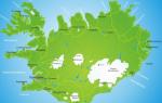
It is washed from the west by the Sea of Okhotsk, from the east by the Bering Sea and the Pacific Ocean. The peninsula stretches from northeast to southwest for 1200 km. It is connected to the mainland by a narrow (up to 93 km) isthmus - the Parapolsky Dol. The greatest width (up to 440 km) is at the latitude of Cape Kronotsky. The total area of the peninsula is ~ 270 thousand km ².
The eastern coast of the peninsula is heavily indented, forming large bays (Avachinsky, Kronotsky, Kamchatsky, Ozernoy, Karaginsky, Korfa) and bays (Avachinskaya, Karaga, Ossora, etc.). Rocky peninsulas protrude far into the sea (Shipunsky, Kronotsky, Kamchatsky, Ozernoy). The central part of the peninsula is crossed by two parallel ridges - the Sredinny Range and the Eastern Range; between them is the Central Kamchatka Lowland, through which the Kamchatka River flows. The southernmost point of the peninsula - Cape Lopatka is located at 50° 51 55With. w. The Kamchatka Territory, a subject of the Russian Federation, is located on the territory of the peninsula. About the origin of the name “Kamchatka”
There are more than 20 versions of the origin of the toponymic name “Kamchatka”. According to B.P. Polevoy, the name of the Kamchatka Peninsula comes from the Kamchatka River, and the river was named in honor of Ivan Kamchaty. In 1659, Fyodor Chyukichev and Ivan Ivanov, nicknamed “Kamchaty”, were sent to the Penzhina River to collect yasak (the nickname was given due to the fact that he wore a silk shirt; in those days, silk was called “Kamchaty Fabric” or “Damascus”). Ivan Kamchaty is a Kalym Cossack, converted in 1649 at his own request, a former industrialist. In honor of Ivan Kamchatsky, one of the tributaries of the Indigirka River was already called “Kamchatka” in the 1650s. On their campaign, they did not limit themselves to the Paren and Penzhiny rivers, they visited the Lesnaya River, where they met with Fedotov’s son and Sava Sharoglaz. It is known that having risen to the upper reaches of the Lesnaya River, they crossed to the eastern coast of Kamchatka, along the bed of the Karagi River they came to the shore of the Bering Sea, where for some time they were engaged in fishing for “fish tooth” (walrus ivory). In 1662, the Upper Kolyma Yukaghirs found all the participants in the campaign killed near Chyukichev’s winter quarters on the Omolon River - “Prodigal”. It is believed that the campaign of Ivan Kamchaty gave rise to an unusual legend among the Itelmens “about the glorious, respected warrior Konsh(ch)at”, which was later heard by Georg Steller and Stepan Petrovich Krasheninnikov. Leonty Fedotov's son and Sava Seroglaz moved to the lower reaches of the Kamchatka River to one of its tributaries, which later began to be called “Fedotovka,” and conveyed to the Itelmens the story about Ivan Kamchat. Since the Itelmens on the Kamchatka River could not know about Ivan Kamchat, his path passed to the north. The Itelmens passed on to other Russian explorers of Kamchatka the legend of Ivan Kamchat, that is, of Konsh(ch)at. The ethnonym “Kamchadal” arose no earlier than the 1690s. Only in the 1690s did the Russians learn that the Itelmens were not Koryaks at all, but a special people. In those days, it was customary to call local residents by the names of rivers. So from the Opuki River there appeared “Oputsky people”, from the Olyutory River - “Olyutorsky”, along the Pokhacha River - “Pogyche” - “Pogytsky”, and from the Kamchatka River - “Kamchatsky”, who in the time of Atlasov began to be called “Kamchadalians” or briefly “ Kamchadals,” and from here, some time later, the southern peninsula was sometimes called “Kamchadalia” or “Kamchadal land.” Therefore, the Itelmen do not consider the ethnonym “Kamchadal” to be an Itelmen word. There are etymological versions. Russian pioneers on the Kamchatka Peninsula encountered fur seals (kam seals) and hunted them. This is where the toponym "Kamchatka" - "land of the Kamchatkas" - came from. Previously, the word “Kamchat” meaning “big beaver” penetrated into Russian dialects through interaction with Tatar traders and spread throughout Siberia. The Turkic “kamka”, Uyghur “kimhap”, “kimhob” in Tajik mean “patterned fabric” (damask) - this word comes from the Chinese “kin hua” (“golden flower”). To trim their hats, the Tatars used not fabric, but the skin of a beaver (or other animal) - in Tatar “kama”, “kondyz” (hence the words “Kamchat”, “Kymshat” come from), where, according to one version, the name of the peninsula originates . There is a version that Kamchatka is a Russified version of the Yakut “hamchakky, ham-chatky”, derived from “khamsa (Kamcha)” - a smoking pipe, or from the verb “kham-sat (Kamchat)” - to move, sway. The first visit by Russians to the land of Kamchatka
People have always been attracted to something unknown and unknown, they strived to gain knowledge about this object or subject. So the Kamchatka Peninsula was the center of attention; people sought to explore it, use its resources, trade with the peoples who lived there, etc. Many different goals were pursued along the way of its development. This wonderful land was discovered by Russian Cossacks more than 300 years ago, but Russians even today know little about it. Back in the 15th century, Russians suggested the existence of a Northern Sea Route from the Atlantic to the Pacific Ocean and made attempts to find this route. The first information about the peninsula dates back to the mid-15th century. In September 1648, the expedition of Fedot Alekseev and Semyon Dezhnev was in the strait between Asia and America, which 80 years later would rediscover the Bering. The travelers landed on the shore, where they met “many kind Chukchi.” Later, Fedot Alekseev’s koch, judging by the information collected by the Bering expedition, was washed up on the shores of Kamchatka. Fedot Alekseev was the first Russian sailor to land and spend the winter on this peninsula. Kamchatka was populated long before the first Russian explorers appeared. Many tribes and nationalities lived on its harsh shores. Koryaks, Evens, Aleuts, Itelmens and Chukchi lived in the tundra, in the mountains, on the coast. The image of Kamchatka first appeared on the “printed drawing of Siberia” in 1667. 30 years later, clerk Vladimir Atlasov, at the head of a detachment of 120 people, went on a campaign “to find new lands” and founded Verkhnekamchatsk. He also delivered to Moscow information about the land that lay between the Kolyma River and America. The activities of Vladimir Atlasov are considered to be the beginning of the Russian development of Kamchatka. Research and discoveries in the northeast of Russia continued at the beginning of the 18th century. They imagined Kamchatka differently at that time, and they portrayed these ideas differently. For example, Semyon Remezov’s “Drawing of all Siberian cities and lands” indicates the large “Kamchatka Island”, and the Kamchatka River flows from the mainland to the east, into the ocean. And he, Remezov, later depicts Kamchatka as a peninsula, although far from our current understanding of its configuration. What knowledgeable Russian people knew about northeast Asia at the time of Bering's expedition can be judged from the map of Siberia compiled by surveyor Zinoviev in 1727. The northeastern tip of Asia is washed there by the sea, where two capes jut out - Nos Shalatskaya (Shelagsky) and Nos Anadyrskaya, to the south of which the Kamchatka Peninsula stretches. The compilers and executors of the map clearly understood that Asia in the northeast is not connected to any continent, that is, the map refuted the assumption of Peter 1, “maybe America has not come together with Asia.” And since Bering’s discoveries in the strait that bears his name were made later, in August 1728, it is clear that they could not influence the drawing of the surveyor Zinoviev’s map. In January 1725, by decree of Peter 1, the First Kamchatka Expedition was organized, which, in addition to Vitus Bering, gave history such names as Alexey Chirikov and Martyn Shpanberg. The first Kamchatka expedition made a major contribution to the development of geographical ideas about northeast Asia, and primarily from the southern borders of Kamchatka to the northern shores of Chukotka. However, it was not possible to reliably prove that Asia and America are separated by a strait. When on August 15, 1728, the expedition reached 67 degrees 18 minutes north latitude and could not see any land, Bering decided that the task was completed and ordered to return back. In other words, Bering did not see either the American coast or the fact that the Asian continent was turning to the west, that is, “turning” into Kamchatka. Upon his return, Bering submitted a note containing a project for a new expedition to the east of Kamchatka. Bering was a true explorer and considered it a matter of honor and patriotic duty to complete what he started. The second Kamchatka expedition was declared “the most distant and difficult and never before done.” Its task was to reach the northwestern shores of America, open a sea route to Japan, and develop industry, crafts, and farming in the eastern and northern lands. At the same time, it was ordered to send “kind and knowledgeable people” to “explore and describe” the northern coast of Siberia from the Ob to Kamchatka. In preparation for the Expedition, the range of its tasks expanded. Ultimately, this led to the fact that, through the efforts of progressive-minded figures of that time, the Second Kamchatka Expedition turned into a scientific and political enterprise that marked an entire era in the study of Siberia and the Far East. In the period from 1733 to 1740, extensive research was carried out by sailors and scientists who were part of the expedition. In May 1741, the packet boats "St. Peter" and "St. Paul", which were to become the ancestors of Petropavlovsk, approached the mouth of Avachinskaya Bay and began to wait for a fair wind. On June 4 they went to sea. The expedition went to the southeast... Almost at the very beginning of the voyage, bad weather separated the ships, and each continued its journey alone. In the history of geographical discoveries, one of the most amazing cases occurred: two ships, sailing separately for a month, approached almost on the same day the unknown shores of the fourth continent, thereby beginning the exploration of the lands that later received the name of Russian America (Alaska). The packet boat "St. Paul", commanded by Alesey Chirikov, soon returned to the Peter and Paul Harbor. The fate of "St. Peter" was less successful. The travelers were hit by a severe storm, an accident, and serious illnesses. Having landed on the famous island, members of the expedition bravely fought hunger, cold, and scurvy. Having survived an unusually difficult winter, they built a new ship from the wreckage of the packet boat and managed to return to Kamchatka. But without the commander. On December 1741, two hours before dawn, the leader of the expedition, Vitus Bering, died. The commander was buried according to Protestant rites near the camp. However, the location of Bering's grave is not precisely known. Subsequently, the Russian-American Company erected a wooden cross at the supposed burial site. In 1892, officers of the schooner "Aleut" and employees on the Commander Islands installed an iron cross in the fence of the church in the village of Nikolskoye on Bering Island and surrounded it with an anchor chain. In 1944, the sailors of Petropavlovsk erected a steel cross on a cement foundation at the site of the commander’s grave. The scientific and practical results of the Bering expedition (especially the Second) are innumerable. Here are just the most important of them. A path through the Bering Strait was found, Kamchatka, the Kuril Islands and northern Japan were described. Chirikov and Bereng discovered northwestern America. Krasheninnikov and Steller explored Kamchatka. The same list includes Gmelin’s works on the study of Siberia, materials on the history of Siberia collected by Miller. The meteorological research of the expedition was interesting; it served as an impetus for the creation of permanent stations not only in Russia, but throughout the globe. Finally, the coast of Siberia from Vaygach to Anadyr is described - an outstanding feat in the history of geographical discoveries. This is just a short list of what was done in the Kamchatka expedition. Such a truly scientific and comprehensive approach to the work that was carried out two and a half centuries ago cannot but inspire respect. The Second Kamchatka Expedition immortalized the names of many of its participants on the geographical map of the world and in the memory of people: Commander Vitus Bering and President of the Admiralty N.F. Golovin, researchers and sailors A.I. Chirikov and M.P. Shpanberg, S.G. Malygin and S.I. Chelyuskin, Kh.P. Laptev and D.Ya. Laptev, D.L. Ovtsyn and V.V. Pronchishchev. Among Bering's associates were prominent scientists. The names of academicians Gmelin and Miller occupy an honorable place in the history of Russian and world science. The most talented assistant to Miller and Gmelin was Stepan Petrovich Krasheninnikov. One of the islands off the coast of Kamchatka, a cape on Karaginsky Island and a mountain near Kronotsky Lake on the peninsula bear his name. Based on them, he created a major scientific work, “Description of the Land of Kamchatka,” the significance of which has not been lost over time. This book was read by Pushkin and, apparently, made a considerable impression on him. kamchatka geographical siberia expedition Alexander Sergeevich compiled quite extensive “Notes while reading “Description of the Land of Kamchatka” by S.P. Krasheninnikov” - the poet’s last and unfinished literary work. The discoverers of Kamchatka were the Cossacks Vladimir Atlasov, Mikhail Stadukhin, Ivan Kamchaty (perhaps this is where the name of the peninsula came from), and the navigator Vitus Bering. Kamchatka was visited by such famous navigators as James Cook, Charles Clark, Jean Francois La Perouse, Ivan Krusenstern, Vasily Golovin, Fyodor Litke. The Russian sloop of war "Diana" was heading to the northern part of the Pacific Ocean to compile a hydrographic description of the coastal waters and ocean lands and bring ship equipment to Petropavlovsk and Okhotsk. At the Cape of Good Hope he was detained by the British, and the ship remained under arrest for one year and twenty-five days. Until the daring maneuver took place. On September 23, 1809, "Diana" rounded Australia and Tasmania and arrived in Kamchatka. For three years, the crew of Russian sailors under the command of Vasily Golovin studied Kamchatka and the North American possessions of Russia. The result was the book "Notes on Kamchatka and Russian America in 1809, 1810 and 1811." After this, Golovin received a new task - to describe the Kuril and Shantar Islands and the shores of the Tatar Strait. Once again his scientific voyage was interrupted, this time by the Japanese. On the Kuril island of Kunashir, a group of Russian sailors along with their captain were captured, and again long days of forced inaction dragged on. However, inaction is not entirely accurate. The inquisitive researcher had a good time, but this was not the most pleasant time for him. His notes about his adventures in captivity among the Japanese, published in 1816, aroused great interest in Russia and abroad. So, the Far East, Kamchatka. She attracted inquisitive minds, called people who cared not so much about their own good, but cared about the good of the Fatherland. Good neighborliness and cordiality in relationships, mutual benefit in business - this is how Russian people saw Kamchatka from time immemorial, this is how he came to this land. This is how he lives on this earth. Why Kamchatka is important for Russia and the whole world
Studying the natural resources of Kamchatka
Kamchatka and its shelf have significant and diverse natural resource potential, which constitutes a significant and, in many ways, unique part of the national wealth of the Russian Federation. The history of scientific research in Kamchatka goes back more than 250 years. They began with the participants of the Second Kamchatka Expedition of Vitus Bering: Stepan Petrovich Krasheninnikov, Sven Waxel, Georg Steller. Thanks to these works, it became known that Kamchatka has rich fur reserves, as well as iron and copper ores, gold, native sulfur, clays, and hot springs. Subsequently, a number of research expeditions were organized to Kamchatka, which were financed by the treasury or by patrons. Gavriil Andreevich Sarychev proposed considering the use of Kamchatka’s natural resource potential from the perspective of trade in fish, fur, walrus tooth, whalebone and oil. Vasily Mikhailovich Golovnin expressed his opinion on the need to use thermal water for recreational purposes. As a result of the First Kamchatka Complex Expedition of the Russian Geographical Society, significant information was obtained on the geography, geology, ethnography, anthropology, zoology and botany of Kamchatka. In 1921 on the river. In Bogachevka (the coast of Kronotsky Bay), local hunters found a natural outlet of oil. Since 1928, in the estuarine part of the river. Vyvenka on the shore of the Gulf of Corfu, employees of Dalgeoltrest began a detailed study and exploration of the Corfu coal deposit. It is also known that the Americans explored and used coal from the Korfu deposit as early as 1903. In 1934, TsNIGRI employee D.S. Gantman gave the first description of the coals of the Krutogorovskoye deposit. In 1940, the USSR Academy of Sciences, together with the staff of VNIGRI (under the general editorship of Academician Alexander Nikolaevich Zavaritsky), compiled and published a geological map of the peninsula on a scale of 1:2000000, which was a synthesis of all the knowledge about the geology of Kamchatka that was available at that time. In accordance with it, mainly Quaternary volcanic and sedimentary deposits were distributed over a significant part of the peninsula. Of the mineral resources, only a few thermal springs have been identified. At the beginning of the 50s. a new stage in geological study has begun: an areal sheet-by-sheet geological survey on a scale of 1:200,000, which made it possible to create a holistic picture of the geological structure, outline and systematize the main directions of prospecting work. Up to 50 years No special prospecting and exploration work was carried out for metallic minerals. Basically, all attention was focused on the search for oil, but already in 1951-1955. During small- and medium-scale geological surveys in potentially ore-bearing areas, numerous primary ore occurrences of copper, mercury, molybdenum, and chromites were identified. Slice sampling established the fundamental gold content of many river valleys. New facts indicated the presence of primary and placer deposits of gold, and new areas favorable for prospecting were outlined. The main result of geological exploration research in the 50-90s. was the actual creation of a mineral resource base in the region for gold, silver, copper, nickel, groundwater, placer platinum, coal, gas, and various building materials. All this is reflected on a map of mineral resources of Kamchatka at a scale of 1:500,000 (responsible executor - Yuri Fedorovich Frolov), made on an updated geological basis and incorporating all the latest data on mineral resources of the Kamchatka Territory. The main stages of environmental management in Kamchatka
The socio-economic development of Kamchatka has always been based on the development of natural resources. Over the historically fixed period from the end of the 17th century, at least five main stages of environmental management can be distinguished. Before the arrival of Russian pioneers (i.e. until the end of the 17th century), a primitive collective method of developing biological natural resources existed on the territory of the peninsula. The physical existence of the population depended on the bioproductivity of ecological systems in their habitats. With the development of Kamchatka (late 17th - mid-18th centuries), the main natural resource of the region involved in economic turnover was furs. The resources of valuable fur-bearing animals (sable, arctic fox, fox, ermine) have come under severe anthropogenic pressure. The role of this type of natural resource can hardly be overestimated, since the pursuit of fur has become one of the main incentives for Russia to search for new lands in Siberia and America. The basis of Kamchatka's fur trade was sable, the extraction of which accounted for up to 80-90% of fur harvests in value terms. In the XVII-XVIII centuries. production of the main resource of the fur trade - sable - was estimated at 50 thousand heads per year. In addition, for the period from 1746 to 1785. About 40 thousand arctic fox skins were exported from the Commander Islands. Predatory extermination led to the depression of the populations of these species of fur-bearing animals, and from the middle of the 18th century, the amount of harvested furs in Kamchatka decreased significantly. Mid-18th century - end of the 19th century are characterized by intensive development (including poaching) of marine mammal resources. In the context of the completion of the territorial division of the world, the most developed countries (USA, Japan, etc.) have increased the pressure on the most accessible biological resources of the world ocean. At that time, the waters of the Okhotsk-Kamchatka Territory were exceptionally rich in various species of sea animals: walrus, seal, bearded seal, sea lion, beluga whale, killer whale, whale, sperm whale, etc. In 1840 Up to 300 American, Japanese, English and Swedish whaling ships sailed in these waters. Over the course of 20 years, they caught over 20 thousand whales. The catch of sea animals has decreased significantly in recent times. This stage of environmental management in Kamchatka has exhausted itself due to the almost complete destruction of its natural resource base. Since the end of the 19th century. to the 20th century Aquatic biological resources were used as the main natural resource base for commercial production (initially, herds of Pacific salmon spawning in the fresh waters of Kamchatka, then other types of aquatic biological resources). The first areas for commercial salmon fishing in Kamchatka were allocated in 1896. From 1896 to 1923, fish catch in Kamchatka increased from 2 thousand to 7.9 million poods. The potential productivity of salmon in all spawning and rearing reservoirs of Kamchatka is estimated at 1.0 million tons, and the commercial productivity is up to 0.6 million tons. The production of aquatic biological resources in Kamchatka has stabilized in recent years and annually amounted to about 580-630 thousand tons, 90% of which are valuable fisheries - pollock, cod, halibut, greenling, flounder, salmon, and seafood. At this stage, the economy of the Kamchatka region had a pronounced single-industry character. The basic sector of the economy was the fishery complex, which accounted for up to 60% of production and more than 90% of the region’s export potential. Currently, the possibilities for sustainable development of Kamchatka by increasing fish catches have been exhausted. Extensive development of natural fish resources has reached the limit of quantitative growth and has become the main factor in their depletion. Also during this period of time, forest resources were actively used in Kamchatka, a timber industry complex was formed and functioned quite successfully, which included logging, production of round timber, sawmilling, and the supply of some products for export. As a result of the use of forest resources during this period, the most accessible and commercially high-quality forests of cayander larch and Ayan spruce in the Kamchatka River basin were cut down, and the volume of industrial logging and, somewhat later, the volume of felling began to decline sharply. Large specialized forestry enterprises with forest resource bases assigned to them for the long term ceased to exist. Currently, the annual volume of wood harvesting and processing in the Kamchatka Territory does not exceed 220 thousand m3, with the estimated cutting area - 1830.4 thousand m3. By the end of the 20th century, this type of environmental management had reached a state of crisis. The main features of the listed periods were that the structure of the regional economy in each of them was distinguished by single-industry specialization in interregional labor exchange. Focusing on one type of natural resource as the main product for interregional exchange invariably led to the depletion of this resource. Changes in types of environmental management were accompanied by the destruction of production and settlement systems. Taking these features into account and in order to avoid destructive socio-economic and environmental consequences, at the present stage a transition is being made to a new type of natural resource development. The new type is based on integrated use, including, along with fish resources, recreational, water, and mineral resources. In this regard, the Government of the Kamchatka Territory is developing a Strategy for the socio-economic development of the Kamchatka Territory until 2025, which corresponds to the key areas of development of the Far Eastern Federal District, the Concept of long-term socio-economic development of the Russian Federation. A comprehensive analysis of the opportunities for economic growth in the Kamchatka Territory shows that the mining industry is currently the only infrastructure-forming industry in the region. Only through the development of mineral deposits is it possible to develop a rational energy and transport infrastructure in the Kamchatka Territory, creating the prerequisites for the successful subsidy-free development of the Kamchatka Territory. Mineral resource base of the Kamchatka Territory and its role in the socio-economic development of the region
The mineral resources of the Kamchatka Territory are represented by various minerals of both federal, interregional and local importance, which can be profitably developed. The subsoil energy resources of Kamchatka are represented by reserves and predicted resources of gas, hard and brown coal, geothermal waters and hydrothermal steam, and predicted oil resources. The hydrocarbon potential of the land is estimated at 1.4 billion tons of oil equivalent, including about 150 million tons of recoverable oil and about 800 billion m3 of gas. Explored and preliminary estimated reserves of natural gas are concentrated in one medium and three small fields of the Kolpakovsky oil and gas region of the Okhotsk-West Kamchatka oil and gas region and amount to a total of 22.6 billion m3. The explored and preliminary estimated coal reserves of the Kamchatka Territory amount to 275.7 million tons, the predicted resources exceed 6.0 billion tons. 7 deposits and more than ten coal occurrences have been studied in varying detail. Brown and hard coals, mostly of medium quality, are used for local needs. To date, 10 deposits and 22 promising areas and areas of primary gold have been identified and studied to varying degrees in the Kamchatka Territory with explored and preliminary estimated metal reserves of 150.6 tons and predicted resources of 1171 tons. Associated silver reserves are accounted for in the amount of 570.9 tons, predicted resources exceed 6.7 thousand tons. Alluvial gold reserves are estimated in 54 small deposits in the amount of 3.9 tons, predicted resources - 23 tons. Residual reserves of alluvial platinum are 0.9 tons, resources - 33 tons. In addition, the ore occurrence of primary platinum with predicted resources of more than 30 tons is being studied. The predicted resources for nickel and cobalt of the cobalt-copper-nickel deposits of the Sredinny crystalline massif of Kamchatka alone are determined at 3.5 million tons and 44 thousand tons, respectively. Individual deposits, for example Shanuch, are characterized by very high average contents of nickel in ores - up to 7%, which allows their processing without preliminary enrichment. The Kamchatka region is provided with all types of building materials (with the exception of raw materials for cement production): sand and gravel mixtures, construction sand, volcanic tuffs, building stone, various concrete fillers, slag, pumice, brick clays, mineral paints, perlites, zeolites. The Ilyinskoye pumice deposit, the largest in the Far East, is unique; its reserves in categories A+B+C are 144 million m3, and are a multi-purpose raw material of local and export importance. More than 50 deposits have been explored in the Kamchatka Territory for the production of building materials. A widespread mineral resource in the Kamchatka Territory is groundwater, which, according to its chemical composition and temperature, is divided into: cold fresh, thermal (thermal energy) and mineral. They are used for domestic and drinking water supply, as well as for balneological and thermal energy purposes. A new direction in the use of cold fresh waters from Kamchatka, which are of high quality, is their bottling and export to regions with a shortage of sources of drinking water supply. Today, there are 289 licenses for the right to use subsoil in the Kamchatka Territory. Of these, 56 licenses are for significant subsoil use objects. Currently, production volumes for the main types of mineral raw materials are: The Kshukskoye gas condensate field is at the stage of pilot industrial development. Annual production is 8-9 million m3 for the needs of the Sobolevsky district. For local needs, 3 small deposits of hard and brown coal are being developed and 2 are being prepared for development. The production volume in 2007 amounted to 21 thousand tons. The annual production of thermal waters is about 13 million m3. Steam from the Pauzhetsky, Mutnovsky and Verkhne-Mutnovsky fields is used to produce electricity. The total capacity of the geothermal power plants operating there is 70 MW. In 2006, industrial gold mining began at the Aginskoye deposit (design capacity - 3 tons of metal per year). The volume of gold production in 2006 amounted to 1195 kg, in 2007 - 2328 kg. Placer gold is mined in the amount of 110-190 kg per year. From 1994 to the present, about 50 tons of alluvial platinum have been mined. In 2007, production volume was 2078 kg. In 2007, the Shanuch copper-nickel deposit produced: 2202 tons of nickel, 300 tons of copper, 50 tons of cobalt. The immediate prospects for the development of the mining industry are primarily that by 2015 in the Kamchatka Territory 6 mines should be built and begin mining: Asachinsky (2010), Baranevsky (2011), Amethyst (2012). ), Rodnikovy (2013), Kumroch (2013), Ozernovsky (2015). Gold production will be 16 t/year, platinum - 3 t/year. By 2018, the production of ore gold will reach 18 tons, platinum - 3 tons. The Shanuchsky nickel mine, operating in pilot production mode, should switch to industrial development mode by 2014. By 2017, balance reserves of nickel will be prepared at the Kvinumskaya area and the second nickel mine in the Kamchatka Territory will be built. Total nickel production at the two enterprises will reach 10 thousand tons per year. Four promising areas for hydrocarbon raw materials are identified within the shelf zones adjacent to the coast of the Kamchatka Territory. Investments in exploration and development of deposits in the Western Kamchatka zone, as well as the creation of coastal infrastructure are estimated at 775 billion rubles. Other promising areas may be involved after the first positive results are obtained in the West Kamchatka area. Total in the period 2008-2025. in the Kamchatka Territory, while maintaining the current level of prices for mineral raw materials, 252.4 tons of gold, 54 tons of platinum, 114.6 thousand tons of nickel, 17 billion m3 of gas, 6.6 million tons of oil on land and 326.5 million tons of hydrocarbons in oil equivalent on the shelf. Total investments in additional exploration, creation of mining and transport infrastructure for the mining industry in the period until 2025 are estimated at 33 billion rubles. in 2008 prices, incl. gold - 16 billion rubles, platinum - 5.1 billion rubles, nickel - 8.4 billion rubles, other minerals - 3.2 billion rubles, excluding the costs of implementing offshore projects. One of the tasks of managing the mineral resource complex is the creation of a diversified system of environmental management that quickly responds to changes in market operating conditions. Considering the development trend of the global market for natural raw materials, it is necessary and sufficient to develop the production and use of: precious metals; hydrocarbon raw materials; non-ferrous metals; balneological resources. These four areas will allow us to take a strong position in the economy. To meet the regional needs and demand of the Far Eastern constituent entities of the Russian Federation, in addition to the mentioned industries, full-scale development of the resources of underground drinking water, building materials, and coal is promising. To ensure sustainable development of the mineral resource complex, it is necessary to increase the mineral resource base not only at the expense of enterprises, but also in the process of public-private partnership. At the same time, pay special attention to the forecast and search for large and unique deposits. Such objects, first of all, can be large-volume deposits of precious metals - gold, platinum within the northern and central parts of Kamchatka (such as Ozernovsky, Galmoenansky, etc.). The same series should include an assessment of the hydrocarbon raw materials of the West Kamchatka, Shelikhovskaya, Khatyrskaya, and Olyutorskaya shelf areas. Any invasion of nature is associated with causing some damage to it. Kamchatka is one of the most vulnerable territories. Therefore, environmental protection is an important element of the environmental policy of the Government of the Kamchatka Territory. The use of the most modern and safe, from an environmental point of view, technologies for the development of mineral resources today is the main task of the legislative and executive authorities of the region. Such a large-scale development of the mineral resource complex cannot but entail large-scale social transformations. The personnel shortage of geologists, miners, and technical specialists of various skill levels necessitates the training of specialists with higher and specialized education, numbering at least 2,500 people; The use of the mineral resource base of the Kamchatka Territory in the near future will help significantly change the overall structure of industry through the creation of new industries - non-ferrous metallurgy enterprises, gas and oil industries, and construction materials. Solving the problem will double the GRP and increase budgetary security. The transport and energy infrastructure created by the industry's facilities will contribute to the development of tourism, social and cultural facilities, and will improve the livelihoods and employment of the population of the Kamchatka Territory, especially its northern part, the development of which is not provided for in the strategies of other industries.
Ancient Kamchatka
The first man entered the Western Hemisphere from the Eastern Hemisphere approximately 25-40,000 years ago. At that time, on the site of today's Bering Strait, there was land that connected northeast Asia with northwest America. The mountains were covered with glaciers, and in the ice-free spaces there were tundras, through which herds of shaggy red mammoths, woolly rhinoceroses, bison and reindeer roamed.
Ancient hunters and fishermen from the southern territories gradually migrated and settled on the coast of the Sea of Okhotsk, Chukotka and Alaska. Some of them settled in Kamchatka.
The most ancient evidence of their presence on our peninsula was discovered by archaeologists near the Ushkovsky spawning lake, 18 km from the village of Kozyrevsk. This is one of the few such ancient sites in the Far East - its age is 13-14 thousand years. During excavations, remains of dwellings, fireplaces, and stone tools were discovered. Scientists believe that this ancient Kamchatka culture spread towards America, connecting the ancient cultures of the Old and New Worlds.
Ten thousand years ago, the ice sheet melted, connecting the Arctic and Pacific Oceans. The connection between Asia and America by land was interrupted. Kamchatka was now connected to the mainland only by a narrow isthmus. The climate began to noticeably warmer, mammoths, bison and other animals of the Ice Age became extinct. But the ancient Kamchatka people continued to exist and explore the harsh North of the planet in the post-glacial period.
 Among them were Itelmens, Koryaks, Chukchis and Ainu. Later the Aleuts and Evens appeared. Outwardly, these peoples were similar; they were separated by different types of farming, culture and living conditions. The Itelmens were engaged in fishing, the nomadic Koryaks were engaged in hunting wild deer, and the sedentary Koryaks were engaged in sea hunting and fishing. The harsh climate, vast impassable spaces of taiga and tundra, mountains, rivers and lakes - all this contributed to the greater disunity of these peoples.
By the second half of the 1st millennium BC. include ancient sites found on the site of modern Petropavlovsk, in Seroglazka, on the southwestern slope of Mishennaya Sopka, on the banks of Avachinskaya Bay, on the left bank of the Avacha River opposite the city of Elizova, near the city of Klyuchi. During this period, the ancient inhabitants of Kamchatka had already learned to make figurines of humans and animals from stone, polish axes, and finely process spear and arrow tips. They were excellent hunters and fishermen. They stood on a par with other tribes of the earth. However, the remoteness and isolation of these places gradually affected the lag in the development of technology and the social system.
Discovery of Kamchatka by Russian explorers in the 17th century
More than 300 years ago, in the mid-17th century, Siberia became part of Russia. The country has become not only a European, but also an Asian state. The development of Siberia and the Far East became a matter of first importance, having enormous significance and influence on the course of world history. The government needed to replenish the treasury and expand the territory of the state. Russian explorers began to penetrate further and further east, in search of new unknown lands and riches, to the shores of the Pacific Ocean.