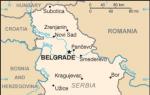
Where is Kremenchug located? About the city of Kremenchug. Background information of Kremenchug
Kremenchug is a city in the Poltava region of Ukraine, and is the administrative center of the Kremenchug region.
The city stands on the main waterway of the country - the Dnieper. The city's agglomeration is among the top ten largest in Ukraine and accounts for almost half a million people. The city has its own symbols - a flag and a coat of arms. The flag has three horizontal stripes - blue, white and dark blue. The white stripe signifies the Dnieper, which flows through the city. The coat of arms depicts a shield topped by a city crown with three towers.
The city has Tatar roots. One of the hypotheses for the origin of its name says that the city received its name from the word “Kermenchuk”, which in Tatar means “small fortress”. Kryukov Posad, which is now part of Kremenchug, is located not far from the place where the Kuruk Treaty was most likely concluded.
Today the city is officially divided into two districts: Kryukovsky and Avtozavodskoy. Kremenchuk stretches from south to north, and its width does not exceed 8 kilometers. The left-bank and right-bank parts of the city are connected via the Kryukovsky Bridge across the Dnieper. The bulk of residents and city enterprises are located on the left bank.
On the right bank there are the districts “Kryukov” and “Rakovka”. The first one is adjacent to the bridge, it houses a car-building and steelworks, and is built up with “Khrushchev” and “Stalin” buildings. The second area is younger and located downstream of the river. On the left bank there are “Center”, “Shchemilovka”, “Reevka”, the first, second and third “Zanasyp”, “Nagornaya part” and the village “Molodezhny”. The city is crossed by two important highways: Dnepropetrovsk - Kyiv and Alexandria - Kharkov.
Processing and engineering enterprises are concentrated in the city; its contribution to the country's budget is 7%. There are an oil refinery, a carriage building plant, a car and wheel assembly plant, a road machinery plant, and a steel foundry. There are meat processing plants, bakeries, clothing factories, a dairy factory, and large confectionery factories: Lucas, Salex, Roshen and Romantika. Upstream there is the Kremenchug hydroelectric power station and reservoir. The city has cultural institutions, for example, the Museum of History and Local Lore, the city gallery, and the Makarenko Museum. City cultural events are held at the City Palace of Culture named after. Petrovsky or in cultural palaces at enterprises. Citizens can receive education at six schools, a medical college, a flight college, a railway technical school, a university of economics, information technology and management, and representative offices of other universities. Sports complexes and three sports schools for children, numerous gyms and sections are open for sports. Kremenchug is a major railway junction in Ukraine, has an airfield and a large port on the Dnieper. There are two railway stations in the city: Kryukov-on-Dnepr and Kremenchug. On the Southern Railway, Kremenchug station is one of the largest.
The city has passenger connections with Kiev, Moscow, Kharkov, Odessa, Simferopol and Dnepropetrovsk. For suburban transport, a rail bus was launched in 2008. A tram appeared in the city in 1899; the tram fleet included 16 motor cars. By the time of the October Revolution, the length of tram tracks reached 12 kilometers and there were three routes in the city.
Kremenchug is a huge industrial city (224 thousand inhabitants, and half a million with satellite cities) a hundred kilometers from Poltava, Kirovograd (Kropyvnytskyi) and Dnepr (opetrovsk). It relates to the shown Poltava approximately like Cherepovets with Vologda: there it is an administrative and cultural center, and here it is an economic and transport center. But the uniqueness of Kremenchug is that it stands on the two banks of the Dnieper approximately in the place where historical Little Russia was replaced by historical Novorossia, and this is significant: I heard from my Kiev acquaintances that the results of the elections in Kremenchug accurately predict the results of elections throughout Ukraine. But in terms of attractions here, let’s face it, it’s downright boring...
I traveled from Poltava to Krechenchug on a private minibus, the phone number of which I found out at one of the Poltava bus stations. A movie was shown in the salon, and, characteristically, in Russian. I looked more at the screen than out the window, the minibus was bouncing on the potholes of one of the worst roads I know (not the Lviv Carpathian region, of course, but comparable), but at some point, out of the corner of my eye, I saw that the landscape outside the window had changed:
Kremenchug, unlike almost all the cities shown earlier in this series, did not have an ancient Russian past. But since the 14th century, the victories of Lithuania over the Golden Horde, a fishing farm has been known in this place, near which in 1550 a “river corral” was created (the base of the Cossack flotilla, which kept Tatar crossings under control), and in 1637 - a fortress, along with Kodak (prototype) already holding the Zaporozhye Sich at gunpoint. The Cossacks, of course, were not at a loss either, and in the same year, the Cossack settlement of Kryukov arose on the right bank of the Dnieper, and then the Cossacks completely drove the Poles away. Under the Hetmanate, Kremenchug was already listed as a city, but in fact it remained a remote periphery until 1764, when in Russian capitals it was first said - “There will be a New Russia!” On the lands of the Wild Field, on the Zaporozhye nomads, to which were added colonies of border Serbians, the Novorossiysk province was established, and Kremenchug, as the lowest city on the Dnieper at that time, became its center, and formally remained so until 1783, and in fact - until 1796, while Ekaterinoslav was being built further down the Dnieper. Then Kremenchug was completely returned to Little Russia, and in 1802 it became a district town of the Poltava province. But those 30 years were not in vain - the city managed to get rich, acquire connections and traditions, and was in no hurry to give up its position, by the beginning of the twentieth century, with a population of 61 thousand people, remaining the largest city in the entire Left Bank of Little Russia, surpassing the provincial Poltava and Chernigov. But alas, that city was wiped off the face of the earth by war and in late Soviet times it was finally reborn into an industrial giant. In 1958, the famous KrAZ produced its first truck, in 1960 the Kremenchug hydroelectric power station in Svetlovodsk produced its first electricity (then it was called Khrushchev, until Nikita Sergeevich himself abolished this name, obeying the law he himself adopted), in 1966 the largest oil refinery in Ukraine began operating (comparable in power, but it only works now at 25-30%), in 1970 - the Komsomolsk Mining and Processing Plant, the most important along with the supplier of raw materials for Ukrainian metallurgy, for which the city of Komsomolsk was specially built, recently noisily renamed the village of Horishni (Upper ) Plavni. That is, what we essentially have: an absolutely central Ukrainian city in history and location with absolutely Eastern Ukrainian industrial modernity.
I got two walks around Kremenchug - I arrived here at dusk, squeezed everything I could out of them before dark, and took a taxi to a crappy hotel somewhere in the depths of the station industrial zone. In the morning I went for a walk literally with the first rays of the sun - until the evening there was a difficult hitchhiking dash to Kirovograd through Chigirin with walks in three cities, and literally every minute counted. However, I passed the station on both walks, and I don’t really remember which frames show morning and which ones show evening.
The railway came here in 1870, the same one as in Poltava, the Kharkov-Nikolaev highway, and even with the exact same station. Moreover, since 1888 the highway was actually Libavo-Kremenchug, connecting the Baltic not just with the Ukrainian breadbasket, but with the Dnieper and, therefore, the Black Sea. The old station, the same as in Poltava, was destroyed during the war:
Behind the station there are industrial zones, one-story suburbs, distant microdistricts, known under the common sonorous name Zanasyp, and a 350-meter winding overpass leads there from the station square:
Station Square, and once Fair Square, is marked by St. George's Chapel. It was built in 2006 by railway workers in memory of Georgy Kirpa, the Minister of Transport of Ukraine, by origin (Khmelnychyna) and career (Lviv Railway) an obvious Westerner, but at the same time moderate pro-Russian views. It is also indisputable that Ukrazaliznitsa flourished under him, which I myself remember very well from my visits to Ukraine in 2004, and it was built under him - and Russia then never dreamed of such roads, nor such trains and stations. More than once I came across the opinion that it was Kirpa who could be a potential savior of Ukraine, who would ensure development for the country, prevent polarization and prevent the oligarchic game of thrones from running wild. But after the 2004 elections, Kirpa shot himself, and if it really was suicide (which, as you might guess, there are big doubts), then maybe he simply understood what kind of crooked path his country had taken? And how significant it is that he was immortalized with a chapel here in the Median City.
Basically, the center of Kremenchuk looks like this, and frankly, it is one of the most dull cities I have seen. The old city was destroyed by the war, and big industry came here only under Khrushchev and Brezhnev, so the appearance of Kremenchug is determined by five-story buildings and the most primitive version of Stalin, at the foot of which you can now and then come across “district” houses. At the same time, the city is well-groomed, lively (not at 6 in the morning, of course, when this shot was taken) and clearly rich - the local factories, especially machine-building ones, are working properly, and the army was able to at least partially compensate for the loss of markets.
Kremenchug is divided into two districts - Avtozavodsky and Kryukovsky, so different that I would call them separate fused cities. It is most logical to imagine the Dnieper as their border, but no: the Kryukovsky district, in addition to Kryukov across the river, also includes the center of Kremenchug with a station, while Avtozavodsky covers the industrial areas of KrAZ and the oil plant far from the river. Both of my walks started from the station, but in different directions and to different areas.
First walk, evening.Avtozavodsky district.
From the station there is a short, noisy street called Halamenyuk in a straight line, and opposite the station square there is a larger parking lot in front of the Amstor shopping center. Then I bought dinner there, but now on Wikimapia it is marked closed. Further down the street is the Kredmash recreation center, and for a long time I puzzled over what kind of equipment it makes (banking equipment?), until I realized that it means “Kremenchug Road Machinery Plant,” which produces asphalt paving plants. It originated back in the 1870s, then producing, like most engineering factories in the South, agricultural implements. Its small area is right behind the cultural center, and from the façade of the cultural center begins Cathedral Street (at the time of the trip - Lenin), which will be useful to us on our second walk.
On the other side of the plant is the City Garden, laid out by Potemkin in 1787, for the visit of Catherine II to the then center of Novorossiya:
Opposite is the Cosmos square with a simple Trinity Church (1999) and a monument to Komsomol members (1972), I don’t know whether it has been decommunized since then or not.
The church looks much more interesting “in profile” than from the apse, but I didn’t come closer to it. This is the successor to the old Trinity Church (1915), demolished back in the 1930s. Today I came across a phrase from the Trinity Church at the Power Station:
The power plant itself is a little further, behind a tricky five-spoke interchange separating the Avtozavodsky district, deep into which goes the wide and spacious Svoboda Avenue, which at the time of the trip was still the 60th Anniversary of the October Revolution Avenue - it was by this time, judging by its appearance, that the district was formed.
And it apparently began with a power plant and a fire station - although the power plant itself looks like the 1920s, and the fire complex looks pre-revolutionary, in fact, all this was built by 1950:
Graffiti on the wall of the power plant with the shadows of people who believed:
Most of Svoboda Avenue looks like this, and the power of Brezhnev's districts in the industrial cities of Ukraine is invariably impressive:
I walked for about 20 minutes to the next square at the fork in the roads to Poltava and Kyiv:
There is a McDonald's here, but I didn't take a picture of it:
Opposite the fountain is the “Forever Alive” memorial (1973) on the site of one of the prisoner of war camps. There were several of them in Kremenchug, and up to 100 thousand people died in them. Here the hero of the plot is a military doctor who secretly treated wounded prisoners in a hospital set up by the Germans, for which he was eventually executed.
By Ukrainian standards, Kremenchug is such a rich city that it can afford to maintain an eternal flame:
The memorial opens with Zhilgorodok (1950-52), a kind of historical center of the Avtozavodsky district. The typical post-war KrAZ Palace of Culture overlooks the same square:
The industrial buildings of all sorts of old mills and factories look a little more solid:
But of the churches, only the old church (1910) survived, which in the 1990s became the Orthodox St. Nicholas Church:
In one of the courtyards near the main street there was a synagogue, which, upon closer inspection, turned out to be a remake:
It is not entirely obvious that almost half of the population of the district Kremenchug, that is, about 30 thousand people, were Jews, and among the district cities only Kremenchug could boast of a larger community. There were 3 choral synagogues and 30 houses of worship, but there was no famous Hasidic tzaddik or Yiddish writer, so nothing reminds of the former scale.
But there were few Orthodox churches in Kremenchug (). For example, the Transfiguration Church (1801-20) among endless blocks of burgher houses:
And although in their place there are now high-rise buildings, from many of the courtyards the completely Chekhovian district spirit has not disappeared to this day:
And here and there there are garbage cans, the appearance of which is most accurately described by the word “ku”:
Now let’s walk towards the Dnieper along the main street - now Sobornaya, under Lenin’s Soviets, and in its time, Catherine’s. A kilometer from the already familiar Kredmash cultural center, it passes between the Stalin-era “gates”:
Next door is a mandatory Stalinist building with a tower in an industrial city:
And further between Sobornaya and Igor Serdyuk Street, parallel to it, lies the former Oktyabrsky Square, which in July was renamed Oleg Babaev Square. The latter, with an absolutely incredible middle name, Maidanovich, is not a hero of the Heavenly Hundred or the ATO, but a local mayor killed by a killer in the summer of 2014, and I don’t presume to guess who exactly he interfered with and how popular he was among the people. In the park there is a monument to the Soldier Liberator, erected in 1949, when charred ruins still lay around:
At the end of the boulevard there is a monument to victims of repression and a couple of old houses: from here to the Dnieper their concentration will be greatest. The shot was essentially taken from their former yard, and I managed to miss the facades facing the parallel Igor Serdyuk Street. The left one belonged to the confectioner Silaev, the right - to the burgomaster Kazachek. But the strangest building of this former courtyard is a turret, similar to a chapel built under the Soviets, now occupied by a cafe:
There is another renovated tower ahead:
Another piece of pre-revolutionary art with a mosaic on the former firewall:
Behind the next intersection is a bank (1900-03):
At first glance, it seems strange that the riverside part of the city has been preserved better than areas away from the Dnieper. But the fact is that most of all the war destroyed the cities on the western banks of the rivers - the Germans marched to the east with a blitzkrieg, retreated to the west, clinging to every inch, and most likely, having lost the fortified outskirts, they preferred to retreat from the coastal ones to fortified positions beyond the Dnieper, not waiting for the Red Army to start drowning them in the river. In the backyard of the bank there is a very touching monument “The First Day After the War”, and the backyard itself faces the deserted Victory Square:
Opposite him before the Maidan stood clearly not the typical Ilyich. The appearance of its “stump” is intermediate between the regional centers (where they are usually painted with plot-based graffiti and painted with poetry) and the outback (where they stand forlornly).
On the left is a monument to the fighters of the Revolution (1938), I don’t know if it’s still there almost a year later. Apparently, the name of the square refers to the victory in the Civil War:
Before the Great Patriotic War, the main temple complex of the district of Kremenchug stood here - the Assumption Cathedral (1808-14) by Giacomo Quarenghi and the winter church-bell tower of Alexander Nevsky (1858-63):
And the Alexander Real School (1878), now a college. In general, one gets the impression that the district Kremenchug was never really beautiful, but was something like Krivoy Rog or Surgut, only in the 19th century - a large and rich city that did not care too much about its appearance. An overview of surviving architectural monuments is available in the Ukrainian Wikipedia.
We are getting closer and closer to the river facade, to the transition from the Left Bank of Ukraine to the Right. Below Victory Square is Pridneprovsky Park, which has many well-kept corners, but I remember more the abandoned cinema painted with mysterious inscriptions. The mysterious inscription “Elephants are not dead” apparently resembles about this episode, when circus elephants were grazing in one of the squares of Kremenchug.
And on the edge of the park are the oldest buildings of Kremenchug, the complex of the Headquarters of military settlements (1853-54) in place and possibly with fragments of even older Government places of the Novorossiysk province:
Fortunately, I came out to the rocky Dnieper bank even before this episode, so I photographed it calmly. The Dnieper here is in its natural channel, and let’s face it, it’s not very wide, God forbid, if it’s half a kilometer. In the middle is the rocky island of Fantasia, where it’s probably good to retire on the side opposite the city:
Under the Dnieper Park there is a granite embankment that does not seem to be from the 18th century, at least in pre-revolutionary photographs it is there:
At the end of which is the Granite Register, that is, a rock on the flat stone of which the flood level has been recorded since the end of the 18th century. There were similar ones in other cities, for example, near Zaporozhye, but most of them, with the construction of hydroelectric power stations, went into the water forever, but this one, on the contrary, will most likely never flood again:
I went downstream. The river station looks brand new, although there have been no passenger ships here for a long time. Pre-revolutionary Kremenchug was one of the largest ports of the Dnieper, and even the first tram there ran from the station to the steamship pier:
Behind the deserted beach you can see the Kryukovsky Bridge, which means it’s time to cross the Dnieper:
That's what I did on the minibus, taking pictures from its rear window. The bridge was built in 1945-49, and the luxurious pylons at both ends remind you that this is also a monument to Victory. Its length is actually not very long - 1.2 kilometers, but subjectively the bridge seems grandiose. Downstream in the water there are still fragments of the supports of the old bridge, built in 1872 for the Kharkov-Nikolaev railway.
The right bank welcomes you with a monument (1940) to the sailors of the Dnieper flotilla who fought in the civil war, and a poster testifying to the new war.
Kryukovsky Posad took shape opposite the Kremenchug fortress back in the 17th century, and its first inhabitants were the Cossacks, who kept an eye on the Poles, sharpening their sabers and smoking pipes, who kept an eye on them from the bastions of Kremenchug. In 1752-64, the border guards of New Serbia were stationed here, with the abolition of which Kryukov became a town in the Novorossiysk province, and with its abolition, it was included in Kremenchug. They say that in fact local government worked until 1817, refusing to obey the government across the river, but in any case, Kremenchug became the first city on both banks of the Dnieper - it crossed the river only at the end of the 19th century, Kiev and Zaporozhye were only under the Soviets, and the cities one shore even now. But Kryukov feels like it’s still a different city, quieter, sleepier and dilapidated than Kremenchug, which is completely regional in its rhythm of life. There is also an industrial giant here - the Kryukov Carriage Works, founded with the advent of the railway in 1768 and over time becoming one of the main ones in the USSR. It stands quite far from the Dnieper, with its façade facing the opposite direction from the center towards the factory settlement of Rakovka, but I didn’t go there anymore, especially since the plant is considered a military plant and I didn’t want to risk burning myself down there either.
From the bridge deep into the narrow triangular Kryukov, the long street Ivan Prikhodko leads, and here the name is to some extent colonial - in honor of the most successful director of the left bank KrAZ: “Kryukov is Kremenchuk!” At its beginning, staliks predominate - here, unlike the center, the riverine part was more destroyed:
And Churkin (1901) with an extremely beautiful lantern:
Not a house, but a gate. Behind the railway there is another Assumption Cathedral (of course, not like the one that died on the Left Bank) and the house-museum of Anton Makarenko, who spent his youth in Kryukov.
But basically Kryukov looks like this:
At Kryukov station, the only thing left from the past is this little house with the windows blocked up:
The old station was clearly typical, but still more interesting than what is in its place now:
The most remarkable building in the area is the Kotlov House of Culture (1925-27) in a belated, pre-Soviet, but completely recognizable Ukrainian Art Nouveau style:
And in general, I agree that I didn’t see much in Kremenchug. But I was in a hurry and tired, and in a situation where this visit to Ukraine could well be my last, I openly regretted the time spent on Kremenchug. Maybe if I had come here leisurely for a day, the impression would have been different, but I remember Kremenchug as the most dull of the largest cities in Ukraine.
At the monument to the soldiers of the Dnieper flotilla, on a quiet street between high-rise buildings and the Dnieper floodplains, I caught a shortcut to the hydroelectric city of Svetlovodsk, which for a long time climbed the hills of the high right bank, from which the blue expanse of the reservoir was constantly opening up behind the trees. In Svetlovodsk, I jumped onto a minibus in the direction of Chigirin, intending to ride it as far as possible and then hitchhike to Chigirin itself. What came out of this is in the next part. The end is already near, and I’m even more tired of this whole topic than you are...
UKRAINE and DONBASS-2016
. Review and table of contents.
Two sides of the same war- see table of contents.
DPR and LPR- see table of contents.
Vinnitsa, Zaporozhye, Dnepr- see table of contents.
Kievan Rus- see table of contents.
Little Russian Ring- there will be posts.
. Child..
. Sobornost Street.
. Center.
. Outskirts.
. In the wake of the Battle of Poltava.
Kremenchug. A city on two banks.
Chigirin and Subbotov. How it all began...
Kirovograd (now Kropyvnytskyi). Big Perspective.
Kirovograd (now Kropyvnytskyi). Streets of the old city.
Kirovograd (now Kropyvnytskyi). Suburb.
Kyiv before and after Maidan- there will be posts.
Heraldry
Coat of arms of Kremenchuk

Kremenchug district
The area is located mainly on the left bank of the Dnieper and only a small territory on the Right Bank. It borders with Kobelyaksky, Kozelshchinsky, Globinsky districts of the Poltava region, Svetlovodsk city council, Svetlovodsk, Onufrievsky districts of the Kirovograd region.
The area of the district is 1224 sq. km.
Population – 43,975 people. (2001).
The Kremenchug district is divided into 19 village councils, uniting 73 settlements. Within the district there are also Komsomolsk city councils
The summer artery within the region is the Dnieper with its tributary Pslom. On the left bank of the Dnieper there is the port of Kremenchug and piers in the villages of Reduty and Keleberda.
The rivers Dnieper, Psel, Sukhoi Kagamlyk, Sukhoi Omelnik, Sukhoi Kobelyachek, and Rudka flow through the area.
Natural resources in the area include iron ore, granite, clay, sand and other minerals.
Farm
There are 3 industrial enterprises in the area: Teklo-Dnepro LLC, Izumrud CJSC (mineral water plant), and the private enterprise Rezinotekhnika. 6 agricultural cooperatives, 10 private agricultural enterprises, 5 agricultural limited liability companies and 2 agricultural closed joint-stock companies. The largest of them are: the agricultural cooperative "Dnepr", private agricultural enterprises "Kolos", "Maiborodivske", CJSC "Poultry Farm "Russia"". 78 farms are engaged in the production of agricultural products, to which 2,500 hectares of land were transferred.
Education
In the area there are: 2 schools - I degrees, 11 schools of I-II degrees, 13 schools of I-III degrees. There are 11 preschool institutions. There are no higher educational institutions in the region. There is a children's and youth sports school. Year of foundation - 1991. The school cultivates 3 sports: football (boys), handball (girls), athletics, the youth sports school football team is a permanent participant in the Ukrainian championship among youths.
Medicine
There is a central district hospital, 2 local hospitals, and 8 outpatient clinics. On the territory of the district there is a sanatorium-preventorium “Verbichenka”, owned by the joint-stock company “Ukrtatnafta”.
The administrative center of the district is the city of Kremenchug, which is not part of the district.
Kremenchug is a city of regional subordination, a railway junction and a port. Consists of Avtozavodsky and Kryukovsky districts. Most of the city is located on the left bank of the Dnieper, the smaller part (Kryukov) is on the right. Distance to Poltava – 119 km.
The Kremenchug agglomeration is one of the 10 largest in Ukraine with a population of about half a million people.
Mineral resources were discovered near the city - large deposits of iron ore of the Kremenchug anomaly, granite, clay, river quartz sands.
Kremenchug was founded in the 16th century for the defense of the Left Bank Dnieper region. Famous Ukrainian historian and ethnographer M.A. Markevich, in particular, believed that Kremenchug arose in 1571.
Economy
Kremenchuk is one of the main donors to the budget of Ukraine, its share in the country's budget is about 7%. The city has concentrated engineering and processing enterprises: Kremenchug Oil Refinery (UkrTatNafta is the leader of the Ukrainian market of fuels and lubricants), Kryukov Carriage Plant, KrAZ, one of the largest in Eastern Europe and the CIS, Kremenchug Automobile Assembly Plant KrASZ, Kremenchug Wheel Plant, Kremenchug Road Road Plant machines (Kredmash), Steel foundry, Kremenchug carbon black plant, Meat processing plant, 3 bakeries, Dairy plant, Distillery, Leather and saddlery plant, 2 garment factories, 3 confectionery factories “ROSHEN”, “Lucas”, “Romashka”, JTI tobacco factory, enterprise for the production of trailers for passenger cars "Kreme" and others.
The total volume of industrial products sold at enterprises' selling prices in 2010 amounted to UAH 28.77 million.
The city is one of the leaders in the region in terms of average salary levels, ahead of Poltava in this indicator.
The city is a major railway junction in Central Ukraine (Southern Railway), has a large port on the Dnieper, and an airfield. Upstream of the Dnieper is the Kremenchug hydroelectric power station, which is part of Ukrhydroenergo and forms the Kremenchug reservoir, which has the largest surface area in the Dnieper cascade.  Culture and education
The city has such cultural institutions as the Museum of History and Local Lore, the Makarenko Museum, the city gallery, the Natalia Yuzefovich gallery, etc. The main cultural events take place in the City Palace of Culture, as well as in the palaces of culture at enterprises (the Palace of Culture of KrAZ, DorMash, Oil Refinery).
Education can be obtained at 6 schools, Kremenchug Melitsinsky College, Flight College of the National Aviation University, Kremenchug National University. Ostrogradsky is the largest university in the Poltava region, which has over 9 thousand students, the Kremenchug University of Economics, Information Technologies and Management, the Kremenchug Institute of the Dnepropetrovsk University of Economics and Law, VPU 7, as well as representative offices of other universities.
For sports in the city there are 3 youth sports schools, sports complexes (Polytechnic, Helicopter, Ukrtatnafta, etc.), numerous sections and private gyms (Antey, Spartak, Titan, Atrium", "MT-Sport").
Transport
The city has two railway stations: “Kremenchug” and “Kryukov-on-Dnepre”. Station "Kremenchug" is one of the largest on the Southern Railway, located on the Kharkov-Poltava-Znamenka-Odessa line.
Kremenchug has direct passenger rail connections with Kiev, Kharkov, Moscow, Lvov, Odessa, Dnepropetrovsk, Simferopol and other large cities. Suburban trains go to Poltava, Romodan, Globino, Khorol, Pavlysh. In 2008, the Kremenchug-Burty-Koristovka section was electrified using alternating current. In 2008, a “rail bus” was launched for regular commuter service. The city also has a large port on the Dnieper.
Attractions
There are 8 museums in the area on a voluntary basis with a historical profile, which contain 10,523 exhibits. About 300 archaeological monuments have been discovered on the territory of the Kremenchug region, 250 of them are mounds, 5 natural monuments, 7 architectural monuments of the early 20th century.
As of 2003, 201 attractions were registered and under state protection. Of these, 72 are monuments of monumental art, 42 mass graves and individual burials of famous people, 57 architectural and urban planning monuments, 21 buildings associated with important historical events and the activities of famous people, 7 archeological monuments and 2 monuments of landscape art.
There are 17 protected areas in the Kremenchug region. The area of the reserve fund is 6511.75 hectares, which is 5.8% of the area.
Objects of national significance:
Biletskivski Plavni Nature Reserve.
Objects of regional significance:
Regional landscape park “Kremenchugskie plavni” (5080 ha)
Objects of local importance:
Landscape: o. Strelechya-2 beam “Wide”
Botanical o. Strelechya-4
Geological Rock – Granite Register
Lakes
There are several lakes on the right bank of the city.
The rock, near the former art warehouses, is a flooded quarry of the 19th century
Lake Fever near the Kredmash plant, the former headquarters of the royal gardens
An artificial lake in Komsomolsky Park with an island in the middle
Flooded quarry on Zanasypi
History of Kremenchuk
A Bronze Age settlement (II-I millennium BC) was discovered on the territory of modern Kremenchuk. On the banks of the Dnieper in the 70s. In the 19th century, a treasure trove of Roman coins dating back to approximately the 2nd-3rd centuries AD was found. e.
Kremenchug itself and the events that took place near the city are mentioned in many documents. In 1559, voivode Daniil Adashev with 8,000 soldiers near Kremenchug, on boats built in these places, descended to the mouth of the Dnieper to repel the invasion of the Crimean Tatars.
In 1590, the Polish king Sigismund III issued a universal order on the construction of the Kremenchug fortress to suppress anti-feudal movements and protect against attacks by the Crimean Tatars, who often plundered Ukrainian lands.
In 1625, near Lake Kurukovoye (near Kremenchug), the registered Cossacks, together with the Cossacks, led by Hetman Mark Zhmail, defeated the Polish-gentry army of Hetman S. Konetspolsky. The Poles were forced to conclude a peace treaty called the Kurukov Agreement. According to this agreement, the number of registered Cossacks increased to 6 thousand people. In documents about these events, Kryukov is mentioned for the first time, which is now the right bank part of Kremenchug.
A popular uprising led by Yakov Ostryanin and Karp Skidan began against Polish rule in 1638. In fierce battles, the rebels liberated many cities on the Left Bank, incl. and Kremenchug. However, the forces were unequal, and in 1641 the troops of Jeremiah Vishnevetsky captured Kremenchug. But this time I did not have to endure Polish oppression for long.
During the liberation war of the Ukrainian people, under the leadership of Bohdan Khmelnytsky, Polish magnates were expelled from Kremenchug, and it became the city of the hundredth Chigirinsky regiment. After the death of Khmelnitsky, the Cossack foreman of the Kremenchug hundred betrayed and went over to the side of Poland. But the Cossack poor and artisans remained loyal to Russia. In 1662, they heroically withstood the siege of the traitor troops. Later, the troops of the Moscow governor G. G. Romodanovsky arrived to their aid.
Ivan Bryukhovetsky tried to calm down the unruly Kremen residents. Having become hetman of the Left Bank in 1663, he then went to Kremenchug and burned it, but he could not take the fortress with the Cossacks who opposed him and retreated to Gadyach. After the Andrusovo Agreement of 1667, Kremenchug was included in the Mirgorod regiment.
In the middle of the 18th century, the Ukrainian artist P. V. Petrashiv (1738 - 1772) came to Kremenchug from the Zaporozhye Sich. Here he painted the iconostasis of the Assumption Church and created a number of paintings to order from the general.
After the liberation of Southern Ukraine from Turkish enslavement, Kremenchug in 1765 was declared a provincial city of the Novorossiysk province.
In 1784, the Yekaterinoslav governorship was created with the Novorossiysk and Azov provinces. This event was solemnly celebrated in Kremenchug. Kremenchug entered the governorship as a district town, although provincial institutions remained there until mid-1789.
In 1784, there was a plague epidemic in the city, which caused a lot of trouble. Doctor of Medicine D. S. Sushchinsky arrived in Kremenchug to fight the plague. He conducted a number of bold experiments that made his name known not only in Russia, but also abroad. His scientific work - “A brief description of microscopic studies of the substance of ulcerative poison, which was produced in Kremenchug” was published in St. Petersburg in 1792. The tireless doctor saved the lives of thousands of Kremenchu residents.
In the 80s. In the 18th century, the Georgian poet Besiki (Vissarion Gabashvili) lived and worked in Kremenchug. In September 1787, David Guramishvili came to him from Mirgorod, who, through his fellow countrymen, transferred his book “Davitiani” to Georgia.
During the Russian-Turkish War of 1787-1791. the city served as a base for Russian troops. Ships for the Black Sea Flotilla were built here - frigates, gunboats, etc. At the same time, an arms factory with a foundry, forge, metalwork and other workshops was founded in Kremenchug. Among the workers there were many Russian craftsmen who came here from the city of Tula.
It was during these years that major Russian commanders O.V. visited Kremenchug. Suvorov and M.I. Kutuzov. Suvorov commanded the Kremenchug division. Seriously wounded in the famous Battle of Kinburg, he was treated in the Kremenchug hospital throughout the winter and spring of 1788.
In connection with the liquidation of the Ekaterinoslav governorship in 1796, Kremenchug was annexed to the Little Russian province. And since 1802, since the division of the Little Russian province into Chernigov and Poltava, it became a district city of the Poltava province.
Administrative and territorial changes also took place in the city itself. Even earlier, in 1796, Kryukovsky Posad was annexed to Kremenchug. The unification of these settlements and their advantageous location on water trade routes had a positive impact on economic development. Kremenchug became the largest industrial and commercial city in the Poltava province. A cloth factory was built here in 1809, a tannery, a hosiery factory and some enterprises were built here in 1812. In 1839, a mechanical plant began operating, employing about 300 people. After 5 years, a steam engine was installed at the plant. The company mainly manufactured agricultural tools - plows, threshers, etc.
The right bank part of the city (Kryukov) turned into a center of salt trade. A lot of Chumatsky carts with salt and fish came here from the south. Special trains were built for this product. In addition to daily trade in the city, huge fairs took place on Fridays and Sundays, where cloth, silk fabrics, grape wines, gold and silver items, tobacco and other goods were sold.
With the development of industry and trade, the city's population grew rapidly and its face changed. If in 1798 9,427 people lived here, then in 1835 - 18,880 people.
In 1804, out of 963 houses in Kremenchug there were only 2 stone ones. The streets were disorderly. A different picture of Kremenchug was portrayed by the author of “Notes on the Poltava Province” N. T. Arandarenko 42 years later. He wrote that “Kremenchug is the best city in the province. The streets here are equal, straight, quite wide, some of them are paved with paving stones, many of the houses are stone, beautiful architecture."
The history of Kremenchug is associated with the activities of many outstanding people of our country. In 1800, a resident of Ravodanovsky began the construction of a submarine he invented. He worked all day long on the banks of the Dnieper, but he did not have enough funds to complete his plan. Ravanovsky turned to the tsarist government for help. However, the government did not consider it necessary to support the inventor. The design of this submarine has not reached us. But those documents that have survived testify that it was a talented and bold plan. Ravanovsky, in fact, became the second inventor of a submarine in Russia after the serf Efim Nikonov.
According to the design of the outstanding architect Giacomo Quarenghi, in 1809 a Cathedral Church in the classical style and an original architectural building for monitoring the movement of ships on the Dnieper were built in Kremenchug.
From May 1819 to March 1820, the partisan poet Denis Davydov served as chief of staff of the 3rd Infantry Corps in Kremenchug.
In the 20s In the 19th century, the Decembrists S.I. were in Kremenchug. Muravyov-Apostol, M.P. Bestuzhev-Ryumin, M.F. Orlov, P.I. Pestel, M.I. Muravyov-Apostol. A letter from M.P. has been preserved. Bestuzhev-Ryumina from Kremenchug from February 19, 1821 to P.Ya. Chaadaev, in which the brutal drill regime in the tsarist army is sharply exposed and condemned.
The great Russian poet A.S. visited Kremenchug twice. Pushkin. He first passed through the city in 1820, when the tsarist government sent him south to Yekaterinoslav. The poet visited the city a second time in 1824, returning from exile to the village of Mikhailovskoye.
Traveling along the Dnieper in 1843 to Zaporozhye, Taras Shevchenko also stopped in Kremenchug. During his second trip to Ukraine, Kobzar visited the city again. Here he wrote down the folk legend about the Kremenchug Chumak, and for the first time paved the direct Romodanov route from Romodan to Kremenchug. And in the story “Kapi-Tanshu” he recalls the great flood of 1845, when “the city of Kremenchug was half destroyed, but Kryukov remained unharmed.” In one of the poet’s albums, a recorded folk song “A pike is swimming from Kremenchug” was preserved.
After the reform of 1861, the development of capitalism noticeably accelerated in Kremenchug. New factories and factories arose, old enterprises were rebuilt. The presence of a railway bridge across the Dnieper, built in 1873, played a major role in the development of the city’s economy. It is characteristic that if previously mostly small enterprises were built, where a small number of workers worked, then after the reform the capitalists began to build increasingly large industrial facilities with more complex mechanical equipment. At the end of the 19th century, mechanical and sawmills, a wood processing plant, Kryukov car repair shops, and a city power plant were built in Kremenchug.
Ukrainian philologist, architect and ethnographer A.A. was born and lived in Kremenchug. Kotlyarevsky (1837-1881), worked as Corresponding Member of the Russian Academy of Sciences P.G. Zhitetsky (1836-1911), Ukrainian composer, author of the “Ukrainian Symphony” N.N. Kalachevsky (1851-1910) Outstanding figures of Ukrainian theatrical art P.K. came here on tour. Saksagansky and I.K. Karpenko-Kary.
Skip to navigation Skip to search
| City | |||
| Ukrainian Kremenchuk | |||
|
|||
| 49°04′39″ n. w. 33°25′26″ E. d. | |||
| A country | Ukraine | ||
|---|---|---|---|
| Status | city of regional significance, district center |
||
| Region | |||
| Area | Kremenchug district | ||
| Internal division | 2 districts: Avtozavodskoy and Kryukovsky | ||
| Mayor | Maletsky Vitaly Alekseevich | ||
| History and geography | |||
| Based | 1571 | ||
| City with | 1649 | ||
| Square | 109.6 km² | ||
| Highest point | 190 m | ||
| Climate type | moderate | ||
| Timezone | UTC+2, in summer UTC+3 | ||
| Population | |||
| Population | ▼ 219,624 people (2018) | ||
| Density | 2460 people/km² | ||
| Agglomeration | ▼ 370,000 (Kremenchug, Horishni Plavni, Svetlovodsk, Vlasovka village and other villages) | ||
| National composition | Ukrainians - 87.0%, others - 13.0% |
||
| Confessional composition | Orthodox, Catholics, Protestants, Jews | ||
| Names of residents | Kremenchuzhan, Kremenchuzhanka, Kremenchuzhanin | ||
| Digital IDs | |||
| Telephone code | (+380) 0536(6) | ||
| Postal codes | 39600-39689 | ||
| Vehicle code | BI, HI / 17 | ||
| KOATUU | 5310400000 | ||
| kremen.gov.ua (Ukrainian) | |||
|
|
|||


Kremenchug(Ukrainian Kremenchuk) - a city in the central part, the administrative center of the Kremenchug region (not part of it). Consists of Avtozavodsky and Kryukovsky districts. Located on the Dnieper River. The Kremenchug agglomeration is one of the ten largest in Ukraine with a population of about half a million people.
Symbolism
The flag of Kremenchuk is a rectangular panel with an aspect ratio of 1:1, consisting of three horizontal stripes - blue, white and dark blue (ratio 2:1:2). The flag illustrates the geographical location of the city: the white stripe signifies the Dnieper River, which flows through the city. The flag was approved on September 21, 1995 at a session of the city council.
The coat of arms was adopted on September 21, 1995 and, like the flag, illustrates the geographical location of the city. The shield is framed by a decorative cartouche and topped with a silver city crown with three turrets.
Etymology
The name of the city comes from the Turkish word kermençik (“fortress, small fortress”). There is also an unreliable legend according to which the name comes from the words “flint” and “I feel” (Ukrainian “I hear”).
There is also a story among the local population that the name of the city came from the fact that flint was transported from it and, driving along the road, it made a characteristic “chug” sound.
There is a version that the name of the city comes from the word “kremenchik”, a diminutive of the word “kremnik” (small “kremlin”). There is also a legend that the name comes from “kremenchik”, a modified word for “flint”, the place of mining.
Story
Base
The official date of the founding of Kremenchug, as mentioned in the chronicle of Joachim Belsky (who continued the historical work of his father Martin Belsky), is considered to be 1571 (this date was made popular in the 19th century by the book “History of Little Russia” by Nikolai Markovich). Belsky mentions Kremenchug in connection with the project of 1590, when the Polish king issued an order to build a fortress here, where they also planned to withdraw the Cossacks from the city so that they would have less conflict with the Turks.
From the historiography of the 19th century (according to an unconfirmed reference by the Lithuanian historian Theodor Narbut), there is a version about the establishment of Kremenchug (1390s - 1420s) by the Grand Duke of Lithuania Vytautas. The continuous existence of Kremenchug as an urban cell, confirmed by sources (and not a fishing retreat, which was mentioned in the revision of the Cherkassy castle in 1552), has been available only since 1637, when the city was “besieged” by the Polish nobleman Stepan Rutsky. However, some researchers, based on archaeological data about people living on the territory of modern Kremenchug, defend the Kiev-Russian ancestry of the city.
In 1638, the Kremenchug fortress was built, the plan of which was developed by the French military engineer Guillaume Levasseur de Beauplan, leaving the book “Description of Ukraine”. At this time, Kryukov appeared on the site of the Zaporozhye winter hut.
After the Treaty of Zborov it was the hundredth town of the Chigirinsky regiment; after the Treaty of Andrusov, Kremenchug went to the Mirgorod regiment.
In 1764, Kremenchug was listed in the newly formed Novorossiysk province and from 1765 to 1783 was its provincial city; then it was a district town of the Yekaterinoslav governorship, but before its reconstruction, from 1784 to 1789, it was considered a vicegerent city.
In 1789, Kremenchug was included in the Gradizhsky district of the Ekaterinoslav governorship. From 1796 to 1802 Kremenchug was listed in the Chernigov province as a district town.
Since 1802 - a district town in the Poltava province.
In 1897, there were about 63 thousand people in the city (Jews - 47%, Ukrainians - 30%, Russians - 19%).
From 1920 to 1922, the Kremenchug province existed.
On September 8, 1941, Kremenchug was occupied by German troops. On September 29, 1943, Kremenchug was liberated by troops of the 5th Guards Army of the Steppe Front. The date of the liberation of Kremenchug is celebrated as the city day. During the war the city was almost completely destroyed. After his release, his active recovery began.
In 1966, the first trolleybuses were launched in the city.
In 1982, the Kremenchug plant for the production of protein and vitamin preparations was built and put into operation.
In 1987, the Kremenchug knitted fabric factory was put into operation.
Kryukov Posad
Kryukov Posad, now part of Kremenchug, is located near the place where the Kurukovo Treaty of 1625 was probably concluded. The first mention of the Kuryukov settlement is found in 1676. From 1764 to 1784. was the Kryukovsky district of the Novorossiysk province. From 1784 to 1796 Kryukov - a town, then a settlement; annexed to Kremenchuk by decree of Paul I, but the actual union took place only in 1817.
Administrative division

Schematic map of Kremenchug districts Avtozavodsky district Kryukovsky district
Youth
3rd
embankment
2nd
embankment
1st fill
Nagornaya
Part
Shchemi-
dexterity

Upland part of the city

Memorial "Forever Alive"
The city is officially divided into 2 administrative districts:
- Avtozavodskoy (144 thousand people) - most of the left bank;
- Kryukovsky (93 thousand people) - the entire right bank and parts of the left bank adjacent to the bridge.
The city is very elongated from south to north, although its width from west to east does not exceed 8 km. It consists of two main parts: the left bank (historical Kremenchug) and the right bank (historically - Kryukov Posad), which are connected to each other using the Kryukovsky Bridge over the Dnieper River. The bulk of the population and most of the city's enterprises are concentrated on the left bank.
There are several districts of the city that differ significantly in the character and density of buildings, the development of infrastructure and, accordingly, the prestige of living.
The most frequently mentioned areas are:
Right Bank:
- “Kryukov” is the part of the right bank immediately adjacent to the Kryukovsky Bridge. Since 1975, it became part of the Kryukovsky district in Kremenchug. The Kryukov Carriage and Steel Works is located here. The area is predominantly 3-5 storey buildings of “Stalinist” and “Khrushchevite” projects. 9-story buildings are present, but not in large numbers. The buildings of the 19th century have been preserved.
- “Rakovka” is located downstream of the Dnieper relative to Kryukov. A young district compared to Kryukov. 5-story (“Khrushchev project”) and 9-story buildings and several 14-story buildings predominate. Residents of Rakovka mostly work at the Carriage Manufacturing Plant, the Steel Foundry Plant, and infrastructure enterprises.
Left Bank:
- “Center” is an embankment located upstream of the Dnieper from the Kryukovsky Bridge on the left bank, an area with the most developed infrastructure. Mostly 3-5 storey buildings of “Stalinist” and “Khrushchevite” projects. 9- and 14-story buildings are concentrated in the embankment area. The buildings of the 19th century, a large number of parks and squares, have been preserved.
- “Shchemilovka” and “Reevka” are coastal areas of private 1- and 2-story buildings. Located relative to the Center upstream of the Dnieper.
- “1st Zanasyp”, “2nd Zanasyp” and “3rd Zanasyp” are areas located downstream from the Kryukovsky Bridge as they move away from the Dnieper and behind the main railway line to the right bank. The embankments are separated from the Center and other areas by a railway track overlooking a bridge (“embankment”). The 1st Zanasyp is a partially 9-story building along the South-Eastern line of the city boundaries, then almost entirely private low-rise buildings up to a small block at the end of the 3rd Zanasyp with 5- and 9-story buildings.
As you move away from the Dnieper, such areas of the left bank of Kremenchug as “Nagornaya part” and “Molodezhny” are distinguished.
In the “Upland part” there are:
- “Vodokanal” or “Brest” is an area with predominantly 9-story and 5-story buildings. In the area of st. Vadim Boyko 3-4 storey buildings of “Stalinist” projects.
- “Gvardeyskaya” is an area with predominantly 3-story “Stalinist” and 5-story “Khrushchev” buildings.
- “Moskovskaya” is an area with predominantly 5-story “Khrushchev” buildings.
- “Pivzavod” is an area with predominantly 9-story buildings.
Somewhat away from the main city highway “Svobody Avenue” - “Lesi Ukrainki Avenue” - “St. Doctor Bogaevsky" are the districts "Khorolskaya" and "Lashki" - with predominantly private buildings.
Along Kievskaya Street there are the areas “Autopark” and “Carrier” (mainly 9-story buildings).
The “Molodezhny” settlement is conventionally divided into two parts: “Blizhny Molodezhny” (mainly 9- and 14-storey block buildings) and “Dalniy Molodezhny” (mainly “Khrushchev-era buildings”). Residents of Molodezhny mainly work at enterprises of the Northern industrial hub (oil refinery, thermal power plant, etc.)
Two strategic highways pass through the city:
- H08 “Dnepr - Kyiv” - along Kievskaya street, then along Svobody Avenue, which turns into st. Halamenyuk, then - st. Pervomaiskaya, then turn onto the street. Heavenly Hundred and Kryukovsky Bridge. On the right bank side of the city - along the street. Prikhodko and further, through Rakovka, towards the city of Dnieper.
- M03 “Alexandria - Kharkov” - from Poltavsky Avenue, across the bypass road in the village of Sosnovka, st. Pervomayskaya, st. Heavenly Hundred, bridge to the right bank part of the city, where along the Western Dam, st. Chumatskaya and further along the street. Academician Gerasimovich - towards Pavlysh.
Economy

Economy. Place of the city in the region
Machine-building and processing enterprises are concentrated in the city:
- Kremenchug Oil Refinery (leader of the Ukrainian market of fuels and lubricants),
- Kryukov Carriage Works,
- Kremenchug automobile plant AvtoKrAZ,
- Kremenchug Automobile Assembly Plant,
- Kremenchug Wheel Plant,
- Kremenchug Road Machinery Plant (Kredmash),
- Kremenchug steel plant,
- Kremenchug carbon black plant,
- Kremenchug meat processing plant,
- Kremenchug plant of reinforced concrete sleepers
- three bakeries and grain warehouse No. 81,
- dairy,
- Distillery,
- leather and saddlery factory,
- two garment factories,
- JTI tobacco factory,
- enterprise for the production of trailers for passenger cars "Kremen",
- four confectionery factories (Roshen, Lucas, Romantika, Salex) and others.
The total volume of industrial products sold in selling prices of enterprises for January-November 2011 amounted to UAH 30.95 billion.
As of 2013, Kremenchug was one of the main donors to the budget of Ukraine, its transferred part to the country’s budget was 5.6%. Upstream of the Dnieper is the Kremenchug hydroelectric power station, which is part of Ukrhydroenergo and forms the Kremenchug reservoir, which has the largest surface in Dnieper cascade.
Population
The population of the city as of November 1, 2016 was 221,201 permanent residents and 222,181 actual population.
Graph of changes in the population of Kremenchug since the 18th century:

Culture and education
In 1787, the first conservatory in the Russian Empire was opened in Kremenchug by the Italian composer Giuseppe Sarti, who was in the service of Prince Potemkin.
The city has such cultural institutions as the local history museum, the Makarenko museum, the city gallery, the Natalia Yuzefovich gallery and others. The main cultural events take place in the city palace of culture, as well as in 4 palaces of culture at enterprises (the KrAZ, Kredmash, Neftekhimik palace of culture and the I.F. Kotlov palace of culture)
Education can be obtained at six schools, Kremenchug Medical College, Flight College of the National Aviation University, Kremenchug National University. Ostrogradsky, Kremenchug University of Economics, Information Technologies and Management, Kremenchug Institute of Dnepropetrovsk University of Economics and Law, VPU No. 7, Kremenchug Railway College.
For sports in the city there are three youth sports schools, sports complexes “Polytechnic”, “Helicopter”, “Ukrtatnafta”, numerous sections and private gyms “Antey”, “Spartak”, “Titan”, “Atrium”, “MT-Sport” , "Athletic" and other sports organizations.
|
|
|
|
| City Palace of Culture | Club named after Kotlova | Palace of Culture "Kredmash" | Palace of Culture "Neftekhimik" |


Transport

Aerodrome
The city is a major railway junction in Central Ukraine, has a port on the Dnieper and an airfield. The city has two railway stations: Kremenchug and Kryukov-on-Dnepr. Kremenchug station is one of the largest on the Southern Railway, located on the - - Znamenka - line.
Kremenchug has direct passenger rail connections with Kiev, Kharkov, Moscow, Odessa, Dnepr (Dnepropetrovsk), Simferopol and other large cities. Suburban trains go to Poltava, Romodan, Globino, Khorol, Pavlysh. In 2008, the Kremenchug - Burty - Koristovka section was electrified using alternating current. In 2008, a rail bus was launched for regular commuter service.
City trolleybus
Kremenchug is one of two settlements in the region where electric transport operates. The length of trolleybus lines is 69 km.
City tram
In 1899, the Belgian joint stock company Kremenchug Trams launched an electric tram.
The tram depot and power station were located at the foot of Sandy Mountain between Ekaterininskaya Street (now Sobornaya) and Troitsky Lane (now Chkalova). The power of the power plant was 4450 horsepower, the tram fleet consisted of 16 motor cars with open platforms on a two-axle bogie with a width of 1524 mm. The length of tram tracks by 1917 was 12 kilometers. There were 3 routes in the city.
The city also operates buses, minibuses and taxis.
Famous people associated with the city
On February 22, 1909, Alexander Aronovich Pechersky, the organizer of the only successful uprising in the Sobibor death camp on October 14, 1943, was born in Kremenchug.
The famous sand animation artist Tatyana Gavrilenko was born in the city and began her creative career.
Twin Cities
As of October 2012, Kremenchug has 14 sister cities:
The city of Kremenchuk is located on the territory of the state (country) Ukraine, which in turn is located on the territory of the continent Europe.In what region (region) is the city of Kremenchuk located?
The city of Kremenchug is part of the region (region) Poltava region.A characteristic of a region (region) or a subject of a country is the integrity and interconnection of its constituent elements, including cities and other settlements that are part of the region (region).
Region (oblast) Poltava region is an administrative unit of the state of Ukraine.