Mount Basman in Crimea how to get there. About the cradle hidden on Mount Basman. Location of Mount Basman on the map
Some of the Crimean natural beauty still remains undeveloped by tour operators, which may be for the better. They are visited by separate groups at their own peril and risk or accompanied by local experts - individual guides, foresters or scientists of various specialties. One of these is Mount Basman. In Crimea, few peaks can compare with it in terms of the abundance of attractions, but it is not an advertised tourist attraction.
Location of Mount Basman on the map
It is located to the north of Yalta, in the southwestern part, is a part of the Nikitskaya Yayla, in fact, a spur of the mountain (they are connected by a jumper). The Basman ridge is surrounded by the main high-altitude “record holders” of Crimea - (1545 m) and (1529 m). But closest to it are the peaks of Bazma (789 m), Kermen (857 m), Saurka (1287 m) and Yaman-Tash (1054 m).
Geography and legends of Basman
The height of Mount Basman is 1136 m. Its slopes are densely covered with forest. During the time of the sailing fleet, timber was harvested here for the needs of shipbuilding of the Russian Empire. As a result, all the “ship” species and individual specimens were removed, but the forest area is still present.
The name of the mountain is translated from Tatar as “step”. Some experts also give another, more sinister interpretation - “a place where it is better not to set foot.” However, archaeologists rather agree with the first option - traces of settlements from different times, a sanctuary and at least two fortresses were found on the hill. Most likely, they belonged to the Principality of Theodoro.
This one is also known to have at least seven horizontal caves and one vertical. Some of them were once used as shelters and sanctuaries. As you can see, this hill has many mysteries, and they have given rise to a lot of legends and myths.
Ridge Valuables Vault
According to available information, residents of different official religions, until the beginning of the last century, periodically went to Basman for some mysterious ritual purposes. Strange pilgrimages are linked to two local legends.
The first of them says that one of the rulers, pressed by the Genoese, hid in caves and cast a terrible spell on a family relic - a golden cradle, where the rulers of the principality were supposed to begin life. Only the heir of the Theodorians can find it, and he is exclusively concerned about the revival of his people, and not about personal interests. So far, no applicants have been found, but storytellers stubbornly talk about many greedy thieves who encroached on the shrine, but were punished by unknown forces - they lost their minds and were physically mutilated.
Another version of the legend claims that the caves of Mount Basman contain nothing more, no less than the Holy Grail. Next, the already familiar scheme is activated - a worthy applicant is not found, and the unworthy are punished by higher powers.
It seems that Crimean archaeologists and speleologists will have to call Indiana Jones to help them - otherwise the Basman riddle will not be solved.
Holidays on Basman: caves and attractions
In the meantime, the mystical treasures remain hidden, inquisitive travelers explore Basman just like that, content with the publicly accessible beauties. 
Relaxing here requires some preparation - there is no water on the slopes, most of the cave cavities are not easy to climb, and it’s impossible to get into the Medvezhya vertical mine without special equipment. The grottoes are not equipped; there is no lighting, walkways, handrails or other safety features. It is also important to take into account that the Basman ridge is surrounded by protected lands, that is, before laying out a route, it would not hurt to find out whether permission will be required to pass it.
Large agencies do not conduct trips to the Basman caves, but groups come here regularly. Usually a private guide or an experienced friend helps them with this. There are markers on the main trails at the peak, but an inexperienced hiker still runs the risk of getting lost. There are also areas for setting up tents, but you will have to pay a little to use them (the forester will collect the money).
The horizontal caves of Basman are indicated by numbers. Nos. 1, 2, 4 and 6 are of little interest, as a result tourists usually strive to get into the remaining three. They are also given their own names: 
- No. 3 (named after Golovkinsky) is interesting for its special climate and the presence of special sinter formations in the form of spirals - helectites. Air enters here both through the horizontal entrance and through the upper vertical tunnel. Consequently, the temperature in it at a distance of a meter can change sharply by several degrees.
- No. 5 (named after Dombrovsky) makes it possible to admire the unique panorama of the mountainous Crimea through the wide opening of the main hall. Previously, there were deposits of sedimentary rocks from which there were deposits of sedimentary rocks - on the cave walls you can see their peculiar “cuts”. Reviews from tourists indicate that the view from Dombrovsky’s cave is one of the most beautiful in Crimea, but not everyone can get to it. Its location is such that children (except teenagers), people in poor health, poor shape and the elderly (excluding special forces veterans) will not be able to complete the required route. No special equipment is needed, but the tourist must be extremely developed physically.
- The same applies to No. 7 (named after Bachinsky) - these are neighbors. In it, archaeologists found the remains of a Christian sanctuary from the late Middle Ages, destroyed by an earthquake.
Traces of human habitation were found in almost all Basman caves - leveled floors, artificial steps, ceramic shards, animal bones. Most likely, they served as a refuge for surrounding residents in case of attack. And the fortresses on the mountain surface were supposed to repel the enemy. The partisans also used them - it is known that during the Great Patriotic War they often visited Basman, and in the wooded part there are partisan graves. Some of them are put in order and even have indexes with names.
Note to tourists
- Address: Bakhchisarai district, Crimea, Russia.
- GPS coordinates: 44.607610, 34.168840.
For experienced, active fans of Crimea, Mount Basman is very attractive. It can give them many impressions at once - a journey through the forest, climbing rocks, descending into the bowels of the earth and even the laurels of a treasure hunter. In conclusion - a video about this natural-man-made wealth of Taurida, enjoy watching!
Heart of the Crimean Mountains
The Basman mountain range (from the Turkic “basamak” - “step”) is located in the very heart of the Crimean mountains. It is surrounded by the highest peaks of Crimea - Kemal Egerek (1529 m), Demir Kapu (1540 m). Opposite it, across the basin of the Donga River, rises the main peak - Roman-Kosh (1545 m). The ridge separates the basins of two tributaries of the Kachi - Donga and Kaspana. The height of the Basmansky ridge at its highest point is 1136m.
The ridge extends in the meridional direction from north to south. Through a small bridge it connects to the ridge of the Kemal Egerek peak. From the west, the mountain slope gently descends into the valley of the Kaspan River, from the east it drops steeply with sheer cliffs into the Donga valley. In the cliffs facing the Donga valley, the openings of several caves are visible. In total, eight caves and one vertical shaft are known on Basman - Medvezhya - a cavity 62 meters deep.
The slopes of the mountain are densely overgrown with forest - oak, Crimean pine, hornbeam, beech. The top of Basman is densely overgrown with thickets of creeping juniper. The forests of the upper reaches of Kachi have served people since ancient times. In 1791 the then commander of the Russian Black Sea Fleet, Admiral F. F. Ushakov, in correspondence with the ruler of the Tauride region S. S. Zhegulin, asks “... to correct the fleet, cut down one hundred beech trees.” In the report of the superintendent of state forests dated November 22, 1790. we find “For the burning of thousands of quarters of coal on the top of Kacha for the Sevastopol fleet... the place for the treasury has been allocated to me.” The Koushan ship grove was also located here. It occupied a fairly decent area - about four thousand acres and was located between the Kaspana and Marta rivers. However, intensive logging for the needs of the fleet devastated the ship grove and already in 1860. “...the former Koushan ship grove will be called the Sultan’s state dacha in the future.” The basis for this was the conclusion of the forester: “Oak oak is not suitable for building ships, the dacha is supposed to be excluded from the category of ship groves.”
Basman was greatly revered by the autochthonous population of Crimea. Until the beginning of the 19th century, many residents of Taurica, regardless of religion, made a mysterious pilgrimage there in order to worship shrines unknown to us.
In the Middle Ages, a whole system of fortifications was created around Basman, blocking the path to it from all directions. The most powerful of them blocked the path to the mountain range from the north, from the upper reaches of the Kacha River. On Mount Kermen-kaya, at an altitude of more than 800 meters above sea level, stood a powerful castle, surrounded by a 70-meter wall with two defensive towers. From the west, the path to Basman from the upper reaches of the Belbek River was blocked by the Kipia fortress (Khoply or Kaplukaya). In the south, on the side of the Main Range of the Crimean Mountains, there were fortresses under the Rock of Rock and on Yamantash. Finally, above the caves themselves was the Basmansky Isar.
Basman Caves- an interesting natural monument.
The cave city on Basman is little known and deserves closer study. Only archaeological exploration was carried out here. Once upon a time, the Basman caves were adapted for permanent habitation. This is evidenced, in particular, by the remains of a hearth in one of the caves, near which charred grains of cereals were collected. It is believed that in the 8th-10th centuries the Basmana caves were used for housing, and in a later period they acquired the significance of local shrines.
Archaeologists have discovered leveled floors, retaining walls, arch supports, and nests for floor beams and canopies in the caves. In the cliff between the caves there are nests and ledges carved into the wall, traces of wooden hanging stairs that connected the caves of different tiers and went up. Here, on a small sloping area, the powerful defensive wall of the already mentioned Basmansky Isar still stands.
A narrow path leads to the caves, starting at the edge of a fifty-meter cliff between two noticeable rocks. Here they are: one, another, third... At the entrance to each there is a number written. The most interesting caves for tourists are Basman-3, Basman-5 and Basman-7.
There is a fairly steep climb leading to cave No. 6, marked with a safety wire. The trail passes through a natural gate - a rounded arched vault. There are still very young, small stalactites and stalagmites here. The cave itself is small, horizontal, the floor is sloped at an angle of 25 degrees. In the stone walls there are marine organisms, in different parts of the cave there are pieces of ceramics and human bones. At first glance, the cave is an ordinary spacious grotto. But in its very depths there is a small gap leading further. This very narrow hole (you can only crawl) leads into an amazing room - small in size - you can hardly stand up in it to your full height. The ceiling of the room is supported by a fairly massive stalagnate; in the floor behind this very stalagnate there is a depression similar to the Athonite ossuaries. Researchers believe that this room is a crypt-cutting.
The Basman-3 cave is founded in Upper Jurassic limestones. It is of karst origin. The length of the cave is 27 meters, width from 1 to 10 meters, height from 1.5 to 10 meters. In Basman-3, through a low rectangular passage you immediately find yourself in a low hall. Three narrow openings connect it to the main hall. The attraction of the cave is the rare calcite sinter formations twisted into a spiral - helictites. The temperature regime of Basman-3 is also very interesting. There is quite a strong movement of air in it, and warm, lighter air penetrates into the main hall through the right, high-lying hall, and cold, denser air flows out in a kind of “airfall” through the left passages. Due to this, the temperature of the cave and its humidity change sharply at a distance of just a few tens of centimeters. There is an assumption that it is precisely such changes in microclimatic conditions that lead to the formation of unique helectites. This cave has scientific and aesthetic significance.
The entrance to Basman-5 is a huge arch (similar to a shell for a large orchestra) 5 meters high and 14 meters wide, from which there is a wonderful view of the Babugansky massif, the Chuchel, Chernaya, Roman-Kosh mountains, the ridges of the Inner Ridge - and all this arranged in a surprisingly harmonious order...
The cave is of karst origin, founded in limestones of Late Jurassic age. It is an inclined cavity, laid along the bedding of limestone, which was once filled almost to the roof with water (the trace left by the ancient lake is clearly visible on the walls). The main hall of the cave steeply, at an angle of 20 degrees, goes deep into the massif. The total length of Basman-5 is 62 meters. Its width is from 1.5 to 10 meters, and its height is from 1 to 15 meters.
The cave hall is well lit with natural light. There are few sinter formations in it, but it is the size that is striking here. A characteristic feature of the cave is the ring-shaped gutters on the walls that encircle it almost at the entrance level and fifteen meters below it. This was imprinted for centuries by the water levels of ancient underground lakes, which at one time served as the only source of water supply for the population who took refuge in caves during the Khazar invasion.
Under the blocky heap, archaeologists discovered the ruins of a miniature single-apse temple-chapel of the 10th-15th centuries. The temple was built from local rubble and lime mortar and had one window and one door in the western part. It was harmoniously integrated into the cave landscape - the tuff vault and the entrance limestone arches of the temple were supported by a natural column and projections of the cave wall.
Around the temple there were several graves with eighteen male, child and female burials dating back to the 14th century. At the end of the 14th century, the temple was destroyed by a strong earthquake, well known from medieval written sources. Apparently, after the earthquake, the lake that existed in the cave also disappeared.
The Basman-7 cave also faces a steep cliff. However, it is better to get into it through a low hole strewn with crushed limestone in the crevice before ascending to the fifth cave. Basman-7 is of karst origin, embedded in Upper Jurassic limestones. Some visitors are hesitant to penetrate its depths due to its size. The length of the cave is 52 meters, and its width reaches only from 0.5 to 0.7 meters, and its height from 1 to 13 meters. It consists of an almost horizontal corridor and several small halls. They also preserve ring-shaped gutters on the walls - ancient water levels. There are also small smudges here. In the near part of the cave, archaeologists uncovered a cultural layer; in it they found bones of wild and domestic animals, shards of pottery.
All the caves in the massif are located at different heights; ring gutters of different sizes are visible on their walls, as if encircling the cave at different levels from the entrance. Characteristic traces of water flow on the surface of these gutters also show that the flow was directed into the massif. Finally, having found sandstone pebbles at the bottom of several caves, which could only have been reached by ships from the upper reaches of the Donga River, we can finally conclude that all Basman caves are ancient ponor caves. About a million years ago, the bottom of the Donga valley was located exactly at the level of the limestone “cap” of the Basman ridge. Obviously, part of the river’s flow was absorbed in the left-bank ponors and through karst cavities it went through the local watershed to the west, into the valley of the Pisara River. Now Donga has crashed into the pliable shales and sandstones for more than 100 meters and is slowly murmuring over the mossy stones, without even showing that all the caves of Basman are its work...
The legend of the cradle hidden on Mount Basman
In the Middle Ages, the lands of the Mountain Crimea belonged to the Principality of Theodoro, whose capital was the city

Heart of the Crimean Mountains
The Basman mountain range (from the Turkic “basamak” - “step”) is located in the very heart of the Crimean mountains. It is surrounded by the highest peaks of Crimea - Kemal-Egerek (1529m), Demir-KapuKachi - Dongi and Kaspany. The height of the Basmansky ridge at its highest point is 1136m. (1540m), opposite it, across the basin of the Donga River, rises the main peak - Roman-Kosh (1545m). The ridge separates the basins of two tributaries
The ridge extends in the meridional direction from north to south. Through a small bridge it connects to the ridge of the Kemal Egerek peak. From the west, the mountain slope gently descends into the valley of the Kaspan River, from the east it drops steeply with sheer cliffs into the Donga valley. In the cliffs facing the Donga valley, the openings of several caves are visible. In total, eight caves and one vertical shaft are known on Basman - Medvezhya - a cavity 62 meters deep.
The slopes of the mountain are densely overgrown with forest - oak, Crimean pine, hornbeam, beech. The top of Basman is densely overgrown with thickets of creeping juniper. The forests of the upper reaches of Kachi have served people since ancient times. In 1791 the then commander of the Russian Black Sea Fleet, Admiral F.F. Ushakov, in correspondence with the ruler of the Tauride region S.S. Zhegulin, asks “... to correct the fleet, cut down one hundred beech trees.” In the report of the superintendent of state forests dated November 22, 1790. we find “For the burning of thousands of quarters of coal on the top of Kacha for the Sevastopol fleet... the place for the treasury has been allocated to me.” The Koushan ship grove was also located here. It occupied a fairly decent area - about four thousand acres and was located between the Kaspana and Marta rivers. However, intensive logging for the needs of the fleet devastated the ship grove and already in 1860. “...the former Koushan ship grove will be called the Sultan’s state dacha in the future.” The basis for this was the conclusion of the forester: “Oak oak is not suitable for building ships, the dacha is supposed to be excluded from the category of ship groves.”
The road to the Kermen clearing begins from the old road that once led to the village of Krymsky. With the completion of the construction of the Zagorsk reservoir in 1976, the adjacent river valleys became a sanitary zone, villages and settlements were liquidated, and residents were resettled in other settlements. The villages of Shelkovichnoye (b. Koush), Lesnikovo (b. Stilya), and the village of Krymsky (b. Chair) disappeared from the map of Crimea. The famous Koushan gardens are abandoned and wild; only in the summer, walking along the road, the fruits of plums, apple trees and pears delight the eye. All that remains of the large village of Shelkovichnoye is a monument to the partisans. Along the sides of the road you can see traces of fences and walls of former houses; stockroses, hollyhocks and marigolds are blooming in the former front gardens.
The village of Krymsky was once famous for its sanatorium for tuberculosis children. The clean air, filled with the aroma of Crimean pine, gave relief to sick children. The only reminders of this are the walls of the former sanatorium brought down by bulldozers.
Before the war, the outskirts of the village provided Beshui-Kopei coal. Under Wrangel, a narrow-gauge railway was built to these mines from the Siren station, traces of which can still be found along the banks of the Kacha. After the Civil War, the mines were restored, mechanized and provided coal to Soviet power. In 1921 The mines produced 3,200 tons of coal. In 1941 the mines were blown up. Beshui-Kopei coal is of low quality, has a high ash content and has no industrial value. Only from great need, during the difficult years of the Civil War and devastation, could its reserves be used. Currently, old, abandoned mines are dangerous to visit, and only lovers of crafts made from beautiful jet stone, which is occasionally found in the dumps of old mines, visit these places.
The road rises along the mountain ridge with several turns and leads us to the Kermen clearing. The very name “Kermen” - “fortress”, tells us that there was once a settlement here, protected by walls. Indeed, on one of the spurs of the ridge, above the rocky gorge of the Donga River - the Kermen-kaya rock, there are the remains of the ancient castle Х111-Х1Увв. Access to the top of the cliff was blocked by a wall made of rubble and lime-sand mortar. At the junction of the western and eastern curtains of the fortress wall, an entrance tower measuring 6x8 meters was erected. The width of the gate is 2.7 meters. The thickness of the walls is 1.5 - 1.7 meters. The southern flank of the defense was closed by another quadrangular tower, measuring 6.3 x 6.5 meters. Behind the tower, above the rocky cliff, there are traces of a posterna - a secret passage, 0.7 meters wide. Inside the fortification there are traces of buildings adjacent to the defensive walls. At the eastern cliff there are traces of a small church.

Scheme of the Kermen-kaya castle
There is another fortification known on the Basmana ridge - a communal shelter. His traces are located at the very top of the mountain. It is a shelter, a fortified corral for cattle from the 1st to the 111th centuries. The settlement is located above a group of caves that were inhabited by humans, and was connected to them by wooden staircases.

a - ruins of fortification walls
1 - 1 - section of caves
The Basman Caves are an interesting natural monument that deserves close study.
A narrow path leads to them, starting at the edge of a fifty-meter cliff between two noticeable rocks. Here they are: one, another, third... At the entrance to each there is a number written.
We go up to the sixth. Gloomy silence, the sharp sound of water drops falling from the limestone arches. Impenetrable darkness envelops almost from the very first steps. The eye searches in vain for any bright spot in this kingdom of eternal night. In the uncertain light of the lantern we examine the beautiful sinter formations on the walls. There are still very young, medium-sized stalactites and stalagmites... It is believed that the third, fifth and seventh caves will be the most interesting for tourists.
The Basman-3 cave is founded in Upper Jurassic limestones. It is of karst origin. The length of the cave is 27 meters, width from 1 to 10 meters, height from 1.5 to 10 meters. In Basman-3, through a low rectangular passage you immediately find yourself in a low hall. Three narrow openings connect it to the main hall. The attraction of the cave is the rare calcite sinter formations twisted into a spiral - helictites. The temperature regime of Basman-3 is also very interesting. There is quite a strong movement of air in it, and warm, lighter air penetrates into the main hall through the right, high-lying hall, and cold, denser air flows out in a kind of “airfall” through the left passages. Due to this, the temperature of the cave and its humidity change sharply at a distance of just a few tens of centimeters. There is an assumption that it is precisely such changes in microclimatic conditions that lead to the formation of unique helectites. This cave has scientific and aesthetic significance.
A very dangerous path leads to the fifth cave, so you need to be extremely careful. The entrance to Basman-5 is a huge arch (similar to a shell for a large orchestra) 6 meters high and 14 meters wide, from which there is a wonderful view of the Babugansky massif, the Chuchel, Chernaya, Roman-Kosh mountains, and the ridges of the Inner Ridge. All this was arranged in a surprisingly harmonious order.
The cave is of karst origin, founded in limestones of Late Jurassic age. It is an inclined cavity, laid along the bedding of limestone, which was once filled almost to the roof with water (the trace left by the ancient lake is clearly visible on the walls). The main hall of the cave steeply, at an angle of 20 degrees, goes deep into the massif. The total length of Basman-5 is 62 meters. Its width is from 1.5 to 10 meters, and its height is from 1 to 15 meters.
The cave hall is well lit with natural light. There are few sinter formations in it, but it is the size that is striking here. A characteristic feature of the cave is the ring-shaped gutters on the walls that encircle it almost at the entrance level and fifteen meters below it. This was imprinted for centuries by the water levels of ancient underground lakes, which at one time served as the only source of water supply for the population who took refuge in caves during the Khazar invasion.
The Basman-7 cave also faces a steep cliff. However, it is better to get into it through a low hole strewn with crushed limestone in the crevice before ascending to the fifth cave. Basman-7 is of karst origin, embedded in Upper Jurassic limestones. Some visitors are hesitant to penetrate its depths due to its size. The length of the cave is 52 meters, and its width reaches only from 0.5 to 0.7 meters, and its height from 1 to 13 meters. It consists of an almost horizontal corridor and several small halls. They also preserve ring-shaped gutters on the walls - ancient water levels. There are also small smudges here. In the near part of the cave, archaeologists uncovered a cultural layer; in it they found bones of wild and domestic animals, shards of pottery.
Finally, let’s summarize everything that is known about the caves of this massif. All of them are located at different heights; ring gutters of different sizes are visible on their walls, as if encircling the cave at different levels from the entrance. Characteristic traces of water flow on the surface of these gutters also show that the flow was directed into the massif. Finally, having found sandstone pebbles at the bottom of several caves, which could only have been reached by ships from the upper reaches of the Donga River, we can finally conclude that all Basman caves are ancient ponor caves. About a million years ago, the bottom of the Donga valley was located exactly at the level of the limestone “cap” of the Basman ridge. Obviously, part of the river’s flow was absorbed in the left-bank ponors and through karst cavities it went through the local watershed to the west, into the valley of the Pisara River. Now Donga has crashed into the pliable shales and sandstones for more than 100 meters and is slowly murmuring over the mossy stones, without even showing that all the caves of Basman are its work...
Archaeologists have discovered leveled floors, retaining walls, arch supports, and nests for floor beams and canopies in the caves. This means that the Basman caves were once adapted for permanent habitation. This is also evidenced by the remains of a hearth in one of the caves, near which charred grains of cereals were collected.
In the cliff between the caves there are nests carved into the wall and ledges of traces of wooden hanging ladders that connected the caves of different tiers and went up. Here, on a small sloping area, the powerful defensive wall of the Basmansky Isar still stands.
The only mystery was the presence of water. Now it is not in the caves, but there should have been an independent source! Judging by the rings on the walls of the cave, reflecting the levels of underground water, there was an underground lake here in ancient times.
Under a blocky heap in the last cave of Basman, archaeologists discovered the ruins of a miniature single-apse chapel temple. The temple was built from local rubble with lime mortar, covered with a tuff vault, and had one window and one door in the western part. Around the temple there were several graves with eighteen male, child and female burials dating back to the 14th century. At the end of the 14th century, the temple was destroyed by a strong earthquake, well known from medieval written sources. There were also human casualties: in the depths of the cave, the skeleton of a man was discovered, crushed by a boulder that had fallen on him.
This means that the cave lake disappeared after the earthquake.
What peoples lived in these places? The Crimean Mountains, and especially their Main Ridge, have long served as a habitat for Taurians. Their hunting grounds, sanctuaries and necropolises were located here. In the nearest district of Basman - near the former village of Lesnikovo (b. Stilya) there is a Taurus burial ground made of stone boxes. It was explored in 1954 by archaeologists of the Mining Detachment of the Crimean Branch of the Academy of Sciences of the Ukrainian SSR. The design features and dimensions of the stone boxes are characteristic of the Taurus burial grounds of the middle stage, dating back to U-1Uvv. BC. During the excavations, fragments of black molded ceramics, bronze rings, flint implements - cores and knife-like blades - were found.
Not far from Basman, on the Gurzuf Saddle pass, there was an ancient Taurus sanctuary. Magnificent finds of archaeologists - coins from all over the ancient Black Sea region, bronze and silver figurines of Poseidon, Zeus and other Greek gods and heroes testify to the coastal piracy characteristic of the Taurians - when ships washed up in bad weather on the rocky shores of Taurica were robbed.
In the late antique and early medieval eras, the population of the surrounding valleys was engaged in agriculture. In the U11-U111 centuries. the coming of the Khazars, and subsequently the Pechenegs and Polovtsians, forced the descendants of the Tauro-Scythian Sarmatoalans to find refuge in the mountains inaccessible to the steppe inhabitants. From the early Middle Ages, from the Gothic conquests, the name of the rivers Marta (German proper name) and Stil - “stille” (Old German) - “quiet”, in contrast to Donga (Turk.) - “ringing”, remained. In the 111th century, a reorientation of the economic structure of the inhabitants of Taurica took place. Agriculture of irrigated river valleys is replaced by transhumance cattle breeding. In case of military danger, a herd of cattle can be driven into the mountains and hidden in a hard-to-reach mountain shelter, fenced with walls. Constant military danger gradually, in the 11th-111th centuries. leads to the formation of a class of feudal lords, under whose protection were peaceful settlements of river valleys and in case of military danger, men became warrior-defenders of castles located on inaccessible mountain cliffs. And
From the mountain shelters, ancient cattle roads led to yaylas - beautiful summer pastures, used since ancient times. The old walls on the yaila, protecting the steep cliffs from sheep falling there, are witnesses of those times. And the names of the peaks speak for themselves - Kemal - Egerek - “the place where Kemal drives the sheep.”
About the cradle hidden on Mount Basman
Once upon a time there were two strong states in Crimea. One of them was called Genoese and was located on the coast, the other was in the mountains and therefore was called mountain.
These states waged continuous war among themselves. The Genoese stole the herds of the mountaineers and ravaged villages. The mountaineers responded by attacking the Genoese fortresses.
This situation could not last indefinitely; disputes had to be resolved. But how? The warring princes asked this question to their advisers.
Some time later, the Genoese ambassador appeared with his retinue to the mountain prince and offered eternal friendship. And if the mountaineers really sincerely desire friendship, then let them give the Genoese a golden cradle - a sacred relic of the mountain people, which is depicted on their banner.
This is the only reason we demand this. - said the Genoese, - that we know how highly you value the cradle. Give it to us - we will make sure that you value peace more than anything else.
Hearing this demand, the mountain prince drew his saber and replied:
Your words are so offensive that I am ready to kill you. Don’t you know that we were all nursed in this cradle and that our ancestors swore allegiance to their people from it?
We long for agreement with you and are also ready to give you the most precious thing we have as collateral.
The leader of the mountain people immediately gathered his advisers and spoke about the Genoese proposal. The mountain councilors thought for a long time. They never wanted to part with the shrine of their people, because this meant that they voluntarily agreed to deprive themselves of their name, freedom and independence.
“We must ask the Genoese for the paper according to which they own land in Crimea,” the council of mountaineers decided. - There is no point in thinking that they will agree to this. And then we will begin negotiations for peace on different terms.
The response of the mountain prince was conveyed to the Genoese ambassador. The ambassador turned silently and with his retinue went to the coast. Another week passed, and a new messenger appeared from the Genoese prince.
Take anything from us,” he said, “but not this paper.”
What do you have that is more expensive? After all, you dared to talk to us about our shrine!
“We are a different matter,” the ambassador said. -o You are known as a proud, undaunted people, and you can be forced to make peace with us only by taking away your shrine.
Thank you for your kind words! - the mountain prince grinned. - But why are you holding on to a piece of paper? What does he give you?
And what rights to the land will remain with us if we lose this paper?
“We probably won’t agree,” said the prince.
Be careful not to make us angry. We will take your shrine by force, since you yourself do not want to give it to us.
“You threaten,” the mountaineer answered, “but it’s easier said than done.” Our people are not afraid of anyone and would rather die to the last in battle. How will he sell his honor?
I can't wait for another answer?
A new war broke out between the Genoese and the highlanders. The ranks of the glorious defenders of the banner with the image of the golden cradle were thinning. The Principality was threatened with destruction. The Genoese demanded the golden cradle, promising to end the war. Then the mountain prince gathered the people and asked whether it would be better to agree to such conditions.
We don't want this! - the soldiers shouted. - We will not allow shame while at least one of us is alive!
My friends! - said the prince... - As long as our shrine is intact, the people live, even if only a handful of people remain from it. Therefore, I will hide the shrine so that none of the enemies will find it. And I will cast a spell on it so that it will be given into the hands only of those who approach it with pure motives...
Having said this, the prince with a small group of close people headed to a cave on Mount Basman, near Biyuk-Uzenbash. They reached it only by the only paths known to them.
The warriors carried the golden cradle into the depths of the winding cave and left the prince alone. Kneeling down, he said quietly:
Mighty spirits! I and my people entrust to you the most precious thing we possess. The greedy Genoese neighbors want to take it away in order to deprive us of our name, honor and freedom. The mountain warriors are now fighting them tooth and nail. If they fail to defeat the cruel enemy and die, I ask you: take our shrine under your protection and preserve it for future generations.
It will be so ! - rang out in the dark emptiness of the cave.
I conjure you to punish the one who wants to take this cradle for the sake of enslaving another people or for the sake of some other evil intent.
It will be so! - came again from the gloomy void.
Mighty spirits! I ask you to open the place where the cradle of our people is kept to those people who will look for it for the revival of my people, its glorious name, its rebellious spirit. And help me in the battle for the lives of my family, the wives and children of my warriors, for our land, mountains, for our fields and homes!
At that moment, an old man in white clothes appeared before the prince and said to him:
Don't despair! Your people are going through difficult days, but better times will come for them. This will not happen soon; he will experience a lot of grief. However, looking into the distance, I see its revived fields, bustling cities, happy people. Don't despair even if you fail...
What will happen to the Genoese, our enemies?
Their fate is unhappy, like all invaders. They will disappear from this earth forever.
The elder slowly went into the depths of the cave, and the prince got out of it and hurried to his soldiers.
The war between the two peoples continued for a long time. And no matter what victories the Genoese achieved, they could not capture the golden cradle.
The last detachments of highlanders left their native land, yielding to the evil force. But the ranks of their enemies also weakened. And when unexpectedly hordes of new invaders descended on the Genoese, they fled in disgrace, never to appear on Crimean soil again. And the paper that gave them the right to own this land was carried away by the wind into a distant sea, and it disappeared forever.
Century after century, battles raged for the mountain land, and a wonderful golden cradle was kept in a cave on Mount Basman.
Many daredevils tried to take possession of her, but they were unable to reach her. They returned disfigured, with their minds clouded. They say that the golden cradle is kept deep in the caves to this day.
During the Great Patriotic War, the slopes of Basman became a base for partisan detachments. The headquarters of the Fourth Partisan Region was located here. From here the people's avengers left for battles and raids. In March 1942 fighters and commanders of the Sevastopol and Akmechet partisan detachments crossed here from the Tea House through the snow-covered yayla. Here, in the Kermen clearing, is the grave of N.P. Krivoshta, the commander of the Yalta detachment.

In the autumn of 1942 A difficult situation developed in the partisan detachments. Fights with punitive forces, constant struggle for existence, carried out sabotage and raids. A large number of wounded and sick people accumulated in the detachments. By agreement with the Mainland, the partisans were supposed to take the wounded to the area of the village of Kikineiz, where boats - sea hunters - would be sent for them from the Mainland. It was necessary to walk more than seventy kilometers through the mountains, carrying the wounded. They moved mainly at night. We waited in the Kikineiz area for more than three days, but the boats never arrived. And then the partisans with the wounded had to go back. In the Basman area, the detachment was ambushed. Nikolai Krivoshta was killed by the first burst. His grave in the Kermen clearing reminds us of those cruel times when battles raged here, when in inhumane conditions, in the cold, without food and warmth, the partisans struck the occupiers over and over again. Many of them did not return home, many rest in unmarked graves under the beeches and pines of the Crimean forest. Eternal memory to them!
Until 1972 In the Kermen clearing there was a tourist shelter of the Prival tourist center. Tourists came here from the shelter on Bogatyr and went to the Karabakh camp site near Alushta. Unfortunately, these places were subsequently chosen by party officials. The dacha of the Crimean Regional Party Committee for a long time turned the clearing into a forbidden place for mere mortals. High officials walked through the local forests with a gun; for their needs, three artificial lakes were built, filled with fish and crayfish. Only one lake has survived to this day - it is home to fairly small crucian carp and crayfish. The remaining two turned into swamps.
It is generally accepted that perestroika gave the people the wealth that officials had saved for themselves. In the case of the regional committee hotel in the Kermen clearing, just the opposite happened. While the dacha was under the jurisdiction of the regional committee, it was maintained in exemplary order. As soon as it was transferred to the balance sheet of the forestry enterprise and the “ordinary” people began to accept it, the dacha was immediately brought to a deplorable state. You should have seen how people destroyed the blue Italian tiles, smashed toilets and sinks with incomprehensible hatred, and urinated in the fireplace. In the end, the dacha, which was a sad sight, fell into disrepair.
Today, the Kermen clearing is being rebuilt again - this time by “new Ukrainians”.
Tourist routes passing through the Kermen clearing lead in the direction of Mount Kemal-Egerek and further to the Yalta Yayla, or back down to the valley of the Marta River, to the Finaros Cordon. You can go down the forest road to the valley of the Kaspana River and from there go to the Lesnikovo parking lot, or along the gas pipeline route, past the Yamantash rock, on which in the Middle Ages there was also a small castle with a temple, up to the yayla. Tourist parking in a clearing - above the forest ranger's cordon on the right in a pine forest, on the edge of the clearing. The parking lot is equipped with a gazebo, toilet, tables and benches. Another parking lot is higher along the ridge, at the former Stilskaya shed, on the ridge of Kemal Egerek, above a spring with an iron trough. Payment for parking is at the Bakhchisarai forestry enterprise, or at the forester.
Tourists traveling through the Kermen clearing need to remember - you are on the border of the Crimean State Reserve! Here it is especially necessary to ensure that the forest is clean and quiet. Take care of the nature of Crimea!
About the cradle hidden on Mount Basman
Once upon a time there were two strong principalities in Crimea. One of them was called Genoese and was located on the coast, the other was in the mountains and therefore was called mountain.
These principalities waged continuous war among themselves. The Genoese stole the herds of the mountaineers and ravaged villages. The mountaineers responded by attacking the Genoese fortresses. This situation could not last indefinitely; disputes had to be resolved. But how? The warring princes asked this question to their advisers. Some time later, the Genoese ambassador appeared with his retinue to the mountain prince and offered eternal friendship. And if the mountaineers really sincerely desire friendship, then let them give the Genoese a golden cradle - a sacred relic of the mountain people, which is depicted on their banner.
“We demand this only because,” said the Genoese, “. that we know how highly you value the cradle. Give it to us and we will make sure that you value peace more than anything else.
Hearing this demand, the mountain prince drew his saber and replied:
Your words are so offensive that I am ready to kill you. Don’t you know that we were all nursed in this cradle and that our ancestors swore allegiance to their people from it?
We long for agreement with you and are also ready to give you the most precious thing we have as collateral.
The leader of the mountain people immediately gathered his advisers and spoke about the Genoese proposal. The mountain councilors thought for a long time. They never wanted to part with the shrine of their people, because this meant that they voluntarily agreed to deprive themselves of their name, freedom and independence.
“We must ask the Genoese for the paper according to which they own land in Crimea,” the council of mountaineers decided. - There is no point in thinking that they will agree to this. And then we will begin negotiations for peace on different terms.
The response of the mountain prince was conveyed to the Genoese ambassador. The ambassador turned silently and with his retinue went to the coast. Another week passed, and a new messenger appeared from the Genoese prince.
Take anything from us,” he said, “but not this paper.”
What do you have that’s more expensive than her? After all, you dared to talk to us about our shrine!
“We are a different matter,” the ambassador said. - You are known as a proud, undaunted people, and you can be forced to make peace with us only by taking away your shrine.
Thank you for your kind words! - the mountain prince grinned. - But why are you holding on to a piece of paper? What does he give you?
And what rights to the land will remain with us if we lose this paper?
“We probably won’t agree,” said the prince.
Look, don't make us angry. We will take your shrine by force, since you yourself do not want to give it to us.
“You threaten,” the mountaineer answered, “but it’s easier said than done.” Our people are not afraid of anyone and would rather die to the last in battle than sell their honor!
I can't wait for another answer?
A new war broke out between the Genoese and the highlanders. The ranks of the glorious defenders of the banner with the image of the golden cradle were thinning, and the principality was threatened with destruction. The Genoese demanded the golden cradle, promising to end the war. Then the mountain prince gathered the people and asked whether it would be better to agree to such conditions.
We don't want this! - the soldiers shouted. - We will not allow shame while at least one of us is alive!
My friends! - said the prince. - As long as our shrine is intact, the people live, even if only a handful of people remain from it. Therefore, I will hide the shrine so that none of the enemies will find it. And I will cast a spell on it so that it will be given into the hands only of those who approach it with pure motives...
Having said this, the prince with a small group of close people headed to a cave on Mount Basman, near Biyuk-Uzenbash. They reached it only by the only paths known to them. The warriors carried the golden cradle into the depths of the winding cave and left the prince alone. Kneeling down, he said quietly:
Mighty spirits! I and my people entrust to you the most precious thing we possess. The greedy neighbors - the Genoese - want to take it away in order to deprive us of our name, honor and freedom. The mountain warriors are now fighting them tooth and nail. If they fail to defeat the cruel enemy and die, I ask you: take our shrine under your protection and preserve it for future generations.
It will be so! - was heard in the gloomy emptiness of the cave.
I conjure you to punish the one who wants to take this cradle for the sake of enslaving another people or for the sake of some other evil intent.
It will be so! - came again from the gloomy void.
Mighty spirits! I ask you to open the place where the cradle of our people is kept to those people who will look for it for the revival of my people, its glorious name, its rebellious spirit. And help me in the battle for the lives of my family, the wives and children of my warriors, for our land, mountains, for our fields and homes!
At that moment, an old man in white clothes appeared before the prince and said to him:
Don't despair! Your people are going through difficult days, but better times will come for them. This will not happen soon; he will experience a lot of grief. However, looking into the distance, I see its revived fields, bustling cities, happy people. Don't despair even if you fail...
What will happen to the Genoese, our enemies?
Their fate is unhappy, like all invaders. They will disappear from this earth forever.
The elder slowly went into the depths of the cave, and the prince got out of it and hurried to his soldiers. The war between the two peoples continued for a long time. And no matter what victories the Genoese achieved, they did not achieve their goal, they could not capture the golden cradle.
The last detachments of highlanders left their native land and gave in to the evil force. But the ranks of their enemies also weakened. And when unexpectedly hordes of new invaders descended on the Genoese, they fled in disgrace, never to appear on Crimean soil again. And the paper that gave them the right to own it was carried away by the wind into a distant sea, and it disappeared forever.
Century after century, battles raged for the mountain land, and a wonderful golden cradle was kept in a cave on Mount Basman. Many brave souls tried to take possession of it, but they were unable to reach it. They returned disfigured, with their minds clouded.
However, the time came, and the mountains revealed their riches. The people living in Crimea today obtained this cradle. In his heart is selfless love for his homeland, like the highlanders, whose banner once depicted a golden cradle.
The legend of the hidden cradle to some extent reflects the struggle of the indigenous population of Crimea with the alien Genoese invaders. It can be assumed that under the name of the “mountain principality” the legend refers to the principality of Theodoro, which in medieval times occupied the southwestern part of the mountainous Crimea; the population of the principality consisted mainly of descendants of the ancient inhabitants of the peninsula.
Legends about the Golden Cradle were very common in Crimea. The book published in the collection is based on a recording made in 1938 by P. Gerasimenko, a resident of the village of Krasnolesye.
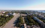
Mount Basman (height 1176 m) is located within the Crimean Nature Reserve on the northwestern side of the Main Ridge. Dark cave openings gape in the steep cliffs of Mount Basman. The same caves, found in other places in Crimea, have given rise to many legends among the local population about treasures allegedly hidden in them and protected by spells against theft.
Biyuk-Uzenbash - now the village of Schastlivoe, Kuibyshevsky district.
Isar Basman.
Shelter, fortified cattle pen of the 9th-13th centuries, above a group of caves there was a small monastery of the 9th-13th centuries.
View of the top of Mount Basman from the heights of Mount Kemal - Egerek
Donga River Gorge

Basman from Nikitskaya Yayla

The settlement is located on the eastern cliff of the Basmansky ridge. In the distance you can see the rock on which the isar is located.

The size of the area enclosed by walls is 80 x 50 m. Currently, the fortification area is overgrown with forest. The fortification area is 0.35 hectares.

The corners of the walls are rounded.

There are two narrow gates in the northern and southern walls.


The walls are dry stacked.


Preserved up to 1.8 m in height.


The thickness of the walls is 1.6-2.1 m.


From the site one entered the karst caves via hanging wooden stairs.

During excavations in 1948, several fragments of red clay pottery were found near the northern gate. The cultural layer on the site is weakly expressed, that is, it served as a shelter and corral for livestock and was used sporadically.
The Basman mountain range (from the Turkic “basamak” - “step”) is located in the very heart of the Crimean mountains. It is surrounded by the highest peaks of Crimea - Kemal-Egerek (1529m), Demir-KapuKachi - Dongi and Kaspany. The height of the Basmansky ridge at its highest point is 1136m. (1540m), opposite it, across the basin of the Donga River, rises the main peak - Roman-Kosh (1545m). The ridge separates the basins of two tributaries
The ridge extends in the meridional direction from north to south. Through a small bridge it connects to the ridge of the Kemal Egerek peak. From the west, the mountain slope gently descends into the valley of the Kaspan River, from the east it drops steeply with sheer cliffs into the Donga valley. In the cliffs facing the Donga valley, the openings of several caves are visible. In total, eight caves and one vertical shaft are known on Basman - Medvezhya - a cavity 62 meters deep.
The slopes of the mountain are densely overgrown with forest - oak, Crimean pine, hornbeam, beech. The top of Basman is densely overgrown with thickets of creeping juniper. The forests of the upper reaches of Kachi have served people since ancient times. In 1791 the then commander of the Russian Black Sea Fleet, Admiral F.F. Ushakov, in correspondence with the ruler of the Tauride region S.S. Zhegulin, asks “... to correct the fleet, cut down one hundred beech trees.” In the report of the superintendent of state forests dated November 22, 1790. we find “For the burning of thousands of quarters of coal on the top of Kacha for the Sevastopol fleet... the place for the treasury has been allocated to me.” The Koushan ship grove was also located here. It occupied a fairly decent area - about four thousand acres and was located between the Kaspana and Marta rivers. However, intensive logging for the needs of the fleet devastated the ship grove and already in 1860. “...the former Koushan ship grove will be called the Sultan’s state dacha in the future.” The basis for this was the conclusion of the forester: “Oak oak is not suitable for building ships, the dacha is supposed to be excluded from the category of ship groves.”
The road to the Kermen clearing begins from the old road that once led to the village of Krymsky. With the completion of the construction of the Zagorsk reservoir in 1976, the adjacent river valleys became a sanitary zone, villages and settlements were liquidated, and residents were resettled in other settlements. The villages of Shelkovichnoye (b. Koush), Lesnikovo (b. Stilya), and the village of Krymsky (b. Chair) disappeared from the map of Crimea. The famous Koushan gardens are abandoned and wild; only in the summer, walking along the road, the fruits of plums, apple trees and pears delight the eye. All that remains of the large village of Shelkovichnoye is a monument to the partisans. Along the sides of the road you can see traces of fences and walls of former houses; stockroses, hollyhocks and marigolds are blooming in the former front gardens.
The village of Krymsky was once famous for its sanatorium for tuberculosis children. The clean air, filled with the aroma of Crimean pine, gave relief to sick children. The only reminders of this are the walls of the former sanatorium brought down by bulldozers.
Before the war, the outskirts of the village provided Beshui-Kopei coal. Under Wrangel, a narrow-gauge railway was built to these mines from the Siren station, traces of which can still be found along the banks of the Kacha. After the Civil War, the mines were restored, mechanized and provided coal to Soviet power. In 1921 The mines produced 3,200 tons of coal. In 1941 the mines were blown up. Beshui-Kopei coal is of low quality, has a high ash content and has no industrial value. Only from great need, during the difficult years of the Civil War and devastation, could its reserves be used. Currently, old, abandoned mines are dangerous to visit, and only lovers of crafts made from beautiful jet stone, which is occasionally found in the dumps of old mines, visit these places.
The road rises along the mountain ridge with several turns and leads us to a clearing. The very name “Kermen” - “fortress”, tells us that there was once a settlement here, protected by walls. Indeed, on one of the spurs of the ridge, above the rocky gorge of the Donga River - the Kermen-kaya rock, there are the remains of the ancient castle Х111-Х1Увв. Access to the top of the cliff was blocked by a wall made of rubble and lime-sand mortar. At the junction of the western and eastern curtains of the fortress wall, an entrance tower measuring 6x8 meters was erected. The width of the gate is 2.7 meters. The thickness of the walls is 1.5 - 1.7 meters. The southern flank of the defense was closed by another quadrangular tower, measuring 6.3 x 6.5 meters. Behind the tower, above the rocky cliff, there are traces of a posterna - a secret passage, 0.7 meters wide. Inside the fortification there are traces of buildings adjacent to the defensive walls. At the eastern cliff there are traces of a small church.
There is another fortification known on the Basmana ridge - a communal shelter. His traces are located at the very top of the mountain. It is a shelter, a fortified corral for cattle from the 1st to the 111th centuries. The settlement is located above a group of caves that were inhabited by humans, and was connected to them by wooden staircases.
The Basman Caves are an interesting natural monument that deserves close study.
A narrow path leads to them, starting at the edge of a fifty-meter cliff between two noticeable rocks.

Here they are: one, another, third... At the entrance to each there is a number written.

We go up to the sixth. Gloomy silence, the sharp sound of water drops falling from the limestone arches. Impenetrable darkness envelops almost from the very first steps. The eye searches in vain for any bright spot in this kingdom of eternal night. In the uncertain light of the lantern we examine the beautiful sinter formations on the walls. There are still very young, medium-sized stalactites and stalagmites... It is believed that the third, fifth and seventh caves will be the most interesting for tourists.
The Basman-3 cave is founded in Upper Jurassic limestones. It is of karst origin. The length of the cave is 27 meters, width from 1 to 10 meters, height from 1.5 to 10 meters. In Basman-3, through a low rectangular passage you immediately find yourself in a low hall. Three narrow openings connect it to the main hall. The attraction of the cave is the rare calcite sinter formations twisted into a spiral - helictites. The temperature regime of Basman-3 is also very interesting. There is quite a strong movement of air in it, and warm, lighter air penetrates into the main hall through the right, high-lying hall, and cold, denser air flows out in a kind of “airfall” through the left passages. Due to this, the temperature of the cave and its humidity change sharply at a distance of just a few tens of centimeters. There is an assumption that it is precisely such changes in microclimatic conditions that lead to the formation of unique helectites. This cave has scientific and aesthetic significance.
A very dangerous path leads to the fifth cave, so you need to be extremely careful.

The entrance to Basman-5 is a huge arch (similar to a shell for a large orchestra) 6 meters high and 14 meters wide, from which there is a wonderful view of the Babugansky massif, the Chuchel, Chernaya, Roman-Kosh mountains, and the ridges of the Inner Ridge. All this was arranged in a surprisingly harmonious order.

The cave is of karst origin, founded in limestones of Late Jurassic age. It is an inclined cavity, laid along the bedding of limestone, which was once filled almost to the roof with water (the trace left by the ancient lake is clearly visible on the walls). The main hall of the cave steeply, at an angle of 20 degrees, goes deep into the massif. The total length of Basman-5 is 62 meters. Its width is from 1.5 to 10 meters, and its height is from 1 to 15 meters.
The cave hall is well lit with natural light. There are few sinter formations in it, but it is the size that is striking here. A characteristic feature of the cave is the ring-shaped gutters on the walls that encircle it almost at the entrance level and fifteen meters below it. This was imprinted for centuries by the water levels of ancient underground lakes, which at one time served as the only source of water supply for the population who took refuge in caves during the Khazar invasion.

The Basman-7 cave also faces a steep cliff. However, it is better to get into it through a low hole strewn with crushed limestone in the crevice before ascending to the fifth cave. Basman-7 is of karst origin, embedded in Upper Jurassic limestones. Some visitors are hesitant to penetrate its depths due to its size. The length of the cave is 52 meters, and its width reaches only from 0.5 to 0.7 meters, and its height from 1 to 13 meters. It consists of an almost horizontal corridor and several small halls. They also preserve ring-shaped gutters on the walls – ancient water levels. There are also small smudges here. In the near part of the cave, archaeologists uncovered a cultural layer; in it they found bones of wild and domestic animals, shards of pottery.

Finally, let’s summarize everything that is known about the caves of this massif. All of them are located at different heights; ring gutters of different sizes are visible on their walls, as if encircling the cave at different levels from the entrance. Characteristic traces of water flow on the surface of these gutters also show that the flow was directed into the massif. Finally, having found sandstone pebbles at the bottom of several caves, which could only have been reached by ships from the upper reaches of the Donga River, we can finally conclude that all the Basman caves are ancient ponor caves. About a million years ago, the bottom of the Donga valley was located exactly at the level of the limestone “cap” of the Basman ridge. Obviously, part of the river’s flow was absorbed in the left-bank ponors and through karst cavities it went through the local watershed to the west, into the valley of the Pisara River. Now Donga has crashed into the pliable shales and sandstones for more than 100 meters and is slowly murmuring over the mossy stones, not even showing that all the caves of Basman are its work...
Archaeologists have discovered leveled floors, retaining walls, arch supports, and nests for floor beams and canopies in the caves. This means that the Basman caves were once adapted for permanent habitation. This is also evidenced by the remains of a hearth in one of the caves, near which charred grains of cereals were collected.
In the cliff between the caves there are nests carved into the wall and ledges of traces of wooden hanging ladders that connected the caves of different tiers and went up. Here, on a small sloping area, the powerful defensive wall of the Basmansky Isar still stands.
The only mystery was the presence of water. Now it is not in the caves, but there should have been an independent source! Judging by the rings on the walls of the cave, reflecting the levels of underground water, there was an underground lake here in ancient times.
Under a blocky heap in the last cave of Basman, archaeologists discovered the ruins of a miniature single-apse chapel temple. The temple was built from local rubble with lime mortar, covered with a tuff vault, and had one window and one door in the western part. Around the temple there were several graves with eighteen male, child and female burials dating back to the 14th century. At the end of the 14th century, the temple was destroyed by a strong earthquake, well known from medieval written sources. There were also human casualties: in the depths of the cave, the skeleton of a man was discovered, crushed by a boulder that had fallen on him.
This means that the cave lake disappeared after the earthquake.

What peoples lived in these places? The Crimean Mountains, and especially their Main Ridge, have long served as a habitat for Taurians. Their hunting grounds, sanctuaries and necropolises were located here. In the nearest district of Basman - near the former village of Lesnikovo (b. Stilya) there is a Taurus burial ground made of stone boxes. It was explored in 1954 by archaeologists of the Mining Detachment of the Crimean Branch of the Academy of Sciences of the Ukrainian SSR. The design features and dimensions of the stone boxes are characteristic of the Taurus burial grounds of the middle stage, dating back to U-1Uvv. BC. During the excavations, fragments of black molded ceramics, bronze rings, flint implements – cores and knife-like blades – were found.
Not far from Basman, on the Gurzuf Saddle pass, there was an ancient Taurus sanctuary. Magnificent finds of archaeologists - coins from all over the ancient Black Sea region, bronze and silver figurines of Poseidon, Zeus and other Greek gods and heroes testify to the coastal piracy characteristic of the Taurians - when ships washed up in bad weather on the rocky shores of Taurica were robbed.
In the late antique and early medieval eras, the population of the surrounding valleys was engaged in agriculture. In the U11-U111 centuries. the coming of the Khazars, and subsequently the Pechenegs and Polovtsians, forced the descendants of the Tauro-Scythian Sarmatoalans to find refuge in the mountains inaccessible to the steppe inhabitants. From the early Middle Ages, from the Gothic conquests, the name of the rivers Martha (German proper name) and Stil - “stille” (Old German) - “quiet”, in contrast to Donga (Turk.) - “ringing”, remained. In the 111th century, a reorientation of the economic structure of the inhabitants of Taurica took place. Agriculture of irrigated river valleys is replaced by transhumance cattle breeding. In case of military danger, a herd of cattle can be driven into the mountains and hidden in a hard-to-reach mountain shelter, fenced with walls. Constant military danger gradually, in the 11th-111th centuries. leads to the formation of a class of feudal lords, under whose protection were peaceful settlements of river valleys and in case of military danger, men became warrior-defenders of castles located on inaccessible mountain cliffs. And
From the mountain shelters, ancient cattle roads led to yaylas - beautiful summer pastures, used since ancient times. The old walls on the yaila, protecting the steep cliffs from sheep falling there, are witnesses of those times. And the names of the peaks speak for themselves - Kemal - Egerek - “the place where Kemal drives the sheep.”
Once upon a time there were two strong states in Crimea. One of them was called Genoese and was located on the coast, the other was in the mountains and therefore was called mountain.
These states waged continuous war among themselves. The Genoese stole the herds of the mountaineers and ravaged villages. The mountaineers responded by attacking the Genoese fortresses.
This situation could not last indefinitely; disputes had to be resolved. But how? The warring princes asked this question to their advisers.
Some time later, the Genoese ambassador appeared with his retinue to the mountain prince and offered eternal friendship. And if the mountain people really sincerely desire friendship, then let them give the Genoese a golden cradle - a sacred relic of the mountain people, which is depicted on their banner.
“We demand this only because,” said the Genoese, “we know how highly you value the cradle.” Give it to us - we will make sure that you value peace more than anything else.
Hearing this demand, the mountain prince drew his saber and replied:
“Your words are so offensive that I am ready to kill you.” Don’t you know that we were all nursed in this cradle and that our ancestors swore allegiance to their people from it?
“We long for agreement with you and are also ready to give you the most precious thing we have as collateral.”
The leader of the mountain people immediately gathered his advisers and spoke about the Genoese proposal. The mountain councilors thought for a long time. They never wanted to part with the shrine of their people, because this meant that they voluntarily agreed to deprive themselves of their name, freedom and independence.
“We need to ask the Genoese for the paper according to which they own land in Crimea,” the council of mountaineers decided. - There is no point in thinking that they will agree to this. And then we will begin negotiations for peace on different terms.
The response of the mountain prince was conveyed to the Genoese ambassador. The ambassador turned silently and with his retinue went to the coast. Another week passed, and a new messenger appeared from the Genoese prince.
“Take anything from us,” he said, “but not this paper.”
- What do you have that is more expensive? After all, you dared to talk to us about our shrine!
“We are a different matter,” said the ambassador. -o You are known as a proud, undaunted people, and you can be forced to make peace with us only by taking away your shrine.
- Thank you for the kind word! - the mountain prince grinned. - But why are you holding on to a piece of paper? What does he give you?
- What rights to the land will we have if we lose this paper?
“We probably won’t agree,” said the prince.
- Be careful not to make us angry. We will take your shrine by force, since you yourself do not want to give it to us.
“You threaten,” the mountaineer answered, “but it’s easier said than done.” Our people are not afraid of anyone and would rather die to the last in battle. How will he sell his honor?
- I won’t wait for another answer?
A new war broke out between the Genoese and the highlanders. The ranks of the glorious defenders of the banner with the image of the golden cradle were thinning. The Principality was threatened with destruction. The Genoese demanded the golden cradle, promising to end the war. Then the mountain prince gathered the people and asked whether it would be better to agree to such conditions.
- We don't want this! - the soldiers shouted. “We will not allow shame while at least one of us is alive!”
- My friends! - said the prince... - As long as our shrine is intact, the people live, even if only a handful of people remain from it. Therefore, I will hide the shrine so that none of the enemies will find it. And I will cast a spell on it so that it will be given into the hands only of those who approach it with pure motives...
Having said this, the prince with a small group of close people headed to a cave on Mount Basman, near Biyuk-Uzenbash. They reached it only by the only paths known to them.
The warriors carried the golden cradle into the depths of the winding cave and left the prince alone. Kneeling down, he said quietly:
- Mighty spirits! I and my people entrust to you the most precious thing we possess. The greedy Genoese neighbors want to take it away in order to deprive us of our name, honor and freedom. The mountain warriors are now fighting them tooth and nail. If they fail to defeat the cruel enemy and die, I ask you: take our shrine under your protection and preserve it for future generations.
“It will be so!” was heard in the gloomy emptiness of the cave.
“I conjure you to punish the one who wants to take this cradle for the sake of enslaving another people or for the sake of some other evil intent.”
- It will be so! - came again from the gloomy void.
- Mighty spirits! I ask you to open the place where the cradle of our people is kept to those people who will look for it for the revival of my people, its glorious name, its rebellious spirit. And help me in the battle for the lives of my family, the wives and children of my warriors, for our land, mountains, for our fields and homes!
At that moment, an old man in white clothes appeared before the prince and said to him:
Don't despair! Your people are going through difficult days, but better times will come for them. This will not happen soon; he will experience a lot of grief. However, looking into the distance, I see its revived fields, bustling cities, happy people. Don't despair even if you fail...
- What will happen to the Genoese, our enemies?
“Their fate is unfortunate, like all invaders.” They will disappear from this earth forever.
The elder slowly went into the depths of the cave, and the prince got out of it and hurried to his soldiers.
The war between the two peoples continued for a long time. And no matter what victories the Genoese achieved, they could not capture the golden cradle.
The last detachments of highlanders left their native land, yielding to the evil force. But the ranks of their enemies also weakened. And when unexpectedly hordes of new invaders descended on the Genoese, they fled in disgrace, never to appear on Crimean soil again. And the paper that gave them the right to own this land was carried away by the wind into a distant sea, and it disappeared forever.
Century after century, battles raged for the mountain land, and a wonderful golden cradle was kept in a cave on Mount Basman.
Many daredevils tried to take possession of her, but they were unable to reach her. They returned disfigured, with their minds clouded. They say that the golden cradle is kept deep in the caves to this day.
During the Great Patriotic War, the slopes of Basman became a base for partisan detachments. The headquarters of the Fourth Partisan Region was located here. From here the people's avengers left for battles and raids. In March 1942 fighters and commanders of the Sevastopol and Akmechet partisan detachments crossed here from the Tea House through the snow-covered yayla. Here, in the Kermen clearing, is the grave of N.P. Krivoshta, the commander of the Yalta detachment.
In the autumn of 1942 A difficult situation developed in the partisan detachments. Fights with punitive forces, constant struggle for existence, carried out sabotage and raids. A large number of wounded and sick people accumulated in the detachments. By agreement with the Mainland, the partisans were supposed to take the wounded to the area of the village of Kikineiz, where boats - sea hunters - would be sent for them from the Mainland. It was necessary to walk more than seventy kilometers through the mountains, carrying the wounded. They moved mainly at night. We waited in the Kikineiz area for more than three days, but the boats never arrived. And then the partisans with the wounded had to go back. In the Basman area, the detachment was ambushed. Nikolai Krivoshta was killed by the first burst. His grave in the Kermen clearing reminds us of those cruel times when battles raged here, when in inhumane conditions, in the cold, without food and warmth, the partisans struck the occupiers over and over again. Many of them did not return home, many rest in unmarked graves under the beeches and pines of the Crimean forest. Eternal memory to them!
Until 1972 In the Kermen clearing there was a tourist shelter of the Prival tourist center. Tourists came here from the shelter on Bogatyr and went to the Karabakh camp site near Alushta. Unfortunately, these places were subsequently chosen by party officials. The dacha of the Crimean Regional Party Committee for a long time turned the clearing into a forbidden place for mere mortals. High officials walked through the local forests with a gun; for their needs, three artificial lakes were built, filled with fish and crayfish. Only one lake has survived to this day - it is home to fairly small crucian carp and crayfish. The remaining two turned into swamps.
It is generally accepted that perestroika gave the people the wealth that officials had saved for themselves. In the case of the regional committee hotel in the Kermen clearing, just the opposite happened. While the dacha was under the jurisdiction of the regional committee, it was maintained in exemplary order. As soon as it was transferred to the balance sheet of the forestry enterprise and the “ordinary” people began to accept it, the dacha was immediately brought to a deplorable state. You should have seen how people destroyed the blue Italian tiles, smashed toilets and sinks with incomprehensible hatred, and urinated in the fireplace. In the end, the dacha, which was a sad sight, fell into disrepair.
Today, the Kermen clearing is being rebuilt again – by “new Ukrainians”.
Tourist routes passing through the Kermen clearing lead in the direction of Mount Kemal-Egerek and further to the Yalta Yayla, or back down to the valley of the Marta River, to the Finaros Cordon. You can go down the forest road to the valley of the Kaspana River and from there go to the Lesnikovo parking lot, or along the gas pipeline route, past the Yamantash rock, on which in the Middle Ages there was also a small castle with a temple, up to the yayla. Tourist parking in a clearing - above the forest ranger's cordon on the right in a pine forest, on the edge of the clearing. The parking lot is equipped with a gazebo, toilet, tables and benches. Another site is higher along the ridge, at the former Stilskaya sheepfold, on the ridge of Kemal Egerek, above a spring with an iron trough. Payment for parking is at the Bakhchisarai forestry enterprise, or at the forester.
Tourists traveling through the Kermen clearing need to remember - you are on the border of the Crimean State Reserve! Here it is especially necessary to ensure that the forest is clean and quiet. Take care of the nature of Crimea!


———————————————————————————————————————————————————————————
Getting acquainted with the numerous natural and historical monuments of Crimea, it is worth choosing the best places to replenish your strength. And the very middle of the southern coast of Crimea - coastal Alupka - is ideally suited for this purpose. I invite you to stop