Chechnya detailed map with roads and villages. Chechnya detailed map with roads and villages Transport links on the map of Chechnya
The Chechen Republic is located in the North Caucasus. A satellite map of Chechnya shows that the republic borders on Georgia, the Stavropol Territory, Dagestan, the republics of North Ossetia-Alania and Ingushetia. The area of the region is 15,647 sq. km.
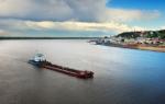
The largest cities in Chechnya are Grozny (the capital), Urus-Martan, Argun, Gudermes and Shali. The economy of the republic, severely undermined by wars, is in the process of recovery. At present, the economy of Chechnya is based on the oil and gas sector and agriculture.
Argun Gorge
Brief history of the Chechen Republic
In the 16th century, Russian expansion began in the North Caucasus. In the XVII-XVIII centuries, the territory of modern Chechnya was a bone of contention between the Russian and Ottoman empires.
1860 - after the Caucasian War, the Terek region was formed on the territory of Chechnya as part of the Russian Empire;
1921 - the creation of the Mountain Autonomous Soviet Socialist Republic;
1922 - the creation of the Chechen Autonomous Region;
1936 - the creation of the Chechen-Ingush Autonomous Soviet Socialist Republic;
1944 - deportation of Chechens and Ingush to Central Asia;
1957 - the creation of the CHIASSR;

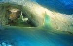
Lake Kezenoy-Am
1991 - the Chechen revolution, the election of President of Chechnya Dzhokhar Dudayev, the formation of dual power, the collapse of the republic into Chechnya and Ingushetia;
1993 - the creation of the Chechen Republic of Ichkeria (not recognized by any state);
1994-1996 - the First Chechen War, the assault on Grozny, the assassination of Dzhokhar Dudayev;
1996 - Khasavyurt agreements (withdrawal of Russian troops from Chechnya and postponing the decision on the status of the republic for 5 years);
1999-2000 - The Second Chechen War (the entry of Russian troops into Chechnya, the assault on Grozny);
2007 - Ramzan Kadyrov became the President of the Chechen Republic;
2009 - removal of the counter-terrorism regime.

Watchtower (Maista)
Sights of Chechnya
On a detailed satellite map of Chechnya, you can see the following natural attractions: the Terek and Sunzha rivers, the Caucasus Mountains, the mountains of Tebulosmta (4493 m), Diklosmta (4285 m), Komito (4262 m), Donosmta (4174 m) and Maistismta (4082 m) .
Among the natural attractions of Chechnya, it is worth seeing the Argun Reserve and the Argun Gorge, the Andean Range, the Kezenoy-Am, Chentii-Am, Gekhi-Am lakes, the Argun and Gekhin waterfalls, the Bamut caves, the Galonchozh lake, the Vedensky, Shatoisky and Shali nature reserves.

Mosque "Heart of Chechnya"
Among the historical sights, the Dyorskaya Tower, the Ushkaloy watchtowers, the ancient city of Khoi and the building in the form of an “English castle” in Grozny have been preserved. It is also worth seeing the Heart of Chechnya Mosque and the Dondi-Yurt Ethnographic Museum.
The specifics of the location of the region on the map of Russia indicates that this subject of the Russian Federation has a favorable location from a geographical point of view. He is in:
- on the southern edge of the country;
- partly in the mountains;
- in an area with a favorable climate.
The subject of the Russian Federation borders on Ingushetia, North Ossetia, Stavropol Territory, Dagestan, Georgia.
Despite the fact that the mountains occupy one third of the Chechen Republic, they are one of its main "visiting cards". Mountain peaks amaze with their beauty and grandeur. At an altitude of more than 2 thousand meters, broad-leaved forests grow, even higher you can find unique subalpine meadows.
Among the highest mountain peaks:
- Tebulosmta - it is located on the border of Chechnya and Georgia;
- Diklosmta - on the border of Chechnya, Dagestan and Georgia;
- Komito is located in the Itum-Kalinsky district;
- Bastylam is located in Itum-Kalinsky district.
Picturesque, with original nature, the republic is comfortably located in the valleys of the Terek and Sunzha rivers. The river network here is very developed, but only in the mountainous areas, in the rest of the republic there are no rivers. Most of Chechnya - the south - is located in the zone of high mountains, lowlands prevail in the north. This is clearly seen on the satellite map of the region.
The climatic conditions of the Chechen Republic are diverse. This is due to the fact that the territory includes both mountains and plains. On average, in the first winter month, the temperature in the Tersko-Kuma lowland is -3 °С, in the mountains it is -12 °С. In summer, respectively, 24-25 and 20-21 ° C are fixed.
Transport links on the map of Chechnya
Transport infrastructure facilities of the Chechen Republic:
- air transport: its work is provided by the Grozny airport;
- road transport: the federal highway "Kavkaz" passes through the territory of the republic, the highway with a long length "Grozny - Kizlyar";
- railway transport.
The last type of transport communication is especially developed. On the territory of Chechnya, the tracks of the Grozny region of the North Caucasian railway pass.
The internal communication is quite developed. Communication with other regions of the country by rail is complicated. External communication with the republic was interrupted in 1999. Over time, it was partially restored: the routes Grozny - Moscow, Grozny - Astrakhan, Grozny - Mineralnye Vody.
Map of the Republic of Chechnya with cities and villages
Chechnya has a developed network of settlements, as evidenced by the map of the region with districts.
The administrative center of the region is the city of Grozny. In general, the republic includes:
- 5 cities;
- 17 districts;
- 3 urban-type settlements;
- 213 rural administrations.
In total, there are 224 rural settlements in the region. This information is especially accurately displayed on the online map of the region with the boundaries of all local territories.
Maps of cities of the Chechen Republic:
Grozny
Map of Chechnya with cities and villages
At the end of the last century, the National Congress proclaimed the independence of the Chechen Republic. Leaders, local council, clergy were elected. Then the Constitution was adopted.
The ecological situation there is critical. It is negatively affected by private oil refineries. They are mainly found in basements and in the yards of private houses. Reservoirs and soil are heavily polluted. The climate is continental. The main role in the temperature distribution is played by the high location above the sea level.
The main production sectors are construction, agriculture, machine-building, woodworking enterprises, food and light industry. Viticulture occupies more than 40%. On a detailed map of Chechnya with roads and villages, the largest villages and cities of the republic are marked.
The first war in this republic took place in 1994-1996. The Khasavyurt agreement was signed at the end of it. The second Chechen war began in 1999. It lasted for about 10 years. All border zones are marked on the map of the Chechen Republic.
Satellite map of Chechnya
Switching between a satellite map of Chechnya and a schematic one is made in the lower left corner of the interactive map.
Chechnya - Wikipedia:
Date of formation of the Chechen Republic: December 10, 1992
Population of Chechnya: 1,394,833 people
Phone code of Chechnya: 871
Square of the Chechen Republic: 15,647 km²
Car code of Chechnya: 95
Districts of Chechnya:
Achkhoi-Martanovsky, Vedensky, Groznensky, Gudermessky, Itum-Kalinsky, Kurchaloevsky, Nadterechny, Naursky, Nozhai-Yurtovsky, Sunzhensky, Urus-Martanovsky, Shalinsky, Sharoysky, Shatoysky, Shelkovskaya.
Cities of Chechnya - a list of cities of the Chechen Republic in alphabetical order:
City of Argun founded in the 15th century. The population of the city is 36486 people.
City Grozniy founded in 1818. The population of the city is 291687 people.
City of Gudermes founded in the 17th century. The population of the city is 51776 people.
City of Urus-Martan founded in the 12th century. The population of the city is 58588 people.
Shali city founded in the 9th century. The population of the city is 53016 people.
Chechen Republic- one of the most famous Russian regions, which became famous for the sad events that engulfed this territory for a long time. For many years, military conflicts took place in Chechnya, which made the republic one of the most dangerous places in the country. Grozny is the capital of the republic.
Most attractions Chechnya belong to the period of renaissance - the post-war period. The most interesting monuments are located in Grozny. One of them is the “Heart of Chechnya” mosque, the largest mosque in all of Europe, which was built in the likeness of the Blue Mosque in Istanbul. In addition to the mosque, the majestic Muslim complex in Grozny, whose area is 14 hectares, is also interesting.
Sights of Chechnya: Argun Gorge, Mosque "Heart of Chechnya", Akhmat-Arena, Grozny City, Hippodrome in Gudermes, National Museum of the Chechen Republic, Church of the Archangel Michael in Grozny, Kezenoyam, Galanchozh, Tsoi-Pede, Monument to Mikhail Lermontov, Dyora, Ushkaloy towers , Colosseum, Gerzel-aul, Chechen State Philharmonic Society, Kh.A. Isaeva, Pkhakoch Castle Complex.
Satellite map of Chechnya. Explore the satellite map of Chechnya online in real time. A detailed map of Chechnya was created based on high-resolution satellite imagery. As close as possible, the satellite map of Chechnya allows you to explore in detail the streets, individual houses and sights of Chechnya. A satellite map of Chechnya easily switches to a regular map mode (scheme).
Chechnya(Chechen Republic) - a subject of the Russian Federation, which is part of the North Caucasian Federal District. The capital of the republic is the city of Grozny.
The climate in Chechnya is continental and is characterized by great diversity depending on the region. So the winter temperature varies in January from -3 to -12 C. The average temperature in summer, in the hottest month of July, ranges between +21 C and +25 C.
There are more than 50 nature monuments in Chechnya. Of these, 10 are various national parks, reserves and biosphere reserves. Rare species of animals and birds and rare plants grow in such protected areas. The nature of Chechnya is very beautiful, which is of great interest to tourists. The unique natural attractions of Chechnya are the Argun State Museum-Reserve, the Shali hunting reserve, Lake Kazenoy-Am, monuments of the Ice Age, etc.
Is in Chechnya and historical monuments, through which one can trace the interesting history of the Chechen Republic. Some of them are stone towers in one of the mountainous regions of the republic. These towers are an example of a unique stone architecture, and therefore are of great value. They were built approximately in the 14-18 centuries.
The city of Grozny is not just the capital of the republic, but also the heart of Chechnya. For a long time it was the epicenter of hostilities, but today life in Grozny is getting better, and he can boast of his beautiful architecture and new buildings. One of them is the “Heart of Chechnya” mosque, which impresses with its rich decoration both outside and inside. Near the mosque there is another building - a Muslim complex, the scope of which is 14 hectares.
Tourism in Chechnya is just beginning to revive after the suspension of hostilities. However, before Chechnya becomes a place of active tourism, a lot of time must pass.