Intercession Church Stanovoy Well. Stanovoy Kolodez Closest airports to the village of Stanovoy Kolodez
FROM THE HISTORY OF THE NAME OF THE VILLAGE STANOVOY WELL.
PREFACE.
This local history essay was written by me when I was in the 10th grade of the Stanovo-Kolodezskaya secondary school. After finishing 9th grade, in the summer, I went from Redkino on foot (local buses did not run then) to the board of the collective farm “Power of the Soviets” (I think so), located almost 5 km from my parents’ house. But I didn’t need the board itself. 150-200m from it, to the west, there is a swamp overgrown with sedge and other grass. The ravine was the source of a small river. Everything pointed to the fact that this particular key could be called the Stanovoi Well. I took a pen and notebook with me and resolutely carried out the investigation, asking questions of many village residents. Of course, I was already 16 years old. However, even now I come across adults who, for various reasons, are not able to engage in research, at least of their ancestry. For many, by the way, writing a letter is as difficult as flying to the moon. Moreover, among Oryol residents, warriors and grain growers, it is not customary to “yak”, engage in “writing”, i.e. memories, so that others “don’t laugh”! But I went to do research.
Apparently, this was determined from above: it was for me to begin at a young age to find out the origin of the name of the village of Stanovoy Kolodez. The essay I wrote later, which I offer to readers without any edits, showed that I am on the right path. I remember that I presented this research to a history teacher at the Oryol State Pedagogical Institute, but she didn’t tell me anything about it for a long time, as it turned out later, having forgotten it on a cabinet in her office. As a result of this, the first copy of the essay was lost. Fortunately, a copy was then found, and I recreated my work. But, as often happens, exams, sessions, books, work in another village, in a newspaper and radio for a long time, for decades, distracted me from further research on the history of my native land.
I recently found this essay on the balcony, in a folder, and was happy for myself, a young researcher: I wasn’t lazy, and most importantly, I wasn’t “ashamed” to visit the scene of events as a journalist, I turned to encyclopedias and scientific works for advice and created a good work, for which is not a shame even today. It must be borne in mind that then, in the mid-60s of the twentieth century, there was no Internet. Until January 1, 1966, there was no electric light in Redkino. However, there was an ineradicable desire to know our land. My passion for journalistic work was then interrupted by the Oryol district military registration and enlistment office, which already in August 1965 sent me one after another summons to the army... . I also wish the young residents of Stanovokolodoz at the beginning of the 21st century new essays on the history of the village.
*
*The HISTORY of any city or village, rooted in the distant past, is undoubtedly of great interest to us now, because from it we learn about certain historical events. The village of Stanovoy Kolodez, located 16-20 kilometers southeast of the city of Orel along the Orel-Livny highway, also has its own history. We do not have exact information about when the village was formed and why it was named so. There are several points of view on this issue and, probably, not only because the history of the village goes back centuries, but also because the word “stan” and its derivative “stanovoe” have several meanings. I. STAN: a) (obsolete), parking, postal station; b) administrative division of the district in pre-revolutionary Russia; c) (military) - the name of the site of Russian troops until the 18th century. (Big Sov. Encyclopedia).
II. STAN: a) a place where road travelers stopped for a rest, a temporary stay, and all the equipment is in place, with carts, livestock, tents or other land; parking place and the entire structure (military camp); b) when going out to plow and mow, a man chooses his camp near the water, a shelter where a cart with belongings stands (wherever he camps, there is a camp); c) camp and encampment, now a station, a village where horses were changed, or a farm at a crossroads, a hut purposely erected for shelter; d) village in the district, residence, stay of the police officer; and e) the very district of his department. The county is divided into 2-3 camps, police stations; f) camp, related to the camp. Camp building (old), camp, for a military camp. Stanovoy bailiff (simply, stanovoy) - a police official, head of the camp; g) spinal vein – spinal cord, vertebral cord; h) anchorage – on which the ship anchors; i) stanovoy bank - a real, ridge bank of the river bed; j) camp hut - winter hut in the fields. (V.I. Dal "EXPLANATORY DICTIONARY, 1882).
III. Initially, the term camp denoted the place where the prince or his representative stayed when collecting tribute. In this meaning, the word camp is used in the chronicles of the 11th-12th centuries. (M.N. Timofeev “Russia in the 16th century”).
As we see, the word "stan" ("stanovoy") is used in many meanings, but they are all connected with the word "stop". In the word “stanovoy”, moreover, the meaning is clearly visible: main, main. The word "stan" came into the Russian language a very long time ago. Stan (to become) is a pan-European word. Let's compare: Old Church Slavonic - STANON, Latin - stet, statum, Sanskrit - sthanam, English - state (hence: state). Readers may ask, if the word “stan” is very ancient, then why are there few geographical names with this word (Stanovoy Ridge, Stanovoye Upland in the Far East, the village of Stanovoye in the Oryol region). Apparently, paradoxically, because it is too common and does not carry any specific feature inherent in a given area.
In addition to the name, a second question arises: when did the village arise? It is known that until the 12th century the Old Russian state was united and was ruled by the Grand Duke of Kyiv. This state also included the Vyatichi people who lived along the Oka River, who submitted to Prince Svyatoslav in the 10th century. We do not know that in the 10th-12th centuries there was any settlement on the site of today’s village. But one document is interesting. The complete collection of Russian chronicles, volume 25, page 237, says that there was an attempt by the princes of Bryansk, Khotetovsky (Mikhailo Khotetovsky) and others to enter the Moscow principality. This chronicle is dated 1408, i.e. the very beginning of the 15th century. The current Stanovoy Well is located a little more than 3 kilometers north of the village of Khotetovo, and why, therefore, shouldn’t the first one exist from the 10th to the 14th centuries?!
Before saying anything about the formation of the village in the 16th-18th centuries, we will consider issues related to the different meanings of the words “stan” and “stanovoy”. First, a word from the old residents of the village. One of them, Pyotr Egorovich GRIBAKIN, told us that once upon a time, before the construction of the Moscow-Kursk railway (hence, before 1868), there was horse-drawn transport that transported people from north to south and back, so that these people could to rest on the road or change horses, a police officer with some scientist came to the village, then still small in number, and ordered to dig a well and build an inn. Soon new residents began to settle around the Stanovoy well, and the name Stanovoy Well was assigned to the village.
Another old-timer, Eremey Lvovich STEBAKOV, joins the above with the only difference that the stanovoi lived in the village, had a well with spring water in the middle of the yard and the only samovar in the entire district. Still others confirm this one way or another, but still others even tell a legend. In the winter, the policeman (bailiff) was riding on the ditch, his horses dispersed him, he could not resist and fell straight into a wide and deep well. They looked for him for a long time, but never found him. Since then they began to call that well Stanov. Thus, everyone talks about the well and about the stanovoy, but when I asked where this well was (is) located, they answered differently. Some said: at the beginning of the village of Ivanovka, 300 meters from the board of the “Power of the Soviets”, others named places near the railway station.
From the Great Soviet Encyclopedia we take information about the police officer. We read: “The police officer: in Russia since 1837, a police officer who was in charge of several volosts (camps). The police officer was subordinate to the district police officer, who was the head of the district police. The duties of the police officer included: protecting public safety, overseeing improvement, collection of duties, arrears and other duties." Consequently, the village of Stanovoy Kolodez, according to these data, could only have appeared at the beginning of the 19th century. Such reasoning, it seems, is not entirely accurate; the history of the village has deeper roots.
At the beginning of the 16th century, the Oka River was the main defensive line of Russia. Along it were fortified cities, and there were troops deployed to protect the Russian outskirts from the enemy. And the vast expanses of forest-steppe lying south of the Oka were called the Wild Field. For several centuries, the population in the Wild Field was located, as it were, in islands. And this, apparently, explains the fact that on the map of the Oryol region north of the Oka you will not find a single village with the name in the second part “Well”. To the south, towards the city of Liven, we find: Bely Kolodez, Gremyachiy Kolodez, Dolgy Kolodez etc. This fact suggests that the village of Stanovoy Kolodez could have arisen precisely at the beginning of the 16th century, and it was an “island” among the Wild Field.
If we also take into account that at that time there were a lot of swamps (all the old-timers talk about this), and the place where the village is located is higher above sea level than other territories, then the construction of houses on the watershed is quite understandable. In the 16th century, slowly but methodically, the Russian border gradually moved south. New cities are emerging in the Wild Field, new areas are being populated, new areas are being developed, guard posts are being set up, and village service is being organized. But, before we talk about this, let’s consider the issue of forming the proper name “Stanovoi” from “stan” meaning “parking lot, postal station.”
Let's turn again to the TSB. In the “postal communications” section we read: “Russian mail is one of the oldest in Europe; the organization of regular postal communications was preceded by the creation in the 13th century of the so-called Yamskaya chase, i.e. post stations with horses and coachmen, for the movement of messengers and messengers with orders and reports. Gradually improving, the Yamskaya chase turned into a special service for movement and transmission of written messages with a regulated work schedule.”
In this case, we can say that the village arose in the XIII-XIV centuries. This is also supported by the fact that Stanovoy Kolodez is located 20 km from the center of Orel. It is known that postal stations and inns were located at a distance of 20 km from each other. Let’s compare: Zmiyovka and Kromy from Orel – 40 km, Trosna, Glazunovka – 60 km each, Ponyri – 80 km, etc. If there are deviations, they are small: it was believed that a distance of 20 km is the most optimal for a horse.
Along the way, let’s look at the second meaning from the TSB of the word “stan”: “an administrative subdivision of a district in pre-revolutionary Russia.” M.N. Tikhomirov, in the book we mentioned, writes that “Russia in the 16th century was mainly divided into counties, volosts and camps. The counties were divided into smaller territorial units: volosts and camps. The camps did not displace the volosts, but existed with them. Oryol district in the 16th century divided into 4 camps."
And again: “Volosts and camps were relatively large territorial units, the smaller unit was the village, with villages and villages gravitating towards it.” So, we have established that the “well” could not be called “stan”, since it was not the only one in the camp, if we keep in mind the meaning of the word “stan” as a territory.
Thus, we come to the 3rd meaning of the word “stan”: “military.” - the name of the site of Russian troops until the 18th century. It is likely that a stanitsa service was organized within the current village. This was dictated by the fact that the entire 16th century was a time of continuous struggle with the Crimean and Nogai Tatars, who raided cities and villages, many residents were captured and taken as slaves, and the settlements were burned. To ensure the security of the southern borders, peasants and artisans built fortresses, created forest blockages (“notches”), dug ditches, and created earthen ramparts.
It is known that one of the Tatar roads from the south to Moscow passed along the watershed, between the Rybnitsa and Optukha rivers, i.e. along the territory where the village of Stanovoy Kolodez is now located. Frequent Tatar raids required the construction of new fortifications. In 1566, the Orel fortress was founded, and “watchmen” (guard posts) were placed along the roads and rivers, where boyar children and Cossacks of 4-6 people were on duty every week. They were on horses and did not have to sleep day or night. When the enemy appeared, the messengers rushed at full speed to Oryol, where measures were taken to meet the enemy. It is quite possible that such a guard post was erected on the site of the village of Stanovoy Kolodez and a village service was organized.
Comparing these facts, we can conclude: the well is called Stanovoy because people stopped near it, and because it was the main one. Most likely, the name of the well appeared first, and then people began to stop and settle around the well. And if we assume the opposite, that first someone’s house appeared, and then a well, then the well would not be called a stanovoy (except if a bailiff lived in that house), but would be named after the name or surname of the owner of the house. When I came to this conclusion, I decided to definitely look for the supposed location of the well.
Near the Stanovoy Kolodez railway station there are no hints of a well. In another place, near the collective farm administration, I also found nothing except a swamp overgrown with sedge and mud. When I was returning back, I saw two women talking. One is young, the other is older. I asked where I could find some grandfather who would explain to me the origin of the name Stanovoy Well and the location of the well.
As a result of a conversation with the women, it turned out that in the place of the swamp that I saw, there was a dig and nearby there was a well. Carts were turning off the highway (road), and even the Tsar stopped by to rest and drink spring water. Praskovya Andreevna Kanatnikova and her daughter, Olga Mikhailovna Shmaneva, added that the French were at this well and that now this place where the swamp is located is called Stanovoe, and the meadow starting from the swamp is called Stanovoe.
“And the village received this name later than it appeared,” concluded Praskovya Andreevna. - “Well, was it without a name?” – I doubted the correctness of her judgment. - "Of course not. The village was called Butyrki!”
I remembered that I had repeatedly heard this word from my mother - Butyrki - and for me it sounded like a disparaging name for the village and had no connection with the second, real one. In conclusion, my interlocutors sent me to Ya.T.Tinyakov, who, in their opinion, knows a lot about this. Indeed, Yakov Trifonovich had certain information, but at first he tried to translate our conversation into general “philosophical” reasoning (not quite, apparently, understood by me due to my youth! - V.A.), and only then said that at first Stanovoy Kolodez was inhabited along Bolshak in close proximity to the so-called. well, and then, in connection with the construction of the Moscow-Kursk railway in 1868 and the formation of the Stanovoy Kolodez station (2 km south of the well), people began to build houses near the station. At first, the entire village was called Butyrki, then, as it grew, only the northern part of the village continued to be called by this name, and the middle was called Stanovoy Well.
And when the southern part of the village was built up and a railway station appeared, the consonance of the words “stanovoy” and “station” created the prerequisites for the name of both the station and the southern part of the village - Stanovoy Well. Over time, the name Butyrka was completely replaced. In conclusion, Ya.T.Tinyakov explained why Ivanovka is called that way: the first person to settle here was Ivan Tinyakov. And the Gremyachiy Well is so called because a stream falls from a cliff and thunders. This is where the village of Gremyache comes from! Yakov Trifonovich added that the “police officer” did not live in the village, but in Orel, and that Stanovoy Kolodez could not be named in “honor” of the police officer. We can agree with this. However, about the time of creation of the village, neither Ya.T. Tinyakov, nor my other interlocutors could say anything; they limited themselves to the fact that “They live here, their grandfathers lived here, and their grandfathers’ grandfathers lived here too!” No one could explain where the name Butyrka came from. One day I asked the head teacher of the Stanovo-Kolodezskaya secondary school, Antonina Egorovna Trofimova, with this question. She said that she heard from one old-timer that the name Butyrka did not apply to the entire village, but only to the part located from the so-called. Stanovoy well towards Orel. This, according to the old-timer, is explained by the following. Before the October Revolution, Butyrskaya existed in Moscow
(hereinafter - from TSB) - “The Central Transit Prison, through which those sentenced to hard labor and settlement from all cities of Europe and Russia passed. Built in 1879, near the Butyrskaya outpost on the site of a prison castle erected under Catherine II by the architect M.F. Kazakov.” One of the roads leading to Butyrka prison also passed through Stanovoy Kolodez. The prisoners were stopped at a camp, in the middle of which there was a well, to rest. When they were taken further to the Butyrka prison, the local residents asked: “Where are they taking you?” - “To Butyrki!” - the prisoners answered. This name was assigned to the northern part of the village, as it was located towards the Butyrka prison.
Reading the book by N.M. Chernov “Literary places of the Oryol region”, edition 2, on page 90, I discovered the following: “The village of Grunets is located in the Korsakov region, halfway from Mtsensk to Korsakov. A small river of the same name divides the village into two parts - Upper Grunets and Nizhny Grunets. Upper Grunets, or, as it is also called - Butyrki, belonged to the Pisarevs." At another time, I learned that the writer I.A. Bunin lived at one time in the village of Butyrki, Eletsk district of the former Orlovskaya province Gradually I began to come to the conclusion that, as a rule, the name Butyrka has a second meaning, not the main one, although there are villages with a single name - Butyrki.
I look in Preobrazhensky’s “Etymological Dictionary”, but it doesn’t say anything about the word Butyrka and what it meant before. Finally, in the famous dictionary of V.I. Dahl we read: “Butyrit (butyrki) - a hut, a dwelling, a settlement, separate from the general settlement, a house on the outskirts, apart.”
So that’s where the second name (and in fact, the first!) comes from Butyrki near the village of Verkhniy Grunets, Stanovoy Kolodez, that’s where there are a lot of Butyrki. Why, after all, in some cases, the first name of the villages - Butyrki - gives way to another, and in other cases - the first (Butyrki) remains?! Let's follow the names of Upper and Lower Grunets. At first there was one settlement and it was called Grunets, but then someone took it and settled on the opposite bank. Residents of neighboring villages also attributed this house to Grunets, but the residents of Grunets themselves called it Butyrki, like a house on the outskirts.
Then, as Butyrok increased, Grunets split into two names: Upper and Lower. If a separate hut was not associated with the name of any nearby village or hamlet, then the name Butyrka became the main one. Let's take a look at why the name Butyrka appeared near the Stanovoy Kolodez? If someone settled on Bolshak next to a well, then it is probably impossible to call such a house Butyrki, because, according to V.I. Dahl’s definition, Butyrki is a hut on the outskirts. In our opinion, all the houses located next to the so-called “well” were never called Butyrki, but always – Stanovoy Well! Butyrki could be the name given to houses appearing in the south and north of Stanovoy Kolodez, as a second name for the village residents themselves. In conclusion, I would like to say about when the village of Stanovoy Kolodez arose. History teacher at the Oryol State Pedagogical Institute Tatyana Gavrilovna Svistunova says that it is quite possible that the village originated from the time of the Tatar-Mongol invasion, who had their own camp and well here, so characteristic of the steppe strip and the Tatar-Mongols themselves. All our arguments are inconclusive. Excavations that need to be carried out at the site of the so-called “well” should provide a definitive solution to this issue.
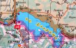
OUR COMMENT. Let's look at page 255 of our book, where a map was published (thanks to A.V. Rubtsov!) of the late 18th and early 19th centuries (the village of Khotetovo was included in the Oryol district in 1796). Before we talk about the NPs located along the Moscow-Kursk Great Road, let’s look at the left side of the diagram. Along the Rybnitsa river there were NPs: the village of Bogorodskoye-Zmiyovo, or a farm without a name, the village of Putimets (several names, on the river Putimets), the village of Bystrin (k)-Nikulino, or the village. Rybnitsa-Chistaya (Frequent?) also, village Rybnitsa, village Dubovik, hut. Babylskoy, the village of Polbolotya-Dubovik, too, the village of Lyubanova-Plesa, too (to the north the Labanov = Lobanov stream flows into the Rybnitsa river: apparently, the village of Lyubanovo is a converted Lobanovo; this is akin to the village of Lupleno = Lobleno); the village of Alshanets-Korsakovo, the village of Rybnitsa, the village of Stretinskoye (where the Rybnitsa river and the Labanov stream meet); Stavtsova village, Vetrova village.
In the south of the map: on the Vishnevets river, there are: the village of Khatetovo, the village of Ivanovskoye, the village of Vishnevets, the village of Verkhovye Vishnevets, the village of Selishcha (b. and Gorodishche; is this a hint of the city of the Khotetovsky princes ); Arkhangelskoe village, Vishnevets village, Vishnevets village (owned by N.I. Novikov, an opponent of Catherine II): Pochinki village, Aganyanka river (either Pogonyalka, or Poganyanka), also Ganyanka stream (maybe from Ganna, t ie Handsome?!)); Rzhavets ravine, Mill yard, Letovka village, or Litovka?; speech Small Rybnitsa.
See the center of the diagram: the Stizh River flows here (on the map - Stish), along its banks are located the Inn (where the village of Redkino now stands), the village of Verkhovye Stizhnogo Kolodezya; also the village of Verkhovye Stizhnogo Kolodezya, the village of Verkhovye Stizhnogo Kolodezya (now here are the villages of Gerasimovka, Molchanovka, Nizhnyaya and Verkhnyaya Stish, Ivanovka, Borzenkova and Kozinovka).
On the right are the maps: the Travna river (here is the highway to Livny), the village of Stanovoy Kolodez = Butyrki, too; village Ilyinskaya (from here my godmother, Aunt Varya); Zyablov ravine (starts near the village of Pilatovka); Malaya Kulikovka village, Kulikov village, Babina village, Bolshaya Kulikovka village. And in the very north of the diagram, next to the highway to Orel, we see the village of Ostrozhnaya = Storozhevaya (hard to read).
Our readers should know that the Great Main Road from Moscow to Kursk and further to the south then went through the village of Stanovoy Kolodez, now a village. And that’s why Tsarina Catherine II was in our area, passing through Crimea. The road to Kyiv passed through the city of Kromy. We do not exclude the possibility that Peter I could have passed our route, moving either to Voronezh or Poltava. In the mid-19th century, a highway was built from Moscow to the south through Kromy. However, our route was not forgotten: a railway was built next to it, in the same direction.
But let’s return to the map on page 255. On the Great Road to Kursk 200 years ago there were inns: at the source of the Stizh River and just south of the village of Khotetovo. On the Ekaterininsky tract there were NPs: the village of Khotetovo, the village of Verkhovye Stizhnogo Kolodez, the village of Stanovoy Kolodez-Butyrki, and the village of Malaya Kulikovka. There were inns in these NPs, not specified. But I know that the half-sister of the poet V.A. Zhukovsky stayed overnight at the beginning of the 19th century in the village of Kulikovka. By the way, the poet Vasily Andreevich Zhukovsky himself followed her and, thus, was in Kulikovka = Stanovoy Kolodez, then still a village, almost two centuries ago.
So there was an inn in the village of Stanovoy Kolodez. On the site of the current village of Redkino there was only the Inn. Moreover, it was not at the very source of the Stizh River, where the road to Kalinino-Lavrovo now begins and where in childhood we looked for treasure on the site of what once existed, according to our ideas, an inn, but a kilometer to the north, i.e. . somewhere in the center of the village of Redkino. Did the source of the Stizh River dry up in 200 years, or did the draftsman make a mistake?! The diagram clearly shows that the road to Kursk runs along the source of the Stizh River, crossing it. They could, of course, move the inn itself to the crossroads of the Orel-Kursk and Orel-Kalinino-Lavrovo roads. On the 200-year-old map there is no such road to Lavrovo.
Couldn’t the draftsman have missed something or not indicate something?! Apparently, yes, since on another map, from 1789 (more ancient), there are some NPs at the source of the Stizh River. Let's try to figure out which ones. So, now look at another map (it is not printed in our book due to poor readability). Between 21 and 22 versts a village is clearly marked (the letter “D.” is inscribed). Its name is impossible to read due to the vague outline of the letters and their visibility. Either the village of Khlyusov, or Amosov (in the middle of the 20th century, a relative of my father named Amosov = Amozov lived in Redkino). Previously, we assumed that Stanovoy Kolodez, Malaya Kulikovka and other NPs in the south of the Oryol region could be inhabited by people from the village of Bolshaya Kulikovka. Didn’t my village of Redkino once bear the name Kulikova?! However, on the collective farm maps of the 20th century, I found the following name at the source of the Stizh River: Agashkovy = Agoshkiny copony. This gives me the right to assume such a reading of the unclear spelling as the village of Agoshkova or Agashkova?! My ancestors most likely came from Bolshaya Kulikovka.
In any case, additional searches are needed.
Further, to Orel, on the site of the village of Stanovoy Kolodez, a village is again indicated: the last two syllables give “...DOVA”. The first letters resemble “D” and “X”: KHODOVA village?! Now, next to the highways we see a lot of NPs with names like KOTOVKA. Kotovka is Hodovka! Khodova - from the word “to walk”. Readers may say that they do not need such searches. They are interesting to us because in 1789 there was no name for Butyrka, nor for Stanovoy Well. Or they were additional and unknown to the mapmaker.
What else needs to be noted. The rivers Rybnitsa and Optukha have been populated since ancient times and very densely, while the Great Road to Kursk, i.e. Bolshak was reluctant to get used to it. People did not want to settle on a watershed, blown from all sides by winds, and also infested with robbers. And only the most courageous and skilled, free and purposeful mastered the new professions that were required by the Great Road from Moscow to Kursk and back. The geography teacher at the Stanovo-Kolodezskaya Secondary School, Antonina Sergeevna Belokhvostova (now retired), told me in the summer of 2008 that, according to old-timers, our village was named so because there was a prison building here, in which prisoners escorted to prison were temporarily kept. Butyrka prison or further to Siberia. Since the transit prisoners were kept in stocks, the place where the arrested stopped for the night was called this: the camp of the convicts. Then the phrase “camp of convicts” turned into the name of the village - Stanovoy Kolodez!
Of course, the words BLOCK and WELL have a common origin - COLODA. True, WELL could also be associated with the word COLD = COLD. Whereas the BLOCK, which rubbed the legs until they bled, on the contrary, provoked FIRE in the prisoner. Be that as it may, such a point of view has a right to exist. We will give a more detailed account of A.S. Belokhvostova separately.
And now let’s give the floor to V. SNORBISHIN from the village of Verkhniy Uslon, Tatar Autonomous Soviet Socialist Republic. In the newspaper “Nedelya” (1977, No. 13, p. 15) he published his message under the intriguing title “Stanovoy Kolodez”. We did not find this publication in the libraries of the Oryol region, and then we asked the same A.V. Rubtsov to visit Leninka in Moscow, which he did. Thanks again to Andrei Viktorovich and the main book depository of the capital for a copy of the note.
See Snorbishin separately
According to archival data, the church opened in 1849 in what was then a small farmstead and was initially made of wood. A resident of the village of Stanovoy Kolodez, Tikhon Lavrentievich Tinyakov, convinced his fellow villagers to begin purchasing and building a temple. Two builders from state peasants were elected to help him - Vasily Kostminovich Verizhnikov and Alexander Vasilyevich Nevrov. Nevrov soon fell ill and died, and Verizhnikov, together with Tinyakov, with their own hands, without craftsmen, laid a stone foundation for the walls and prepared it for the construction of a wooden church.
The wooden structure of the church was transported to Stanovoy Kolodez from the village of Durnevka, Mtsensk district. It was bought from the landowner Karpov, whose ancestors once built this church, for 1000 rubles in banknotes. From archival materials it is known that in Durnevka this church was consecrated in the name of the Holy Apostle and Evangelist John the Theologian, and services were held there for 97 years. Then the landowner Karpov built a stone temple, and the wooden frame was sold. It was this that the residents of the Stanovoy Kolodez village bought with the permission of His Eminence Smaragd, Archbishop of Oryol, together with all the utensils that belonged to it, except for the circle of liturgical books. The residents of Stanovoy Kolodez built their temple without outside help. For his special zeal in the construction of the temple, Verizhnikov was elected church warden. He performed his duties with great diligence.
So the village of Stanovoy Kolodez turned into a village. The wooden walls of the century-old church were erected in a new place and consecrated in the name of the Intercession of the Blessed Virgin Mary, because the village of Stanovoy Kolodez previously belonged to the parish of the Intercession, the church of the village of Bolshaya Kulikovka, and its residents wished to preserve the holiday celebrated by their ancestors.
Until 1859, the parish of the church consisted of one village of Stanovoy Kolodez, and then parishioners from the Sretensky parish of the Lupleny and Gerasimovsky farms of the Pyatnitsky Society of the Lavrovsky volost were added to it. All parishioners were state peasants.
In 1861, priest Yevsey Kosminsky opened a school at the church.
The improvement of the church gradually progressed. The church chronicle, which was started in 1870 under the dean priest Peter Gorokhov, reports that in 1863, due to an increase in the number of parishioners, the temple was expanded to the sides by 10 arshins, and the following year a new iconostasis was erected. Further in the chronicle it follows: “In 1865, the real church was all painted with icons and sacred paintings. In 1866, the shroud was purchased. In 1867, a tomb was made for the shroud from a new icon case with icons in the altar and behind the choir. Two candlesticks standing in front of the icons of the Resurrection of the Lord and the Balykino Mother of God were donated by the builder of the church, Maxim Aleksandrovich Tinyakov. In 1870, a bell costing 69 poods 20 pounds was purchased for this church...”
An entry for 1889 in the church chronicle reports that permission was received from the Most Reverend Misail to build a stone church and the procurement of material began. And on August 20 of the same year, a solemn service took place with the participation of priests from the villages of Sretenskoye, Khotetovo, Telegino and the deacon of the village of Bogoroditskoye. After the liturgy celebrated in the old church, a prayer service was served with the blessing of water, and the entire space of land intended for the construction of a new church was sprinkled with holy water. A lot of people gathered for the service. The peasants came with bread and salt, and generously donated everything for the construction of a new church.
After this, active work began on the construction of a new temple, which stopped only with the onset of cold weather, and was resumed in the spring of next year. The church was built by the priest together with the peasants. The construction of the temple was led by the church elder of the village of Stanovoy Kolodez, a merchant (who came from a peasant background), Maxim Aleksandrovich Tinyakov, who donated a significant amount of money for the construction.
By 1892, the construction of the church was completed, it was plastered inside and out, and they began to surround it with a wooden fence on a stone foundation. The following year, the interior decoration of the church began; the walls of the refectory and altars were painted with oil paints. The 1895 entry states that the church fence was completed and a church guardhouse was built. At the same time, the middle iconostasis was erected and finished, the dome and walls of the temple were painted.
By the end of 1895, the new building of the stone three-altar church in the village of Stanovoy Kolodez was completed. Its consecration took place on December 21, 1895. For this purpose, His Grace Misail, Bishop of Oryol and Sevsky, and a large number of clergy from different parishes of the Oryol province arrived at Stanovoy Kolodez. On this day, the consecration of the middle altar, the iconostasis and the temple in the name of the Intercession of the Most Holy Theotokos was carried out. The antimension for the newly consecrated church with the procession of the cross was moved from the old church.
An entry for 1897 in the church chronicle states that the priest of this church, Andrei Obolensky, and the church warden, Maxim Aleksandrovich Tinyakov, received permission from His Eminence Mitrofan, Bishop of Oryol and Sevsky, to build chapel iconostases, which were ordered from master Abasheev for 2,400 rubles. And on June 16, 1898, Bishop Mitrofan and many guest priests arrived at Stanovoy Kolodez to consecrate the side-chapel iconostases of the local church. The left side chapel was consecrated in the name of the Holy Myrrh-Bearing Women, and the right side - in the name of St. Maximus the Confessor. The consecration took place in front of a large crowd of people, so that our spacious church could not accommodate all the worshipers.
This is how a three-altar church arose in Stanovoy Kolodez. And in March 1898, permission was received to sell the old parish wooden church, with all its utensils. On March 18, 1898, a divine service was held there for the last time. The temple was sold with the iconostasis and utensils for 1000 rubles for setting up a temple at the Ponyri station of the Moscow-Kursk railway.
After the Bolsheviks came to power, the temple continued to operate for some time. But already in the 30s, services were held secretly in the evenings or at home.
At the end of the 30s of the last century, after almost a century of service to people, the temple in the village was closed. They removed the cross, dismantled the dome, and destroyed a large amount of church utensils. Many people gathered near the temple when local Komsomol members threw down the cross from it. People condemned their actions, quietly expressed dissatisfaction, tried to frighten them with God's wrath, but no one dared to openly speak out in defense of the ancient church. The fear of the wrath of the authorities was at that time stronger than the fear of the wrath of God.
For some time, the temple building, or rather what was left of it, was used as a grain warehouse, where collective farm grain was brought. Old-timers talk about how the women who worked there took out the icons and hid them in the bushes, so that they could later take them home and protect them from destruction. But the authorities noticed this and ordered the icons to be returned to their place. By the way, later, when the temple began to be restored, several ancient icons were brought into it from the village of Lupleno. Namely, from that village there were women who worked in the grain warehouse in the 30s.
In 1938, the building was rebuilt as a school. At the base of the school were the ancient walls of the temple, a second floor was built, a sports hall (also known as an assembly hall) was added, and an entrance was made from the side of the altar. Thus, the temple of God turned into a temple of knowledge. Gravestones from the church cemetery were used as auxiliary building material, which served as the basis for the steps to the school.
Oddly enough, all this was done not by some strangers, but by local residents who were baptized in the same church and attended services here. But there is nothing to be surprised about, this was the time.
During the Nazi occupation, the building, now a school, became a German hospital. Eyewitnesses of those events said that there was a German cemetery on the territory of the church-school. This information has not yet been confirmed or refuted. But this could well have happened, since many soldiers died in the hospital, and it is unlikely that the Germans would bury their soldiers in the Russian cemetery, which was located not far from the former church.
During the battles for Stanovoy Kolodez in July 1943, the building was badly damaged. So, immediately after the liberation of the village, the school had to be rebuilt. And for several more decades the temple building was used as a school. Students of those years, now adults, say that the whitewash was constantly falling off from the walls at the entrance (there was an altar in the church), and the faces of saints could be seen from under it.
In 1987, a new school was built nearby, and the old school building was left orphaned. The economic village men took away everything that could be carried away from the former school, and soon all that was left of it was one skeleton, that is, a meter thick wall of the former temple.
Revival of the temple

From the memoirs of Galina Mikhailovna Fisenko, a resident of the village of Stanovoy Kolodez: “It all started when the village residents began to raise funds for the restoration of the temple. In August 1992, residents of the village M. Studennikova and N. Bukhvostova went to Bishop Paisius of Oryol and Bryansk with a request to help restore the church, but he refused, since the diocese at that time did not have the funds necessary for this. Then the village residents made the same request to the Optina elder, schema-abbot Ily. Schema-abbot Iliy promised to help find people and funds to restore the temple.”
The special concern of the Optina elder Elijah about the fate of the Church of the Intercession in Stanovoy Kolodez is not accidental, because he comes from these places. In addition, as the Oryol local historian writes, a native of the village of Stanovoy Kolodez Vasily Agoshkov, the grandfather of the Optina elder Elijah, Ivan Nozdrin, was a church warden in this church.
In 1992, Vladimir and Tatyana Gusev came to Stanovoy Kolodez. At that time, these were not “priest and mother,” but simply believing Orthodox Christians. They exchanged the capital and a prestigious job at the Moscow Regional Philharmonic for the Oryol village and an almost completely destroyed church. Here they had nothing but faith in God and the order of the Optina elder schema-abbot Elijah to restore the Church of the Intercession of the Most Holy Theotokos.
Schema-abbot Iliy actively supported the restoration of the temple. Thanks to his holy word, both new Russians and humble parishioners donated to the restoration of the temple. These donations came not only from residents of the village of Stanovoy Kolodez, but also from residents of various Russian cities (including Moscow and St. Petersburg). Large companies also acted as donors. They provided bricks, reinforcement, wood and much more needed for construction, often without even asking for mention of their company.
Vladimir and Tatyana Gusev, by their personal example, were able to involve people in the restoration of the temple. In addition to the village residents, people from different cities of Russia worked on the restoration of the temple. They worked and often didn’t even say their names. Among them were many homeless tramps. No one asked for money for the work; the only reward that Father Vladimir could offer people was lunch. Several hundred people were involved in the restoration of the temple.
First, a small temple was restored (this room was previously used as a school cafeteria) to hold services. It was consecrated at the end of June 1993. Eyewitnesses recall that Father Iliy was present at the lighting. And the first service took place there at Epiphany in 1994. It was conducted by the already ordained Father Vladimir.
Through the efforts of the clergyman Father Vladimir, local residents, volunteers from different regions of Russia, as well as representatives of small and medium-sized businesses, the Church of the Intercession of the Blessed Virgin Mary was restored in the village of Stanovoy Kolodez. It took about ten years to be restored.
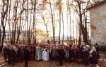
In 2000, on the feast of the Kazan Icon of the Mother of God (November 4), the temple was consecrated, and regular services began. Village residents remember that it was a very solemn event. Many parishioners gathered in the temple - village residents and guests.
In 2000, with the blessing of Elder Elijah, the Stanovokolodezskaya icon of the Intercession of the Most Holy Theotokos was painted for the temple.

Photo from the archives of the Intercession Church, 2006.
There is a Sunday school at the church, which is attended by the children of our village. The number of parishioners in the church increases every year; people from neighboring villages and from the city of Orel also come here. A lot of young people come here, especially on major holidays.
prepared by Kristina Nozdrina, student of the Stanovokolodezsk Secondary School
Using our website, you can plot the route from the village of Terbuny to the village of Stanovoy Kolodez both by car and by public transport (bus, train). All routes are formed based on maps from Yandex and Google services. We are glad that our service was useful to you and you were able to find out how to get by car from the village of Terbuny (Russia) to the village of Stanovoy Kolodez (Russia).
Distance between the village of Terbunami and the village of Stanovoy Kolodzem
If you drive along the road by car, the distance between the village of Terbuny, Terbunsky district, Lipetsk region and the village of Stanovoy Kolodez, Oryol district, Oryol region is 199.2 km.
- Travel time
3 hours, 35 minutes
excluding traffic jams and time for rest and food
- Fuel consumption
with a consumption of 10 liters per 100 kilometers
- Travel costs
at a fuel cost of 35 rubles per liter
- Straight line distance
distance between centers of cities, towns, villages
- Distance by road
according to the Yandex Maps service for 2015
- tell friends
| Start of the route | |||
| ↓ | Less than 1 minute - 0 km | ||
| Borodilovka village, | Less than 1 minute | 0 km | |
| ↓ | 3 minutes - 1.6 km | ||
| Petrishchevo village, Stanovlyansky district, Lipetsk region, Russia | 3 minutes | 1.6 km | |
| ↓ | 4 minutes - 2.6 km | ||
| Predtechevo village, | 8 minutes | 4.2 km | |
| ↓ | 2 minutes - 1.9 km | ||
| village Izmalkovo, Izmalkovsky district, Lipetsk region, Russia | 10 minutes | 6.1 km | |
| ↓ | 10 minutes - 10.7 km | ||
| Chermoshnoye village, Izmalkovsky district, Lipetsk region, Russia | 21 minutes | 16.8 km | |
| ↓ | 16 minutes - 16.9 km | ||
| Ivanovka village, Krasnozorensky district, Oryol region, Russia | 37 minutes | 33.7 km | |
| ↓ | 16 minutes - 17.3 km | ||
| Peshkovo village, | 53 minutes | 51 km | |
| ↓ | 21 minutes - 21.2 km | ||
| Lyutoye village, Livensky district, Oryol region, Russia | 1 hours, 14 minutes | 72.2 km | |
| ↓ | 3 minutes - 4.1 km | ||
| Parakhino village, Livensky district, Oryol region, Russia | 1 hours, 18 minutes | 76.3 km | |
| ↓ | 4 minutes - 2.9 km | ||
| Zdorovetskie Vyselki village, Livensky district, Oryol region, Russia | 1 hours, 23 minutes | 79.1 km | |
| ↓ | 2 minutes - 1.8 km | ||
| Otradny village, Livensky district, Oryol region, Russia | 1 hours, 25 minutes | 81 km | |
| ↓ | 3 minutes - 1.8 km | ||
| Rovnets village, Verkhovsky district, Oryol region, Russia | 1 hours, 29 minutes | 82.8 km | |
| ↓ | 2 minutes - 1.7 km | ||
| Akhtyrka village, | 1 hours, 31 minutes | 84.5 km | |
| ↓ | 2 minutes - 1.4 km | ||
| Novoyakovlevka village, Kolpnyansky district, Oryol region, Russia | 1 hours, 33 minutes | 85.8 km | |
| ↓ | 1 minute – 1.3 km | ||
| Agarkovo village, Kolpnyansky district, Oryol region, Russia | 1 hours, 35 minutes | 87.1 km | |
| ↓ | 1 minute – 1.2 km | ||
| Drovosechnoye village, Kolpnyansky district, Oryol region, Russia | 1 hours, 37 minutes | 88.3 km | |
| ↓ | 1 hours, 36 minutes – 98.7 km | ||
| Chibisovka village, Kolpnyansky district, Oryol region, Russia | 3 hours, 14 minutes | 187 km | |
| ↓ | 5 minutes - 3 km | ||
| Sedmikhovka village, | 3 hours, 19 minutes | 190 km | |
| ↓ | 1 minute – 1.1 km | ||
| Kosogor village, Zolotukhinsky district, Kursk region, Russia | 3 hours, 21 minutes | 191.1 km | |
| ↓ | 1 minute – 1.2 km | ||
| Novokoroninskie Vyselki farm, Zolotukhinsky district, Kursk region, Russia | 3 hours, 23 minutes | 192.2 km | |
| ↓ | 5 minutes - 3.1 km | ||
| village of Boevo, Zolotukhinsky district, Kursk region, Russia | 3 hours, 28 minutes | 195.3 km | |
| ↓ | 6 minutes - 3.9 km | ||
| Derlovo village, Zolotukhinsky district, Kursk region, Russia | 3 hours, 35 minutes | 199.2 km | |
Fuel consumption calculator:
Flights
We have selected several air ticket options for this route. The search for air tickets was carried out taking into account price and departure time. If you want to buy an inexpensive air ticket from the village of Terbuny to the village of Stanovoy Kolodez or on another route, then follow the link.
Train tickets
Do you need inexpensive train tickets to the village of Stanovoye Kolodez or to the village of Terbunakh? We will help you in this matter. Follow this link. .
Bus tickets
Do you need inexpensive tickets for intercity or international buses in the village of Stanovoy Kolodez or in the village of Terbunakh? We will help you in this matter. Follow this link. Tickets for intercity buses.
Closest airports to Stanovoy Kolodez village
- Bryansk, Bryansk urban district, Bryansk region, Russia.
- Zimnichki village, Kirovsky district, Kaluga region, Russia.
Closest airports to Terbuny village
- Voronezh, Voronezh urban district, Voronezh region, Russia.
- Kursk, Kursk urban district, Kursk region, Russia.
- Belgorod, Belgorod urban district, Belgorod region, Russia.
- Tambov, Tambov city district, Tambov region, Russia.
Hotels
Do you need to find and book an inexpensive hotel in the village of Stanovoy Kolodez or in the village of Terbunakh? Our website has a convenient online hotel booking resource. Just follow the link.
Jacob's wellStanovoi Well- village of Oryol district, Oryol region of the Russian Federation. The village of Stanovoy Kolodez is the administrative center of the municipal formation “rural settlement of Stanovo-Kolodezskoye”. The population as of 2010 is 2337 people. The village has a station of the same name on the Moscow Railway. The distance from Orel is 22 kilometers.
In the village there is a branch of Sberbank, a grain receiving enterprise, and the Stanovokolodezskaya secondary school.
- 1. History
- 2 Attractions
- 3 Streets
- 4 Notable natives
- 5 Notes
- 6 Literature
Story
Stanovoy Kolodez was founded by people from the village of Bolshaya Kulikovka, located 11-12 km from the city of Orel and was originally also called Bolshaya Kulikovka. “List of populated places according to information from 1866” it was listed at number 67. In the 19th century it was a state-owned village, 21 km from Orel, 25 km from the police officer’s apartment. The police officer did not live in the village, and the village got its name from the fact that a police officer drowned in a well. The number of households in 1866 was 145, men - 417, women - 450.
On July 18-27, 1943, in the area of the village of Stanovoy Kolodez, combat operations of the 3rd Guards Tank Army took place. T.n. The Oryol offensive operation or (Operation Kutuzov) was the first operation for the 3rd Guards Tank Army. During this operation, the Soviet command used tanks of the new type A for the first time. Initially, it was planned to introduce the army into a breakthrough of the enemy’s defenses, carried out by combined arms armies, and develop an offensive in the direction north of Orel, but subsequently the plans were changed.
On July 18, 1943, the 3rd Guards Tank Army was tasked with launching an offensive in a southwestern direction towards Stanovoy Kolodez - Kromy in order to, in cooperation with the troops of the Central Front, encircle and destroy the German 9th Army of Walter Model. The entry of the 3rd Guards Tank Army into the breakthrough was planned at the junction of the 3rd and 63rd Soviet armies with the support of aviation from the 15th Air Army.
However, on the first attempt, the front armies failed to break through the enemy’s defenses, and instead of entering into a “clean” breakthrough, the 3rd Guards Tank Army had to break through the enemy’s defenses on pre-prepared lines. On July 19, the army's tank corps were brought into battle and by the end of the day, having broken the enemy defenses along the Oleshnya River, they advanced 18-20 km, which forced the enemy to begin withdrawing units and formations from the Mtsensk area.
Assembly of 100 minibuses was stopped
On July 20, the commander of the Bryansk Front, Colonel General M. M. Popov ordered the 3rd Guards Tank Army to go on the offensive in the direction of Otrada, cut the highway and the Mtsensk-Orel railway, and reach the Oka River by the end of July 20.
On July 21, the 3-z Guards Tank Army made a new attempt to advance on Stanovoy Kolodez. On July 21 - 23, units of the 3rd Guards Tank Army, together with units of the 63rd Army, fought southeast of Orel, advanced 15 km and reached the Optukha River.
In the 90s, they tried to establish the assembly of Polish Zuk minibuses in the village, however, due to economic problems, the assembly did not go beyond 100 cars.
Attractions
Intercession Church- Founded in 1849. Three-Altar Church. Restored in 1993. The revered icon is the Old Well Icon of the Mother of God.
Streets
- Quiet Garden
- Central
- Kolkhoznaya
- Privokzalnaya
- Redkino
- School
Notable natives
Iliy (Nozdrin)
Notes
- Radzievsky A.I. Tank strike. - P. 112.
- Radzievsky A.I. Tank strike. - P. 113.
- Koltunov G. A., Solovyov B. G. Battle of Kursk. - pp. 231-232.
- Koltunov G. A., Solovyov B. G. Battle of Kursk. - P. 232.
- Shein D.V. Tanks are led by Rybalko. - P. 101.
- Koltunov G. A., Solovyov B. G. Battle of Kursk. - pp. 232-234.
- Koltunov G. A., Solovyov B. G. Battle of Kursk. - P. 236.
- Koltunov G. A., Solovyov B. G. Battle of Kursk. - P. 239.
Literature
- “List of populated places according to information from 1866” (St. Petersburg, 1871)
- Shein D.V. Tanks leads Rybalko. The combat path of the 3rd Guards Tank Army. - M.: Yauza, Eksmo, 2007. - 320 pp. (Red Army. Elite troops). - ISBN 978-5-699-20010-8 - Circulation 5000 copies.
- Battle of Kursk. Chronicle, facts, people: