A fascinating journey from Ayia Napa and Protaros to Cape Greco. Why you need to go to Cape Greco if you are relaxing in Protaras or Ayia Napa Cape Greco how to get by bus
Cavo Greco or otherwise Cape Greco located between Ayia Napa and Protaras - two popular resorts in Cyprus. Since these resorts are somewhat deprived of sights, the picturesque Cape Greco helps to somehow brighten up this shortcoming. Those who rest there do not even have to have a car to get here. You can get there by bus that runs between Ayia Napa and Protaras. He just makes a stop at the road leading deep into the peninsula. Recall that from the side of Ayia Napa there is a bus at number 101, and from the side of Protaras - at number 102.
You can also ride a bike ... yes, even on foot you can, but it's difficult. But we - Limassol or Pafov residents - still have to get there as usual, by car.
Cape Greco is the easternmost point of the Greek part of the island. On approaching Cyprus, often before landing at Larnaca airport, the plane makes a U-turn over the sea and the outlines of the cape are clearly visible through the window. As, for example, in the second photo.


Now let's take a look at the map with interesting places marked on it that we will visit today.
If you are moving from the direction of Ayia Napa, then on the way you will definitely come across a lonely tree, which everyone who passes here loves to shoot. You might think that it is the only one preserved on the cape. The benches placed nearby only strengthen this thought. We, too, could not pass by without showing this "attraction" of Cavo Greco.
If you follow the path from Protaras, then you will not meet a tree, well, unless you specifically set a goal and drive further until the next turn to the cape.
Lonely tree coordinates
34.973000 34.058900 - point on the roadside near a lone tree


Then we move along the road leading deep into the cape to the point marked on the map as "Fork". Let's turn left there and get to the first object of interest to us - a stone arch or bridge. It is located about 250 meters from the turn. In view of the danger of destruction, walking along this arch is prohibited.
Sometimes it is called the "Bridge of Sinners", although how many people sinned here and how - remains a mystery.
Bridge coordinates
34.971700 34.075000 - bridge of sinners

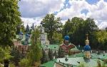
After taking a photo, we move further along the same path. After about 450 meters we will reach the next place of interest to us. At the end of the path, keep to the right and stop at the parking area, next to which there is a church. And although the church is not a monument of antiquity, but how harmoniously it looks in the surrounding landscape!

If you think that we deliberately "littered" the sea in the photo, then this is not so. It really is such a deep color there, especially in clear weather and in the setting sun. No wonder the area of the sea in this area is called the blue lagoon. By the way, there is another blue lagoon in Cyprus, but it is located on the opposite side of the island, not far from the Baths of Aphrodite.
In the photographs in the photo album, you can see how the color of the roof of the church changed over time. In the pictures of 2008, she was all white, and in 2012 she was already blue. So not only we decided to celebrate the amazing color of the sea.
Benches are installed right on the site, from which you can admire the opening landscape for a long time.

But that is not all. We must go to the stairs on the edge of the platform, which will lead us to the grotto. It is from the stairs that a view of the textured stone will open, which we have chosen to be the "visiting card" of the section on the pitfalls of Cyprus.

The stairs will lead to a cave, in front of which there is a small beach.


In principle, you can swim there, although the bottom is quite rocky. But you can swim here in a more extreme way - jump off an eight-meter cliff, inside which these grottoes "live". Like that.

Coordinates of the church and caves (grottoes)
34.975500 34.075900 - parking place next to the church
For those who have taken a “dry ration” with them, we will suggest one place nearby, where it is comfortable to stay for a snack. Yes, you can even take a barbecue with you and have a real picnic. To do this, at the end of the path, do not turn right to the church, but turn left. In general, now we drive westward for 350 meters until we find ourselves in a parking lot in the area of \u200b\u200ba picnic place called Agioi Anargyroi.

Agioi Anargyroi picnic area coordinates
34.975400 34.072000 - parking place next to the picnic spot Agioi Anargyroi
Well, having seen enough of the beauties in this part of Cape Greco, let's move on to another part of it. To do this, you need to return to the fork again and turn left. After about a kilometer and a half, we will run into the gate - there is no further passage, since the antenna field is located further. We are looking for a place to leave our vehicle (if there is one, of course) and head on foot to the right of this territory. First of all, you must find the bear! Try to see it in this photo.

No, the man in the T-shirt is not a bear, it's me. And now you have one hour of free time for an independent walk along the cape, and I'll stand here at the bear, and chew sandwiches.
But for starters, we’ll still show one more photo taken from this place.

bear coordinates
34.963500 34.081140 - parking place "at the bear"
Caves at Cape Greco
Another interesting place that is definitely worth a look. To do this, we return to the highway along which buses run and head towards Ayia Napa. Seeing the "lonely tree" we no longer accelerate, because after a hundred meters there will be a turn to the left. There is also a sign with the inscription "Sea Caves". We turn here onto a dirt path and drive about 600 m to the site where everyone usually parks.
On the last section of the road, you need to drive very carefully - the road there is quite bumpy. When in doubt, just walk this piece on foot.


If you look at the sea, then you should go to the caves to the right. But we decided to explore the "left" territory, which is closer to the photogenic cliff, around which we still walk.

On this side, you can capture beautiful views of the "moon" landscape in combination with the sea.


And in general, if you wish, you can also find "animals" here, no worse than a "bear".

We return to the place where we left the car and now go to the right. Here, caves will open to our eyes.


Cape Cavo Greco in Cyprus (Κάβο Γκρέκο) is very close to Ayia Napa and Protaras. Sea caves, Cavo Greco national park and the legend of the sea monster are waiting for you! A bonus is a beautiful sunset.
What to do on Cavo Greco
- see the gorgeous Cypriot sunset
- take a walk in the national park
- go diving or snorkeling
- sit on a bench at the edge of the world
- admire the sea caves where the monster lives
How to get to Cape Greco
There are two ways to get to Cape Greco from Ayia Napa or Protaras:
- By bus. Bus route 101 travels from Ayia Napa to Paralimni via Cape Greco and Protaras. Back from Paralimni - bus 102, absolutely the same route, but for some reason it goes under a different number.
- By car. We take a car to your taste (we recommend a convertible for more romance) and turn onto the Paphos-Ayia Napa highway (A1).
- By bike or quad bike
But we are in a hurry - the sunset is near! And sunsets in Cyprus are a separate issue.

The very, very extreme part of Cape Greco is occupied by the radar station of the British military base, so you can’t drive there. The road leads past the base, to the western part of the cape.

Here it is, the famous Cypriot sunset. Such sunsets can be seen not only on Cavo Greco, but almost anywhere on the coast of Cyprus. Better, of course, on the western part of the island 🙂


Sea caves of Cavo Greco
The western part of Cape Greco is famous sea caves. There is a special observation deck equipped with benches. Great place for a romantic date. 💍❤️


Legends say that in the waters washing the rocks of Cape Greco, there is a real sea monster. Local fishermen nicknamed him "To Filiko Teras", which translates as "friendly monster". Unlike other monsters, it doesn't do any harm. Swimming and swimming 🙂 picturesque bay of Aphrodite - our favorite place in Cyprus.
Meanwhile, evening falls on Cavo Greco. The place with the sea caves of Cavo Greco is marked on the maps under the name Sea Caves.


Our photo at Cape Greco in Cyprus goodbye 🙂

Cape Cavo Greco in Cyprus is very beautiful. It occupies one of the first places in my small personal hit parade of the beautiful places I saw in Cyprus.
🌴 How to find a good hotel in Ayia Napa? Hundreds of hotels, apartments, small villas in the mountains are scattered throughout the island. You can check the cost of hotels in Cyprus and choose the best option for yourself on the well-known and beloved by many site.
Cape Greco, sometimes called Capo Greco or Cavo Greco, is located in the easternmost part of the island between Ayia Napa and Protaras.
Cape Greco acquired its uniqueness due to the incredible beauty of the transparent, turquoise sea and numerous grottoes and caves located on the western side of the cape.
Grottoes carved into the coastal rocks by the sea surf annually attract many lovers of travel and exploration. It is quite difficult to go down to the grottoes from the top of the cape, so most tourists and adventurers come to the cape by boat.
The unusually clear water around the cape will give a lot of pleasure to lovers of underwater photography, snorkeling and diving. Fans of extreme diving will not remain without vivid impressions. In the bays on the southern and northern sides of the cape, overhanging rock and deep water allow daredevils to make desperate jumps from high cliffs.
Endangered and rare plants are found on the surface of the cape, and migratory birds often use Cavo Greco as a place to rest during their flight across the sea.
Unfortunately, it is impossible to reach the easternmost part of Cape Greco. On its edge, where the lighthouse stands, is one of the four British bases in Cyprus. There is a radar station at the base, and the passage for local residents and tourists is closed.
In the northern part of the cape there is an observation deck, and not far from it there is a small picturesque church of the holy unmercenaries (Ayii Anargyri). From here, along the stairs located on the edge of the site, you can go down to the cave and a small rocky beach.


Bridge of Lovers in Cyprus
 Cape Greco is considered one of the most romantic places in Cyprus. One of the unique ones is the “bridge of sinners” or “bridge of lovers”, the official name of the bridge is Kamara tou Koraka (literally translated from Greek “crow arch”).
The Bridge of Sinners in Cyprus is a rock hanging over the water that looks like a real bridge. In the center of the bridge, created by nature, a crack is clearly visible. Due to the high risk of destruction, the area around the bridge is fenced off, and the passage to it is closed, which, however, does not stop lovers of vivid photographs. The bridge of lovers in Protaras is a favorite place for photo shoots of couples having a wedding in Cyprus.
According to local legend, the bridge of sinners will collapse at the moment when the foot of the biggest sinner on earth sets foot on it.
Ayia Napa sea monster
The second legend about Cape Greco is the legend of the Ayia Napa monster. According to legend, a sea monster lives in the coastal waters of the cape. It is believed that the legend was based on ancient Greek myths about the monster Scylla, a half-dog, half-woman who grabbed people from passing ships. The legend endowed the monster with a friendly character and, undoubtedly, attracts tourists and adds mysticism and mystery to Cape Greco.
National Park "Cavo Greco"
 On the territory of Cape Greco is the National Forest Park "Cavo Greco", where everyone can independently explore the surrounding hiking trails and attractions.
In the Cavo Greco park, there are many benches and gazebos where you can hide from the midday sun and relax, as well as specialized picnic areas.
On the north side of Cape Greco is one of the most famous beaches in Cyprus - Konnos Bay and the blue lagoon, which got its name from the brightest blue color of the coastal waters. Konnos Bay is one of the most popular stopping places for numerous sea pleasure boats from Ayia Napa and Protaras.
How to get there
Cape Greco is a 10-minute drive from the centers of Ayia Napa and Protaras. The cities are connected by bus routes No. 101 and No. 102, passing by Cape Greco. From Protaras there is the 102nd route, from Ayia Napa - the 101st.
From Ayia Napa, hikers can reach Cape Greco using the footpath that starts from the Grecian Sands Hotel and runs along the entire coast to Cape Greco.
The most favorite ways to get around are, of course, those that can be rented at special rental offices. All vehicles can be parked at the observation deck.
Cape Greco (Cyprus) on the map of the island is also sometimes called Cavo Greco or Capo Greco. It is located on the southeastern side of the country and is the end of the bays of Famagusta and Ayia Napa from the south and east. Administratively, the region belongs to Ayia Napa.
Tourists and residents of the island recognized Cape Greco as the most romantic place in Cyprus. It attracts with its excellent scenery and very clean sea. You can get there by bike or even on foot.
Cape Greco: description
This place, unique in its beauty, attracts with its unusual caves located in the west of the cape. Outwardly, they resemble amazing castles created by the most talented architects. In fact, they were formed as a result of sea surf.
The glory of the most romantic place in Cyprus Cavo Greco in Cyprus received, among other things, thanks to the "bridge of lovers" - a unique rock hanging over the water and resembling a real bridge. Immediately, beginners try themselves in diving from a height.
A small church, standing on a steep cliff, attracts young couples who choose a place for their wedding against the backdrop of a bright blue sea and a clear blue sea.
On the shore you can meet rare and endangered plant species, and the marine world is striking in its richness. The water here is clean and clear, which makes diving a great pleasure and leaves many new impressions. Spearfishing is also possible here. 
On the very edge of the cape there is a lighthouse, surrounded by a fence and belonging to the territory of the English military base, and therefore access to the most beautiful view is closed. But this is just a minor inconvenience. You can still have a great time here. For this, many gazebos have been installed where you can hide from the scorching sun and just relax on the benches after a long walk, enjoying the surrounding natural beauty.
Cape Cavo Greco (Cyprus): legends
There is a legend among the locals about a monster that lives in coastal waters. The inhabitants call it "friendly monster" ("To Filiko Teras"). This legend is based on ancient Greek myths and stories about the deadly Scylla.
The main attractions at Cape Greco
The cape is very beautiful and attracts lovers of scuba diving or snorkeling in clear waters, but very wild. Therefore, with children it will not be very comfortable here. 
Mostly extreme people come here to test their strength and jump from a high cliff into the sea (8 meters high). A little lower there is a small cliff 2 meters high, from which it is convenient to jump for women and children. The most cowardly will suit the gentle entrance to the water, which can be reached by a rather mysterious descent.
There is a sports diving school on the cape, where instructors teach scuba diving, show experienced divers the most interesting places to explore the underwater world. There are also children's groups.
In addition to diving and jumping from a height, several other areas of active recreation have been developed on the cape, including: hiking, parasailing, horseback riding, rowing, swimming, and fishing. 
While traveling through Capo Greco, you can visit the Museum of Sculptures, which operates in the open air and is located on the seashore. The exposition of the museum contains sculptures and installations from contemporary sculptors from around the world. Entrance is free, opening hours are seven days a week 24 hours a day.
Forest Park Cavo Greco

The forest park of the cape, starting from the eastern part and having a total area of almost 385 hectares, received national status in 1993. Rare species of irises, orchids, crocuses and other plants grow in the park.
The flora of the park has over 400 different plant species. All vegetation is carefully signed with nameplates
Special viewing platforms, walking and cycling paths, recreation and picnic areas have been created for vacationers. One of the routes leads to the ruins of the temple of Aphrodite. At the highest point of the park area, there is an observation deck with a wonderful view of the sea.
Cape Greco (Cape Greco, Capo Greco) is the easternmost point of the Republic of Southern Cyprus. It consists of two parts, this is the cape itself, that is, a narrow strip of land protruding into the sea, expanding at the end and on the map - similar to a hammer, and a wider base, which is also attributed to the cape because of the thesca located here, the Cavo Greco park.
Coordinates: 34°57"42"N 34°4"51"E.
Height up to 20 m.
Dimensions 1 by 1.5 km.
The shores of the cape are up to 10 m high, rocky, all cut up by grottoes and caves, some of which are very popular and have their own names and legends. Now let's take a closer look at the map of Cape Greco. There is a lighthouse, transmitting antennas of radio stations broadcasting to the Middle East and an English military base. The entire peninsula is crossed by a good road ending at the Lighthouse.
Blue Lagoon.
The southeast side of the "hammer handle" is washed by the Blue Lagoon. This bay is very popular with sightseeing boats for the beauty of the surrounding rocks and the transparency of the waters. Guides will show you the caves where pirates hid, robbers took refuge, or fishermen just escaped from the storm. Then they will offer to swim in the clean and warm waters of the bay, having previously informed the sign, according to which swimming in the Blue Lagoon brings prosperity and well-being. And desperate lovers of extreme sports jump from a 7-8 meter cliff into the blue of the sea to the enthusiastic applause of the passengers of a passing motor ship. At the very end of the Blue Lagoon is the most popular of the local grottoes, Stone Arch or Stone Arch. Actually, this is not a grotto, but a bridge or an arch left over from the collapsed ceiling of the cave. The overlap is weak, so walking on it is not recommended, and the photos are beautiful!

State forest park "Kavo Greko".
Further on the peninsula, to which this hammer is attached, is the Kavo Greko State Forest Park, completely open to tourists, and, unlike the Crimean reserves, absolutely free.
The area of the park is almost 400 hectares. It occupies a wide strip along the eastern and western coasts, on the map similar to the clumsy letter P, in the area of \u200b\u200bthe lintel of which rises a small mountain, overgrown with pine, with an admixture of juniper forest, the height of which does not exceed 100 m.
Attractions "Cavo Greco".
A serpentine dirt road winds from the main highway to the top, though there is a barrier for 500 meters and then you have to walk. An arboretum has been planted on the plateau, a recreation area with benches, viewing platforms and a gazebo has been equipped. At the very top - a monument - a flock of birds taking off. On the plate at the monument it is written - From Cyprus, in the world A message about peace, friendship, freedom, faith in God and Man.
A small but pretty church of Agioi Anargyroi has been built on the east coast. Steps leading to the sea are carved into the rock from the church.

There are also several "healing" caves, including the cave of the Cyclops.
The main attraction of the western coast are the Sea Grottoes. In this place, the Mediterranean Sea "bit off" 130 meters of land, and in the thickness of the coastal cliff there were traces of its teeth in the form of grottoes and rocks with an annular hole. The grottoes are very popular with tourists, lovers of long jumps into the sea and photographers.
How to get to Cape Greco.
Of course, the easiest way to get to Cape Greco is by renting a car. Fortunately, the roads in Cyprus are European, so from Larnaca, Paphos, Limassol or any other city, enter the coordinates into the navigator and go. For those who do not drive a car or are afraid of left-hand traffic, you can take a tour or use the bus service.

From Ayia Napa, Paralimni and Protaras, you can get to Cape Greco by bus number 101/102. The route starts from the Ayia Napa water park, passes near the cape (1.5 km from the cape and 1 km from the park) then through Protaras and ends in Paralimni.
Still, of course, you can walk, and this is about 10 km from Ayia Napa one way. Of course, it’s closer from Protaras, three and a half kilometers, but still, stomping in the heat in the dusty semi-desert is somehow not comme il faut. It is better to rent an ATV or a bicycle, since bike paths are laid throughout the peninsula.
Somehow my wife and I were resting in Cyprus in Larnaca, or rather, to the resort area, 10 km from the city in the direction of Ayia Napa. On the second day of our holiday, we took a boat trip from Larnaca to Protaras. During the journey, the ship stopped near Cape Greco. We swam and dived in clean, absolutely transparent water. The high shores cut by the sea, the abundance of caves and grottoes, the greenery of a pine forest (which is rare in these places) on small mountains greatly aroused our curiosity, and it was decided to visit this miracle of nature without fail.

On the same day, a meeting was held on the topic: How to get to Cape Greco?
Renting a car or a quad bike was abandoned, left-hand traffic scared away. Bus + on foot too - poor mobility, and there is not enough time. As a result, the decision was made, the bike.
Bicycle rental.
We got to Ayia Napa without any problems, since the shuttle bus stops 50 meters from the hotel. 30-40 minutes and we are already in the center of Ayia Napa.
With the choice of a rental office, we were not picky, we went to the first one we liked.
The procedure for renting a bike amazed me no less than Cyprus itself: we chose bicycles, bargained, knocking down the price from 7 euros to 5! Then the guy wrote down our data in a journal: last name, first name, hotel, gave a map of the area, checked the brakes, wheels and that's it! No passport, no bail, but a happy journey!
And here we are already rolling along the half-empty streets. The first stop is the Bridge of Lovers.

The Bridge of Lovers is a must-visit place for everyone who has visited these parts on foot, by car, by plane, or simply sailed by on a pleasure boat. It is located almost in the city, some 400 meters from the main city beach Pantachou. The place is really amazing, and can amaze even an experienced tourist who is fed up with all kinds of views! A snow-white, ten-meter arch, from a distance resembling the letter omega, seems to soar over the turquoise sea, it is not for nothing that the photos of the Bridge of Lovers adorn the avenue of all travel companies offering holidays in Cyprus.
Naturally, the transport was parked, and we fully observed the obligatory ceremony for lovers, walked along the bridge, kissed, took a photo, etc. Then I went down the arch to the water, took a swim, examined the grotto located nearby.
Jumping from the Bridge of Lovers into the sea, 6 meters high, is not recommended, it is a bit small, although some daredevils jump. But a little to the side there are rocks suitable for these purposes. It is difficult to capture the jump in the photo, so watch the video.
Finally Cavo Greco!
Then it was not very long, about 5 kilometers, but in the heat a slightly tiring smooth climb to the turn to Capo Greco. But the path was good, the bikes ran briskly, another one and a half kilometers, rare pine trees began, here is the turn to the dirt road. The soil is light brown, and where the top layer is cut off by the wheels, it is absolutely white - either limestone or clay. The same color dust covers everything around the road, trees, bushes, stones, travelers. And dry heat, saturated with the smell of pine needles, juniper and something bitter. After wandering around a little, examining the endemic flowers that managed to survive until August, and having rested in the thin shade of a stunted pine, we continued to climb. A third to the plateau there is a barrier, a tray of beer, water, cigarettes and parking. Moreover, the prices are doubled against the supermarket, so it’s better to take everything with you, but we didn’t calculate, so we had to spend money on beer, water and ice cream. It was probably possible to go further, but the horses joined the tree and went on foot.

There are no Red Book plants, no “bird” monument, and not even the opportunity to sit in the shade of a wooden gazebo, but the magical, ringing blue of the sea and a fresh cool breeze that served as our reward for climbing into the 35-degree heat! Visibility, as they say, is a million to a million. A cape with radio antennas, the coast to AiNapa and further towards Larnaca, outlined by a white fluffy edge of the surf, everything is in full view. It seems that if it were not for a slight haze on the horizon, then the promised land would be visible!
Having received great pleasure and having made a sea of videos and photos of Cape Greco, we went down. And then, having overcome by an effort of will a great desire to move further, to the Golubaya Bay (unfortunately, time did not allow), we went back to the next point of the journey, to the sea grottoes.
Sea caves.
To be honest, when going for a walk, neither I nor my wife had heard of any Sea Grottoes. Just on the way to the mountain, Larisa noticed melons and a well-pierced primer, popular with cars and ATVs, going to the right, towards the sea. Therefore, without thinking for a long time, we bought a melon from the owner and moved along the intended path, well, we had to have lunch and swim somewhere. In general, after the Bridge of Lovers, I somehow did not expect something more grandiose, but what I saw at the end of the road exceeded all expectations!

Imagine you are flying down a rather steep, bumpy slope, in a white cloud of dust, trying to slow down. Finally, the descent ends, the bike still stops at the edge of a vertical cliff, the dust clears and, lo and behold, the horseshoe of a small bay, the blue blue sky merges with the turquoise sea, you come to the edge, and there is crystal clear water and the darkness of magical grottoes. Yes, the sea monster, which, according to legend, lives in these parts, has chosen a good home for itself! In general, it is very difficult to convey all the impressions of the Sea Grottoes, it is better to see it once! So the number of photos was limited only by the charge of the batteries in the camera. In addition to tourists - lovers of wild species, photographers and wedding corteges, local cliffs attract a large number of people who want to jump into the water from a great height. The height of the cliff with a negative slope of 7 - 8 meters and even plus a decent depth. Isn't it the perfect place to test yourself?

Having admired the beauties and finished the preliminary photo session, we went to the end of the lagoon and made a halt, laid a blanket, pulled up an awning. What could be more beautiful, the surf boils at your feet, a fresh wind tears the awning and cools your body, the Black Pearl slowly floats across the sea ... And you lie, drinking tart Cypriot wine, snacking on fragrant melon, and lazily watching what is happening. To be honest, after this trip, I had a strong desire to spit on all the stars of hotels, pick up stews and put up a tent somewhere here, on the wild cliffs near Cape Greco, and let the whole world wait!
But Time flies quickly, and in Cyprus, perhaps, someone else specially drives it, and the sun began to sink to the horizon, and I had to remember that when bargaining for bicycles, the main argument was - Well, not for a day, but only for 6 hours, which are already ending, and it’s at least an hour to drive to Ayia Napa.
Back to Ainapa.
Back we drove quickly, the benefit from the mountain (after climbing it). Relaxed and tired, looking forward to dinner at the hotel, I missed the turn to the lower highway, thanks to which we not only drove a couple of extra kilometers, but also looked at the ancient Roman aqueduct, or rather that restored part of it that passes over the river, or rather the stream that should flow under the arch in the spring.