Kremlins, children, kroms. Fortresses of Russia: a list. The most famous fortresses in Russia
In Rus', the word "city" called any fortified place surrounded by a fortress wall. The construction of defensive structures was vital, as it guaranteed protection from numerous external enemies.
Moscow Kremlin
The history of the Moscow Kremlin can be conditionally divided into two stages: wooden and stone. The very word "Kremlin" in translation from Old Russian means a fortress located inside the city itself, the so-called citadel. The first wooden Kremlin was built during the reign of Ivan Kalita (1328-1341). This is not surprising, since only the rich and strong prince had the money to build temples and fortifications, and it was Ivan Kalita who found them, because he was the first ruler-entrepreneur.
In 1366-1367. during the reign of Dmitry Donskoy, the construction of a new Moscow Kremlin began - a stone one. Instead of wooden fortifications, a “city of stones” arose, which was expanded almost to the limits of the present. The Moscow Kremlin was surrounded by the first impregnable white-stone fortress in North-Eastern Rus'. The fortifications were lower than modern ones, but it was they that prevented the Lithuanian prince Olgerd from capturing Moscow in 1368, 1370 and 1372, when he made his campaigns. Under Ivan III (1462-1505), the reconstruction of the Moscow Kremlin began; the fortifications of Dmitry Donskoy dilapidated and were no longer a reliable defense against the enemy. The character of the Grand Duke affected the construction: the fortifications were built slowly and thoroughly - for centuries to come. For this work, not only Russian, but also Italian architects were invited. Probably, Ivan III did this on the advice of his second wife Sophia Paleolog, who was brought up in Italy.
The construction of Moscow fortifications was completed only in 1516, already during the reign of Vasily III, the son of Ivan III and Sophia Paleolog.
Pskov Kremlin

The Kremlin or Krom, as Pskovians call it, is located on a rocky cape at the confluence of two rivers - the Great and the Pskov. The wooden walls of the Kremlin were erected in the VIII - X centuries, in the X - XIII centuries. the first stone fortifications appeared, after which the construction of new Kremlin towers began, the strengthening of the fortress walls and their growth in height. Two southern passage gates led to the Kremlin, of which only the Great (Trinity) gates have been preserved, reliably protected by the Trinity Tower and zahab. Initially, the Great Gate was 5 - 6 m below today's level. From which we can conclude about the power of Perseus (the first stone wall of the Kremlin with south side), the height of the walls of which exceeded 20 m. The deep ditch - Rowing, - laid by the Pskovites parallel to the foot of Perseus, turned the Kremlin into an impregnable fortress. Nobody lived in the Kremlin. A people's council gathered here, food supplies were stored, there were cages guarded by guard dogs - "Kromsky dogs". Theft from the Kremlin was considered a serious state crime and was punishable death penalty. On the territory of the Kremlin is the Trinity Cathedral - the main temple of Pskov and the Pskov land.
Dovmontov city is the second belt of defensive fortifications of Krom. The territory fortified with stone walls and towers adjoins the Pskov Kremlin from the south. It is named after Prince Dovmont (in baptism Timofey), who reigned in Pskov from 1266 to 1299. honor was placed a stone church in the southern part of the Kremlin. Despite the small territory - about one and a half hectares - in the XII-XVI centuries. Pskovians are erecting more than 20 church and civil buildings made of stone in the Dovmontov city. At the time of the veche republic (until 1510), Dovmontov was considered the center of the church and administrative administration of Pskov and the Pskov land. Unfortunately, the temples and administrative buildings of the Dovmont city have not survived to this day. One can judge about the ancient buildings only by the foundations of some medieval churches raised above the ground, the number of which, as they assume, corresponded to the number of Pskov suburbs.
Kremlin of Novgorod the Great

The Novgorod Kremlin is one of the oldest monuments of Russian military defense architecture of the 15th-17th centuries. total area fortress inside the walls - 12, 1 ha. A deep moat surrounds it from the north, west and south. The fortress walls, standing on the shaft, have a length of 1487 m, a height of 8 to 15 m, a thickness of 3.6 to 6.5 m. , Kokuy, Intercession, Zlatoust, Metropolitan, Fedorov and Vladimir.
The original Detinets was made of wood, but over the years it was rebuilt many times, and finally, after the annexation of Novgorod to the Moscow State in the 15th century, it became stone. By the way, the Moscow Kremlin was also rebuilt around the same period. This is probably why the walls of the Moscow and Novgorod Kremlins are similar.
Until the 18th century, the Novgorod Kremlin performed purely defensive functions in the north-west of Rus'. And after the annexation of the Baltic states to Russia, it lost its defensive purpose, however, like many other fortresses of Rus'.
In the Kremlin are: the most ancient temple Russia's St. Sophia Cathedral (1045-1050), the oldest civil building - the Vladychnaya (Faceted) Chamber (1433) and other monuments of the XV-XIX centuries.
In the center of the Kremlin there is a monument to the Millennium of Russia (1862).
Kazan fortress

No historian will name the exact date of the construction of the Kazan Kremlin. Researchers believe that the complex appeared between the 10th and 12th centuries. At first, all buildings were built of wood, and the Kremlin itself consisted of fortress walls. But every year more and more buildings appeared, and then the complex turned into a real city - this is how Kazan was born. First, the fortress was an outpost for the Bulgar princes, then for the khans of the Golden Horde. From the 16th century, it came under the control of the Russian state - it was captured by Ivan the Terrible.
At first, the troops turned the Kremlin fortifications into ruins, but it is from this moment that a new page in the history of the complex begins. Ivan the Terrible started a grand reconstruction of the Kremlin: architects and masons arrived from Pskov. For six years, the masters have changed the appearance of the building beyond recognition. Orthodox churches, bell towers and towers appeared on the territory. Instead of wooden fortifications, stone ones were erected. This citadel has long been famous as the most impregnable fortress medieval Rus'.
But in the 18th century, this function became unimportant - the state expanded its borders. Only during the uprising of Yemelyan Pugachev, the Kremlin was used as a fortification during the siege of Kazan. After that, the complex lost its military purpose completely. From the end of the 19th century, the fortress began to take on a modern architectural image, and today it is a symbol of reconciliation between Orthodoxy and Islam.
The main entrance to the Kremlin lies through the Spasskaya Tower - on May Day Square. Pay attention to the statue of the Dragon Zilant. This creature is considered a symbol of Kazan and the protector of the city. There are many legends about the Kazan basilisk - it is believed that the monster lives at the bottom of the lake and the hills at the mouth of the river, it happens in the surrounding forests.
Particularly stands out Spasskaya Tower - the main part of the complex. Sheinkman Street stretches from it - the former Bolshaya, which was the most basic in the Kremlin. This tower was built later than the others - in the 17th century as a symbol of the greatness of Rus'. Pskov craftsmen have worked hard to create a traditional Russian bell tower with a majestic eagle on its spire. For a long time there was a church inside, and a chapel nearby. But later the building was dismantled, making a through entrance.
The Spasskaya Tower is not the only one; only eight of the original thirteen have survived. No less interesting is Taynitskaya, also built in the 17th century. Massive lower and miniature upper tier, great view to the city from the promenade - all this deserves attention.
Nizhny Novgorod Kremlin

In 1221, at the confluence of the Oka and Volga rivers, Prince Georgy Vsevolodovich founded a border fortress, which became the main defensive structure in the war with the Volga Bulgaria. Initially, the fortifications were wooden and earthen, and the fortress had an oval shape. The main feature of the fortress was that it was built on uninhabited territory. Soon the fortress found itself in the center of the struggle between the Suzdal princes and the Mordovian tribes. However, this war could not be compared with the misfortune that would fall on Rus' decades later - the country would plunge into the “Mongolian darkness”. Nizhny Novgorod will repeatedly leave Novgorod to be torn to pieces by the Tatars. The fortress will also be captured, however, this will happen in its "wooden" being. In the future, along with the growth of the city, the expansion of the fortress will also occur: stone walls and the gate Dmitrievskaya tower will be built. The stone Nizhny Novgorod fortress will never be captured by the enemy, despite the fact that he will repeatedly appear under its walls.
The Kremlin of Nizhny Novgorod is notable for the fact that of all Russian fortresses it has the largest height difference between its structures. The legend also adds glory: supposedly, somewhere in the local dungeons, the missing library of Ivan the Terrible is buried.
Astrakhan fortress

Kolomna fortress

The Kremlin was built by Italian masters for six years. Researchers believe that the construction was headed by the architect Aliviz Novy - a native of Venice or Milan, Aloisio Lamberti da Montagnana. And since 1528 Petrok Maly led the work.
16 towers were erected along the perimeter of the Kremlin; all the achievements of Western European fortification architecture of that time were used in the construction. The territory of 24 hectares was surrounded by a two-kilometer wall, the thickness of which was more than three meters, and the height of the walls was more than 20 meters.
August 15, 1531 construction was completed. The Kolomna Kremlin has become a first-class fortification, one of the most interesting buildings of his era. After that, Kolomna remained a military center for a long time: it was here in 1552 that the army of Ivan the Terrible gathered before the march on Kazan.
How many towers were originally - 16 or 17, is not exactly known. Only seven towers, including the gates, have survived to this day. By the middle of the 19th century, in some sections of the Kremlin there was no longer a single tower, only ruined walls.
The Pyatnitsky Gates, the four-sided Pogorelaya (Alekseevskaya) Tower, the Spasskaya Tower, the Simeonovskaya Tower, the Yamskaya (Troitskaya) Tower, the hexagonal Faceted Tower and the round Kolomenskaya (Marinkina) Tower, which is the tallest, have survived to this day. Marinkina she was nicknamed by the people in honor of Marina Mnishek. In the Time of Troubles, it was her fault that the impregnable fortress was taken by the Poles for the only time - Marina Mnishek fraudulently let them into the city. There is a legend that after these events, the traitor was imprisoned in the tower and died in it.
Smolensk Kremlin

A remarkable example of the achievements of military engineering at the end of the 15th century - the Smolensk fortress - was built according to the design of Fyodor Kon. A precious necklace of 38 towers, laid on the Dnieper hills - this is how this fortress is called today. It was built on the initiative of Tsar Fyodor Ivanovich, who sought to protect Smolensk from the Polish-Lithuanian invaders. The foundation stone of the fortress was laid by Boris Godunov in 1595, and by 1602 the fortress had already been completed and consecrated. Its main feature was the ability to conduct a three-level battle. In 1609, the Smolensk fortress was able to withstand a 20-month siege by the Polish king Sigismund III, in 1708 it stopped the Swedish king Charles XII, who was marching on Moscow. In 1812, the French lost many soldiers near the walls of the Smolensk fortress, in retaliation they blew up 8 fortress towers. Initially, the length of the fortress walls was six and a half kilometers. Unfortunately, sections of no more than three kilometers in length have been preserved today. Impressive sixteen-sided towers not only acted as a defensive structure, but also served as the face of the city, as they overlooked the Moscow road.
Ivangorod fortress

Ivan the Terrible ordered to build a fortress protecting the Russian borders from the Teutonic Knights in 1492. It was not by chance that the place was chosen: the fortress was erected opposite the Livonian fortress of Narva. Repeatedly Ivangorod then passed to the Swedes, then again returned to the Russians. In 1704, after the capture of Narva by Russian troops, Ivangorod capitulated and was finally returned to Russia. The fortress was badly damaged during the Great Patriotic War. On its territory there were two concentration camps for Russian prisoners of war. Before the retreat, the Germans managed to blow up six corner towers, large sections of the walls, a hiding place and buildings in the courtyard of the fortress. However, 10 towers with stone walls and an ancient Orthodox Church Ivangorod in the Leningrad region are well preserved to our time.
Shlisselburg Fortress (Oreshek)

Founded at the source of the Neva on Orekhovy Island, the fortress received its second name - Oreshek. The initiator of the construction was in 1323 the grandson of Alexander Nevsky Yuri Danilovich. Built of wood at the age of 30, the fortress completely burned down, after which it was rebuilt from stone. After the annexation of Novgorod to the Moscow Principality, the fortress was seriously strengthened, dismantled to the foundation and rebuilt around the perimeter of the entire island, new defensive 12-meter walls 4.5 meters thick. The old rivals of Rus', the Swedes, repeatedly tried to take possession of the fortress, and in 1611 they succeeded. For 90 years, the Swedes ruled in the fortress, which they called Noteburg. Only during the Northern War did it return to its old owners and was again renamed Shlisselburg, or "Key City". Since the 18th century, the fortress has been losing its defensive significance and has become a prison with notoriety and strict rules. For the slightest disobedience of the prisoners, execution awaited, the prisoners died of consumption and tuberculosis. For all the time no one managed to escape from the Shlisselburg fortress.
Vladivostok fortress

A unique monument of military-defensive architecture, which has no analogues in the world. The Vladivostok Fortress is the only Russian sea fortress that has been preserved since the 19th century and is included in the UNESCO list. The tsarist government, according to experts, invested very serious capital in its construction. In the 70s-90s of the 19th century, earthen batteries were built, which served as the main defense of the city. August 30, 1889 is considered the birthday of the fortress, when the naval keyser flag was raised over its walls. In 1916, on an area of over 400 sq. meters, about 130 different forts, strongholds, fortifications and coastal batteries were erected with almost one and a half thousand guns. All buildings had telephone and visual communication, as well as the necessary communications, including ventilation and electricity. Thanks to the available reserves, the fortress could withstand a two-year siege. The grandiosity of the fortress frightened the enemies so much that they never dared to attack.
Porkhov fortress

One of the few fortresses with one-sided defense that have survived in the north-west of the country. Similar structures were erected in Rus' from the middle of the 14th century until the end of the 15th century. He founded the Porkhov fortress, as well as most of the entire defensive system of the Novgorod principality, Alexander Nevsky. For a long time, the fortress protected from the raids of the Lithuanians, who passionately wanted to capture both Novgorod and Pskov. Initially, the fortification was built of wood and earth. But already at the end of the 14th century, the Lithuanians so increased the power of their attacks and their number that the Novgorodians urgently began to erect stone walls. It is curious that these walls are the first walls of a Russian fortress that can withstand blows from gunpowder weapons. In the second half of the 18th century, the fortress fell into such a state that, in order to protect the people from stones falling out of the walls, it was decided to dismantle it. The fortress was saved, oddly enough, by bureaucratic red tape. Only the "most dangerous places" were dismantled. Today, a sample of military Novgorod architecture of the XIV-XV centuries is open to tourists.
The center of any ancient Russian city was a small fortress, at different times called detinets, krom and, finally, the kremlin. Usually it was erected on a hill - on a hill or a steep bank of a river. The prince lived in the Kremlin with his retinue, as well as representatives of the higher clergy and city administration. A settlement grew around, inhabited by artisans and merchants, also surrounded by an external fortress wall. Traces of this ancient urban landscape in some places have survived to this day. We made a trip to some of the most iconic places.
Kolomna was founded in the middle of the XII century. At first, the city fortifications were wooden. The stone Kremlin was built in the second quarter of the 16th century by order of Vasily III to protect the southern borders of the Moscow principality. It is believed that it was designed by the Italian architect Aleviz Fryazin, and the Moscow Kremlin itself was taken as a model. Gradually, the borders of Muscovy expanded, the Kremlin lost its military significance. In the XVIII-XIX centuries it was gradually destroyed and repeatedly rebuilt. Fragments of the fortress wall of the 16th-17th centuries with towers and gates have survived to this day. On the cathedral square of the Kremlin there is the Assumption Cathedral, the Tikhvin Cathedral and the hipped bell tower. In the Novo-Golutvin Holy Trinity Monastery, adjacent to the square, Catherine II stopped. It is believed that it was here that she first tasted the local delicacy - Kolomna marshmallow. Dmitry Donskoy got married in a small Resurrection Church. Today, most of the Kremlin is occupied by private residential areas of the XIX-XX centuries.

The first fortifications on the territory of Kazan appeared in the 10th century. The modern appearance of the Kremlin was formed after the conquest of the city by Ivan the Terrible. The white-stone fortifications and buildings mainly date from the second half of the 16th-17th centuries. However, construction continued until the end of the twentieth century. The Kremlin includes a complex of defensive structures, the Annunciation Cathedral, the Transfiguration of the Savior Monastery, the governor's (khan's) palace with the palace church and the Syuyumbike tower, offices, a cannon yard, a cadet school and the Kul-Sharif mosque.

The city was founded in 1221 on a high bank at the confluence of the Oka and the Volga. The stone Kremlin was erected at the beginning of the 16th century. The fortress, unique in military and technical terms, withstood many sieges, and was never captured by the enemy. The mighty wall connecting thirteen towers has been perfectly preserved to this day. Today, thematic museum expositions are organized in separate towers. Also on the territory of the Kremlin are the Cathedral of Michael the Archangel with the ashes of Kozma Minin, the palace of the military governor, the house of the vice-governor, the cadet corps, the buildings of the garrison barracks and military memorials.

Pskov, first mentioned in 902, is rightfully considered one of the oldest Russian cities. After joining the Moscow principality, it was the most important defensive center on the northwestern borders. The first stone fortifications appeared in the middle of the 13th century. In the XV-XVI centuries they were reinforced with towers. As a result, the Pskov fortress became one of the best Russian fortresses. It consisted of several defensive rings. Three have survived to this day. Actually Krom was erected at the mouth of the Pskov and Velikaya rivers. On the territory of the Kremlin is the Trinity Cathedral with a majestic bell tower.

The city arose, presumably, in the second half of the 13th century as the winter headquarters of the Mongol khans. The stone Kremlin was erected in the last quarter of the 16th century, after the conquest of Astrakhan by the troops of Ivan the Terrible. Fragments of fortress walls and towers have survived to this day. Also, the historical and architectural ensemble of the Kremlin includes the majestic Assumption Cathedral, the complex of buildings of the Trinity Monastery, the house of the senior cathedral clergy, the Prechistenskaya bell tower, an artillery yard with a torture tower, officers' rooms.

The foundation of Pereyaslavl Ryazansky (the city has been called Ryazan since 1778) is attributed to the end of the 11th century. Three centuries later, the city became the capital of the Ryazan principality. Until the beginning of the 16th century, the princely court was located on the territory of the Kremlin, then the residence of the bishop. However, until the 18th century, the Kremlin continued to function as a fortress that protected the southern borders of Russia from the raids of the Crimean Tatars. The Kremlin ensemble in its present form was formed during the XV-XVIII centuries. Among the architectural monuments are the Assumption Cathedral with a multi-tiered bell tower, the Archangel, Spaso-Preobrazhensky and Nativity Cathedrals, the cozy Church of the Holy Spirit, Oleg's Palace (the largest civil building of the Kremlin) with a carved facade and a white stone porch, the Singing Building, the walls and towers of the Spassky Monastery and various outbuildings.

Rostov was founded in 862. In pre-Mongol Rus', this city was considered as significant as Novgorod or Kyiv. No wonder he was called the Great. Here was the residence of the archbishop, and then the metropolitan. Actually, what is today called the Kremlin is a complex of buildings that includes the Metropolitan's Palace, the Assumption Cathedral and the famous Rostov belfry. In the 17th century, the buildings were surrounded by a stone fortress wall with loopholes, wide windows and rich decoration.

Tobolsk was founded in 1587. The only stone Kremlin in Siberia is located here. It differs from other structures of this kind in that it was built in an already existing city and was intended not for defense, but to house the administration. The fortress wall began to be erected only at the end of the 17th century, but at the end of the 18th century it was already partially dismantled. However, towers with fragments of fortifications have survived to this day. The modern appearance of the Kremlin was formed mainly in the XVIII-XIX centuries. Sophia-Uspensky and Intercession Cathedrals, the governor's palace, Gostiny Dvor, the Order Chamber, the prison castle and the provincial printing house are located on its territory.

Uglich on the right bank of the Volga was first mentioned in 1148. Since the 14th century, it has been part of the Moscow principality. The ensemble of the Uglich Kremlin was formed during the XV-XIX centuries. It includes the chambers of specific princes (a unique monument of civil architecture of the 15th century), the Church of Tsarevich Dmitry on the Blood, the majestic Transfiguration Cathedral with a multi-tiered bell tower, the mayor's house and the Epiphany Winter Cathedral. A fragment of the moat has been preserved from the defensive fortifications.

Veliky Novgorod is one of ancient cities our country, the center of the origin of Russian statehood. The official date of foundation is 859. The first mention of the Novgorod Kremlin dates back to 1044. Fragments of the fortress walls of the citadel of the 13th century and nine towers built in the 15th century have survived to this day. On the territory of the Kremlin there is the Cathedral of Hagia Sophia - one of the oldest in Russia, the belfry, the Faceted Chamber, the Church of Andrei Stratilat, the Likhudov Corps and other buildings of the 11th-19th centuries. There is also a monument to the Millennium of Russia.

The Volok settlement on Lam was first mentioned in 1135. Thus, Volokolamsk claims to be the oldest city in the Moscow region. Detinets arose on a high hill in the 12th century. A century later, the city was completely burned down several times. Later rebuilt. The Kremlin was wooden and only partially built in stone. The remains of the ramparts and ditches of the XIV-XVI centuries have survived to this day. On the territory of the Kremlin today are the Resurrection and St. Nicholas Cathedrals and a five-tiered bell tower.

The city of Gdov was first mentioned in chronicles dating back to 1322. The stone Kremlin was erected in the second half of the 14th-15th centuries. It occupied an exceptionally important fortification position on the shores of Lake Peipus and covered the approaches to Pskov from the north. Fragments of the fortress walls (on the southern and eastern sides) and earthen hills on the site of the destroyed towers have survived to this day. The Kremlin also houses the Dmitrievsky Cathedral.

The exact date of foundation of Vologda is unknown. The first mention refers to 1147. The construction of the stone Kremlin began in the second half of the 16th century under Ivan the Terrible. However, the fortifications were only partially erected. Later stone fragments were supplemented with wooden fortifications. By the first quarter of the 19th century, the fortress had completely fallen into disrepair and was destroyed. Of the ancient walls, only the southwestern tower and the remains of the ramparts have survived. Today, the name "Kremlin" is assigned to the Bishop's Palace, surrounded by a mighty wall. The Kremlin ensemble includes St. Sophia and Resurrection Cathedrals, government cells, various buildings and chambers.

The first mention of Tula dates back to 1146. It is believed that the settlement (probably in the form of a fort) was originally of a military nature, intended for the garrison of the Ryazan prince, and later had the most important strategic importance for the defense of the southern borders of the young Moscow state. The Tula Kremlin has never submitted to the enemy. Stone fortifications were erected in the first decades of the 16th century by order of Vasily III. Then, over the course of two centuries, they were completed and rebuilt. Today, the historical and architectural complex combines buildings of the 16th-20th centuries and includes powerful fortress walls connecting nine towers, the Holy Assumption and Epiphany Cathedrals, shopping arcades and the building of the first city power plant. The towers house thematic museum expositions.

The first buildings in the bend of the Kamenka River appeared in the 10th century. A full-fledged wooden fortress with earthen ramparts arose about a century later. In fact, the Suzdal Kremlin remained so until the beginning of the 18th century, when a strong fire destroyed all the wooden buildings. The shafts are still preserved. In addition to them, the Kremlin complex includes the Nativity Cathedral of the XIII-XVI centuries and the Bishops' Chambers of the XV-XVIII centuries. In the western part of the Kremlin today there is also a wooden St. Nicholas Church built in 1766. It was transported in 1960 from the village of Glotova, and installed on the site of the lost Church of All Saints.

An urban settlement on the Osetr River arose in the 11th century. The stone Kremlin, as in other southern Russian cities, was founded in the reign of Vasily III. In subsequent years, he was repeatedly raided by the Crimean Tatars, but successfully defended himself. When the boundaries of the Moscow principality expanded, the fortress lost its military significance. The Zaraisk Kremlin is almost completely preserved. A powerful wall connects eight towers. Inside are St. Nicholas and St. John the Baptist Cathedrals, as well as various buildings of the XVI-XX centuries.

The settlement of Porkhov at the confluence of Shelon and Dubenka was founded by the will of Alexander Nevsky in 1239 as part of the defensive system of the Novgorod land. The stone fortress in the shape of a pentagon dates back to the end of the 14th century. It retained its military significance until 1764. The walls (currently restored) and three towers have survived to this day. Inside the Kremlin is St. Nicholas Church built in 1412.

The Alexander Kremlin (Aleksandrovskaya Sloboda) is the oldest suburban residence of the Moscow sovereigns. The stone fortress with a luxurious palace and cathedral was erected at the beginning of the 16th century and immediately became the place of regular stay of the sovereign's court. Under Ivan the Terrible in 1564-1581, the capital of Rus' was actually located here. The historical and architectural ensemble of the Alexander Kremlin today includes the Trinity Cathedral, Crucifixion, Sretenskaya, Pokrovskaya and Assumption churches, hospital and private buildings.
In 1573, when the voluntary entry of the main part of Bashkiria into the Russian state was already completed, the Bashkirs turned to Ivan the Terrible with a petition about building a fortress on their land. P.I. Rychkov wrote about this event: "According to reliable corrections, it was found that the Bashkirs about the construction of this city had their petition in 7081 (that is, from the Nativity of Christ 1573) not only so that they could pay the yasak laid on them here, as inside their dwellings, to pay more preferentially, but and from the enemies they would have shelter and protection here". The shezher of the Bashkirs of the Yurmata tribe says: "It was difficult to carry yasak to the city of Kazan, which was far away: the great king was asked to build the city of Ufa on their land". In the shezher of the southeastern Bashkirs, it is told that "The Bashkirs began to ask the king to repel raids ... and for the convenience of paying yasak, it was allowed to build a city on their land".
In 1574, a small fortified point was built by a detachment of Russian archers on the high right bank of the Belaya River, not far from the mouth of the Ufa River. The place for its construction was chosen very well. The Sutoloka River flowed from north to south, protecting the settlement from the east, there was a steep rise from the southwest, and the Belaya River represented an almost insurmountable barrier for the steppe dwellers; from the northeast, it was defended by a special earthen rampart, the remains of which were preserved until the end of the 19th century. The exceptional advantage of the location of the settlement in terms of its protection subsequently contributed to the successful repulsion of all attacks by neighboring nomadic tribes.
The settlement founded by archers on the mountain, according to R.G. Ignatiev, at the beginning bore the name of the same mountain - Turatau - "Mountain - fortress", and when it was surrounded by an oak wall, it began to be called "Imenkala", "Oak fortress". Almost simultaneously, the settlement began to be called Ufa. In the same century, this name was established outside the city. The origin of the word "Ufa" is still unclear. According to the largest Turkologist N.K. Dmitriev, the name "Ufa" goes back to the ancient Turkic word "uba", which means "hill", "mound", "mountainous place". The hypothesis of V.I. Filonenko about the origin of the name of the city from the ancient Turkic word "ufak", "small", "small".
The builders of the fortress on the Belaya River were Russian service people, Bashkirs, Mishars. The Bashkirs not only directly participated in the construction of buildings, but also provided its population with food by paying yasak.
The city of Ufa at that time consisted of three parts:
- a) prison;
- b) planting, i.e. cities in the proper sense of the word;
- c) suburban part of Ufa: pages of history. / Comp. M.V. Ageeva. - Ufa, 2006.
The basis of the future city was the "Kremlin", the beginning of construction of which dates back to 1574-1586. The Kremlin, or Detinets, was erected at the southern end of a high cape on the right bank of the Sutolka River at its confluence with the Belaya. Now on this site stands the monument of Friendship in honor of the 400th anniversary of the voluntary annexation of Bashkiria to the Russian state.
In plan, the Kremlin was a broken quadrangle with an area of no more than 1.2 hectares. The length of the walls was about 450 meters. The walls were built from huge oak logs placed vertically. The fortifications of the walls included three towers - Mikhailovskaya, Nikolskaya (named after the icons attached to the towers) and Naugolnaya (in the corner of the fortress) Obydennov M.F. Mystery of the Ufa Hills. - Ufa: Bashkir book. publishing house, 1986. . Each tower had a specific purpose. Through the northern gate, located in the Mikhailovskaya tower, there was the only land road connecting Ufa with other cities. south gate in the Nikolskaya tower they led to the settlement, to the rivers Sutoloka and Belaya Bukanova R.G. Fortified cities of the South-East of Russia in the 18th century. The history of the formation of cities on the territory of Bashkiria. - Ufa: Kitap, 1997. . The Naugolnaya tower was a watchtower and provided a view towards the road leading to the northeast, to Siberia.
In the Kremlin, a cathedral church, powder magazines and grain warehouses, a governor's house, a command hut, a prison and other buildings were erected. Here were the houses of the local nobility. About two hundred service people lived in such a fortress. A settlement soon arose near the Kremlin, the location of which is indicated by Posadskaya Street Obydennov M.F. Mystery of the Ufa Hills. - Ufa: Bashkir book. publishing house, 1986..
It is believed that Posadskaya Street - the first street in Ufa - appeared outside the fortress in the 17th century. It has survived to our time, adjacent to the hill where the Friendship Monument rises. As in any Russian settlement of the 17th century, merchants and artisans Uzikov Yu.A., Naimushin P.A. lived here. What is your name, street? - Ufa: Bashkir book. publishing house, 1980. . Another street was called Bolshaya Moskovskaya (Old Ufa), because Moscow archers settled on it. Streets at that distant time arose very simply: houses were located along the roads. At the beginning of the city's existence, it had two main roads: the Kazan and the Siberian way. In ancient Ufa, they formed Bolshaya Kazanskaya Street (now the October Revolution) and Bolshaya Sibirskaya (now Mingazhev Street).
Founded in 1574, a fortified settlement on the Ufa Peninsula grew rapidly; it more and more successfully performed the functions of a stronghold of the tsarist government in Bashkiria, was a reliable protection of the local population from the devastating raids of the Nogai and Siberian nomads. The rise was also facilitated by a very profitable geographical location it at the junction of four roads, in the very center of the region. That is why the previously unknown Ufa in 1586 received the status of a city and from that time began to be mentioned in the official documents of the Russian government, primarily in the category books, most of which are occupied by the annual murals of the city governors. By the end of the XVI century. lists of cities for individual districts were determined in the bit books. Here, among other cities for December 7095, i.e. 1586, for the first time the "new city in Ufa" is mentioned.
The construction of new fortifications in Ufa, an increase in the number of servicemen, equipping the garrison with the latest weapons, especially terrible for the steppe people with cannons and squeakers, put an end to the raids of nomads on the Bashkir lands. Therefore, the inevitable consequence of the transformation of Ufa into a city was the stormy protests of the prince of the Great Nogai Horde Urus (1578-1590), an open enemy of the Russian state, and his murzas. They also protested against the construction of the city of Samara on the Volga. Astrakhan Governor K.F. Lobanov-Rostovsky in September 1586 reported this to Tsar Fyodor Ivanovich: "He writes, sovereign, Prince Urus, ... so that your sovereign city in Ufa and Samara will not be in the future."
To settle the conflict with the Nogai feudal lords, a version was invented that these cities were allegedly built in the interests of the Nogais themselves to protect their uluses from Cossack raids. Ambassadors were sent from Moscow to Prince Urus and his murzas with royal letters. However, the Nogais continued to insist on their demand. On November 2, 1586, Prince Urus repeated his protest, threatening to ruin the city of Ufa History of Ufa. Brief essay. / Ed. Ganeeva R.G. and others. Ufa. Bashkir book. publishing house, 1976..
For further negotiations with the Nogais, the candidacy of Tsarevich Murat Giray, who had been expelled from the Crimea as a result of a palace coup, was chosen shortly before. Murat Giray appeared in Moscow, was received by the tsar, and then sent to Astrakhan. He was given the task of bringing the feudal lords of the Great Nogai Horde into submission. On November 5, 1586, the ambassadors of Prince Urus were invited to dinner at Murat Giray. During dinner, the prince spoke to them about the power allegedly granted to him by the Russian sovereign over the Volga, Yaik, Don and Terek; turning then to the question of cities, he declared that they were built "according to his petition to the sovereign." Not sparing words, the prince convinced the ambassadors that the cities were erected in the interests of the Nogais themselves. In conclusion, he emphasized: "and put the city forward to the sovereign ... where he needs it" .
The ambassadors of Urus agreed with the arguments of Murat Giray and, having received royal gifts, left for their Horde. Before leaving, they were instructed in the most blunt terms that they "should not send their people to the sovereign Ukraine and dishonor the sovereign's ambassadors." In the same year, Murat Giray achieved his goal: Prince Urus was forced to submit to the Moscow authorities, to take an oath of allegiance and hostages. Thus, the protests of the Nogais, caused, in particular, by the appearance of the city of Ufa, ceased forever.
The question of the first builders of the city caused great controversy. In the literature, the opinion has become widespread that they were Moscow service people. However, one can agree with this statement with a reservation, because among them, in addition to Muscovites, there were a lot of newly baptized, foreigners, Polotsk gentry. In any case, among the Ufa nobles of the late XVI century. there were only two Muscovites, the rest were from other Russian cities. They arrived, obviously, from Kazan, which by that time had become a Russian stronghold in the East and was quite close to Bashkiria.
In addition to service people, representatives of the indigenous population of the region also took an active part in the construction of the city. The Bashkirs were not only directly involved in the construction of the city, but also provided great material support. One of the shezhera says that Ufa "was built ... with the money of the Bashkirs themselves." Finally, the Mishars also took part in the construction of the city.
The class structure of the emerging at the end of the XVI century. in Ufa, the permanent urban service population was typical of the outlying fortified cities of Russia. At the same time, it also had some features, determined by the sources of recruitment of service people. Their main part consisted of Russian settlers from other cities; among them were also serving Tatars, transferred from the Kazan district, and newly baptized, including representatives of various nationalities.
The upper layer of urban society was made up of boyar children. Next came servicemen newly baptized and Tatars, collars - service people serving the city gates, leaders (guides), interpreter (translator), watchman, blacksmith. The most numerous group of the population were archers - more than 150 people. Thus, the total number of inhabitants of the city at the end of the XVI century. was small History of Ufa. Brief essay. / Ed. Ganeeva R.G. and others. Ufa. Bashkir book. publishing house, 1976. p. 26.
Until the beginning of the 1990s, the Ufa garrison was provided with state food, that is, with the so-called grain salary. But since the supply of grain from the central regions of the state was associated with significant difficulties, at first the Ufa administration resorted to creating its own grain base. For this, in the vicinity of the city, the “sovereign”, or tithe, arable land was cultivated, the harvests from which went to supply service people with bread.
Ufa service people, peasants who arrived from the central regions of the country, in addition to agriculture, were also engaged in cattle breeding. In addition to these main branches of the economy were hunting and fishing. But the main duty of service people was military service.
The appearance of a fortress city in the center of Bashkiria by the steppe neighbors of the Bashkirs (the Nogai Murzas, the Siberian Khan and other nomads) was met with extremely hostility. Repeated attacks were made on Ufa, but all of them were successfully repulsed by the garrison.
With the advent of a new, Ufa, county within the Russian state, a voivodeship form of government was established in the region. The governor headed the main administrative institution of the city - the Ufa command hut; a garrison army consisting of 150-200 archers was subordinate to him. Until recently, the question of the first governor of the city was controversial. Starting from P.I. Rychkov, all researchers considered the founder and first governor of Ufa to be Ivan Nagogoy. This statement was based on a folk legend that brought to us the events of a long past past, but without preserving the details. Meanwhile, in the discharge books, Mikhail Alexandrovich Nagoi is listed as the first Ufa governor.
With the construction of the city walls and the appearance of a settlement (a commercial and industrial part adjoining close to the fortress), the prison located in the center began to be called the Kremlin. In the middle of the 17th century, the city received its coat of arms. In Kazan, the seal of the Ufa command hut was cast with the image of a running marten on it (later this symbol would decorate the coat of arms of Ufa). The population of the city, together with the garrison, by this time numbered about one and a half thousand people. In the second half of the 17th century, in honor of the arrival of the icon of the Mother of God in Ufa from Smolensk, a stone Smolensk Cathedral Church was erected in the center of the Kremlin (now the Monument of Friendship is on this site).
From the city-fortress Ufa in the XVII-XVIII centuries gradually turned into the administrative and economic center of the region.
Zasechny lines and fortress cities
The defense of the Russian borders was built taking into account the tactics of sudden attacks and received a "multi-stage" system, which included: 1) cities that served as collection points for Russian troops; 2) fortified cities with permanent, but not so significant in number, garrisons; 3) fortified lines of great length, created either on the basis of the use of the defensive properties of the terrain, or artificial; 4) sentinel and stanitsa services.
I. Initially, at the end of the 15th - the first half of the 16th century, the Moscow government was limited mainly to strengthening the “bank” of the Oka River, for which the troops of the “serving” Tatar princes stationed in a number of cities (Kashira, Serpukhov, Kasimov) were used. Stone fortresses were built in Nizhny Novgorod (1500-1511) and Tula (1507-1520). The raid of 1521, undertaken by the Crimean khans and Kazan Tatars immediately after the final annexation of the Ryazan principality to Moscow (1520), showed the insufficiency of the measures taken. A huge number of prisoners fell into the hands of the nomads. In this regard, the Moscow government stepped up work to strengthen the cities of the "shore". New fortifications were erected in Kolomna (1531) and Serpukhov (1556). Regiments of noble cavalry were regularly sent to the “shore”, and a permanent guard service was organized in the south of the country.
II. The next major event was the creation of the Tula notch line (In the documents of the 16th-17th centuries it was called the Great notch line. Its main city was Tula, from where in the 17th century the reconstruction of the fortifications of the line was supervised, therefore, later it was called Tula, by analogy with Belgorod and Izyumskaya). Its construction began in the 50s of the 16th century. The line included some old reconstructed cities, a number of new cities (Bolkhov, Shatsk, Dedilov), notches and ramparts. In the 70s of the XVI century. the line was extended to the west, including the cities of Pochep, Starodub, Serpeisk, Sevsk. In the east, the line has found its continuation in the form of notches of the Nizhny Novgorod Territory. Tula notch line in the 17th century. underwent a radical reconstruction and was supplemented with artificial ramparts with bastions. Under the protection of the Tula line, which retained its strategic importance until the middle of the 17th century, the Russian population quickly spread to the south.
In 1571, the system of sentry and stanitsa service was reorganized, the charter of the service was drawn up and, in addition to the watchman and villages sent from individual cities, all-Russian sentry posts in the “field” on the banks of the Volga, Don, Oskol and Seim were established, which existed until the founding on the field of the first cities - Voronezh and Liven.
III. The government of Tsar Fyodor and Boris Godunov, using the consolidation of the entire course of the Volga in the hands of the Russian centralized state, vigorously continued the urban planning policy of Ivan IV on the basis of the colonization of the southern lands and began government colonization of the region.
At the end of the XVI century. at a considerable distance from the Tula notch line, in the "wild field" the cities of Voronezh (1585), Livny (1585), Belgorod (1596), Stary Oskol (1596), Valuyki (1599), Kromy are being built, Kursk is being renewed (1596) and fortifications of Tsarev-Borisov. The functions of managing the guard and stanitsa service were completely transferred to the new cities, since Moscow could no longer manage it promptly.
IV. The construction of a new grandiose defensive line in the south of Russia began in 1635. A new defensive line with a length of more than 800 km - the Belgorod line - blocked the main Tatar invasion routes: Kalmiusskaya, Izyumskaya, Muravskaya and Nogaiskaya steppe roads. The line included 27 fortress cities, earthen ramparts and natural barriers: rivers, forests, swamps.
In the course of the struggle for the reunification of Ukraine with Russia and the Russian-Polish war that began in 1654, the Belgorod Line acquired organizational unity and played an important role, covering the rear of Russian troops from the south.
Since 1654, the mass resettlement of Ukrainians to free lands beyond the Belgorod line began. This contributed to the reduction of the military danger and, accordingly, the fall in the strategic importance of the western sections of the line.
After the end of the war with Poland (1667), as the southern black earth regions were settled, the struggle with Turkey, which made claims to the whole of Ukraine, became inevitable. In 1677-1678. The Russian army defeated the Turkish and Tatar troops near Chigirin. Taking into account the possibility of new invasions, the government in 1679 decided to build a "new line" - Izyumskaya, in the southwestern part of the territory of the Belgorod category. Its construction was carried out in 1680-1681. She, as it were, joined the Belgorod Line, in connection with which the western flank of the Belgorod Line lost its military significance; its eastern part continued to fulfill its functions until the beginning of the 18th century.
Construction in the south of Russia was carried out on a vast territory for two centuries, which naturally led to a variety of types of architectural and planning solutions for cities of this period.
During the period under review, the fortresses of the “shore” cities were actively reconstructed. Almost all of these cities were considered as outposts, covering approaches to Moscow, and as defense centers for large areas, capable of withstanding numerous hordes of Tatars, withstanding a long siege and providing shelter to the inhabitants of the area. Each of the cities housed significant garrisons. However, of course, special importance was attached to Nizhny Novgorod, which occupied key positions at the confluence of the Volga and Oka and served as a rallying point for troops in the struggle against the Kazan Khanate, as well as Kolomna, the original patrimony of the Moscow Grand Dukes, which controlled the middle course of the Oka and was a former rallying point for troops in the struggle. with southern nomads. In accordance with strategic considerations, the Kremlins of these cities had a very significant size, comparable to the size of the Moscow Kremlin. The stone fortresses of Nizhny Novgorod and Kolomna received an irregular shape in plan. The walls of the Nizhny Novgorod Kremlin have significant breaks, since the relief of the site is complex, with strong elevation changes.
The new stone fortresses of Tula and Zaraysk were built in the same period. The dimensions of these fortresses are relatively small, and yet, new urban planning trends have already appeared in the choice of a place for their construction. In Zaraysk, the Kremlin, although it was built on the site of previously existing, insignificant fortifications, but the calm relief of the hill made it possible for the builders to give the Kremlin the shape of a rectangle. In Tula, for the construction of the Kremlin, unlike the cities near the Oka, a new place was chosen on the left low bank of the Upa River, since its construction on the territory of the Tula settlement was extremely difficult.
In the 16th century, in contrast to earlier times, the increased height of the walls and the use of powerful artillery made it possible to reduce the requirements for the defensive properties of the terrain. First of all, attention was paid to the possibility of convenient construction of both the fortress and the city as a whole. This affected, in particular, the choice of the location of the fortress in relation to the river. The "island" location of the fortress was no longer considered advantageous. The “rectilinear” method of location (Tula, Zaraisk, Kolomna, Nizhny Novgorod) and the “reverse loop” method (Belev, Venev, Krapivna) were more widely used, since these methods did not hamper the development of the city.
The Kremlins of Tula and Zaraysk, built on sites with favorable terrain, can be regarded as an example of an “ideal” solution for a 16th-century fortress city. Kremlins are rectangular in plan, the length of the sides of which is determined on the basis of the ancient Russian proportional ratio of the side of a square to its diagonal, which was often used in temple architecture.
Following the all-out fortification of the cities of the "shore", the largest event of the Moscow government aimed at increasing the defense capability of the southern borders of the country was the creation of a unified defense system - the Tula notch line. The goal of organizing a new frontier was later formulated in the letter of Tsar Mikhail Fedorovich: “... so that with notches from the Busurmans, from the Crimean and from the Nagai military people to our state, the move should be taken away and the Orthodox peasants from the war should be taken into captivity and plundered ... not to give out ".
The very idea of building an extended line of fortifications, which, along with the fortresses of cities, would include earthen ramparts, water barriers, forest blockages, has been known since ancient times. (“Snake ramparts” on the southern border, notches in the Pskov land, mentioned in the annals under 1137 - 1139). However, neither in the pre-Mongolian period, nor in the era of feudal fragmentation, individual fortifications were united (and could not be united) into an integral system, managed, supported and controlled from a single center. This became possible only in the second half of the 16th century. in connection with the success of the unifying policy of the Moscow grand ducal government. It was then that from the separate fortifications and notches located beyond the Oka from the south and representing, as it were, the advanced line of defense in comparison with the cities of the "shore", the Tula notch line was formed; from the middle of the 16th century work begins on the creation of new notches, special national fees “for serif work” appear, an administrative apparatus is formed for the centralized management of the notch line, which is already conceived as a single defensive complex.
There is almost no information about the type and nature of the fortifications of the feature itself at the first stage of its existence (from the middle of the 16th century to 1638). It is known that the composition of the line included both natural obstacles - rivers, swamps, lakes, ravines, and artificial ones connecting them - notches, ditches, ramparts, gouges, palisades, prisons; at the bottom of the river fords, sharp stakes were driven in, “smooth logs with an oak frequent nail” were flooded in the water. Actually, the notch was called a lev strip 20-30 sazhens wide, where the trees were cut down at the height of human growth and tumbled down with their peaks towards the enemy, forming impassable blockages. In especially dangerous places, the notch line doubled and even tripled. For passage in the line, a gate was arranged, at which there was a guard; the fortifications of the gates were turned both to the "field" and to the Moscow side, in order to be able to repel the Tatars returning after the raid.

Tula (Big) notch line of the 16th century.
The Zasechnaya line was located south of Kozelsk, then rose to Przemysl, passed near Belev, Odoev, Likhvin, Krapivna, covered Tula, leaving Dedilov “in the field”, and then past Veneva went to the north, resting on the Oka above Pereyaslavl Ryazansky. Shatsk and Ryazhsk notches were located separately, from Shatsk going north to the Oka, and from there again south to Sapozhko, Ryazhsk and again north to Skopin. The fortresses of all the cities located near the line were considered an integral part of its fortifications. Thus, the banks of the Oka with the cities located on them turned out to be covered by a reliable advanced line of defense.
The government monitored the condition of the fortifications of the line, forbade laying stiles across the line and cutting wood in the adjacent zone, but in the first quarter of the 17th century. due to the difficult situation inside the country, government control has weakened. As a result, by the 30s of the XVII century. old fortifications dilapidated and collapsed, fallen trees rotted on the fences, and in many places new roads appeared through the fences, which could be used by the Tatars. As mentioned above, the Tatar raids through the security line during the Smolensk War of 1632 - 1634. were an important reason that contributed to the failure of Russian military operations on the western border. Therefore, in 1635, the government began preparations for the reconstruction of the line: a voivode was sent to the notches with engineers (foreign specialists - fortifiers), with draftsmen and assistants; they were to describe and measure the existing fortifications. In 1638, a survey was conducted among the inhabitants of cities and villages located near the line, about the presence of forests, fords and the terrain. Shortly thereafter, the reconstruction of the Tula defensive line began, directed and financed by the government.
During the reconstruction, the Zasechnaya line underwent some changes: where young growth, unsuitable for creating blockages, grew up on the site of the old fences, earthen ramparts were poured, some old gates were filled up, and new ones were erected in places more convenient for defense. Old fortifications were rebuilt everywhere, and their defense capacity increased significantly: for example, simple lowering or folding gates without towers were replaced by towers with oblams (combat sheds) surrounded by a fort. The wooden fortification on the Bobrik River, which had gently sloping banks for a considerable length, which consisted of a straight standing prison with 27 towers, was replaced by a chopped town with slanting taras (triangular log structures covered with earth); the town had two passing towers and four diverting bulls (bastions) and was surrounded by gouges and a moat with a backyard dug in at the bottom. Thus, the wooden fortifications of the Tula line were replaced by wood-and-earth ones, more progressive for that time and better suited for artillery fire.
Particular attention was paid to the fortifications of the gates, which were placed on roads and near bridges across rivers and swamps. So, the bridge across the "big mud" on the Ryazan road was protected by several rows of gouges (gouge - a structure of two or three logs connected to each other and dug into the ground obliquely at such a distance from each other that a horse could not pass between them; behind a standing prison was erected with gouges (a number of densely placed vertical logs, fastened with horizontal braces on the inside). The prison surrounded a hexagonal tower, in which the passage gates were located. The Durakov gates of the Volga notch were fortified with a moat and a rampart, and from the side of the "field" - with earthen town (13.5 × 13.5 sazhens) with folding gates.
Earthen towns were built in different places of the Zasechnaya line and were designed to fight against the superior forces of the Tatars, representing a reliable shelter for a small garrison. These fortified points were surrounded by an earthen rampart. On the top of the shaft there was a standing prison, above the gate towered a two- or three-tiered tower, covered with a tent, under which there was a log house for guards. Inside the town, a cellar for storing ammunition was arranged, deeply deepened into the ground and covered with turf (in contrast to stone towers, explosives were never stored in wooden towers); sometimes there was a guard hut and a crate for storing supplies. The towns were not included directly in the notch, since the enemy could set fire to fallen trees and damage the wooden fortifications of the town: between the ramparts of the town and the notch, 15-20 fathoms of free space were left, blocked by a particle (sharp stakes driven into the ground in a checkerboard pattern), ditches and gouges.

Town-outpost on the way through the notch line. Reconstruction
In general, the strengthening of the notch line after its reconstruction, according to A.V. Nikitin, were of three types. He attributed to the first the fortresses built in the 16th century. with the maximum use of natural conditions: on hills, at the confluence of rivers, on steep plateaus among ravines; sometimes old settlements were used to build new fortifications. From the side of the plateau, they were protected by earthen ramparts (up to three) and ditches; the ramparts were arranged in tiers, which, as it were, repeated the system of the lower, middle and upper battlements of the fortress walls and towers. Earthen fortifications were supplemented with wooden ones - prisons. The entrance was located in the center or on the side of the ramparts separating the fortress from the plateau, and compositionally stood out with a travel tower. The advantage of such fortresses, built according to old Russian traditions, was good protection from the flanks and the ability to conduct artillery fire in a fan without changing the position of the gun. The disadvantages were the rigid dependence on the terrain, difficulties with water supply and the comparative high cost of construction and operation. Therefore, during the reconstruction of the line in 1638, such fortifications were no longer built, giving way to other types of defensive structures.
The second type of fortification of the trait was the above-described structures at numerous gates through the notches. They were, as a rule, a rectangular small prison with a travel tower, flanked by earthen ramparts, ditches and gouges. Such prisons were not intended for the permanent presence of the garrison: they housed only guard posts, and the main army of 150 - 200 people. probably lived in nearby villages.
The third type of fortification is represented by only two examples: these are the Graboron Gates and Zavitai near Tula. They were built with the participation of the Dutch engineer Krafert in the form of earthen ramparts with redoubts and peals, characteristic of the European fortification of that time. The need to build a frontier of this type was caused by the lack of forests in the immediate vicinity of Tula. As a result, Tula was covered by a powerful shaft of trapezoidal section, stretching for 5000 fathoms and including 16 smaller and 6 large earthen towers. The smaller towers were called, probably triangular in terms of projections - caponiers with a side of 33-35 m, large - bastions. Tours were installed on top of the shaft - a wattle fence stuffed with earth, covering the defenders of the fortification.
The structure of the Tula notch line, as mentioned above, included many cities beyond the Okka with their fortifications. Often these were old cities that arose long before the creation of the Tula defensive line; some of them (Pronsk, Odoev, Belev) served as the capitals of specific principalities, which retained relative independence even after their official entry into the Muscovite state. Perhaps Ivan the Terrible's brutal reprisal against the families of the princes Odoevsky, Vorotynsky and Belev princes was explained by his desire to more reliably strengthen his power in the strategically important Tula lands for Moscow.

Handwritten map of the Zasechnaya line, 1706. with indication of the cities of the Tula line
The special attention of the Moscow government to the Tula and Ryazan "Ukrainian" cities was manifested not only in the desire to secure existing settlements. During the XVI - the first third of the XVII century. in these areas new cities are being built (Sapozhok, Epifan, Skopin) and desolated old ones (Mikhailov) are being renewed; sometimes old settlements are transferred to new places that are more strategically advantageous (Venev, Krapivna). It is interesting that some cities, which undoubtedly arose in connection with the foreign policy plans of Ivan the Terrible, were built at the expense of large boyars and were formally considered privately owned: for example, the new city of Gorodensk (called Venev since 1572) was set up in the middle of the 16th century. in a new place instead of the destroyed Venev at the expense of the boyar I.V. Sheremetev. After the disgrace of Sheremetev, he was granted to Prince I.F. Mstislavsky, and in 1572 went to the treasury. In those same years, Prince I.F. Mstislavsky rebuilt Epifan; the garrison of the Epiphany fortress received a salary from the owner of the city.
Tula - the most important stronghold of the Zasechnaya line - is considered an ancient city, the first annalistic mention of which dates back to 1147. However, at the beginning of the 16th century. Tula was essentially rebuilt: the fortress and the settlement were moved from the right bank of the Upa (a tributary of the Oka) to the left. The Tula Kremlin is one of the first stone fortresses of Moscow Rus', a powerful southern citadel of the Russian state. The beginning of a new the city is coming dated 1509, when “by order of the Grand Duke Vasily Ivanovich, a city of derevyans was set up on Tula, and a city of stones was set up for the fifth summer.”

Tula. City plan 1766
The resettlement of residents in the city was carried out taking into account their professions and social status. The courtyards of governors, nobles, boyar children, noble clergy were, as a rule, within the limits of the kremlin and prison; townspeople within the borders of the prison; Don Cossacks, security guards, archers and gunners, blacksmiths, potters, and coachmen lived in the settlements. At the same time, all the settlements of the “military people” adjoined the prison on the south side, from where an enemy invasion was usually expected. In general, the settlements of the city were distributed relatively evenly, as far as the relief allowed, around the prison, along the main roads. Some shift in the development of the settlements towards the mouth of the Tulitsa River was due to the fact that here, beyond the Upa River, there was a road to Moscow, near which the settlements of blacksmiths (armourers) grew rapidly; there was also a pit settlement.
The wooden fort of Tula arose after the stone Kremlin, covering a large area in a semicircle from three yards from the main fortress. According to the painting of 1629, the prison had only 29 towers, of which seven were travel towers. In the inventory of 1685, made after the reconstruction of the prison in 1674, a detailed description of its construction is given: the walls consisted of "links", "gorodnya" and were "double, oak in two walls"; over the walls there was a battle passage bridge, and their top was "riddled, on pillars, covered with boards on both sides." The height of the walls reached more than four meters. Among the gate towers, Krapivenskaya stood out, corresponding to the main axis of the Kremlin. It was cut into “six walls” and reached a diameter of 7.6 m and a height of 13.8 m. Apparently, the tower served as the main vertical of the prison and ended with an observation tower. Part of the walls to the south of the Krapivena Tower in the 17th century. was replaced with earthen fortifications. An earthen rampart about 4.5 m high was reinforced with five earthen bastion towers; the fortifications also included three wooden travel towers with loopholes up to 6.7 m high. A ditch 9-10 m wide and 2-2.5 m deep adjoined the rampart.
The fortifications of the fort were relatively evenly distributed around the rectangular Kremlin, giving rise to a clear planning structure of the settlement with the main streets converging to the main fortress of the city and the city market located near its walls. The area occupied by trade extended to the northwest and southwest of the Kremlin.
Of the places of worship, the most significant within the prison was the John the Baptist Monastery, founded in honor of the deliverance of the city from the troops of Devlet Giray in 1552. At the end of the 17th century. the monastery was surrounded by a stone fence, and three stone churches were built inside. The Uspensky maiden monastery near the Odoevsky gates of the Kremlin, which arose in the middle of the 17th century, was also a notable complex. Both monasteries, standing out among the surrounding buildings, have become a kind of connecting accents between the parish churches scattered around the suburbs and the monumental ensemble of the Tula Kremlin.
The cathedral was the center of the Kremlin. At the end of the 16th century, the ensemble of the Tula Kremlin included two cathedral churches and a bell tower. In the first quarter of the XVII century. they were replaced by one wooden church"about three tops", instead of which in the second half of the century the stone five-domed cathedral church of the Assumption was erected, which existed until the 60s of the 18th century. The cathedral with the bell tower was located northeast of the crossroads of the "large" streets of the Kremlin, and in front of its main western facade was the triangular Cathedral Square. "Big" were two wide, perpendicular to each other streets, connecting the Pyatnitsky and Ivanovsky gates (a street parallel to the Upa River), Odoevsky and Vodyanye. Opposite the cathedral, to the northwest of the intersection of "big" streets, was the archbishop's courtyard with "mansions". On the "big" street closer to the Pyatnitsky Gates there was a lab hut, and on the opposite side there was a prison, fenced with a high fence. At the Pyatnitsky Gate, near the market, there was a command hut, in front of which there was a “state” barn for storing military equipment. On the “big” street near the Ivanovsky Gates there was a well, on both sides of which there was previously a square “so that that de well was made for the whole city for siege time”.

Tula. The system of fortifications in the XVII century.

Tula. Kremlin. Reconstruction by V.Ya. Klymenko

Tula. General view in the 17th century. Reconstruction by V.Ya. Klymenko
The cities of the Tula notch line were far inferior in size to the large cities of the “shore”. Being away from the Oka - an important highway(not counting Belev, located in the upper reaches of the Oka), they were not any significant trading centers; the craft in them also served mainly the needs of the settlement and the nearby agricultural district. Population growth was also hindered by the relatively weak protection of these cities from Tatar raids. So, in Vienna at the end of the XVI century. there were about 100 households, and according to the census of 1636, the number of inhabitants even decreased (after the devastation of the city by the Tatars in 1633).
According to the social composition, the population of the old towns of the line was clearly divided into two parts. The first was formed by the townspeople - the indigenous population, bearing the tax: such are the Obrochnaya and Ozerenskaya settlements of Veneva, the Belevskaya Zavyrskaya settlement, which was privately owned until 1640, and then taken to the treasury. The second part of the population was made up of service people placed in these cities by the state: archers, Cossacks, gunners, zatinshchiks, collars, etc., as in the cities of the “shore”. They settled in separate settlements: this is how the Dragoon and Streltsy settlements appeared in Shatsk. Veshnevetskaya, Pushkarskaya and Zatinnaya Sloboda in Belev, Zatinnaya Sloboda in Pronsk. Monastic settlements are not characteristic features of cities, although Belev has existed since the 16th century. the settlement of the Belevsky Spassky Monastery (founded in the second quarter of the 16th century as the burial place of the former Belevsky princes).
The earliest information about the fortifications of the towns of the line dates back to the 70s of the 16th century. At that time in Venev-Gorodensk there was a triangular wooden fortress with a perimeter of about 200 fathoms with a tower above the gate topped with two tents; in the fortress there were 10 granaries, a guard hut, a collar hut, two archery huts and 71 log and plate cages of service people and peasants “for siege time”. The garrison of the fortress - 50 archers - was located in the settlement in the streltsy settlement; near the fortress was the estate of Prince II. F. Mstislavsky with his mansions, barns, stables and kennels. In Epifani, a fortress similar in plan, but almost twice as large, was erected by the same prince. Its walls were double - the outer one was formed by a standing prison about two fathoms high, and the inner one was a fence for one fathom. The gap between the prison and the fence was covered with earth. Hexagonal towers stood at two corners, and twice as high (14 fathoms to the roof) a passage tower with seven tiers of fighting was erected above the gate. In the settlement at that time there was a settlement of foot archers (86 yards), seven yards of collars and a black settlement.
In the 17th century the fortifications of the cities of the Zasechnaya line were repeatedly renewed, and often rebuilt. As a result, they all acquired a relatively uniform appearance, being more or less regular, wooden, with a perimeter of 200 - 300 fathoms, with seven to nine towers; the smallest were the fortresses of Sapozhka (perimeter 198 sazhens, six towers, as in the 16th century) and Venev (perimeter 186 sazhens, seven towers), and the largest was Belevskaya Fortress (366 sazhens, 11 towers). Structurally, in most cases they were chopped in various versions: “in bulls” - Venev, “three walls” - Dedilov, “cells in two walls” - Pronsk, but there were also simpler fortifications - a standing prison (Sapozhok, Ryazhsk). Posad was sometimes left without fortifications (Dedilov), sometimes it was surrounded by a slanting (Odoev, Shatsk or even chopped (Pronsk) prison.

View of Odoev. Rice. Kusovnikov. Copy of the 19th century.

Belev. Fortress of the 17th century

Krapivna. Fortress. 1741
Common to all these cities was the desire of urban planners to make the most of the natural properties of the area for defense purposes: the Dedilov fortress, for example, was surrounded by lakes on three sides, and two small lakes were located in the fortress itself, which solved the problem of water supply during the siege; the fortress of Krapivny was inscribed in the bend of the river, and the remaining side was covered by a swamp and a ravine. The promontory position of the fortress was traditionally considered the most advantageous; therefore, many cities of the line belong to the sector-cape type with radial streets fanning out from the fortress (more precisely, from the market, which was invariably located in front of its wall facing the city). The “regularity” of the fortress itself only slightly influenced the street layout: for example, in Aleksin, in front of the fortress facade, we find three streets parallel to this facade, but, probably, their direction was no less (if not more) determined by the river, to which they come out almost perpendicular.

Boot. Plan of 1780

Alexin. Plan. 1760
Skopin, which arose probably in the 16th century. as the patrimonial city of the Romanovs under the name of Ostrozhka, it is located on an area similar to Sapozhok, between the Voslebed and Pesochinka rivers, which flow in parallel into the Verda River. However, the city did not receive any regular planning due to the difficult terrain - the bank of the Verda River was too mountainous, and there were swamps near the Voslebedi River. Therefore, a significant piece of territory between Verda and Voslebed, as well as the cape between Verda and Pesochinka, were not developed at all. The fortress turned out to be located not on a cape and not parallel to the rivers, but quite independently on level ground. At the same time, it did not become the only planning center of the city: the market was located not under the walls, but to the south-west, on a special square stretching obliquely to the bridge over the Verda River. As a result, a lateral “fan” of streets was formed, converging to the shopping area, while the radial streets of the central part of the city are oriented towards the fortress, and the transverse ones run parallel to its facade, then breaking and merging into the “fan” of the shopping area.

Skopin. Plan. 1760
The Tula notches, combined with the fortifications of the cities lying near the line, were a serious obstacle to the Tatar raids and a reliable base for the Russian guard service. However, already in the second half of the XVI century. south of the Tula notch line, “in the field” new cities were built: Orel (1566), Voronezh and Livny (1585), Yelets (1592), Belgorod, Kursk and Oskol (1596), Tsarev-Borisov and Valuyki (1599). Their emergence was due to the beginning of intensive government colonization of the southern regions. All these cities were fortified and served as strongholds for villages and watchmen - sentinel detachments that constantly traveled to the steppe along certain routes. In terms of urban planning, the "Polish" cities had significant differences from the cities of the Zasechnaya line. As an example, we will consider the largest and most interesting cities in terms of urban development - Orel and Kursk.
Orel was founded at the behest of Ivan the Terrible in 1566 in the interfluve of the Oka and Orlik. We have no information about the initial stage of its existence: the earliest data date back to 1636, when the city was rebuilt after it was completely destroyed in the Time of Troubles. According to the historian T. G. Svistunova, the Oryol fortress of the 16th century. had three lines of fortifications and consisted of a chopped "city", a prison and a suburb surrounded by gouges. The "city" housed the cathedral, the governor's house, government buildings and siege yards of boyar children; on the territory of the prison there were yards of gunners, collars and a blacksmith, as well as two parish churches that stood near the towers of the prison: Bogoyavlenskaya gunners and Nikolskaya collars. There were about 30 courtyards of the black settlement in the suburb.
In 1636 Oryol was rebuilt by the governor B. Koltovsky. moreover, the territory of the city increased due to the annexation of beyond-river lands. The population of the city also increased, and its social composition changed: there were Cossacks-transferees settled behind the prison in the Cherkasy Sloboda, but the townspeople disappeared, and their land was given to the gunners. The disappearance of the townspeople was explained by the disadvantages of living in a "Ukrainian" city, which was often exposed to military dangers. Orel continued to exist as a fortress city with a corresponding garrison: Pushkarskaya Sloboda was still located in the prison, boyar children and noblemen settled on the left bank of the Orlik, Cossack Sloboda appeared near the Oka, and Streletskaya appeared near the Karachevskaya (Korchakovskaya) road. In the second half of the XVII century. the populationcontinued to grow at the expense of service people: there were Soldiers and Dragoons Zaotskaya settlements.
However, later, after the construction of the Belgorod line, the military threat to the city was significantly weakened: on the other hand, the development of the country's economy and the beginning of the formation of the all-Russian market made commercial production of bread profitable in the southern Russian lands. Under these conditions, the favorable geographical position of Orel in the upper reaches of the Oka became important, thanks to which Orel quickly became a major center for the trade in bread from Livensky, Kromsky, Orlovsky and Mtsensk districts to Kaluga and Moscow) and salt from Solikamsk to Ukraine. As a result, courtyards of visiting merchants appeared in Orel, in 1676 the settlement (behind the prison) was again officially restored, archers, Cossacks and gunners increasingly began to engage in trade, three market squares were formed in Staraya, Zaorlitskaya and Zaokskaya parts of the city. Orel finally lost its military character after a fire in 1689, when the city fortress was partially burned down and no longer restored.
From what has been said, it is clear that Orel is an example of the transformation of a military settlement into a large one for the 17th century. shopping center, which finds direct expression in its planning, building and composition. In many ways, the opposite picture is given to us by another large "Polish" city, also covered in the middle of the 17th century. Belgorod line - Kursk.
Kursk arose in the 8th century. at the confluence of the Kura River with the Tuskor River. According to the "Life of Theodosius of the Caves", already in the XI century. it was a populous city with stone temples, markets, bakeries. The early development of the city was explained by its convenient for transit trade position at the crossroads from Kyiv to the upper reaches of the Volga and the Seim. Already at that time, the city had two lines of fortifications and settlements beyond the river Kur and Tuskor. During the Tatar-Mongol invasion, the city was destroyed, but revived in the same place. From 1355 he fell under the rule of Lithuania, and from 1508 he entered the Moscow principality.
In 1594, a new fortress was built in Kursk by governor Ivan Polev and head Nelyub Ogarev. From that moment on, the commercial city of Kursk became an important stronghold of the Muscovite state.
In the layout and composition of Kursk and Orel there are some common features: both cities are located on capes at the confluence of the rivers, both have settlements beyond the river for service people, and even the layout of these settlements is similar: beyond the Kur, as in Orel beyond the Oka, there are two settlements - Cossack and Pushkarskaya - with a relatively regular geometric grid, and behind Tuskor . as well as behind Orlik, - Streletskaya Sloboda with a free layout, which was caused by the complexity of the relief - an abundance of ravines and small tributaries of the Tuskor. In the central part of Kursk, as in Orel, one can read the fan arrangement of streets, but already in the appearance of this “fan” one can see an interesting difference: the streets do not converge directly to the facade of the fortress and its travel towers, but to a vast trading area, quite far removed from the fortress walls. This is explained by the fact that in front of the fortress there is a ravine used by the builders of the fortress instead of the traditional moat; as a result, the fortress is planned to separate itself from the city, being included in the system of its streets only through the bridge leading from the square to the Pyatnitskaya travel tower.

Kursk. General view of the fortress. Drawing from the beginning of the 18th century.
However, this planning isolation of the fortress and the increase in the importance of bargaining not only diminish, but even increase the role of the fortress in the three-dimensional composition of the city. Unlike Orel, Kursk is best perceived not from the river, but from the Moscow road passing through the central cape. The Kursk fortress had an almost triangular shape. The tip of this triangle with an earthen bastion - Belgrade - was turned to the confluence of the rivers. Inside the fortress, next to the bastion, at the top of the triangle, there were economic and partly administrative buildings, and all the most active buildings in terms of silhouette were grouped at the base of the triangle - the front, urban facade of the fortress. As a result, an impressive and original composition was formed, recorded in a drawing of 1740. In the foreground there was a fortress wall - a standing prison with three tented towers. Behind the wall, to the right and left of the gate, not obscured by the Pyatnitskaya travel tower and clearly visible from the city, stood St. Nicholas Church and the cathedral bell tower with the bishop's house. The height of individual volumes decreased from the center to the periphery, where the courtyards of the inhabitants were located; Thus, the high-rise composition of the foreground panorama of the fortress was built along a triangle, the top of which was marked by the completion of the Pyatnitskaya Tower, and the sides were formed on the left by a bell tower, a two-story bishop's house and a one-story outbuilding, and on the right - by the head of St. Nicholas Church, lowered in relation to the main volume of the refectory and a bell tower and, finally, residential development of courtyards. This triangle, located in a vertical plane, created the impression of orderliness and stability, the inviolability of the composition of the fortress and, as it were, repeated the horizontal triangle of the fortress plan. But the panorama of the fortress was not limited to this: the Znamensky Monastery was located behind the listed buildings.
Despite the presence of powerful fortifications, Orel, Kursk and other "Polish" cities could not serve as reliable protection for Russian lands from Tatar raids: the Tatars simply bypassed them, seeking rich booty in the central regions of the state. As a result, almost simultaneously with the idea of reconstructing the Tula notch line, another project arose: the construction of a new continuous chain of fortifications far "in the field", south of the new "Polish" cities. The beginning of this construction was laid in 1635 by the creation of the Kozlovskaya fortified line - an earthen rampart and the city of Kozlov. The Kozlovsky shaft blocked the Nogai road; in addition to Kozlov, the Belsky and Chelnova fortresses (1636) were located in the system of this line, and Tambov, Upper and Lower Lomov stood on the eastern branches of the Nogai road. Then the Izyum road was cut: the Yablonovsky rampart and the fortresses Userd, Yablonov (1637) and Korocha (1638) were erected here. The construction of fortifications continued at a rapid pace, and by 1654 a single powerful defensive line, the Belgorod Line, had formed from separate ramparts, abuts and fortresses.

This feature began at the Polish-Lithuanian border and went east along the right wooded bank of the Vorskla River; since the river was shallow, a continuous strip of notches and gouges was stretched along it and the fortresses Volny, Hotmyzhsk (1640), Karpov (1646) were set up. The Muravsky Way, which ran in the steppe between the rivers Vorskla and Sevsrsky Donets, was blocked by the Karpovsky Shaft 27.5 km long with the city of Bolkhovets (1646) and Belgorod moved to a new location. From Belgorod, the line went south along the Seversky Donets, then turned east along the Nezhegol River, where the city of Nezhegolsk was set up in 1654, and along the Koroche River went to the Yablonovsky shaft. Next, the Novooskolsky rampart was backfilled, ending at the Tikhaya Pine River: its banks were protected by forests and swamps, and Userda's fortifications stood at the fords (1637). Olshansk (1644) and Ostrogozhsk (1652). Further, the line went far to the north along the high banks of the Don and Voronezh; along the Don were the fortresses Korotoyak (1647), Uryv (1648), Kostensk (1642) and the fortified Borshchev Monastery, founded by the Don Cossacks in 1613. From Voronezh, built back in the 16th century. and now included in the line, and up to Kozlov itself, two lines of defense stretched: along the left bank of the Usman and Voronezh rivers there were gouges, blockages and other obstacles, and on the right high bank stood the fortresses of Orlov (1646), Usman (1645). Belokolodsk, Romanov (1614, the patrimonial city of the Romanov boyars), Sokolsk and Dobry (1647). The Belgorod line ended with the Kozlovsky shaft. Its total length was almost 800 km, and about 140 km fell on earthen ramparts; along the entire length of the line, new fortress cities were erected (a total of 23 cities, not counting the four that existed earlier).

Kostensk. 18th century plan

Kozlov. City plan of the early 18th century.
Depending on the location and strategic tasks, the fortresses of the Belgorod line were divided into two main types: fortresses in the system of earthen ramparts and fortresses on steep river banks. The first type included, for example, Bolkhovets, Belgorod, Novy Oskol, Nezhegolsk, in which the shaft of the trait served simultaneously as one of the walls of the city, as well as Yablonov, Verkhososensk, Belsky and Chelnova, whose earthen fortifications were located behind the shaft. These cities stood on open steppe areas, devoid of natural barriers, and blocked the main routes of Tatar invasions. Fortresses of the second type were wooden, without earthen ramparts, and were built on the high banks of the rivers as strongholds for guard and stanitsa service, as well as points of military control over fords and crossings.
Common to both types of fortresses was the geometric "regularity" of their outlines: they all had a more or less regular rectangular shape, which was explained by the fortification requirements of that time (the ability to conduct active all-round defense using artillery, the absence of a "dead" shelling zone). The only exception was Userd, who had an oval fortress; it was placed on the old settlement and followed its configuration. However, Olshansk, which was built seven years later also on the old settlement, already received “normal”, rectangular in terms of fortifications.
Despite the similarity of plans, outwardly architectural appearance wooden and wood-and-earth fortresses differed markedly from each other: wooden "cities" were characterized by an abundance of vertical elements, since their towers were placed at a relatively small (50 - 100 m) distance from one another. In earthen fortresses, the distance between the towers increased by two to four times, and in the general silhouette of the fortifications, earthen ramparts with their smooth, calm outlines played an important role.
An example of a wood-and-earth city is Yablonov, built under the guidance of the town builder Ivan Andreev. It was located under the protection of the Yablonovsky rampart, along which, from the “Polish” side, earthen towns were filled every kilometer - like protrusions of the rampart, inside each of which there was a guard hut, and on the rampart, which served as the back wall of the town, there was a wooden travel tower. There was also such a town opposite the southern travel tower of the Yablonovsky earthen city. This earthen city of regular rectangular outlines had branch towns-bastions and caponiers; along the top of the earthen rampart there was a wooden wall - a prison with oblams, which included nine deaf and four passing towers. The perimeter of the city was 1600 m, in proportioning it, according to the old Russian tradition, the ratio of the side of the square and its diagonal was used. Inside the earthen city, almost in the center of it, the same rectangular small wooden city with walls cut down by gorodnyas and three towers, and the passage was located in the middle of the wall on the “Moscow” side, and a blank wall flanked by two blank towers faced the “field”. Thus, Yablonov had a three-line defense system: the Yablonovsky rampart with an earthen town, the rampart of an earthen city and wooden fortifications of the inner fortress. Other cities of this type could have a double defensive line: for example, Bolkhovets was not located behind the Karpovsky shaft, but, as it were, cut it, and the “outdoor” side of the earthen city was strongly advanced in relation to the shaft. The second line was formed by a wooden standing prison with seven towers.

Yablonov. Fortress of the 17th century Reconstruction by G.A. Karimov

Bolkhovets. Fortress of the 17th century Reconstruction by G.A. Karimov
According to the construction of the walls, wooden “cities”, like the fortresses of the Tula line, were divided into two types: a standing prison (usually with oblams) and a chopped (crowned) city. An example of the first type is Ostrogozhsk, the second - Korotoyak. In the case of a standing prison, the city wall, despite its significant horizontal length, acquired a pronounced vertical orientation due to vertically placed logs with pointed ends; the chopped wall, calmer, with a strongly emphasized horizontal, was more closely linked with the chopped towers, which became the only carriers of the vertical principle.
In contrast to stone kremlins, in wooden fortresses, not round or rectangular, but quadrangular in plan, blind towers were placed in the corners; travel, on the contrary, were more often polygonal, since, having a significantly higher height than ordinary towers, they had to have a correspondingly large base area (taking into account the use of wooden structures). Therefore, travel and guard towers were even more pronounced dominants of the fortress ensemble than in the fortresses of the cities of the “shore”. For example, in Ostrogozhsk, ordinary towers from the ground to the oblams had 30 crowns, and the Moscow Passing Tower had 60 crowns: its total height was 20 sazhens (more than 40 m). At the top of the tower there was an "attic" - an observation tower, from which one could "see the steppe across the river beyond the Quiet Pine for 30 or more miles."
In the fortresses of the cities of the Belgorod line, approximately the same structures were located as in the stone kremlins of the holy fools of the fortified "shore" and the wooden fortifications of the Tula cities: a church, a moving out hut, sometimes combined with a prison cellar for storing ammunition, a complex of the voivodship yard surrounded by a special fence and included two -three huts and outbuildings (a soapbox, a kitchen, a stable, sheds, etc.), as well as siege yards of residents in case of wartime. The place inside the fortress was used as sparingly as in stone kremlins: an ordinary siege yard had an area of 100 to 200 m 2 . The privileged population - the children of the boyars and the clergy - were few in the new cities, and the allotments assigned to them differed slightly in area from the allotments of the Cossacks, archers and gunners. The fortress sometimes also housed a marketplace with shops, barns and a free area between the trading rows; this decision, not typical for the cities considered earlier, was caused, on the one hand, by the constant military danger, on the other hand, by the small population and the underdevelopment of trade. In small fortresses, siege courts were not arranged, and the number of buildings was reduced to a minimum: in Aleshna there was no cathedral, and in Orlov it was replaced by a chapel.
The wooden or wood-and-earth citadels of the Belgorod line were even more pronounced architectural, compositional and planning centers of their cities than the stone fortresses of the "shore". The entire urban structure was originally built and unfolded from the fortress, which can be clearly seen in the example of Korotoyak. Three settlements where service people were settled, the Korotoyatsk governor D.S. Yakovlev located on three sides of the square fortress (its fourth side was facing the Don). It is significant that in the “Building Book” the position of the settlements in relation to the fortress (“the new city of Korotoyak”) was first recorded: the first settlement was located “above the city” (along the Don), the second - “on the other side of the city” and the third - "from below the new town of Korotoyaka". Yards in the settlements were arranged along the streets that run parallel and perpendicular to the fortress. For the most part, the perpendicular streets are oriented towards the fortress, which was also reflected in their description: “... two streets of smaller traffic from the Moscow arrival to the new city of Korotoyak”; "... passing through a large garnaya street, from the city of Korotoyak ... really downhill, to the Korotoyatsky boyar." Parallel streets were laid for access to the Don and the Korotoyachka river, which was also reflected in the Building Book: “... yes, in the same settlement, two lanes were made for water to the Don River”; "... the alley was made to the river Don, for animal watering." Thus, the layout of the settlement acquired features of regularity, as if reflecting the regularity of the main urban core - a square fortress.

Shorty. Plan before redevelopment of the XVIII century.
The “regularity” of new cities, as has been repeatedly noted in the literature, was facilitated by a one-time allotment of land plots to residents. Sometimes these plots differed somewhat in size from each other (in Userda, the Cossacks received estates 8 × 15, and the archers 6 × 10 sazhens), sometimes they were the same (in Khotmyzhsk, all categories of the population - Cossacks, archers, gunners and even boyar children - were given standard plots are 7 × 14 sazhens.The cities built by Ukrainian settlers (for example, Akhtyrka, built in 1654 near the Belgorod line by the "Cherkasy" under the leadership of the governor L. Kamynin, and " Cherkasy "was set in 1652 by Ostrogozhsk. This was an indirect influence of the methods of Western European urban planning. The impression of "regularity" was also facilitated by the uniformity of residential development, for example, in the "Building Book of Orlov" the "hut of a new three sazhens" is most often mentioned with a story and a cage, and only in a few cases - among the clergy and individual boyar children, a stable, a bathhouse and a hut of “four fathoms” are listed.
One of the largest and most interesting cities in terms of urban development of the Belgorod line was founded at the end of the 16th century. Voronezh Information about its original form is contained in the Patrol Book of 1615. At that time, the city fortress was logged and located on the banks of the Voronezh River. In terms of plan, it was an irregular quadrangle with a perimeter of about 130 fathoms, that is, it was very small: due to lack of space, there was neither housing nor siege courtyards inside it, and even the cathedral church was supposed to be moved outside. However, at this small fortress there was a large garrison - 666 yards of service people. These courtyards were reliably protected by the second line of fortifications with a standing stockade on taras covered with earth with 25 towers; behind the prison there was a ditch, and behind the ditch stood gouges.

Voronezh. General view of the city. 18th century engraving
Belgorod - the main city of the Belgorod line, its administrative center - was distinguished by its significant size; according to the description of the cities of the line of 1668, the Belgorod fortress had a perimeter of about 650 sazhens, and the three walls of the prison adjoining it from the west stretched for more than 1350 sazhens. Thus, in terms of the length of the fortifications, Belgorod exceeded Voronezh by more than two times, and in terms of area, almost five times. Accordingly, the composition of the city was also more representative.

Belgorod. Plan of the city and Zasechnaya line. Drawing from the beginning of the 18th century.
A feature of Belgorod was that the prison was conceived as a direct continuation and an integral part of the fortress; their fortifications were of the same type, and the front wall of the fortress at the same time served as the back wall of a prison equal in width to it. At the same time, the fortress itself formed the "rear" facade of the city, and the front, to which the road from Korocha approached, overlooking the Seversky Donets, served as the front wall of the prison. The cult center was moved into the fortress - the city cathedral and the metropolitan's yard, behind which there were outbuildings. The administrative center (sovereign's court, order, prison, customs and mug yards) and the city market were located in the prison: the first in its southeastern part, near the fortress, and the second - in the southwestern, between the two main roads connecting with the city all settlements (except Streletskaya). At the same time, the prison abounded in religious buildings: according to the description of the city in 1678, there were nine churches and two monasteries in it, that is, a church for every 30-35 courtyards located in the prison. Such a large proportion of religious buildings was explained by the fact that not a single settlement, except for Streletskaya, had its own church; Thus, the suburban population was listed in the parishes of the guarded churches, which further increased the importance of the "guarded" part in the life of the city and gave it an advantage over the fortress. The role of the fortress, on the contrary, was insignificant: it communicated with the city only through the prison, where its only gates went, and the road that ran through its territory led only to the metropolitan court and the cathedral, that is, it could not serve as the main city highway. It is interesting that the gate between the fortress and the prison was marked with a clock tower - a unique case for the cities of the Belgorod line. V. P. Zagorovsky rightly connects the appearance of the clock with the desire to emphasize the importance of the city as the administrative center of the line.

Belgorod. Fortress plans from the early 18th century.
The composition of the city from all sides opened entirely, but in completely different aspects. The most "grand front", as we have already noted, was the panorama of the city from behind the Seversky Donets, from the Korochanskaya road: the walls and towers of the prison rose above the low buildings of the settlements beyond the river, behind which one could see numerous churches and Nikolskaya clock tower fortress gates. From Vezelka, the city successively opened up along the longitudinal axis: Streletskaya Sloboda - a fortress with a cathedral located almost in the center - a prison with churches and monasteries (both monasteries were located precisely at this facade) - settlements beyond the Donets. The panorama from the side of the Bolkhovets road was the least rich, but also quite curious: here, an earthen rampart adjoined the fortress, visually cutting it into two parts. The churches of the Streltsy Sloboda stood at the very facade of the fortress, adding variety to the composition and serving as a link between the residential area and the fortress towers.
The complexity and multifaceted composition of Belgorod, as mentioned above, was explained by its exceptional importance as the main city of the Belgorod line. However, the relatively "typical" solutions of ordinary cities had many individual features and differed greatly from each other. As an example, we can cite Upper and Lower Lomov, located at the northern tip of the Belgorod line on the Lomov River and built simultaneously in 1635.
Both fortresses are practically the same size and shape, the same number, location and shape of the towers, the same set in relation to the river; both have two churches (even the dedication of one of them, Vozdvizhenskaya, coincides) and the usual set of other buildings; in every city near the fortress there is a maiden monastery; both fortresses are evenly surrounded by settlements on three sides, and the main axis of both fortresses is the continuation of the Moscow road.

Nizhny Lomov. Plan of 1740

Upper Lomov. Mid 18th century plan
In addition, Nizhny Lomov, unlike the Upper Lomov, has a clearly defined “ceremonial” facade from the side of the Moscow road. This road passes through a detached travel tower - as if on the threshold of the city; its route, marked by two parish churches, leads to community center the holy fool, fully deployed in front of the fortress facade: on the left or the road there is a marketplace, on the right - a tavern and customs, behind which rise the walls and buildings of the maiden monastery. The location of the monastery seems to be very successful: walled, rectangular in plan, it seems to repeat (and anticipate) the ensemble of the fortress, which benefits from such a neighborhood in the scale and strength of the impression it makes. At the same time, the opposite facade of the fortress also does not look like “backyards”: two parish churches are placed near it.

Valuyki. Plan of 1740
In general, in the planning, building and composition of the cities of the Zasechnaya line, the following features can be avenged.
1. Since all these cities were built as fortresses and their main function was defensive, the population of the cities consisted almost exclusively of service people. In many cities there was no posad population at all: it appeared only in relatively large cities that became centers of crafts and trade, but even there it was insignificant.
2. In all "Ukrainian" cities, the unconditional planning and compositional center of the city was the fortress; its dominance was more pronounced than in the "coastal" and Tula cities, since with the simultaneous breakdown of the entire city on the ground, the city planners from the very beginning considered the fortress as the core of the city and the main city-forming factor.
3. As a result, the layout of township streets was much more dependent on the location and configuration of the fortress: in many cities, a rectangular grid of streets running perpendicular or parallel to the fortress walls and ramparts is clearly visible.
4. The value of the market as an independent center, but in comparison with the old cities is small; sometimes the bargaining was even located in the fortress, and not near its walls, which led to a complete monocentric urban planning solution.
5. The compositional role of additional dominants (mainly town churches) is also relatively small. They also certainly obeyed the ensemble of the fortress with the city cathedral located inside it.
6. In the planning of Belgorod cities, there are features of regularity, which is explained by the one-time breakdown of new settlements with the regulation of the size of yard and garden plots and taking into account the presence of a regular fortress as an urban core during the breakdown.
The Belgorod line, the construction of which was completed in 1653, was of great importance for the foreign and domestic policy of Russia. She allowed to close Russian lands from Tatar raids, to populate vast southern regions and prepare for the war with Poland for Ukraine in 1654-1667; unlike the Smolensk war of 1632-1634. the southern flank of the Russian troops was reliably protected by the newly built line.
The construction of the Belgorod line created favorable conditions for the further development of the southern marginal lands, which were soon assigned the name of Sloboda Ukraine. This process was also facilitated by the rushing to the east from the 30s of the 17th century. thousands of Ukrainian migrants from neighboring territories occupied by Lithuania and Poland. The current situation was flexibly used by the government to create new fortified areas on the way of the Crimeans and Nogays to central regions countries. Realizing that the construction of new fortresses and fortified lines would require the weakening of already established defensive systems, government bodies in every possible way contributed to the resettlement of Ukrainians to their southern and southwestern borders. The newly arrived population enjoyed numerous “compensated” privileges: they received significant plots of land, were exempted from taxes and taxes, and enjoyed the right to borrow possession of various lands. One of the main privileges left for the Ukrainian settlers was the traditional Cossack self-government on a regimental basis. In the 50s of the XVII century. four regiments were formed on the territory of Sloboda Ukraine - Ostrogozhsky, Sumy, Akhtyrsky and Kharkov. In the early 70s of the XVII century. the Balakleysky regiment is formed, attached in 1677 to Kharkov, and by 1685 a new, Izyumsky regiment was created.
In a short time, south of the Belgorod line, a population was concentrated, consisting of people from the Dnieper region, Polissya, Podolia, Volhynia. Some of the villagers were "transferees" from the central regions of Russia and boyar children. The influx of population to the "empty" lands created the conditions for the construction of new and expansion of existing cities and settlements. Over half a century, over three hundred different settlements were founded on the territory of the Sloboda regiments. In 1654, the male population of Sloboda Ukraine was more than 80 thousand, and the total number of inhabitants was about 200 thousand people, of which 15% were urban dwellers. This was about five times more than the average for the European part of Russia. By the mid 50s of the XVII century. such large fortress cities as Chuguev, Sumy, Akhtyrka, Lebedin, Kharkov were erected, Tsarev-Borisov was restored, Mayatsky town was founded, Tor (Salty) - the center of salt extraction.

Kolomak. Mid 18th century plan

Izyum fortress. Plan of 1775
Along with the practice of autonomous deployment of fortresses in the border areas that were part of the Belgorod category, a new form appeared - the creation of lines from several cities under the leadership of the local regimental foreman. So there was a line that included Kharkov, Olyshany and Valki. In the 60-70s of the XVII century. Ataman Yakov Chernigovets, with the permission of the Belgorod governor, builds "on the Tatar fords" along the Seversky Donets the cities of Bishkin Liman, Andreevy Loza, Balakleya, Savinsky, Izyum. A similar line appeared at the same time along the Mzhi River: Zmiev, Sokolov, Vodolaga, Valki. Kolontaev, Krasnokutsk, Bogodukhov are being built along the Merle River. The chains of cities were deployed with their front to the main enemy routes and bordered the gigantic territory between the Seversky Donets and Oskol rivers, which jutted out like a wedge far to the south to Tsarevo-Borisov, the oldest Russian city on the southern border.
The lands of the suburban regiments, which initially served as a kind of military foothold, by the end of the third quarter of the 17th century. acquired significant importance for the Russian economy, becoming one of the main regions of bread suppliers. Significant development in Sloboda Ukraine received guild craft and trade. Not only Russian merchants, but also merchants from Shlensk, Gdansk, Leipzig, and Nizhyn Greeks came to the largest Kharkov and Sumy fairs. The production of saltpeter developed. In the royal lands, which occupied part of the suburban lands, grapes, watermelons were grown, apiaries and “sovereign fishing” were located. In the 70s of the XVII century. the settlements of the region were in particular danger in connection with the Russian-Turkish war, when the allies of Turkey, the Crimean Tatars, especially actively sought to invade Russia. To protect them, the Russian government decided to resort to a tried and tested method: the construction of a new continuous line of fortifications beyond the Belgorod line.
In 1678, a project arose for the construction of a relatively short fortified line Userd - Polatov - Novy Oskol, which would strengthen that section of the Belgorod line (Userd - Verkhososensk - Novy Oskol), where the Tatars twice “break through” an earthen rampart and broke through to the Russian side. However, when the section of the rampart from Userd to Polatov had already been backfilled, this plan was changed: from a purely local event, the new construction turned into the construction of a 530-kilometer defensive line stretching along the Valuya, Oskol, Seversky Donets and Mzhe rivers to the upper Kolomak.
The organization of new construction practically did not differ from that used in the construction of the Belgorod Line. Governors II were appointed leaders. V. Sheremetiev (who was replaced by II. II. Khovansky), A. S. Opukhtin, G.I. Kosagov. The Cossacks of the Kharkov regiment, led by Colonel Grigory Donets, took an active part in the construction. The main works were carried out in 1679 - 1681. The fortifications of the line, called Izyumskaya, passed through the previously erected lines of cities on the Mzha and Seversky Donets and included settlements on Oskol. This made it possible, in wartime conditions, to create a large fortification complex in almost two construction seasons, which included 20 cities and fortified settlements located at a distance of 20-30 km from one another. By the nature of the fortifications, the Izyum line was similar to the Belgorod line. Innovations include the device of teeth (pointed protrusions) instead of towns-bastions on the Polatovsky shaft. Battlements were strategically less advantageous than bastions, since they did not make it possible to conduct all-round shelling: the use of battlements was caused by the haste of construction, since the construction of bastions required a lot of time and labor. The use of hydraulic structures is also curious: for example, a dam was built on the Kolomak River, which raised the water level near the city of Vysokopolya. The composition of the line included the ancient "rolls" surveyed back in 1636 by the Belgorod governor A. Turgenev, blocking the Muravsky Way - the main route of the Tatar raids. During the construction of the Izyum line, great importance was given to the uniformity of the settlement of all its sections, up to the forced resettlement of the "svedenets" on lands of little economic use. As a result of fortification and urban planning activities in the second half of the 17th century. south of the Belgorod line, a new, densely populated area is emerging, distinguished by a rational system of settlements, based on group settlement around regimental cities and strip settlement along the notch lines.
The historical situation that arose on the southern borders of the Russian state by the middle of the 17th century, and the subsequent reunification of Ukraine with Russia, contributed to the merger of trends that had taken root in Russian and Ukrainian urban planning. Many cities beyond the Belgorod line, and some within it, were built by Ukrainian settlers under the guidance of governors sent by the government. So, for the construction of the city of Chuguev in 1638, Maxim Lodyzhensky was seconded with service people, who, together with immigrants from the Right-Bank Ukraine, set up the first Chuguev prison. The prison of the Kharkov fortress was built in 1655-1656. by a group of refugees from the Transdnieper region according to the drawing of the Chuguevsky governor Grigory Speshnev, and then rebuilt by the governor Voin Sslifontov. Separate cities were built by Russian military people: in 1656, a detachment under the command of voivode II. Rzhevsky, the original fortress of the city of Zmiyov was laid. In a number of cases, cities were built on the initiative and under the leadership of the leaders of Ukrainian settlers, in particular, the six fortresses mentioned along the Seversky Donets, as well as Pecheneg, Lebedin, and others.
The cities of Sloboda Ukraine had a dual purpose: they served as shelters for the population fleeing from the Polish-Lithuanian lords and were points of defense of the southern and southwestern borders of the Russian state. The fortifications of most cities had a two- or three-part structure. In Valki "near the prison" there was a small town "for siege time." Inside the fortifications of Zolochev - a "small prison", Zmiyov - an "earth town". The description of Balakleya mentions: “small town”, “big city” and “posad”. Sumy and Lebedin had a similar structure. Izyum's fortifications also consisted of three parts. As in the Ukrainian cities of the Dnieper and the Left Bank, the "small town" or "castle" was actually a citadel that performed a defensive function. It housed powder magazines, military supplies, occasionally barns and warehouses of wealthy citizens. The area of the citadel, depending on the overall size of the town, ranged from 0.2 ha (Zolochiv) to 3.2 ha (Izyum) and occupied either one of the inner corners of the fortress, or adjoined its fence or corner from the outside. A fortress with a citadel was not only a more reliable defensive structure, but also ensured greater efficiency in the construction of a new city. A small fortification built at the first stage made it possible, under its cover, to build the main fortress in a more relaxed atmosphere.
The functions of the fortress or "big city" were much wider. It housed the cathedral square, trading shops, military and administrative institutions, the yard of the governor. A significant number of residential quarters were also located here. The size of the territory occupied by the "big city" was: in Liman, Balakliya, Savinsky - about 3.5 hectares, in Zmiev, Lebedin, Sumy - 15.4-17 hectares, in Izyum - 28.6 hectares.
In cities such as Sumy, Lebedin, Novaya Vodolaga, Balakleya, in addition to the "small city" and "big city", there were also fortified settlements. However, the settlement of the suburban city did not constitute a special social and administrative unit, but was only a further spread of the settlement beyond the boundaries of the fortress. The size of the settlement could either exceed the area of the city fortress (Sumy) or be inferior to it (Lebedin).
Panorama of the city of Sumy in the XVIII century.
Panorama of Kharkov in the XVIII century.
The position of cities relative to the Zasechnaya line left an imprint on their main functions, which was reflected in the features of the planning organization of the city territory. Cities that were built "on the line" were included in the system of fortifications of the main defensive line as interconnected links. Most often they were located at the Tatar "stiles" - fords across the rivers. Their task, like the task of the entire line, was to prevent the enemy from breaking through to the central regions of the country. Such cities, as a rule, were stretched along the river bank and had a non-centric planning structure, which most fully corresponded not only to the tasks of defense, but also to the nature of functional connections in the populated strip along the line. An example is Izyum, which was the extreme southern fortification of the Izyum line, which in this place abruptly changed direction and moved from the left bank of the Seversky Donets to the right. Along with it, the river was crossed by the road that ran along the fortifications, which connected the guard town of Izyum-Kurgan on the left bank and the fortress of Izyum on the right. Between the old town and the new fortress, coastal settlements united by a bridge arose. As a result, the territory of the city received an elongated shape, consisting of parts successively located on both sides of the river. At the same time, the main defensive structure - a fortress with a citadel - closed the city from the south, the most dangerous side.
The cities "within the line" were under the cover of fortifications and fortresses of the main line and played the role of their internal backups. Most of them were also located on fords under the cover of rivers, making up, as it were, the second defensive lines, which contributed to the development of a planning structure similar to cities "on the line." Thus, the cities of Krasnokutsk and Bogodukhov, which were part of a group of fortresses along the Merle River, received a linear layout in the form of one or two parallel streets that connected the fortress and settlements located on both sides of it. The lower danger of an enemy attack compared to cities "on the line" allowed the population to occupy economically advantageous coastal areas at a fairly large distance from the fortress. As a result, the length of the cities "within the line" was very significant and many times exceeded the size of the fortress.
Cities "beyond the line" served as outposts, advanced at different distances from the line "in the field." They took upon themselves the first blow of the enemy, which could come from any direction. Therefore, their strengthening and planning organization of the territory had to be built taking into account all-round defense. For this, in the first place, areas with complex natural barriers were used - winding riverbeds abounding in oxbow lakes, swamps, elevated headlands with ravines and gullies at the confluence of rivers, "reserved" forests. Abandoned ancient settlements were often used. The autonomous location of cities "beyond the line" created the conditions for a relatively uniform development of suburban lands in all directions and the emergence of radial economic ties. All this contributed to the formation of centric planning systems in cities “beyond the line”. Thus, the fortress of Akhtyrka, founded in 1652 on the "Crimean side" at the western shoulder of the Belgorod line, occupied a place surrounded on three sides by a loop of the river.
During the construction of cities beyond the Belgorod line, significant changes occur in the construction of city fortresses. Wooden fortifications are gradually being replaced by wood-and-earth ones, and in the 70-80s of the 17th century. the type of fortress with a low fort along the rampart was predominantly distributed, which was especially evident during the construction of the cities of the Izyum line. So, in 1681 New Perekop was surrounded by an earthen rampart. Instead of the traditional passable towers through the rampart, here “there are chopped woods in the passable gates”. The peals of earthworks of bastion and redan types, redoubts, "earth towers" are widespread. Along with angular peals, redans (Zmiev, Izyum) appear on the straight sections of the city ramparts. All this testifies to that. that such fortification techniques as the bastion and polygonal fronts, which became widespread in Russian defensive construction in the first half of the 18th century, were gradually prepared by the entire course of the development of fortification in the south of the Russian state.

Zasechnye features in the south of the Russian state in the 50-80s of the XVII century.
The completion of the construction of the Izyum line, as it were, summed up the measures taken by the Russian government to protect the southern borders in the 17th century. Now the Russian lands were reliably protected by three powerful rows of fortifications - the Tula, Belgorod and Izyum lines, which were like indestructible dams, which were supposed to break full of Tatar raids. Their power was even somewhat exaggerated - it was noted in the literature that even weaker fortifications could successfully resist the Tatar cavalry, while all three features were designed for the enemy to use artillery that the Tatars did not have. However, the Russian government in this case showed reasonable foresight, erecting fortifications using the latest achievements of Western European fortification, so that in the event of a Russian-Turkish war they could withstand the siege of the Turkish army. The defensive lines, huge in length, most clearly expressed the strength and power of the Russian state; the strict organization and regularity of their fortifications resisted the surrounding steppe, like reason against the elements, like a force inspired by thought and will, against a blind and unreasonable force. We can safely say that such a scope of military engineering and urban planning activities has no analogues in the practice of other European states.
http://stepnoy-sledopyt.narod.ru/history/goroda-kreposti/gor...
From the book "Urban Planning of the Moscow State of the 16th - 17th Centuries". M. 1994.under the general editorship of N.F. Gulyanitsky
Blogger Georgy Malets writes:
Derbent is the most ancient city of the Russian Federation. It is located in Dagestan, on the shores of the Caspian Sea. Historians suggest that its age is at least 5 thousand years, although the exact date of the foundation of the city is unknown. The main attraction of the city is the Derbent Fortress.
In ancient times, Derbent was located in the most strategically vulnerable place of the Caspian Passage, where the mountains of the Greater Caucasus come closest to the sea, leaving only a narrow three-kilometer strip of plain. The citadel occupies the top of the hill closest to the sea.
The path along the coast was blocked by two fortress walls adjoining the citadel in the west, and in the east going into the sea, preventing the fortress from being bypassed by water. Between these walls was the city of Derbent.
The length of the walls within the city is 3.6 kilometers. The northern and southern walls were built parallel to each other, the distance between them varies from 300 to 400 meters.
The sea wall closed the entrance to the city from the side of the Caspian Sea. In the water, the wall continued for almost half a kilometer.

The citadel rises on top of a 300-meter steep hill. Steep slopes reliably protected it from the invasion of enemies from the east and north.

During the excavations, ancient burials were found.

Within the walls of the fortress defensive complex there were several small but very strong gates through which in ancient times it was possible to get to Derbent. The gates were opened for guests, allies and merchants.

Modern name The city of Derbent appears in written sources starting from the 7th century and means “locked gates” in Persian.
The massive walls that surrounded the settlement from all sides were a reliable defense against the invaders.

The fortress in the vicinity of Derbent was built to protect the peoples who inhabited Asia Minor and Transcaucasia from the destructive invasions of northern nomads.

Historians have not been able to find out who built the Derbent fortress. There are many legends: from fire-breathing giants that inhabited the earth before the advent of mankind, to its foundation by Alexander the Great.
Ancient buildings were erected during the reign of the Sassanid dynasty.

Zindan - a pit for prisoners in the form of a cone, so that prisoners could not get upstairs.

In our time, a partial reconstruction of the fortress was carried out, but they did it, it seems to me, not very carefully. In some places, frankly new stones and tiles are noticeable, flower vases are randomly placed, new lanterns, wires hang roughly.
The truth pleases that no one came up with the idea to install fences on the inside of the fortress wall so that "tourists do not fall down." It looks much more natural this way, and no one falls off the wall anyway.
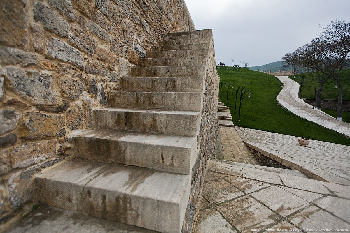
Naryn-Kala citadel stretches along the city for 700 meters.
In the walls of the citadel there are many tower-like ledges located at a distance of 25-35 meters.
The southern part of the fortification is equipped with steps, and platforms are located on its wide walls.
In some places the passages along the wall are very narrow, you have to walk sideways.
The thickness of the walls reaches 3.5 meters in some places, and the height is 20 meters.
The city was not in the most advantageous strategic position and was vulnerable from the Caucasus Mountains and the sea, so the local population paid special attention to its strengthening.
Inside the citadel, ancient khan baths with windows in the roofs, as well as buildings that have survived to this day, have been preserved.
Two stone water tanks located inside the citadel were built in the 11th century by Byzantine craftsmen. Large reserves of water were placed in the tanks, which allowed the fortress to withstand a long siege of the city by the invaders.
In ancient times, there was a bathhouse here. Of course, before the interiors looked completely different: there were beautiful walls and floors, a unique steam supply system.
Interestingly, now all the internal structures of the citadel are literally underground. Over the long years of the existence of the fortress, a lot of rock was brought inside, under which city buildings eventually turned out to be.
The citadel served not only as a defensive, but also as the administrative center of the city. It housed the office, the court and the underground prison, from which it was impossible for the prisoner to escape.
One of the ancient buildings was a cross-domed church of the 5th century, later converted into a Muslim religious institution.
There is even a theory about the existence in ancient times in Eurasia of a continuous fortification line that divided the continent in half.
The steep slopes of the citadel reliably protected it from the invasion of enemies from the east and north.
A great view of Derbent opens from a height.


