Sahara Desert. How sands suitable for life appeared. The Jericho rose comes back to life after rain in the Sahara. Hyenas thrive in the Sahara climate zone
Borders
Of course, a desert of this size could not occupy the territory of one or two African countries. It captures Algeria, Egypt, Libya, Mauritania, Mali, Morocco, Niger, Sudan, Tunisia and Chad.
From the west, the Sahara is washed by the Atlantic Ocean, from the north it is bounded by the Atlas Mountains and the Mediterranean Sea, and from the east by the Red Sea. The southern border of the desert is determined by the zone of sedentary ancient sand dunes at 16 ° N, south of which is the Sahel - a transitional region to the Sudanese savannah.

Regions

It is difficult to attribute the Sahara to any particular type of desert, although the sandy-stony type prevails here. The following regions are distinguished in its composition: Tenere, Great Eastern Erg, Great Western Erg, Tanezruft, Hamada-el-Hamra, Erg-Igidi, Erg-Shesh, Arabian, Algerian, Libyan, Nubian deserts, Talak desert.
Climate
The climate of the Sahara is unique and is due to its location in the zone of high-altitude anticyclones, downstream air and dry trade winds of the northern hemisphere. It rarely rains in the desert, and the air is dry and hot. The sky of the Sahara is cloudless, but it will not surprise travelers with blue transparency, since the finest dust is constantly in the air. Intense solar exposure and evaporation during the day gives way to strong radiation at night. At first, the sand heats up to 70 ° C, it radiates with heat from the rocks, and in the evening the surface of the Sahara cools much faster than air. average temperature July is 35°.


High temperature, with its sharp fluctuations, and very dry air make being in the desert very difficult. Only from December to February comes the "Saharan winter" - a period with relatively cool weather. IN winter time temperatures in the Northern Sahara can drop below 0° at night, although during the day it rises to 25°. Sometimes it even snows here.
Desert nature
Bedouin walking on the dunesDespite the fact that the desert is usually represented as a continuous layer of hot sand that forms dunes, the Sahara has a slightly different relief. In the center of the desert, mountain ranges rise, more than 3 km high, but along the outskirts, pebble, stony, clay and sandy deserts in which there is practically no vegetation. It is there that nomads live, driving herds of camels across rare pastures.
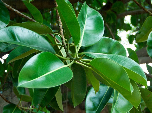
OasisThe vegetation of the Sahara consists of bushes, grasses and trees in the highlands and oases located along the riverbeds. Some plants have fully adapted to the harsh climate and grow within 3 days after rain, and then sown seeds for 2 weeks. At the same time, only a small part of the desert is fertile - these areas take moisture from underground rivers.
The well-known one-humped camels, some of which were domesticated by nomads, still live in small herds, feeding on cactus thorns and parts of other desert plants. But these are not the only ungulates living in the desert. Pronghorn Addaxes, Maned Rams, Dorcas gazelles and Oryx antelopes, whose curved horns are almost as long as their bodies, are also well adapted to survive in such difficult conditions. The light color of the wool allows them not only to escape from the heat during the day, but also not to freeze at night.
Several species of rodents, including the gerbil, the Abessinian hare, which comes to the surface only at dusk, and hides in burrows during the day, the jerboa, which has surprisingly long legs, allowing it to move with huge jumps like a kangaroo.
Predators also live in the Sahara desert, the largest of which is the fennec fox - a small fox with wide ears. Also there live dune cats, horned vipers and rattlesnakes, leaving winding traces on the surface of the sand, and many other species of animals.
Video: From Casablanca to the Sahara
Sahara in the movies

The mesmerizing landscapes of the Sahara never cease to attract filmmakers. Many films were shot on the territory of Tunisia, and the creators of two famous paintings left a memory of themselves among the sands. The planet Tatooine is not actually lost in space, but is located in the Sahara. Here is a whole "out-of-this-world" village of last episode « star wars". At the end of filming, the "aliens" left their homes, and now the bizarre dwellings and gas station of interplanetary aircraft at the disposal of rare tourists. In the neighborhood of Tatooine, the white Arab house from The English Patient is still visible. You can get here only by jeep and with an experienced guide, because you have to drive off-road, with a complete lack of signs and landmarks. Fans of The English Patient need to hurry a little more and the ruthless dune will finally bury this unusual attraction under the sand.
A truly endless sea of sand, stone and clay, with only rare green spots of oases and one single river This is the Sahara desert. Its territory is eight million square kilometers. That's bigger than Australia and slightly smaller than Brazil! Five thousand kilometers of heat and sand, from the Atlantic coast of Africa to the Red Sea. Origin great desert Sahara holds many secrets and mysteries.
Scientists have conducted computer simulations of the Earth's climate. Research has shown the following:
- the desert exists on the site of the ancient Tethys ocean, which existed in the Mesozoic era eleven million years ago (the remnants of this ocean are the Mediterranean, Black and Caspian Seas).
- during the Paleolithic period (10-12 thousand years ago), the climate in North Africa was much more humid. The Sahara was not a desert, but a steppe-savannah.
- about 5-7 thousand years ago, a drought began, the land of the Sahara was losing moisture more and more, grasses dried up.
Skeleton of a whale in the Sahara Desert
The photo shows the remains of a 15-meter-high beast that died thirty-seven million years ago and sank to the bottom of the ancient Tethys ocean. And in Egypt there is the Valley of the Whales, included in the list " world heritage UNESCO".

Got in a situation with these remains in the desert alone important point- the rate of growth of the soil level, on average, according to official studies, is 1-2 mm per year. For 37 million years, several tens of kilometers should have accumulated, and these bones lie on the surface. And not only in the Sahara, there are such remains on the surface of other deserts, in the Gobi (Mongolia), Atacama (Chile). How did they get to the surface - they were probably brought by the same deluge, which happened relatively recently - only 10 thousand ago.
The territory of the Sahara desert is not all covered with sand. But we are presented with the image of this desert: solid sands, dunes with rare rocky massifs.

But there is still a lot of sand - where does it even come from ?! Various versions are being put forward:
- The classical one comes from the fact that the sand is from the Tethys Ocean. But it is not clear why there was so much sand at the bottom of the ocean
- There is a version that sand is the result technological processing rocks. V. Kondratov expresses such a version and connects it with aliens, who for some reason needed it
- I found a version, quite plausible, related to the action of the waves of the flood. More details here:
Lesser Known Landscapes of the Sahara Desert

Chad. 16° 52′ 24.00″ N 21° 35′ 31.00″ E

Egyptian desert

All these are remnants of the original surface. They look like islands. The rest of the territory may not have been so solid, the flood carried away the rest of the soil when the waves passed through the continent. The washed away soil is the sands of the Sahara. Soil, rocks, washed by water erosion of the flow grain of sand to grain of sand.
In general, not all of the Sahara is “yellow”. Exists in the eastern part white desert. It is full of bizarre remnants, covered with white sand, which gives it the appearance of the Arctic north, there are also many karst deposits and caves.
 Rather, here the waters of the ocean receded gradually, here the organic traces of the ocean were preserved to a greater extent.
The Sahara desert and life in it
The fact that the territory of the Sahara desert was once inhabited and actively used is also evidenced by numerous cave drawings found in different parts of it. In the years when glaciers raged in the north, the population of the Sahara was engaged in cattle breeding and agriculture, as well as hunting and even fishing. 


Somewhere in the middle of the second millennium BC, the outlines of chariots drawn by horses appear on the rocks. The image of a horse on the rocks of the Sahara can be traced back to the 2nd century AD.

Also one of the most common rock art Sahara is an image of mysterious creatures, which many researchers mistake for gods, ancient astronauts or aliens.
One of the largest and most famous deserts on the planet is the Sahara, which covers the territory of ten African countries. In ancient writings, the desert was called "great". This endless expanses sand, clay, stone, where life is found only in rare oases. Only one river flows here, but there are small lakes in oases and large reserves groundwater. The territory of the desert occupies more than 7.7 million square meters. km, which is slightly smaller than Brazil and more australia.
The Sahara is not a single desert, but a combination of several deserts that are located in the same space and have similar characteristics. climatic conditions. The following deserts can be distinguished:
Libyan
 Arabian
 Nubian

There are also smaller deserts, as well as mountains and dormant volcano. You can also find several depressions in the Sahara, among which Qatar can be distinguished, with a depth of 150 meters below sea level.
Climate conditions in the desert
The Sahara has an extra-arid climate, that is, dry and hot tropical, but on far north- subtropical. In the desert, the temperature maximum on the planet was recorded at +58 degrees Celsius. As for precipitation, they are absent here for several years, and when they fall, they do not have time to reach the ground. A frequent phenomenon in the desert is the wind that raises dust storms. The wind speed can reach 50 meters per second.
There are strong daily temperature fluctuations here: if during the day the heat is over +30 degrees, which makes it impossible to breathe or move, then coolness sets in at night and the temperature drops to 0. These fluctuations cannot withstand even the most solid rocks that crack and turn into sand.

In the north of the desert is the Atlas mountain range, which prevents the penetration of Mediterranean air masses into the Sahara. Humid atmospheric masses move from the south from the Gulf of Guinea. The climate of the desert affects the neighboring natural and climatic zones.
Plants of the Sahara Desert
Vegetation spread unevenly throughout the Sahara. More than 30 species of endemic plants can be found in the desert. Flora is most represented in the Ahaggar and Tibesti highlands, as well as in the north of the desert.
Plants include the following:


 Acacia


Animals in the Sahara Desert
The animal world is represented by mammals, birds and various insects. Among them, jerboas and hamsters, gerbils and antelopes, maned sheep and miniature chanterelles, jackals and mongooses, dune cats and camels are found in the Sahara.


There are lizards and snakes here: monitor lizards, agamas, horned vipers, sand ephs.


The Sahara Desert is special world where an extra-arid climate has developed. Here is the hottest place on the planet, but there is life here. These are animals, birds, insects, plants and nomadic peoples.

Desert location
The Sahara Desert is located in North Africa. It occupies the expanse from the western part of the continent to the eastern one over 4.8 thousand kilometers, and from north to south 0.8-1.2 thousand kilometers. The total area of the Sahara is approximately 8.6 million square kilometers. From different parts of the world, the desert borders on such objects:
- in the north, the Atlas Mountains and the Mediterranean Sea;
- in the south - the Sahel, a zone passing to the savannahs;
- in the west - the Atlantic Ocean;
- to the east is the Red Sea.
Most of the Sahara is occupied by wild and uninhabited spaces, where you can sometimes meet nomads. The desert is divided between such states as Egypt and Niger, Algeria and Sudan, Chad and Western Sahara, Libya and Morocco, Tunisia and Mauritania.
Sahara desert map

Relief
In fact, sand occupies only a quarter of the Sahara, and the rest is occupied by stone structures and mountains volcanic origin. In general, we can distinguish such objects in the desert:
- Western Sahara - plains, mountains and lowlands;
- Ahaggar - highlands;
- Tibesti - plateau;
- Tenere - sandy expanses;
- Air - plateau;
- Talak - desert;
- Ennedi - plateau;
- Algerian desert;
- Adrar-Iforas - plateau;
- Al-Hamra;
The largest accumulations of sands are in such sandy seas as Igidi and the Great Eastern Erg, Tenenre and Idekhan-Marzuk, Shesh and Aubari, the Great Western Erg and Erg-Shebbi. There are still different forms of dunes and dunes. In some places there is a phenomenon of moving, as well as singing sands.

If we talk in more detail about the relief, sands and the origin of the desert, then scientists argue that the Sahara was previously the ocean floor. There is even the White Desert, in which white rocks are the remains of various microorganisms of antiquity, and during excavations, paleontologists find the skeletons of various animals that lived millions of years ago.
Now the sands cover some parts of the desert, and their depth in some places reaches 200 meters. Sand is constantly carried by the winds, forming new landforms. Under the dunes and dunes of the sands there are deposits of various rocks and minerals. When people discovered deposits of oil and natural gas, they began to extract them here, although it is more difficult than in other places on the planet.
Water resources of the Sahara
The main source of the Sahara desert is the Nile and Niger rivers, as well as Lake Chad. Rivers originated outside the desert, they are fed by surface and underground waters. The main tributaries of the Nile are the White and Blue Nile, which merge in the southeastern part of the desert. The Niger flows in the southwest of the Sahara, in the delta of which there are several lakes. In the north, there are wadis and streams that form after heavy rains and also flow down from the mountain ranges. Inside the desert itself there is a network of wadis, which was formed in antiquity. It is worth noting that under the sands of the Sahara there are groundwater that feeds some reservoirs. They are used for irrigation systems.
River Nile

Among interesting facts about the Sahara, it should be noted that it is not completely deserted. More than 500 species of flora and several hundred species of fauna are found here. variety of animals and flora forms a special ecosystem on the planet.
In the bowels of the earth sandy seas deserts have sources of artesian water. One of interesting phenomena is that the territory of the Sahara is changing all the time. Satellite images show that the area of the desert is either increasing or decreasing. If the Sahara used to be a savanna, now it is a desert, it is very interesting what a few thousand years will do with it and what this ecosystem will turn into.
About ten thousand years ago, the territory where the most big desert our planet, the Sahara, was covered with grass, low shrubs and was densely populated. After the fact that our planet slightly changed the tilt of its axis, the climate began to change gradually, it became hot, the rains stopped - and many representatives of the animal world left the resulting desert.
Sahara (translated from Arabic - "desert") is the largest desert on our planet, which is located in northern Africa and is located on the territory of ten states. On geographical map it can be found at the following coordinates: 23° 4′ 47.03″ s. w., 12° 36′ 44.3″ e. d.
The Sahara occupies about thirty percent of the African continent, and its area is about 9 million km2:
- From east to west, the length of the desert is 4800 km: the Sahara begins off the coast Atlantic Ocean and ends at the coast of the Red Sea.
- The length of the Sahara from south to north ranges from 800 to 1200 km. The desert begins in the north of the mainland near the coast of the Mediterranean Sea and the Atlas Mountains, the southern border is limited to 16 ° N. sh., in the region of sedentary ancient dunes, south of which begins the tropical savannah of the Sahel, a transitional area between the desert and the fertile soils of Sudan.
When exactly on the territory of the African continent the Sahara desert was formed, scientists do not have a common opinion: earlier its age was estimated at 5.5 thousand years, then at four, recently they began to lean towards the idea that it is even younger, and its lands became desert only about three thousand years ago.
The desert is located in the northwest of the stable ancient African platform, so ground trembling is now rarely observed. In the center of the platform, from west to east, the relief rises: one of the largest high-mountain regions of the desert are the Ahaggar and Tibesti plateaus, where, unlike the rest of the Sahara, snow falls for a short time almost every year.
From the northern and southern parts of the uplifts there are deflections of the platform, where in former times the sea was located, and therefore the presence of marine sedimentary rocks is characteristic of the soil. In the south of the desert, the deflection of the platform led to the formation large lakes who are the main suppliers fresh water of your region. First of all, we are talking about Lake Chad and the Ounianga group of lakes.

Sands occupy only a fourth of the Sahara, while the thickness of the sand layer is about 150 meters. Rocky soil predominates: it occupies about 70% of the desert area, the rest is volcanic mountains, as well as pebble and sandy-pebble soil.
There are also many aquifers (sedimentary rocks with varying degrees permeability, the cracks and voids of which are filled with water), which are the main suppliers of water to oases.
Sometimes fertile lands are also found in the desert - mainly near oases that take water from underground rivers and reservoirs, the water of which, due to its own pressure, was able to reach the ground.
On the map of Africa, the Sahara is divided into several regions:
- Western Sahara - located in northwestern Africa, the territory is characterized by coastal lowlands that turn into elevated basement plains and plateaus.
- The central highlands of Ahaggar - on the map is located in the south of Algeria, the highest point is Mount Tahat with a height of 2918 meters, so snow often falls here in winter.
- The Tibesti mountain plateau is located in the center of the desert, in the north of the state of Chad and partly in the south of Libya. highest point The plateau is the Emi-Kushi volcano, almost 3.5 km high, on the top of which snow falls annually.
- The Tenere Desert is located in the south-central Sahara. It is a sandy plain with an area of \u200b\u200babout 400 thousand km2, which is located in the northeastern part of Niger and in western Chad.
- The Libyan Desert - on the map of Africa, it is located in the north and is the driest region of the desert.


Climate
Sahara is the hottest and hottest place on our planet: even the driest desert in the world, Atacama, which is located in South America, cannot be compared with it.
The weather here in summer is extremely hot: the air temperature at this time often exceeds 57°C, and the sands heat up to 80°C. At the same time, the Sahara desert is one of the few places on our planet where evaporation significantly exceeds the amount of precipitation (with the exception of narrow coastal strips). While the average precipitation is only 100 mm (while in the center they may not be for several years in a row), it evaporates - from 2 to 5 thousand mm of moisture.
Conventionally, the Sahara can be divided into two climatic zones, northern (subtropical) and southern (tropical):
The northern part of the desert is characterized by hot summers (up to 58°C) and cold winters (especially cold weather in the mountains, where temperatures can drop to -18°C). The annual rainfall is 80 mm, rainy weather here from December to March and in August, while thunderstorms and even severe short-term floods are not uncommon. In winter, the high plateaus of Ahaggar and Tibesti receive a short snowfall almost every year.


The south is characterized by mild winters, and at the end of a hot and dry period, rains fall. IN mountain regions there is little rainfall, and it falls evenly throughout the year. In the lowlands, rains fall in summer, often accompanied by thunderstorms, with about 130 mm of precipitation per year. In the west, near the coast of the Atlantic Ocean, higher humidity than in the rest of the Sahara, there are often fogs.
The difference between day and night air temperatures in the Sahara is often about forty degrees: the average temperature in the center of the desert in July is 35 ° C, while at night the air temperature drops to +10 or + 15 ° C. The weather here is warm even in winter: the temperature of the coldest month of the year is + 10 ° C (therefore, snow is an extremely rare phenomenon).
The climate of the Sahara is greatly influenced by constantly blowing strong winds, especially in the north of the desert (only 20 days a year are windless). Winds blow mainly from north to east: the movement of humid air masses of the Mediterranean air stops mountain range Atlas mountains.


As for the air currents that move from the south, when they reach the central part of the desert, they manage to lose moisture. Therefore, the winds in the northern part of the desert have a particularly destructive force. They move at a speed of about 50 m / s and, raising dust, sand, small stones to a height exceeding a thousand meters, cause tornadoes and severe sandstorms, often moving dunes.
Water resources
the only river North Africa, which passes through eastern part Sahara towards mediterranean sea is the Nile, whose length is 6852 km (the river is the second longest after the Amazon, and flows through South America).
Since a large part of the water evaporates as you move through the desert, its two tributaries, the White and Blue Nile, which flow into it in the southeast of the desert (they are very clearly distinguishable on the map), play an important role. In the 60s of the last century, the Nasser reservoir was created between Egypt and Sudan, total area which exceeds 5 thousand km2.
In the south of the Sahara, several river flows flow into Lake Chad, the area of \u200b\u200bwhich ranges from 27 to 50 thousand km2 (depending on precipitation in the region), after which part of the water leaves the lake - and the water continues to flow into northeast direction while replenishing watersheds.
In the southwest flows the Niger River, which flows into the Gulf of Guinea of the Atlantic Ocean. This river is interesting in that starting almost near the ocean, 240 km from the coast, it flows into opposite side, into the Sahara, after which it turns sharply to the right and continues its journey in a southeast direction (the shape of the river, if you look at the map of Africa, resembles a boomerang).


IN northern part desert water comes from wadi streams, temporary streams of water that appear after heavy rains and flow down the mountains. Wadis also feed the desert soil in its central part. A lot of rainwater is in the dunes: once in the sand, the water seeps through the slopes and flows down.
Under the sands of the desert there are huge pools of groundwater, thanks to which oases are formed (there are especially many of them in the north of the Sahara, while in the south the aquifers are located deeper).
Another source of water in the big desert planets are located on the outskirts and in mountain ranges relic lakes(remains former seas), often swampy and salty, although fresh water is often found among them (for example, the water of most lakes of the Unianga group).
Flora
There is little vegetation in the Sahara - mostly shrubs, herbs and trees that grow near a natural reservoir, along a wadi or in high-altitude regions, among them olives, cypress, dates, thyme, citrus fruits.
In areas where there is little water supply, only those types of vegetation are found that tolerate drought well. There are no plants at all in rocky massifs, in places where sands accumulate.
Fauna
Almost 4 thousand representatives of the animal world live in the desert, most of which are invertebrates. Animals of the Sahara desert live mainly near the water (they are practically not found in arid regions) and are nocturnal.
Most of the animals are monitor lizards, cobras, lizards, chameleons, snails. Crocodiles, frogs, crustaceans are found in reservoirs. There are about sixty species of mammals, among them - cheetah, spotted hyena, sand fox, mongoose.
About 300 species of birds live in the Sahara, 50% of them are migratory. These are, first of all, ostriches, African owl, trumpet and desert crows and others.
Desert and people
Despite huge area, the desert is sparsely inhabited: only 2.5 million people live here. Some peoples lead a nomadic lifestyle, but most prefer to settle down. People settle only near oases, as well as in the valleys of the Nile and Niger rivers, where in order to survive on their own and feed livestock, there is enough water and vegetation. At the same time, cattle breeding: goats and sheep prevails over fishing and hunting.
The Sahara Desert is one of largest deserts peace. The Sahara stretches across most of North Africa, covering 9 million square kilometers. In fact, the Sahara Desert occupies 30% of the entire African continent. It is the hottest and hottest place in the world with summer temperatures often exceeding 57 degrees Celsius. The desert receives an annual downpour and very powerful sandstorms that raise the sand 1000 meters in height and move the dunes.
We continue the theme of the deserts of Africa. In previous editions of LifeGlobe we told you about the White Desert in Egypt and the Namib Desert, but now it's time to talk about the Sahara. Some say that the Sahara desert before the first ice age was much larger, and some say that the Sahara desert appeared 4000 years ago. For example, German scientists, using methods of computer modeling of the Earth's climate, found that the Sahara became a desert 4,000 years ago. 10 thousand years ago, the largest desert in the world was covered with grass and low shrubs, but then the summer became hotter, and the rains almost stopped. Naturally, many ancient civilizations disappeared, and all living things left the Sahara. According to scientists from the Potsdam Institute for Climate Research, the transformation of the Sahara into a desert was one of the most dramatic climatic events on Earth in foreseeable millennia. Why is the climate so unstable? It turns out that the inclination of the earth's axis to the Sun is gradually changing: approximately 9 thousand years ago it was 24.14 degrees, now it is 23.45 degrees. Today, the Earth comes closest to the Sun in January, ten thousand years ago - at the end of July. Subtle changes in the Earth's orbit around the Sun, amplified by interactions with the atmosphere, ocean and land, are changing the climate beyond recognition.


The climate of the Sahara is extraordinary. The wet factor is the broad position of the Sahara north and south of the Tropic of the North. This explains the fact that most of the desert throughout the year is under the influence of the northeast trade wind. An additional influence on the climate is exerted by the Atlas mountain barrier located in the north, elongated from west to east and preventing the main mass of humid Mediterranean air from penetrating into the desert. In the south, from the side of the Gulf of Guinea, wet masses freely enter the Sahara in summer, which, gradually drying up, reach it. central parts. The extreme dryness of the air, the enormous deficit of humidity, and, accordingly, the exceptionally high evapotranspiration are characteristic of the entire Sahara. According to the precipitation regime in the Sahara, three zones can be distinguished: northern, central and southern.

IN northern zone Precipitation falls in winter and their amount does not exceed 200 mm per year. To the south, their number decreases, and in the central zone they fall sporadically. Their average value does not exceed 20 mm. Sometimes there is no precipitation at all for 2-3 years. However, unexpected showers can occur in such areas, causing severe flood. The aridity of the Sahara also varies in the latitudinal direction, from west to east. On the Atlantic coast, heavy precipitation does not fall, since rare westerly winds are cooled by the Canary Current passing along the coast. Fogs are frequent here. On the tops of mountain ranges and highlands, the amount of precipitation slightly increases due to the condensation of water vapor. Sahara is distinguished by a high degree of evaporation. Its total annual value varies from 2500 to 5500 mm, which is more than 70 times the amount of precipitation.


The Sahara is characterized by high, one might say, record holders of air temperature. The average temperature of the coldest month, January, does not fall below 10 ° C in almost the entire Sahara. The average July temperature in the central part of the desert is 35 ° C. Temperatures above 50 ° C are noted in many places in the Sahara. The nights in the Sahara are cool, the temperature drops to 10 -15 ° C. On the plains, the temperature rarely reaches minus 5 ° C. In the mountains, frosts are frequent. The daily amplitudes of air temperatures are very large - up to 30 ° C, and on the soil surface - up to 70 ° C. At the beginning of summer, hot sirocco winds blow in the north of the Sahara, which come from the central part of the desert. strong winds cause dust and sand storms, the wind speed during the storm reaches 50 m/s. Masses of sand and small stones rise into the air, which greatly affect people and animals. Storms arise as suddenly as they end, leaving behind clouds of slowly settling dry dusty "fog". Tornadoes are also frequent in the Sahara.

The Sahara desert consists of one quarter volcanic mountains, one quarter of sand, rocks and gravel plains, and small areas of permanent vegetation. Vegetation includes shrubs, grasses and trees in the highlands and in the oases along the riverbeds. Some of the plants are well adapted to this climate and grow within three days of rain, and sow their seeds within two weeks after that. Only a small part of the Sahara desert is fertile - these areas take moisture from underground rivers and oases.


