Large islands of the Atlantic Ocean on the map. The largest islands in the Atlantic Ocean
There is something incredibly attractive about the land that appears on the horizon in the middle of the endless ocean. Islands, surrounded by hundreds of kilometers of water, always give rise to fantasies of treasures, great secrets and new discoveries.
The history of the inhabitants of distant islands is also no less interesting and original, because for centuries these civilizations have developed in a deep relationship with the world around them and in conditions of almost complete isolation from other cultures and peoples.
It sounds incredible, but today explorers are still able to experience the exciting feeling of touching new lands, like Christopher Columbus, and there is much more ahead of us.
10. Rockall
Rockall (Rockall) can hardly be called an island in the usual sense for us, because it is not so much land as a granite rock covered with bird droppings. Rising 18 meters above the water, it is formally the westernmost point of Great Britain. Rockall is located 465 kilometers from the coast of England and 710 kilometers from Iceland.
Despite its remote location, this volcanic island ok was known even to the northern peoples of antiquity, and they called it Rocal (Rocal), which translates roughly as "windy bald head." This name seems quite appropriate for such an isolated and uninhabited place. British politician Lord Kennet once said the following about Rockall: "There is no place more desolate, full of despair and horror."
At one time, the Celts called this rock Rocabarraigh. In Scottish mythology, Rokabarreich was considered a special stone, which was destined to appear above the surface of the water only 3 times in the history of mankind, and last time associated with the end of the world.
In 1955, with World War III and the threat of nuclear holocaust on everyone's lips, Rockall was officially declared a Crown Island for the first time. This was done to avoid using the lone rock as a Soviet observatory from which enemy intelligence could observe the launch of British nuclear missiles in the area. North Atlantic.
9. Jan Mayen
Photo: Dreizung
Jan Mayen is a large island located approximately halfway between Norway and Greenland, 595 kilometers north of Iceland. This land consists of 2 parts - the southern tip and the larger northern one, which are interconnected by a narrow isthmus.
Jan Mayen is an island of volcanic origin, and the most remarkable detail of the general landscape is the conical peak of the Beerenberg volcano. For the first time this place was discovered by Scandinavian sailors, who said that from the coast of Iceland to this harsh land, 2 days of sailing.
Northern sailors nicknamed the island of Svalbaro (Svalbaro, cold coast). At the end of the Vikings, the Norwegians and Icelanders almost stopped conquering the sea horizons, and the island was forgotten for many centuries. Jan Mayen has a complex history of rediscovery. It is reliably known that this land was again discovered in the summer of 1614 by 3 different expeditions. It was then that the island got its final name, in which Jan is the name of the Danish captain of the whaling ship that landed on this land in May 1614. Subsequently, Jan Mayen became such a popular bay among Danish whalers that they even settled their temporary camp here. . Thousands of whales died at the hands of people in the vicinity of the island, which led to the almost complete extinction of some native species.
In 1634, 7 Danish hunters tried to winter on the island for the first time for several months. All of them died from scurvy and other diseases caused by constant feeding on raw polar bear meat.
After several years of uncontrolled destruction of whales, these sea creatures were forced to leave the waters around Jan Mayen in order to find a safer place to live. Following the whales, the Danes also left the island, and this place again became wild and uninhabited.
In the 20th century, this land became part of Norway, and today an extremely small number of people have access here, among which are mainly scientists and the Norwegian military.
8. Litla Dimun
Photo: Erik Christensen
Litla Dimun is one of the smallest islands in the Faroe archipelago (Faroe). It has the shape of a truncated cylindrical cone, and the entire southern part of this land is surrounded by sheer cliffs, which are almost impossible to moor.
The inaccessibility of this islet is perhaps the main reason why this place has never been inhabited by people, which makes it rather unique for the northern region of the Atlantic Ocean. However, during the Neolithic era, sheep grazed here, as evidenced by their ancient remains.
Until the 19th century, Litla Dimun was a pasture for wild sheep descended from the Faroese artiodactyls since the time of the first settlers of northern Europe. The breed of these mammals resembled animals whose bones were also found on other isolated islands off the coast of Scotland. This species of wild goat died out long ago, and today only modern Faroese goats graze on the windy slopes.
In autumn, local peasants moor at Litla Dimun to visit the wild herds, slaughter the necessary amount of livestock for food, and shave some of them. All sheep are driven to northern lands islands, where they are collected together, their legs are tied, and then they are lowered in nets into a boat that delivers animals to the mainland. Sheep are locked up in barns for the winter so that the selected livestock can survive the harshest time of the year in safe conditions.
7. Fula
Photo: Dr. Julian Paren
Foula is part of the Shetland Islands and is considered one of the most remote and sparsely populated places in Europe. Despite the fact that 38 people live here, the island has a very long history, dating back to the third millennium BC.
A stone of an unusual round shape, discovered in the northern part of the island, has long occupied the minds of archaeologists, who eventually confirmed that it was installed here 1000 years before the birth of Christ. The boulder resembles an ellipse rather than a sphere, and its axis is aligned with the tilt of the Earth's axis of rotation at the winter solstice, suggesting its connection with religious rituals.
Modern population Foula has preserved the cultural identity of an isolated island with Nordic elements. Even the name of this place, like most others Shetland Islands, draws its origins from the language of the Normans (an ancient northern people) who conquered and inhabited the region during the Viking Age.
locals still follow the Julian calendar and celebrate Christmas on January 6, unlike the rest of Scandinavia, which celebrate this Christian celebration at the end of December. On Fula, it is customary to spend Christmas Eve first at home with the family, and its completion is always marked by a general gathering in one place.
Fula Island is one of last places, where the already extinct Norn language was used everyday and was a colloquial dialect. Norn is an Old Norse language and was spoken by the inhabitants of the northern islands until the end of the 18th century. It began to die out only after the Norwegian Crown granted Scotland rights to the northern islands at the end of the 15th century.
6. St. Kilda
Photo: Otter
St. Kilda is a small group of islands located far to the west off the coast of Scotland. Hirta - the most big Island of this archipelago, and the only inhabited piece of land in the area. St Kilda is deservedly considered the most famous cluster of land among the rest of the Scottish islands, thanks to its remoteness, history and amazing scenery.
The archipelago impresses with steep rocky slopes rising 30 meters above the water of the North Atlantic. Hirta is available for landing on its coast in only a few places, and even those are not so easy to get close to - ideal weather conditions are required for this.
Previously, for almost 2000 years, northern peoples lived on the islands of St Kilda, as evidenced by the artifacts found here, some of which date back to the early stone period. There are suggestions that the ancient Scandinavians sailed to the northern archipelago and assimilated with the island civilization as early as the Viking Age. In support of this theory, examples are given of several place names of Nordic origin, which have long denoted objects on the islands of St. Kilda.
The main feature of the culture of St. Kilda has always been absolute self-sufficiency, and the isolation of the inhabitants of this land from the rest of the world has greatly influenced their mentality. The islands were so remote that for a long time the locals adhered to a religion that combined both Celtic Druidism and Christianity. Druid altars were very widespread here until the 18th century, despite many attempts by missionaries to accustom the inhabitants of the archipelago to a purer form of Christianity.
The true proof of the disinterest of the inhabitants of the islands in what is happening outside their home was an incident that occurred in the 18th century. One day, soldiers arrived looking for the missing Prince Charles Edward Stuart, heir to the British throne, and the islanders had no idea who he was. Moreover, they have not even heard of their own king George II (George II). The visitors were shocked by the incredible ignorance of isolated peoples.
5. Dragoon
Photo: Icelandic Times
Drangey is an island located in the Skagafjorour in northern Iceland. Most of all, this piece of land is famous for the prehistoric volcano, which collapsed over 700,000 years so that it turned into a real fortress island with steep rocky cliffs. Due to the harshness of the terrain, Draungay can only be reached by one single route, and nothing else.
In the 11th century, the Icelandic folk hero Grettir the Strong landed on this island with his brother and a slave, and together they lived on an unfriendly land for several years. The reason for this resettlement was the expulsion of Grettir from Iceland, which was considered one of the most cruel punishments of the Viking Age.
As the story goes, when the fire went out of the exiles, and they had nothing else to make it, Grettir went in search of a source of fire outside the island. The heroes no longer had a boat, so Grettir himself sailed 6 kilometers along open ocean to the shores of the mainland. He was going to get a flame in a place called Reykir, but was eventually killed by his enemies, who found him dying from an infection.
Draugnay is home to millions of seabirds, which used to be hunted here every summer by about 200 farmers from the surrounding settlements. In a few months, birders managed to kill up to 200,000 birds, and this was considered a good catch for the hunting season.
People hunted birds with the help of a floating trap, which they made from three rafts or boats tied together. The structure was covered with a net with horsehair loops. In these floating snares, the prey usually became entangled. This practice was for a long time a fairly common method of hunting in Iceland, but later it was recognized as inhumane, because the rafts often sailed far into the sea, and the birds stuck in them died of starvation after many days of drifting away from their native nests.
4. Surtsey
Photo: NOAA
Surtsey is an islet located near south coast Iceland. It is the youngest formation of the Vestmannaeyjar volcanic archipelago, and rose from the sea on November 14, 1963 as a result of a volcanic eruption that began under the sea water.
The eruption lasted 4 years and produced an island with an area of 2.6 square kilometer. Over the past decades, erosion has destroyed Surtsey so much that it has become 2 times smaller than its original size. The island is of great interest to scientists from a number of scientific fields, because it is so convenient to observe the formation processes here. new form relief and the origin of life that took place on Earth hundreds of millions of years ago. Geologists and biologists often sail here for research, and access to this land is strictly limited to ordinary civilian visitors.
In Iceland, new islands of the same morphology are now often appearing, but so far they are still too young and barely visible above the water, and many of them are destroyed too quickly and go back to the bottom of the ocean. The fragility of these formations is explained by the fact that they are a mixture of sandbanks with volcanic gravel, formed when hot lava comes into contact with cold ocean water. However, the eruption that gave birth to Surtsey was special, because it reached its final stage when the water no longer had access to volcanic vents, and magma spread over dry slopes.
The island has developed its own flora and is now covered in moss. Birds quickly settled in Surtsey, and in 1998 the first shrubs even appeared here.
In 1977, scientists were seriously puzzled by the appearance of potato sprouts on a dormant volcano. The researchers soon found out that this plant culture was planted secretly for the sake of a prank, and this was the work of teenagers with neighboring island. Another embarrassment happened when tomatoes appeared on Surtsey. As it turned out, the tomato sprout grew from seeds brought to the volcanic land through the excrement of one of the scientists, who did not endure a more civilized toilet. Tomato and potato seedlings were carefully removed, and responsible parties were reprimanded for introducing foreign crops onto virgin soil.
3. Svalbard
Svalbard is a permafrost archipelago far to the north above the Arctic Circle and the northernmost permanent settlement on the planet. Another name for this place is Svalbard or Spitsbergen, and it refers to the territory of Norway, although there is also a whole settlement of Russian miners on one of the largest islands in the archipelago.
Norway's relationship with the archipelago is somewhat atypical. Officially, this zone is considered demilitarized, and minerals on its territory can be mined by any foreign government that has signed the Svalbard Treaty. By the beginning of 2016, 45 parties had already participated in the signing of such an agreement.
Glaciers cover 60% of the entire area of Svalbard, and during the winter polar night reigns here. In Longyearbyen, the largest settlement in the archipelago, the polar night lasts from October 26 to February 15. This is almost 3.5-4 months of darkness.
There is no developed road system on the island, and only rare similarities of snow-covered roads are laid between the cities and mines. Snowmobiles are the main mode of transport on the islands, especially in winter.
Traveling outside the cities can be very dangerous because Svalbard is home to a large colony of polar bears. All who leave the settlements are required to carry appropriate equipment, and local authorities it is strongly recommended to carry a firearm with you in order to be able to ward off a powerful predator on occasion.
Svalbard may sound like a naturalist and gun lover's paradise, but it's nearly impossible to move here unless you're hired by an Icelandic company. Most of the houses and buildings on the islands are owned by private corporations that rent out properties to local workers.
2. Flannan
Photo: JJM
The Flannan Isles are a group of 7 small coastal islets in Scotland. Their total area is only 588 thousand square meters. People have left these places since the lighthouse of the largest island of Eilean Mor (Eilean Mor) was fully automated.
The small size of the Flannan Archipelago and its relative remoteness from the mainland has long been the reason for its uninhabited. However, the ruins of a chapel, several shelters and other objects prove that these places were once inhabited by a hermit community of monks.
At the end of the 19th century, a 23-meter lighthouse was built on the island of Eilean More, and in 1900 the archipelago became the site famous history about the mysterious disappearance of all 3 caretakers of the navigation tower. They disappeared at the same time and completely without a trace.
All three men disappeared on the day of a severe storm, which destroyed one of the two local wharfs, and also caused severe damage to the navigation equipment and infrastructure of the settlement. On one of the cliffs, the turf was torn at a height of 61 meters - the waves breaking on the slopes of the island were so high and powerful. The disappearance of the caretakers has attracted close attention of the British public to the archipelago and has given rise to many of the most incredible theories.
The circumstances of the disappearance of 3 men seemed very strange, given that the inside of the lighthouse was in perfect order, with the exception of one overturned chair in the kitchen. All gates and doors were locked, the flag was lowered, the beds were not made, and all the clocks had stopped. According to the rules of the Scottish Lighthouse Authority, under no circumstances should the tower be left completely unattended, but for some reason all 3 employees of the station disappeared at once. Another odd detail was that there was only one set of storm clothing left inside the lighthouse. It turns out that one of the caretakers was in such a hurry to get out that he was not up to the right equipment, corresponding to the terrible bad weather?
The mystery of the disappearance of the caretakers still remains unsolved, but the main version of the authorities is that all the lighthouse workers were simply washed away into the sea.
1. Rhone
Photo: john m. macfarlane
Rhone Island is often referred to as North Rhone to distinguish it from another Scottish island of the same name. This northern patch of land, washed by the cold waters of the Atlantic Ocean, is so isolated and remote that it is often forgotten to map the UK. Over the past 1500 years, Rhone has been abandoned more than once and left completely uninhabited for a long time. No more than 30 people lived here at the same time.
Prior to the Viking Age, Rhona was supposedly a haven for Christian hermits. Subsequently, most local islands was captured by the Vikings and ruled by the Norwegian monarchs for several centuries. The presence of the ancient Scandinavian peoples on this land has not yet been reliably proven, although the name "Rhone" itself is probably of Norwegian origin.
In the 8th century AD, Saint Ronan settled here. It was said that it was he who built a small Christian chapel, which still stands in its place. Archaeologists believe that this is the oldest Christian building in all of Scotland, which has survived to this day.
by the most curious tourists it is allowed to crawl into a small semi-flooded building made of earth and rough rock, and inside in the corner of the chapel you can see an ancient stone cross. Such artifacts shed the best light on how the monks lived, who voluntarily chose the harsh Rhone as their hermitage a millennium ago.
The island land of the Atlantic Ocean consists of many islands and archipelagos of various origins - continental, volcanic, less biogenic. The most characteristic and interesting type of the ocean are islands of oceanic origin.
Islands of the central part, located along the axis of the mid-ocean ridges and being their integral part, have a certain unity of nature associated with the history of their occurrence, geological structure, oceanic type, etc. These include: Iceland, the Faroe Islands, the Shetland Islands, about. Ascension, oh Saint Helena. All of them represent the surface part of the huge Mid-Atlantic Ridge. As a rule, they are characterized by oceanic-type crust, active manifestations of young Cenozoic volcanism, most often fissured (basic lavas).
Iceland
It is the second largest island in the Atlantic Ocean (after Great Britain) and the largest island of oceanic origin in the world. Its area is more than 103 thousand km 2, its length from west to east is about 500 km, and from north to south it is more than 300 km. Iceland is located between 63° and 66° N. sh. and 13° and 24° W e. The Arctic Circle passes by half a degree north of the island. The position of Iceland within the rift zone of the mid-ocean ridge and in the high latitudes of the Northern Hemisphere near the Arctic largely determines its natural conditions.
Geological structure and relief
A characteristic feature of Iceland is a powerful earth's crust (up to 28 km). The basis of the island is the only basalt plateau in the world. Its largest part is called Oudadahrain. The plateau is crossed by rift faults, along which there are many, some are still being formed.
Of the 150 volcanoes on the island, 26 are active. These are fissure, shield and cone volcanoes. Of the fissure volcanoes, the most active volcano is Laki (818 m) with 115 craters. Hekla (1491m) is also an active fissure volcano. All Icelandic volcanoes characterized by abundant outpourings of basaltic lava. A series of basalt plateaus is riddled with intrusions of gabbro and quartz porphyrites. The fjord region of northeast Iceland is characterized by the presence of laccoliths and small batholiths. The highest point of the island is Hvannadalshnukur (2119 m). The development of the rift of the Mid-Atlantic Ridge continues, as evidenced by the emergence of new volcanic islands near Iceland (for example, the young island of Surtsey).
The climate of the island is cold and humid.
The Iceland Low and the warm Irminger Current have a huge influence on its formation. The interaction of cold Arctic and warm Atlantic air masses forms the fronts on which active cyclogenesis occurs. Strong winds, high relative humidity, abnormally high winter temperatures (average January in Reykjavik 2°C), large amounts of precipitation in the form of rain and sleet (up to 3000 mm) with a winter maximum - that's character traits island climate. There is little heat here sunlight, the average July temperature is only 11°C, and in the mountains - about 0°C.
The abundance of glaciers is a distinctive feature of the island. Their total area is 11.8 thousand km 2, which is approximately 11.5% of the area of Iceland. The most characteristic are ice caps with tongues, some of which can reach the shores of the ocean.
Glaciers are usually asymmetrical in shape. Some of them cover the tops of volcanoes, others hide entire lava plateaus with several volcanic masses under the ice. The largest ice domes are Vatnajökull (area - 8390 km 2) and Laungiökull (1022 km 2). In Iceland, the pulsations of glaciers are well studied, since the beginning of the first millennium AD, 4 phases of the advance and retreat of glaciers have been noted, and at present - the 5th stage of retreat.
Among the forms of exogenous relief, glacial and water-glacial forms predominate - modern and relict.
Icelands are short, originate in glaciers, abound in numerous rapids and waterfalls, and have large potential reserves of hydropower. Lakes occupy 3% of the island's area, often located in chains in river valleys. Lakes of volcanic and glacial origin, and in coastal areas- lagoon. Most big lake- Tingvadlavatn, its area is 283 km 2, maximum depth 114 m, the bottom of the lake lies 10 m below sea level.
The island has abundant outcrops of hot and warm waters. They exist in groups and individual griffins. Some sources gush with a certain frequency.
According to the chemical composition, the waters of the springs are divided into alkaline (usually nitrogenous) and acidic (sulfate or hydrogen sulfide-carbon dioxide). Alkaline water outlets are often located at the foot of hills and in lowlands and are of great importance as sources of heat. As you know, gushing springs all over the world are called geysers. This is the Icelandic word "geysa" - "gush". The most famous is the Big Geyser. Its vent is composed of calcareous tuff, has a cup-shaped shape, up to 3 m wide, periodically boils up, and a column about 15 m high is thrown out. In total, 250 groups are known in Iceland thermal springs and 12 outlet fields for steam and gases - sulfatar.
The soils of the island are formed on volcanic rocks-lavas, tuffs. During volcanic eruptions, ash material of the basic composition, as well as stony and sandy sediments of melting waters, settles on the surface, therefore the soils are underdeveloped, thin. Peaty-soddy subarctic soils are also widespread, strongly resembling alpine mountain-meadow soils, but with a significant participation in the composition of the profile of volcanic rocks. The profile is poorly differentiated into horizons, the soil reaction is neutral or slightly acidic.
The organic world is insular. Herbaceous vegetation dominates. Large areas are occupied by moss-lichen communities on stone placers.
There are areas completely devoid of vegetation, such as lava fields of recent eruptions. Lots of swamps. The flora of the island includes 440 species of higher plants and about 600 species of mosses and lichens. The poverty of the floristic composition can be explained by the isolated position, the geological youth of the island, the peculiarities of the climate, and the uniformity of the soils. The origin of the Icelandic flora is still the subject of scientific debate.
Along the river valleys you can find thickets of stunted birch, willow, juniper, which the Icelanders proudly call "forests". The meadows are dominated by forbs - anemones, daisies, forget-me-nots, from cereals there are pike, fescue, bluegrass. The country is currently great work on forest plantations of spruce (European and Sitka), Siberian larch. The total area of forests is now 1% of the territory of Iceland.
Animal world in terms of species composition, it is even poorer than vegetable. Lemmings, arctic foxes live here, reindeer was brought from the mainland, and the Icelandic mouse is endemic. Absolutely no reptiles and amphibians. There are many birds (more than 200 species, 76 of them are nesting).
The main occupations of the population are fishing, sheep breeding and greenhouse vegetable growing. The culture of greenhouse agriculture is very high.
There are four national parks, several reserves and natural monuments on the island. The most famous is the Thingvellir National Park, where volcanic landscapes are protected.
The Atlantic Ocean is the second largest water area after Pacific Ocean covers 20% of the earth's surface. The Atlantic Ocean used to give more than 2/5 of the world catch, later, due to uncontrolled fishing, the number of fish decreased greatly. Following the recent introduction of a strict fishing limit, the number of fish in the Atlantic Ocean has begun to increase. Several islands are scattered across the Atlantic Ocean, the largest of them are located in the northern part of the ocean. Consider a list of the islands of the Atlantic Ocean from smallest to largest in area.
Total area: 25,460 square kilometers.
This is one of the largest islands, shaped like a triangle, with a population of over five million people. This island, belonging to Italy, is dominated by a mountainous terrain, on the eastern part of the island there is an active volcano Etna, with a height of over 3300 meters above sea level. The height of this volcano still cannot be determined, since it is constantly changing as a result of eruptions. As a result, earthquakes are not uncommon on the island, the last most destructive occurred in 1908. In Sicily, the climate is mild - short warm winters and long hot summers, with a huge number of sunny days.
9 - Marajo

Total area: 40,100 square kilometers.
Marajo is the largest island in Brazil with a population of no more than 380,000 people. They live in villages on the small eastern coastal stretch of the island. Despite the fact that the island is partially located in the Atlantic Ocean, it is completely washed by the fresh waters of the Amazon, Para and Tocantins rivers, not letting salt water to the shores. Of the animals on the island of Marajo, buffaloes are the most common, freely roaming everywhere. Every year in autumn, local hunters hunt for buffaloes, which breed very quickly. Due to their meat, skins, a hunter's family can live for several months. If the east of the island is inhabited by local residents, then the west is covered with impenetrable jungle. On the island, you can get rich quickly just by raising cattle.
8 - Tierra del Fuego

Total area: 47,992 square kilometers.
The island is located between the Pacific and Atlantic oceans, divided between the two countries of Chile and Argentina. Considering the two countries, it is home to over 250,000 people. Considered unfriendly and mysterious island. The island received the name Tierra del Fuego from one navigator, who, sailing to the island, saw from afar a huge number of fires of local residents and mistook them for volcanoes. Despite the harsh climate on the island of Tierra del Fuego, the number of tourists who want to stay away from civilization is increasing every year.
7 - Ireland

Total area: 70,273 square kilometers.
On the island of Ireland, washed by the Atlantic Ocean, there are no more than six million people. Despite the fact that Irish and English are considered the official languages of Ireland, all residents speak mainly English language. Ireland has become famous all over the world thanks to the very beautiful local nature, where evergreen hills reign due to warm winters and cool summers. There is practically no heat there. A large area of the island of Ireland is occupied by plains, only in the north and west mountainous relief prevails. Trees on the island occupy no more than ten percent of its area. The fauna on the island is scarce, there are no more than 380 bird species. Ireland is considered the safest and friendliest country in Europe.
6 - Haiti

Total area: 76,480 square kilometers.
The island of Haiti has a mountainous relief, in the bowels of which there are many minerals, such as gold, copper, silver, and iron. The climate on the island of Haiti is tropical, winters are very warm, rainy, and summers are hot. Over 20 million people live on the island, as it is divided by two countries Dominican Republic and the Republic of Haiti, which export cocoa, coffee, sugar, tobacco, and bananas. The island is often shaken by earthquakes, the most powerful occurred in 2010, when more than 222 thousand people died.
5 - Iceland

Total area: 103,125 square kilometers.
The island of Iceland is located almost at the Arctic Circle, arose as a result of volcanic eruptions. In its bowels there are several active volcanoes, which erupt quite often about once every four years. Volcanoes are found mainly in cracks in the earth's crust. The last prolonged volcanic eruption was in 2010. In addition to volcanoes, a large number of hot springs, geysers, and glaciers are scattered around the island. Despite the large land area, no more than 321 thousand people live on the island due to its harsh climate. There are very few animals on the island and no reptiles at all. Of the wild mammals there, only the arctic fox, which has a hard time on this inhospitable island.
4 - Cuba

Total area: 110,860 square kilometers.
The most famous island with fertile land with a population of over 11 million people. Cuba mostly has flat terrain, its highest point does not exceed two kilometers. Despite fertile land and an abundance of minerals like nickel, cobalt, copper, iron ore, phosphorites, rock salt, Cuba is one of the poorest countries. Thirty years ago, huge deposits of gas and oil were discovered in the west of Cuba, and their development has only recently begun. The climate on the island of Cuba is tropical, the average air temperature is 25 degrees Celsius, they have rainy winters and dry summers. Hurricanes often visit Cuba, causing significant damage to the economy and the population.
3 - Newfoundland
Total area: 111,390 square kilometers.
It is located close to North America, washed by the Gulf of St. Lawrence and the Atlantic Ocean. The climate on the island of Newfoundland is foggy, cold, the sun rarely illuminates it, no more than 120 days a year. Summers are short and rainy, the air temperature rarely rises above 17 degrees, but winters are warm and very snowy. The island is famous for its chic flat and mountainous reliefs, their plateaus often end in steep cliffs, many lakes and swamps are scattered throughout the island, only the southwest is densely covered with coniferous forests. Previously, a lot of fish lived off the coast of the island, but due to uncontrolled fishing, the number has sharply decreased. Despite the cool summer, 479 thousand people live on the island.
2 - UK

Total area: 242,495 square kilometers.
The island of Great Britain includes four countries: England, Wales, Scotland, Northern Ireland, is washed by four seas, and is separated from France by the English Channel. This magnificent island Tumanov is inhabited by over 63 million people. England occupies the largest area of the island, Scotland is the second largest, followed by Wales and Northern Ireland. For most of the year, drizzling rains fall on the island, mainly on its western part. Winter in the UK, thanks to the warm North
Atlantic current, mild, warm, sometimes snowy, air temperature rarely drops below 15 degrees, in summer it sometimes rises to 35 degrees. The terrain of the island is mostly hilly, only in Scotland and Wales is dominated by medium-altitude mountains. There are not many animal species left in the UK at the moment due to the intense hunting that is now strictly controlled. More than 100 species of birds fly to England from other countries in a certain season.
1 - Greenland

Total area: 2,130,800 square kilometers.
Greenland is not only the largest island in the Atlantic Ocean, but also on earth, washed by the Atlantic and North Arctic oceans. Greenland belongs to the country of Denmark. Over 82 percent of the area of Greenland is covered with ice, about 57 thousand people live on the remaining 18 percent of the island's territory. In coastal areas, occupied by ice, the climate is mild, in winter the air temperature drops below 10 degrees, but in summer it does not rise above 9 degrees. It can be said that the weather in the coastal regions of Greenland is cool all year round, but very strong winds blow. There is little vegetation on the island. It inhabits 30 species of mammals, 700 species of insects, few species of birds.
The island of Newfoundland belongs to Canada and is part of the province of the same name. This is one of the most famous island Atlantic, however, he is famous not for geographical characteristics, but for the breed of dogs bred on it. Where is Newfoundland located? What features does it have? Let's find out.
Atlantic Ocean islands
The Atlantic, or Atlantic Ocean, stretches between eastern shores North and South America and west coast Africa and Eurasia. It is second in size only to the Pacific Ocean. The coastline of the Atlantic is heavily indented, approximately 15% of its waters are represented by seas, straits and bays.
The bottom relief is cut by hollows, trenches, numerous ridges. Some rifts, uplifts and volcanoes rise above the water, forming landmasses. So, relatively recently (in 1963) the volcanic island of Surtsey was formed.
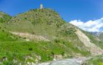
Most major islands Atlantic Ocean: Azores, Bermuda, British, Antilles, Falkland, Bahamas, the Tierra del Fuego archipelago, etc. Compared to the islands of the Pacific Ocean, there are quite a few of them. Some of them are inhabited, others are completely deserted and even impregnable, such as Rona, Draungley or Rockall, once called "a place of despair and horror."
Newfoundland (island): climate and geography
It is located off the northeast coast of North America. It is separated from the Canadian mainland by the straits of Cabot and Belle-Ile. It is considered the boundary between the Atlantic Ocean and the Gulf of St. Lawrence.
The area of the island of Newfoundland is 111,390 square kilometers. It is one of the largest in the Atlantic and is the sixteenth largest in the world. The coastline stretches for 9.6 thousand kilometers. To the south of it are the overseas possessions of France - Miquelon and Saint-Pierre.

The climate of Newfoundland is temperate maritime. It is often foggy and cold here. A sudden wind easily turns into a storm. For the whole year, the island has an average of about 120 sunny days.
Summer in Newfoundland does not last long, it is usually rainy and cool. In winter there is a lot of snow. The average temperature in July ranges from 10 to 17 degrees in different parts of the island. In January, it does not fall below -12 degrees, and in southern parts happens not lower than -5.
Relief
The island is characterized by mountainous and hilly landscapes. The average height on its territory is 400-600 meters. He is a continuation mountain range Appalachians. The highest point of the island of Newfoundland is the peak of Kaboks, which soared to 814 meters. It is located on the Long Range in western region islands.
In the western part, the mountain plateau of the island passes into the coastal lowlands, but mostly ends in steep cliffs. The eastern and northeastern shores of Newfoundland are indented with rocks. In the waters next to it are several hills, which are called banks. Their total area is almost equal to the island itself.

On the southeast side is the Great Newfoundland Bank. It is a huge shelf. In its area, the water depth does not exceed one hundred meters. The bank is located at the intersection of cold and warm currents, which brings fog to the island.
Geology of the island
Geological structure The island of Newfoundland is associated with its mainland origin. Together with Greenland, Scandinavia and British Isles it is a typical Caledonite, that is, it was formed during the era of the Caledonian folding.
The foundation of Newfoundland Island was formed in the Cambrian and Early Ordovician from terrigenous-carbonate rocks. At that time, the island was the bottom of the Iapetus Ocean. Even 600 million years ago, the eastern and western parts of the island were on different sides of this ocean.
During the period of Late Caledonian folding, the ocean began to close, and two opposite continental plates began to collide along the Greenland-Newfoundland and Scandinavia-Britain lines. At this moment, there was an active compression of sedimentary rocks.
The surface of the island formed from the shallows and from the collision of plates was exposed to glaciers. This can be seen from numerous lakes, characteristic dashed rock ledges and moraine deposits.
Discovery history
The island is part of the Canadian province of Newfoundland and Labrador. One of its first inhabitants was the Beothuk Indians. Viking settlements have been found on the territory of the island of Newfoundland. They lived here around the 11th century. Their settlements of Pointe Rosé and L'Anse aux Meadows are classified as UNESCO World Heritage Sites.
11 years before the discovery of America by Columbus, the island was discovered by Bristol sailors, but they kept silent about this because of the abundance of fish off its coast. Official opening Europeans happened in 1497. Captain John Cabot called it "New Earth", in fact, this is how the name of the island is translated from English.

In 1583, Newfoundland became the first overseas colony of England. Within a few centuries, the British population reached almost two hundred thousand, while the Beothuk were completely destroyed. As a result, there is no indigenous population on the island.
Nature
The southwest of Newfoundland is covered with dense coniferous forests. They are located in the valleys of the largest rivers and on the coasts. The composition of the forests differs little from the forests of the mainland. The most common species are black spruce, birch, balsam fir. It also grows dogwood, blueberries and lots of mosses.

The rest of the space falls on meadows, swamps and tundra. On the island are National parks Gros Morne and Terra Nova. The latter is located in the northeastern part of the island. Its area is 400 km2. It is located right on the coast of Bonavista Bay and is cut by numerous fjords and spits.
The shelves around the island used to be a kind of marine "pasture", where many aquatic organisms lived. Due to the mass catch in the 20th century, they destroyed most fish. After that, the authorities imposed strict restrictions on fishing.
Own breed of dog
The name of the island is reflected in the name of the dog breed - Newfoundland. In Russia, the animal is called a diver. The exact origin of the breed is unknown. According to one version, it was bred specifically for the inhabitants of the island.
In past centuries fishing was the main occupation of the locals. The nature of the dog is fully consistent with their requirements. This fact usually serves as the main argument that the breed was bred specifically for local fishermen.

The dog is very friendly and not suitable for hunting. But she swims well and copes well with the role of a companion. This is a very intelligent animal, able to make independent decisions if necessary. Such a skill was extremely useful if it was necessary to save a drowning owner.
Conclusion
The island is located off the coast of Canada and is part of the province of Newfoundland and Labrador. The nature of the island is rocks, coniferous forests, swamps, bays and fjords. Its first inhabitants were Indians, who were completely destroyed by the colonizers.
Now the population of the island of Newfoundland is quite homogeneous: the British make up 93%, the rest of the inhabitants are French and a mixed population. The locals are descendants of the first colonizers. The life and language of the population in certain parts of the island are not much different from those that existed in the 16th century. This and other features of Newfoundland are very attractive for tourists.
A huge ocean separates the continents, meanwhile, hundreds and thousands of small islands can be scattered in it. We have selected ten of these islands located in the Atlantic Ocean that attract visitors for a variety of reasons, from sandy beaches to remoteness and untouched nature!
- Tristan da Cunha
A remote group of islands of volcanic origin is mesmerizing amazing nature and the animal world. It is named after Tristao da Cunha, who was Portuguese navigator who discovered these islands in 1506. The population of the island is only 302 people.
- Porto Santo Island, Portugal
Located 43 kilometers northeast of Madeira, the island of Porto Santo was discovered in the early 15th century. Porto Santo is a rocky island with sculptural waves of sand, beautiful rocky and sandy beaches. Christopher Columbus himself once stopped in the town of Vila Baleira. His museum is located in the city, which is also the best place for shopping on the island.
- Fernando De Noronha, Brazil
The archipelago consists of 21 islands and is located 354 km from the Brazilian coast. Due to the South Equatorial Current, the water here is very warm and you can dive without a suit to a depth of 40 m. Seascape attracts tourists with tunnels, canyons and rocks.
- Canary Islands, Spain
The archipelago consists of a group of islands scattered in the ocean. La Palma and Tenerife are the most popular among tourists who come here to enjoy the many beaches, untouched nature, impeccable resorts and gambling. Yes Yes! Tenerife is famous for its casinos, which are visited by tourists from almost all over Europe. Numerous roulettes, blackjacks, slot machines many are dizzy and make their hearts beat faster. If you do not like the noisy atmosphere of the casino, then you can play your favorite gambling games on the portal http://freeslots-777.com on your computer via the Internet.
- Newfoundland
The large Canadian island in the Atlantic Ocean has stunning scenery. From mountains and picturesque coastline to dense forests, the island attracts those willing to explore and discover.
- Azores, Portugal
The archipelago is one of the autonomous regions of Portugal, and is located at a distance of 1360 km from the mainland in the Atlantic Ocean. The island owes its stunning scenery, fertile soil and lush greenery to its volcanic origin. Nine islands scattered over a 600 km stretch of ocean belong to the archipelago.
- Barbados
Untouched islands boast warm weather all year round. The unique culture of Barbados comes from English, African and West Indian settlers. Therefore, distinctive architecture, cuisine, music and dance can be found in Barbados. Tourists will be able to see historical heritage, shops, nightclubs, and the beauty of nature.
- Faroe islands