Easter Island. Rapa Nui National Park. Main attractions. What to see. A little sad digression
Photographer Gerhard Bachmayer
Easter Island - an island in the southern part Pacific Ocean, territory of Chile. The local name of the island is Rapa Nui (rap. Rapa Nui). Area - 163.6 km². Coordinates - 27°07′ S sh. 109°21′ W / 27.116667°S sh. 109.35°W d. (G) -27.116667, -109.35.
Easter Island. Rapa Nui National Park
Easter Island, along with the Tristan da Cunha archipelago, is the most remote inhabited island in the world. The distance to the continental coast of Chile is 3703 km, to Pitcairn Island, the nearest inhabited place, is 1819 km. The island was discovered by the Dutch traveler Jacob Roggeveen on Easter Sunday 1722.
The capital of the island and its only city is Hanga Roa. In total, 3.7 thousand live on the island (2005).
Rapa Nui is largely known for its moai, or stone statues made from compressed volcanic ash, which, according to local residents, contain the supernatural power of the ancestors of the first king of Easter Island, Hotu-Matu'a. In 1888, annexed by Chile. In 1995, Rapa Nui National Park became a UNESCO World Heritage Site.


The island has the shape of a right triangle, the hypotenuse of which is the southeast coast. The sides of this "triangle" have lengths of 16, 18 and 24 km. At the corners of the island rise extinct volcanoes: Rano Kao (rap. Rano Kao) (324 m) near the settlement of Mataveri; Pua Katiki (rap. Puakatike) (377 m) and Terevaka (rap. Terevaka) (539 m - the highest point of the island).
The highest crater of the Terevaka volcano is called Rano Aroi (rap. Rano Aroi) (about 200 m). Actually "Rano-Aroi" is the name of the lake that fills the extinct crater.
Another Terevaka crater - Rano Raraku (rap. Rano Raraku) (160 m) is also a lake with a large supply of fresh water, surrounded by reed beds. The diameter of this crater is about 650 m.
The diameter of the Rano Kao crater is about 1500 m, the depth is 800 m. The volcano has a symmetrical shape and is surrounded by hilly terrain. The southern slope breaks off at.
Vegetation is more abundant on the inner slopes of volcanoes. This is due to more fertile soil, lack of strong wind and the "greenhouse effect".
Easter Island is of volcanic origin. The soil was formed as a result of erosion of the slopes of volcanoes. The most fertile soil is located in the north of the island, where locals grow yam, or sweet potatoes, and yams. The most common rocks on the island are basalt, obsidian, rhyolite, and trachyte. Sheer cliffs in La Perouse Bay (locally called Hanga Hoonu) are made up of red lava


The climate of Easter Island is warm, subtropical. The average annual temperature is 21.8 °C, the coldest month is August (19.2 °C), the warmest is January (24.6 °C). The island lies near the southern border of the zone of southeasterly winds blowing in summer. In winter, the northwest prevails, but there are also southwest and southeast winds. Despite the proximity to the tropics, the climate on the island is relatively temperate. Heat is rare. This is due to the proximity of the cold Humboldt Current and the absence of any land between the island and Antarctica. Winds from the Antarctic in July-August often reduce the daytime air temperature to 20° Celsius.
The main source of fresh water on the island is lakes formed in the craters of local volcanoes. There are no rivers on Rapa Nui, and rainwater easily seeps through the soil, resulting in The groundwater flowing towards the ocean. Since there is not much water on the island, local residents in the past built wells and small reservoirs everywhere.


Moai - stone statues on the coast of Easter Island in the form of a human head up to 20 meters high. Contrary to popular belief, they "look" not towards the ocean, but into the depths of the island. Some moai have "caps" made of red stone. Moai were made in quarries in the center of the island. How they were delivered to the coast is unknown. According to legend, they "walked" themselves. Recently, enthusiastic volunteers have found several ways to transport stone blocks. But what exactly the ancient inhabitants used (or some of their own) has not yet been determined. Many unfinished idols are in the quarries. A detailed study of the island gives the impression of a sudden cessation of work on the statues.
Rano Raraku is one of the most interesting places for tourists. At the foot of this volcano there are about 300 moai, of various heights and at different stages of readiness. Not far from the bay is ahu Tongariki, the largest ritual site with 15 statues of various sizes installed on it.
On the shores of Anakena Bay is one of the most beautiful beaches of the island with crystal white coral sand. Swimming is allowed in the bay. Picnics are organized for tourists in palm groves. Also, not far from the Anakena Bay, there are ahu Ature-Khuki and ahu Naunau. According to ancient Rapanui legend, it was in this bay that Hotu-Matu'a, the first king of Rapa Nui, landed with the first settlers of the island.
Te-Pito-te-henua (rap. Navel of the Earth) - a ceremonial platform on the island of round stones. Quite a controversial place on Rapa Nui. Anthropologist Christian Walter claims that Te Pito-te-henua was established in the 1960s to attract gullible tourists to the island.
Rano Kao volcano has Observation deck. Nearby is the Orongo ceremonial site.
Puna Pau is a small volcano near Rano Khao. In the distant past, a red stone was mined here, from which “headdresses” were made for local moai.


The flora of the island is very poor: experts count no more than 30 species of plants growing on Rapa Nui. Most of them were brought from other islands of Oceania, America, Europe. Many plants that were previously widespread on Rapa Nui have been exterminated. Between the 9th and 17th centuries, there was an active felling of trees, which led to the disappearance of forests on the island (probably before that, palm trees of the Paschalococos disperta species grew on it). Another reason was the eating of tree seeds by rats. Due to the irrational economic activity human and other factors, the resulting accelerated soil erosion caused great damage to agriculture, as a result of which the population of Rapa Nui was significantly reduced.
One of the extinct plants is Sophora toromiro, whose local name is toromiro (rap. toromiro). This plant on the island in the past played an important role in the culture of the Rapanui people: it was used to make "talking tablets" with local pictograms.
The trunk of a toromiro, with a diameter of a human thigh and thinner, was often used in the construction of houses; spears were also made from it. In the 19th-20th centuries, this tree was exterminated (one of the reasons was that the young growth was destroyed by sheep brought to the island).
Another plant on the island is the mulberry tree, whose local name is mahute (rap. mahute). In the past, this plant also played a significant role in the life of the islanders: white clothes, called mahute, were made from silkworm cocoons, which were worn by women (similar to the Polynesian tapa). After the appearance of the first Europeans on the island - whalers and missionaries - the importance of mahute in the life of the Rapanui people decreased.
The roots of the ti plant (rap. ti), or Dracaena terminalis, were used to make sugar. Also, this plant was used to make a powder of dark blue and green, which was then applied to the body as tattoos.
Makoi (rap. makoi) (Thespesia populnea) was used for carving.
One of the surviving plants of the island, which grows on the slopes of the Rano Kao and Rano Raraku craters, is Scirpus californicus, used in the construction of houses.
In recent decades, a small growth of eucalyptus has begun to appear on the island. In the XVIII-XIX centuries, grapes, banana, melon, sugar cane were brought to the island.


Before the Europeans arrived on the island, the fauna of Easter Island was mainly represented by marine animals: seals, turtles, crabs. Until the 19th century, chickens were bred on the island. Kinds local fauna, who previously inhabited Rapa Nui, became extinct. For example, the species of rat Rattus exulans, which in the past was used by the locals for food. Instead, rats of the species Rattus norvegicus and Rattus rattus were brought to the island by European ships, which became carriers of various diseases previously unknown to the Rapanui.
Now 25 species of sea birds nest on the island and 6 species of land birds live.


Easter Island has a unique landscape with volcanic craters, lava formations, glowing blue water, beaches, low hills, livestock farms and many archaeological sites, and most of them are devoted to the study of moai figures. They reach a height of 10 m. One of the figures, on the Anakena beach, was installed almost in its original position, and a memorial plaque was placed next to it in memory of the arrival of Thor Heyerdahl in 1955.
The rest of the figures are scattered around the island. Each of them has its own name. Poike is a statue with an open mouth, which is very loved by the locals. Ahu Tahai is another notable statue, with beautifully shaped eyes and a hairdo on top of her head. From here you can reach two of the many caves on the island - one of them seems to have been the center of religious ceremonies.

History of Easter Island

Sailors, when they first saw the island, were amazed by these colossal stone statues that lined the coast of the island. What kind of people were they capable of installing multi-ton stone giants? Why did they settle in such a secluded place? Where did the stone from which the sculptures are made come from?
The first settlers on the island were Polynesians in the 5th century BC. Their culture has survived to this day in the form of giant stone figures. (moai). The bearers of this culture were also called "long-eared", because it was customary for them to stretch their earlobes to the shoulders. In the XIV century. under the leadership of Hotu-Matu "and" short-eared ", adherents of the culture of" human birds "landed on the island." By the end of the 17th century, they managed to destroy the "long-eared" natives, and their culture was lost. ancient culture Easter Island has survived only fragmentary information.

It is generally accepted that the leader of the tribe, on the eve of death, ordered to carve a moai in the tuff rock of the Rana-Raraku volcano - his own portrait in the form of a bird-man. After the death of the leader, moai were placed on ahu, i.e. in the sanctuary, and his gaze was fixed on the dwellings of the tribe. It was believed that in this way he was able to transfer strength and wisdom to the heirs, and at the same time protect them in a moment of trouble. Today, many moai (height 12 m, weighing several tons) restored and can be viewed. These are Tahai, Tongariki, Akivi, Hekii and Anakena - the place where Hotu-Matu landed.
In Orongo (Orongo), a place at the foot of the Ranu-Kau volcano, the first settlers built a sanctuary for the supreme deity Makemake and annually sacrificed to the bird-man. To do this, from the island of Motu Nui, located at a distance of 1 km, the first tern egg was delivered here, which was considered the incarnation of a deity. All local tribes participated in competitions for swimming speed, and the leader of the victorious tribe took the place of the bird-man.
At the foot of Rano Raraku volcano
His head and eyebrows were shaved, and his face was covered with black and red paint and settled in a special ritual dwelling. Thus, for a year he became the spiritual leader of all the tribes inhabiting the island. The warrior who won the competition, who brought victory to his leader, was not forgotten either - he was awarded with all kinds of gifts.
The inhabitants of Easter Island owned a script that is not fully deciphered. Small wooden tablets are covered with carved inscriptions. (gopdo gopdo) that have survived to this day. These tablets are in every house on the island, but none of the residents could really explain their meaning and purpose. Rongo-rongo no larger than 30-50 cm in size, the drawings on them depict animals, birds, plants and astronomical signs. Conventionally, the images can be divided into three themes: the first depict local gods, the second depict the actions of the islanders, including the crimes they committed, and the third are dedicated to the history of internecine wars. The islanders were also excellent portrait carvers, as the small church at Hanga Roa testifies. Here, ancient pagan beliefs merge with Christianity: a bird is certainly depicted above the heads of the saints.
According to legend, in 1400, a small handful of Polynesians, led by the leader Hotu Matua, reached a desert island in the vast Pacific Ocean in their canoes. They named it Te-Pito-te-Khenua, "the navel of the earth." And Hotu Matua established several holy places along the coast. On the islands where he came from - perhaps the Marquesas, there was a custom to install moai, monuments to the leaders of the tribe in the form of monumental stone statues.
The idols - numbering 900 in their completed form - have a height of more than 10 m and a girth of 4.5 m, and unfinished statues lie in the quarry, whose height should have been 22 m! Perhaps they were moved from place to place with the help of thick wooden rollers made from tree trunks that grew in the jungle.

The grandiose figures first plunged onto tree trunks, which served either as rollers or sledges. They were then slowly pushed through miles of dense jungle. To cope with such work, the efforts of more than one hundred people would be required.
In 1722, the first European landed on the island - the Dutch admiral Jacob Roggeveen. On this day, the Christian world celebrated Easter, which is why the European name Rapa Nui.

Captain James Cook visited Easter Island in 1774 and found that most of the idols were down, and some were completely broken or showed signs of abuse. The island was practically uninhabited, and the miserable remnants of the once numerous tribe huddled in fear in some terrible caves. What's happened? The islanders' explanations were jerky and contradictory. Archeology gave scientists more coherent information: soon after the departure of the Dutch expedition, a demographic catastrophe occurred on the island - overpopulation and famine. The cult of stone idols led to the fact that the forest on the island was reduced, respectively, reducing the sources of food. Several lean years in a row made the situation catastrophic. Bloody civil strife and cannibalism began. When Captain Cook arrived on the island, he counted only 4,000 inhabitants instead of the 20,000 reported by Roggeveen in 1722. But the worst was yet to come. In 1862, Peruvian soldiers landed on the island and took away 900 people as slaves. Later, part of the population was sent to Peru as slaves, and the rest also did not stay long on the island. By 1877, only 111 people remained on Easter Island. Later, part of the population was sent to Peru as slaves, and the rest also did not stay long on the island. In 1888, Chile annexed it to its territory. There was no self-government until 1966, when the islanders first elected their own president.
The eastern part of Easter Island, called Poike, was formed 2.5 million years ago as a result of powerful eruption volcano. After 1 million years, there was South part islands, Ranu Kau, and 240 thousand years ago - Maunga Terevaka in the northeast, the highest island mountain (509 m).

On Easter Island there is a settlement of Hanga Roa, where most of the population lives. Their existence is provided mainly by tourism. There are various hotels and restaurants here, and the extremely friendly locals will make sure that your stay here is comfortable and unforgettable.
Since 1964, an airport has been operating on Easter Island, which has strengthened ties with the outside world. Every year, this mysterious piece of land is visited by at least 20,000 tourists. For the 3,800 people now living on the island, sheep farming, modeled after the end of the 19th century. is an important part of the economy.
When to come
The most suitable period to visit Easter Island is from October to April, during this period the air temperature warms up to 22-30 ° C, and the water in the ocean - up to 20-23 ° C. It often rains from May to September, the weather is windy and cloudy, but it is still warm and the temperature fluctuates between 17 and 20 °C.
Easter Island beaches
The beaches of Easter Island are some of the best in Chile, summer time the water warms up well, so families with children often come here. Anakena Beach deserves special recommendation: a quiet bay, tall palm trees, sand that, when wet, takes on a pink hue, silent statues of formidable moai - all this conquers at first sight and makes you forget about time.
Tapati Rapa Nui Festival
If you find yourself on Easter Island at the end of January, be sure to visit the Tapati Rapa Nui folklore festival, which is a competition of dance and music ensembles. Both island teams and teams from Tahiti participate in the competition.
In addition, a Queen will be elected during the festival. Moreover, not only the contenders themselves, but also their relatives will fight for the title. The girl who will be the most pretty and whose relatives will be able to catch the most fish and weave the longest cloth will win.


Visiting attractions

Since 2011 on Easter Island has been working new system payment for visiting attractions. Arriving on the island, each tourist will purchase a bracelet on his hand, which will give him the right to multiple visits to all the sights of the island. The exceptions are the Orongo ceremonial center and the Rano Raraku volcano, which can be viewed once. The authorities were forced to take such a non-standard step, since so far a large number of tourists have tried to evade paying for a visit. Now the situation with the "hares" must be resolved radically.
Wristbands can be purchased at Mataveri Airport, they are valid for five days and cost $21 for Chilean residents and $50 for foreign tourists. The bracelet can be transferred to another person.
Mysterious moai
With the phrase "Easter Island", the first thing that appears before your eyes is the rows of huge moai statues, their stern gazes turned into the distance. The creation and history of these frozen statues for a long time remained a mystery to scientists, even today many aspects continue to remain not fully clarified or controversial.
It is believed that the inhabitants of Easter Island made moai statues in honor of deceased relatives. (in another version - dead leaders) and installed on a special platform, which was called ahu and was nothing more than a burial place. Each clan had its own ahu. The islanders worshiped moai, and they gave them strength and protected their descendants from various disasters. The rite of worship of the moai looked like this: opposite the ahu, a fire was made, next to which the worshipers were placed on their haunches, with their faces down, they rhythmically raised and lowered their palms folded together.

To date, it is known that the statues were made in the quarry of the extinct volcano Ranu Raraku, unfinished moai were also found there, including the largest 21-meter El Gigante. On average, the height of the statues ranges from 3 to 5 m, statues of 10-12 m are less common. On the heads of some statues, you can see "caps" made of red rocks of the Puno Pao volcano - pukao. They were supposed to symbolize the typical hairstyle of the islanders.
Most of the scientific debate revolves around how the locals managed to transport these huge statues from the quarry to the ahu platforms. There are currently two main versions. According to one, the statues were brought to their destination by portage using various wooden rails, stops and other devices. As an argument in favor of this version, its defenders cite the fact that there are virtually no forest areas left on the island, all of which were used to roll statues. In the mid 50s. 20th century Norwegian anthropologist Thor Heyerdahl, together with the descendants of the native tribe of the "long-eared", carried out an experiment on carving, transporting and installing a moai statue. The last "long-eared" showed scientists how their ancestors carved statues with stone hammers, then dragged the statue with a drag in the prone position, and, finally, using a simple mechanism consisting of stones and three levers, installed it on the platform. When scientists asked why they had not told about this before, the natives replied that no one had asked them about it before. According to another version (it was put forward by the Czech researcher Pavel Pavel) the statues were moved in a vertical position with the help of cables. With this method of transportation, the impression was created that the statues were “walking”. In 2012, a group of anthropologists during the experiment successfully proved the legitimacy of this version.
Heads and Tails: Easter Island
Data
- Name and Dimensions: Easter Island is also known as Rapa Nui. Its area is about 162.5 sq. km.
- Location: The island lies at 27°S, 109°W. Politically, it is considered a territory of Chile. The nearest inhabited land is Pitcairn Island, more than 2,000 km to the west. To Chile 3700 km, to Tahiti - 4000 km.
- Uniqueness: Fame for Easter Island brought its stone idols made from local volcanic tuff. More than 10 m high, they weigh more than 150 tons.
- UNESCO World Heritage List: The island was inscribed on the UNESCO World Heritage List in 1995.
Easter Island(Spanish) Isla de Pascua, in Rapa Nui Rapa Nui) is the most remote inhabited island in the world, the distance to the nearest inhabited place is Pitcairn Islands- 1819 km and to the continental coast Chile- 3703 km.
Name of Easter Island
Easter Island named so by its discoverer - a Dutch traveler Jacob Roggeveen, since it was discovered on Easter Day in 1722. This island is also known as Rapa Nui, (big Rapa), as the island was called by Polynesian (Tahitian) sailors and whalers, as opposed to simply Brine- islands 650 km south of Tahiti.
Location of Easter Island
Easter Island is located in pacific ocean(27 ° 07 "S. 109 ° 21" W), geographically it belongs to Polynesia, this is the most eastern point"Polynesian Triangle". The nearest continent, South America, is located more than 3,700 km to the east from Easter Island. 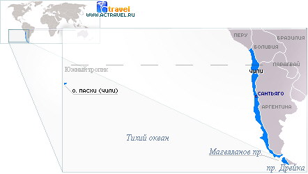
form Easter Island resembles a right triangle. Island of volcanic origin. Extinct volcanoes rise in the corners of the island: early kao(324 m), Pua Katiki(377 m) and Terevaka(539 m, the highest point of the island). The length from west to east is 24 km, from north to south - 12 km. The area of the island is 163.6 km2. 
Administratively Easter Island part of the Chilean region Valparaiso, headed by a governor accredited to the Chilean government and appointed by the president Chile.
Capital easter islands, the only permanent settlement, Hanga Roa located in the southwest of the island. There is an airport near the city Mataveri.
Airport Mataveri built in 1962 by specialists from the American NASA: V pacific ocean urgently needed a space launch tracking base and a reliable runway to rescue astronauts during emergency landings.
Climate of Easter Island
Climate easter islands subtropical. The average annual temperature is 21.8 °C, the coldest month is August (19.2 °C), the warmest is January (24.6 °C). Despite being close to the tropics, temperatures are comparatively moderate. Heat is rare. This is due to the proximity of the cold Humboldt Current.
History of Easter Island

Easter Island known primarily for its numerous stone statues - moai, created ancient civilization islands.
About even the approximate date of settlement easter islands there are still heated debates in the scientific community. It is assumed that the first settlers appeared here from the 300-400s to the 1200s. n. e. According to local legends, the settlers arrived on the island on two huge pirogues with large families. The settlements were founded by the legendary leader and father of all Rapanui Hotu Matu'a.
Who the first Rapanui were and where they came from is also a moot point. Linguistically, the Rapanui language is confidently attributed to the Polynesian group, most researchers consider the Rapanui to come from Eastern Polynesia, ethnically close to the people Maori(New Zealand). It is also interesting that on Easter Island, the only one in the distribution area of \u200b\u200bthe Polynesian languages, there was a written language before the arrival of Europeans. There were at least three writing systems, the best known of which is rongo-rongo- hieroglyphic carving on wooden boards. None of the scripts has been deciphered to date, the last carrier of rongo-rongo was forcibly taken to Peru to slave labor in 1863. 
Famous traveler and explorer Thor Heyerdahl defended the opposite, South American, Peruvian origin of the Rapanui and gave a lot of evidence of the origin of the inhabitants easter islands from South American Indians.
There is also a third, less popular theory about the origin of the Rapanui from the Melanesians, finding cultural parallels on Solomon Islands And New Guinea.
Recorded on Easter Island the legend of the war of two island tribes - long-eared (hanau-eepe) And short-eared (hanau-momoko) is considered by some researchers to be confirmation of the simultaneous presence of different races on the island, most often Peruvians and Polynesians.
The highest cultural flourishing civilization easter islands reached in the XVI-XVII centuries, when the population was supposedly about 10 thousand people.
As a result of an anthropogenic ecological catastrophe (all the forests on the island were cut down, the population was deprived of food sources and material for making boats) and a series of wars, the population had decreased to 2 thousand people by the time the first Europeans appeared on the island. Subsequently, almost all Rapanui were taken to Peru for slave labor. In 1888, when Easter Island annexed Chile only 178 local residents lived on the island. Currently on Easter Island 3.7 thousand people live, about 60% of which are indigenous Rapanui.
The ancient Rapanui were not only extremely warlike, they were engaged in cannibalism - they ate human meat. Fingers and toes were considered a delicacy.
Almost the only documented Rapa Nui rite was the competition to find the first egg, reflected in the popular adventure feature film. Kevin Costner "Rapa Nui": young warriors of different clans on a certain day went swimming on reed bundles to a nearby rocky islet Motu Nui, where they searched for the first egg of the season of the sooty tern. The whole egg must be delivered back to Easter Island and hand over to the leader. The rite was an element of the cult Tangata-manu(bird-man). The Rapanui are sometimes referred to as "bird worshipers". One of the most frequent themes in petroglyphs (rock carvings), after the male and female genital organs, were birds and, especially, the frigate bird, both in the direct image and in the image of a man with the head of a frigate. 

Attractions Easter Island

Moai, ahu, pukao
The main attraction of the island - stone idols - moai(literally from Rapanui - images). As soon as they are not called: statues, and giants, and idols, and colossi. Representatives of our company during the study tour proposed a new term, vividly picked up by domestic tourists - " doldons".
Overwhelming majority " doldons"carved out of the rock of the volcano Rano Raraku. The largest (unfinished) statue measured about 20 m and weighed 270 tons. Moai "doldons" were delivered in a completely incomprehensible way to the coast, where they were installed with their backs to the ocean, facing inland. A total of 997 moai are recorded on the island ( see map about. Easter above).
It is known that moai were considered receptacles of a special magical power - mana ancestors of the Rapanui.
Outwardly, moai are strikingly different from each other, there are several types of statues. Various hypotheses explain the variety of styles either by a gradual change of "fashion" for pictorial means, or by the actual depiction of different island races with their external differences (of course, assuming that ethnically different peoples existed on the island).
Ways to transport giant statues are being discussed by numerous groups of enthusiasts around the world, mathematical calculations and experiments are being carried out, but local legend says that "the moai walked by themselves."
Almost all "doldons" have reached the new time in a fallen form. It is believed that the massive overthrow of the moai took place during inter-clan wars on the island. Currently, many statues are set back to their rightful places.
Moai were installed on a pedestal ( ahu), and sometimes supplemented with a cap ( pukao) from red tuff. It is considered proven that at least some "doldons" had eyes made of white coral. Some of the idols have now reconstructed eyes.
On the slopes Rano Raraku currently there are many unfinished statues at various stages of production. There is a complete impression of the sudden cessation of moai production.
Rano Raraku

Rano Raraku - ancient volcano, on the slopes of which there are about 300 moai, of various heights and at different stages of readiness. Not far from the bay is ahu tongariki, the largest ritual site with 15 statues of various sizes installed on it.
Anakena
Anakena- a bay with a beach of coral sand. According to legend, it was here that the leader and forefather of the Rapanui people landed. Hotu Matu'a. Nearby are ahu Ature-Hooks And Naunau.
puna pau
puna pau- a small volcano where red tuff was mined for the manufacture of pukao hats crowning moai heads.
early kao
early kao- a volcano with the best observation deck of the island. Nearby is ahu Orongo.
Easter Island(Spanish Isla de Pascua) - an island of volcanic origin, belonging, lying in the South Pacific Ocean, between Chile and the island of Tahiti (fr. Tahiti). Together with a small uninhabited about. Sala y Gomez (Spanish Isla Sala y Gómez) forms the commune and province of Isla de Pascua (Spanish Provincia de Isla de Pascua) within the region (Spanish Region de Valparaíso). The local name given to the island by Polynesian whalers is: Rapa Nui(Rapa Nui).
The only city of Hanga Roa (Spanish: Hanga Roa) is the capital of the island.
About 6 thousand people live on the island, about 40% of them are Polynesians or Rapanui, indigenous people, the rest are mostly Chileans. Rapanui people speak the Rapanui language, believers profess Catholicism. On the territory of the island with an area of about 165 km² there are 70 extinct volcanoes. They have not erupted even once in 1300 years from the date of its colonization. The island has the shape of a right-angled triangle with sides of 24.18 and 16 km., At the corners of which rise the cones of extinct volcanoes: Rano Kao (rap. Rano Kao; 324 m), Pua Katiki (rap. Puakatike; 377 m) and Terevaka ( rap Terevaka; 539 m - the highest point of the island). Between them lies a hilly plain formed by volcanic tuffs and basalts. Many underwater caves and a bizarre, steep coastline are formed by lava tubes and influxes.
There are no rivers on Rapa Nui, the main sources of fresh water here are lakes that arose in the craters of volcanoes.
Photo gallery not open? Go to site version.
The climate is subtropical, average monthly temperature from +18°С to +23°С. Mostly herbs grow here, as well as a few eucalyptus and banana plants.
Along with the Tristan da Cunha archipelago, Rapa Nui is considered the most remote inhabited island in the world: the distance to the mainland Chilean coast is almost 3514 km, and to the nearest inhabited place, the Pitcairn Islands (Eng. Pitcairn Islands belonging to the UK) - 2075 km .
Basically, Rapa Nui became famous for its stone giants, in which, according to legend, local population, the mystical power of the ancestors of Hotu Mato'a (Hotu Mato-a), the first king of the island, is enclosed.
Easter Island is undoubtedly the most mysterious island in the world. the globe. With its curiosities and inexplicable mysteries, it attracts the attention of historians, geologists and culturologists like a magnet.
Story
In 1722, a squadron of 3 ships under the command of the Dutch traveler, Admiral Jacob Roggeveen (Dutch Jacob Roggeveen; 1659-1729), heading from South America in search of the riches of the Unknown Southern Land (lat.Terra Australis Incognita), on Sunday, April 7, the day of Christian Easter, she discovered a small island in the South Pacific Ocean. At the council, gathered by the admiral, the captains of the ships signed a resolution proclaiming the opening of a new island. Surprised travelers discovered that on Easter Island (as sailors immediately dubbed it) three different races coexist peacefully: redskins, blacks and whites. Local residents greeted the travelers differently: some waved their hands in a friendly manner, and some threw stones at uninvited guests.
The Polynesians, the inhabitants of Oceania, call the island "Rapa Nui" (rap. Rapa Nui - Big Rapa), however, the islanders themselves call their homeland "Te Pito-o-te-Khenua" (rap. Te-Pito-o -te-henua, which means " the center of the world»).
Formed by a series of large volcanic eruptions, the secluded island has served as a habitat for seabird colonies for millions of years. And its steep, steep banks marked the navigation path for the ships of the Polynesian navigators.
 Legends say that about 1200 years ago on the sandy beach of Anakena (rap. Anakena) King Hotu Mato-a descended and set about colonizing the island. Then, for many centuries, a mysterious society existed on this island lost in the ocean. For unknown reasons, the islanders carved giant statues known as "moai". These idols are today considered one of the most inexplicable ancient artifacts on Earth. The islanders built villages from houses of an unusual, elliptical shape. Presumably, the newly arrived settlers adapted their boats for temporary housing by turning them upside down. Then houses began to be built in a similar way, most of the hundreds of such buildings were destroyed by missionaries.
By the time the island was discovered, its population was 3-4 thousand people. The first settlers found lush vegetation on the island. Giant palm trees (up to 25 m high) grew here in abundance, which were cut down for the construction of dwellings and boats. People brought various plants here, which perfectly took root in the soil enriched with volcanic ash. By 1500, the population of the island already amounted to 7 - 9 thousand people.
As the population grew, separate clans formed, concentrated in different parts of Easter Island, connected by the common construction of statues and the cult that arose around them.
In 1862, Peruvian slave traders took out most inhabitants of the island, destroyed them original culture. In 1888, Rapa Nui was annexed to Chile. Today, the islanders are engaged in fishing, farming - growing sugar cane, taro, sweet potatoes, bananas, and also work on cattle farms and make souvenirs for tourists.
Sights and mysteries of Rapa Nui
Despite its small size, Easter Island has many attractions, both natural and man-made. In 1995, the Rapa Nui National Park (Spanish: el Parque Nacional de Rapa Nui National) was included in the UNESCO World Heritage Register.
The entire territory of the island is an archaeological reserve, a single amazing open-air museum.
There are 2 sandy beaches on Easter Island: located in the northern part of the island, Anakena Beach (Spanish: Playa Anakena), one of the few beaches where swimming is officially allowed, perfect place for surfers. The second beautiful deserted beach located along south coast islands, this is a real gem called Ovahe (Spanish: Playa Ovahe). Ovahe is surrounded by picturesque cliffs, it is much larger than Anaken.
The main attraction of the island and an unresolved mystery that has haunted the minds of scientists for centuries, of course, are the Moai sculptures. Huge ancient statues rise almost everywhere along the southern part of the island.

It is not known why the islanders began to massively create gigantic statues. Their incomprehensible obsession subsequently led to a catastrophic depletion of forest resources. The forest needed to transport the giant moai was mercilessly cut down. The first monolithic human-height sculptures were made from basalt. Then the islanders began to make huge statues (more than 10 meters high, weighing up to 20 tons) from soft volcanic tuff (compressed volcanic ash), an ideal material for sculpture. Located a little inland of the island, the Rano Raraku crater (Spanish: Rano Raraku; a small extinct volcano up to 150 m high) is the place where the famous giants are carved. Hundreds of islanders worked on their creation from morning to evening. Today, here you can see all the stages of painstaking work, unfinished figures are scattered right there. Probably, the production of statues by skillful sculptors took place with the observance of numerous ceremonies and rituals. If a defect occurred during the manufacture of the statue, which was considered a sign of the devil, the carvers abandoned their work and took on another.
When the statue was carved and the bridge connecting it to the rock of the crater was cut off, the figure rolled down the slope. At the base of the crater, the statues were placed in a vertical position, and their final refinement was carried out here. How then were the massive moai transported to various places on the island? Statues weighed up to 82 tons at a height of up to 10 m. Sometimes they were moved and installed at distances of over 20 km!
As the Easter legends say, moai … went to their places on their own. Some researchers believed that they were dragged. Later they came to the conclusion that the figures moved in an upright position. What it really looked like remains one more unsolved mystery civilization of Easter Island.
In 1868, the British tried to take one of the statues home. However, they abandoned this idea, limiting themselves to a small bust (2.5 m high). It was installed in London's British Museum. Hundreds of natives and the entire crew of the ship took part in the process of transporting and loading the "baby".
At the location of the statue, they were installed on ahu (rap. Ahu) - polished stone platforms of various sizes, slightly inclined towards the sea. Then the final stage of the creation of cult figures took place - the installation of eyes made of volcanic glass or corals. The heads of many stone idols were decorated with “hats” (rap. Pukao) made of reddish rock.
Moai pedestals have a height of more than 3 m, a length of up to 150 m, and the weight of their stone slabs is up to 10 tons. About 200 unfinished figures were found near the crater of the volcano, among which there are giants over 20 meters in length.
Over time, the number of moai reached 1000, which made it possible to build an almost continuous line of monuments along the coast of Rapa Nui. The reason why the inhabitants of the tiny island spent time and energy on the creation of numerous giants remains a mystery today.
It is believed that the statues of Easter Island were images of noble representatives of the clans. The typical design of the statue - without legs, with an angular grim face, a protruding chin, tightly compressed lips and a low forehead - remains one of the the greatest mysteries Easter islands. All statues (except seven moai, located in the middle of the island) stand on the coast and "look" at the sky towards the island. Some experts consider them to be the guardians of the dead, who protected the deceased from natural elements with their powerful backs. Mysterious giants, silently lined up on the coast, turning their backs to the Pacific Ocean - like a powerful army guarding the peace of their possessions.
Despite some primitive moai, the statues are fascinating. The giants look especially impressive in the evening, in the rays of the setting sun, when only huge, chilling silhouettes loom against the sky ...
So the Rapa Nui civilization reached its peak, then something terrible happened.
An ominous story about the merciless use of natural resources and the ruin of the island. Europeans who first set foot on Easter Island were amazed at how people could survive in such a deserted place. It ceased to be a mystery when recent research showed that in ancient times the island was covered with dense forest, there was an abundant tropical paradise here.
Apparently, the resources of the island seemed inexhaustible, trees were cut down for the construction of dwellings and canoes, and giant palm trees were used to transport moai.
The destruction of the forest has led to soil erosion and depletion. Meager harvests, lack of food led to armed conflicts between the island clans, moai - symbols of power and success were overthrown. The fight intensified over time, according to legend, the winners ate their enemies to gain strength. In the southwestern part of Rapa Nui there is a cave "Ana Kai Tangata", the name of which is ambiguous: it can mean "a cave where people eat", or it can mean "a cave where people ate". The culture of Rapa Nui, which had been formed over the past 300 years, collapsed.
Due to the lack of a forest, the islanders found themselves cut off from the outside world even more than before. Even fishing was difficult for them. Easter Island turned into a devastated desolate piece of land with depleted soils, with about 750 inhabitants surviving. Under these conditions, the cult of the bird-man was born here. Over time, it acquired the status of the dominant religion on the island, which was practiced until 1866-1867.
Due to the lack of material for the construction of canoes and the possibility of sailing away from the island, the Rapanui people watched with envy the birds soaring in the sky.
 On the edge of the Rano-Kao crater, the ritual village of Orongo (rap. Orongo) was founded, where the god of fertility Makemake (rap. MakeMake) was worshiped and peculiar competitions were held between men of different clans.
In the spring, each clan selected the most physically fit warriors who needed to descend from the steep slopes to the shark-infested sea, swim to one of the islets and bring back an unharmed egg of a sea bird, a dark mallard (lat. Onychoprion fuscatus). The warrior who managed to deliver the egg first was proclaimed the Bird-Man (the earthly incarnation of the deity Makemake). He was awarded an award and special privileges, and his tribe received the right to rule the island for a year, until the next competition.
Also unique to Orongo are the hundreds of centuries-old petroglyphs carved into the hard basalt rock by the Birdmen. There is an opinion that the petroglyphs depict the winners of the annual competitions. About 480 such petroglyphs have been found around Orongo.
The culture of the Rapanui began to revive, perhaps the inhabitants of the island would again be able to flourish, but in December 1862 ships of Peruvian slave traders moored to the island and took away all the able-bodied inhabitants of the island. At that time, the economy was booming and needed labor. Due to poor nutrition, unbearable working conditions and disease, no more than a hundred islanders survived. And only thanks to the intervention of France, the surviving residents of Rapa Nui were returned to the island. At the time of the annexation of the island to Chile in 1888, about 200 indigenous people lived here.
Missionaries who arrived on the island discovered a declining society here, and it did not take long for its inhabitants to convert to Christianity. Changes were immediately made to the clothing of the indigenous population, or rather, its complete absence. The inhabitants of the island were deprived of their original lands, they lived in a small part of the island, while the arrived farmers used the rest of the land for agriculture.
Tattoos were banned, houses and ritual shrines were destroyed, works of art of the Rapanui were destroyed. All were destroyed wooden sculptures islands, religious artifacts, and, most importantly, "" (rap. Rongo Rongo) - wooden planks of the "talking tree", dotted with unique writing. Easter Island is the only island in Polynesia whose inhabitants developed their own writing system. Ancient legends, legends, religious chants were carved with a shark's tooth on planks of dark toromiro wood, only a few of which have survived to this day. Kohau tablets with images of a winged bird-man, frogs, turtles, lizards, stars, crosses and spirals inscribed on them are another mystery of the outlandish island that scientists have not been able to decipher for more than 130 years. Now only 25 left rongo-rongo scattered throughout the museums of the world.

In 1988, Rapa Nui gave scientists another surprise. During excavations in a small swamp in the depths of the island, Australian scientists found the remains of a medieval knight in full gear, sitting on a war horse. In peat, which has preservative properties, the knight and horse are well preserved. Judging by his armor, the knight was a member of the German Catholic Livonian Order (1237-1562). In a belt purse, gold Hungarian ducats minted in 1326 were found; these coins were in circulation in Poland and Lithuania. Scientists could not explain how the rider ended up thousands of kilometers away in a remote pacific island. Before the discovery of America (1492), more than 150 years remained from 1326! Thoughts about the existence of the phenomenon of teleportation involuntarily arise. No more, more or less convincing arguments explaining the appearance of a medieval crusader knight on Easter Island have been found to this day.
A little sad digression
The phenomenal Easter Island, which is a small piece of land (only 165 m²), at the time of the construction of the mysterious giants, was 3-4 times larger than before. Some part of it, like Atlantis, disappeared under water. Into the quiet sunny weather areas of flooded land are visible through the water column. There is even such an incredible version: the mysterious Easter Island is a tiny surviving part of the progenitor of mankind, the mythical mainland of Lemuria, which sank about 4 million years ago.
And the pearl island, located in Oceania far from civilization, suggests certain thoughts and conclusions. The history of Easter Island is a miniature copy of the history of our time. She is able to teach an object lesson to us, the inhabitants of planet Earth. All of us, in essence, are the inhabitants of the island, floating in the endless ocean.
(+15
points 3
ratings)
Easter Island
EASTER ISLAND, RAPA NUI
Island in the South Pacific, Chile. The area is 163.6 square kilometers. Along with the archipelago Tristan da Cunha is the most remote inhabited island in the world. The distance to the mainland coast of Chile is 3,703 km, to Pitcairn Island, the nearest inhabited place, is 1,819 km. The island was discovered by the Dutch traveler Jacob Roggeveen on Easter Sunday 1722. The capital of the island and its only city is Hanga Roa. In total, 4,888 people live on the island.

Easter Island is largely known for its moai, or stone statues made of compressed volcanic ash, which, according to the locals, contain the supernatural power of the ancestors of the first king of Easter Island, Hotu-Matu'a. In 1888, Easter Island was annexed by Chile. In 1995, Rapa Nui National Park became a UNESCO World Heritage Site.
Easter Island has many names:
Hititeairaghi, or Hit-ai-ranks;
Tekaouhangoaru;
Mata-ki-te-ragi(translated from Rapanui "eyes looking at the sky");
Te-Pito-o-te-henua(translated as "the navel of the earth");
Rapa Nui("Great Rapa"), a name mainly used by whalers;
san carlos island(so named by González Don Felipe in honor of the King of Spain);
Teapi(as James Cook called the island);
Waihu, or waihou, (this name was also used by James Cook, and later by Forster Johann Georg Adam and Laperouse Jean Francois de Galo);
Easter Island(so named by the Dutch navigator Jacob Roggeveen because he discovered it on Easter Day 1722).

Most often, Easter Island is called Rapa Nui, although it is not of Rapanui, but of Polynesian origin. The island got its name thanks to the Tahitian navigators who used it to distinguish between Easter Island and Rapa Island, which lies 650 km south of Tahiti. The very name "Rapa Nui" has caused a lot of controversy among linguists about the correct spelling of this word. Among English speakers, "Rapa Nui" (2 words) is used to refer to the island, and "Rapanui" (1 word) is used when referring to a people or local culture.

The island has the shape of a right triangle, the hypotenuse of which is the southeast coast. The sides of this "triangle" are 16, 18 and 24 kilometers long. Extinct volcanoes rise in the corners of the island: Rano Kao (324 m) near the settlement of Mataveri; Pua Katiki (377 m) and Terevaka (539 m - the highest point of the island).
The highest crater of the Terevaka volcano is called Rano-Aroi (about 200 m). Actually "Rano-Aroi" is the name of the lake that fills the extinct crater.

Another Terevaka crater - Rano Raraku (160 m) is also a lake with a large supply of fresh water, surrounded by reed beds. The diameter of this crater is about 650 m.
The diameter of the Rano Kao crater is about 1,500 m, the depth is 800 m. The volcano has a symmetrical shape and is surrounded by hilly terrain. The southern slope breaks off into the ocean.

Vegetation is more abundant on the inner slopes of volcanoes. This is due to more fertile soil, the absence of strong winds and the "greenhouse effect".
Easter Island is of volcanic origin. The soil was formed as a result of erosion of the slopes of volcanoes. The most fertile soil is located in the north of the island, where locals grow sweet potatoes and yams. The most common rocks on the island are basalt, obsidian, rhyolite and trachyte. Sheer cliffs in La Perouse Bay (locally called Hanga Hoonu) are made up of red lava.

The island is surrounded by small islands: at the southeastern tip - Motu Nui (the largest island on which the military leaders of the inhabitants of Rapa Nui were elected in the distant past), Motu Iti, Motu Kao Kao (a magnetic anomaly is observed near this island), at the western tip - Motu-Tautira and at the eastern tip - Motu-Marothiri.
The climate of Easter Island is warm, subtropical. The average annual temperature is 21.8 degrees Celsius, the coldest month is August (19.2 degrees Celsius), the warmest is January (24.6 degrees Celsius). The island lies near the southern border of the zone of southeasterly winds blowing in summer. In winter, the northwest prevails, but there are also southwest and southeast winds. Despite the proximity to the tropics, the climate on the island is relatively temperate. Heat is rare. This is due to the proximity of the cold Humboldt Current and the absence of any land between the island and Antarctica. Winds from the Antarctic in July-August often reduce the daytime air temperature to 20 degrees Celsius.

The main source of fresh water on the island is lakes formed in the craters of local volcanoes. There are no rivers on Rapa Nui, and rainwater easily seeps through the soil, forming groundwater flowing towards the ocean. Since there is not much water on the island, local residents in the past built wells and small reservoirs everywhere.
The flora of the island is very poor: experts count no more than 30 species of plants growing on Rapa Nui. Most of them were brought from other islands in Oceania, America and Europe. Many of the plants that were once widespread in Rapa Nui have been extirpated. Between the 9th and 17th centuries, there was an active felling of trees, which led to the disappearance of forests on the island (probably, before that, palm trees of the Paschalococos disperta species grew on it). Another reason was the eating of tree seeds by rats. Due to unsustainable human activities and other factors, the resulting accelerated soil erosion caused enormous damage to agriculture, resulting in a significant reduction in the population of Rapa Nui.

One of the extinct plants is Sophora toromiro, whose local name is "toromiro". This plant on the island in the past played an important role in the culture of the Rapanui people: it was used to make "talking tablets" with local pictograms.
The trunk of a toromiro, with a diameter of a human thigh and thinner, was often used in the construction of houses; spears were also made from it. In the 19th-20th centuries, this tree was exterminated (one of the reasons was that the young growth was destroyed by sheep brought to the island).

Another plant on the island is the mulberry tree, locally called mahute. In the past, this plant also played a significant role in the life of the islanders: white clothes called "tapa" were made from the bast of the mulberry tree. After the appearance of the first Europeans on the island - whalers and missionaries - the importance of mahute in the life of the Rapanui people decreased.
The roots of the tee plant, or Dracaena terminalis, were used to make sugar. Also, this plant was used to make a powder of dark blue and green, which was then applied to the body as tattoos.
Makoi (Thespesia populnea) was used for carving.

One of the surviving plants of the island, which grows on the slopes of the Rano Kao and Rano Raraku craters, is Scirpus californicus, used in the construction of houses.
In recent decades, a small growth of eucalyptus has begun to appear on the island. In the XVIII-XIX centuries, grapes, banana, melon and sugar cane were brought to the island.

Before the Europeans arrived on the island, the fauna of Easter Island was mainly represented by marine animals: seals, turtles, crabs. Until the 19th century, chickens were bred on the island. The species of local fauna that previously inhabited Rapa Nui have become extinct. For example, the species of rat Rattus exulans, which in the past was used by the locals for food. Instead, rats of the species Rattus norvegicus and Rattus rattus were brought to the island by European ships, which became carriers of various diseases previously unknown to the Rapanui.
Now 25 species of sea birds nest on the island and 6 species of land birds live.

During the cultural heyday of Easter Island in the 16th and 17th centuries, the population of Rapa Nui is estimated to have been between 10,000 and 15,000 people. Due to the ecological catastrophe that broke out as a result of the anthropogenic factor, as well as clashes between the inhabitants, the population by the time the first Europeans arrived was reduced to 2-3 thousand people. The number of 3,000 inhabitants was also indicated by James Cook when visiting the island. By 1877, as a result of the export of local residents to Peru for hard labor, epidemics, and extensive sheep breeding, the population decreased even more and amounted to 111 people. By 1888, the year of Chile's annexation of the island, 178 people lived on the island.

At the beginning of the 20th century, a significant part of the population of Rapa Nui (mostly young Rapanui) moved to mainland Chile. It wasn't until the 1950s, as living standards improved, that there was some improvement in the island's demographics. By 1960, more than 1,000 people already lived on Rapa Nui.
According to the 2002 census, 3,791 people lived on the island (for example, in 1988 - 1,938 people). At the same time, 200-300 Rapanui lived on the mainland of Chile, Tahiti and in the USA. The growth was largely due to the resettlement of part of the Chileans from the mainland to Easter Island. The ratio of the indigenous and visiting population has changed. If in 1982 the number of Rapanui on the island was 70%, then in 2002 it was only 60%. The remaining 39% were Chileans, 1% were other peoples. The population density on the island is 23 people per square kilometer (by comparison, in Germany - 230, in Russia - 8.4).

In the middle of the 19th century, there were 6 permanent settlements on Rapa Nui: Anakena, Tongariki, Vaihu, Vinapu, Mataveri and Hanga Roa. Currently, almost the entire population lives in Hanga Roa, administrative center Easter islands. Mataveri and Moeroa in the southwest are often seen as one settlement.
The official language on the island is Spanish, as well as Rapanui. The inhabitants are predominantly Catholic.
Moai of Easter Island
Moai - stone statues on the coast of Easter Island in the form of a human head up to 20 meters high. Contrary to popular belief, they do not look towards the ocean, but inland. Some moai have red stone caps. Moai were made in quarries in the center of the island.

How they were delivered to the coast is unknown. According to legend, they "walked" on their own. Recently, enthusiastic volunteers have found several ways to transport stone blocks. But what exactly the ancient inhabitants used (or some of their own) has not yet been determined. The Norwegian traveler Thor Heyerdahl in his book "Aku-Aku" gives a description of one of these methods, which was tested in action by local residents. According to the book, information about this method was obtained from one of the few remaining direct descendants of the Moai builders. So, one of the Moai, overturned from the pedestal, was hoisted back by using logs slipped under the statue as levers, by swinging which it was possible to achieve small movements of the statue along the vertical axis. Movements were recorded by lining the upper part of the statue with stones of various sizes and alternating them. Actually, the transportation of the statues could be carried out by means of a wooden sledge. This method local presents as the most likely, but he himself believes that the statues still reached their places on their own.

Many unfinished idols are in the quarries. A detailed study of the island gives the impression of a sudden cessation of work on the statues.
Rano Raraku is one of the most interesting places for tourists. At the foot of this volcano there are about 300 moai, of various heights and at different stages of readiness. Not far from the bay is ahu Tongariki, the largest ritual site with 15 statues of various sizes installed on it.

On the shores of Anakena Bay is one of the most beautiful beaches of the island with crystal white coral sand. Swimming is allowed in the bay. Picnics are organized for tourists in palm groves. Also, not far from the Anakena Bay, there are ahu Ature-Khuki and ahu Naunau. According to ancient Rapanui legend, it was in this bay that Hotu-Matu'a, the first king of Rapa Nui, landed with the first settlers of the island.
Te Pito-te-henua ("Navel of the Earth") - a ceremonial platform on the island of round stones. Quite a controversial place on Rapa Nui. Anthropologist Christian Walter claims that Te Pito-te-henua was established in the 1960s to attract gullible tourists to the island.
There is an observation deck on Rano Khao volcano. Nearby is the Orongo ceremonial site.

Tourism is the main source of income for the population. The only regular flight service to Easter Island is operated by the Chilean airline LAN Airlines, whose planes depart from Santiago in Tahiti, making an intermediate landing on Easter Island. Domestic flights are carried out according to the scheme Santiago - Easter Island - Santiago. Depending on which ticket you ordered, international or domestic, the departure takes place from two different terminals of the airport in Santiago. The flight schedule depends on the time of the year. In December-March flights are carried out several times a week. The rest of the year - once or twice a week. The flight lasts about 5 hours. Starting from November 2010, you can also get to Easter Island by direct flight from the capital of Peru - Lima. All planes land at the only airport on Easter Island - Mataveri. Rapa Nui has only one marina for small ships. There is no regular shipping communication with other parts of the planet.

There are several hotels on the island, including four- and three-star levels. Rapa Nui prices are very high. This is due to the fact that most of the products are imported. The sights of the island can be reached by taxi, rented cars, bicycles, horses or on foot.
Since 1975, the island has been hosting the Tapati festival every year in late January - early February, accompanied by dances, chants and various traditional Rapanui competitions.


