Great navigators left Lisbon. Vasco da Gama, Portuguese explorer of the Age of Discovery
The African port of Ceuta, captured by the Portuguese in 1418, became the first springboard for the implementation of the Atlantic expeditions. The main initiator and inspirer of the development of new lands was the Portuguese Infante Enrique (Henry). The nickname "Seafarer" given to him by his contemporaries testifies to the role he played in initiating long-distance sea voyages. The main task that Henry the Navigator set was to find out how far south of Africa the lands of Muslim states stretch.
It was supposed to lay a trans-African trade route bypassing the countries of Islam. Travels were also motivated by the search for the mythical Christian kingdom of Prester John. Some thought it was on Far East, others in the South. Wealthy merchants and shipowners were involved in organizing the expedition. The first significant geographical discoveries of Portuguese navigators were the island of Madeira (1419) and Azores (1427).
Geographical searches in the Middle Ages were held back in part by myths about the existence of the limits of the earth - boundaries, the crossing of which is mortally dangerous for humans. One of these limits was considered Cape Nun off the coast of modern Morocco. Starting from the 20s. 15th century this line was regularly crossed by Portuguese navigators. As a result, the myth about the limits of the ecumene was dispelled. After Captain Gil Eanesh reached Cape Bojador in 1434, the speed of sea progress to the south averaged one degree per year. In 1446, Captain Dinis Dias reached the territory of Senegal; a year later, another Portuguese captain, Alard Fernandez, advanced almost to the coast of Sierra Leone.
Travel has been supported catholic church. According to the bull of 1455 of Pope Nicholas I, all the lands and seas discovered south of Cape Bojador were transferred to the possession of the Portuguese king Afonso V and his descendants. Since that time, the royal authorities of Portugal have set the task of laying a sea route around Africa to India. The context of the relevant papal decisions was determined by the fall of Constantinople in 1453 and the capture of the old trade routes by the Ottoman Turks. In this regard, Afonso V was instructed to make a geographical map of the world.
In 1456, Captain Diogo Gomes reached the territory of modern Cape Verde. From the 60s. 15th century actively developing African coast Gulf of Guinea, from where Portuguese caravels brought gold and ivory to Europe. However, the death in 1460 of Infante Enrique led to a sharp decline in the number of Portuguese travels.
A new impetus to the travels of Portuguese sailors was given in 1469 to the merchant Fernand Gomes the right to a monopoly on trade in the Gulf of Guinea. In exchange, Gomes undertook to explore 100 miles in southbound. Moving further south Portuguese sailors crossed the equator. The development of the Southern Hemisphere began.
Further development of the lands of southern Africa was facilitated by the opening in 1481 by King Juan II of a trading post on the Gold Coast. In 1482, the Portuguese entered the mouth of the Congo River, and by 1486 they reached the territory of Namibia. In 1488, an expedition led by Bartolomeu Dias reached the southernmost point of Africa, which he called "Cape of Storms." Rounding the African continent from the south, the European expedition for the first time traveled from the Atlantic to Indian Ocean. Almost at the same time, Pierre de Covilhã, secretly sent by the Portuguese king to search for the kingdom of Prester John, came overland to Ethiopia and India. The information he collected proved that there was a sea route from Europe to Asia. These discoveries of Portuguese travelers refuted the ideas that had prevailed since the time of Ptolemy about the encirclement of the Indian Ocean on all sides by land. The Cape of Storms was renamed Cape Good Hope, indicating the hope of reaching India by sea route.
Not only a country with wonderful climate And magnificent beaches, but also with a long glorious history. The past of Portugal is marked by many years of yoke of various conquerors, and from the beginning of the 15th century, it itself acquires the status colonial empire. A small state in the southwest of Europe, with a territory only twice the size of the Moscow region, owned colonies on the western and eastern coasts of Africa, in eastern India. And the largest colony was in South America- Brazil.
The foundations of maritime and colonial dominance on the West Coast of Africa were laid by the son of King Juan I, Enrique. Beginning in 1415 and until his death in 1460, he organized several expeditions, which resulted in the colonization of the coast from north Africa to the equator. In addition to capturing and exploring the lands, the Portuguese were interested in mapping and spreading Christianity.
The result was impressive - ships with gold and slaves reached the country. Enrique received a monopoly on the slave trade. At the same time, the expeditions gave impetus to the development of shipbuilding, ships were needed that could deliver a large number of cargo.
The economy of the state, as you know, determines its policy. Export of Portugal in those years was not great. The country has grown, and still grows, wheat and maize, olives and almonds, grapes and citrus fruits. But the main obstacle to active foreign trade was geographical position country: it was far from the existing trade routes. The search for new trade routes was vital. And these routes were found.
Discovered by Portuguese navigators sea route to india . In 1487, the expedition of Bartolomeo Dias, sailing along the west coast, discovered South coast Africa. Prior to this discovery, it was believed that Africa stretched far to the south. So the Cape of Good Hope was opened, hopes for the opportunity to find a sea route to the coveted India with its riches.
This path was found ten years later by the sailors of Vasco da Gama. At the same time, the lands of East Africa and West Coast India, now Goa.
The largest Portuguese colony, Brazil, was discovered in 1500 by the expedition of Pedro Álvares Cabral. The famous Florentine and Spanish navigator Amerigo Vespucci served in the Portuguese navy for five years, from 1500 to 1504. Having sailed to the shores of America on Spanish ships in 1499, he contributed to the exploration of Brazil by the Portuguese.
A practical confirmation of the spherical shape of the Earth was the discovery of an expedition led by the Portuguese Ferdinand Magellan. In 1519, his ships, moving along east coast South America, found a strait between the mainland and the archipelago Tierra del Fuego, Strait of Magellan.
The value of the great geographical discoveries of the Portuguese navigators is unusually high, their honor and glory forever belongs to Portugal.
Yuri Trifonov
By the end of the 15th century, Europeans were quite ready for long-distance sea voyages. On geographical maps they began to depict the cardinal directions, a grid of parallels and meridians, and scales of distances. Back in the 14th century, the Chinese compass was improved in Italy: the floating magnetic needle was now attached to a disk with divisions. Based on the Arab ships with a slanting sail, the Spaniards and the Portuguese created new type ship - caravel. These ships could keep their course in any direction of the wind with the help of an oblique sail and at the same time develop great speed thanks to the direct sails. They were small in size, did not require a large crew, and at the same time were so high that it made it possible to store enough provisions in the holds.
Henry the Navigator
One of the first who was carried away by the idea of long-distance sea voyages was the Portuguese prince Henry the Navigator(1394-1460). As a young man, he learned from books about the possibility of reaching countries rich in gold, moving on ships around Africa.
Prince Henry sent ships south every year, but the captains, having brought the ships to Cape Bojador (26 ° north latitude), turned back. The view of the desert shores hot by the sun terrified the sailors, reminding them of the flaming abyss of hell, where the souls of sinners burn. There was a legend that the navigator who rounded Cape Bojador would never return. Between the sailors there were conversations: “How can we step over the boundaries drawn by our ancestors, and how much benefit will there be from the death of our souls and our bodies?” Only in 1434, one of the captains, fearing the wrath of Prince Henry, overcame fear and went around the "devil's" cape. As proof of the existence of life in the south, he presented his ruler with wild roses brought from there.
Every year, the Portuguese ships went further and further south, moving along the coast of Africa. Each new expedition brought reports of unprecedented animals and plants, strange customs of the black inhabitants of this continent.
Bartolomeu Dias and the Cape of Good Hope
Finally, in 1488, the crew of the ship Bartolomeu Dias(1450-1500) managed to go the farthest. The exhausted team demanded to turn to their native shores. It cost the captain incredible efforts to persuade the sailors to sail a little more. Two days later, the flotilla sailed to the cape, behind which the African coast turned to the north. The Indian Ocean stretched out before the sailors. Subsequently, this cape was called the "Cape of Good Hope" - the hope that soon the sea route to India would be opened.
Vasco da Gama travel to India
After 10 years, on July 8, 1497, four ships sailed off the coast of Portugal, led by a confidant of the king, a nobleman Vasco da Gama. They prepared for the expedition very seriously: they selected people who could be relied upon and who possessed the necessary knowledge, maps were verified, navigation devices were purchased. On the way, we often had to repair wind-worn ships. From the lack of fresh fruits and vegetables, the sailors suffered from scurvy. Their teeth fell out, their bones ached, and many died. Already beyond the Cape of Good Hope, the sailors met with Arab merchants. Not wanting to let rivals into India, the Arabs refused to give the Portuguese a pilot familiar with the winds and currents of the Indian Ocean. Only by chance in one of the ports did they manage to hire an Arab sailor.
In May 1498 Vasco da Gama's flotilla saw the shores of India. In the huge port of Calicut (the modern city of Calcutta), the local sultan allowed the Portuguese to stand next to the Arab and Indian ships and buy pepper and spices. Only two ships and less than half of the sailors held the path to their native shores, but the goods they brought were sold at a price many times greater than the cost of their purchase, equipment and the entire expedition. material from the site
Portuguese India
Now in Portugal everyone was ready to rush for oriental goods. Lacking the strength to capture vast territories, the Portuguese limited themselves to occupying convenient bays. Small fortresses were erected on their banks - forts, bristling with cannons. At first they were built along the entire African coast. After that, a large Portuguese fleet entered the Indian Ocean and began to destroy Arab merchant ships. Having become the masters of the Indian Ocean, the Portuguese forced the rulers of the coastal cities of India to trade spices only through them. Portuguese trading settlements arose near Indian cities - trading posts. In 1510, the Portuguese captured the first Indian city on the coast - Goa. A fortress was created here, soldiers settled. The King of Portugal appointed and sent there the Viceroy of the Portuguese possessions in India.
Moving further east, the Portuguese found out that the spices themselves were produced not in India, but on the islands of Indonesia. Having reached them in 1511, the Portuguese squadron approached the port of Malacca. Merciless cannon fire destroyed the walls of the fortress and put to flight even the war elephants of the local ruler. So in the hands of the Portuguese was the strait, through which all the trade in spices went. Now nutmeg and cloves were shipped directly to Europe. Along the established local trade routes, the Portuguese soon reached China and Japan, where their trading posts also appeared. All forts, trading posts and local cities became Portuguese colonies, that is, territories deprived of local government and under the authority of officials sent from the invader country - metro-poly.
Portuguese discoveries in America
Questions about this item:
“What is the most important thing in traveling?See, understand, enjoy, love!
Colors, shapes, aromas, tastes add up
into vivid pictures in memory, so that later we
could look at them all my life"
About the country, its history and people
Portugal is one of the oldest countries in Europe with rich history. Portugal is charming country, which can be called a quiet European province, where virgin nature serenely coexists with a developed tourist infrastructure, and respect for national customs coexists peacefully with pan-European traditions.
The country of great navigators Portugal is located in the western part of the Iberian Peninsula. In the south and west it is washed by the waters of the Atlantic Ocean, on land it borders on Spain. Portugal includes the Azores, located in the Atlantic Ocean about 1,450 km west of Lisbon, and the island of Madeira, 970 km southwest of Lisbon, which are autonomous regions of Portugal. The area of the country, together with the islands, is 92.39 thousand square meters. km.
The name of the country comes from the name of the Roman settlement of Portus Cale at the mouth of the Douro River. In 1139, Portugal became an independent kingdom from Spain. At that time, it occupied only the northern third of its modern territory. In 1249, the last Muslim ruler in the south of the country was expelled, and since then its borders have changed little. The era of conquest began in the 15th century, when Portuguese maritime explorers such as Bartolomeu Dias, Vasco da Gama, Ferdinand Magellan traveled around the world, making great geographical discoveries. By the 16th century, the territories they discovered formed a huge empire that stretched from the coast of Brazil to Africa and Asia. It was during this era that the economy of Portugal reached its greatest prosperity.
In 1910, the monarchy was overthrown in Portugal, and in 1974 a democratically-minded military junta put an end to the dictatorial regime that had existed since 1926. Portugal is one of the few countries in Europe that was not occupied by Nazi troops during World War II.
The constitution adopted in 1976 declared Portugal a parliamentary republic with direct elections and universal adult suffrage.
By handing over the last of its overseas territories, Macau, Macau, which it had held since 1680, to Chinese rule in 1999, Portugal ended a long and sometimes turbulent colonial era in its history.
The events of Portuguese history had a huge impact on the culture of the country and introduced the features of Moorish and Oriental styles into architecture and art. Traditional folk dances and tunes, especially lyrical fado, do not lose their significance to this day, which can be seen and heard right on the streets. According to one version, the name fado comes from the Latin word fatum, which means fate. The melodies of the songs harmoniously combine Moorish, African and Brazilian melodies, the theme of loneliness, longing and foreboding of a sad fate runs through all the songs, but this does not mean that this type of music is suitable only for melancholics. The ability to sing of sadness, to turn it into an object of admiration is one of the national traits of the Portuguese, and it is not without reason that for several centuries almost every family in this country has been waiting for sons and husbands who set off to conquer the sea, and the journey could end in the most unpredictable way.

The population of the country is mono-ethnic, 99% of the 10.8 million population are Portuguese. Many peoples have settled on the Iberian Peninsula for a long time. The most ancient inhabitants - the Iberians - were undersized and swarthy. Over the centuries, the appearance of the Portuguese was formed under the influence of the Celts, Phoenicians, Greeks, Romans, Arabs, as well as Germanic tribes (Visigoths and Alemanni).
Portugal is a monolingual country. Official language- Portuguese. It is spoken by more than 200 million people worldwide on three continents: Eurasia, Africa and South America. This language has similarities with Spanish, since both belong to the Ibero-Romance subgroup of the Romance group of languages, however, with a similar grammatical structure, there are significant differences in pronunciation between them. The formation of the language was greatly influenced by the Germanic tribes and the Arabs (Moors), from whom the Portuguese language borrowed many words, as well as the contacts of travelers, discoverers and merchants with Asian peoples.
National features: Do not question the historical greatness of the country - the Portuguese are proud of their past, especially against the backdrop of the modest place that the country occupies today. The Portuguese are very painful to compare them with the Spaniards, despite the similarity of languages, characters and national cultures. Bullfighting is also popular here, but, unlike the Spanish bullfight, where the bull is killed, in Portuguese the animal is pacified by a team of unarmed fighters (forkados).
In this country, the percentage rural population- one of the highest in Western Europe, many foreigners work at its factories, construction sites and fields, including from Ukraine. Average annual income per capita: 22,500 USD (data from the World Bank, 2011). Average life expectancy is approaching 80 years. As in other countries, women in Portugal live longer, almost 82 years, while men still do not reach 76. The retirement age is 65 years, and the actual retirement age is 61-62 years.
Portugal is a country of great sea voyages, grandiose geographical discoveries and tart port wine. Mild climate, fresh forest and meadow aromas, light ocean breeze And endless expanses Atlantic, unique architecture in the style of "Manueline" and strong coffee ... All this deserves to get to know this interesting country better.
Wgetting to know Porto
They say about the cities of Portugal: they pray in Braga, they work in Porto, they party in Lisbon. My acquaintance with Portugal began from Porto. Porto, the second most populated city in Portugal with a population of 240 thousand inhabitants, gave its name not only to port wine, but to the whole country. The historical center of Porto is located on the right bank of the Douro River, a few kilometers from its confluence with the Atlantic Ocean. The city center has been declared a World Cultural Heritage by UNESCO.
Porto is well known for its entrepreneurial spirit, distinctive culture and local cuisine. The city is often called northern capital Portugal. Porto is home to the largest university in Portugal (about 29,000 students).
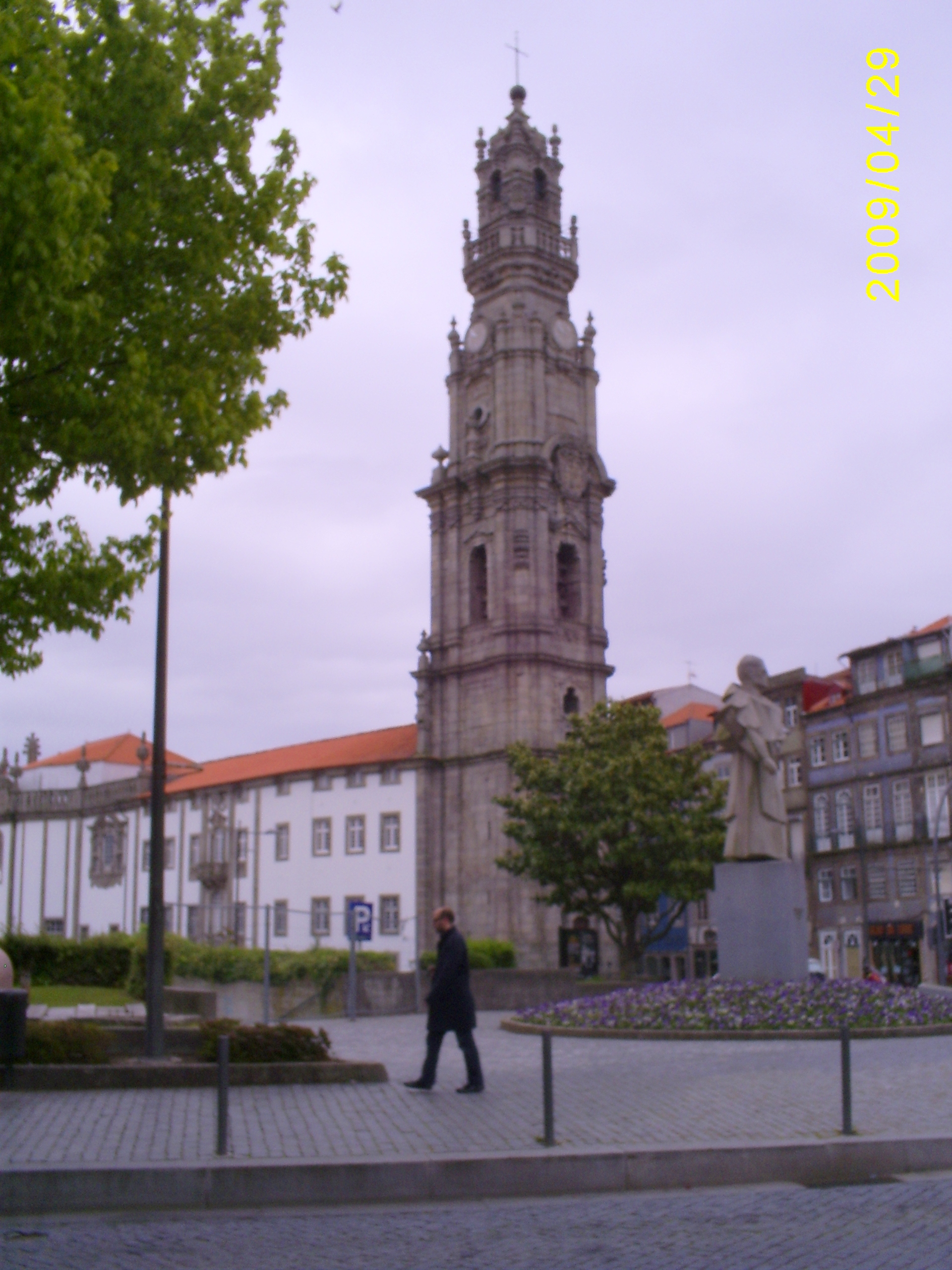
One of the most striking sights of Porto is the Clerigos Tower - the highest in Portugal - 76 meters or 225 steps. The baroque church was built for the brotherhood of clerics ("Clerigos") by the architect Nicola Nasoni according to the Roman scheme. Its construction began in 1732 and ended in 1750 with the construction of a monumental staircase. July 28, 1748, despite the fact that the building was not yet fully completed, the church was opened for worship. Torre dos Clerigos has become the symbol of the city of Porto. She happens to be national monument since 1910.
The city is famous for the production of different brands of port wine. We visit one of the ancient "port wine houses" - Galem, get acquainted with the history and features of the production of this popular drink. And, of course, we taste some varieties, and whoever wants to buy the wines they like. Warming up the appetite with tasting wines, we begin our acquaintance with Portuguese cuisine in one of the restaurants, where we enjoy the national fish dish called “bacalau”.
Having refreshed ourselves with “bacalau” and tasting port wines, we walked with pleasure along the embankment of the Douro River, where such pretty boats float.

Four bridges are thrown across the Douro River, connecting the historical part of the city with Vila Nova de Gaia, a small neighboring town where the world-famous port wine is stored. One of the bridges (by Louis the First) was built according to the design of Gustave Eiffel: a two-tier structure of impressive size seems openwork and light.

On the highest point of the old city, the Se Cathedral was built. Erected in the 12th century on a granite rock, it originally served as a fortress. Later it was rebuilt, but it has retained its severe appearance to this day. Inside the cathedral is not very interesting. Decor lovers will be impressed by the luxurious silver altar, the construction of which took 800 kg of silver, and the patio, lined with the famous Portuguese azulejo tiles.

WITH Cathedral Square opens beautiful view to the city.

From the cathedral to the river, the descent goes through the poorest district of Porto. The area of luxurious villas is located near the ocean. You can get here on the current tram-museum, which has not changed since 1930. It's called the Electric Machine Museum. However, each of Porto's trams can serve as an exhibit: inside vehicle upholstered in wood, the driver rules it while standing, for the simple reason that there is no seat for him. When the tram reaches the end point of the route, the driver moves from the head to the tail, where there is also a cab, and drives his car in a “reverse course”: the rails in Porto end in a dead end. The most scenic route runs along the ocean coast. From the windows of noisy and old trams you can see fashionable villas, chosen by wealthy people from all over Europe.
Porto, like other Portuguese cities, is distinguished not only by its peculiar architecture, but also by the fact that many houses are lined with multi-colored tiles.

From the early Middle Ages to the 17th century, there was a law that forbade the aristocracy not only to build, but also to stay in the city for more than three days. Even the king did not have his residence in Porto. He was visiting Bishop's Palace built by Nicolo Nazzoni. It is a masterpiece of 18th century Portuguese Baroque architecture. The port city is located all on the hills, it has many funny houses and streets.

It was also interesting to visit the store and a kind of book museum Livraria Lell - the oldest in Portugal and one of the most incredibly beautiful bookstores in the world. Unusual, simply fabulous interior, which is located on two floors of the store. Spectacular and massive decoration of the walls, ceiling, everything is made of noble wood using original and unusual carvings, combined with the surprisingly curved lines of the red staircase that leads to the second floor. No less impressive is the magnificent ceiling made of expensive stained glass. The bookstore is located five minutes walk from the city center.

This pretty fountain caught our attention.

Not to mention the visit railway station Sao Bento. In addition to its direct destination, Sao Bento Station is interesting for its wall-paintings, lined with azulejos tiles in white and blue tones. The largest of them is made of 20 thousand tiles and decorates the waiting room. This panel completely occupies one of its walls. The picture depicts episodes from the history railways, as well as important moments in the history of Portugal.

When leaving Porto, behind the fortress walls, my first meeting with the Atlantic Ocean took place. I go knee-deep into the ocean, the water is quite cool, but you can still take a dip.
Two days in Lisbon
Lisbon is the capital of Portugal and The largest city countries. 570 thousand people live in it. It is located on the right bank of the Tagus River, which flows into the Atlantic Ocean. Its history goes back about 20 centuries. Lisbon was built on seven hills, like Rome and Moscow. Just like Moscow, Lisbon is patronized by George the Victorious. The city became the capital of the state in 1147 after the liberation from Arab colonization. Lisbon owes this to the first king of Portugal, Alfonso Henriquez. Based main city The country was the Phoenicians as a stop at the crossroads of sea routes and named Alis Ubbo - a blessed bay. The city was under the control of the Roman Empire, the Moors, the Spaniards.

We begin our acquaintance with the center of Lisbon - one of the main attractions. In the 18th century, bullfights and public executions took place here. We visit the park of Edward VII and the monument to the Marquis de Pombal. This is a large green meadow with neatly trimmed bushes of the correct geometric shape.
Lisbon is a modern European city located on 15 hills. Walking on it you have to constantly go up and down from the hills. We climb one of the hills, where with the help of a guide we get acquainted with the Moorish fortress of Sant Jorge. Once upon a time, Portuguese kings lived here, and now only a shell with pine groves inside. But this is the highest point of Lisbon and the views from here are appropriate. From the fortress walls you can see a strange structure - openwork frames of arches sticking into the sky. To take in the views of the Tagus River and ancient area Lisbon Alfama, we walked along the esplanade and climbed the rampart old fortress. The fortress of San Jorge (St. George) has been a fortification covering the mouth of the Tagus River since ancient times. In 1147, King Alphonse Enriques converted the fortress into a royal residence. In 1511, King Manuel I built himself a palace outside the fortress, and here he placed an armory and a prison. During the earthquake of 1755, the fortress was very badly damaged, and only in 1938, under Salazar, the ruins were restored, and only a few details were preserved, reminiscent of the original Moorish Alcasava, later - royal residence where Vasco da Gama celebrated with pomp the success of his trip to India. The fortress walls have been restored and now you can walk along them around the old quarter of Santa Cruz. Various exhibitions are arranged in the fortress towers, telling about the history of the fortress and the whole city. The viewpoints offer a magnificent view of Lisbon.

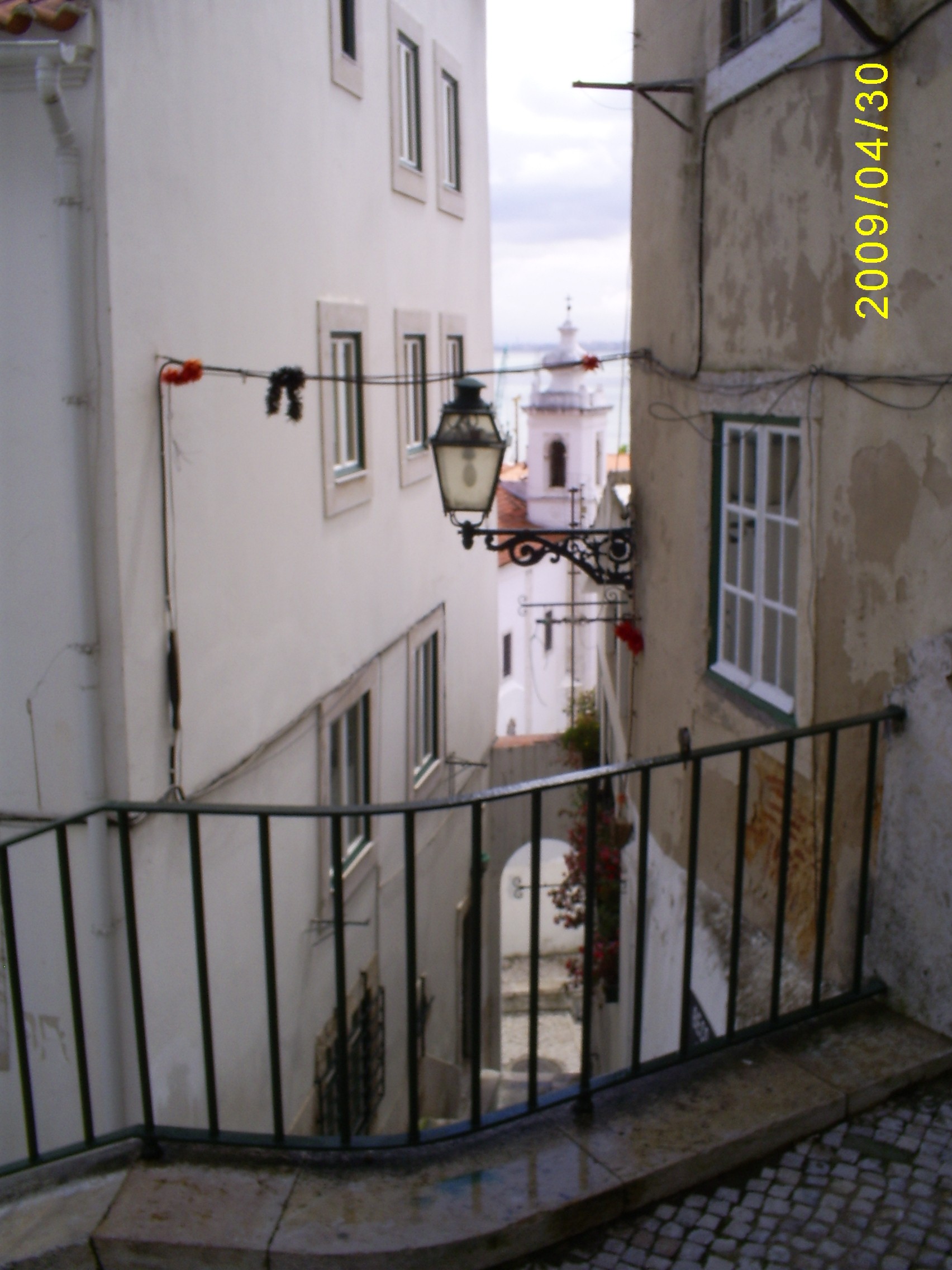
Picturesque streets with houses covered with painted tiles scatter from the fortress in different directions. Benches are carefully placed in the middle of each lift. Most of streets leads to Alfama - the most old quarter Lisbon, which, being built on rocky ground, survived the earthquake without much damage. Here once was the center of the Roman city, and later - the center of the Moorish city. Jews also lived in Alfama until their expulsion in the 16th century. ABOUT metropolitan city it doesn’t remind you of anything: Alfama is more like a fishing village, where the housewives clean fish right on the street and scribble on antediluvian sewing machines, and ropes with linen are tied to orange trees growing right on the steps. Going for a walk in Alfama, tune in to the fact that, most likely, you will get lost - this intricacies of streets practically defies logic.
We go down from the castle on a retro tram running along route No. 28, which resembles the transport of the beginning of the last century, and go on a tour of the city center. We pay tribute to how our tram famously climbs the hills and rushes along the narrow winding streets with a frightening rattle. At one of the moments of the trip, we easily reach the wall of a neighboring house with our hands.

We get off at the bus stop and before us opens an amazing view of the capital. In Lisbon, such observation terraces are called miradores. We found ourselves on the best of them - Miradouro de Santa Luzia. We approach the fence and freeze in admiration. No wonder Lisbon is called " White City”: in front of us is a whole block of like toy, sun-drenched snow-white houses with orange tiled roofs.

There are many in the city interesting buildings unusual architecture.

We descend to Commerce Square, which is considered one of the most beautiful squares in Portugal. Here, before the earthquake, there was a royal palace built in 1511 by Manuel I. In its center, on a high plinth, rises an equestrian statue of the reformer king José I, whose minister was the Marquis de Pombal. Majestic Triumphal Arch, decorated with bas-reliefs and statues famous people and connecting the square with Augusta Street, was completed in the 19th century. Then the square got its present name "Commerce Square" due to its proximity to the port, which is the main source of trade in the city. From here you have a magnificent view of the Tagus River, to which you can go down the stairs. WITH south side The square is dominated by two square towers, and on three sides the square is framed by buildings of ministries and banks.

The next point of our trip is the Belem area. Where the Tagus flows into the ocean, stands Belem (that is, Bethlehem) watch tower, and a little closer to land rises the monastery of Jeronimos - an excellent example of the main national style - Manueline, that is, Gothic mixed with Arabic script, sea knots and astrolabes. Two world-famous Portuguese are also buried here - Vasco da Gama (who set off from the Belem Tower, setting off in search of an alternative route to India) and Luis Camões. True, only one tomb remained of Camões, the poet himself died of the plague and was buried in some kind of lost common grave.

Nearby is the coffee shop Casa dos Pastéis de Belém, where they make the best sweets in the city, and perhaps in the country.
Next to the monastery is the Bethlehem Tower (Torre de Belen), built in the 16th century, the symbol of Lisbon. This is one of the best examples of the Manueline style, the tower is under the protection of UNESCO. It is decorated with lanterns, openwork Venetian balconies, stone carvings, a statue of the Madonna of the Navigators under a huge canopy and a sculpture of a rhinoceros. From the inside, the tower looks quite gloomy - there used to be a prison here. The quadrangular Belen Tower is known as a monument to the Portuguese Age of Discovery. The tower, built in 1515-1520 and designed in the Manueline style, is a classic symbol of all of Portugal. This tower was erected in honor of the glorious military and maritime past of Portugal and rises on the spot where caravels once set off to distant lands.

Not far from the Tower on the embankment of the Tagus River in the direction of the April 25 Bridge is the Monument to the Navigators.

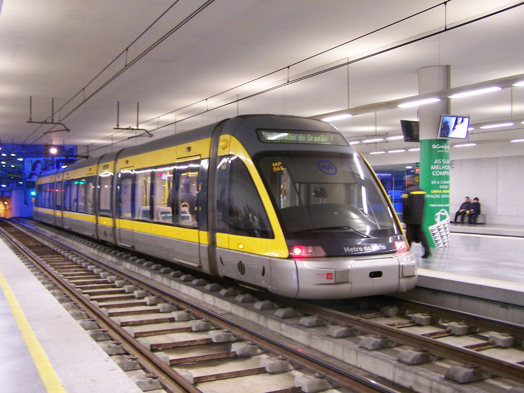
What is Lisbon remembered for, in addition to its historical sights? First of all, original architecture that combines different styles. We fell in love with its squares and streets, lined with tiles of various configurations and colors. His numerous souvenir shops with all kinds of colored tiles and products from it did not leave indifferent. The city also has one of the largest oceanariums. With pleasure we rode along the famous tram route No. 28 along its steep streets and with no less pleasure - under the ground on the metro in modern cozy carriages, admired the original interior of its stations.
It's time to say goodbye to hospitable Lisbon. We are passing through one of the most long bridges Europe. 45 months after the start of work (half a year ahead of schedule), on August 6, 1966, a solemn opening ceremony took place in the presence of the highest officials of the state. The structure was named "Salazar Bridge" in honor of the then dictator of Portugal. Shortly after the Carnation Revolution, the bridge was renamed in honor of the day when this event took place - the April 25 Bridge.

Royal Sintra
In the morning we leave Lisbon and head to Sintra. At 27 km from Lisbon, at the foot of the low coastal mountains of the Sierra da Sintra, there is a small town of Sintra, which since 1995 has been on the list world heritage UNESCO. The Portuguese themselves consider it the main attraction of the country, the pearl of Portugal. Back in the 8th century, the Moors appreciated the defensive significance of this place and built a fortress here. In 1147, Afonso I Henriques drove out the Arabs and for the next 600 years the city was the summer residence of the Portuguese kings.
Among luxury parks, centuries-old forests, bewitching landscapes, amazing palaces, castles, monasteries rise on the hills.
In the city itself, the National Palace of Sintra is located, and in the adjacent mountainous and forested area on a hill - the Palacio da Pena Palace and the dilapidated Castle of the Moors.

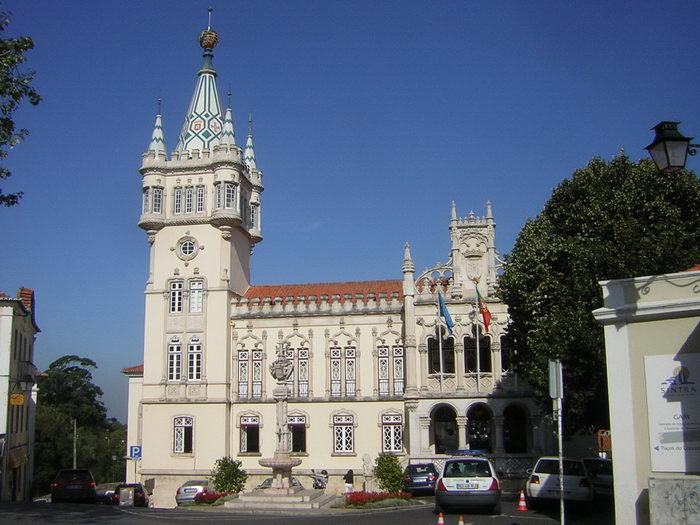
Near the station there is a beautiful city hall.
Before climbing the mountain to the Palacio da Pena Palace, we walk with pleasure in the urban part of Sintra, built up with old mansions. The streets wind whimsically and often end with steep stairs, steps lead to observation terraces, which offer stunning views of the mountains and the ocean. Cityscape abounds green forests, exotic flowers and exquisite palaces.

In the city you can find many castles and palaces that have been preserved in their originality. These castles contain an important historical and artistic collection, which attracts Portuguese and foreign artists to the city. Interesting and original are not only castles and palaces, but also houses in this fabulous city.

The proximity of the ocean and the mountain ranges provide humid, cool and slightly windy weather, which is great for relaxing even in very hot summers. That is why, already in the 15th century, the summer residence of the royal family of Portugal became fairytale castle Palacio da Pena, which, together with its luxurious park, crowns one of the highest hills of Sintra. Located 450 meters above the city of Sintra, it is one of the most significant examples of Portuguese architecture of the Romantic period. Rising on a rocky hill, it surprisingly harmonizes with the surrounding landscapes, combining lush vegetation and rocky cliffs.
The palace was founded in 1839 when the husband of the Portuguese Queen Maria II Ferdinand II of Saxe-Coburg-Gotha (1816 - 1885) purchased the ruins of the Jerome Monastery and began to rebuild them according to his romantic taste in order to create here summer residence. In order to realize his fantasies, Ferdinando II turned to a German friend, Baron Eschwege, for help and appointed him the construction manager. And since in the 19th century, romantically minded architects no longer hesitated to mix different styles, then the castle, like a three-dimensional puzzle, was assembled from German and Portuguese towers, Moorish arches and courtyards, and Indian domes. And to top it off, they painted it all in bright colors, which delights not only adults, but also children. The whimsically eccentric architecture of the palace combines Moorish, Gothic and Manueline motifs and the spirit of castles. Central Europe. The palace stands on the top of the mountain, it can be bypassed along the perimeter along a special path. Ferdinand II also built here one of the most spectacular parks in Portugal, which was designed and planted for over 4 years, starting in 1846.
This one is the most beautiful and romantic castle Portugal is jokingly called "Snow White's Palace" and is often compared to the Bavarian Neuschwanstein. Pena Palace can be reached by bus number 434 from the city center for 4.5 euros, but you can also get on the path on foot.

We climb the rock where the fortress built by the Moors between the 9th and 10th centuries is located. During the capture by the Christians, the fortress surrendered without a fight. After the 15th century, the fortress lost its strategic importance. From above, a wonderful landscape opens: among the sea of greenery, you can see the blue ocean and the white-red roofs of settlements and the capital.

We go down on foot to feel the beauty of the surrounding nature more strongly. The entire slope of the mountain is littered with huge boulders, as after a collapse or rockfall. It is not clear how tall trees can grow on these stones.
I pass by the ruins of an old Moorish fortress - once life was stormy here, and now only dilapidated stone walls remind of its former greatness.

Royal Sintra will forever be remembered as one of the most harmonious places in the world, combining and beautiful scenery, created by mother nature, and man-made palaces and castles, created by talented architects. Lord George Gordon Byron, admiring the beauty of Sintra, called it a paradise, and then forever immortalized the town in the famous poem “Great Paradise”.
The resort towns of Cascais and Estoril
After lunch we head to the westernmost point of Europe - Cape Roca. The path to it runs along the "Portuguese Riviera", with a visit to the resort towns of Cascais and Estoril. Although Lisbon stands on the coast of the ocean, there are no beaches in the city and those who want to plunge into the depths of the sea or just relax on the coast, Lisbon people go to these nearby resort cities. These cities are very nice and cozy.
15 km west of Lisbon is a magnificent resort - Estoril. It has a unique microclimate: warm and sunny summers, moderate temperatures the rest of the year. It is from the resort of Estoril that the tourism industry of Portugal originates. A little over a century ago, the amazing beauty of nature and the mild Atlantic climate attracted the world's elite and representatives of famous aristocratic families to Estoril. Gorgeous sandy beaches, the purest water and inaccessible to a mere mortal, hotels are traditionally in demand among people of considerable income. Fans of outdoor activities will enjoy an incredible variety of water sports activities, including 8 newest water parks, and excellent golf courses.
Her Majesty the Queen of England often rests in Estoril, and the notorious Linda Evangelista has chosen a villa for herself. We pass by the hotel where our first and only President of the USSR, Mikhail Gorbachev, had a rest.

Located just a few kilometers from Estoril and 20 kilometers from Lisbon, Cascais is a typical example of Portuguese architecture with brightly colored tiled roofs and white walls lined with colorful ceramic tiles.
The name Cascais comes from the word cascale - "small stone". The city has a rich historical and architectural ensemble: a history museum, a maritime museum, churches and chapels of the 15th century. On Central Square there is a monument to Don Pedro.

IN small town there are other monuments. We liked this sculptural warrior.

I really liked this unusual pretty bouquet.

A very attractive walk upper city with a beautifully maintained city park and the romantic castle of the Aristocrat.

If you move further from the city along the rocky coast, you will find yourself in Guinsha - the realm of wide dunes with frequent storm winds. This corner untouched nature is a real paradise for windsurfers. Here is the picturesque cliff of Boca de Infierno (“the mouth of the underworld”): the sea has washed out a hole in the rock, and now “infernal stew” is constantly boiling in these stone jaws.

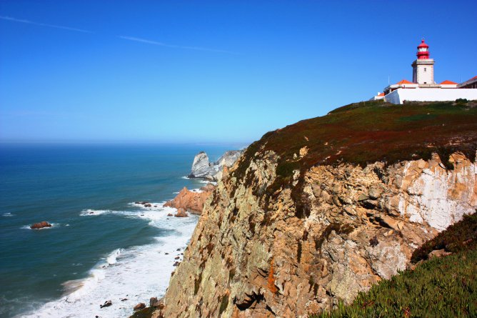
capeCabo deRoca
The mountain road leads to a cliff from which a dizzying panorama of the ocean and coastal rocks. This is the most western point Europe, Cape Cabo de Roca, which became a landmark only in 1979. Before that, the "end of the world" on the Iberian Peninsula was considered the Spanish Cape Finisterre (lat. "end of the earth"). A rock 140 meters high, like the prow of a ship, protrudes into the ocean. Ignoring the protective barrier, I approach its edge. Standing at the very edge, I listen to the solemn music of the ocean and fill with its energy. Probably the great Portuguese navigators, standing at western coasts native continent and peering into the boundless ocean expanses, they wondered: “What is beyond these expanses?” and to find the answer to this question they went on long sea voyages.

We overcame here a difficult journey by bus through many European countries from the westernmost point of our native Ukraine, the Transcarpathian city of Chop (48º05′ N, 22º08′ E). We take a photo for memory with our yellow-blue national flag next to a stone stele, on which the coordinates (38º47′ N, 9º30′ W) are carved and the inscription “ Onde a terra acaba e o mar comeca….". Shrouded in mist or illuminated by the bright sun, this place is one and only, where, as the poet Camões said: TOthe earth ends and the ocean begins» , - this is how the words carved on a stone stele sound in translation.

This is a memorial stone.

As evidence of my presence in such a charismatic place, I acquire in service center Cape personalized certificate stating that she really was here. On reverse side in different languages, including Russian, the following words are written: “ I certify that I was at Cape Roca in Sintra, Portugal, at the most western point European continent, at the very edge of the world, “where the earth ends and the ocean begins”, where the Spirit of Faith, Love and a thirst for adventure prompted the Portuguese caravels to set off in search of a new world» .
The souvenir shop has a lot of different products about staying in the westernmost point of Europe, especially a lot of souvenirs with drawings on various ceramic products. I choose a fridge magnet in the form of a small ceramic tile with the image of a cape as a memento of visiting this unique place.

But the main thing that we take away from this place is the memories of what the westernmost point of our native European continent looks like. The turquoise smoothness of the Atlantic caresses the eye, and the menacing rocks evoke legends of tragic, unrequited love.
We have reached the extreme point our native continent, and with this I end my story about the journey through Iberian Peninsula, my Pyrenean Romance.
Vasco da Gama, the greatest navigator of the fifteenth century, was born in the Portuguese city of Sinezh in the family of a high-ranking official. As a very young man, he learned to sail, but most attracted young man ship management. As da Gama grew up, the decision of the ruler of the country to continue the geographical discoveries initiated by Dias coincided. The young navigator was ready to go to sea, waiting only for orders.
Road to India
The long-awaited order was given in 1491. Da Gama was given four ships. At the head of his small flotilla, the young admiral set sail. For twelve days they reached the Green Cape. By mid-spring, they passed Mozambique and Melendi, behind which a sea trade route opened between India and the African continent.
With a fair wind, the flotilla moved on, first along the coast of Somalia, then, turning to the northeast, moved further and further away from the coastline. Twenty-three days later, Vasco da Gama dropped anchor off the coast of Calcutta. Opening for Portugal trade route to India was completed in less than nine months. The places of King Henry the Navigator came true.
But opening sea route to India did not guarantee the establishment of trade relations with the state. Its ruler Zamorin was dominated by Muslim merchants. These aggressive fanatics completely subjugated the weak Indian government. They forced Zamorin to deceive the captain of the Portuguese ships to go ashore. As soon as da Gama and his entourage entered the Zamorin palace, they were arrested and imprisoned as military hostages. Upon learning of the betrayal, the Portuguese remaining on the ships began to take hostages. Shots were also fired at the buildings of the city. Only under the threat of complete destruction of the city did the Indians free the hostages. The trade treaty with India was concluded under the threat of cannon fire.
After successfully reaching the goal of their mission, the ships turned towards their native port. The return trip was more difficult and longer - only after twenty-six months the travelers arrived in Belem. Vasco da Gama received an audience with the king. As a gift to the ruler, the naval commander brought full holds of jewelry, as well as a golden idol. The idol weighed almost thirty kilograms, its eyes were made of emeralds, and its chest was decorated with walnut-sized rubies.
After less than ten years, the Portuguese again equipped an expedition to India. This time the flotilla consisted of several dozen ships, led by Cabral. But sailing under his leadership was not as happy as da Gama's journey. Most of the flotilla sank, in addition, the local population was unfriendly towards the Portuguese sailors. Traders from the locals, having attacked foreigners, exterminated most of them.
Cabral began to prepare for the next expedition, but, remembering the sad fate that befell the first and its ineffectiveness, the king did not allow the offending naval commander to the mission. In the name of the king, da Gama took command.
Two years lasted his second voyage to the shores of India. Arriving here, he knew how to act in order to bring the local population into submission. Forceful intervention proved to be the most effective. Well-armed Portuguese soldiers, or rather, pirates, began to mercilessly exterminate the local population. One mention of the Portuguese brought everyone into mortal horror. Making regular raids into the villages, they everywhere collected bloody tribute. Vasco da Gama burned the ships of the Hindus along with everyone on board, people on the shore were burned alive, there was no mercy even for women and children. The streets of the villages were littered with corpses and dying people.
The brutal massacre was appreciated by the ruler of Portugal. The returning corsair was favored by the authorities and awarded titles and gold. After the second voyage to India, da Gama became the richest man in the state.
On the third voyage to the Indian shores, the navigator set off already in the status of Viceroy. Now his task was not to bring the peoples into submission, but to make the Portuguese colonies as prosperous as they were before. This voyage was as successful as the previous two.
The strengthening of the power given by the name of the Portuguese king was just as ruthless. At the same time, not only the local peoples suffered, but also the Portuguese, who violated the interests of their government.
Significance of Vasco da Gama
Vasco da Gama was a typical representative of his era. Cruelty towards the natives was the norm for this time. But this same man remained for centuries as the greatest navigator and excellent steward, faithful to his homeland.


