Island patterned Vyborg Bay. Vyborg Bay. Ruins of ancient buildings and piers. From Vyborg to Primorsk
Stone pier of the "Advanced Pilskaya Battery" on Chernova Island (Mustasaari). Vyborg Bay.
Vyborg Bay is a bay that juts deep into the shore in the northern part of the Gulf of Finland Baltic Sea. It got its name from the city of Vyborg, located in the northernmost part of the bay.
There are quite a lot of different ancient (and not so ancient) buildings in the bay. Let's stop at some of them.
Cape South Spear (Keihasniemi)
Judging by the Finnish map, along the entire northeastern coast of the peninsula, from Cape Keihasniemi itself, now South Kopje, plots of land were cut on which numerous buildings were located. The shore is lined with granite; closer to the tip of the cape there is a long granite pier. A little to the east there is a small, also made of stones, closed harbor with a small passage for boats. From the pier, steps lead to the shore, where a path leads past the foundations of destroyed buildings.
Pier at Cape South Spear (Keihasniemi)
There are decent gaps between the blocks, but in places where they fit tightly, the blocks are fitted along a curved plane.
Closed harbor at Cape South Spear
During the summer:
Tura Tower on Verkholaz Island (Korkeasaari)
Externally, the tower really resembles a classic chess tour. Its history is unknown to us. On some maps it is marked as a monument of the 14th century. The arrangement of the windows suggests that perhaps earlier a spiral staircase ran upward along the inner wall of the tower.
It is clearly visible that the tower was rebuilt and repaired many times - some of the seams between the stones were sealed with modern mortar, and a concrete platform on metal rails is visible at the top. The stones of the upper tier are fastened with metal brackets.
Ruins of the Suur-Merijoki manor
Mexican style
Estate foundation. It can be seen that the brick walls were lined with granite
For what purpose was it necessary to cut and move such facing slabs? A strange combination of brick and granite.
Estimated composition megalithic complex Vyborg Bay.
Already discovered objects.
1. Ring complex in Mon Repos Park.
2. Northern rock reflector in Mon Repos Park.
3. Ring complex in Zimino on the Lohaniemi Peninsula.
4. Ring complex on the islands of Big and Small Shield and Neighbor.
5. Southern terrace reflector on the islands of Big and Small Shield and Neighboring.
6. Western terraced reflector on the Keihasniemi Peninsula.
7. Western reflector wall on the Keihasniemi Peninsula.
Proposed objects of the megalithic complex of the Vyborg Bay.
1. Ring complex on the Ala Somme peninsula southwest of Sokolinskoye village.
2. Ring complex in the north-west of the Keihasniemi Peninsula on the isthmus in
side of the village of Podberezye.
3. Ring complex south of the village Podberezie.
4. Ring complex in the Vysotsk area on the islands of Krepysh and Peredovik.
5. Ring complex in the area of Shcherbakovo.
6. Southern and northern reflectors about. Vysotsky.
Destroyed objects of the megalithic complex of the Vyborg Bay.
1. Ring complex in Vyborg opposite the Annensky fortifications.
2. Ring complex in the area of the Sorvali cemetery.(?)
3. Southern terraced reflector of the rocky foundations of Mon Repos Park and the southern
coast of Tverdysh Island (?)
During the Empire, on Ovchinny, which was then called Nikolaevsky, the garrison of a mine station built a small Orthodox church. Like other buildings on the island, it disappeared in the flames of war in the spring of 1940. Only fragments of the foundation and fence have been preserved, and in the spring the lilacs, planted a long time ago at the entrance, bloom.

The last parishioners of the church were Cossacks from the Life Guards Cossack Regiment and the Imperial Convoy who went to Finland after the Bolshevik coup in 1918. and participants of the Kronstadt uprising who left across the ice to Terijoki. In 1918-24. Ovchinny-Turkinsaari became an analogue of the Turkish Gallipoli and the Greek Lemnos. In the mid-20s. The Finnish military began to settle on the island and the camp was moved. Archives with data about the new resettlement site were lost during the war.


Fort letter "B" of the Vyborg fortress, built before the First World War


Vyborg, the first personnel forge armed forces Finland. The building was built in 1914 by military engineer Glushkov for the Russian theological seminary, founded as part of the Russification program in Finland. In 1918, a training unit of the Finnish troops, nicknamed the Markovilla School, was located here. The name came from the builder of the nearby villa, Markus Wright. During the Soviet period, the building housed the tuberculosis hospital of the Ministry of Defense.


The Ronkaa estate near Vyborg, built in 1846-48. Nowadays the tuberculosis sanatorium "Vyborg-7"


Bunker No. 19 Line "T" was built already during the Winter War, taking into account the lack of time and analysis of the destruction of bunkers on the Mannerheim Line. Roof thickness 3m.


Now butterflies spend the winter in the bunker.

Anti-tank ditch in rock formations.

Evening in Vyborg. The castle is finally without scaffolding.
This archipelago in the northern part of the Gulf of Finland includes three “birch” islands: Bolshoi, Western and Northern and more than a dozen small islands. During the Great Patriotic War there was a Finnish garrison here, and until the end of the 40s, each island bore a Finnish name. Nowadays, only the name of the strait separating the archipelago from the mainland - Björkesund - reminds us of its former belonging to Finnish territory. Now on the Birch Islands there is a wonderful reserve of the same name, where fish is found in abundance, ducks and swans nest, and both common and rare representatives of the flora grow.

Located in the Vyborg Bay, for a long time it was known only to history buffs and radio amateurs. Russian fortifications were erected here in the mid-19th century, and a Finnish artillery battery was located here from 1917 until the Second World War. At the turn of the 19th – 20th centuries, Alexander Popov tested his wireless telegraph on the islands of the archipelago, and from 1963 to 2012, Maly Vysotsky Island was leased from Finland. During this period, specialized expeditions to Maly Vysotsky, which did not belong to Finland, but temporarily did not belong to Russia, were popular among radio amateurs, and where a special call sign was used for communication sessions.

This small granite island, located in the eastern part of the Gulf of Finland, has such rich history that a whole article would not be enough to describe everything, so we will limit ourselves to just a few interesting facts. Stone Age sites and sacred objects dating back to 5-7 thousand years BC were discovered here. On the island in 1900, Popov conducted the first practical radio communication sessions - to serve the rescue expedition to remove the battleship Admiral General Apraksin from the stones. Before the revolution, Gogland was one of the most popular places for yacht travel. And although the island is considered one of the most dangerous places for shipping in the Baltic, local residents have long been considered excellent sailors and were willingly hired as sailors on sailing ships.

A relatively large island – as the name suggests. Until 1917, it was densely populated, and its fleet consisted of about 80 ships carrying out transportation between Russia, Finland and Sweden. After Finland gained independence, the volume of traffic fell sharply, and Moshchny became one of the smuggling points. Now, apart from three lighthouses, nothing reminds of the former port life - on the island there is only a small border outpost with a radio technical post and a post for illuminating the surface and underwater situation of the Leningrad naval base.

Two nearby islands in the central part of the Gulf of Finland. Big Tyuters has long been known as the "island of death". During the Second World War, the Germans mined it; in subsequent years, several attempts were made to clear the island of mines, but only the last seventh was successful. In 2005, Russian and Swedish specialists neutralized more than 30 thousand explosive objects. There are lighthouses on both islands, and members of the staff are the only inhabitants of Tyuters, with the exception of the ringed seal, which is very common on Maly.

A small island in Klyuchevskaya Bay, Vyborg district, is perhaps one of the calmest and greenest on our list. Beautiful forests with plenty of mushrooms and berries have been preserved here, as well as clean shores along which all kinds of fish swim and spawn. And since there are no conservation restrictions, the island is quite popular place recreation, but local residents are increasingly complaining about poachers and uncultured tourists.

Peter the Great once gave this rocky island in the eastern part of the Gulf of Finland to his jester Jan Lacoste along with the mocking title of “Samoyed King.” After this, the jester began to appear at balls wearing a tall tin crown, pushed over one ear, which greatly amused the St. Petersburg aristocracy. However, after the death of the Tsar, Lacoste lost his possessions: it turned out that instead of a seal, Peter the Great’s charter on the granting of the island included... a ruble. Well, after that, Yan was generally exiled to Siberia, because he was plotting against the all-powerful temporary worker Menshikov.
The next time the island made its mark in Russian history was during the Great Patriotic War, and this happened under very tragic circumstances. In June 1942, Sommers, captured by Finnish troops, was recklessly landed by amphibious assault. The desperate battle lasted for three days, but the poorly planned operation of the operation prevailed over steadfastness and courage. Soviet soldiers. Of the one and a half thousand Red Navy men who landed on this piece of land, none survived. The island was only liberated after Finland left the war in 1944.

The most amazing thing is that in Gulf of Finland have their own Virgin Islands - practically namesakes Virgin Islands that are located in the Caribbean Sea. South Virgin is especially interesting: it contains a mysterious round labyrinth of pebbles, built by ancient people. This labyrinth is called Paris: some say that in honor of the intricate streets of Paris, others say that this name comes from the Swedish word Paris, that is, church parish, and reflects the sacred essence of this place.
IN There are many islands, large and small, in the Gulf of Finland...
However, only a few will be able to name any islands other than Kotlin Island, on which Kronstadt is located. At the same time, there are very interesting and beautiful islands.

1. Kotlin Island
The most famous, the most important and the most inhabited island Gulf of Finland. The length of the island is about 12 km, maximum width less than 3 km, area about 16 sq. km. The island is connected to mainland a road passing through a complex of flood protection structures (Dambe). On part of the island is the city of Kronstadt.
The island is located on the legendary routes “from the Varangians to the Greeks” and “from the Varangians to the Arabs”, and is mentioned in the 1269 agreement between Novgorod and the Hansa. The city that stood on this site was at least 500 years older than St. Petersburg. And given that the contract stated that ships would be reloaded on the island, “as it was in ancient times,” the city was much older. Subsequently, arriving merchants waited on the island for pilots from Novgorod, who led trade caravans across the Neva and Volkhov to Ilmen.
There is a legend according to which the Swedes, when landing on the Russian island, hastily fled, leaving a pot on the fire. This legendary bowler hat is depicted on the coat of arms of Kronstadt. The name Kotlin supposedly comes from the word “boiler”. According to another legend, Kotlin was named so because on old maps the neck of the Gulf of Finland east of the island resembled a cauldron.
On an islet dumped on the shallows south of Kotlin Island, Peter I founded Fort Kronshlot in 1703, which blocked the main fairway leading to the mouth of the Neva, where the new capital of the empire, St. Petersburg, was being built for a potential enemy. On May 7, 1704, the fortifications, which included two batteries on Kotlin Island, came into operation (the date of the founding of Kronstadt).
In 1723, a fortress was founded on Kotlin and given the name Kronstadt. Peter I considered Kronstadt part of the capital.
1. Gogland Island
This small granite island, located in the eastern part of the Gulf of Finland, is one of the most famous islands Gulf of Finland. Gogland is located 180 km west of St. Petersburg. Its area is about 21 square meters. km, height - up to 176 m.
The basis of the island is granite, which forms many different-sized hills and valleys, where small fresh lakes glacial origin. The entire coastline is indented with hundreds of bays of all shapes and sizes.

Although the island is considered one of the most dangerous places for shipping in the Baltic, local residents have long been considered excellent sailors and were willingly hired as sailors on sailing ships.
The nature of Gogland is rich and diverse. There are about 700 species of vascular plants alone (for comparison, the same number of species in the Leningrad and Pskov regions, which are tens of times larger than Gogland). Almost 80% of the island's territory is covered with coniferous and small-leaved forests. The foot of the rocks is covered with blueberries, raspberries, alpine currant and juniper bushes.
The fauna is represented by 25 species of beetles, 6 species of amphibians and reptiles, 126 species of birds (a quarter are listed in the Red Book of Nature Leningrad region). As for mammals, their composition is unknown because it is constantly changing. Here they often see shrews and various mice, sometimes white hares, squirrels and foxes, European mink, and raccoon dogs.
Gogland is a Mecca for archaeologists and historians. Stone Age human sites, medieval pirates, the Battle of Hogland, envoys of Peter the Great, the death of "Lefort", "America", the Struve meridian, Popov's radio communication session in 1900, 300 years of wars, endless fortifications and dozens of sunken ships, battles of World War II, constant a change of owners, which ended only in 1947 with the return of the island home to Russia.
2. Transund Archipelago
The island is located in the Vyborg Bay; for a long time it was known only to history buffs and radio amateurs. Previously there was a Finnish artillery battery.

At the turn of the 19th - 20th centuries, Alexander Popov tested his wireless telegraph on the islands of the archipelago, and from 1963 to 2012, Maly Vysotsky Island was leased from Finland. During this period, specialized expeditions to Maly Vysotsky, which did not belong to Finland, but temporarily did not belong to Russia, were popular among radio amateurs, and where a special call sign was used for communication sessions.
3. Sommers
Peter the Great gave this rocky island to his jester Jan Lacoste along with the mocking title of “Samoyed King.” It is located in the eastern part of the Gulf of Finland.

The next time the island made its mark in Russian history was during the Great Patriotic War, and this happened under very tragic circumstances. In June 1942, Sommers, captured by Finnish troops, was recklessly landed by amphibious assault. The desperate battle lasted for three days, but the poor planning of the operation prevailed over the steadfastness and courage of the Soviet soldiers. Of the one and a half thousand Red Navy men who landed on this piece of land, none survived. The island was only liberated after Finland left the war in 1944.
4. Moshchny Island
It's a pretty big island. It used to be densely populated. Now on the island there is only a small border post with a radio technical post and a post for illuminating the surface and underwater situation of the Leningrad naval base.

5. Big Tyuters and Small Tyuters
The two islands are located in the central part of the Gulf of Finland. There are lighthouses on both islands; the attendants are the only inhabitants of the islands. On Maly Tyuters there is a ringed seal.

Bolshoi Tyuters has long been known as the “island of death.” During the Second World War, the Germans mined it; in subsequent years, several attempts were made to clear the island of mines, but only the last seventh was successful. In 2005, Russian and Swedish specialists neutralized more than 30 thousand explosive objects. There are lighthouses on both islands, and members of the staff are the only inhabitants of Tyuters, with the exception of the ringed seal, which is very common on Maly.
6. Fox Island
One of the calmest and greenest islands, lost in Klyuchevskaya Bay of the Vyborg region. Beautiful forests with plenty of mushrooms and berries have been preserved here, as well as clean shores along which all kinds of fish swim and spawn.
This is perhaps one of the calmest and greenest islands of all those listed. There are no conservation restrictions and the island is a fairly popular vacation spot for those who have a boat.
7. Virgin Islands
The Gulf of Finland has its own Virgin Islands. These are practically the namesakes of the Virgin Islands, which are located in the Caribbean Sea. South Virgin is especially interesting: it contains a mysterious round labyrinth of pebbles, built by ancient people.

This labyrinth is called Paris: some say that in honor of the intricate streets of Paris, others say that this name comes from the Swedish word Paris, that is, church parish, and reflects the sacred essence of this place.
More information about the islands on the website
The Vyborg skerries are the name given to the coast of the Gulf of Finland along with numerous islands (including the Vyborg Gulf), stretching from Primorsk to the Russian-Finnish border. The word "skerries" (skar) is of Swedish origin. This is what they call a fancifully cut coastline seas or lakes with groups of small rocky islands. Skerries are typical for Sweden, Finland and the Scandinavian countries in general.
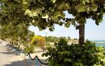
The Vyborg Bay is part of the Gulf of Finland, as if embedded deep into the continent. Through the Saimaa Canal, the waters of the bay communicate with the system of inland lakes of neighboring Suomi. The water here is less salty than in the Gulf of Finland: it is diluted by numerous fresh springs. The waters of the Vyborg Bay are replete with islands. There are some that are so large that entire settlements can easily be accommodated on them, such as the island of Tverdysh, on which part of Vyborg is located. Many and small, no more than ten meters in length. Vyborg Bay is an area of intense shipping, and in addition, it is popular with owners of small vessels: yachts and boats. For twenty years now, the international regatta “Sails of Vyborg” has been taking place in the waters of the bay. Large vessels, heading to Vyborg sea port, as well as to the ports of Vysotsk and Primorsk, you have to move along a very complex fairway, maneuvering between numerous islands.
From Vyborg to Primorsk
Recently, Vyborg, the only city in Russia with a preserved medieval architecture and unique monuments of northern modernity, has become the last outpost of free visitation in the North-West of the region: once you cross the Saimaa Canal, the border zone begins. During the perestroika years, the city gained a lot, but also lost a lot. Favorite ones have already been trampled here tourist routes, but safety historical monuments leaves much to be desired. Vyborg still remains a place of pilgrimage for residents from neighboring Finland.
The Vyborg skerries seem to be divided by Vyborg into two almost equal parts: the city is the “deepest” point of the Vyborg Bay. To the west, the least developed coastal areas stretch all the way to the border. And from ancient Viipuri to Primorsk the line of Vyborg skerries is called the Golden Coast. This stretch of coast has such a pretentious name not only because it has stunning scenery and unexpected landscapes. Currently, the lands of the Golden Coast are among the most sought after on the country house construction market in the Vyborg region. And once upon a time it was a strip of continuous children's health resorts and sanatoriums.
If you move from Vyborg towards Primorsk, then along the way you will meet settlements that had a variety of “specializations” in Soviet times, which have survived to this day. In Sokolinskoye there is a wonderful tuberculosis sanatorium and summer cottages for artists. Zimino was initially a sanatorium zone for the proletarians of the Vyborg Shipyard, then it became simply a sanatorium-type boarding house. A local landmark is the famous oriental-style gazebo for meditation by Kuzmich from Rogozhkin’s “Peculiarities of the National Hunt.”
Vysotsk is a city of maritime border guards, a traditional open-air children's art school and the last refuge of Stanislav Rostotsky. By the way, the updated longships from the film “And Trees Grow on the Stones,” along with the dominant St. Olaf, the Round, Clock towers and the Town Hall tower are still business card Vyborg. Uuransaari Island (now Vysotsky Island) was recaptured by Peter I during Northern War. By order of the emperor, the construction of fortifications began here, the remains of which have survived to this day. The city, with just under two thousand inhabitants, was better known as Trongsund (Swedish: Trangsund) until 1918. During the period of twenty years of Finnish independence, it was renamed Uuras (Finnish: Uuras).
The Sovetsky settlement is the first raider-perestroika redistribution at the Vyborg Pulp Mill and the business berth of LUKOIL. By the way, the plant itself was built by the Finns in the late twenties of the last century. When its reconstruction was required in post-Soviet times, the Finns and Swedes again came to the rescue.
Landyshevka (under the Finns Ala Kiriola) - a pioneer summer and the estate of a branch of the famous Nobels. Glebychevo and Pribylovo (Finnish: Makslahti) are a ceramic factory and the legendary Guards Helicopter Regiment of the Russian Air Force. Cosmonaut German Titov served here and historian and dissident Roy Medvedev taught here for six years. In the area of Glebychev and further to Primorsk, the fortifications of the Mannerheim Line are perfectly preserved.
And finally, Primorsk (formerly Finnish Koivisto and Swedish Björke; all names are translated the same: “Birch”) - a scientific base, an oil terminal ( end point Baltic Pipeline System), a beautiful Lutheran Cathedral (now the House of Culture and local history museum), which mysteriously lost its multi-register organ. The purchase of an organ for the church in Germany was sponsored by Emperor Nicholas II, who often vacationed on the nearby Beryozovy Islands. One of the legends is associated with the seaside church, according to which, during the advance of Soviet sailors, the pastor’s daughter chained herself to the bell tower and shot back to the last bullet. And in the early 1990s, a small monument made of local stone appeared next to the temple: a sail and a cross - a memory of all those who died and a sign of reconciliation.
Islanders
Finnish archaeologists who studied the territories of the settlements of Koivisto, Hyarkala (before perestroika there was a wonderful pioneer camp “Olympian”), Manola, found stone axes there even before the start of the Winter War, and in modern Ermilovo (near Primorsky) a stone hoe. The finds were dated stone age.
Actually, before the Swedes gained a foothold on the Gold Coast, Karelians had lived on these lands since ancient times. And not only them. The islands and the coast were a real trade crossroads, so trade strongholds were created here, multicultural, mixed ethnic composition settlements. So today's Primorsk began as a trading settlement called Berezovskoye. The first chronicle mention dates back to 1268. But even earlier, on the strait located somewhat to the south small island Ravitsa (in translation from Karelian Nourishing) was a medieval market place. Residents delivered food from the shore to the island in exchange for handicrafts brought by shipbuilders. Warehouses of Novgorodians, Karelians and merchants of the Hanseatic League were built on numerous islands. And only later did the trading people from the islands move to the shore.
In the 14th century, fishermen and sailors became the owners of the islands. Most large islands sheltered farmers. Island communities, villages, hamlets and even small towns. By the middle of the 20th century, almost all habitable islands were inhabited. After all, it was natural for the Finns to use various watercraft as public and personal transport: boats, cutters, steamers.
To this day, on the islands of the Vyborg Bay you can find the remains of military fortifications, foundations of old buildings, stone roads, good berths. Due to little knowledge island part The bay attracts a huge number of tourists and local historians. Local population has preserved the tradition of collecting autumn gifts on the islands - mushrooms and berries. In addition, the islands attract lovers sea travel on boats or yachts. And of course, the Vyborg skerries are a place of pilgrimage for fishermen. In summer, pike, pike perch, bream, perch, roach, rudd, and eel are caught here. In winter, burbot and smelt appear. Lucky people get their hands on Baltic salmon.
It is necessary to take into account the special way of life that has developed in the lands of the Swedish crown. The fact is that the northern Europeans never had the final enslavement of the peasants, as in Russian Empire. The feudal lords were content with quitrents and other duties; at the same time, peasants and ordinary people remained free people and often acquired land themselves, becoming landowners. Hence such a popular farm way of life, which has developed not only on the mainland Karelian Isthmus, but also on the islands.
Vyborg estates
As a result of the Northern War of 1700-1721, the territory of the Karelian Isthmus was annexed to Russia. In 1811, the Vyborg province became part of the autonomous Grand Duchy of Finland. The proximity to the capital of the empire left its mark on the composition of landowners, the appearance, way of life and life of Vyborg estates. Their owners were representatives of the highest nobility of the Russian Empire and those close to the imperial court. In the 18th century, new estate construction began, adopting the motif of expensive decorations and interiors of St. Petersburg. A striking example is the Monrepos estate. Unlike those who settled in the rich and luxurious south, the Vyborg founders of the “noble nests” were mostly merchants or officers, therefore luxurious palace and park ensembles can't be found here.
The world of the Vyborg estate was created by the labor of peasants, and by the end of the 19th century most of the land was already their property.
Mon Repos. Perhaps Mon Repos would have remained a nameless manor, the monarch’s payment to the vassals for diligent service, if not for a number of happy accidents, who marked this territory on the shores of the Vyborg Bay. The first owner of Mon Repos after Peter's Victoria was Pyotr Alekseevich Stupishin, from 1780 - the Vyborg governor, holder of the Order of St. Anna I degree. A number of crown estates were administratively subordinate to Stupishin, the income from which was transferred to the treasury. One of them, the Lille Ladugard estate on the island of Linnansaari, Stupishin chose for his summer residence. The territory was cleared of stones and leveled, an access road to the manor house was built, a linden alley was planted, and a dam was erected. Improvement included draining low-lying meadows, building wells, filling fertile soil, and planting plants. A large amount of construction work was carried out by soldiers of the local garrison. Several residential buildings were erected, including manor house, a number of outbuildings. But the death of the Vyborg governor interrupted the grandiose arrangement of the family nest.
And the heyday of Mon Repos and its world fame as a unique rocky and romantic park are now forever associated with the name of the Nikolai family. He owes it the name “My Repose” (that’s how “Mon Repos” is translated). We should not forget that Mon Repos was never a ceremonial park: nevertheless, it was an entourage estate with meadows, cows, pastures, vegetable gardens and greenhouses and a completely rural way of life.
Kaislahti. Kaislahti means "Reed Bay" in Finnish. In the 30s of the 17th century, a German officer, quartermaster Gerhard Leffe took possession of the empty lands of a disabled cavalryman. Then he bought part of the land from local peasants, and a quarter of the village land, which belonged to the Dominican monastery, Vyborg castle and the priest’s estate in the Middle Ages, became his property. Thus a large estate was formed. Then the owner of the estate was a major, whose name has now been forgotten. During the Northern War, Russian troops destroyed the estate: it was then that a legend arose about the ghost of a nameless major, who, with a sword and a cocked hat, searches for his lost family at night. In subsequent centuries, the estate passed from hand to hand to various military and civilian ranks as a reward for service, was given away for debts and was revived by zealous owners, and even became the residence of the Minister of Finance Lars Gabriel von Hartmann.
Now about former estate The only reminders of Kaislahti are the old birch alley and the ruins of a brick factory, a steam sawmill, a stable and a cowshed. Since 1948, Kaislahti has become the Soviet village of Popovo.
Sahlgren's estate. On Boat Island (formerly called Venajansaari, translated as “Russian”) this estate, built by the famous Vyborg architect Uno Ulberg, is still perfectly preserved, although no one has been involved in its conservation or restoration. Now it is privately owned. It is curious that Russians are well aware of this red brick villa-estate: in the series about Sherlock Holmes “The 20th Century Begins” directed by Igor Maslennikov, the estate “played the role” of the lair of the German spy von Bork.
Nobel estate. In 1894 southern part Ala Kiriola (now Landyshevka) was acquired by Edla Nobel, the widow of Ludwig Nobel. Ludwig Nobel is a Swedish and Russian engineer, inventor, entrepreneur and philanthropist, the elder brother and business partner of the famous founder of the Nobel Prize, Alfred Nobel. By the beginning of the 20th century, the Nobel estate was expanded by purchasing several neighboring manors.
The elder Nobel was fluent in five languages, was the founder of the Russian Technical Society, and the initiator of the introduction of the metric system of measures in Russia. He gave money for research to the Academy of Sciences and the Russian Technical Society, financed a school for railway masters and a school for workers. After his death, the Branobel partnership decided to establish a student scholarship in his name at two St. Petersburg institutes - Mining and Technological. After the death of Ludwig Nobel's widow, her youngest daughter Marta lived in the estate with her husband, doctor Georg Oleinikov. On the contrary, on the island, two hundred meters from the shore, a garden was laid out, later called Doctor’s. There, grapes, peaches and corn were grown in greenhouses.
In the summer of 2010, the great-grandson of the brother of the founder of the Nobel Prize, Pyotr Oleinikov, visited the estate, who arrived with his wife Anna. Today the Nobel clan numbers about 300 people.