The transport infrastructure of the Crimea is on the verge of big changes. "transport system of the Crimea"
Transport plays an important role in the intra-district, inter-district and inter-state division of labor. Being a consumer a large number energy carriers, transport plays a rather noticeable negative environmental role.Table 1 gives a general idea of the transport system of the peninsula. 3.5.
The main place in the transportation of goods and passengers is occupied by road transport. The axis of the peninsula is the Simferopol-Moscow highway. The main frame highways: Simferopol-Feodosia-Kerch, Simferopol-Sevastopol, Simferopol-Evpatoria, Simferopol-Alushta-Yalta-Sevastopol, Simferopol-Alushta-Sudak-Feodosia. The rest of the roads have regional and local significance. In general, the average density of roads per unit area is quite high and amounts to 244 km/1,000 km2 (in Ukraine - 234 km/1,000 km2).
There are 6,625 km of roads in Crimea. Bands of stable pollution are formed along them. In 1992, vehicle emissions reached 160 thousand tons.
The functioning of roads inevitably affects the state of the environment. The most common means of land-based non-rail transport - a car - uses oil, gas or vegetable raw materials as fuel, while in the soil
ECOLOGY IRIMP
Yantropogenic factors in the formation of the ecological situation
Table 3.5
The state of transport of Crimea i from 1999
Trucks, pcs. 36 278
Passenger buses, pcs. 7 830
Cars, PC. 247 379
Cargo ships, pcs. 36
Fishing vessels, pcs. 73
Passenger ships, PC. 34
Towing vessels, pcs. 24
Research vessels, pcs. 5
Service vessels, pcs. 26
Trolleybuses, pcs. 424
Tram cars, pcs. 31
Railways, km 644.2
Motor roads, km 6,625.0
Trolleybus lines, km 328.1
Tram lines, km 20.0
Pipelines, km 1,126
heavy metals enter from the exhaust pipes of cars, and the air basin is polluted with gaseous emissions and noise.
Forest belts have been planted along the roads of the peninsula, which include many fruit trees. Previously, they not only decorated the roads, but also served as an additional source of delicious fruits (apricot, quince). Now, when the intensity of the traffic flow has sharply increased, they have become accumulators of harmful substances hazardous to health. In recent years, many forest belts have been cut down for fuel, which is why they cease to fulfill their protective functions (Fig. 3.14).
In cities, cars account for an average of 70-80% of the total pollution. In Crimea, car pollution has increased markedly in recent years due to low-quality fuel, as well as in connection with the importation of a large number of cars from abroad, often those brands that are already banned for use in other countries.
The average daily traffic intensity on the first-class motorway in the Simferopol-Krasnogvardeyskoye section reaches 12-13 thousand cars. Its fluctuations are observed during the week and according to the seasons of the year: in the summer months in southbound sometimes a continuous stream of cars moves.
The construction and operation of
RICE. 3.14. Cut down forest belts along highways in the flat Crimea
roads in the mountainous Crimea (Fig. 3.15). The great steepness of the slopes makes it necessary to create the most complex road serpentines (on the slopes of Ai-Petri, in the area Baydarsky Gate, on the Alushta-Sudak section), dissected terrain and landslides - build bridges and tunnels. Due to the small width of the roads, loaded dump trucks and high-speed passenger cars often move in the same lane “back to back with each other”. Few well-designed transport interchanges allowing vehicles to maneuver in the event of an accident.
In the flat Crimea, local roads (along agricultural lands, canals, in villages) are often not well-maintained, which is why vehicles choose detours, creating more and more new roads. It would seem that these are minor violations, but throughout the peninsula, under such “road lands”, there are significant areas of the most fertile lands.
Railway transport. Most cargo is transported on the Simferopol-Dzhankoy and Dzhankoy-Kerch sections. Linearly elongated roads and railways are a kind of corridors along which pollutants are transported over considerable distances: hydrocarbons, nitrogen-containing substances, heavy metals, etc. Fires occur with incomplete combustion of fuel and the emission of sparks. At the same time, the roads are a kind of "garbage chutes". They also become barriers to the spread of plants and animals, and prevent the natural flow of water (Fig. 3.16).
ECOLOGY OF CRIMEA
Anthropogenic factors in the formation of the ecological situation
Rice. 3.16. Kerch Peninsula: railroad and highway blocked the surface flow of fresh water into the lemon, coastal engineering facilities - access sea waters, thereby once the natural ecosystem of estuaries
Rice. 3.15. Landslides on the roads of Crimea
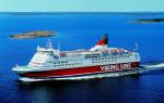
Sea transport is traditional for the peninsula, although its share in the movement of goods and passengers is insignificant due to the underdevelopment of the port economy and the lack of modern vehicles.
The youngest pipeline transport is used to supply gas in the directions: Golitsino-Glebovka-Simferopol, Simferopol-Sevastopol, Dzhankoy-Simferopol, Krasnoperekopsk-Dzhankoy-Feodosia-Kerch. It is planned to lay a gas pipeline along the bottom of the Karkinitsky Gulf from the Shtormovoe field (in the Black Sea) to the Glebovsky gas storage facility. Pipelines, unlike other vehicles, affect environment for a short time, only during earthworks during laying, but often uncultivated plots of land, piles of garbage remain along them. In addition, pipelines are potential objects of environmental risk in case of any emergency.
Air Transport. By traffic volume Simferopol airport in the early 90s. not far behind Kyiv, Moscow, St. Petersburg. In the future - the use of former military airfields in the area of the village. Kirovskoe, the cities of Saki, Dzhankoy, near Kerch (Bagerovo), north of Sevastopol (Belbek), etc. For recreational transportation, helipads were also built on the peninsula in Yalta, Alushta, near the Marble Cave, on the Chatyrdag plateau, but the high cost and noise pollution have suspended their operations.
Along with traditional modes of transport for resorts, especially those located in highlands, it is necessary to create special, high-speed and environmentally friendly pure species messages. Vertical transport ( cable cars) has not received development due to the complexity of construction and environmental restrictions (given the presence of reserves in the mountains). The first cable car in Crimea was not vertical, but horizontal: it was built in 1943-1944. for the transport of military cargo through Kerch Strait. Small sections of cable cars for transporting vacationers in the 60s. 20th century were built in Yalta (in the sanatoriums "Gorny", "Donbass", on the slopes of the city of Darsan, etc.). The cable car from Miskhor to Ai-Petri was built for more than 10 years and began to function since 1988. Its length is 3.5 km, the height difference is 1142 m.
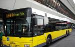
More environmentally friendly vehicle is a trolleybus. It provides communication not only in cities, but also between them (Simferopol-Alushta-Yalta). The total operational length of trolleybus lines exceeded 300 km.
The transport network of the Crimea in the future is presented to specialists in different ways: it is proposed to build a railway along south coast
You review the article (abstract): “ Transport of Crimea» from disciplines « Ecology Krimu»
TRANSPORT
Transport, along with communications, education, energy, which is part of a complex of infrastructure industries that provide the basic conditions for the life of society, is the most important tool for achieving the social, economic and other priorities of the region. Calls to really influence economic growth, transport reduces delivery time, thereby speeding up trade, affects the development and deployment of productive forces, and, as a result, an increase in labor productivity. Thanks to the expansion of the transport network, the accessibility of social infrastructure services to the population improves, the conditions for using free time improve, and the quality of life in general increases.
Therefore, the level of development of transport in the region determines the level of socio-economic development. The functioning of the transport complex of the Autonomous Republic of Crimea is provided by 32 thousand people, which is almost 8% of the number of employees in the sectors of the economy of the republic.
The transport system includes 6.7 thousand km of paved roads, including 2.3 thousand km of motorways; 0.7 thousand km of railways, of which 0.3 thousand km are electrified. The length of main gas pipelines is more than 0.6 thousand km. Scope of work performed various types transport of Crimea, is given in the table.
|
Cargo transported |
Passengers carried |
Cargo turnover |
Passenger turnover |
|||||
|
Thousand tons for 2005 |
Thousand for 2005 |
Million tkm. for 2005 |
||||||
|
All modes of transport |
||||||||
|
Railway |
||||||||
|
Automotive |
||||||||
|
Aviation |
Currently, in the transport of Crimea, the main transport of goods and passengers is road transport, which accounts for more than 90% of intra-regional traffic. Passenger traffic through the bus station network increased by 70.0%. This was facilitated by the development of the route network and an increase in the number of departures of buses with the replacement of rolling stock with buses of a higher level of comfort, the opening of new international and interregional routes.
The main axis of the Crimean highway network is the Kharkiv-Simferopol highway. In addition, the leading frame formations of the system include the Simferopol-Sevastopol highways; Simferopol-Alushta-Sudak-Feodosia; Simferopol-Feodosia-Kerch; Simferopol-Evpatoria; Simferopol-Alushta-Yalta-Sevastopol.
The main road routes of regional importance on the territory of Crimea are the Simferopol-Krasnoperekopsk-Armyansk roads and further to Kherson-Nikolaev-Odessa. The role of this road especially increased after the construction of a motor bridge across the river. Dnieper near Kherson.
Intra-regional passenger and freight transportation is provided by the following roads: Krasnoperekopsk-Dzhankoy-Nizhnegorsk; Evpatoria-Chernomorskoe and others. For these roads, the asphalt-concrete type of pavement is predominant, and only a small part (21.3%) has a black-gravel pavement.
The average density of the Crimean road network, calculated relative to total area, equals 244 km per 1000 km, against 234 km in Ukraine. The density of hard-surfaced roads varies widely across regions.
Problems of further improvement of the territorial structure of the road network and reducing the destructive impact road transport on the environment, reducing the scale of expropriation of agricultural land for roads in Crimea should be addressed as follows: a widespread improvement in the quality of road surfaces local importance, in the reconstruction of the lane and the improvement of pavements on roads of interregional and republican significance, in the expansion of the lane, in the elimination of numerous dirt roads that duplicate the main highways of republican and local significance in the direction of movement.
Rail transport occupies a leading position in the transportation of raw materials, fuel, building materials and other bulk cargo, as well as passengers in interregional exchange. The Crimean branch of the Pridneprovskaya railway is one of the busiest lines due to access to non-freezing warm seas and the Caucasus. The deployed operational length of the main railway tracks is more than one thousand kilometers, and the deployed length of stationary tracks is about 0.5 thousand km.
The main sections of the railways of Crimea: Simferopol-Dzhankoy (91 km), Simferopol-Sevastopol (77 km), Dzhankoy-Vladislavovka (101 km), Vladislavovka-Port Krym (108 km), Simferopol-Ostryakovo-Evpatoria (82 km).
The leading transport hubs - Sevastopol, Feodosia, Kerch and Yevpatoria - transship cargo from sea transport to road, rail and vice versa. The most heavily loaded sections of the Crimean branch of the Pridneprovskaya railway are: a) Simferopol-Dzhankoy, b) Dzhankoy-Vladislavovka, c) Vladislavovka-Kerch. The Dzhankoy-Novoalekseevka section has the highest traffic density per one kilometer, since it is located on the main direction of interregional exchange. A fairly high intensity of cargo movement is observed at the Dzhankoy-Vadim section. The formation of cargo traffic in this direction is determined by the location in the northern part of Crimea of large enterprises of the chemical industry of interregional significance.
The main cargoes transported by rail include: coal, coke, oil and oil products, iron and manganese ores, ferrous metal ores, ferrous scrap, timber, chemical and mineral fertilizers, grain, cement, etc.
The development of the railway transport subsystem of the Crimea at present, in terms of the intensity of public functioning, has reached its maximum value. Further improvement of the territorial structure and capacity building railway network the region should be carried out on the basis of solving the following tasks: a) increasing the carrying and throughput capacity of railways based on the construction of second tracks, double-track inserts, and in the longer term - triple-track inserts, which will allow not to withdraw additional land resources from agricultural circulation; b) construction in the near future of second tracks on sections of the Simferopol-Dzhankoy-Kerch sections; c) reconstruction and increase on this basis of the capacity of the Kerch ferry crossing or the construction of new railway lines: Krasnoperekopsk-Razdolnoye-Chernomorskoe-Evpatoria, Bakhchisaray (Syuren station) -Yalta, Nizhnegorsk-Belogorsk.
An increase in throughput and a noticeable decrease in the level of negative impact of railway transport on the environment can be facilitated by the electrification of the railway line Dzhankoy-Kerch-Port Crimea throughout.
The most traditional mode of transport in Crimea, providing both intra-regional and interstate transportation, is sea. The basis of the export-import cargo turnover of the ports of the region is iron ore, grain, machinery, equipment, chemical industry products and other bulk cargoes, which account for more than 2/3 of export goods. Imports are dominated by machinery and equipment, canned food, tea and other foodstuffs. Through the Crimean seaports, various cargoes are transported with more than 40 countries of the world.
Small cabotage transports oil and oil products, iron ore, sinter, manganese ore, salt, building materials, fish and other seafood. Despite the more than a thousand-kilometer length of the coastline of the Crimean peninsula, the share of this type of transport in the intra-regional transportation of passengers and goods is small. This situation is explained by the predominant attraction of the main economic structures of the regional complex to the mainland and the underdevelopment of the coastal production core. Moreover, the recreational specialization of the coastal areas is not in harmony with the majority of the social and production structures of the peninsula and slows down sea cargo flows. Maritime transportation of Crimea is carried out through the following main seaports: Sevastopol (commercial, fish, passenger, base of the military fleets of Russia and Ukraine), Kerch (fish, merchant, ferry crossing), Feodosia (military. cargo), Yalta (passenger, to a lesser extent cargo), Evpatoria (passenger, cargo).
Merchant fleet agency and chartering services were used by 55 countries of the world, which accounted for 9.1% of the services provided by the enterprises of the transport complex. The closest ties are with Russia (19.8% of total services exports), Sweden (14.5%) and Panama (12.4%).
Quite well developed in Crimea air Transport. Simferopol is not only the only major hub overhead lines region, but also one of the largest airports in Ukraine, not much inferior in terms of traffic volume to Kyiv, as well as to the famous airports of Moscow and St. Petersburg.
In 2005 transportation of passengers by planes of the Simferopol aviation enterprise exceeded 2.2 million people.
An important place in the transport system of the Crimea belongs to the gas pipeline network. The total length of gas pipelines is more than 800 km. With the discovery and development in 1966 of natural gas deposits within the Crimea, the first Glebovka-Simferopol gas pipeline was put into operation. At that time, the total length of the gas pipeline in the republic was 159 km. And in 1967, a branch of the Simferopol-Sevastopol gas pipeline was laid, and by 1970 - Dzhankoy-Simferopol. With the construction of these gas pipelines, the problem of gas supply to the city of Crimea with natural gas was partially solved at the expense of local natural gas reserves.
The longest main gas pipelines are Golitsino-Glebovka-Simferopol; Dzhankoy-Simferopol. A gas pipeline to Feodosia and Kerch is under development. At the current stage of development of the Crimean economy, the growing demand for gas can be partially met by local resources. In this regard, a branch was built to Krasnoperekopsk from the Shebelinka-Dnepropetrovsk-Krivoy Rog-Izmail gas pipeline. With the commissioning of the Krasnoperekopsk-Dzhankoy gas pipeline in 1975, the Crimean gas pipeline system was connected to the inter-district gas pipeline network of Ukraine, which ensured an uninterrupted supply of natural gas to consumers. It is planned to lay a gas pipeline along the bottom of the Karkinitsky Gulf from the Shtormovoye field located on the shelf to the Glebovsky gas storage facility. This will ease the fuel problem in Crimea.
Improvement of the territorial structure of the gas pipeline network is possible by solving the following problems: 1) expanding the existing gas pipeline system through the creation of an extensive multi-line network covering eastern territories Crimea; 2) construction (in addition to Glebovskoye) of underground storage facilities, allowing more complete and uniform supply of natural gas throughout the year to all consumers in the region; 3) construction of a gas pipeline network with an optimal pipe diameter (more than 500 mm), which will not only reduce the consumption of pipes, but also significantly reduce the destructive effect of gas pipelines on agricultural land.
It should be noted that part of the services for passenger and freight transportation by all modes of transport of the Autonomous Republic of Crimea in the total export volume of the complex is insignificant. So, for the services of maritime transport of foreign and coastal sailing accounts for 5.4%, air transport- 1.1%, urban and road transport - 0.6%, railway transport - 0.1%. But in comparison with 2004, there is a tendency to increase the volume of exports of the above services.
By 2007, it is predicted to increase the volume of traffic by all modes of transport: for the carriage of passengers - by 1.0%; for the transportation of goods - by 2.0%. The forecasts are primarily due to the commissioning of a railway crossing through the Kerch Strait; activation of the work of business entities of all forms of ownership in the international road transport market; opening of new airlines from the airports of the Autonomous Republic of Crimea to the CIS countries and other foreign countries; implementation of the state program "Rural bus"; replacement of the passenger vehicle fleet of small capacity with buses of medium and large capacity.
Transport complex Crimea - 2.9 out of 5 based on 9 votes
Crimea is comparable to the area of Belgium, and in terms of natural resources it is immeasurably richer. The permanent population of Belgium is 5 times larger. There are no special complaints about environmental, transport and social problems from the Belgians.
Crimea can, according to scientists, receive 20 million tourists a year with an average vacation time of 15 days. But right now it cannot accept even 7 million, with an average rest period of 7-10 days. The question is different - while there is no concept for the development of the entire Crimea for 2020-2030, there is no point in discussing ideas and proposals master plans Simferopol, Yalta, Sevastopol and other cities.
It is clear that in the 2019 season, with the commissioning of the Kerch transport crossing (bridge plus tunnel) and the Tavrida federal highway, the traffic load will increase by 5-10 times. And Simferopol is already suffocating in traffic jams.
While the scheme of the main decisions for discussion
Port of Salgir in the center of the Arabat Spit, this is the closest point for connecting the Crimean railways and highways with the waterways of the Russian Federation, including Moscow, and with the Don Federal Highway.
Cellular scheme of development of the Crimean transport system. Developed by Igor Rusanov on the basis of projects from the turn of the 1970s-80s of the KrymNIIproekt Institute, the All-Union Scientific Program KURORT and his own scientific research from the 1980s to 2015.
Azov Gates of Crimea - Port Salgir and the new seaside resort Salgirsky in the center of the Arabat Spit, Nizhnegorsky district. Railway along the Salgir River: Port Salgir, Nizhnegorsky, Oktyabrskoye.
Decentralization of economy, culture and tourism. Unloading of Simferopol, understudy of the capital Guards. Development of local clusters of small and medium-sized businesses along several ancient cultural corridors.
Cartographic materials for pre-project studies and feasibility studies (feasibility study) passenger traffic and transportation of autotourists to the Crimea we discuss, share useful links.
Gallery LOGISTICS. Ferry line across the Sea of Azov: Rostov region - Crimea
Some structural solutions for year-round operation Crimean resorts
.
1. In sanatoriums and rest homes with treatment, part of the buildings must be re-profiled as boarding houses for veterans. Permanent residence of older people as in nursing homes, but with qualitatively better living and cultural conditions, a developed base spa treatment, parks and sports facilities, opportunities to receive relatives.
Boarding houses for veterans can range from charitable to elite.
2. Sports boarding schools and Olympic bases in the Crimea in the general system of the Russian Federation can combine a constant load with training camps, competitions, festivals, master classes and other event events during the holidays.
3. Sanatorium boarding schools, children's complexes (kindergarten school), lyceums of various profiles from art to scientific and technical, as well as sports centers, can combine a permanent and shifting contingent of children.
4. holiday villages, camps of freelancers and shift workers near coastal airfields that are not currently in use. Something that develops the lifestyle of Soviet academic campuses and the American Silicon Valley. Not just summer cottages or cottages, but an extensive infrastructure for conferences, sports, and recreation.
5. Deep development for all Crimean resorts according to general principle "sea - mountains - city": the creation of centers active tourism, which in summer season will serve vacationers, and from autumn to spring the local urban population.
Already this year, Crimea will receive a powerful impetus for development associated with the launch of a number of large transport and infrastructure facilities. Recently opened in Simferopol new terminal airport, in May the movement of vehicles along the Crimean bridge will begin, and at the end of the year the construction of the first stage of the federal highway "Tavrida" will be completed. All this will radically change the face of the region and will firmly connect it with the mainland.
Previously, the main transport and logistics corridor for Crimea was the north-south direction, along which goods and most tourists arrived from mainland Ukraine. After returning to Russia, the east-southwest communication corridor became a strategic artery. The role of a connecting node at the Perekop Isthmus was intercepted by the Kerch Strait, and Kerch became the gates of Crimea. Realizing that the ferry service would not be able to serve the growing traffic between mainland Russia and the peninsula in the future, the federal center immediately began to create new infrastructure facilities here.
New "air gates"
After Kyiv's decision to stop transport links with Crimea, Simferopol Airport became the second "window to the world" for the region after the Kerch crossing. But old Harbour Air, operating at the limit of capacity, even after the expansion was not ready to meet the increased passenger connections with the rest of Russia.
On April 16, the opening of a new airport complex in Simferopol under the name "Crimean Wave" took place. Its construction cost 32 billion rubles and became the largest investment project implemented in Crimea. Financing was carried out on the principles of public-private partnership: 30% of the amount was allocated by investors, and 70% was provided as a loan by RNKB and Rossiya banks operating in Crimea.
"Crimean Wave" has an area of 78 thousand square meters. m and is the most powerful air hub in the south of Russia. It is capable of accepting all types aircraft which are operated on the territory of the Russian Federation, including wide-body airliners manufactured by Boeing and Airbus. At first, the terminal will be able to serve 6.5 million passengers a year and eventually increase the volume to 10 million. Its throughput per hour will be 3.6 thousand passengers.
The architectural project was developed by Samoo Architects & Engineers from South Korea, and the construction was carried out by the Crimean company Akkons Pro. The work continued for about two years. The construction of a new air terminal complex took 7 thousand tons of metal structures alone. The ceiling of the building is supported by 136 curvilinear columns up to 35 meters high, each with a unique radius of curvature. This made it possible to make the roof wavy.

A special "smart system" has been installed in the building, which automatically controls all technological processes from the movement of elevators and escalators to the level of lighting and the operation of fire-fighting equipment. In addition, the terminal is equipped with the first domestic baggage system.
The highlight of the new terminal is a giant green wall with an area of 1.6 thousand square meters. m 110 m long and 15 m high. This is the largest wall of plants in Europe, located inside the building. In addition, near the airport, the arrangement is being completed. landscape park an area of 11 hectares with a fountain and a playground.
Taking into account the resort and tourist specifics of the Crimea, a separate parking lot has been equipped in front of the airport terminal for tourist buses, which is not found in any other airport in Russia. In addition, the facility is fully adapted for passengers with handicapped movement.
century bridge
After saying goodbye to the country of the victorious Euromaidan, the Crimean peninsula actually turned into an island. From Ukraine, trains and trucks stopped going here, Kyiv stopped supplying Dnieper water and electricity. In this situation, the Kerch Strait turned out to be the main channel of communication between the region and mainland Russia. But the ferry service is not able to serve the growing traffic due to its low capacity and dependence on weather conditions. That's why priority for Moscow it became a bridge to the banks of Taurida.
On January 30, 2015, the government appointed Stroygazmontazh Arkady Rotenberg as the sole contractor for the construction of a multifunctional transport crossing across the Kerch Strait, and in February a state contract was signed for the design and construction of the facility. Engineering surveys and a feasibility study for the future structure were carried out by the Giprostroymost-St. Petersburg Institute, which previously designed bridges across the Golden Horn Bay and to Russky Island in Vladivostok.
The active phase of construction started in February 2016, and at the end of the following year, the assembly of the superstructures of the automobile part of the bridge was completed and the roadbed was formed. Today, the road is completely asphalted, and road markings are applied on it.
After a recent inspection of the facility by President Vladimir Putin, it became known that the passage through the automobile part of the bridge would be opened ahead of schedule in May, although according to the schedule, this was supposed to happen on December 18.
In parallel, work is underway to build the railway part of the bridge, whose commissioning is scheduled for the end of next year. The readiness of the railway crossing is now estimated at 60%.
The bridge has a length of 19 kilometers and is the longest surface bridge structure in Russia and Europe. A four-lane highway and a double-track electrified railway run on two parallel bridges from the Kerch coast to the island of Tuzla, pass along the island itself, and then again connect with the Tuzla Spit on Taman with two bridges. This route bypasses mud volcanoes, objects of historical and architectural heritage and zones of tectonic faults.

Bridge crossing technical parameters
The bridge is able to withstand the pressure of ice blocks, storms and strong sea currents, which are not uncommon in the Kerch Strait. It is guaranteed to last for 100 years and can withstand even a magnitude 9 earthquake. Such large-scale bridge crossings in such a short time and under such difficult geological conditions have not yet been built in Russia.
More than 10 thousand people from different regions of the country work hard at the "construction of the century". Only Russian companies act as subcontractors of the work, thanks to which domestic plants receive orders, and bridge engineers increase their experience.
In the summer-autumn of last year, two navigable spans 227 meters long, 35 meters high and weighing about 5 thousand tons each were fixed on the fairway supports. Under them is formed free for passage sea vessels a space 185 meters wide and 35 meters high.
The bridge rests on 595 massive pillars and 7,000 piles. It is equipped with noise screens and lighting system, collection technology and 7-stage wastewater treatment. The automobile part of the bridge was equipped automated system traffic management, which will regulate traffic flows and provide drivers with the necessary information.
The design capacity of the bridge will be 40 thousand cars and 47 trains per day, which will allow transporting more than 16 million tons of cargo and 15 million passengers per year.
The total cost of the bridge is 228 billion rubles. The construction is financed from the Russian state budget, without attracting private investment. This - largest project Federal Target Program for the Socio-Economic Development of Crimea and Sevastopol.

Cars will move along the bridge at a speed of 120 km/h and will be able to get from one side of the Kerch Strait to the other in 10-15 minutes. Passenger trains will run at the same speed, while freight trains will be limited to 80 km/h. Travel on the new bridge will be free, as Russian law allows the introduction toll only if there is a free transport alternative, and the current ferry service is paid.
The presence of the Crimean bridge requires the creation of railway and automobile approaches on both sides of the strait. From the side of Taman, a double-track railway with a length of 42 km and a 40-kilometer four-lane highway will approach it, which will connect the bridge with federal highway M-25. On the Crimean coast, the length of access railway lines will be 18 km, and automobile roads - 9 km.
The Crimean bridge is the "road of life" and a vivid symbol of the unity of the peninsula with Russia. It is rightly called the "construction of the century", a project of national importance. Even the name of the bridge was chosen in the All-Russian online voting (64% chose the option "Crimean Bridge"). The commissioning of this grandiose engineering structure will complete the integration of Crimea into the Russian space.
This explains the painful reaction of Ukraine to the implementation of the project. At first, Kyiv propagandists and "experts" foaming at the mouth argued that the bridge was just a decoration skillfully filmed in the Mosfilm pavilion, then they predicted the bridge would soon collapse under the influence of natural factors. When it became impossible to deny the obvious, calls were made to arrange a terrorist attack on the bridge or even bomb it. The bridge remains a desirable target for attacks by hostile forces, but the Russian security services are ready to stop their encroachments. As FSB Director Alexander Bortnikov recently reported, law enforcement agencies control the situation in the area of the bridge and are ready to repel the threat of terrorist attacks, including from Ukraine.
Even at the construction stage, the safety of the bridge from the sea was provided by a joint group of the Black Sea Fleet and the FSB border guards. In turn, the Russian Guard will form a naval brigade specifically to protect the infrastructure facility, for which several high-speed anti-sabotage boats of the Grachonok project will be purchased. Also, a detachment of combat scuba divers may appear in the Russian Guard, whose tasks will include repelling attacks of saboteurs under water and monitoring sea depths. In addition, Penguin surface-underwater drones capable of detecting and destroying explosive devices and enemy divers are planned to be used to protect the bridge. The bridge itself will be equipped with a video surveillance system and stationary police posts, and its marine supports will be protected from a possible bulk of ships by special hydraulic structures made of metal and reinforced concrete.
Main road artery
The continuation of the grandiose bridge across the territory of the Crimean peninsula will be the federal highway "Tavrida". Its capacity is designed for 40,000 vehicles per day. For comparison: in 2016, the average traffic intensity on the sections of the future highway was just over 18 thousand vehicles per day.
Last year, the governments of Crimea and Sevastopol signed contracts for the construction of the Tavrida with St. Petersburg-based VAD, which is the contractor for the project. The creation of the highway is carried out at the expense of the federal budget and is tentatively estimated at 149.2 billion rubles.
The official start of work was given in May last year. The construction process is divided into seven stages - six on the territory of the Republic of Crimea and one in Sevastopol. In June of this year, the contractor promises to start laying asphalt on the very last - Sevastopol - site of "Tavrida". By the end of the year, it is planned to launch traffic on two lanes of the highway, and the construction of the facility will be completed with the opening of the remaining two lanes for traffic in December 2020.
The total length of the four-lane expressway will be 250 km. Full route looks like this: Kerch - Feodosia - Belogorsk - Simferopol - Bakhchisarai - Sevastopol. The motorway will become the main road of the peninsula, connecting the east with the center and southwest of the region. At the same time, it will bypass the main settlements, which will prevent the chaotic transit movement of large volumes of transport through them.

"Tavrida" will have 18 road interchanges and 123 artificial structures, including bridges and elevated pedestrian crossings. Also, the track will be equipped with lighting, video surveillance systems, treatment facilities, noise screens, charging stations for electric vehicles, parking lots and parking lots. The Crimean autobahn will be assigned a technical category 1-B, and the speed on it will be 120 km/h.
The new airport terminal, bridge and highway will radically transform the entire transport and infrastructure system of Crimea. In addition to their direct purpose, these facilities will become catalysts for the economic peninsula and the entry of new companies and investors there. This will allow Crimea to turn into an advanced region of Russia.
Crimean studies Grade 9: “Transport system, its modernization. Transport "arteries" of Crimea, seaports, airports. Practical work No. 9 “Application on contour map the main objects of the Crimean transport system” (training).
Planned results:
personal: develop the ability to analyze, compare, form the ability to generalize and draw conclusions, broaden one's horizons;
metasubject: develop the ability to highlight the main thing;
subject: study the features of the Crimean transport system, ways of its modernization; get acquainted with the transport arteries of the peninsula, seaports, airports with the consolidation of knowledge in work on a contour map.
Lesson type: learning new material.
Equipment: demonstration map of the Crimea, the textbook "Crimea Studies: Social and Economic Review", a notebook with a printed basis, edited by A.V. Suprychev, atlas, multimedia complex with direct Internet access.
During the classes.
I . Organizing time.
Preparing students for the lesson.
II . Learning new material.
Transport provides economic ties and is engaged in the transportation of passengers. "The circulatory system" is called the transport complex, which affects the economic development of individual territories. Carrying out the exchange of products between different regions, transport completes the process of the geographical division of labor. The location of the Crimean peninsula between Cherny and Seas of Azov contributed to the development of sea communications in ancient times. All the main cities of Crimea were located on the coast and were ports. Inside the peninsula there were horse-drawn roads and mountain trails. The convenient geographical position of the Crimea led to the fact that caravans passed here. trade routes linking China with Europe. Merchants traveled along the Silk Road, trading people selling Chinese silk (the first period in the history of the development of the transport system).
From the second halfXIXcentury to the first half of the XX century - the second period of the formation of the transport complex of Crimea. After the abolition of the anti-serfdom reform of 1861, the construction of railways began: Lozovaya - Sevastopol, Dzhankoy - Feodosia, Vladislavovka - Kerch. Great importance had a road to Sevastopol, because. it became the framework around which the transport network of the peninsula was formed.
From the second half of the 20th century to the beginning of the 21st century, the third period of formation of the transport system of the peninsula continues. In 1950, the construction of the Moscow-Simferopol highway was completed. In 1955, a railway crossing was built across the Kerch Strait, shortening the route from the Crimea to the Caucasus. The network of main gas pipelines, power lines, the rapid development of air transport. The construction of a bridge across the Kerch Strait until December 2018 is the main and long-awaited road and rail route that will even more firmly connect Crimea with mainland Russia. Today, the main automobile axis of the peninsula is the Simferopol-Feodosia-Kerch highway, which connects the peninsula with the ferry crossing "Crimea". Important highways are Simferopol - Evpatoria, Simferopol - Alushta - Sudak - Feodosiya, Simferopol - Alushta - Yalta - Sevastopol. High intensity of traffic on the motorway Simferopol - Krasnogvardeyskoye - Dzhankoy. A sore point of roads is their small width.
After the reunification of Crimea with Russia, the role of rail transport changed. Transportation by this type of transport has decreased, and passenger transportation is mainly carried out within the suburban traffic.
The increased role of maritime transport is traditional for the peninsula. It is he who helps to carry out the most important and significant interregional relations: the port of the Caucasus - the Kerch sea fishing port; the port of Novorossiysk - the port of Sevastopol; port of Novorossiysk - Kerch Trading port. Kerch ferry crossing is the "road of life" for the Crimea. After the construction of the bridge across the Kerch Strait, the role of railway transport will change, its importance for Crimea will increase. After the lifting of sanctions, of course, the "weight" of the traditional maritime transport for the peninsula with the main ports: Sevastopol, Kerch, Yalta, Evpatoria, Feodosia - carrying out trade, passenger, and cargo transportation will become greater. Federal target program provides for the resumption of activities of all seaports of the republic.
Air transport is well developed in Crimea. Simferopol is the largest airport in Russia. After reconstruction in 2018, about 7 million passengers will be able to serve here annually. The airport near Sevastopol Belbek is used to receive government aircraft.
Pipeline transport is the youngest. It is used by Chernomorneftegaz to supply gas to consumers. The length of the gas transmission network is 1361 km.
Trolleybus communication is successfully developing in Crimea not only in cities, but also between them. Europe's first mountain trolleybus route Simferopol - Alushta - Yalta was put into operation in 1961.
Demonstration of the video "Crimea. Trolleybus. Simferopol-Yalta” dated November 29, 2014, duration 12 min. (Skip the first minute, and then both geography and history - interesting!).
For Crimean resorts located in mountainous areas, cable cars and elevators are used to deliver vacationers to the sea.
According to the Minister of Resorts and Tourism of Crimea Sergey Strelbitsky, a single retro-transport system will be created on the peninsula in the near future. In Crimea, retro-techniques of 1950-1970 will be launched: a tram, a trolleybus, a bus, a train, a motor ship, a taxi, an airplane. Tourists will be able to get an unforgettable experience from the opportunity to ride on retro transport, as well as get acquainted with the cultural - historical heritage Crimea.
In the future, the transport complex in Crimea will continue to develop and it must be environmentally friendly in order to maintain recreational resources and the image of the republic not only as an “open-air museum”, but also as a popular holiday destination.
III . Consolidation of the theoretical part of the lesson.
What role does transport play in the lives of people and territories?
What are the three stages in the development of the transport complex in the Crimea?
How has the role of the leading modes of transport changed after the annexation of Crimea to Russia? Give a brief description of the main modes of transport of the peninsula.
What problems and prospects are facing the transport complex of the peninsula?
IV . Implementation of practical work No. 9 "Drawing on the contour map of the main objects of the transport system of Crimea"(p. 77 notebook with a printed base). Working in pairs, show wireframe on the map car roads, railways, gas pipelines, seaports, airports.
V . Summing up the lesson with grading active students.
VI . Homework: paragraph 26, do practical work number 9.