P ov Crimea. Crimea (Crimean Peninsula)
On the border of two climatic zones, where the East meets the West, this unique region is located - the Crimean peninsula. How many people live here today? What features of the nature of the peninsula can be identified? What is the area of Crimea in sq. km? The answers to all these questions are in this article.
Crimea is a special and amazing land!
Crimea, Taurida is a true peninsula of treasures: natural, architectural, cultural and historical. Here you can see the rocky peaks of the mountains, high waterfalls, ruins of ancient Greek cities and beautiful caves.
General information about Crimea:
- total population - about two million people;
- almost 60% of them live in cities;
- - the city of Simferopol;
- the peninsula is multinational: today about 130 different ethnic groups live here;
- the southern coast of Crimea is a continuous chain of resort villages, sanatoriums, children's camps and recreation centers.
Unique and inimitable Here three natural zones converged at once: these are steppes, mountains and sea coast with a subtropical climate. On the territory of the peninsula, botanists counted 240 endemic species - plants that cannot be found anywhere else in the world!
Crimea is also known for its other records. So, the city of Simferopol is connected with the coast by the longest trolleybus line in the world. Its length is 90 kilometers! At the same time, in the Crimea (in the village of Molochnoe near Evpatoria) there is the shortest tram line on the planet. It was built solely to bring vacationers to the sea.
What is the area of Crimea in sq. km. and the extent of its borders? About it will be discussed in the next section.
Geographical position, area of Crimea
The Crimean peninsula is located in the southern part of Eastern Europe. It separates two seas - Black and Azov. From neighboring Taman Peninsula Crimea is separated by the narrow Kerch Strait.
Quite often, Crimea is called an island, as it goes deep into the sea surface and is almost completely isolated from the mainland. Only two isthmuses and a narrow Arabat Spit connect it with the mainland.

In many gazetteers you can find information that the area of Crimea in sq. km is 26,100. This figure is not entirely true, and the data is outdated. After all, the sensible Crimea has not been held since the 1980s. Only in 2009 did Ukrainian surveyors determine the exact area of Crimea. It amounted to 25.6 thousand square kilometers. Thus, the Crimea "decreased" by almost 500 square meters. km! This is not so little. For example, almost 4 Simferopols could be accommodated in such a territory!
The total length of the borders of Crimea (all, including land) is 2,500 kilometers. The peninsula resembles an irregularly shaped quadrangle. Someone sees a bunch of grapes in its shape, which is very symbolic, given the centuries-old local traditions of winemaking.
Where did the name Crimea come from?
Since ancient times, the peninsula, together with the Black Sea region adjacent to it, bore the proud name of Taurica. This toponym, obviously, came from the name of the tribes of the Taurians. He could be found on geographical maps up to the 17th century.
Since the middle of the 15th century, another name for the peninsula, Crimea, has been spreading more and more. Most likely, it comes from the name of the Mongolian city Kyrym. It was from him that the Khan of the Horde was born, who conquered and settled on the lands of the Northern Black Sea region.
After the annexation of Crimea to the Russian Empire, it began to be called differently - Tauris.

Features of the nature of Crimea
Despite the small area, the peninsula boasts a unique variety of natural conditions, as well as landscapes. Well, where else in the world can you visit a wild and deserted semi-desert, and then, after driving some 50 kilometers, find yourself in the subtropics, surrounded by lush vegetation?
Crimea strikes with the beauty and diversity of its flora and fauna. More than 200 endemic flora species can be found here. And in terms of species diversity of insects, Crimea has no equal in all of Europe!

There are dozens of seaside parks with exotic plantings on the peninsula, and the most beautiful grandiose underground caves, and even the so-called failed volcanoes - remnant mountains. The most famous of these peaks is Mount Ayu-Dag - the symbol of Gurzuf and the entire South Coast.
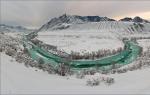
In terms of relief, the territory of Crimea can be divided into three parts: flat, mountainous and hilly. The Crimean mountains consist of three parallel ridges. The highest of them reaches a height of 1500 meters (the highest point of the peninsula is Mount Roman-Kosh, 1545 m). Main ridge Crimean mountains, in turn, consists of separate arrays - yayl. Each of them has its own name (for example, Demerdzhi-yayla, Karabi-yayla, etc.).
The population of Crimea and its ethnic composition
According to statistics at the end of last year, about two million people live in Crimea. According to Ukrainian sources, almost 20,000 Crimeans left the peninsula in 2014. At the same time, it was replenished due to a significant influx of refugees from the war zone in the Donbass (about 200 thousand people per year).
Ethnic composition Crimea is very colorful. Representatives of more than 120 different nationalities live here. Even 250 years ago, the most numerous people of the Crimea were the Tatars. However, over time, the situation has changed dramatically. After the end of World War II, most of the Crimean Tatars were deported from their historical homeland.

Today, Russians are the most numerous ethnic group on the peninsula (68%). Next come Ukrainians (16%), Crimean Tatars (12%) and Armenians (no more than 1%). Most residents of Crimea are Orthodox.
Conclusion
Accurate in sq. km is 25.6 thousand. The total length of the borders of the peninsula is 2500 kilometers. Almost two million people live in this area today.
The geographical position of the Crimea is very advantageous and always has been. After all, it was not in vain that the ancient Greeks built their colony cities on its shores. The peninsula is deeply incised into the Black Sea and is connected to the mainland only by two rather thin isthmuses.
Crimea has long been rightly called the natural pearl of Europe. Here, at the junction of temperate and subtropical latitudes, as if in focus, concentrated in miniature character traits their nature: mountains and plains, ancient volcanoes and modern mud hills, seas and lakes, forests and steppes, landscapes of the Black Sea sub-Mediterranean and semi-deserts of the Sivash region ...
Located Crimean peninsula in the south of Russia at the latitude of southern France and northern Italy.
His outlines peculiar, some see them as a flying bird, others - a bunch of grapes, others - a heart.
But each of us, looking at the map, immediately finds in the middle of the blue oval of the sea an irregular quadrangle of the peninsula with a wide ledge of the Tarkhankut Peninsula in the west and a long, narrower ledge of the Kerch Peninsula in the east. Kerch Strait separates the Crimean Peninsula from the Taman Peninsula - the western tip Krasnodar Territory.
Crimea, washed almost from all sides by the waters of the Black and Azov Seas, could be an island, if not for the narrow, only 8 kilometers wide, Perekop Isthmus, connecting it with the mainland.
The total length of the borders of Crimea– more than 2500 km.
Square- 27 thousand square meters. km.
Max Distance from north to south is 207 km, from west to east - 324 km.
extreme points: in the north - the village of Perekop (46°15' north latitude), in the south - Cape Sarych (44°23' north latitude), in the east - Cape Lantern (36°40' east longitude), in the west – Cape Kara-Mrun (32°30′ E long.).
Water Black Sea(area - 421 thousand sq.
sq. km, volume - 537 thousand cubic km) wash the Crimea from the west and south. The largest bays are Karkinitsky, Kalamitsky and Feodosia.
From the east and northeast, the peninsula is surrounded by the Kerch Strait (width 4-5 km, length 41 km) and Sea of Azov(area - 38 thousand sq. km, volume - 300 cubic km), which forms the Kazantip, Arabat and Sivash bays.
coastpeninsulas heavily indented by numerous bays, coves and bays.
Crimean mountains divided the peninsula into two uneven parts: a large steppe and a smaller mountain.
They stretched from the southwest to the northeast from the vicinity of Sevastopol to Feodosia in three almost parallel ridges separated by longitudinal green valleys. The Crimean Mountains are about 180 km long and 50 km wide.
The main ridge is the highest, the most famous mountain peaks are located here: Roman-Kosh - 1545 m, Chatyrdag - 1525 m, Ai-Petri - 1231 m.
The southern slopes facing the sea are steep, while the northern slopes are steep.
The peaks of the Crimean Mountains are treeless, undulating plateaus called yayls (translated from Turkic means "summer pasture"). Yayly combine the properties of plains and mountains. They are connected by narrow low ridges, along which mountain passes pass. The paths from the steppe part of the Crimea to the Southern coast have long run here.

The beginning of the ascent to the Devil's Stairs pass, ancient road that leads from the forest areas mountain Crimea to the South Coast.
The highest yayls of Crimea: Ai-Petrinskaya (1320 m), Yalta (1406 m), Nikitskaya (1470 m), Gurzufskaya (1540 m).
The limestone surface of the yayla has been dissolved by rainwater for many centuries, water flows have made numerous passages in the thickness of the mountains, deep wells, mines, caves of amazing beauty.
The inner ridge of the Crimean mountains is lower than the Main one (the highest point - Mount Kubalach reaches 739 m). It stretched from the Mekenziev mountains near Sevastopol to Mount Agarmysh for 125 km.
The outer, or Northern, ridge is even lower - from 150 to 340 m, it is called the foothills.
The rocks of which it is composed lie at an angle: the southern slopes break off with steep cliffs, and the northern ones are gentle, long, gradually turning into a plain.
Steppe takes large area Crimea. It represents the southern outskirts of the East European, or Russian, plain and slightly lowers to the north. The Kerch Peninsula is divided by the Parpach Ridge into two parts: the southwestern - flat and the northeastern - hilly, which is characterized by the alternation of ring-shaped limestone ridges, gentle depressions, mud hills and coastal lake basins.
However, mud volcanoes they have nothing in common with real volcanoes, since they do not erupt hot lava, but cold mud.
In the flat part of the peninsula, varieties of southern and carbonate chernozems predominate, dark chestnut and meadow chestnut soils of dry forests and shrubs, as well as brown mountain-forest and mountain-meadow chernozem-like soils (on yayles) are less common.
More than 52% of the territory of the republic is occupied by arable land, 4.7% - by orchards and vineyards.
The remaining lands are predominantly pastures and forests.

The expanses of Crimea
Square forests reaches 340 thousand.
ha. The slopes of the Crimean Mountains are occupied mainly by oak forests (65% of the area of all forests), beech (14%), hornbeam (8%) and pine (13%).
On the southern coast in the forests grow relic high juniper, evergreen small-fruited strawberry, pistachio tupolis, a number of evergreen shrubs - Pontic needle, Crimean cistus, red pyracantha, shrub jasmine, etc.
On the peninsula 1657 rivers and temporary drains.
Their total length is 5996 kilometers. However, the vast majority of them are small, in summer almost all watercourses dry up. There are only 257 rivers longer than 5 km.
The most significant of the rivers in their own way geographic location are divided into several groups: the rivers of the northern and northeastern slopes of the Crimean mountains (Salgir, the most long river peninsulas - 232 km; Wet Indole - 27 km; Churuksu - 33 km, etc.); rivers of the northwestern slope (Chernaya - 41 km, Belbek - 63 km, Kacha - 69 km, Alma - 84 km, Western Bulganak - 52 km, etc.); the rivers of the southern coast of Crimea (Uchan-Su - 8.4 km, Derekoika - 12 km, Ulu-Uzen - 15 km, Demerdzhi - 14 km, Ulu-Uzen East - 16 km, etc.); river-beams of the flat Crimea and the Kerch Peninsula.
The rivers of the northwestern slopes of the Crimean Mountains flow almost parallel to each other, until the middle of the course they are typically mountainous.
The rivers of the northern slopes on the plain deviate to the east and flow into the Sivash. The short rivers of the Southern Coast flowing into the Black Sea are typically mountainous throughout their entire length.
The mountain river Wuchang-Su runs down to the sea, forming waterfalls in four places.

Crimea. Baidarsky reserve. Kozyrek waterfall during the snowmelt period (left).
One of the tributaries of the Black River during high water (on the right).
The main source of river nutrition is rainwater - 44-50% of the annual runoff; The groundwater give 28-36% and snow nutrition - 13-23%. The average long-term surface and underground runoff of the Crimea is a little over 1 billion cubic meters. water. This is almost three times less than the volume of water that annually enters the peninsula through the North Crimean Canal. The natural reserves of local waters are used to the limit (73% of the reserves are used).
The main surface runoff is regulated: several hundred ponds and more than 20 large reservoirs have been built (Simferopol on the Salgir River, Chernorechenskoye on the Chernaya River, Belogorskoye on the Biyuk-Karasu River, etc.).
Through the North Crimean Canal, 3.5 billion cubic meters of gas is supplied to the peninsula annually.
cubic meters of water, which made it possible to increase the area of irrigated land from 34.5 thousand hectares (1937) to 400 thousand hectares (1994).
In Crimea, mainly along the coasts, there are more than 50 estuary lakes with a total area of 5.3 thousand square meters. km used to produce salts and therapeutic mud: Saki, Sasyk, Donuzlav, Bakal, Old, Krasnoe, Aktash, Chokrak, Uzunlar and others.
Sources:
All about the Crimea: Reference and information publication / Under the general.
ed. D.V. Omelchuk. - Kharkov: Caravel, 1999.
Yena V.G. Nature of Crimea // Crimea: present and future: Sat. articles - Simferopol: Tavria, 1995.
In this article, we will tell you about Crimea peninsula. Despite the fact that in last years more and more tourists flock to rest on the Mediterranean coast of Turkey, as well as on the tropical islands of Thailand.
However, Crimea still remains a popular holiday destination for hundreds of thousands of people. Foreign tourists, first of all visit metropolitan city Ukraine - Kyiv, in which there are many historical and architectural sights.

Peninsula Crimea and the Sea of Azov. View from space
In addition, in the city of Kyiv, you can use the Internet directly in the parks.
Crimea map
And if one of the tourists did not take his tablet computer on a trip, then he can buy a Kiev laptop at an affordable price in numerous FoxMart stores in the city, which offer a wide range of laptops from various world famous brands, such as: SAMSUNG, ACER, LENOVO, ASUS, HP, SONY and some others.
Thanks to the Internet and a laptop, you can learn a lot of necessary, useful and, of course, interesting information, for example, about the Crimean peninsula.
Peninsula Crimea located in the southern part of the Republic of Ukraine. Geographically Crimea The Russian peninsula belongs to the Northern Black Sea region.
On the peninsula Crimea located Autonomous Republic Crimea, the city of Sevastopol, as well as part of the Kherson region. Peninsula Crimea in the documents of the Russian Empire until the 20s of the XX century it was called Tauris.
After creation Soviet Union The Taurida Peninsula was renamed and received the name " Crimea».
Toponym " Crimea” probably comes from the Turkic word “kyrym”, which literally means a rampart, wall, ditch.
The Crimean peninsula is washed by: in the west and south - the Black Sea, from the east - the Sea of \u200b\u200bAzov, including the Sivash Bay. Peninsula Crimea deep into the Black Sea.
The area of the Crimean peninsula is approximately 26,860 km², of which 72% is a flat surface, 20% is occupied by Crimea mountains, 8% are water bodies - lakes, rivers.
The length of the coastline of the peninsula Crimea is over 1000 km.
The total length of sea and land borders peninsulas Crimea is over 2500 km.
The greatest length Crimea of the peninsula in the direction from west to east between the picturesque capes Kara-Mrun and Lantern is approximately 325 km, and in the direction from north to south from the narrow Perekop Isthmus to Cape Sarych is 205 km.
There are the largest bays on the Black Sea coast: Karkinitsky Bay, Kalamitsky Bay, Feodosiya Bay.
On the coast Sea of Azov- the following bays: Sivash Bay, Kazantip Bay and Arabat Bay.
in the east Crimea peninsula between the Black Sea and the Sea of Azov is the Kerch Peninsula, and in the west the tapering part Crimea and forms a relatively small Tarkhankut Peninsula.
In the northern part of the peninsula Crimea It is connected to the mainland by a rather narrow Perekop isthmus, the width of which at its widest point does not exceed 8 km.
Peninsula Crimea according to the nature of the relief, it is divided into platform-flat, which occupies 70% of the entire territory, the rest falls on the folded-mountain surface. On the southern part of the peninsula Crimea sprawled beautiful Crimea sky mountains. The highest mountain of the peninsula Crimea- Mount Roman-Kosh, which reaches a height of 1545 meters above sea level.
extreme north point Crimea peninsula is located on the Isthmus of Perekop, its extreme south point- This beautiful cape Sarych, extreme western point- this is Cape Kara-Mrun (Priboyny) on the Tarkhankut Peninsula, extreme eastern point peninsula is Cape Lantern on the Kerch Peninsula.

The picturesque nature of the Crimean peninsula
Crimea is popular seaside resort located in the southwest of Russia. The main reasons why people tend to the peninsula are: the sea and mountains. Crimea It is washed by two seas: Black and Azov. Most of the resorts are located on the south coast, whose climate is comparable to the Cote d'Azur.
Crimea: the history of the name of the peninsula
There are several versions of the origin of the name of the peninsula: from the Turkic " Crimea” translates as “ditch”.
Another version says that the name comes from the city of Kyrym, the former residence of the Golden Horde governor and became popular in the 13th century. This name was not the first for the peninsula - others are known in history:
- Taurica is the ancient name of the peninsula, descended from the tribe of Taurians who previously inhabited these places.
- Tavria is a name that came into use in the 15th century.
- Taurida - came into use since 1783, when the peninsula became part of the Russian Empire.

Also Crimea in different years identified with Cimmeria and Lesser Scythia.
During the years of Soviet power, there was the Crimean region, after Ukraine gained independence - the Autonomous Republic of Crimea, and since 2014, the Republic of Crimea has appeared as part of Russia.
The geographical position of the Crimea briefly
Crimea is washed from the east by the Sea of Azov, from the south and west by the Black Sea, and in the north of the peninsula there is the salty Sivash Bay. Most of the peninsula is located in temperate zone, and the South Coast - in the subtropical, thus providing a profitable geographical position of Crimea like a resort.
The peninsula is divided into 3 conditional parts: steppe, mountains, southern coast. Extreme points of Crimea:
- north - Perekop isthmus;
- south - Cape Sarych (located at 44°23′14″ N);
- west - Cape Priboyny;
- east - Cape Lantern.

The most high point- Roman-Kosh (1545 meters), located on Babugan-yayla.
18 settlements in Crimea have city status. The most populated among them are Sevastopol, Simferopol and Kerch. The main resorts are Yalta, Alushta and Evpatoria.
The area of Crimea is 27 thousand km².
Cape Sarych - the southernmost point of Crimea
The capital of Crimea is Simferopol, whose name translates as "collector city".
History of Crimea
Since ancient times, the peninsula has been the scene of hostilities. Many nomadic tribes came here, then giving way to stronger ones. That's why history of Crimea contains many bloody pages and kept them in her legends and traditions.
The first settlers of the peninsula in the Middle Paleolithic were Neanderthals, whose sites were found in several places: Kiik-Koba, Chokurcha (considered the oldest human dwelling in Europe).
A little later, in the Mesolithic, the Cro-Magnons appeared here.
Later, these places were settled by the Cimmerians in the XII century BC. e., as well as Taurians and Scythians who came to these lands in the 7th century BC.
e. Later, Greek settlers came to the lands of Taurida, organizing many cities on the coast and starting trade with local population. This is how the Kingdom of Bosporus, Chersonese, Kerkinitida and a number of other cities appeared.
 The Goths, Huns, Khazars, Byzantines, Tatars, Genoese, Turks left their mark here.
For a long time (1441 - 1783) the Crimean Khanate with its capital in Bakhchisarai was located here.
Most of the time was under the control Ottoman Empire, and after the transition under the rule of Russia, the khanate was disbanded.
In 1475, these lands were captured by the Ottoman Empire, which defeated both the Genoese and the mountainous principality of Theodoro. The Turks ruled here for 3 centuries, but in 1774 Prince Dolgoruky annexed Taurida to the Russian Empire.
Before 1954 Crimea was part of Russia until it was transferred to the Ukrainian SSR.
In 2014, the peninsula returned to Russia again.

The peninsula is full of unusual, interesting and mysterious. I invite you to know some Interesting Facts about Crimea:

You can learn more about Crimea on other pages of our site.
Where is Crimea located?
Where is Crimea located on the map of Russia? The Crimean peninsula is located in the northern part of the Black Sea, and from the northeast it is washed by the Sea of Azov. In the north of Crimea, it is connected with the mainland Perekop Isthmus (the bay).
Now, of course, many Russians are interested and curious to know how long it takes to fly to Crimea from different cities in Russia, because the Crimean peninsula has become part of the Russian Federation and is likely to break the flow of tourists here.
On a detailed map of the Crimean coast, you can see that the entire coastline stretches for 2.5 thousand kilometers.
It is also interesting that on Black Sea coast main resort towns– Sochi and Abkhazia, which are competitors of Crimea in terms of tourism, so it is recommended to read interesting article about comparing these places for the quality of recreation and leisure - if it is better to relax: in Sochi or in the Crimea?
There are many mountain peaks on the peninsula, of which the highest is Rimsko-Kosh, 1545 meters high.
The northernmost point of the peninsula is the Perekop Strait, to the south - on Cape Miklavts, in the west - in Cape Kara-Mran, in the east - in the cape, on the Kerch Peninsula.
Geography of Crimea
The northern channel is the largest on the peninsula.
 Detailed map of the Crimean coast
In Yandex and Google, you can find a detailed map of Crimean cities and cities where the most popular settlements on the peninsula will be defined as Yalta, Alushta, Alupka, Feodosia, Dzhalta, Sudak and others.
Sevastopol is a heroic city with many sights during World War II. The most famous natural and historical sights - Crimean caves: marble, red and Emine-Bayr-Khosar cave.
 Map of cities and places
What is Crimea
climate and natural areas Crimea
Answers:
Crimea, despite its relatively small territory, has a diverse climate. The climate of Crimea is divided into three subzones: Steppe Crimea (most of Crimea, north, west and center of Crimea). Crimean Mountains Southern coast of Crimea The climate of the northern part is temperate continental, on the southern coast - with features similar to subtropical.
average temperature January from -1 ... -3 ° C in the north of the steppe zone to +1 ... -1 ° C in the south of the steppe zone, on the southern coast of Crimea from +2 ... + 4 ° C. The average July temperature of the South Coast and the eastern part of Crimea: Kerch and Feodosiya is +23…+25 °C. Precipitation varies from 300-400 mm per year in the north to 1000-2000 mm in the mountains. In summer (in the second half of July) in the steppe part of Crimea, the daytime air temperature reaches +35…+37 °C in the shade, at night up to +23…+25 °C.
The climate is predominantly dry, seasonal dry winds prevail. The Black Sea warms up to +25 °С in summer. The Sea of Azov warms up to +27…+28 °С. The steppe part of Crimea lies in the steppe zone of the temperate climate. This part of the Crimea is characterized by long dry and very hot summers and mild, little snowy winters with frequent thaws and very changeable weather.
The Crimean Mountains are characterized by a mountain type of climate with pronounced zonality in height. Summers are also very hot and dry, while winters are wet and mild. The southern coast of Crimea is characterized by a sub-Mediterranean climate.
Snow cover is only temporary, it is established on average once every 7 years, frosts only during the passage of the Arctic anticyclone.
The Crimean peninsula has long been called the natural pearl of Europe for a reason. Here, at the junction of subtropical and temperate latitudes, as if in focus, the characteristic features of their nature are concentrated in miniature: plains and mountains, modern mud hills and ancient volcanoes, lakes and seas, steppes and forests, landscapes of the semi-desert of the Sivash region and the Black Sea sub-Mediterranean.
The Crimean peninsula is located in southern Ukraine at the same latitude as southern France and northern Italy.
The outlines of the Crimea are very peculiar, some see them as a bunch of grapes, others - a flying bird, others - a heart. Each of us, looking at the map, immediately sees in the middle blue sea an irregular quadrangle with a wide protrusion of the peninsula in the west and a long, narrower protrusion of the Kerch Peninsula in the east. The Kerch Strait separates the Crimean Peninsula from the Taman Peninsula, the western tip of Russia.
The total length of the land borders of Crimea is more than 2500 km. Area - 27 thousand square meters. km.
Crimea is washed almost from all sides by the waters of the Black and Azov Seas. It could be an island, if not for the narrow, only 8 kilometers wide, Perekop Isthmus, connecting it with the mainland.
The maximum distance from north to south is 207 km, from west to east - 324 km.
Extreme points: in the north - the village of Perekop, in the south -, in the east -, in the west - Cape Kara-Mrun.
The waters of the Black Sea (area - 421 thousand square kilometers, volume - 537 thousand cubic kilometers) wash Crimea from the west and south. The largest bays are Karkinitsky, Kalamitsky and Feodosia. The shores of the peninsula are heavily indented by numerous coves and bays.
From the east and northeast, the peninsula is surrounded (width 4-5 km, length 41 km) and the Sea of Azov (area - 38 thousand sq. km, volume - 300 cubic km), which forms the Arabat, Kazantip, and Sivash bays.
The Crimean mountains divided the peninsula into two uneven parts: a large steppe and a smaller mountain. They stretched from the southwest to the northeast from the neighborhood to three almost parallel ridges separated by parallel green valleys. The Crimean Mountains are about 180 km long and 50 km wide.
The main ridge is the highest, the most famous mountain peaks are located here: - 1545 m, - 1525 m, - 1231 m. The southern slopes, which face the sea, are very steep, while the northern ones, on the contrary, are flat.
The peaks of the Crimean Mountains are treeless plateaus, which are called (translated from Turkic means "summer pasture"). Yayly combine the properties of both mountains and plains. They are connected by narrow lowered ridges, along which mountain passes pass. The paths from the steppe part of the Crimea to the Southern coast have long run here.
The highest yayls of Crimea: Ai-Petrinskaya (1320 m), Gurzufskaya (1540 m), Nikitskaya (1470 m), Yalta (1406 m). The limestone surface of the yayla has been dissolved for many centuries under the influence of rainwater, water flows have made numerous passages, mines, deep wells, amazingly beautiful caves in the thickness of the mountains.
The steppe occupies most of the territory of Crimea. It is the southern outskirts of the East European, or Russian, plain and slightly decreases to the north. The Kerch peninsula is divided by the Parpach ridge into two parts: the southwestern - flat and northeastern - hilly, which is characterized by the alternation of gentle depressions, ring-shaped limestone ridges, mud hills and coastal lake basins. However, mud volcanoes have nothing in common with real volcanoes, as they eject not hot lava, but cold mud.
Varieties of calcareous and southern chernozems predominate on the flat part of the Crimea; dark chestnut and meadow chestnut soils of dry forests and shrubs are less common, as well as brown mountain-forest and mountain-meadow chernozem-like soils (on yayla).
More than half of the territory of the peninsula is occupied by fields, about five percent - by gardens and vineyards. The remaining lands are predominantly pastures and forests.
The forest area is 340 thousand hectares. The slopes of the Crimean Mountains are covered mainly with oak forests (65% of the area of all forests), beech (14%), pine (13%) and hornbeam (8%). On the southern coast in the forests grow relict tall juniper, pistachio tupolis, evergreen small-fruited strawberry, a number of evergreen shrubs - Crimean cistus, Pontic needle, red pyracantha, shrub jasmine, etc.
The main source of river nutrition is rainwater - 44-50% of the annual runoff; snow nutrition provides 13-23% and groundwater - 28-36%. The average long-term surface and underground runoff of the Crimea is just over 1 billion cubic meters of water. This is almost three times less than the volume of water that annually enters the peninsula through the North Crimean Canal. The natural reserves of local waters are used to the limit (73% of the reserves are used). The main surface runoff has been regulated: a couple of hundred ponds and more than 20 large reservoirs have been built (on the Salgir river, Chernorechenskoye on the Chernaya river, Belogorskoye on the Biyuk-Karasu river, etc.).
Through the North Crimean Canal, 3.5 billion cubic meters of water are annually supplied to the peninsula, which made it possible to increase the area of irrigated land from 34.5 thousand hectares to 400 thousand hectares (since the 30s of the XX century).
In Crimea, mainly along the coasts, there are more than 50 lakes-estuaries with a total area of 5.3 thousand square meters. km used to obtain salts and therapeutic mud: Donuzlav, Bakal, Staroe, Krasnoe, Chokrakskoe, Uzunlarskoe, etc.
This article will focus on the unusual and a unique corner the globe- about the beautiful Tauris! How many people live on the peninsula and what is the size of the territory of Crimea? Square, nature, ethnic and religious composition will be the subject of this information article.
Crimea: the origin of the name of the peninsula
A long time ago, back in ancient times, where the south of Crimea is now, there were the most ancient settlements of the Taurians. Even then, the peninsula bore the loud name of Taurica. The name of the Crimea, by which he knows him modern world, ancient Taurica received centuries later. This happened only at the beginning of the XIV century. Researchers suggest that this name is associated with the Mongolian city called Kyrym. And the thing is that after the Mongols took possession of the northern part of the Black Sea region, the Khan of the Horde settled in this city and named his possessions in honor of his native lands.
There is another version of the origin of the name. Perhaps there is a connection between the Crimea and the Isthmus of Perekop. Indeed, in Turkic, “perekop” sounds like “kyrym”, that is, “ditch”. During the Middle Ages, the peninsula was renamed Tavria. This name was somewhat changed after its territory was annexed to the Russian Empire. Since the end of the 18th century, the peninsula with the edge closest to it was called Tauris.
Which total area Crimea? This will be discussed further.
Territory of Crimea: area and geographical location
Crimea is washed by two seas at once: Azov and Black. The coastline of the peninsula reaches 2.5 thousand kilometers! Half of this length refers to the Sivash.
In its shape, Crimea resembles an irregular quadrangle. Actually, why is Crimea called a peninsula, and not a full-fledged island? The point is the Perekop Isthmus, 8 km wide, which connects it to the mainland. At this point, the extreme northern point of the peninsula is located. The southern one is located on Cape Sarych.
What is the area of Crimea? As for the length of sea and land borders, it is 2,500 kilometers. If you connect your imagination, then in the silhouette of the Crimea you can see a bunch of grapes, a heart or even a flying bird. The area of the Crimean peninsula is about 27 thousand square kilometers.
Nature and relief
The area of Crimea is small, but the peninsula has unique feature: this is an amazing variety of natural conditions and landscapes. The flora and fauna of the peninsula amaze with its beauty and richness. In Crimea, you can visit the wild steppe, enjoy the views of green vineyards or the exotic vegetation of the south coast, admire the rocks of volcanic origin, or descend into a karst cave.

As for the nature of the relief, Crimea can be divided into 3 parts:
More than 7/10 is the North Crimean Plain.
Kerch Peninsula with its ridge-hilly plains.
The mountainous part of the peninsula.
The main ridge has highest altitude. It is a chain of separate massifs, consisting of limestone with flat tops. These massifs (yayly) are separated from each other by deep canyons.
Population of Crimea
Judging by the data for October 2014, the Crimean peninsula has about 2 million inhabitants. Over the past year, according to information received from Ukraine, about 20.5 thousand Crimeans moved to the territory of this country. However, at the same time, 200,000 people moved to Crimea from the Lugansk and Donetsk regions. There are about 50,000 foreigners living and working on the peninsula.
Even at the end of the 18th century most The population of the Crimea was represented by the Tatars. However, two centuries later, the peninsula became a multi-ethnic territory inhabited by representatives of various cultures. Today, more than 100 different ethnic groups live in Crimea, the most numerous of which are Russians (68%), Ukrainians (16%), Crimean Tatars (11%), Armenians (about 1%).

The most common religion in Crimea is Orthodoxy. A little less Muslims, there are also Protestants and Catholics, Jews.
Urbanization processes on the peninsula
According to 2014 data, the number of urban residents of the peninsula was 1.3 million people, or 58% of the total population. Over the past 15 years, the number of citizens has decreased significantly. This indicator is a consequence of the fact that absolutely all the republics in 2014 were legally assigned to the number of villages.

The nationality, which in its number prevails on the peninsula, is Russian. There are more of them among the townspeople, but not among the rural population. There are still fewer of them in the villages, because Ukrainians and, of course, Crimean Tatars predominate there.
Curious facts about the peninsula
1. Crimea is a unique peninsula, the area of which simultaneously accommodates 3 natural zones. These are subtropics, mountains and steppes.
2. Flora of Crimea has 240 species of unique vegetation, characteristic only of its territory.
3. Crimea distinguished itself by the longest public transport route: the length of the trolleybus route between the cities of Simferopol and Yalta is almost 90 km!

4. "Krymtrolleybus" is listed in the Guinness Book of Records for one more parameter. True, this can hardly be called an achievement. Transport park almost completely worn out, and the average age of a local trolleybus is 26 years, which is a definite record in the world!
5. Surprisingly, the peninsula has the shortest tram line. It does not reach even two kilometers in length, and the purpose of its creation is the same - to quickly transport tourists to the seashore.
6. There is a power plant on the peninsula that runs on solar panels. Yes, not simple, but the most powerful in the whole world! It was built by the Austrians on the territory of the village of Perovo in 2011.
7. Representatives of about 130 nationalities live in Crimea today!
Conclusion
Now you know everything about the area of Crimea and the population of this marvelous peninsula. It goes deep into the Black Sea and is almost completely isolated from the land. The area of Crimea is 27 thousand square kilometers. Almost two million people live in this area.
The area of Crimea, as can be estimated, is quite small. However, the territory of the peninsula boasts a unique variety of landscapes, flora and fauna.
Crimea (Crimean Peninsula) is South part Ukraine. The territory of the peninsula unites the Autonomous Republic of Crimea, Sevastopol, part of the Kherson region ( northern part Arabat Spit). The modern name, the peninsula received from the Turkic word, which means shaft, wall. Earlier, in historical sources, it was called Tauris.
The south and west of the peninsula is washed by the Black Sea, the east by the Sea of Azov.
The northern side of Crimea is connected to the continent, the connection to the continent was made thanks to a narrow isthmus called Perekop. The area of the entire Crimean peninsula is approximately equal to 26860 sq. km. Approximately 72% of them are occupied by a flat surface, more than 20% of the entire territory is occupied by a mountainous surface and 8% are lakes.
The coastline of the Crimean peninsula stretches for a distance of more than 1000 km. Most large bays Crimea, located on the Black Sea coast, are: Karkinitsky Bay, Kalamitsky Bay, and the Bay which is called Feodosiya. The largest bays of the coast of the Sea of Azov are Sivash, Kazantip Bay and Arabatsky.
The whole of Crimea can be divided into three large parts, which are called peninsulas, so the east of Crimea is the Kerch Peninsula, the south is the Gerakleian Peninsula, and the north is the Tyup-Tarkhan Peninsula.
From 1954 - 1991, Crimea was part of the Ukrainian SSR, as having a common economy and territorial proximity, as well as various ties: economic, cultural, etc.
The Republic of Crimea, as an autonomous state, was proclaimed in 1991.
Crimea area
The area of the peninsula is about 26,860 square kilometers. The highest mountain point is Mount Roman-Kosh, whose height is 1545 m. The distance of the peninsula from west to east is 326 kilometers, from north to south - 205 kilometers. The center of the peninsula is the village of Azov.
Demographics of Crimea
The population of Crimea consists of many peoples. The ethnic composition is quite diverse. However, the bulk of the population are Russians (58.3%), Ukrainians (24.3%) and Crimean Tatars (12.1%). According to the 2001 census, Belarusians, Tatars, Armenians, Jews, Poles, Moldovans, Azerbaijanis, Uzbeks, Koreans, Greeks, Karaites, Krymchaks and others live in Crimea.
The majority (Russians, Ukrainians, Greeks and Bulgarians) are Orthodox. Crimean Tatars profess Sunni Islam, as well as Jewish, Protestant and Catholic religions.
1,969,800 people live on the peninsula, of which urban population- 1,239,800 people, and rural residents - 730 thousand people (as of February 1, 2008).
The largest cities of the peninsula: Simferopol, Sevastopol, Kerch, Evpatoria and Feodosia
by the most big city, which is located on the Crimean peninsula, is Sevastopol, its population is three hundred and eighty-nine thousand nine hundred and twenty-one inhabitants, these are data that are given as of 2009.
The second most populous city in Crimea is Simferopol, it is worth noting that between these two cities there has always been some kind of competition for numbers and superiority, but the capital Autonomous Republic Crimea, to which Simferopol is recognized, has always been inferior to Sevastopol in this race. Kerch rightfully occupies the third place in terms of population, about one hundred and fifty thousand people live here.
Economy of Crimea
The main place in the Crimean economy is occupied by industry and tourism. More than 530 enterprises are located on the peninsula that are engaged in mechanical engineering and metalworking, shipbuilding, ferrous metallurgy, the chemical industry, etc. Large enterprises such as the Selkhozdetal plant, the Feodosia Mechanical Plant, the Foton Production Association, NPO Pnevmatika and others are located on the peninsula. The shipbuilding industry is represented by three enterprises. Viticulture and winemaking are developed in the republic. 10 enterprises are engaged in the processing of grapes and the production of vintage and champagne wines.
12% of the republic's GDP is trade. She is in third place. Construction, healthcare, and agriculture are also developing on the island.
Export is actively developing in the republic. Partnership relations are maintained with 107 countries of the world. The CIS countries receive 45% of all goods, the EU countries - 23%. The main trading partner of Crimea is Russia (29% of deliveries).
The volume of imports of products is growing. Crimea receives products from Russia, Italy, Turkey, the Netherlands and Syria. Mechanical machines, building materials, means of transport, alcoholic beverages, etc. are imported into the republic.
Transport is developing in the republic. All cities and towns of Crimea are interconnected bus routes. There are intercity trolleybus routes. The peninsula has Black Sea ports: Evpatoria, Sevastopol, Yalta, Feodosia and Kerch. Through the Kerch Strait there is ferry crossing, which connects the peninsula with Russia.
In 2010, Russia and Ukraine signed an agreement according to which a bridge will be built connecting Krasnodar and Crimea. Completion of construction is scheduled for 2014.
History of Crimea
It is known from the sources of the Russian chronicle that the Crimea was previously referred to as Taurida, and it is from here that the name of the Taurida province came.
It is also known that the modern name of the Crimean peninsula comes from the word "kyrym", which can be translated as a rampart, wall or moat.
The peninsula has an interesting, eventful history. On its territory surprisingly intertwined historical events different times: the German war, the turbulent times of 1917, the army of Admiral Kolchak and all this next to the monuments of the times of the Greeks and Romans, next to the Genoese monuments.
Traces of human presence on the peninsula date back to the Paleolithic times. The Kiik-Koba cave keeps traces of the Neanderthal site. Many documents and monuments have been preserved that tell about the life of the peninsula in ancient times.
The beginning of our era is marked by the fact that in the Crimea, until the 3rd century AD, there was a Scythian state, which was destroyed by the Goths. They, under the pressure of the Huns, in the 4th century, went to the mountains of Crimea and mixed with the descendants of the Scythians and Taurians. Cave cities in the area of Bakhchisaray and Sevastopol testify to their existence. The 6th century brought the dominance of Byzantium.
Then the Golden Horde established itself on the peninsula, and it became known as the Crimean. The 15th century brought the rule of the Turks to the Crimea, who gradually began to lead a sedentary lifestyle, engaged in gardening and viticulture.
Already in 1239, the Crimea was enslaved by the invasion of the Mongol army of Khan Batu, from now on the steppe part of the peninsula is part of the Golden Horde. After that, Crimea saw many more battles for the development of its territories. Already from the beginning of the fourteenth century and by the middle of the fifteenth century, the Adygs, who inhabit eastern regions peninsulas. In 1475, the Ottoman army, led by Gedik Ahmed, recaptures the principality of Theodoro and the Genoese possessions, the khanate, which was referred to as the Crimean, now becomes the possessions of the Ottoman Empire, but already in 1774, according to the treaty, which had the name Kyuchuk-Kaynardzhy peace, Crimea becomes an independent state, power over which is exercised by his own khan.
In 1776, Suvorov resettled the population of Armenians and the Greek population in the Azov province, and in 1783, Empress Catherine II signs the Manifesto, according to which Crimea is now annexed to the Russian Empire, also in Russian empire henceforth the Taman Peninsula is also included.
From 1853 to 1856 the Crimean War was going on. From 1917, when the Great October Revolution began and until 1920, the Civil War when several times the power is seized alternately by the “reds” and the “whites”. In 1921, the Autonomous Crimean SSR was formed, which is part of the RSFSR. From 1921 to 1923, a terrible famine sets in in the Crimea, its consequence is high mortality, and thus more than a hundred thousand lives were claimed, the main component of this figure being the population of the Crimean Tatars.
During the Great patriotic war from 1941 to 1944, the occupation of Crimea was carried out from the invasion of enemy fascist Germany and Romania as well.
In 1945, the autonomy of Crimea was abolished, and many settlements, cities and villages of Crimea were renamed, at the same time the Crimean region was formed. In 1948, Sevastopol was separated into a separate administrative and economic center, and from now on it becomes a city of republican significance. Since 1987, Crimean Tatars again began to come to Crimea from the places where they were deported. In 1954, the Crimea was given to the Ukrainian SSR, Russia made such a gift to Ukraine on the occasion of the tercentenary of the Pereyaslav Rada. In 1978, the Constitution was adopted in the Ukrainian SSR, in which Sevastopol is listed as a city with the status of republican subordination. In 1991, the Crimean Tatars sought to give Crimea the status of autonomy, which, nevertheless, is part of Ukraine.
Culture (show business), sights of Crimea
Crimea is home to many peoples and cultures. On the peninsula you can find architectural structures Ancient Greece, Italy, Tatar and Armenian. The ruins of Chersonese, which have been preserved since ancient times.
On the territory there are several dozen objects that are of interest. They can be classified as monuments of history, architecture, landscape gardening art, natural objects, etc. The famous Crimean caves are of interest to tourists: Marble, Red, Emine-Bair-Khosar.
Crimea was decorated by many famous architects. But the greatest contribution belongs to N.P. Krasnov. His project belongs to 61 buildings in the Crimea: palaces of the nobility, mansions, villas, etc.
The main sights of Crimea: Livadia Palace; Dulber Palace; Palace of Charax; hunting house of Prince Yusupov; Yalta Alexander Men's Gymnasium; Women's gymnasium in Yalta: Yalta church.
Science is developing on the peninsula. On the territory of the republic there are large scientific centers and universities.
Many rest houses and sanatoriums, boarding houses and camps are located on the territory of the peninsula. The most popular holiday destinations are Yalta and Alushta, as well as the southern coast of Crimea, Feodosia, Sudak, Evpatoria.
Banks of Crimea
Many large banks are located on the territory of Crimea: Aval, Morskoy Bank, Privatbank, Forum Bank, Finance and Credit Bank, Vabank, Imeksbank, Krysky branch of IPB, Kievan Rus, OTR-bank and others.
Crimea real estate
The real estate market in Crimea is steadily expanding. This is proved by numerous new buildings, which show what requirements are put forward for the quality of housing, what level of comfort and life support becomes optimal. New buildings offer various services: from private parking and beach, to service. The leaders are the new buildings of Yalta.
Airport in Crimea
Belbek — international Airport, which serves the city of Sevastopol and other cities of Crimea. It was created on the basis of the military airfield of the same name. The name of the airport comes from the name of the river Belbek, in the south-west of Crimea. It is located on the seashore, on the territory of the Nakhimovsky district of Sevastopol, on the northern side of the city, adjacent to the Lyubimovka microdistrict.
Regular flights from Sevastopol in 2012 are not carried out. Charter:
The airport is located 2.5 kilometers from road junction"Simferopol - Sevastopol / Yalta - Belbek Airport, near the village of Fruit, on the territorial bulk of the Nakhimovsky district. The distance to the southern part of Sevastopol (in a detour around the bay) is 25 kilometers, to Zakharov Square ( main square North side) - 9 kilometers, to Simferopol - 50 kilometers, to Yalta - 95 kilometers.
By public transport, direct access to the airport can be reached by shuttle bus No. 137 (Ushakov Square - Belbek Airport - Star Coast), in the summer months, the frequency of flights is 30 minutes.
Also from the center of Sevastopol public transport to get to the airport from the square. Zakharov on the North side. To do this, you need to cross from the Grafskaya Pier by boat Sevastopol bay. Next, by bus, following route No. 36 "Northern - Kacha", get to the stop. Belbek Airport. The travel time is about 40-50 minutes.
In the future, the city authorities plan to move the Sevastopol-Simferopol railway line a little to the west, closer to the airport.
Famous personalities of Crimea
Crimea is associated with many well-known and famous personalities of different times who sang of its beauty in their poems and works:
I.K. Aivazovsky, famous marine painter
A.P. Chekhov, an outstanding Russian writer
A.T. Averchenko, Russian writer, satirist
M.I. Tsvetaeva - poetess, prose writer.
Adam Mickiewicz, Polish poet sang of the beauties of Crimea
A.N. Apukhtin, Russian poet
Yu.V. Drunina Russian Soviet poetess.
Crimea in the Yandex search engine.
Recent events in Ukraine have made the query "Crimea" extremely popular among users of the Yandex search engine. Over the past month, users have made 1,447,541 such requests. Along with the query "Crimea", Yandex search engine users also searched for:

In addition, analysts of the Market Leader publication compiled a table that reflects the interest of users from neighboring countries in the query "Crimea".